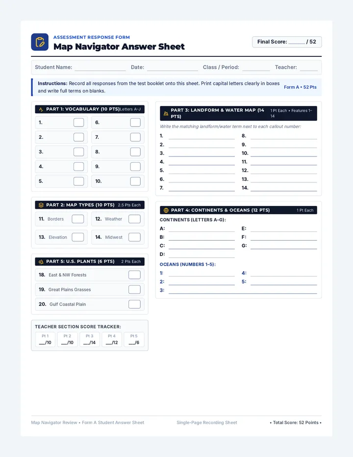
Map Navigator Quiz
Social Studies Assessment Series • Geography
Map Navigator Quiz
Total Score: _______ / 52
Name:
Date:
Period / Class:
Instructions: Write the matching vocabulary letter next to each definition in Part 1. In Part 2, circle the best response identifying the proper type of map.
Part 1: Geography Vocabulary Match (10 Points • 1 pt each)
Match each definition with its correct term
Vocabulary Word Bank:
A. Climate B. Compass C. Geography D. Globe E. Government F. Landform G. Latitude H. Longitude I. Physical Feature J. Vegetation
1. The general pattern of weather in a region over many years.
2. An instrument with a magnetized needle indicating cardinal directions.
3. The study of Earth's surface, climates, and human interactions.
4. A spherical, three-dimensional scale model of Earth.
5. An organized system and leaders that establish laws and public order.
6. A natural physical land shape such as a mountain, valley, or plateau.
7. Parallel lines measuring angular distance north or south of the Equator.
8. Meridian lines measuring distance east or west of the Prime Meridian.
9. Any natural surface landmark, including rivers, hills, and oceans.
10. Plant life, forests, grasses, and shrubs that grow naturally in an area.
Part 2: Types of Maps in Action (10 Points • 2.5 pts each)
11. A teacher wants to display state borders, country limits, and national capitals. Which map should they use?
A. Climate map
B. Physical feature map
C. Political map
D. Regional map
12. A scientist studying annual precipitation and average seasonal temperature zones across a continent needs a:
A. Climate map
B. Political map
C. Physical feature map
D. Regional highway map
13. Which map uses shading and contour colors to represent elevation, mountain ranges, river basins, and plains?
A. Regional map
B. Physical feature map
C. Political map
D. Demographic voting map
14. A map showing shared cultural traits, economic industries, and agriculture across the "Midwest" or "Sunbelt" is a:
A. Regional map
B. Topographic profile map
C. Global political map
D. Climate isotherm map
Map Navigator Review • Form A Page 1 of 3 (20 Points) Turn over for Part 3 Landform Map →
Map Navigator Quiz • Page 2
Student Name:
Part 3: Detailed Water & Landform Map (14 Points • 1 pt each)
Use the Word Bank to identify every numbered physical feature
Landform & Water Word Bank: Each term matches one numbered feature (1–14)
Source Hill River Peninsula Mouth Bay Plain Island Delta Valley Tributary Gulf Cape Sea
1 2 3 4 5 6 7 8 9 10 11 12 13 14 N S E W Scale: 1 inch = 50 miles
Write the correct term from the Word Bank next to each numbered callout on the map:
Map Navigator Review • Form A Page 2 of 3 (14 Points) Turn over for Part 4 World Continents & Oceans →
Map Navigator Quiz • Page 3
Student Name:
Part 4: World Continents & Oceans Map (12 Points • 1 pt each)
Continents: A–G • Oceans: 1–5
7 Continents (Letters A–G):
Africa Antarctica Asia Australia Europe North America South America
5 Oceans (Numbers 1–5):
Arctic Ocean Atlantic Ocean Indian Ocean Pacific Ocean Southern Ocean
Equator (0°) Equator (0°) ANTARCTICA A B C D E F G 1 1 2 3 4 5
Continents A–G (7 Pts):
A:
E:
B:
F:
C:
G:
D:
Oceans 1–5 (5 Pts):
1:
4:
2:
5:
3:
Part 5: Vegetation Regions of the United States (6 Points • 2 pts each)
Forests • Grasslands • Gulf Coastal Plain
Forests 18. (2 Pts)
Which vegetation region covers much of the eastern U.S. and Pacific Northwest, characterized by dense canopies of deciduous and evergreen trees?
A. Temperate & Coniferous Forests
B. Desert scrubland
C. Arctic tundra
D. Tropical savanna
Grasslands 19. (2 Pts)
The interior Great Plains of the central United States are dominated by which vegetation type, featuring deep-rooted grasses and few natural trees?
A. Alpine mountain tundra
B. Temperate Grasslands (Prairies)
C. Dense tropical rainforests
D. Mangrove tidal thickets
Coastal Plain 20. (2 Pts)
The Gulf Coastal Plain extends along the southern U.S. coast. What plant life and environment naturally characterize this region?
A. Glacial permafrost soils
B. High rocky mountain scrub
C. Coastal wetlands, swamps & pine woods
D. Arid cactus sand dunes
Map Navigator Review • Form A Page 3 of 3 (18 Points) • End of Assessment (52 Points Total) •
Map Navigator Answer Key
Teacher Grading Guide MASTER KEY
Map Navigator Answer Key
Total Quiz Value: 52 Points
Part 1: Vocab 10 Pts
Part 2: Map Types 10 Pts
Part 3: Landforms 14 Pts
Part 4: Continents 12 Pts
Part 5: US Plants 6 Pts
Part 1: Geography Vocabulary Match Key (10 Points • 1 pt each)
10 / 10 Points
- Weather pattern over years
A • Climate
- Magnetized direction tool
B • Compass
- Study of Earth & human activity
C • Geography
- Spherical 3D scale model
D • Globe
- System of laws & public leaders
E • Government
- Physical shape (mountain, valley)
F • Landform
- Parallel lines North/South of 0°
G • Latitude
- Meridians East/West of 0°
H • Longitude
- Natural surface landmark feature
I • Physical Feature
- Natural plant life, trees, shrubs
J • Vegetation
Part 2: Types of Maps in Action Key (10 Points • 2.5 pts each)
10 / 10 Points
Question 11 (2.5 Pts) CORRECT: C
Answer: Political map
Explanation: Political maps focus on human-made territorial borders, national boundaries, states, cities, and capital locations established by governments.
Question 12 (2.5 Pts) CORRECT: A
Answer: Climate map
Explanation: Climate maps specifically display long-term weather patterns, annual rainfall/precipitation averages, and temperature zones across regions.
Question 13 (2.5 Pts) CORRECT: B
Answer: Physical feature map
Explanation: Physical feature maps use contour lines and shaded relief to illustrate natural elevation, mountain ranges, valleys, and river systems.
Question 14 (2.5 Pts) CORRECT: A
Answer: Regional map
Explanation: Regional maps group adjacent areas sharing common physical, cultural, or economic traits (such as the "Midwest" or "Sunbelt").
Grading Guidance • Page 1 Checkpoints:
• Part 1: Award exactly 1 point per correct matching letter. Ensure students distinguish clearly between (horizontal / Equator) and (vertical / Prime Meridian).
• Multiple choice questions are worth 2.5 points each. If partial credit is used, award 1 point if a student selected another thematic map type but demonstrated understanding of cartographic conventions.