Hemisphere Hunt Slides Grade 4 Geography Expedition
Lesson 1 • Continent Quest
Global Navigation
Continent on the Map
Where in the world is North America? Discover our home continent's hemispheres, bordering oceans, and global neighborhood.
2 Hemispheres
Northern & Western
3 Giant Oceans
Pacific, Atlantic, Arctic
3rd Largest
Continent on Earth
01
Earth's Four Hemispheres
Global Coordinates
Latitude Divider
Northern Hemisphere
The Equator cuts Earth into North and South. North America sits entirely north of the Equator .
Every part of North America has north latitude!
Longitude Divider
Western Hemisphere
The Prime Meridian divides East and West. North America sits almost entirely in the Western Hemisphere .
Located west of the Atlantic Ocean!
Geographer's Rule: When someone asks for North America's global address, remember: North and West!
02
Surrounded by Water: Three Oceans
Ocean Boundaries
Arctic Ocean
To the North
Icy, cold waters touch northern Canada, Alaska, and Greenland. Frozen sea ice covers much of it year-round.
Home to polar bears & narwhals
Atlantic Ocean
To the East
Stretches between eastern North America, Europe, and Africa. Carries busy shipping lanes and the Gulf of Mexico.
Borders eastern Canada & the U.S.
Pacific Ocean
To the West
The largest, deepest ocean on Earth. Borders the western shores of Canada, the United States, and Mexico.
Part of the volcanic "Ring of Fire"
Water forms natural boundaries on three sides of North America!
03
Continental Gateways
Connections & Straits
Southern Gateway
Isthmus of Panama
A narrow strip of land connecting Central America (the southern tip of North America) directly to South America.
Key Fact: The famous Panama Canal cuts across this isthmus, linking the Atlantic and Pacific!
Northwestern Gateway
Bering Strait
A narrow body of water separating Alaska (North America) from Russia (Asia). At its narrowest, it is only 55 miles wide.
Key Fact: Thousands of years ago, an ancient ice bridge connected the two continents here!
Total Land Area: About 9.5 million square miles!
Only Asia and Africa are larger
Globe Detective Challenge
Quick Check
Clue 1
Which two hemispheres hold North America?
Think about Earth's horizontal and vertical divider lines.
Answer: Northern & Western
Clue 2
Which ocean lies directly to the West?
This giant body of water is the largest ocean on Earth.
Answer: Pacific Ocean
Clue 3
What narrow landform joins North & South America?
It shares a name with a famous ship canal.
Answer: Isthmus of Panama
Next Step: Grab your Globe Detective Worksheet and start your map hunt!
Ready for Action
Globe Detective Worksheet Continent Quest • Lesson 1
Globe Detective Worksheet
Grade 4 Geography
Name:
Date:
Score: / 20
1
Earth Coordinates & Hemispheres
(6 pts)
Mark the correct hemisphere and name Earth's main dividing reference lines.
1. Relative to the Equator, North America is in:
[ ] Northern
[ ] Southern
2. Relative to Prime Meridian, North America is in:
[ ] Eastern
[ ] Western
3. The 0° latitude line dividing North/South is:
4. The 0° longitude line dividing East/West is:
2
Bordering Oceans & Compass Directions
(6 pts)
Match each ocean to its clue and write its border direction:
Arctic Atlantic Pacific
Ocean Clue Ocean Name Direction (N / S / E / W) Earth's largest, deepest ocean
|
| Cold, icy ocean near the North Pole |
|
|
| Ocean separating Americas from Europe/Africa |
|
|
3
Continental Boundaries & Gateways
(4 pts)
1. Narrow strip of land linking North to South America:
2. Narrow waterway separating Alaska from Asia:
4
Geographer's Think Box
(4 pts)
Explain why North America is called both a northern and a western continent. Mention at least one dividing line.
Continent Quest • Grade 4 Social Studies North America Unit • Worksheet 1
Globe Detective Answer Key Teacher Guide • Lesson 1
Globe Detective Answer Key
Answer Key • 20 Pts
Quick reference guide and suggested scoring for Grade 4 Social Studies.
1
Earth Coordinates & Hemispheres (6 pts)
1.5 pts each
1. Relative to the Equator:
✓ Northern Hemisphere
All North American territory lies north of 0° latitude.
2. Relative to Prime Meridian:
✓ Western Hemisphere
Entire continent sits west of the Prime Meridian (0°).
3. 0° latitude divider line:
Equator
4. 0° longitude divider line:
Prime Meridian
2
Bordering Oceans & Directions (6 pts)
1 pt per cell
Ocean Clue Correct Ocean Correct Direction Earth's largest, deepest ocean Pacific Ocean West Cold, icy ocean near the North Pole Arctic Ocean North Ocean separating Americas from Europe/Africa Atlantic Ocean East
3
Continental Boundaries & Gateways (4 pts)
2 pts each
1. Land link to South America:
Isthmus of Panama
Accept: Panama or Central American isthmus.
2. Waterway separating Alaska & Asia:
Bering Strait
Accept: Bering Sea / Bering Strait.
4
Geographer's Think Box Rubric & Sample (4 pts)
Open Response
Exemplar Student Response (Full Credit - 4 pts):
"North America is in the Northern Hemisphere because it is located entirely north of the Equator. It is also in the Western Hemisphere because it lies west of the Prime Meridian."
Full Credit (4 pts): Mentions both hemispheres correctly and references at least one divider line (Equator / Prime Meridian) in complete sentences.
Partial Credit (2-3 pts): States Northern and Western correctly but forgets divider lines or writes incomplete sentences.
Common 4th Grade Misconception: Students often think Central America and Greenland are separate continents. Emphasize that Greenland and Central American nations are part of the North American continent!
Continent Quest • Teacher Resources Lesson 1 Answer Key
Border Crossing Slides Grade 4 Geography Expedition
Lesson 2 • Continent Quest
Regional Nations
Three Big Neighbors
Meet Canada, the United States, and Mexico—three massive nations sharing one incredible continent, each with its own culture, landscapes, and traditions.
Canada
Northern Giant • Ottawa
United States
50 States • Washington, D.C.
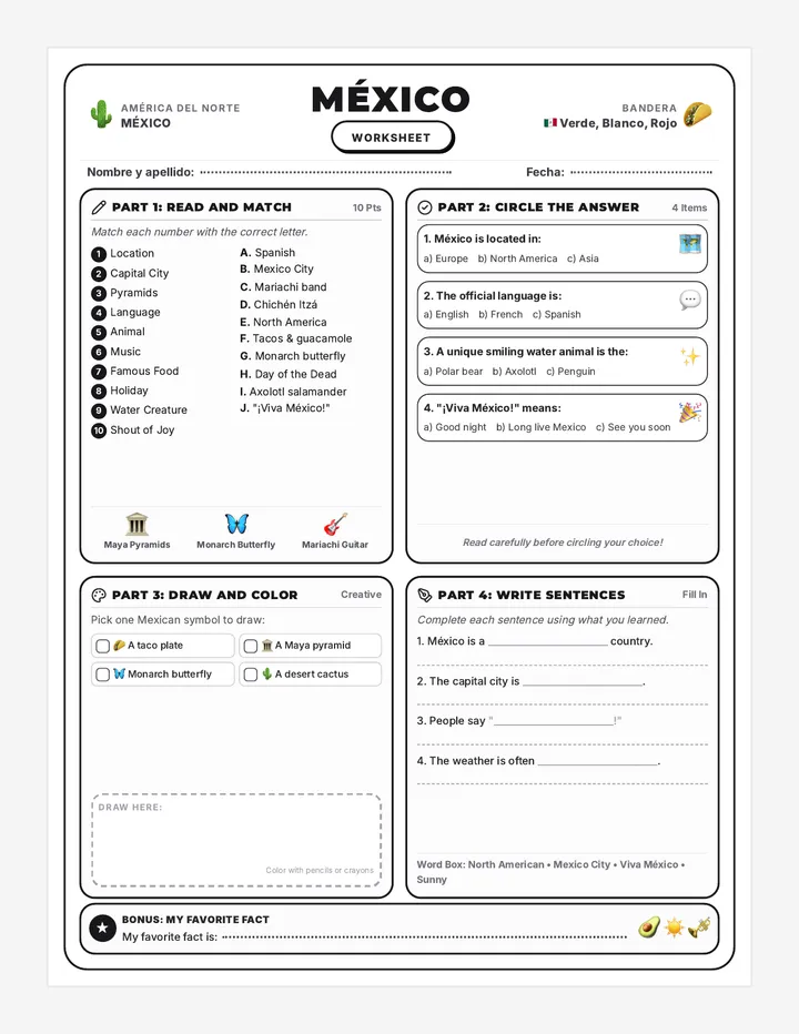
Mexico
Ancient Heritage • Mexico City
CA
Canada: The Great Northern Neighbor
2nd Largest Country on Earth
Capital & Languages
Ottawa
Canada has two official languages: English and French (especially spoken in Quebec).
Natural Environment
Boreal Forest & Lakes
Canada has more lakes than all other countries combined! Vast pine forests stretch into freezing arctic tundra.
Iconic Symbols
Maple Leaf & Beaver
The red maple leaf sits proudly on the Canadian flag. Hockey and lacrosse are Canada's beloved national sports.
Peaceful Border: The border between Canada and the United States is the longest undefended international border in the world!
US
The United States: Coast to Coast
50 States & Territories
Capital & Government
Washington, D.C.
The federal capital sits along the Potomac River. The nation is made of 50 states, plus territories like Puerto Rico and Guam.
Diverse Landscapes
From Plains to Coasts
Spans Atlantic beaches, Appalachian ridges, the great Midwestern breadbasket, towering Rocky Mountains, and Pacific cliffs.
People & Culture
Nation of Immigrants
English is the most widely spoken language, alongside Spanish and hundreds of native and world languages.
Two Non-Contiguous States: Alaska sits in the far northwest (next to Canada), and Hawaii is an island archipelago in the Pacific!
MX
Mexico: Land of Sun & Heritage
Rich History & Vibrancy
Capital & History
Mexico City
One of the world's oldest and largest cities, built over Tenochtitlan, the historic capital of the ancient Aztec Empire.
Languages & People
Spanish & Indigenous
The world's most populous Spanish-speaking country. Over 68 Indigenous languages, like Nahuatl and Maya, are spoken today.
Trio Trek Organizer Continent Quest • Lesson 2
Trio Trek Comparison Chart
Grade 4 Geography
Name:
Date:
Team:
Expedition Task: Research and record key facts about North America's three largest countries using your slides and class discussion. Ensure each cell is neat and legible!
1
The Three Big Neighbors Comparison
Category Canada United States Mexico Capital City
|
|
| Major Languages |
|
|
|
| National Symbol / Flag Emblems |
|
|
|
| Key Physical Landscape |
|
|
|
| Famous Tradition or Sport |
|
|
|
2
The Wider Neighborhood
Central America Quick Facts:
How many nations make up the Central American land bridge?
Name two Central American countries:
Caribbean Islands Quick Facts:
What body of water surrounds these islands?
Name two Caribbean island nations or territories:
3
Explorer's Regional Reflection
Choose one country (Canada, USA, or Mexico) you would most like to visit. Write 2-3 complete sentences explaining what you would see and do there.
Continent Quest • Grade 4 Social Studies North America Unit • Organizer 2
Trio Trek Teacher Guide Teacher Resource • Lesson 2
Trio Trek Teacher Guide
Instructional Master
Complete country comparison answer keys, talking points, and pacing support.
✓
Master Country Comparison Matrix
Expected Student Entries
Category Canada United States Mexico Capital City Ottawa Washington, D.C. Mexico City Major Languages English and French (official) English, Spanish, Indigenous Spanish, 68+ Indigenous National Symbol / Emblem Maple leaf, beaver Bald eagle, Stars & Stripes Golden eagle on cactus, serpent Key Landscape Boreal forest, arctic tundra, Great Lakes Great Plains, Rockies, Appalachians, coasts Sierra Madre mountains, Sonoran desert, coasts Famous Tradition / Sport Ice hockey, lacrosse, winter festivals Baseball, 4th of July, Thanksgiving Día de los Muertos, fútbol, mariachi
✓
Part 2 Keys: Central America & Caribbean
Central America (7 Nations):
Number of nations: 7
Accept any two: Guatemala, Belize, Honduras, El Salvador, Nicaragua, Costa Rica, Panama .
The Caribbean Islands:
Surrounding water: Caribbean Sea
Accept any two: Cuba, Jamaica, Bahamas, Haiti, Dominican Republic, Puerto Rico .
?
Classroom Discussion Questions
Shared Borders:
"Why do you think the border between Canada and the US is called 'undefended'? How do neighbors benefit from peaceful borders?"
Multiple Languages:
"Why are English and French spoken in Canada, while Spanish and Indigenous languages are spoken in Mexico?"
Climate Contrast:
"How does climate change as you travel south from northern Canada to southern Mexico and Central America?"
Differentiation & Scaffolding for Grade 4:
For Support: Provide a laminated word bank with capital names, flags, and languages to assist with spelling.
For Extension: Have advanced students calculate approximate flying times between Ottawa, Washington D.C., and Mexico City.
Wild Terrain Slides Grade 4 Geography Expedition
Lesson 3 • Continent Quest
Physical Geography
Land of Wonders
From towering snowcapped peaks and endless prairies to mighty freshwater seas and deep red canyons—explore the natural marvels of North America!
2 Major Ranges
Rockies & Appalachians
5 Great Lakes
20% of Earth's Fresh Water
Great Plains
Vast Continental Heartland
01
Two Mountain Spines: West vs. East
Continental Elevators
Western Giant
The Rocky Mountains
Stretches over 3,000 miles from northern British Columbia (Canada) all the way to New Mexico (USA).
Features:
Jagged, snow-capped peaks rising over 14,000 feet. Home to grizzly bears, bighorn sheep, and the Continental Divide!
Eastern Ancient
The Appalachian Mountains
Stretches over 1,500 miles from eastern Canada down to central Alabama in the United States.
Features:
Much older than the Rockies! Weathering and erosion have rounded their summits into lush, green, rolling tree-covered ridges.
The Continental Divide in the Rockies decides which ocean river water flows into!
Pacific vs. Atlantic
02
The Heartland: Plains & River Basin
Center of North America
Vast Grasslands
The Great Plains
A massive expanse of flat prairies and gently rolling grasslands spreading between the Mississippi River and the Rocky Mountains.
Known as "America's Breadbasket" for producing wheat, corn, and grain. Historic grazing lands of giant bison herds!
Mighty Waterway
The Mississippi River
Flows over 2,340 miles from Lake Itasca in Minnesota down into the warm Gulf of Mexico in Louisiana.
Along with its Missouri and Ohio tributaries, it creates one of the world's most productive river transportation networks!
Geography Connection: Water flowing from both the Rockies and the Appalachians empties into the Mississippi river system!
03
Freshwater Seas & Carved Canyons
Natural Marvels
Freshwater Giant
The 5 Great Lakes
Superior, Michigan, Huron, Erie, and Ontario. Remember the acronym H-O-M-E-S !
Formed by melting Ice Age glaciers. They hold about 20% of all the unfrozen surface fresh water on planet Earth!
Landform Explorer Activity Continent Quest • Lesson 3
Landform Explorer Activity
Grade 4 Geography
Name:
Date:
Score: / 20
1
Landform Matching
(5 pts)
Match each geographic feature to its description by writing the correct letter in the blank.
A. Rocky Mts.
B. Appalachians
C. Great Plains
D. Great Lakes
E. Mississippi R.
1. A 2,340-mile river highway flowing from Minnesota into the Gulf of Mexico.
2. Ancient, tree-covered, rounded mountain range running through eastern North America.
3. Five massive bodies of water holding 20% of Earth's unfrozen surface fresh water.
4. High, sharp, snowcapped peaks stretching 3,000 miles in western North America.
5. Vast central grasslands known as the continent's agricultural breadbasket.
2
Geographer's True / False
(4 pts)
1. The Grand Canyon was carved primarily by ocean tides.
[ ] True [ ] False
2. The Rocky Mountains are younger and taller than the Appalachians.
[ ] True [ ] False
3. The acronym H-O-M-E-S helps remember the 5 Great Lakes.
[ ] True [ ] False
4. The Great Lakes are located along the border of Mexico and the US.
[ ] True [ ] False
3
Expedition Field Postcard
(11 pts)
Choose ONE landform. Imagine you are an explorer visiting it right now. Write a 3-4 sentence postcard message home describing the scenery, climate, and what you see.
Selected Landform:
POSTAGE
Dear ,
Your Explorer,
Deliver To:
Continent Quest • Grade 4 Social Studies North America Unit • Activity 3
Landform Explorer Answer Key Teacher Resource • Lesson 3
Landform Explorer Answer Key
Answer Key • 20 Pts
Quick scoring guide and exemplar responses for the Landform Explorer Activity.
1
Part 1: Matching (5 pts)
1 pt each
E 1. Mississippi River (2,340 mi to Gulf)
B 2. Appalachian Mountains (Ancient/rounded)
D 3. Great Lakes (20% world's fresh water)
A 4. Rocky Mountains (3,000 mi sharp peaks)
C 5. Great Plains (Central grasslands breadbasket)
2
Part 2: True / False (4 pts)
1 pt each
1. Grand Canyon ocean tides: False
Carved by the Colorado River!
2. Rockies younger than Appalachians: True
Appalachians are hundreds of millions of yrs older.
3. H-O-M-E-S acronym for Great Lakes: True
Huron, Ontario, Michigan, Erie, Superior.
4. Great Lakes on Mexico border: False
Shared by Canada and the United States.
3
Exemplar Expedition Postcards (Part 3)
Reference Models
Option A: Rocky Mountains Postcard
"Dear Mom and Dad, I am standing high in the Rocky Mountains! The jagged peaks are covered in snow, and the air is crisp and cold. Yesterday our expedition spotted a bighorn sheep leaping along the rocky cliffs. It feels like we are on the roof of the continent!"
Option B: Grand Canyon Postcard
"Dear Class, Greetings from the rim of the Grand Canyon in Arizona! Looking down a whole mile to the Colorado River is breathtaking. The red and gold rock layers stretch as far as the eye can see under the bright desert sun. You won't believe how deep it is!"
Postcard Scoring Rubric (11 Total Points)
Criteria Exemplary (Full Pts) Proficient (Minor Gaps) Developing Geographic Accuracy (4 pts) Accurately identifies landform, location, and true physical traits (4 pts) Identifies landform with mostly accurate physical details (3 pts) Contains geographic errors or vague descriptions (1-2 pts) Descriptive Details (4 pts) Uses vivid sensory words (cold air, red rocks, rushing water) (4 pts) Includes 1-2 descriptive adjectives about the scenery (3 pts) Minimal description; repeats basic prompt words (1-2 pts)