A3 Basin & Range
B3 Permian Basin Oil
C3 Austin (Capital)
D3 Major Lake
4
A4 Rio Grande Valley
B4 King Ranch
C4 Port of Houston
D4 Gulf of Mexico
1. Grid Spotting: What coordinate is the Port of Houston located in? What major natural water feature borders it in D4?
2. Icon Decoding: Look at B3 on the grid. What resource icon is shown, and which famous Texas basin region is it located in?
3. Elevation Climb: Locate the highest mountain in Texas, Guadalupe Peak, on the grid. Give its coordinate, and identify its general cardial direction (e.g., North, West) relative to the state capital in C3.
Unit: Eco Texans // Lesson 1 Verify your coordinates before moving to Page 3! Page 2 of 3
Texas Geography Field Journal
COMPREHENSION // DAYS 1-2
Compare the wettest region of Texas (coastal plains) with the driest region (deserts/mountains) by writing key facts based on your briefing on Page 1.
What cities, key landforms, or primary jobs are found in this region? Describe why so many people live here:
What landforms, vegetation, or physical barriers make this region difficult to settle? Describe why fewer people live here:
Geographic Factors (TEKS 4.7A): Look at where Dallas/Ft. Worth (C2) and Austin (C3) are located. Why do you think large cities grew in the East and Central parts of Texas rather than the West? Explain using geographical terms (water, crops, resources).
The Compass & Elevation Connection: As an explorer travels from East to West across the state of Texas, what major changes do they see in both the climate (rainfall) and the terrain (elevation)?
Unit: Eco Texans // Lesson 1 Scout Mission Complete! Secure your log in your binder. Page 3 of 3
Key Motivations for Modification:
EXPLORATION REEL
Environmental Shapers
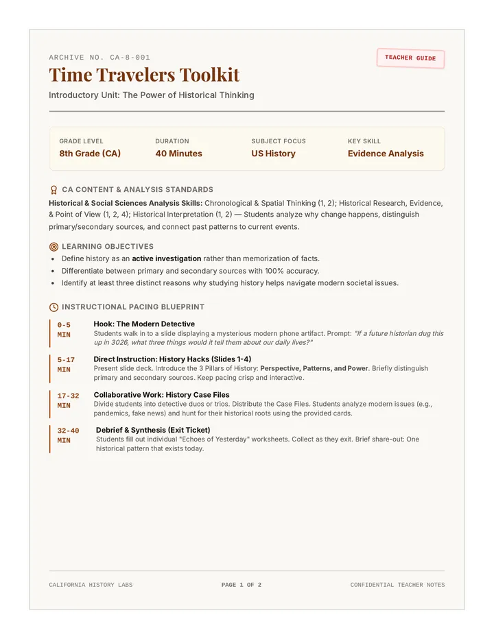
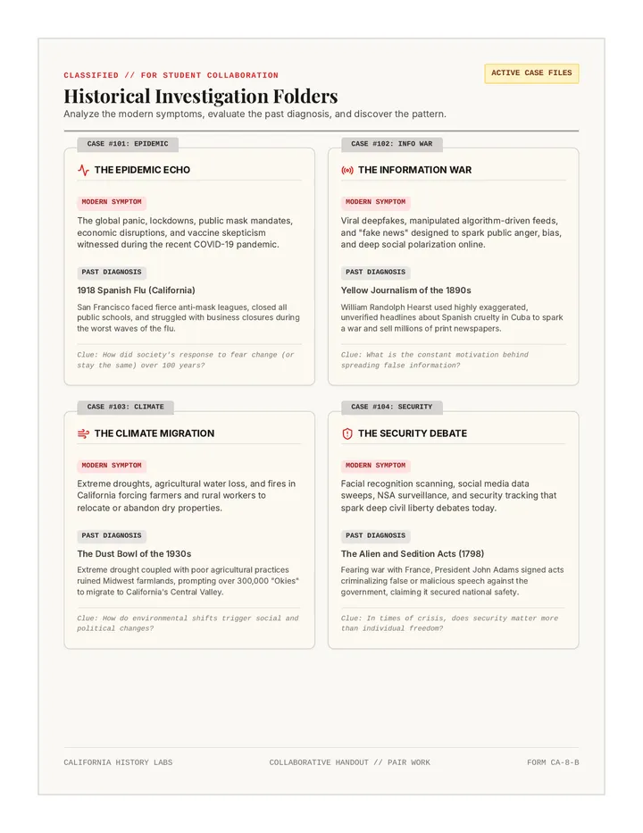
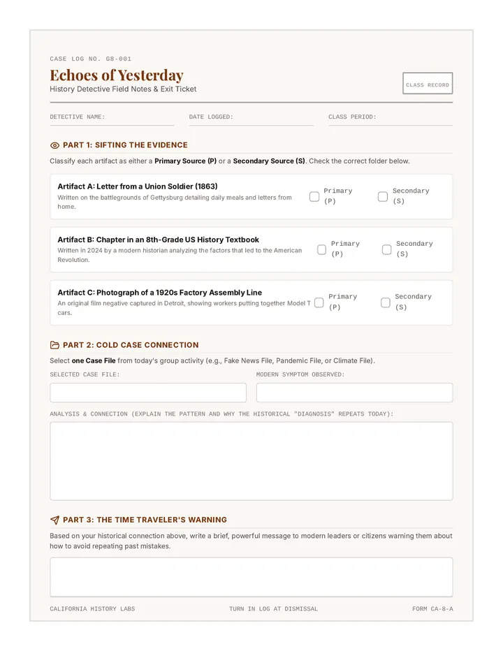
In 1901, the Spindletop oil gusher erupted in Southeast Texas, forever changing the state's economy. Texans carved up the coast, dredged deep harbors, and built heavy refineries to handle this "black gold."
Teacher Note: Discuss how Spindletop launched Texas into the modern industrial age!
Unit: Eco Texans Next: Deep dive into Dams and Reservoirs
NATURE NEGOTIATORS // SLIDE 05
Did you know Texas has only one major natural lake? (Caddo Lake). Every other major lake is actually a man-made reservoir created by building heavy river dams.
How it works: A concrete dam blocks a flowing river, creating a giant backing pool of water (reservoir) for cities to draw from.
1. Flood Control: Holds back flash floods during heavy rainstorms, protecting cities downstream.
2. Reliable Water: Stores millions of gallons of drinking water for homes and crops during dry droughts.
Economic & Survival Boost
1. Flooded Ecosystems: Land behind the dam is permanently flooded, destroying wild forests and homes.
2. Disrupted Wildlife: Blocks fish and other river animals from migrating upstream to reproduce.
Environmental Consequence
Unit: Eco Texans TEKS 4.8(C) Consequence Analysis
NATURE NEGOTIATORS // SLIDE 06
Texas sits on top of huge subterranean pools of oil (petroleum). To extract this valuable fuel, Texans have built thousands of drilling rigs and pump jacks across the state.
The Scale of Change: Entire landscapes have changed from empty prairies to active oil fields that buzz with energy day and night.
1. Economic Explosion: Created millions of jobs, generated massive tax revenue for Texas schools, and turned cities like Houston into global business capitals.
Economic Consequences
1. Severe Pollution: Chemical runoffs can ruin local soil, and air pollution from heavy refineries hurts breathing quality. Potential oil spills damage fragile coastal marshes.
Environmental Consequences
Unit: Eco Texans Oil fuels the economy but alters the native ecosystems.
NATURE NEGOTIATORS // SLIDE 07
A consequence is simply the result of an action. Consequences are not always bad—they are a mixture of trade-offs.
Historical Decisions
Historically, people focused heavily on modifying the land for immediate economic growth (clearing massive forests to build early railways).
Modern Perspectives
Today, Texans realize we must balance physical modifications with conservation to ensure future generations have clean water, green forests, and rich ecosystems.
Jobs, safe drinking water, reliable electricity, fuel for transport, and tax money for roads and schools.
Loss of ancient forests, river and ocean pollution, endangered wildlife habitats, and air quality issues.
Challenge: Can we have a thriving economy while protecting our beautiful state?
Unit: Eco Texans Explore these trade-offs in your comic strip activity!
NATURE NEGOTIATORS // SLIDE 08
Quick Quiz #2
A. Human Adaptation
B. Human Modification
C. Industrialization
D. Geography Mapping
Discussion Prompt
If you were a city council member voting on whether to build a new dam on a wild Texas river:
Pro-Dam: What will you tell families who need water and fear heavy flooding?
Pro-Wild: What will you tell wildlife biologists who want to save endangered fish and ancient river-forests?
Get ready for your Nature Negotiators comic log assignment! Environmental Shapers Unlocked! 🛠️
Describe the trade-offs of the Oil Boom: Why did people choose to modify the environment in this way?
Scout Explanation (TEKS 4.8C Consequence Analysis)
Unit: Eco Texans // Lesson 2 Evaluate the past vs. present choices on the final page → Page 2 of 3
Human-Environment Interactions
CREATIVE TASK // DAY 4
Comic Artist Mission (TEKS 4.8C)
Think of a major Texas environment modification (such as building a highway, drilling oil wells, or building river dams). In the comic boxes below, illustrate the Double-Edged Sword—one box showing how it helps human business, and one box showing how it impacts native nature.
Frame 1: Human Benefit
Draw a scene showing how this modification helps humans support themselves (crops, cities, jobs, or energy):
[Draw Benefit Here]
Caption:
Frame 2: Nature's Price
Draw a scene showing how this same modification harms wild ecosystems (animals, forests, water, or soil):
[Draw Impact Here]
Caption:
Self-Reflection (TEKS 4.8C): Why is it important for modern Texas leaders to plan for both economic benefits and environmental costs before making a modification?
Unit: Eco Texans // Lesson 2 Mission accomplished! Hand this log in for scout review. Page 3 of 3
B. The East has high, rugged mountain borders.
C. The East has rich soil, flat land, and coastal ports.
D. The West has the highest density of ancient oak forests.
2. When a coastal family builds their wooden house on concrete stilts on the shore of Galveston, which type of human-environment interaction are they demonstrating?
A. Natural Modification of the Coastline
B. Human Adaptation to Hurricane Risks
C. Physical Modification of River Channels
D. Conservation of Marine Habitats
3. What was the main economic motivation for Texans to dig thousands of oil wells and build massive refineries after the 1901 Spindletop gusher?
A. To restore native forest ecosystems to East Texas.
B. To prevent destructive coastal flooding along the Gulf.
C. To earn profits, supply energy, and create industries.
D. To study rare desert minerals in the Basin and Range.
4. When engineers build a concrete dam across a major flowing river in Central Texas, what is a primary NEGATIVE environmental consequence of this modification?
A. It permanently reduces local school funding.
B. It floods local ecosystems and disrupts wildlife migration.
C. It creates a major drought in the Gulf of Mexico.
D. It forces citizens to remove central air conditioning.
Eco Texans Unit Assessment // Part C Turn page for Case Study & Short Answer Section → Page 2 of 3
Geography & Society Audit
PART D // TEKS 4.8C
Read the following scenario and write complete paragraph answers for the questions below. Ensure your responses use geographic terminology!
The Piney Woods Highway Project: To help oil tankers and agricultural trucks move products faster between Houston and East Texas, state leaders have approved the construction of a major six-lane asphalt highway. This highway will cut directly through the ancient forests of the Gulf Coastal Plains. While the highway will help businesses thrive, it requires clearing 5,000 acres of pine woodlands, splitting animal migration corridors in half, and creating heavy industrial noise near forest streams.
1. Economic Evaluation (TEKS 4.8B): Explain the positive economic reasons why Texas leaders approved this modification. How does this highway help Texans support themselves and conduct business?
2. Environmental Evaluation (TEKS 4.8C): Describe the negative consequences this modification will have on the natural environment of the Piney Woods. What long-term damage will occurred?
Eco Texans Unit Assessment // Part D Double-check all spelling and details before submitting. Page 3 of 3
| 2-1 Points |
| (Emerging) | Fragmented | Provides single-word answers or fragmented notes. Misidentifies economic as environmental or shows critical gaps in adaptation vs modification. |
"Texas leaders approved this modification because highways help companies transport cargo much faster and safer. In our lessons, we learned that people support themselves through business and trade. Connecting the major coastal city of Houston to East Texas farms and oil wells lets tankers and cargo trucks deliver food, fuel, and raw lumber to people who need them, which creates jobs and helps the economy grow."
"The highway will negatively impact the environment of the Piney Woods because physical modifications like clearing forests destroy native ecosystems. Stripping 5,000 acres of pine woodlands leaves local forest animals without nesting trees or food sources. Cutting the migration corridor in half means animals cannot travel to find water or mates. Additionally, noise and chemical runoff from cars will pollute the forest streams."
Eco Texans Assessment Key // Rubrics & Exemplars Scouring Guide Complete // High Standards of Texas Excellence Page 2 of 2