Crescent Cartography Student Packet Independent Study Packet
Crescent Cartography
Theme: Physical Geography & Ancient Farming
Lesson 1: Fertile Crescent
Explorer Name:
Date:
The Cradle of Civilization
Imagine a vast, boomerang-shaped strip of fertile land surrounded by harsh deserts and rugged mountains. This is the Fertile Crescent , located in the modern-day Middle East. Thousands of years ago, early humans transitioned from hunting and gathering to farming here, marking the birth of civilization.
Two major rivers, the Tigris and the Euphrates , made this miracle possible. Rising in the snow-capped Taurus Mountains of Turkey, they flowed southeast into the Persian Gulf. Each spring, melting mountain snow triggered violent, unpredictable floods. These floods deposited silt , which is a thick, dark, and nutrient-rich soil, across the flat floodplains. To survive, early farmers learned to control this wild water using canals, dykes, and basins, a process called irrigation .
Key Term Match-Up (Write the letter of the correct definition):
1. _____ Silt
2. _____ Irrigation
3. _____ Fertile Crescent
A. The redirection of river water to dry fields using human-built canals.
B. Fine, fertile soil particles left behind by retreating spring floods.
C. A crescent-shaped region in the Middle East with highly productive farmland.
Map & Geography Check-In
Geographic Profile
• North: Taurus Mountains
• South: Syrian Deserts
• East: Zagros Mountains
• West: Mediterranean Sea
1. Why were the spring floods both a blessing and a disaster for early Mesopotamian farmers?
2. Locate the water sources. How did snow in the Taurus Mountains (hundreds of miles away) affect crops in the flat southern floodplains?
© Eastern Odyssey Education Suite Page 1 of 2
Part 3: The Irrigation Blueprint
Engineering Challenge for Early Farmers
Your Scenario: You are an agricultural planner in the southern city of Ur. The Euphrates River is wild, flooded with silt, but the fields further inland are dry and parched. If you don't route the water, your city will starve. If you don't control the flow, the city will drown.
Your Engineering Instructions:
Draw a Canal network from the river to the dry crop fields.
Design a Silt Basin (a pool to let heavy mud settle before water enters the crops).
Incorporate Gating or Levees to stop high-water floods from washing away delicate barley.
Design Canvas (Draw or Describe your Layout) Print & Sketch
WILD EUPHRATES RIVER (High Silt Water)
Flow →
Clay & Silt Plain (Build Canals & Basin Here)
Proposed Basin Area
Proposed Canal Path
THIRSTY BARLEY FIELDS
Design Rationale:
Why must you let the muddy river water sit in a "Silt Basin" before letting it flow into your narrow, shallow crop canals? What happens if you skip this step?
Did you know? Mesopotamia means "land between rivers" in Greek. Without coordination to clean canals of blocking mud, ancient crops would fail, which forced early cities to create laws and governments!
© Eastern Odyssey Education Suite Page 2 of 2
Crescent Cartography Teacher Guide Teacher Facilitation Guide
Crescent Cartography
Sub-Ready Lesson Plan & Answer Keys
Lesson 1 Key
Grade 6 Social Studies
Pacing Guide: 45-50 Minutes
Format: Independent Packet
Materials Needed: Pencil, Colored Pencils
Sub Instructions & Pacing
0-5 mins: Intro. Hand out the packets. Read the background scenario out loud to spark curiosity. Emphasize that students are stepping into the shoes of early engineers.5-20 mins: Reading & Map. Students read the "Cradle of Civilization" text and inspect the regional profile map. They complete the analysis questions on page 1.20-40 mins: Engineering Challenge. Students construct their design on page 2. Prompt them to draw canal lines, label a silt basin, and sketch protective walls.40-45 mins: Wrap-up & Reflect. Students answer the critical design rationale. Collect packets for grading.
Answer Keys & Discussion Prompts
Page 1 Key Term Match-Up Answer Key
Expected Matching: 1 = B (Silt), 2 = A (Irrigation), 3 = C (Fertile Crescent).
Q1: Unpredictable Floods (Page 1)
Expected Answer: Floods were a blessing because they brought water and left behind silt, the rich black soil, that nourished crops. They were a disaster because they were unpredictable and violent, and could drown whole villages and crops without warnings.
Q2: Mountain Water Source (Page 1)
Expected Answer: Melting winter snow in the Taurus Mountains in Turkey rushed downstream through the Tigris and Euphrates rivers. This meant that weather hundreds of miles away directly caused the spring floods and mud in the southern flat farm regions.
Page 2: Irrigation Blueprint Rubric
Design Evaluation: Look for a canal route originating at the river and leading directly into the Barley Fields. A silt basin should be drawn as an intermediate pool. Give points for clear pathways and labels showing water gates/dams.
Design Rationale Answer: Water from the river is full of thick sediment (silt). If it flows straight into canals, the mud settles inside them, clogging the channels and stopping the water entirely. Silt basins let mud drop to the bottom first so cleaner, flowing water can go down the canals.
Extension Activity (For Fast Finishers):
Scribe Academy Student Packet Independent Study Packet
Egyptian Scribe Academy
Theme: Ancient Writing & Social Hierarchy
Lesson 2: Ancient Egypt
Apprentice Name:
Date:
The Power of the Pen in Ancient Egypt
In Ancient Egypt, very few people could read and write, which was fewer than 1% of the population! Those who mastered this skill were known as scribes . They held a highly respected position in society, exempt from paying taxes and spared from hard manual labor like farming or building pyramids.
Scribe school was brutal. It began around age five and lasted for over a decade. Apprentices spent long hours memorizing thousands of hieroglyphs , which are complex pictographic symbols where symbols represented sounds, ideas, or objects. Scribes wrote on papyrus , a heavy paper-like material made from wild river reeds. They beat the reeds flat, layered them crosswise, pressed them dry, and polished them with smooth stones to make scrolls.
The Secret Scribe Code
Use the Hieroglyph decoder below to translate the ancient Egyptian scribe's wisdom!
𓄿 (A) Falcon
𓃀 (B) Foot
𓂧 (D) Hand
𓇋 (I) Reed
𓅓 (M) Owl
𓈗 (W) Water
𓋴 (S) Cloth
𓂋 (R) Mouth
Decrypt the Pharaoh's Scroll: What message did the scribe write?
𓋴 𓂋 𓇋 𓃀 Block 1
𓂧 𓇋 𓂧 Block 2
𓅓 𓄿 𓂧 Block 3
Translation 1:
Translation 2:
Translation 3:
Follow-Up Question: Why would a scribe's high social status make others want to attend scribe school?
© Eastern Odyssey Education Suite Page 1 of 2
Part 3: The Scribe Apprentice Challenge
Daily Life & Modern Symbols
Activity A: Design a Modern Hieroglyph
Ancient Egyptian hieroglyphs used drawings of animals and everyday tools to represent concepts. If you had to invent a single hieroglyphic symbol to represent "The Internet" or "Smartphones" , what would it look like? Sketch your design below and explain your logic.
Symbol Canvas
Explanation of Design:
Explain the elements of your symbol and why they represent modern connectivity.
Activity B: Diary of an Apprentice Scribe
It is your first day at the Scribe Academy at the Temple of Karnak. Your teacher, an elderly royal scribe, is incredibly strict, demanding perfect repetition. Write a short log entry (3-4 sentences) describing your first day. Mention the materials you used (river reeds, papyrus) and how you feel about your social status compared to standard farmers.
Scribe Academy Teacher Guide Teacher Facilitation Guide
Egyptian Scribe Academy
Sub-Ready Lesson Plan & Answer Keys
Lesson 2 Key
Grade 6 Social Studies
Pacing Guide: 45-50 Minutes
Format: Independent Packet
Materials Needed: Pencil, Blank paper (opt)
Sub Instructions & Pacing
0-5 mins: Lesson Launch. Distribute packets. Explain to students that they are "apprentices" in Ancient Egyptian scribe school.5-15 mins: Reading. Students read the "Power of the Pen" background. Have them underline the benefits scribes enjoyed compared to common field laborers.15-25 mins: Secret Code Decryption. Students use the hieroglyph key to decode the royal message and complete the reflection on Page 1.25-45 mins: Creative Challenges. Students construct their "Modern Hieroglyph" (A) and write their "First Day Log" (B) on page 2.
Answer Keys & Discussion Prompts
Page 1: Secret Scribe Code & Follow-Up Answer
Expected Decryption: Block 1 = S-R-I-B (Scribe), Block 2 = D-I-D (Did), Block 3 = M-A-D (Mad). Total Message: "Scribe Did Mad".
Follow-Up Question Answer: Scribes enjoyed elite privileges such as no taxes and no physical labor, making the high-effort training very attractive to escape standard farming life.
Page 2 Activity A: Modern Symbol
Evaluation Guide: Any creative drawing representing technology is acceptable (e.g., a hand holding a glowing brick, a circle with curved wifi rays, or an eye staring at a small frame). The written explanation should connect the visual parts of their drawing to the actual purpose (such as connectivity, rapid typing, or digital signals).
Page 2 Activity B: Apprentice Diary
Grading Criteria: Look for 3-4 complete sentences. Students must mention at least one key scribe tool (river reeds, papyrus scrolls, soot inks) and express feeling superior or relieved that they aren't working under the scorching sun harvesting wheat or shifting heavy stones for building projects.
Extension Activity (For Fast Finishers):
Have students sit in partners. Using the 8-character key on Page 1, they write a 3-word secret code message of their own on scrap paper, swap, and decode each other's messages!
© Eastern Odyssey Education Suite Lesson 2 Guide
Mesopotamian Patents Student Packet Independent Study Packet
Mesopotamian Patents
Theme: Ancient Technology & Human Innovation
Lesson 3: Mesopotamia
Patent Agent Name:
Date:
The Dawn of Tech: Mesopotamia's Innovations
Between the Tigris and Euphrates rivers, the ancient Sumerians faced major challenges. They had to transport heavy harvests, plow hard clay soils, and manage complex city economies. Instead of giving up, they became some of the greatest inventors in human history.
First came the wheel . Originally created around 3500 BCE as a flat turntable for shaping pottery, clever builders soon flipped it sideways, attached it to axles, and invented the wheeled cart. Suddenly, a single ox could haul three times more grain than before!
Next was the plow . Made of heavy wood or bronze, this tool sliced through hard soil, letting air and moisture in. Plown fields produced massive surplus crops. Finally, to track all this trade, Sumerians invented Cuneiform , a wedge-shaped writing system pressed into wet clay tablets. They recorded wheat bags, sheep, and taxes, which served as the first databases!
Invention Matching (Match the invention to the major problem it solved):
1. _____ The Wheeled Cart
2. _____ The Seeder Plow
3. _____ Cuneiform Writing
A. Managing city grain records, taxes, and large business transactions.
B. Moving heavy, bulky agricultural harvests over dry clay land.
C. Breaking hard, sun-baked clay soils so seeds can take root easily.
Patent Agent Review Log
As a Senior Patent Agent in Babylon, you must evaluate these brand-new applications. Answer the questions below to decide if they deserve royal patents!
1. How did flipping a clay potter's turntable sideways to create the "Wheeled Cart" fundamentally transform trade and food transportation?
2. Without Cuneiform writing, why would it be impossible for a king to manage a complex city-state with thousands of citizens?
© Eastern Odyssey Education Suite Page 1 of 2
Part 3: The Royal Invention Pitch
Secure Funding from King Hammurabi
The Pitch Mission: Select one of the three iconic inventions (Wheeled Cart , Seeder Plow , or the river Sailboat ). You must draft an official Patent Application and a persuasive "Shark Tank" style pitch to convince King Hammurabi to fund its production.
Mesopotamian Patents Teacher Guide Teacher Facilitation Guide
Mesopotamian Patents
Sub-Ready Lesson Plan & Answer Keys
Lesson 3 Key
Grade 6 Social Studies
Pacing Guide: 45-50 Minutes
Format: Independent Packet
Materials Needed: Pencil, Markers/Pencils
Sub Instructions & Pacing
0-5 mins: Scenario Setup. Hand out the packets. Tell students they are working as Patent Agents in the Ancient Babylonian Patent Office, reporting directly to King Hammurabi.5-20 mins: Inventors' Reading. Students read the "Dawn of Tech" passage. They write their evaluations on Page 1.20-40 mins: Patent Pitch. Students select one invention (wheeled cart, seeder plow, sailboat), sketch it, and compose their persuasive written pitch to the King.40-45 mins: Peer Review / Wrap-up. Ask students to share their pitches with neighbors. Collect completed packets for grading.
Answer Keys & Discussion Prompts
Page 1 Invention Matching Key
Expected Matching: 1 = B (Wheeled Cart), 2 = C (Seeder Plow), 3 = A (Cuneiform Writing).
Q1: The Wheeled Cart Impact (Page 1)
Expected Answer: Before the wheeled cart, transport relied on human backs or sleds dragged over dry mud, which was extremely slow and limited in weight. Adding wheels meant a single beast of burden (ox) could haul massive, heavy loads of surplus crops across long distances, dramatically boosting commerce and food trade.
Q2: Cuneiform & City Management (Page 1)
Expected Answer: A king cannot remember every single citizen's taxes, transactions, or trade stocks. Cuneiform allowed records to be stored permanently in clay. Without writing, there would be constant disputes over grain ownership, and collecting royal taxes would fail.
Page 2: Patent Pitch Evaluation Rubric
Technical Sketch: Look for a hand-drawn depiction of their chosen technology. It must contain simple arrows or labels pointing out parts (e.g., "wooden axle", "bronze share", "linen sail").Persuasive Pitch: The text must address King Hammurabi and explain how the invention aids the kingdom. Highly proficient pitches will explicitly include terms like surplus (extra food), efficiency (saved labor), or trade (river/road networks).
Monsoon Adapters Student Packet Independent Study Packet
Monsoon Adapters
Theme: Climate Cycles & Human Adaptation in India
Lesson 4: Monsoon Asia
Village Leader Name:
Date:
The Winds of Change: India's Monsoon Climate
In India, life is governed by a giant weather pattern called the Monsoon . The word doesn't just mean "rain"; it actually refers to a seasonal wind shift. Because land heats and cools faster than the ocean, the winds change directions completely twice a year, driving a powerful cycle of wet and dry seasons.
From June to September , the Summer Monsoon blows warm, moisture-packed air from the Indian Ocean in the southwest. This brings torrential downpours that drench the earth, turning dry fields into lush, muddy swamps perfect for growing rice , which requires standing water to grow.
From October to May , the winds reverse. The Winter Monsoon blows dry, cold air from the snow-capped Himalayan Mountains in the northeast. For months, almost no rain falls. To survive, ancient Indians had to invent incredible water-harvesting tools like stepwells (huge, decorated stone pits that collected summer rainwater for winter use).
Monsoon Comparative Matrix
Compare the two monsoon cycles of the Indian Subcontinent using the reading passage. Fill in the blanks.
Season Feature Summer Monsoon Winter Monsoon 1. Months Active: June to September October to May 2. Wind Direction: From Indian Ocean (Southwest) From ________________________ 3. Primary Impact: Torrential rain, floods, swampy soil ____________________________ 4. Agricultural Role: Allows wet rice cultivation Relies on stored reservoir water
1. Why are stepwells (elaborate stone water storage wells) considered a genius human adaptation to a monsoon climate? What would happen during the dry season without them?
2. Agriculture Connection: Explain why crops like rice must be grown during the summer monsoon rather than the winter monsoon.
© Eastern Odyssey Education Suite Page 1 of 2
Part 3: The Monsoon Survival Plan
Scenario: Redesigning Ancient Ganges Village
Your Scenario: You are the elected Elder of
Monsoon Adapters Teacher Guide Teacher Facilitation Guide
Monsoon Adapters
Sub-Ready Lesson Plan & Answer Keys
Lesson 4 Key
Grade 6 Social Studies
Pacing Guide: 45-50 Minutes
Format: Independent Packet
Materials Needed: Pencil, Colored Pencils
Sub Instructions & Pacing
0-5 mins: Lesson Launch. Distribute packets. Explain to students that they are taking on the role of village planning elders in ancient India, facing dual climate threats (floods and droughts).5-20 mins: Reading & Matrix. Students read the "Winds of Change" background text and complete the comparative matrix on Page 1.20-40 mins: Redesigning Haripur. Students select adaptations, sketch their layout on the canvas, and draft their written defense to the council on Page 2.40-45 mins: Cool-Down Discussion. Guide a brief whole-class check or review student designs. Collect packets for grading.
Answer Keys & Discussion Prompts
Page 1: Matrix Fill-In Answers
Expected Answers: Himalayan Mountains (Northeast) Drought, dry, cold air, parched soil, cracked earth
Page 1 Q1: Stepwell Analysis
Expected Answer: Stepwells capture and store the massive, overwhelming rainwater during the summer wet season so that communities have reliable water to survive the eight months of winter drought.
Page 1 Q2: Agriculture Connection
Expected Answer: Rice requires swampy, water-logged conditions to grow. This wet state is only possible during the summer monsoon rains. Winter wind is dry and lacks rain, which kills delicate rice crops.
Page 2: Redesign Evaluation Rubric
Map Sketch: Checkboxes must be marked. Sketch must show elevated houses, a stepwell, or rice crop basins. Justification text must explain how stilt homes save lives in summer, and reservoirs hold water for dry winter crops.
Extension Activity (For Fast Finishers):
In pairs, have students brainstorm how monsoons might affect trade routes. Ask: "If you were an ancient sailor in the Indian Ocean, how would you use the seasonal monsoon wind shifts to plan your trading voyage to and from Africa?" (Crucial connection to Indian Ocean trade!)
© Eastern Odyssey Education Suite Lesson 4 Guide
Japan Island Survival Student Packet Independent Study Packet
Japan Island Survival
Theme: Island Geography & Marine Adaptations
Lesson 5: East Asian Islands
Islander Name:
Date:
The Ring of Fire: Living on the Edge
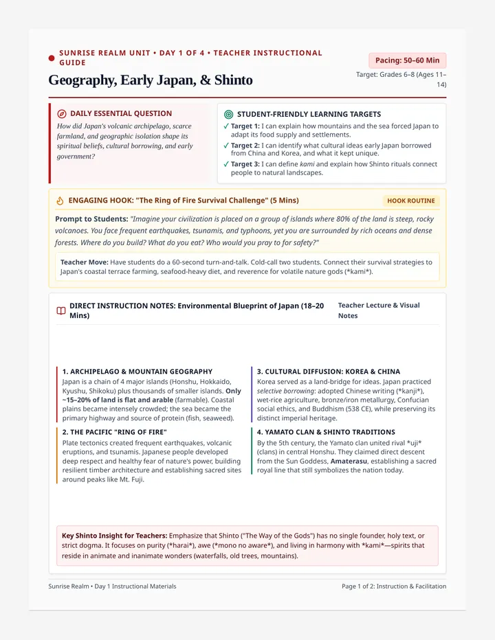
Japan is an archipelago , which is a chain of over 6,000 islands stretching along the eastern coast of Asia. Unlike the flat, fertile river valleys of Egypt or Mesopotamia, Japan's physical landscape is incredibly rugged. Over 70% of Japan is covered in steep, volcanic mountains, leaving very little flat land (coastal plains) for people to live and grow food.
Furthermore, Japan sits directly on the Ring of Fire , an active zone of tectonic plates where earthquakes, volcanic eruptions, and massive ocean tsunamis are a frequent, terrifying reality of daily life.
To survive, the Japanese people had to adapt. Denied broad river plains, they carved flat stairs directly into steep mountain slopes, a process called terrace farming , allowing them to grow rice on mountains. Surrounded by the rich waters of the Pacific Ocean, they turned to the sea, becoming master fishermen and harvesting nutrient-dense seaweed (nori) and fish as their primary source of protein.
Geographic Term Check-In (Match the term to its physical description):
1. _____ Archipelago
2. _____ Ring of Fire
3. _____ Terracing
A. A volcanic and seismic belt wrapping around the rim of the Pacific Ocean.
B. Carving flat steps into mountain slopes to create usable farm surfaces.
C. A grouping or string of islands surrounded by water.
Island Geography Analysis
Reflect on Japan's dramatic physical geography and explain how it forced unique cultural habits.
1. With 75% of the land covered in mountains, why was flat land so incredibly valuable in ancient Japan? How did this affect where cities were built?
2. How did Japan's isolation as an island chain protect it from invading armies (like the Mongols) while also pushing it to rely on sea trade?
© Eastern Odyssey Education Suite Page 1 of 2
Part 3: The Archipelago Adaptation Guide
Scenario: Survival Blueprint for coastal Honshu
The Adaptation Task: Imagine you are an advisor to a newly settled clan along Japan's rocky coastline. The mountains behind you are steep, and the ocean is vast. Complete the layout below to instruct your clan on how to survive and thrive.
Japan Island Survival Teacher Guide Teacher Facilitation Guide
Japan Island Survival
Sub-Ready Lesson Plan & Answer Keys
Lesson 5 Key
Grade 6 Social Studies
Pacing Guide: 45-50 Minutes
Format: Independent Packet
Materials Needed: Pencil, Colored Pencils
Sub Instructions & Pacing
0-5 mins: Scenario Setup. Distribute packets. Tell students they are geographic advisors to an ancient Japanese clan living along Honshu's volcanic, sea-facing cliffs.5-20 mins: Archipelago Reading. Students read the "Ring of Fire" background and analyze the physical geography of Japan, answering questions 1 and 2 on Page 1.20-40 mins: Designing the Adaptation Guide. Students sketch terraced steps on Page 2 (A), list marine resources (B), and draft active natural disaster safety rules (C).40-45 mins: Debrief. Ask students: "How does physical geography force humans to change their diet and architecture?" Collect packets for grading.
Answer Keys & Discussion Prompts
Page 1 Geographic Vocabulary Key
Expected Matching: 1 = C (Archipelago), 2 = A (Ring of Fire), 3 = B (Terracing).
Q1: Mountainous Terrain (Page 1)
Expected Answer: With over 70% of Japan covered in steep mountains, flat land (the coastal plains) was extremely rare and highly valued for growing crops. This meant cities had to be packed densely together along the narrow coastal rims of the islands.
Q2: Island Defense & Trade (Page 1)
Expected Answer: Japan's surrounding seas served as a natural barrier, making it incredibly difficult for invading foreign armies to land troops. However, being surrounded by water meant Japan naturally developed expert boat builders, lookouts, and merchants who relied on the seas to trade with other island coastal regions.
Page 2: Adaptation Blueprints Rubrics
Terrace Sketch (A): Sketch must depict horizontal "steps" on a mountain. Written text should state that terracing stops mudslides and holds water.Sea Harvests (B): Fish (protein), seaweed/nori (vitamins), clams (nutrient collection).Ring of Fire Tips (C): 1. Wooden houses bend and absorb seismic waves. 2. Build high-ground trails to flee tsunamis. 3. Watch volcanic chimneys.
Extension Activity (For Fast Finishers):