Lenny.com
Explore
Create
ActivitiesNewMathEnglish Language ArtsScience & EngineeringSocial StudiesGlobal LanguagesHealth & Physical EducationSpecial EducationCounseling & Life SkillsArts & CreativityESL
Lenny.com
Lenny.com
Explore
Create
ActivitiesNewMathEnglish Language ArtsScience & EngineeringSocial StudiesGlobal LanguagesHealth & Physical EducationSpecial EducationCounseling & Life SkillsArts & CreativityESL
Lenny.com
Lenny.com

Solutions

Lenny for EducatorsLenny for SchoolsLenny for Districts

Product

ExploreSign inCreateSupportAbout

Resources

Getting startedMTSS Acceleration Program

Newsletters

School Funding Newsletter

© 2026 Lenny Learning Inc.

TermsPrivacyAccessibility
LinkedInInstagramX
Lenny

Ancient Mesopotamia

Development of city-states and agriculture in the Fertile Crescent. Examines cuneiform script, ziggurat construction, and early legal systems like the Code of Hammurabi.

Social StudiesSocial Studies PracticesLocation WordsMapsOrder EventsChronology and CausationEvaluating SourcesHistorical ThinkingGeography, Humans, & the EnvironmentAmerican Symbols and LandmarksCitiesStatesState CapitalsRegions of the United StatesGeographic SkillsPhysical GeographyHuman GeographyRegional GeographyGeography of AfricaGeography of AsiaGeography of EuropeGeography of OceaniaGeography of the AmericasSociety and Environment of EuropeSociety and Environment of AsiaSociety and Environment of The AmericasSociety and Environment of the Middle EastSociety and Environment of AfricaHistoryPrehistoryComparing Ancient River CivilizationsAncient MesopotamiaAncient Egypt and KushAncient South AsiaEarly ChinaGreeceRome and the Byzantine EmpireAncient World HistoryNative Peoples of North AmericaNative Peoples of Mesoamerica and South AmericaAfrican EmpiresMedieval AsiaMedieval EuropeThe Silk RoadMedieval HistoryIslamic EmpiresWorld ReligionsRenaissance PeriodAge of ExplorationThe Thirteen ColoniesThe American RevolutionUS History Early RepublicFounding of the United StatesUS History AntebellumUS Civil WarReconstruction PeriodThe Gilded AgeUS ImperialismWorld ImperialismWorld War IUS History 1920sGreat DepressionWorld War IIThe Cold WarUS History 1950-60sUS History 1960s-70sWorld History 20th CenturyContemporary US HistoryContemporary World HistoryHolidaysCivics and GovernmentCitizenshipGovernment FoundationsThe ConstitutionUS ConstitutionExecutive BranchLegislative BranchJudicial BranchState and LocalPolitical ParticipationPublic PolicyPolitical SystemsPower and AuthoritySocial MovementsDefining DevianceTheories of DevianceCrime and Criminal JusticeEconomicsBasic Economic PrinciplesSupply and DemandWhat is MoneyEconomic FundamentalsMicroeconomicsMacroeconomicsBanking and FinanceEconomic SystemsGlobal EconomicsCorporations and PowerThe Changing WorkplaceUnemployment and LaborClass and InequalitySocial MobilityGlobal InequalityPsychologyHistory of PsychologyPsychology as a ScienceBrain and Nervous SystemNeuroscience and BehaviorGenetics and BehaviorSleep and ConsciousnessSensory ProcessesPerceptual OrganizationClassical ConditioningOperant ConditioningObservational LearningCognitive LearningMemory ProcessesThinking and Problem SolvingLanguage and CognitionTheories of MotivationStress and CopingPrenatal and Infant DevelopmentChildhood DevelopmentAdolescent DevelopmentAdulthood and AgingSelf and IdentitySocial CognitionSocial InfluenceAttraction and RelationshipsGroup BehaviorPrejudice and DiscriminationAnxiety and Mood DisordersClinical PsychologyForensic PsychologyPhilosophy & EthicsIntroduction to PhilosophyMajor Philosophers & IdeasMind and Body ProblemFree Will vs DeterminismEthics & MoralityReligion & PhilosophyPolitical Philosophy

Videos

How Geography Shapes Global Food Security

How Geography Shapes Global Food Security

This educational video explores the complex field of agricultural geography, examining why food insecurity persists in a world that produces enough calories to feed everyone. Host Alizé Carrère guides viewers through the intricate web of historical, political, economic, and environmental factors that determine who has access to food. The narrative moves from local examples of farming to global systems, explaining how colonialism, the Columbian Exchange, and various agricultural revolutions have shaped our modern food landscape. The video covers critical themes including the distinction between subsistence and commercial farming, the shift from polyculture to monoculture, and the impact of the Green Revolution. It delves into the geography of hunger, explaining concepts like food deserts and the difference between food availability and food access. Significant attention is paid to how historical events, such as the triangular trade and colonization, disrupted indigenous food systems and established export-oriented economies that still influence global food distribution today. For educators, this resource serves as a powerful tool to connect geography, history, and economics. It moves beyond simple definitions to show students the systems thinking required to understand global challenges. The video provides excellent opportunities for classroom discussions on food justice, the environmental impacts of industrial agriculture, and the importance of biodiversity. It is particularly useful for units on human geography, economic development, and sustainability.

CrashCourseCrashCourse

11mins 32s

Why the Bronze Age Civilizations Collapsed

Why the Bronze Age Civilizations Collapsed

In this episode of Crash Course World History, John Green explores the mysterious collapse of the Bronze Age civilizations in the Eastern Mediterranean around 1200 BCE. The video challenges the traditional narrative of separate, isolated civilizations by demonstrating how Egypt, the Hittites, the Mycenaeans, and others formed a highly interconnected international system defined by trade, diplomacy, and war. It examines the evidence for this interdependence, including the famous Uluburun shipwreck and the Amarna Letters.

CrashCourseCrashCourse

12mins 58s

The Rise and Achievements of Ancient Babylonia

The Rise and Achievements of Ancient Babylonia

This educational video explores the rise and legacy of the ancient Babylonian Empire, tracing its emergence from the earlier civilizations of Sumer and Akkad. Hosted by Justin, the lesson explains how Babylonia became a dominant power through military strength, a unified government under an absolute monarch, and a robust economy driven by trade and sophisticated metalwork. It details how the Babylonians adapted and expanded upon previous cultural traditions, particularly in religion and governance. The video delves into the significant scientific and cultural achievements of Babylonia, highlighting their advanced understanding of astronomy which led to the creation of both lunar and solar calendars. It also showcases their architectural marvels, such as the Ishtar Gate and the legendary Hanging Gardens of Babylon. A major focus is placed on King Hammurabi and his famous Code of Laws, introducing students to concepts of justice, retributive punishment ("an eye for an eye"), and the presumption of innocence. Ideal for history and social studies classrooms, this resource helps students understand the characteristics of early empires and the lasting impact of Mesopotamian innovations. It connects ancient practices to modern concepts, such as timekeeping and constitutional law, making history relevant and engaging. The video includes built-in pauses for student reflection, encouraging critical thinking about rituals, the utility of science, and the ethics of ancient legal systems.

Miacademy & MiaPrep Learning ChannelMiacademy & MiaPrep Learning Channel

12mins 39s

Mapping the World: History, Types, and Essential Skills

Mapping the World: History, Types, and Essential Skills

This comprehensive video introduces students to the fundamental concepts of cartography, tracing the evolution of mapmaking from ancient clay tablets to modern digital visualizations. It begins by exploring how ancient civilizations like the Babylonians, Indians, and Chinese first documented their surroundings to communicate spatial information. The narrative moves through significant historical milestones, including the "birth certificate of America" and the artistic "Leo Belgicus" map, while also sharing the fascinating story of "paper towns" used to catch copyright infringers. The video breaks down the technical aspects of geography by categorizing maps into three main types: physical, political, and special purpose. It provides clear definitions and visual examples for each category, helping students distinguish between maps that show natural features versus human-made boundaries. The instruction then shifts to essential map-reading skills, detailing critical components such as the compass rose, map keys (legends), scale ratios, and the global grid system of latitude and longitude. For educators, this resource serves as an excellent anchor for a geography unit. It combines historical context with practical skills, making it versatile for both social studies and STEM applications. Teachers can use the segment on "paper towns" to spark discussions about intellectual property, while the sections on scale and coordinates offer direct mathematical applications. The video effectively bridges the gap between viewing a map as a simple picture and understanding it as a complex data visualization tool.

Miacademy & MiaPrep Learning ChannelMiacademy & MiaPrep Learning Channel

10mins 25s

The History of Money: Debt, Barter, and War

The History of Money: Debt, Barter, and War

Hosted by John Green, this episode of Crash Course World History challenges the traditional economic narrative that money evolved naturally from barter systems to solve logistical problems. Instead, it presents anthropologist David Graeber's theory that complex credit and debt systems existed long before coinage, and that physical money (coins) emerged primarily as a tool for states to fund wars and professional armies.

CrashCourseCrashCourse

14mins 4s

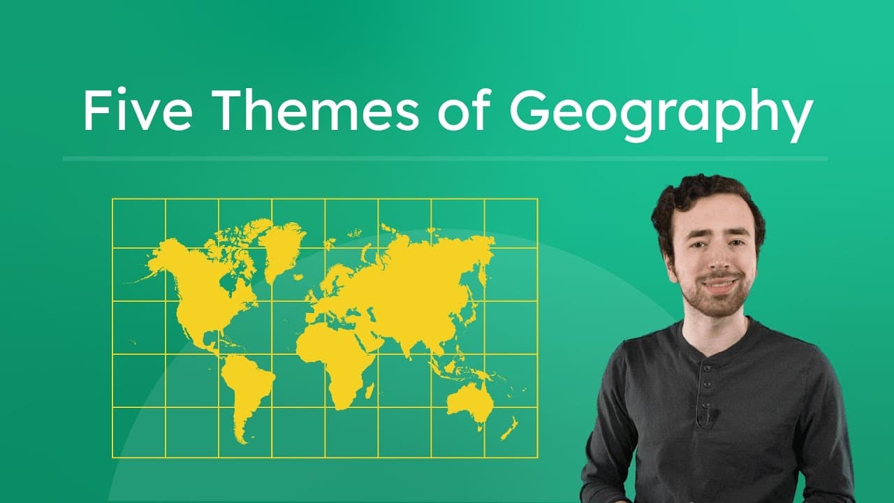
Unlocking History Through the Five Themes of Geography

Unlocking History Through the Five Themes of Geography

This educational video provides a comprehensive introduction to the Five Themes of Geography—Location, Movement, Place, Region, and Human-Environment Interaction—and demonstrates their critical role in shaping human history. The host, Justin, moves beyond simple map-reading to explain geography as the study of the Earth and how humans interact with it. Using water as a central unifying concept, the video illustrates why early civilizations like Mesopotamia and Egypt developed where they did, emphasizing the necessity of fresh water for drinking, irrigation, and transportation. The video explores each theme individually while also highlighting their interconnected nature. It defines concepts such as absolute versus relative location, cultural diffusion through trade and war, and the distinction between adapting to and modifying the environment. Historical examples are woven throughout, including the construction of mud-brick homes in timber-scarce Mesopotamia, the spread of culture from the Olmecs to the Aztecs, and the shifting political boundaries of the Persian Empire and Alexander the Great's territory. Ideal for middle school social studies and geography curricula, this resource helps students transition from viewing geography as just memorizing capitals to understanding it as a dynamic force that drives historical development. It offers clear definitions, visual examples, and interactive pause points that encourage critical thinking about government structures and map analysis, making it a versatile tool for introducing units on ancient civilizations or world geography.
Miacademy & MiaPrep Learning ChannelMiacademy & MiaPrep Learning Channel

11mins 13s

Materials

River Cradle Slides

River Cradle Slides

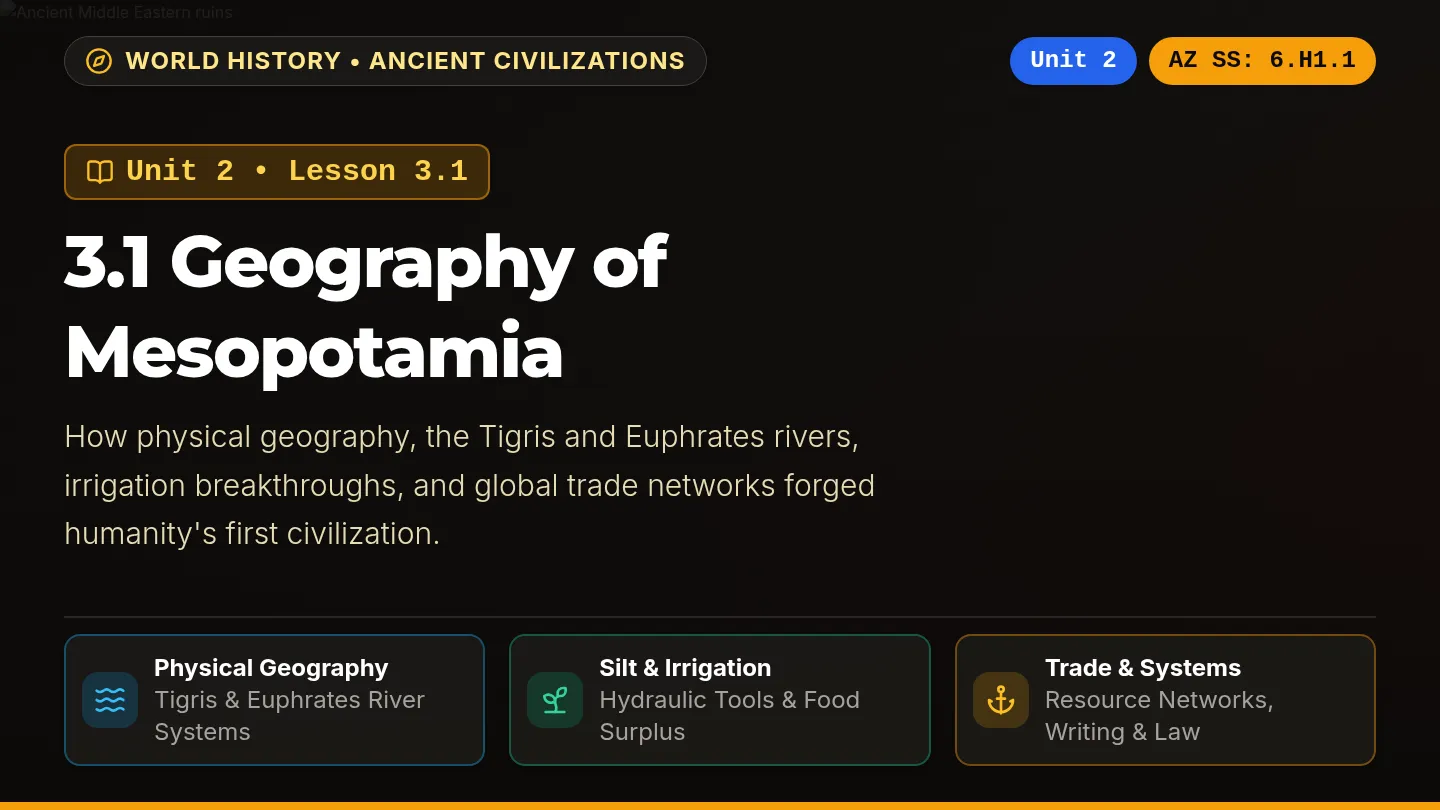
A dark-themed, visually vibrant classroom slide deck labeled Unit 2: Lesson 3.1 Geography of Mesopotamia, aligned with Arizona History and Social Science standards on every slide, featuring rich photography, high-contrast color-coded cards, and interactive review prompts.

SZ

Sandra Zoerhoff

Mesopotamia Adventure Packet

Mesopotamia Adventure Packet

A 6-page printable-ready student adventure packet about ancient Mesopotamia with enlarged readable Nunito fonts, a 5-paragraph reading passage, 4 text-dependent questions, scaffolded missions, and a culminating Settler Council simulation.

D

destiny.lanier

Fertile Crescent Map Worksheet

Fertile Crescent Map Worksheet

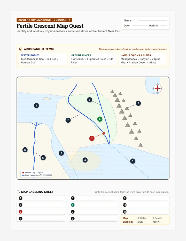
A printable two-page Ancient Near East map labeling worksheet and geographic analysis packet covering Mesopotamia, the Tigris and Euphrates rivers, Babylon, Egypt, and surrounding physical features.

JK

Jordan Krueger

Mesopotamia City States Slides

Mesopotamia City States Slides

An engaging, academically rigorous 11-slide presentation on Mesopotamian city-states for 9th grade World History, covering geography, irrigation breakthroughs, urban structure, water rights, the shift from priests to warlord kings, empires, cultural diffusion, and Hammurabi's Code.

E

ebakke

Mesopotamia Knowledge Test

Mesopotamia Knowledge Test

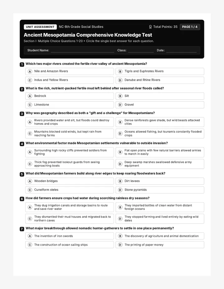
A comprehensive 4-page black-and-white assessment on Ancient Mesopotamia featuring 20 multiple-choice questions covering geography, agriculture, city-states, and societal developments, followed by a 15-term vocabulary matching section. Formatted with high-contrast monochrome styling optimized for crisp classroom photocopying and printing.

M

maryroxanne.abella

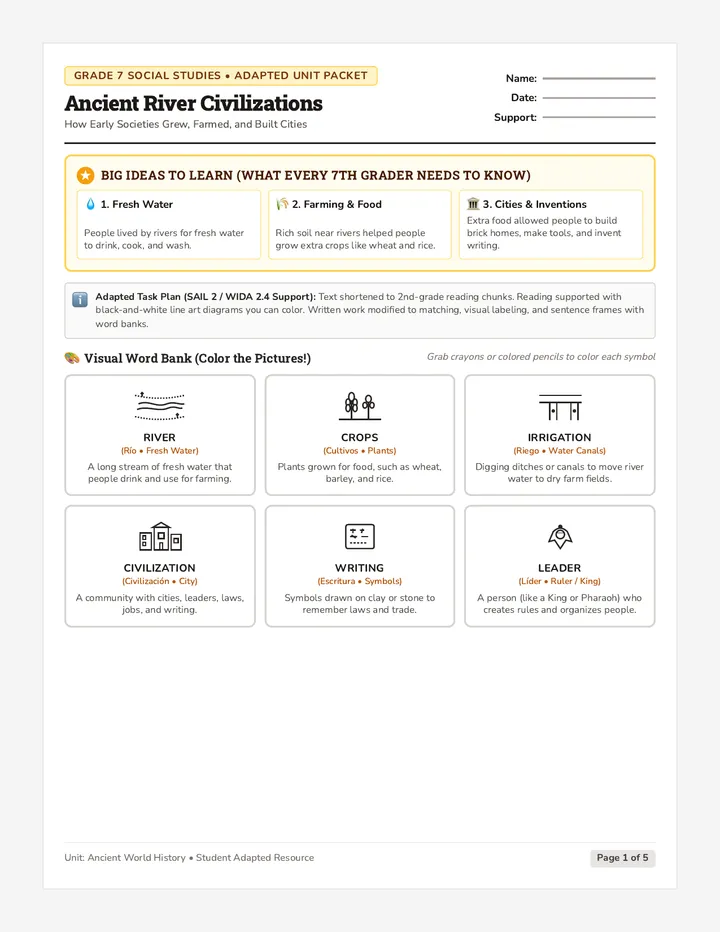
River Civilizations Adapted Packet

River Civilizations Adapted Packet

A 5-page adapted student learning packet on ancient river civilizations tailored for a 7th-grade English learner in a SAIL 2 inclusion model (WIDA 2.4). Features simplified chunked text, black-and-white line art illustrations ready for coloring, visual vocabulary cards, an organizer matrix, sentence frames, and a creative draw-and-label culminating task.

CQ

Colleen Quinn

Sequences

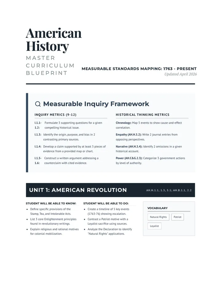
Curriculum Blueprint Document v2

History Horizon Sequence

A comprehensive high school curriculum plan for American History, covering 13 units from the American Revolution to the modern era, aligned with North Carolina Social Studies standards.

AK

Amity Kea

21
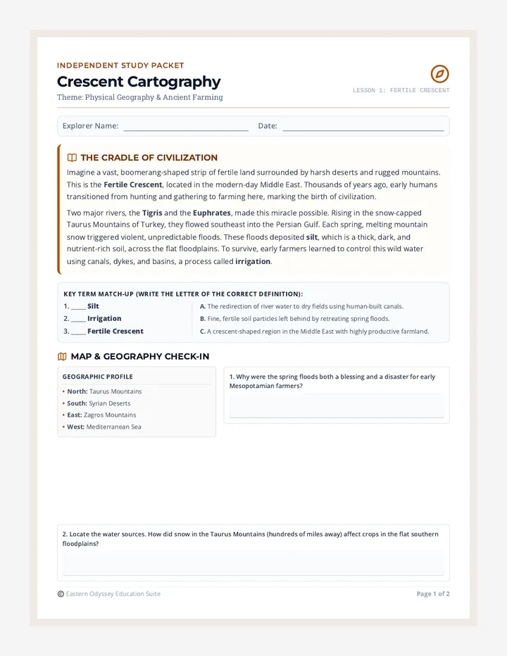
Crescent Cartography Student Packet

Eastern Odyssey Sub Packets

A sequence of 5 highly engaging, self-guided emergency sub plans for 6th-grade Eastern Hemisphere Social Studies, focusing on Ancient Egypt, Mesopotamia, the Fertile Crescent, Monsoon Asia, and Japan's island geography. Each sub plan includes a student packet and a teacher guide.

T

tpayne

10
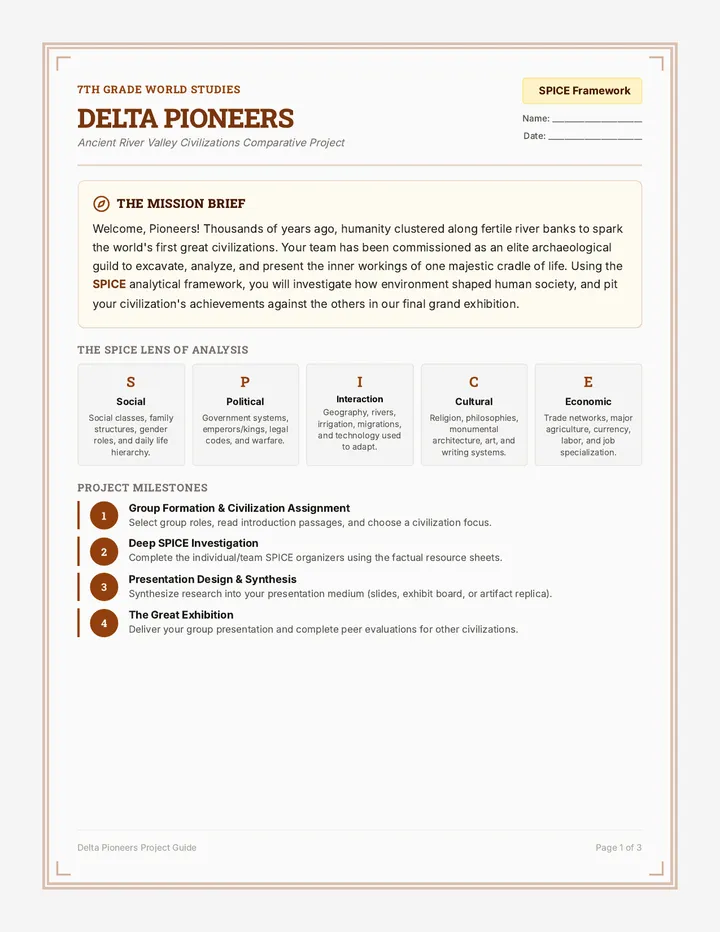
Pioneer Portfolio Project Guide

River Kingdoms

An immersive historical sequence guiding 7th-grade students through the excavation, comparison, and long-term legacy of the world's four primary river valley civilizations using the SPICE framework.

NE

Nicole Elder

9
Africa Geography and Trade Worksheet

Ancient Empires and Innovations

A weekly unit sequence exploring the physical geography of Africa, the trans-Saharan gold-salt trade, and the major technological and cultural innovations of ancient Sumer. Tailored with high-support, high-rigor scaffolds designed for SPED students.

AG

Amina Gueye

5
Mapping the Sand Slides

Desert Discoveries

A differentiated social studies unit covering the geography, cultures, and empires of the Middle East and North Africa, adapted for 3rd-grade readability based on the DESE Investigating History Grade 6 curriculum.

JS

Janette Sullivan

43
Empire Rise Slides

Code of Justice

A case-study approach to the Code of Hammurabi, examining social hierarchies, gender roles, and the evolution of justice through primary source analysis and simulations.

13

Lessons

Explorer Epochs Wall Chart

Early World Explorers

A comprehensive lesson on early world exploration from 300 BCE to 1500 CE, focusing on the geographical, cultural, and religious impacts of key explorers across different continents.

J

jcasey

14
Royal Decree Assessment Upgrade

Cradle of Civilization

A comprehensive lesson on the rise of Mesopotamian civilization, covering geography, irrigation, the development of city-states, writing systems, and the formation of the world's first empires.

J

jedriend

9
Time Cartographers Slides

Time Cartographers

An 80-minute sixth-grade lesson on understanding, building, and interpreting historical timelines, teaching BCE/CE, BC/AD, Circa, and Chronological Order, focusing on Mesopotamia, Egypt, the Indus Valley, and global history.

AA

Adam Amster

4
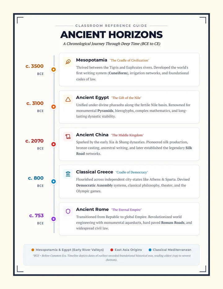
Ancient Horizons Timeline Poster

Ancient Civilizations Timeline

A lesson package designed to introduce the chronology of five fundamental ancient civilizations. It includes a high-impact master reference poster and printable large-scale timeline cards for classroom display.

SZ

Sandra Zoerhoff

2
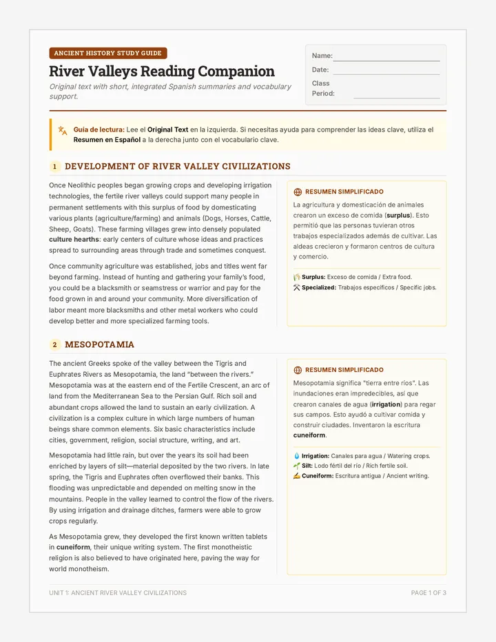
Civilizations Reading Companion

River Valley Civilizations

A comprehensive history lesson focusing on the development of the four major ancient river valley civilizations, featuring differentiated text and scaffolded reading supports for ESL students.

JO

Jacob Obannon

1
River Valley Pioneers Slides

River Valley Pioneers

A high school world history lesson focusing on the geographic factors of the Neolithic Revolution. Students participate in a station rotation activity, analyzing maps, data, and geographical details of four major river valleys (Nile, Tigris-Euphrates, Indus, and Yellow Rivers) to determine why agriculture began in these specific regions.

AH

Ashley Hopf

4