Penguin Path Slides PENGUIN PATH
Global Habitat Expedition
Where do they waddle?
Quick Question!
"If you wanted to see a penguin in the wild, where would you go?"
❄️ 🧊 🐧
Let's see if your guesses match the map...
Tuxedoed Wonders
Embedded media
Watch closely! We will pause at 0:37 to check the map.
Map Check!
Which continents did you see highlighted?
Antarctica
South America
Africa & Australia
The Secret: Ocean Currents
Cold Currents
Bring nutrients and chilly water from the south. This lets penguins live in warm places like Africa!
Warm Currents
Bring warmer water from the equator. Some penguins, like the Galápagos, are built for this!
Your Mission: The Penguin Atlas
Grab your markers and your worksheet!
01
Find and color the 6 penguin regions.
02
Draw the ocean current arrows.
03
Label the oceans they swim in.
Final Thought...
"Why do penguins live along the coast and not in the middle of a desert?"
Food Source
Water/Swim
Penguin Path Worksheet THE PENGUIN ATLAS
Field Mission Log • Grade 3 Geography
EXPLORER:
DATE:
Mission Objective
Map the 6 global regions where penguins waddle and label the ocean currents that keep them cool.
1
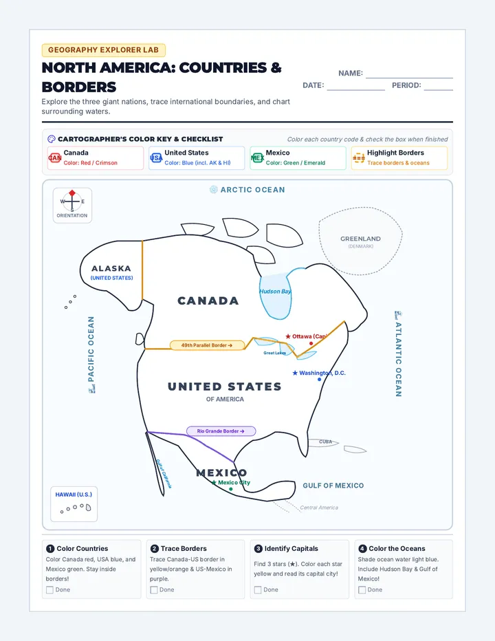
Global Habitat Map
Step 1: Color the Regions
• Antarctica
• South America
• Africa
• Australia
• New Zealand
• Galápagos
Step 2: Draw Currents
→ BLUE
Cold Currents
→ RED
Warm Currents
Equator
SOUTH
AFRICA
AUSTRALIA
NZ
ANTARCTICA
GALÁPAGOS
2
Quick Observations
1. Which continent is the coldest habitat for penguins?
2. Which penguin habitat is closest to the Equator?
Explorer Fact
"The Galápagos Penguin is the only species that lives north of the equator in the wild! They stay cool thanks to the cold Humboldt Current."
3
Reflection
Why do penguins live along the coast (near the water) and not in the middle of a hot desert? Use what you learned about their food and swimming to answer.
Penguin Path Answer Key TEACHER ANSWER KEY
Penguin Path • Grade 3 Geography
INTERNAL USE ONLY
1
Map Marking Guide
6 Habitat Regions
Antarctica: Entire bottom continent.South America: Coastal Chile and Argentina (southern tip).Africa: Southern tip (South Africa/Namibia).Australia: Southern coastlines.New Zealand: Small islands southeast of Australia.Galápagos: Islands on the Equator west of S. America.
Ocean Currents
C
Cold Currents (Blue): Arrows should move from Antarctica UP towards the Equator along the coasts of S. America, Africa, and Australia.
W
Warm Currents (Red): Arrows should move from the Equator DOWN along the east coasts of continents (optional for advanced students).
Key Concept: Penguins follow cold, nutrient-rich water. This is why they can live in "hot" places like Africa or the Galápagos—the water itself is cold!
2 Quick Observations
1. Coldest habitat?
Antarctica
2. Closest to the Equator?
The Galápagos Islands
3 Reflection Guide
Look for answers that connect water , food , and adaptations .
"Penguins need to live near the coast because they get all their food (fish, krill, squid) from the ocean. They are flightless birds but amazing swimmers, so they need to be right next to the water to survive and hunt. They wouldn't find any fish to eat in the middle of a desert!"
TEACHING TIP
Use the video at 0:37 as the primary visual reference for the mapping activity. Encourage students to look for the "beige" highlights on the teal map in the video.