Earth Branches Sort Interactive Geography Notebook
Earth's Two Realms
Unit 1: Foundations
Notebook Page: ______
Explorer Name:
Date:
Class Period:
Notebook Setup Instructions:
1. Cut along the outer solid border of this page to fit your notebook. Glue it down flat.
My Definition: Physical Geography
My Definition: Human Geography
Physical Geography sorting pocket
Glue 6 physical cards here. Focuses on natural earth features & systems.
Slot 1
Slot 2
Slot 3
Slot 4
Slot 5
Slot 6
Human Geography sorting pocket
Glue 6 human cards here. Focuses on human activity, culture, & cities.
Slot 1
Slot 2
Slot 3
Slot 4
Slot 5
Slot 6
Explorer Connection Prompt:
How do physical geography features (like rivers or mountain ranges) directly affect where and how humans build their cities? Give one specific example.
Interactive Notebook Cutouts
Sorting Cards & Checklist
Do Not Glue This Whole Page
Cutout Checklist
Write your customized definitions on the notebook base page first.
Carefully cut along the dashed borders of each of the 12 cards below.
Sort the cards into Physical vs. Human piles before gluing them down.
Target Counts
6 Physical
6 Human
🏔️
The Rocky Mountains
Massive rugged peak formations created over millions of years of tectonic activity & uplift.
Card #1
🚇
Subway Systems
Underground electric passenger rail lines engineered to move millions of city residents daily.
Card #2
🌊
Ocean Currents
Massive continuous loops of warm and cold ocean waters circulating and regulating regional climates.
Card #3
🏗️
Hydroelectric Dam
Concrete barrier built across a river to block flow, control floods, and generate electrical power.
Card #4
🌴
Amazon Rainforest
A hyper-diverse tropical forest ecosystem that supports over three million unique flora and fauna species.
Card #5
🗺️
National Borders
Political boundary lines dividing sovereign countries, agreed upon by treaties and defense treaties.
Card #6
🌪️
Tornado Alley
An atmospheric region in the US central plains with peak conditions for warm and cold air collisions.
Card #7
🌽
The Corn Belt
An agricultural economic region in the US Midwest dominated by family farms and commercial corn crops.
Card #8
🏜️
Sahara Desert
An arid climatic region with extremely low annual rainfall, dynamic sand dunes, and severe sun exposure.
Card #9
⛪
Notre-Dame Cathedral
A historic monument and place of worship representing religious heritage, tourism, and Gothic architecture.
Card #10
🌋
Volcanic Islands
New landmasses created in the ocean when underwater magma eruptions erupt, cool, and pile up.
Card #11
🗣️
Multilingual Signs
City and road signs printed in multiple languages to support cultural diversity and immigrant populations.
Card #12
Grid Guardians Foldable Interactive Geography Notebook
Coordinate Grid Guardians
Unit 1: Foundations
Notebook Page: ______
Navigator Name:
Date:
Class Period:
Grid Navigator Mission:
1. Glue the two folding flaps (from the Cutout Sheet) onto the GLUE ZONE below. Beneath each flap, write its key traits.
Foldable Placement Area (Glue Flaps Here)
GLUE FLAP 1 HERE Write definitions underneath in notebook after gluing.
GLUE FLAP 2 HERE Write definitions underneath in notebook after gluing.
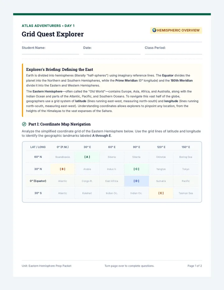
The Explorer Rescue Grid
60°N
30°N
Equator (0°)
30°S
60°S
90°W
45°W
Prime Meridian (0°)
45°E
90°E
N
S
W
E
Wreckage Signals
A 30°N, 45°W
B 60°S, 90°E
C 0°, 45°E
D 30°S, 90°W
E 60°N, 0°
N S W E
Navigator Synthesis Challenge:
Why are coordinates critical for aircraft and maritime pilots compared to landmarks or addresses? Discuss absolute location versus relative location.
Interactive Notebook Cutouts
Coordinate Folding Flaps
Do Not Glue Flat
Assembly & Folding Instructions
Step 1: Cut Outer Cut out the entire rectangular box for both Flap 1 and Flap 2 along the solid black lines .
Step 2: Fold Flap Fold back the flap along the dotted line . Make a sharp crease so it swings open cleanly.
Step 3: Glue Down Apply glue only to the hashed GLUE ZONE on the back, and press it onto the Page 1 base sheet.
Step 4: Label Inner Lift the flap. Write definitions, traits, and nicknames (e.g., "Parallels", "Meridians") inside the book.
Fold Line Along Dotted Border Below
🌐
Lines of Latitude
Nicknamed: Parallels
Measuring distances north and south of the equator. Run horizontally around the globe.
GLUE BACK Apply glue only to this side of the tab.
Fold Line Along Dotted Border Below
🌍
Lines of Longitude
Nicknamed: Meridians
Map Matchup Activity Interactive Geography Notebook
Map Matchup & Skills
Unit 1: Foundations
Notebook Page: ______
Cartographer Name:
Date:
Class Period:
Cartographer Mission:
1. Cut out the compass labels from Page 2. Paste them onto the correct directions on the Compass Rose diagram .
Compass Rose Directions
Cut and paste the directions (N, NE, E, SE, S, SW, W, NW) onto the matching boxes on the compass diagram.
Cardinal: North, South, East, West
Intermediate: NW, NE, SW, SE
Political Map Sort
Slot 1
Slot 2
Slot 3
What is shown here?
Physical Map Sort
Slot 1
Slot 2
Slot 3
What is shown here?
Thematic Map Sort
Slot 1
Slot 2
Slot 3
What is shown here?
Map Analysis Synthesis:
If you wanted to plan a cross-country hiking trip and also check where the major state capitals are, which two maps would you need to combine? Explain.
Interactive Notebook Cutouts
Map Pieces & Labels
Do Not Glue Whole Page
Cut and paste these directions onto the Page 1 Compass Rose:
N ✂️
NE ✂️
E ✂️
SE ✂️
S ✂️
SW ✂️
W ✂️
NW ✂️
🏙️
Capital Cities Star
A map legend entry showing a star inside a circle to represent a nation or state's central administration.
Card #1
🏔️
Elevation Color Bar
A gradient scale on a legend ranging from deep green (sea level) to dark brown/white (high mountain peaks).
Card #2
🔥
Population Heat Map
A specialized map displaying demographic census counts color-coded from yellow (low) to deep red (dense).
Card #3
🛣️
State Highway Lines
Thin red and blue lines dividing county and state districts, showing borders and federal vehicle routes.
Card #4
🏞️
River Tributaries
Kingdom Creator Project Project Mission & Portfolio
Fictional Kingdom Creator
Unit 1: Portfolio Task
Notebook Page: ______
Cartography Design Team:
Class Period:
Your Cartographic Mandate:
You are royal cartographers commissioned to map a brand-new, undiscovered kingdom. Your map must prove your absolute map mastery by utilizing coordinate grids, specific thematic elements, physical landforms, and clear legend symbols. Use this planner sheet to draft your parameters before drawing on the map grid (Page 2).
Step 1: Kingdom Profile & Identity
Kingdom Name:
Dominant Climate / Biome:
Primary Language:
Primary Resource / Industry:
Step 2: Map Checklist
Compass Rose (8 directions labeled)
Grid System (drawn coastline boundaries)
3 Physical Elements (Mountain range, River, Bay)
3 Political Elements (Capital, 2 Towns, Border)
1 Thematic Element (e.g., Rainfall, Mining areas)
Map Key / Legend (6 complete icons)
Step 3: Landmark Coordinates
Write down coordinates inside your kingdom's boundary lines for these key features.
1. Royal Capital:
2. Mountain Peak:
3. Shipping Port:
4. Foreign Border:
Step 4: Map Key Icon Drafts
Draft the custom symbols you will draw on your map grid. Keep them clean and handwriting-friendly.
⭐
Capital
⚫
Town
▲
Mountain
~~
River
---
Border
Thematic
Cut along solid black outer line. Fold Page 1 and Page 2 together as a "fold-out atlas page" in your notebook.
Map Canvas Spec-G
Kingdom Atlas Grid
Boundary: 30°N to 30°S, 45°W to 45°E
0° Equator
0° Prime Meridian
30°N
20°N
10°N
10°S
20°S
30°S
30°W
15°W
15°E
30°E
Compass
N S W E
Kingdom Map Legend
⭐
⚫
▲
~~
---
Geography Champions Quiz Unit 1 Assessment
Geography Foundations Quiz
Score: ______ / 25 pts
Explorer Name:
Date:
Class Period:
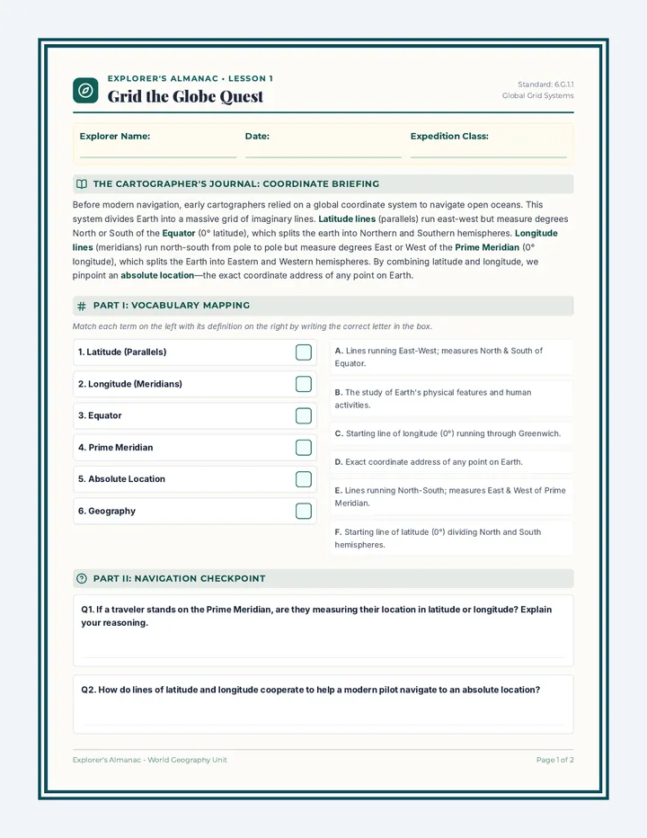
A Section A: Branches of Geography Matchup
Write the letter P for Physical Geography or H for Human Geography next to each scenario. (1 pt each)
1. Tracking the annual migration patterns of monarch butterflies across North America.
2. Investigating how French and English are spoken in bilingual regions of Montreal, Canada.
3. Mapping the elevation contours and active tectonic fault lines of the San Andreas Fault.
4. Examining the population density shifts and suburban growth of Cairo, Egypt.
5. Measuring ocean floor depth and coral reef bleach damage in the Great Barrier Reef.
B Section B: The Coordinate Grid Master
Reference Globe Quadrant
Prime Meridian (0°)
Equator (0°)
30°N
30°S
45°W
45°E
W
X
Y
Z
Analyze the positions of Points W, X, Y, and Z to complete questions 9 and 10.
6. What line of latitude represents 0°?
7. What line of longitude represents 0°?
8. Do lines of latitude run East-West or North-South?
9. What are the coordinates of Point Y?
10. What are the coordinates of Point Z?
Page 1 of 2 — Continue to Page 2 on reverse side or separate booklet.
Unit 1 Assessment
Geography Foundations Quiz
Explorer Name: _________________
C Section C: Map Type Matchups
Match each map purpose or feature to the correct map type: Write PL for Political, PH for Physical, or TH for Thematic. (1 pt each)
11. Showing the boundaries, city limits, and capital cities of Western European nations.
12. Utilizing color shading to show annual rainfall levels in the Pacific Northwest.
13. Showing topographical contour lines, elevated plateaus, and ocean depths.
14. Distinguishing highways, toll roads, county lines, and state trooper command posts.
15. Displaying the global distribution of oil exports and major cargo shipping lanes.
D Section D: Cartographic Analysis & Short Answer
Provide complete, detailed geographical explanations for the questions below. (5 pts each)
16. The Legend Dilemma:
Geo Explorer Teacher Guide Unit 1 Teacher Resource
Global Explorers Facilitation Guide
Middle School Geography
Teacher Master
Printing & Notebook Setup Best Practices:
• Paper Selection: Print the base pages (Page 1 of each material) on standard printer paper. For cutout pages (Page 2), try to use slightly heavier matte cardstock if available, which makes cutting easier and ensures flaps swing cleanly.Glue Warning: Advise students to use glue sticks rather than liquid school glue. Liquid glue causes notebook paper to warp, wrinkle, and bleed. Liquid glue can also stick adjacent pages together.Pacing Tips: Model the folding process for the "Grid Guardians" foldable under a document camera. Always have a sample completed notebook yourself to display.
Earth Branches Sort Answer Key (Day 1)
Definitions written by students can vary slightly, but should summarize these core themes:
Physical Geography (6 Cards):
Card #1: The Rocky Mountains (Tectonic)Card #3: Ocean Currents (Circulation)Card #5: Amazon Rainforest (Ecosystem)Card #7: Tornado Alley (Atmospheric)Card #9: Sahara Desert (Climatic)Card #11: Volcanic Islands (Magma)
Human Geography (6 Cards):
Card #2: Subway Systems (Transit)Card #4: Hydroelectric Dam (Infrastructure)Card #6: National Borders (Political)Card #8: The Corn Belt (Agricultural)Card #10: Notre-Dame Cathedral (Culture)Card #12: Multilingual Signs (Language)
Grid Guardians Coordinate Key (Day 2)
Coordinates are plotted on the Page 1 grid relative to the intersecting Equator (0° Lat) and Prime Meridian (0° Long).
Point Latitude Longitude Target Grid Position (Quadrant) A 30° N 45° W Top-Left Quadrant (1 grid box up, 1.5 grid boxes left) B 60° S 90° E Bottom-Right Quadrant (2 grid boxes down, 3 grid boxes right)