Grid the Globe Worksheet Explorer's Almanac • Lesson 1
Grid the Globe Quest
Standard: 6.G.1.1
Global Grid Systems
Explorer Name:
Date:
Expedition Class:
The Cartographer's Journal: Coordinate Briefing
Before modern navigation, early cartographers relied on a global coordinate system to navigate open oceans. This system divides Earth into a massive grid of imaginary lines. Latitude lines (parallels) run east-west but measure degrees North or South of the Equator (0° latitude), which splits the earth into Northern and Southern hemispheres. Longitude lines (meridians) run north-south from pole to pole but measure degrees East or West of the Prime Meridian (0° longitude), which splits the Earth into Eastern and Western hemispheres. By combining latitude and longitude, we pinpoint an absolute location —the exact coordinate address of any point on Earth.
Part I: Vocabulary Mapping
Match each term on the left with its definition on the right by writing the correct letter in the box.
1. Latitude (Parallels)
2. Longitude (Meridians)
3. Equator
4. Prime Meridian
5. Absolute Location
6. Geography
A. Lines running East-West; measures North & South of Equator.
B. The study of Earth's physical features and human activities.
C. Starting line of longitude (0°) running through Greenwich.
D. Exact coordinate address of any point on Earth.
E. Lines running North-South; measures East & West of Prime Meridian.
F. Starting line of latitude (0°) dividing North and South hemispheres.
Part II: Navigation Checkpoint
Q1. If a traveler stands on the Prime Meridian, are they measuring their location in latitude or longitude? Explain your reasoning.
Q2. How do lines of latitude and longitude cooperate to help a modern pilot navigate to an absolute location?
Explorer's Almanac - World Geography Unit Page 1 of 2
Explorer's Almanac • Lesson 1
The Coordinate Quest
Standard: 6.G.1.1
Mapping Absolute Locations
Part III: Plotting on the Grid
Below is a grid map representing a mysterious ocean archipelago. Use your knowledge of global grid structures to plot, label, and identify coordinates.
40° N
20° N
0° (Equator)
20° S
40° S
40° W
20° W
0° (P.M.)
20° E
40° E
A
B
C
Task A: Identify Location
Identify the coordinates for each point plotted above:
Point A: 20° N , 20° E
Point B: ______ , ______
Point C: ______ , ______
Task B: Plot Coordinates
Using a pencil, plot these points directly onto the map above:
📍 Point D: 40° S, 20° E (Label as "D")
📍 Point E: 0° (Equator), 40° W (Label as "E")
Part IV: Peer Navigator Discussion
Partner Brainstorming Prompts:
Work with an adjacent crew member. Discuss: "If you travel exactly 40 degrees East along the equator starting at the Prime Meridian, does your absolute latitude change, or only your absolute longitude?" Write down your consensus and justification.
Explorer's Almanac - World Geography Unit Page 2 of 2
Grid the Globe Slides Explorer's Almanac • Chapter I
6.G.1.1 Foundations
Grid the Globe
Mastering Latitudes, Longitudes, and Absolute Locations
Ready your map and compass Slide 1 of 4
The Coordinate Systems
6.G.1.1 Grid Lines
L
Latitude
Imaginary lines that run East to West around the globe.
Also called Parallels
Measure distances North or South
Starting line: Equator (0°)
λ
Longitude
Imaginary lines that run North to South from pole to pole.
Also called Meridians
Measure distances East or West
Starting line: Prime Meridian (0°)
Latitude lines flat like rungs, longitude lines tall and long Slide 2 of 4
The Baselines
Hemispheres
Splitting the Spheres
Every line on the grid starts from one of these two pivotal base points. They split our massive round planet into four distinct navigation zones called Hemispheres .
Northern Southern Eastern Western
The Equator (0°)
Splits the Earth horizontally into the Northern and Southern Hemispheres.
The Prime Meridian (0°)
Splits the Earth vertically into the Eastern and Western Hemispheres.
Where these two lines intersect is off the coast of West Africa (0°, 0°) Slide 3 of 4
Partner Mission
Interactive Brief
Cooperative Navigation
Work with your adjacent navigator. Look at Part III of your Grid the Globe Worksheet :
1. Point C Challenge
Confirm you both have the exact same coordinates written for Point C. Hint: Check which side of the Equator and Prime Meridian it sits in!
2. Plot Point D and E
Work together to place Point D (40° S, 20° E) and Point E (0°, 40° W) perfectly on your mapping grids. Check each other's pencil work!
Be precise! Even a difference of one degree represents about 69 miles! Slide 4 of 4
Geography and Globes Worksheet Explorer's Almanac • Lesson 2
What is Geography
Standard: 6.G.1.1
The Branches of Geography
Explorer Name:
Date:
Expedition Class:
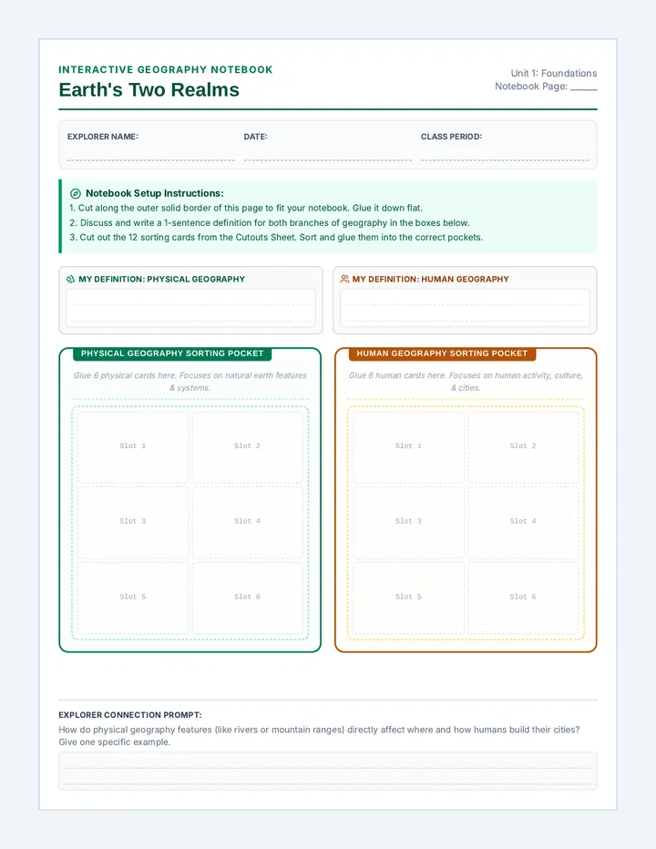
Defining Our Field: Earth Writing
The word geography comes from the ancient Greek words "geo" (meaning Earth) and "graphia" (meaning to write or describe). Therefore, geography is literally "Earth writing"—the study of the physical features of the Earth and how human beings interact with their environments. To make sense of this massive study, geographers divide the discipline into two primary fields:
Physical Geography: The study of natural features and processes of the Earth's surface, including landforms, climate, water bodies, soil, and ecosystems.Human Geography: The study of how human activities, cultures, economies, settlements, and political systems are distributed across and shape the Earth.
Part I: Branch Classification Challenge
Classify each of the following real-world geographic scenarios as either Physical Geography (P) or Human Geography (H) .
1. Tracking the path of a volcanic eruption in Hawaii ____
2. Mapping how a religious holiday is celebrated in Asia ____
3. Investigating how ocean currents affect regional climate ____
4. Studying the layout of subway lines in a busy city ____
5. Analyzing why global migration routes shift across national borders ____
Part II: The Intersecting Branches
Read the scenario below and answer the standard analytical prompts.
"A town is built at the base of a high, steep mountain. When heavy rain falls, the mountain's natural rivers flood, washing away the farming crops and houses built by the townspeople."
A. Identify one element of Physical Geography in this scenario:
B. Identify one element of Human Geography in this scenario:
Explorer's Almanac - World Geography Unit Page 1 of 2
Explorer's Almanac • Lesson 2
Spherical Representation
Standard: 6.G.1.1
Globes as Models
Part III: What is a Globe & How is it Used?
A globe is a three-dimensional, spherical model of the Earth. It is the only representation of our planet that does not distort shape, size, distance, or direction. Flat maps inevitably stretch or shrink certain regions (this is called distortion ) because it is mathematically impossible to flatten a round sphere perfectly onto flat paper. Globes are used by cartographers, ocean navigators, and scientists to analyze true global shapes and relative distances, especially across the poles.
Geography and Globes Slides Explorer's Almanac • Chapter II
6.G.1.1 Foundations
Geography & Globes
Defining Our Discipline, Its Branches, and the Power of 3D Models
Understand how to see the whole sphere Slide 1 of 4
The Two Branches
Human vs. Physical
Physical Geography
The study of natural landforms, atmospheric cycles, and Earth's processes.
✨ Mountains, Rivers, Oceans
✨ Climates, Volcanoes, Deserts
Human Geography
The study of how people live, settle, communicate, and build borders.
✨ Cities, Borders, Religions
✨ Trade, Culture, Migration
How do physical environments affect human settlements? Slide 2 of 4
Spherical Accuracy
Globes vs. Flat Maps
Modeling the Sphere
Earth is a three-dimensional sphere. A globe is a scaled, 3D model that preserves accurate relative size, direction, and shape of physical landmasses.
⚠️ The Map Dilemma:
Whenever we flatten a 3D sphere onto a 2D sheet of paper, the shapes or sizes must stretch. This is called distortion !
True Size & Shape
No stretching of Antarctica or Greenland like flat maps do!
Limit: Scale Details
Hard to zoom down to a specific neighborhood or town street!
Globes are perfect for macro-relationships, maps are best for micro-details Slide 3 of 4
Active Navigation
Task Brief
The Polar Shortcut Quest
Work with your peer navigator. Examine Part V of your Geography and Globes Worksheet :
"On a flat paper map, a flight from New York to Beijing seems like it should go straight East or West across the Pacific Ocean. But on a round globe, a straight string shows the shortest route is flying North directly over Canada and the Arctic Pole."
🌍 Why does the sphere reveal this shorter route? Write down your joint explanation!
Globes show "Great Circle" routes—the true absolute shortest paths across a sphere! Slide 4 of 4
Map Masters Worksheet Explorer's Almanac • Lesson 2
Map Masters Codex
Standard: 6.G.1.1
Map Types & Elements
Explorer Name:
Date:
Expedition Class:
The Mapmaker's Language
Maps are visual tools that explain spatial patterns. To interpret a map, we must understand its vocabulary. A physical map displays natural geography, including elevation, rivers, and mountain ranges. A political map outlines governmental boundaries, showing nations, states, and major cities. A thematic map focuses on a specific theme, such as climate, population density, or natural resources. To read these maps, cartographers include a map key (legend) to explain symbols and a compass rose to display cardinal (N, S, E, W) and intermediate (NE, NW, SE, SW) directions. Unlike absolute location, relative location describes where a place is compared to another point (e.g., "The library is three miles north of the school").
Part I: Cartographic Elements
Identify the correct term from the reading passage that matches each definition.
1. ___________________ A map that displays geographical themes like average rainfall or natural resource distribution.
2. ___________________ A symbol showing cardinal and intermediate directions (North, South, East, West).
3. ___________________ The position of a place in comparison to the location of other landmarks or regions.
4. ___________________ An explanatory table or box on a map that decodes symbols, colors, and patterns.
5. ___________________ A map displaying natural landforms and elevation patterns, like oceans, rivers, and mountains.
Part II: Navigational Scenarios
Read each scenario and circle the correct map style that best solves the cartographer's problem.
Scenario A: A construction crew is planning a new railway line across a mountain range and needs to find the route with the lowest elevation.
Physical Map Political Map Thematic Map
Scenario B: A researcher is investigating which regions of South America have the highest concentration of copper and iron mines to map economic trade corridors.
Physical Map Political Map Thematic Map
Explorer's Almanac - World Geography Unit Page 1 of 2
Explorer's Almanac • Lesson 2
The Directional Guide
Standard: 6.G.1.1
Relative Locations & Directions
Part III: Relative Location and Cardinal Directions
Look at the archipelago diagram below. Use cardinal and intermediate directions to determine relative positions.
Map Masters Slides Explorer's Almanac • Chapter II
6.G.1.1 Map Literacy
Map Masters
Decoding Physical, Political, and Thematic Projections
Understand how to read the landscape Slide 1 of 4
Types of Maps
Physical vs. Political vs. Thematic
Physical
Displays natural geographic features and elevations of Earth.
Focus: Mountains, Rivers, Oceans, deserts, elevations.
Political
Displays legal and civic boundaries built by humans and governments.
Focus: Borders, States, Capital Cities, territories.
Thematic
Displays specific themes, patterns, or data distributions across geography.
Focus: Climate, Population, Resources, history, wealth.
Every map has a unique purpose and tells a different story. Slide 2 of 4
Map Anatomy
Cartographic Keys
Tools of the Map
Without a key and orientation, a map is just an abstract drawing. Navigators use these essential tools to decode symbols and plan journeys with relative accuracy .
Map Key / Legend
Explains the meaning of symbols, colors, dots, and hash lines (e.g., star = capital city).
Compass Rose
Shows cardinal (N, S, E, W) and intermediate (NE, NW, SE, SW) directions on a grid.
Relative Location is stated using these compass points! Slide 3 of 4
Active Inquiry
Task Brief
Map Master Scenario
With your partner, read Part IV of the Map Masters Worksheet . Discuss the jungle scenario:
"A group of travelers is stranded in a dense jungle. They need to choose the best map type to navigate safely. Which map do you recommend, and what symbols in the map key will save their life?"
👉 Be prepared to share your partner's answer with the class!
Think critically: What obstacles are natural (physical) vs human-made (political)? Slide 4 of 4
Continents and Oceans Worksheet Explorer's Almanac • Lesson 3
Continents & Oceans
Standard: 6.G.1.1
Spatial Relationships
Explorer Name:
Date:
Expedition Class:
The Global Master Layout
Earth's surface is covered by approximately 71% water and 29% land. The land is divided into seven massive blocks called continents : Asia (the largest and most populous), Africa (split by the Equator), North America, South America, Antarctica (the frozen southern land), Europe, and Australia (the island continent). These landmasses are surrounded and connected by five vast, continuous bodies of saltwater called oceans : the Pacific Ocean (the deepest and largest), the Atlantic Ocean (which separates the Americas from Europe and Africa), the Indian Ocean (south of Asia), the Southern Ocean (encircling Antarctica), and the Arctic Ocean (the smallest and shallowest, surrounding the North Pole).
Part I: Size Rankings & Statistics
Rank the landmasses and waters by area based on the reading briefing and write them in order (largest to smallest).
The Largest Continents (Rank Top 3)
Asia
________________________
________________________
The Largest Oceans (Rank Top 3)
Pacific Ocean
________________________
________________________
Part II: Hemisphere & Location Clues
Q1. Which continent is completely frozen, sits entirely in the Southern Hemisphere, and contains the South Pole?
Q2. Which two continents are located entirely within the Western Hemisphere? (Hint: Think about lines of longitude!)
Explorer's Almanac - World Geography Unit Page 1 of 2
Explorer's Almanac • Lesson 3
The Global Chart
Standard: 6.G.1.1
Global Mapping
Part III: Labeling Earth's Major Features
Study the simplified world map grid below. Match the letters and numbers on the map with the lists below.
Equator (0°)
Prime Meridian (0°)
1
2
3
4
5
6
7
A
B
C
D
E
Continents (1-7)
1. North America
5. _________________
Continents and Oceans Slides Explorer's Almanac • Chapter III
6.G.1.1 Earth's Structure
Continents & Oceans
Mapping Earth's Seven Grand Landmasses and Five Great Waters
71% saltwater, 29% solid ground Slide 1 of 4
The Seven Continents
Global Landmasses
The Seven Giants
Continents are Earth's primary land divisions. They range from massive, heavily populated hubs to desolate, frozen wastes.
Largest: Asia • Smallest: Australia (Island Continent)
1 Asia
2 Africa
3 North America
4 South America
5 Antarctica
6 Europe
7 Australia (Oceania)
Europe and Asia are physically connected, often called Eurasia! Slide 2 of 4
The Five Oceans
Global Waters
P
Pacific Ocean Deepest, largest ocean on Earth.
A
Atlantic Ocean Separates the Americas from Europe & Africa.
I
Indian Ocean Sits south of Asia, bounded by Africa and Australia.
S
Southern Ocean Encircles the frozen continent of Antarctica.
Ar
Arctic Ocean Smallest, shallowest ocean, covering the North Pole.
All oceans are connected as a single "World Ocean," which regulates the climate of our entire planet.
Mariana Trench in the Pacific is the deepest point, over 36,000 feet deep! Slide 3 of 4
Cooperative Review
Task Brief
The Coordinate & Continent Connection
With your partner, review the global coordinates and relative placement of landmasses:
🎯 Challenge 1: The Crossing
Which continent is crossed by BOTH the Equator (0° latitude) and the Prime Meridian (0° longitude)? Talk it out using your map worksheet!
🎯 Challenge 2: The Atlantic Voyage
If you sail directly East from South America, across the Atlantic Ocean, which continent will you land on first? Verify your prediction together.
Write down your final agreement on Part IV of your worksheet! Slide 4 of 4
Cultural Cartography Worksheet Explorer's Almanac • Lesson 4
Cultural Cartography
Standard: 6.B.1.1
Culture & Spatial Layout
Explorer Name:
Date:
Expedition Class:
The Sacred Landscape
Geography is not just about rocks and rivers—it is deeply shaped by human culture, religion, and philosophy. How a society views the divine, nature, and community shapes its local geography. This can be seen in sacred architecture : Hindu temples are oriented to face the rising sun, Islamic mosques feature tall minarets designed to echo the call to prayer, and Christian cathedrals were historically placed in the absolute center of European towns as community hubs. Culture also influences toponymy (the naming of places). For example, many California cities (e.g., San Francisco, San Diego) were named after Catholic saints by Spanish explorers, while cities like Varanasi in India are named after rivers considered sacred in Hinduism.
Part I: Beliefs & Building Styles
Examine how specific values influence space. Fill in the classification boxes below.
Sacred Architectures
Minaret Dome: Tall tower on a mosque used to signal community prayer.
Torii Gate: Traditional wooden gate marking the boundary to Shinto sacred space.
Gopuram Tower: Highly decorated, ornate tower marking Hindu temple entries.
Toponyms (Naming)
Varanasi, India: Named after Varuna & Assi rivers, sacred in Hinduism.
San Antonio, TX: Spanish naming, "Saint Anthony", showing historical Catholic missions.
Kyoto, Japan: Means "Capital City", reflecting imperial political philosophies.
Part II: Cultural Cartography Scenarios
Q1. If Spanish Catholic missionaries built settlement outposts across California, what kind of toponyms would you expect to see on a political map of that region? Provide an example.
Q2. Why is the center of a historical city often a religious temple, mosque, or cathedral rather than a regular warehouse? What does this choice say about that society's core values?
Explorer's Almanac - World Geography Unit Page 1 of 2
Explorer's Almanac • Lesson 4
Layout of Shanti Valley
Standard: 6.B.1.1
Mapping Cultural Spaces
Part III: Analyzing Shanti Valley's Cultural Space
Examine the spatial layout diagram of Shanti Valley , a simulated ancient settlement built around specific religious and philosophical principles (peace, respect for nature, and solar worship).
Cultural Cartography Slides Explorer's Almanac • Chapter IV
6.B.1.1 Cultural Geography
Cultural Cartography
How Religions, Values, and Philosophies Shape Our Physical Landscapes
Buildings and names are monuments of cultural beliefs Slide 1 of 4
Sacred Architecture
6.B.1.1 Human-Made Space
Values Built in Stone
Architectural sites reflect a society's values. When we build, we arrange structures to align with celestial events, holy directions, or societal hubs.
Orientation Matter:doorways face sunrise, holy centers, or sacred rivers.
🕌
Islamic Minarets High towers built to project call to prayer throughout town spaces.
⛩️
Shinto Torii Gates Sturdy wooden boundaries separating regular life from divine wilderness.
Space arrangement tells us what a culture holds most sacred! Slide 2 of 4
Toponymy
The Power of Names
Religious Names
Many place names celebrate historical spiritual figures (e.g., San Francisco = St. Francis).
Natural Toponyms
Varanasi, India is named for two sacred spiritual rivers (the Varuna and Assi).
What's in a Name?
Toponymy is the study of place names. Names act as historical footprints, revealing who first mapped a land and what cultural values they brought with them.
📍 Look at a local county map: how many cities bear Spanish, indigenous, or English royal roots?
Naming a town is a direct exercise of cultural influence! Slide 3 of 4
Group Investigation
Town Layout
Shanti Valley Layout Check
With your partner, review Part III of your Cultural Cartography Worksheet :
1. Layout Alignment
Explain why the doorway of the Solar Temple points East. What natural phenomenon are the town's founders celebrating with this alignment?
2. Modern Comparison
Look at a modern town. Instead of a sacred temple at the center, what buildings sit in our prime, central blocks? What does this say about our modern values?
Be prepared to present your comparison to the council! Slide 4 of 4
Border Boundaries Worksheet Explorer's Almanac • Lesson 5
Border Boundaries
6.C&G.1.6 • 6.E.1.1
Civics & Resource Trade
Explorer Name:
Date:
Expedition Class:
Physical Geography & Civic Borders
Political borders on a map look like solid lines, but they are deeply influenced by Physical Geography. Natural barriers like wide rivers, high mountain ranges, and harsh deserts often act as ready-made boundaries that divide human populations and define civic states. For instance, the Pyrenees Mountains form a natural border between Spain and France. However, borders are also areas of shared natural resources (oil, coal, rivers, agricultural valleys). If two countries share a river, they must cooperate on trade, fishing, and navigation (6.E.1.1), otherwise they risk entering major border disputes. When natural borders are fair, they foster stable economic trade corridors; when resources are distributed unevenly, they can generate intense global friction.
Part I: Natural Barriers vs. Geometric Borders
Classify each political border scenario. Write NATURAL if formed by physical geography, or GEOMETRIC if built along straight coordinate grid lines.
1. The Rio Grande river separates Texas (USA) and Mexico. _____________________
2. The border between Canada and the western US lies along the 49th parallel line of latitude. _____________________
3. The majestic Himalayan Mountains separate the borders of India and China. _____________________
4. The border dividing Egypt and Libya is a perfectly straight line of longitude (25° E). _____________________
Part II: Core Civic Questions
Q1. (6.C&G.1.6) Why is a high mountain range like the Pyrenees Spain/France boundary much easier to defend and maintain as a civic border than a flat open plain?
Q2. (6.E.1.1) Imagine two countries share a major navigable river along their border. How does cooperating on boat traffic and pollution control benefit BOTH economies?
Explorer's Almanac - World Geography Unit Page 1 of 2
Explorer's Almanac • Lesson 5
The Delta Resource Challenge
6.C&G.1.6 • 6.E.1.1
Shared Boundary Management
Part III: Resource and Border Simulation Map
Study the simulation map below. The Union of Alpine (North) and the Republic of Coastline (South) share a rich timber forest and a major coal deposit on their shared border.
⛰️ Union of Alpine
🏖️ Republic of Coastline
Rio Delta (Shared Border River)
Border Boundaries Slides Explorer's Almanac • Chapter V
6.C&G.1.6 • 6.E.1.1 Political Borders
Border Boundaries
Natural Barriers, Human-Made Boundaries, and the Economics of Resource Trade
Where physical earth shapes the division of nations Slide 1 of 4
Natural Borders
6.C&G.1.6 Civic Boundaries
Barriers of Nature
Before modern agreements, physical features acted as natural walls. Rivers, deserts, and mountain peaks separated human tribes and created lasting, organic borders.
Example: The Pyrenees Mountains split France and Spain.
Water Borders (Rivers/Lakes) Easy to map, but change paths over centuries.
Geometric Borders Straight, artificial lines built on latitude or longitude grid lines.
Water lines and mountain ridges represent major physical boundaries! Slide 2 of 4
Resource Economics
6.E.1.1 Trade Dynamics
Navigable Rivers Economic arteries. Countries must agree on cargo rights and port taxes.
Shared Mineral Zones Valuable copper, coal, or timber spanning border lines require joint mining councils.
Dividing the Assets
Physical boundaries don't stop underground minerals or river currents. Countries must build economic trade treaties to avoid resource disputes.
💰 Cooperation increases wealth; resource wars exhaust national economies!
Cooperating on environmental river pollution saves money for both countries! Slide 3 of 4
Crew Arbitration
Simulation Brief
The Delta Resource Council
With your peer council, review Part III of your Border Boundaries Worksheet :
"The Union of Alpine wants to float massive logging cargo down Rio Delta, but the Republic of Coastline built a giant dam on the southern end to generate electricity. This blocks the logs and stops shipping trade."
👉 Propose a win-win compromise (6.C&G.1.6 & 6.E.1.1) that satisfies both power and trade!
Draft your treaty in Part IV of your worksheet! Slide 4 of 4
Master Study Guide Explorer's Almanac • Final Study Guide
Master Study Guide
Standards Covered: All
Unit Review Sheet
Explorer Name:
Date:
Expedition Class:
Part I: Explorer's Dictionary Review
Fill in the blanks with the correct vocabulary terms from your unit ledger.
1. ______________________: The starting horizontal line of latitude (0°).
2. ______________________: The starting vertical line of longitude (0°).
3. ______________________: Exact address of a place on Earth measured by coordinate grids.
4. ______________________: Where a place is relative to other landmarks or buildings.
5. ______________________: A map displaying natural features like valleys and rivers.
6. ______________________: A map displaying human boundaries built by governments.
7. ______________________: A map covering specific data themes like average family income.
8. ______________________: Chart decoding the map symbols and colors.
9. ______________________: Compass displaying directions (N, S, E, W, NE, NW, SE, SW).
10. ______________________: The complete physical and human study of Earth.
Part II: Locations to Know Checklist
Be prepared to locate and write the names of these 7 continents and 5 oceans on any blank global projection map.
The Seven Continents
[ ] North America
[ ] Europe
[ ] South America
[ ] Asia
[ ] Antarctica
[ ] Australia
[ ] Africa
(Largest: Asia)
The Five Oceans
[ ] Pacific Ocean (Largest)
[ ] Atlantic Ocean
[ ] Indian Ocean
[ ] Arctic Ocean
[ ] Southern (Antarctic) Ocean
Explorer's Almanac - World Geography Study Ledger Page 1 of 2
Explorer's Almanac • Final Study Guide
Master Concepts Check
Standards Covered: All
Conceptual Synthesis
Part III: Conceptual Practice Questions
Reflect on the primary concepts of the unit lessons. Draft concise answers below.
6.G.1.1 How does a 3D globe avoid the layout distortions that flat paper maps struggle with? Explain shape and scale.
6.B.1.1 Describe how a society's belief systems or values influence the spatial layout and sacred architecture of its cities. Provide a concrete example.
Global Summit Assessment Explorer's Almanac • Final Assessment
Global Summit Exam
Score: ______ / 50
Unit Summit Assessment
Explorer Name:
Date:
Expedition Class:
Part I: Multiple Choice (18 Points)
Select the single best answer for each question. Mark your choice clearly.
1. Which imaginary baseline runs vertically from pole to pole and marks 0 degrees longitude?
A The Equator
B The Prime Meridian
C The Southern Circle
D The Tropic of Cancer
2. A researcher is studying how the distribution of massive oil reserves along a national border influences trading routes. Which branch of geography is this study focused on?
A Physical Geography only
B Human Geography only
C Both branches cooperating
D Neither branch covers economics
3. "The county library stands exactly two miles North of the city hall." This sentence describes what type of spatial marker?
A Absolute Location
B Relative Location
C Toponymy Study
D Hemisphere Division
Part II: Core Cartographic Match
Write the correct letter in the matching square.
1. Thematic Map
2. Compass Rose
3. Absolute Location
A. Exact address using latitude and longitude coordinates.
B. Shows specific themes like regional crop yield or climate patterns.
C. Displays cardinal and intermediate directional directions.
Explorer's Almanac - World Geography Summit Page 1 of 2
Explorer's Almanac • Final Assessment
Global Summit Exam
Score: ______ / 50
Analytical Problems
Part III: Coordinate and Spatial Analysis
Review the simplified grid below. Write the absolute coordinates of points and answer the relative location questions.
20° N 0° (Eq) 20° S 20° W 0° 20° E
X
Y
1. What is the coordinate address of Point X?
Latitude: ______________ , Longitude: ______________
2. What is the coordinate address of Point Y?
Latitude: ______________ , Longitude: ______________
3. In what relative compass direction does Point X sit from Point Y?
Direction: _________________________________________
Part IV: Standards-Aligned Written Synthesis
Draft complete, academic paragraphs to resolve the prompts. (10 Points Each)
Teacher Almanac Guide Explorer's Almanac • Companion Guide
Teacher Almanac Guide
Teacher Resource Guide
Pacing & Delivery Notes
Recommended 45-Minute Daily Pacing Guide
Warm-Up (5 Mins)
Review prior day's exit card. Introduce core daily question on board.
Instruction (15 Mins)
Present Lesson Slide Deck. Conduct guided checks & interactive vocabulary.
Teamwork (20 Mins)
Partners collaborate on mapping worksheets & scenario-based logic.
Debrief (5 Mins)
Peer share-outs of critical thinking consensus. Collect work.
Pedagogical Notes & Common Misconceptions
Lesson 1: Grid the Globe (Latitude/Longitude)
Misconception: Students often flip Latitude & Longitude coordinates. Remind them: Latitude lines are flat like rungs of a ladder, and you climb "up" (North) or "down" (South) of the Equator. Longitude lines are long and run tall from pole to pole. Always write Latitude first!
Lesson 2: Geography & Globes (Physical vs. Human)
Misconception: Students often think the branches do not interact. Emphasize that Physical landscapes (mountains/rivers) dictate human geography (where cities are built, how borders are drawn). Use the Hawaii volcano vs. Asian holiday celebrating to highlight.
Lesson 3: Map Masters (Projections & Distortion)
Instruction Tip: Bring a desk globe and a flat world map. Show how Greenland looks massive on the flat map, but on the round globe, Africa is actually 14 times larger than Greenland! Globes represent reality; maps represent specialized, flattened compromises.
Differentiated Scaffolding Strategies
Support for Emerging Navigators:
Provide coordinate cards where students can physically touch grid markers.
Pre-label cardinal compass directions on Page 2 grid maps.
Sentence stems: "Point X is located in the Northern hemisphere because..."
Extension for Master Cartographers:
Have students write coordinates down to half-degrees (e.g., 20.5° N).
Research local city toponymy (town name history) for indigenous roots.
Draft formal border treaties with written dispute protocols for Lesson 6.
Explorer's Almanac - Teacher Companion Ledger Page 1 of 2
Explorer's Almanac • Companion Guide
Master Answer Keys