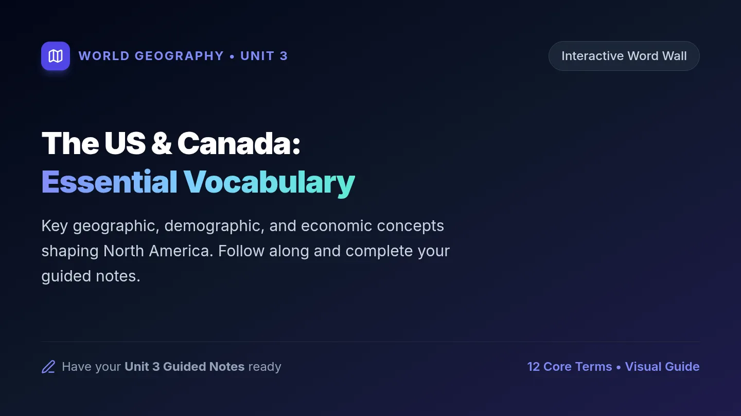
North America Regions Slides
World Geography • Unit 2 Physical & Human Factors
Student Reading Companion
US & Canada: Physical Geography
Analyzing how landforms, rivers, climates, and human choices define North America.
Learning Target
“I can identify physical and human factors—such as climate, vegetation, political units, and river systems—that constitute a region.”
1. Preview Geography Vocabulary
2. Analyze Reading (Q1–Q7)
3. Closing Region Synthesis
Before Reading • Terminology
Key Geography Vocabulary
Look for these in the text!
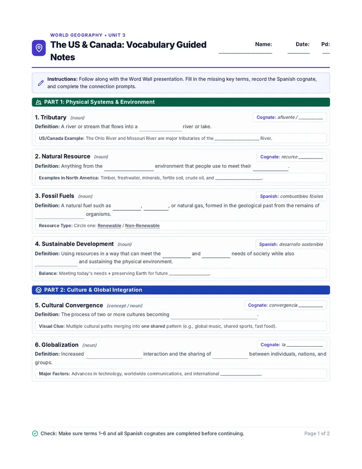
Tributary
A river or freshwater stream that feeds directly into a larger main river or lake (e.g., Missouri & Ohio Rivers).
Canadian Shield
A massive, horseshoe-shaped northern expanse of ancient exposed rock that is packed with valuable mineral deposits.
Rain Shadow Effect
When high coastal mountains block rain clouds from passing, causing arid deserts to form directly to the east.
Humid Continental
A climate zone characterized by marked seasonal contrast: freezing, snowy winters paired with warm or hot summers.
Teacher Prompt: Have students predict which factor (climate, landform, or water) each term connects to.
Slide 2 of 11
Reading Section 1 • North America Overview
Continental Bounds & Bordering Oceans
Q#1 Review
Political Units & Boundaries
Together, the United States and Canada stretch from the Arctic Ocean down to Mexico, and from the Pacific to the Atlantic. Alongside Mexico, they form the continent of North America.
Question 1 from Reading: Reading Check
Which three oceans border North America?
Sentence starter: “North America borders the Arctic, Pacific, and Atlantic Oceans.”
Teacher Facilitation Notes
Target Answer:
Arctic Ocean (North), Pacific Ocean (West), Atlantic Ocean (East).
Scaffolding Prompt:
Have students trace North, West, and East with their hands while naming each ocean to reinforce mental maps.
Political Factor: 3 sovereign nations on continent
Focus: Identifying continental boundaries & political units Slide 3 of 11
Reading Section 2 • The Land
Shared Landforms: Western Mountains
Q#2 Review
Over 7 Million Square Miles
The western part of both the United States and Canada features dramatic mountain ranges, basins, and plateaus. The colossal Rocky Mountain range cuts through both countries, extending from Alaska down to New Mexico.
Question 2 from Reading:
What landforms do the United States and Canada share?
Sentence starter: “Both countries have mountain ranges (the Rocky Mountains), basins, and plateaus.”
Teacher Facilitation Notes
Key Concept:
Physical regions cross political borders. Natural landforms like the Rockies do not stop at the 49th parallel.
Target Answer:
Mountain ranges (Rockies), basins, and plateaus.
Physical Factor: Shared tectonic & mountain regions
Focus: Recognizing trans-national physical landforms Slide 4 of 11
Reading Section 2 • Central & Northern Lands
The Great Plains & Canadian Shield
Q#3 Review
Plains to Ancient Bedrock
East of the Rockies lie the broad, flat Great Plains running through central US and Canada. To the far north lies the Canadian Shield: a huge area composed of ancient rock rich in natural minerals.
Question 3 from Reading:
What makes up the Canadian Shield?
Sentence starter: “The Canadian Shield has a huge area of ancient rock rich in minerals.”
Teacher Facilitation Notes
Target Answer:
Ancient rock that is extremely rich in mineral deposits.
Connection to Human Factors:
Why do people settle or build industries near the Shield? Mineral wealth drives mining, metallurgy, and energy extraction!
Physical factor drives economic human activity
Focus: Mineral resources and geology defining northern regions Slide 5 of 11
Reading Section 2 • Hydrology
Mississippi River System & Great Lakes
Q#4 Review
Continental Water Networks
The Mississippi River is North America's largest river system, flowing south to the Gulf of Mexico. It is fed by tributaries like the Missouri and Ohio. The five interconnected Great Lakes meet the St. Lawrence River to reach the Atlantic.
Question 4 from Reading:
How do the Missouri and Ohio Rivers connect to the Mississippi River? (use term tributaries)
Sentence starter: “The Missouri and Ohio Rivers are tributaries that merge into the Mississippi River.”
Teacher Notes
Required Term:
Ensure students write “tributaries” in their response as asked in the reading.
Great Lakes (H-O-M-E-S):
Huron, Ontario, Michigan, Erie, Superior lie along the US-Canada border.
River systems define trade, transport, & borders
Focus: River basins, tributaries, and border lake systems Slide 6 of 11
Reading Section 3 • Climate & Vegetation
Pacific Northwest vs. Rain Shadow Deserts
Q#5 Review
Coastal Mist vs. Inland Aridity
The Pacific Northwest has mild, humid weather and lush green forests. However, tall Pacific mountain ranges block rain clouds coming from the ocean, creating dry deserts immediately east of the mountains.
Question 5 from Reading:
Why are deserts found east of some Pacific mountain ranges?
Sentence starter: “Deserts form east of the mountains because Pacific mountains block ocean rain clouds.”
Teacher Facilitation Notes
Science Integration:
Rain shadow effect: Moist air rises on the windward side, drops rain, and dry air sinks on the leeward (east) side.
Check For Understanding:
Ask: “Where is the lush vegetation?” (Coast/west) “Where is the desert?” (East of the range).
Physical factor: Landforms directly dictate climate & plants
Focus: Landforms interacting with climate & vegetation Slide 7 of 11
Reading Section 3 • Central Plains
Great Plains Climate & Human Modification
Q#6 Review
Grasslands to Farmlands & Cities
The Great Plains experiences a humid continental climate with cold winters and hot summers. Originally covered by vast prairie grasses, human settlement transformed this physical region into agriculture and cities.
Question 6 from Reading:
What climate does the Great Plains region experience?
Sentence starter: “The Great Plains has cold winters and hot summers (humid continental).”
Teacher Facilitation Notes
Human Factor Highlight:
Point out: The reading explains how settlers replaced wild grasses with commercial farms and cities—a key human factor!
Target Answer:
Humid continental climate (cold winters, hot summers, rainfall from Gulf & North).
Human Factor: Modification of natural vegetation
Focus: Climate extremes and human agricultural impact Slide 8 of 11
Reading Section 3 • Regional Climates
Northeast, South, & Tropical Pockets
Q#7 Review
Comparing US Climate Regions
The Northeast shares the Great Plains' humid continental climate. The South has mild winters (humid subtropical). Only two unique areas have a tropical climate: the southern tip of Florida and the Hawaiian islands (2,400 miles out in the Pacific).
Question 7 from Reading:
Where in the United States does the reading identify tropical climates?
Sentence starter: “The reading identifies tropical climates in the tip of Florida and the Hawaiian islands.”
Teacher Facilitation Notes
Target Answer:
The southern tip of Florida and Hawaii.
Geography Nuance:
Emphasize that most of the US mainland is temperate or continental; true tropical zones require extreme southern latitude or Pacific island isolation.
Latitude & ocean location define climate zones
Focus: Latitude, maritime influence, and tropical zones Slide 9 of 11
Guided Practice • Skill Application
Classifying Regional Factors
Physical vs. Human Factors
Work with a partner: Classify each example from our reading into the correct regional factor category.
Physical Factors (Natural)
- Landforms: Rocky Mountains, Canadian Shield ancient rocks
- Water Systems: Mississippi River, Great Lakes, Tributaries
- Climate & Plants: Rain shadow deserts, humid continental, tropical tip
Human Factors (Created by People)
- Political Units: US, Canada, and Mexico national boundaries
- Land Transformation: Replacing Great Plains grasses with farms & cities
- Resource Extraction: Mining rich mineral deposits in the Shield
Discussion Question: “How did physical climate and landforms determine where humans built farms and cities?”
Slide 10 of 11
Wrap-Up • Learning Target Mastery
Closing Region Check
Self-Assessment
Target Reminder:
“I can identify physical and or human factors such as climate, vegetation, political units and river systems that constitute a region.”
Prompt 1
Name one river system and describe how tributaries define its region.
Prompt 2
Explain why deserts form east of the Pacific mountain ranges.
Prompt 3
Give one example of a human factor changing a physical region in North America.
Teacher Note: Collect the completed student reading packet with Q#1–Q#7 or have students orally debrief one prompt!
Slide 11 of 11