Grand Canyon Reading Passage
Earth Science & Geography • Upper Elementary
Name: Date:
The Grand Canyon
Earth's Giant Nature Museum & Geological Time Machine
Location Arizona, USA
Carved into northern Arizona's high desert lies the Grand Canyon: a vast gorge stretching 277 miles long, up to 18 miles wide, and sinking over a mile deep (6,000 feet). It is so gargantuan it can be identified by astronauts in space! More than a stunning scenic view, the canyon is an open geological book preserving billions of years of Earth's history in stone.
Peeling Back the Layers: Canyon Rock Strata
Youngest (Top) to Oldest (Bottom)
Rim Layer Kaibab Limestone ~270 Million Yrs Warm ancient sea; contains fossils of sponges, corals & shark teeth.
Upper Cliffs Coconino Sandstone ~275 Million Yrs Petrified sand dunes of a vast desert; preserves fossil reptile footprints.
Red Wall Redwall Limestone ~340 Million Yrs Sheer 500-foot gray cliff stained red by iron washing down from layers above.
Wide Slopes Bright Angel Shale ~515 Million Yrs Muddy ocean floor loaded with ancient trilobite and worm burrow fossils.
Gorge Base Vishnu Basement Rock ~1.8 Billion Yrs Extremely hard metamorphic rock & ancient magma—nearly half as old as Earth!
*Geological Principle: According to the Law of Superposition, sedimentary rock layers build up over time—the oldest layers rest at the bottom!
The Great Sculptor: Water, Uplift & Time
How did water carve through massive rock? About 70 million years ago, tectonic forces beneath Earth pushed the flat Colorado Plateau miles into the air. Then, about 5 to 6 million years ago, the swift-moving Colorado River began coursing across this high plateau.
The rushing river carried heavy sand, gravel, and boulders, functioning like powerful liquid sandpaper that steadily cut into stone. Together with freezing winter water splitting rocks and monsoon flash floods washing away debris, this process called erosion created the giant canyon we see today.
Field Facts
- Length: 277 miles (446 km)
- Depth: Over 6,000 feet
- Carver: Colorado River
- Oldest: 1.84 Billion Years
National Park since 1919
Field Note: The canyon is still being carved! The river deepens the gorge by roughly the width of a sheet of paper every year.
Page 1 of 2
Field Guide • Section 2
Ecosystems, Heritage & Comprehension
Student Name:
From Snow to Desert Heat
Because the canyon drops over a mile, it features distinct microclimates. The high North Rim receives heavy winter snow and supports cool pine forests, while the canyon floor 6,000 feet below can soar past 105°F! Animals like desert bighorn sheep and the endangered California Condor (with a huge 9.5-foot wingspan) make this vertical landscape their home.
12,000 Years of Heritage
Indigenous peoples have inhabited the canyon region for over 12,000 years. Eleven Native American tribes hold sacred ancestral ties to the area, including the Havasupai ("People of the Blue-Green Water"), Hopi, Navajo, and Hualapai. In 1908, President Theodore Roosevelt declared: "Leave it as it is... the ages have been at work on it." It became a National Park in 1919.
Key Terms: Erosion: moving rock by water/wind • Strata: stacked rock layers • Plateau: raised flat land • Microclimate: local small-area climate
Field Assessment: Read & Respond
Use evidence from pages 1 and 2 to answer
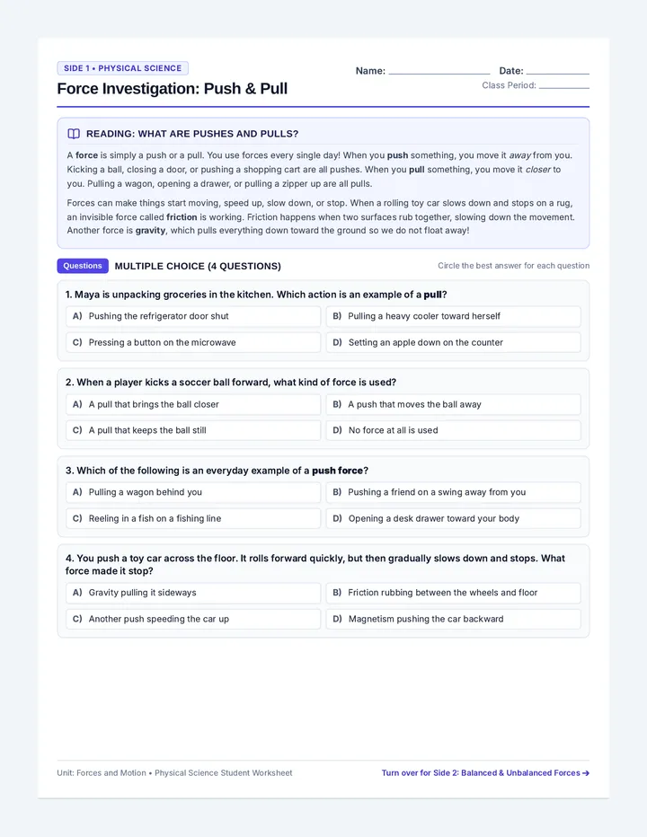
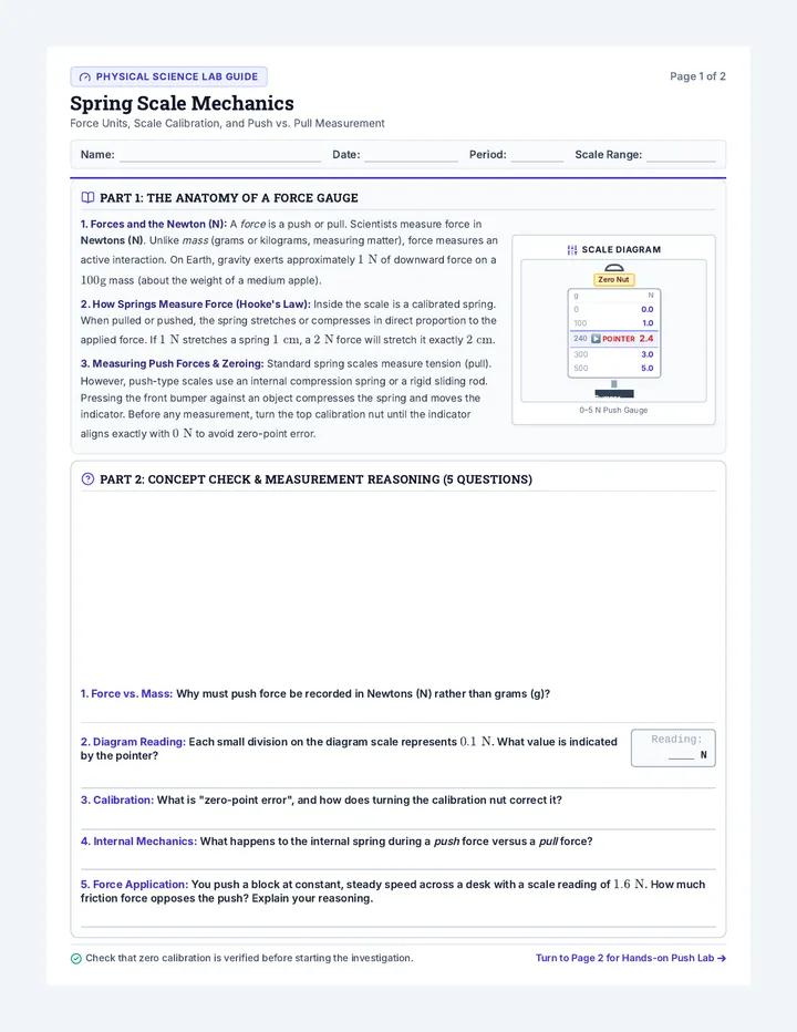
1. According to the Law of Superposition and the rock diagram on page 1, which statement is true?
A The Vishnu Basement Rock at the river bottom is the newest layer.
B The Kaibab Limestone on the rim formed more recently than Bright Angel Shale.
C All rock layers in the canyon were formed by desert sand dunes.
D The Colorado River formed long before any of the rock layers existed.
2. Cause & Effect: How did water act like "liquid sandpaper" to carve through miles of solid rock? Cite two specific details from the text.
3. Connecting Ideas: Why can temperatures at the canyon rim feel cool while the canyon floor is scorching hot? Explain using the term microclimate.
Earth Science & Social Studies Reading Series National Park Heritage Study Page 2 of 2