Cloud Systems Textbook Section
Module 3 Atmospheric Science & Meteorology
Section 3.2
Core Concept
Cloud Systems and Atmospheric Moisture
Essential Question: How do pressure and temperature changes in the atmosphere create clouds?
Key Scientific Terms
water vapor Water in the form of an invisible gas in the air.
condensation The cooling process where a gas turns into liquid drops.
condensation nuclei Microscopic particles like dust or smoke that water clings to.
Clouds may look light and still from the ground. In reality, they are active weather systems. Every cloud is made of billions of liquid water droplets or ice crystals floating together.
Pilots, meteorologists, and scientists track cloud development every day. Clouds signal changes in air pressure, wind direction, and upcoming storm systems.
Diagram 3.2A: The Three Stages of Cloud Formation
Atmospheric Process
STAGE 1
Thermal Heating
Solar radiation warms the ground and water surfaces. Liquid water evaporates into warm, invisible water vapor.
STAGE 2
Upward Lift & Cooling
Warm air is less dense, so it rises into the upper atmosphere. Higher altitudes have lower air pressure and colder temperatures.
STAGE 3
Condensation Point
The vapor cools and begins condensation onto microscopic condensation nuclei, forming a visible cloud.
Aviation & Physics Application
How Can a Million-Pound Cloud Float?
A medium cumulus cloud contains about 500,000 kilograms (over 1.1 million pounds) of water. The cloud stays suspended in the sky because the water is spread across billions of microscopic droplets. Rising thermal currents of warm air push upward beneath the cloud to balance its mass.
Module 3: Earth Systems & Meteorology Page 74
Module 3 Atmospheric Science & Meteorology
Field Classification
Meteorological Analysis
Cloud Classification in the Troposphere
Meteorologists categorize clouds by altitude zone and physical structure to predict weather changes.
High Level > 20,000 ft
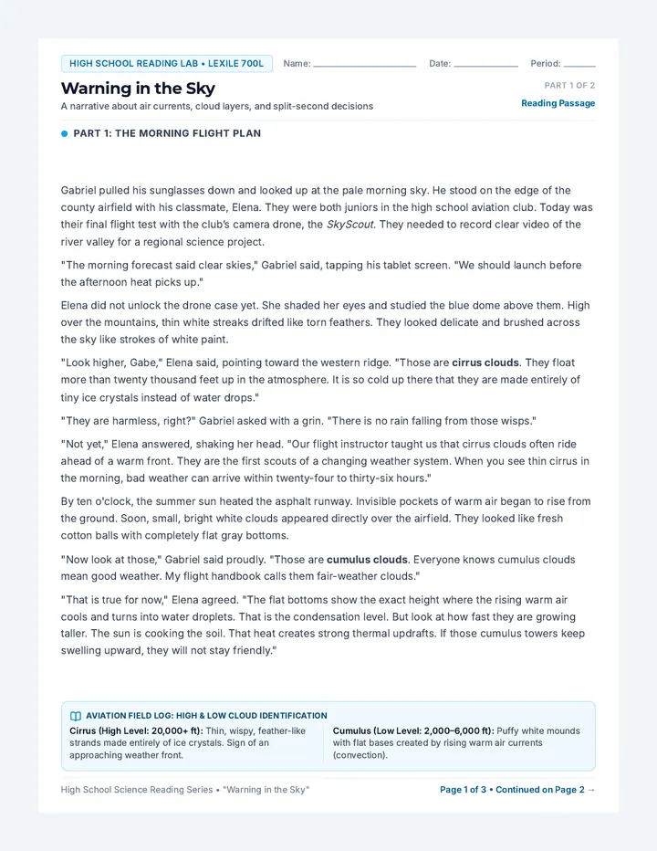
Cirrus (Ci)
Characteristics: Thin, wispy, feather-like streaks. Because temperatures are far below freezing, they are made entirely of ice crystals.
Forecasting Note: Often indicates fair weather today, but signals an approaching warm front and precipitation within 24 to 48 hours.
Ice Bands
Vertical Storm Tower
Cumulonimbus (Cb)
Characteristics: Enormous vertical towers with flat anvil-shaped tops. They can extend from 2,000 feet up past 40,000 feet.
Forecasting Note: Causes severe weather: torrential rain, lightning, strong downdrafts, and hail. Poses major turbulence risks to aircraft.
Severe Risk
Mid Level 2,000 - 6,500 ft
Cumulus (Cu)
Characteristics: Sharp outlines, distinct puffy mounds, and flat horizontal bases created by localized rising warm air.
Forecasting Note: Generally indicates stable, fair weather. If they continue growing vertically during hot afternoons, storms may follow.
Fair Sky
Low Level Surface - 6,000 ft
Stratus (St)
Characteristics: Low, uniform, featureless gray layers covering the entire sky like a horizontal blanket. When at ground level, it is called fog.
Forecasting Note: Produces overcast skies with low visibility, light mist, or persistent cool drizzle.
Overcast
Meteorological Analysis: Field Check
1. Aviation Safety
Why do pilots deliberately avoid flying through large cumulonimbus clouds?
Focus: Wind & turbulence
2. Weather Tracking
You spot thin, icy cirrus clouds moving in on Friday. What weather should you anticipate for the weekend?
Focus: Frontal systems
3. Particle Role
Why are microscopic condensation nuclei required before water vapor can condense into a visible cloud?
Focus: Condensation
Module 3: Earth Systems & Meteorology Page 75