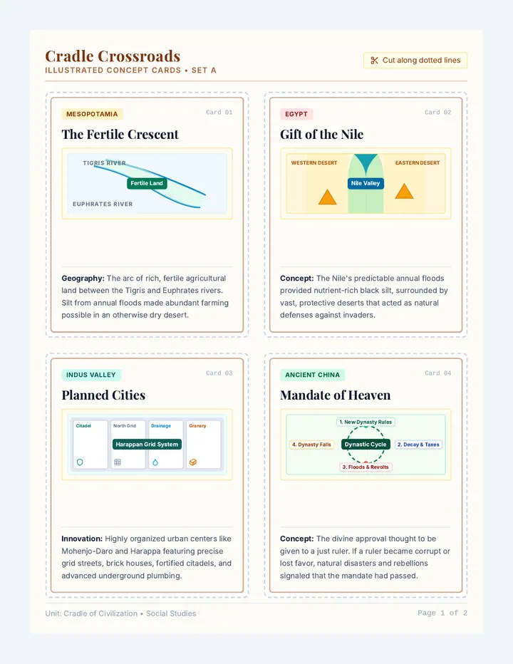
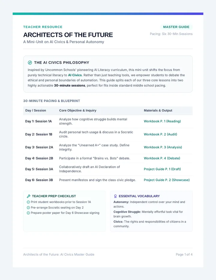
Oceania Map Slides
Instructional slides for the Oceania mapping unit. Covers the three subregions, major countries, and key physical features with clear, large text and visual cues for classroom presentation.
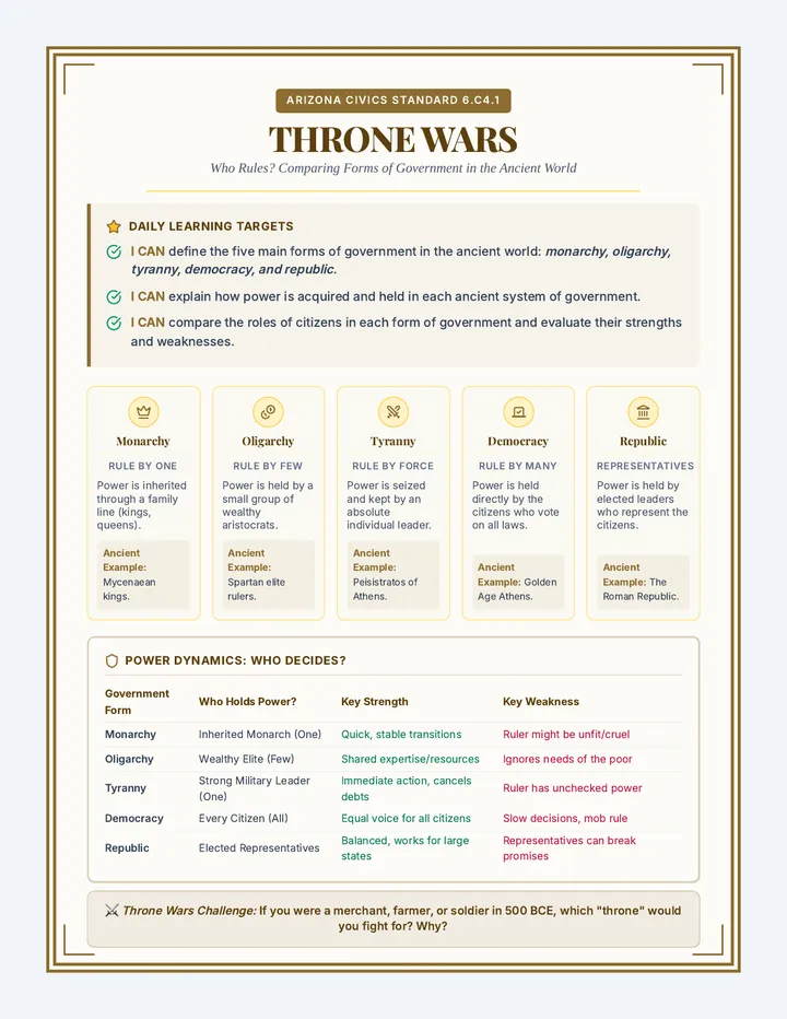
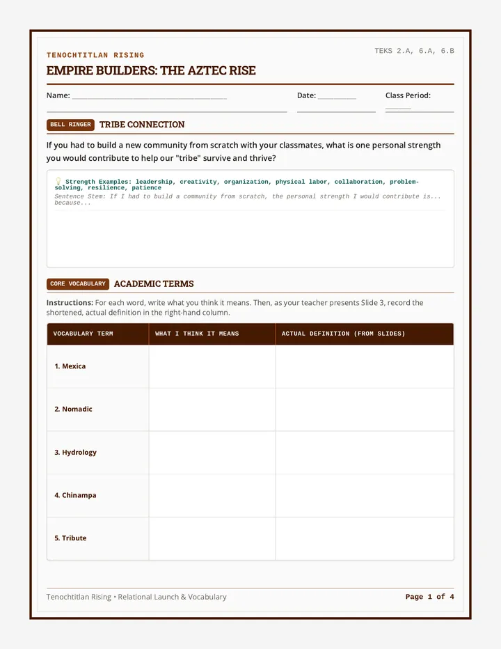
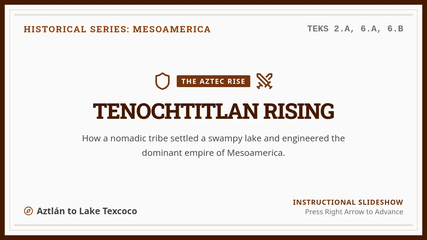
Island Hopper Map Worksheet
A political map worksheet for Oceania where students label major countries (Australia, NZ, Fiji, etc.) and color-code the three subregions (Melanesia, Micronesia, Polynesia). Includes a structured layout for labeling and a legend for subregion identification.
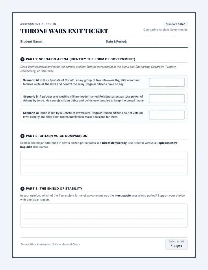
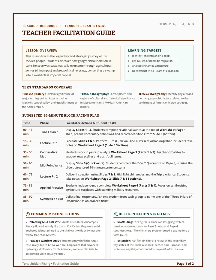
Physical Frontiers Worksheet
A physical geography worksheet for Oceania. Students identify and label major landmarks like the Great Barrier Reef, Uluru, the Southern Alps, and the Outback. Includes a checklist of features and specific map symbols for mountains and reefs.
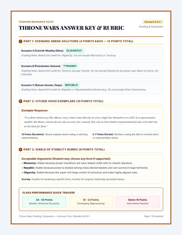
Oceania Map Answer Key
A comprehensive answer key for both the political and physical map worksheets. Includes detailed lists of countries by subregion, physical feature coordinates (locations), and a grading checklist for teachers.