Carolina Regions Lesson Plan
NC Social Studies Standard Course of Study
4.G.1 • 5-Day Complete Lesson Plans
Grade 4 Social Studies | North Carolina Geography & Inquiry
Compelling Question: "Which region is the best in North Carolina?"
Unit Conceptual Focus
In this unit, students examine the physical features, climate, and human geography of North Carolina’s three regions: the Coastal Plain, the Piedmont, and the Mountain Region. Students build foundational spatial reasoning to evaluate how geography shaped settlement, industry, and daily life over time, culminating in an evidence-based inquiry debate justifying which region is best for North Carolinians.
ANCHOR CHART: 4.G.1 Learning Progression
Day 1
The Coastal Plain & Tidewater Region
Analyze barrier islands, flat sandy plains, wetlands, maritime climate, shipping ports, and agriculture.
Day 2
The Piedmont: Rolling Hills & Fall Line
Examine the fall line, rolling clay topography, river systems, urban growth, manufacturing, and tech hubs.
Day 3
The Mountain Region: Blue Ridge & High Peaks
Investigate the Appalachian ranges, Mount Mitchell, elevation, cool climate, tourism, timber, and mining.
Day 4
Regional Comparison & Human-Environment Interaction
Compare elevation profiles and climate contrasts; evaluate how geographic barriers dictated historical settlement.
Day 5
Inquiry Culmination: The "Best Region" CER Debate
Synthesize geographic evidence into a structured Claim-Evidence-Reasoning persuasive presentation.
Physical Features → Climate → Human Adaptation → Evidence-Based Justification
North Carolina 3-Region Geographic Profile
| Feature | Coastal Plain | Piedmont | Mountain Region |
|---|
| Elevation | 0 – 300 ft above sea level | 300 – 1,500 ft (Plateau) | 1,500 – 6,684 ft (Mt. Mitchell) |
| Topography | Flat sandy soil, barrier islands, swamps | Rolling hills, red clay, waterfalls/rapids | Steep peaks, rugged ridges, deep valleys |
| Climate | Humid subtropical; mild winters, hot summers | Moderate four seasons, adequate rainfall | Cool summers, cold winters, heavy snowfall |
| Key Economy | Farming, commercial fishing, shipping ports | Banking, research, higher education, tech | Tourism, forestry, Christmas trees, mining |
North Carolina Standard Course of Study Alignment: 4.G.1.1, 4.G.1.2, 4.G.1.3 • ELA Writing & Speaking Connections: W.4.1, SL.4.1
4.G.1 • Day 1
4th Grade Social Studies | North Carolina Geography
Focus: The Coastal Plain
<table class="w-full border-collapse"><tbody><tr class="border-b border-slate-200"><td class="w-[22%] px-2 py-1 font-bold bg-sky-100 text-sky-950 border-r border-slate-300">Standard</td><td class="px-2 py-1 text-slate-800"><strong>4.G.1.1</strong> - Compare the physical and human characteristics of the distinct regions of North Carolina (focus: Coastal Plain).</td></tr><tr class="border-b border-slate-200"><td class="px-2 py-1 font-bold bg-sky-100 text-sky-950 border-r border-slate-300">I Can Statement</td><td class="px-2 py-1 text-slate-800">I can describe the physical features, climate, and key human activities of North Carolina’s Coastal Plain using map evidence.</td></tr><tr class="border-b border-slate-200"><td class="px-2 py-1 font-bold bg-sky-100 text-sky-950 border-r border-slate-300">Essential Question</td><td class="px-2 py-1 text-slate-800">How do the flat lands, waterways, and Atlantic coastline shape life and work in North Carolina's Coastal Plain?</td></tr><tr><td class="px-2 py-1 font-bold bg-sky-100 text-sky-950 border-r border-slate-300">Vocabulary</td><td class="px-2 py-1 text-slate-800">Coastal Plain, Tidewater, Outer Banks, barrier island, sound, wetland, port, agriculture, maritime climate</td></tr></tbody></table>
Materials & Preparation
- Physical relief maps of North Carolina showing the Tidewater and Inner Coastal Plain
- Coastal Plain feature photograph cards (Cape Hatteras Lighthouse, sandy loam farms, Wilmington Port, Dismal Swamp)
- Regional Student Data Folders & 3-Region Interactive Flipbook
WICOR Strategies
- Writing: Quick-write analyzing why barrier islands shift over time; summary notes in regional organizer.
- Inquiry: Formulate questions regarding why early European settlers first landed along the coast rather than inland.
- Collaboration: Turn & Talk photo analysis comparing Tidewater marshlands to rich farmland soils.
- Organization: Color-coded regional physical characteristics matrix.
- Reading: Close reading of informational passage on the Graveyard of the Atlantic and coastal wetlands.
Warm-Up / Do Now (7 Minutes)
Coast Detective: Display an aerial photo of the Outer Banks showing narrow sand separating ocean from Pamlico Sound. Ask: "What challenges and advantages would people face living on a strip of sand surrounded by ocean waters?" Students record two observations and share with an elbow partner.
Introduction / Mini-Lesson (12 Minutes)
Introduce unit inquiry: "Which region is the best in North Carolina?" Unpack I Can Statement. Explain that the Coastal Plain covers nearly 45% of NC, stretching from the Atlantic to the Fall Line. Distinguish between the wet Tidewater sub-region (barrier islands, sounds, salt marshes) and the fertile Inner Coastal Plain.
ANCHOR CHART: The Coastal Plain Profile
- Physical Features: Low, flat elevation (0-300 ft), barrier islands (Outer Banks), sounds, swamps, dark sandy-loam soil.
- Climate: Humid subtropical, long hot summers, mild winters, high humidity, vulnerable to Atlantic hurricanes.
- Human Adaptation: Commercial seafood harvesting, agriculture (sweet potatoes, peanuts, cotton), shipping ports (Wilmington), coastal tourism.
Barrier Islands + Flat Lowlands + Maritime Climate = Coastal Agricultural & Maritime Hub
Visual Model:
Cross-section diagram illustrating Ocean → Barrier Island → Sound → Tidewater Wetland → Flat Inner Farmland.
Grade 4 • North Carolina Geography Day 1 • Plan Overview
4.G.1.1 Day 1 • Instructional Sequence & Differentiation Coastal Plain Analysis
I Do - Teacher Modeling (8 Minutes)
Model how geographers analyze physical features to understand economy. Project a map of eastern NC showing Cape Fear River and Wilmington. Think aloud: "Notice how flat the land is and how wide the slow-moving rivers become near the ocean. Because water depth allows large container ships, people built deep-water ports. Flat land with warm weather created prime soil for farming crops like sweet potatoes." Fill in the first row of the "Feature → Climate → Human Impact" anchor table.
Check for Understanding (4 Minutes)
Cold-call Turn & Talk prompt: "Why do you think major mountain sports like skiing are impossible in the Coastal Plain, while commercial fishing and beach tourism thrive?" Listen for students using the terms low elevation and Atlantic coastline.
We Do - Guided Practice (12 Minutes)
Distribute Coastal Plain excerpt. Read aloud with students choral reading bolded geographic terms. Guide students to identify two physical features (barrier islands, blackwater swamps) and two climate details (mild coastal winters, high humidity). Complete guided sentence stems on board: "The Coastal Plain’s physical landform of _____ makes it ideal for _____ because _____."
You Do - Independent Practice (14 Minutes)
Students complete their Coastal Plain Regional Profile Sheet in their unit folders:
- Color and label the Coastal Plain and Tidewater on the outline map.
- List three major physical features and two climate characteristics.
- Constructed Response: Explain one major reason why someone might argue the Coastal Plain is the "best" region to live or work in, citing specific physical and economic evidence.
Small Group / Intervention
Feature Picture Sort: Match photo cards (lighthouses, crops, swamps) with matching label strips. Use frame: "The coastal plain has _____ which helps people _____." Chunk reading to one paragraph.
Enrichment / AIG
Coastal Resilience Challenge: Investigate how hurricanes and shifting sands at Cape Hatteras threaten infrastructure. Propose one adaptation engineers use to protect coastal communities.
Differentiation & Supports: Provide illustrated vocabulary word banks with real photos. Permit oral rehearsal before writing. Allow students to use physical raised-relief maps for tactile exploration.
Closure (3 Min)
"Name one physical feature of the Coastal Plain that makes it completely unique from any other part of NC."
Exit Ticket
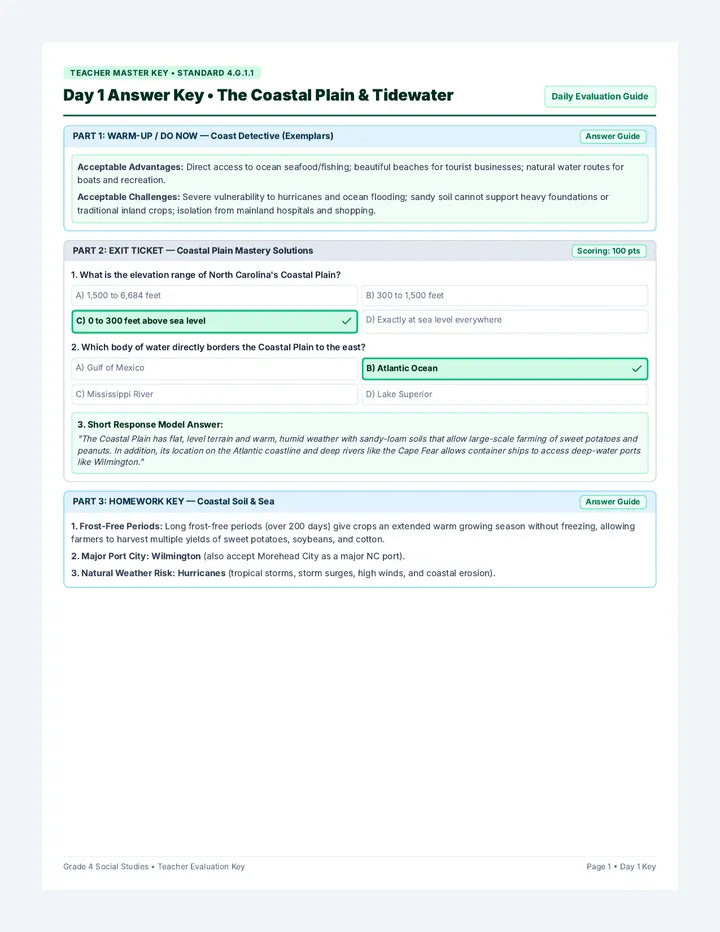
3 multiple-choice questions on elevation, waterways, and one sentence on economic strength.
Teacher Notes
Sort exit tickets: Mastered / Approaching / Reteach. Check that students differentiate barrier islands from inner farmland.
Grade 4 • North Carolina Geography Day 1 • Lesson Delivery & Assessment
4.G.1 • Day 2
4th Grade Social Studies | North Carolina Geography
Focus: The Piedmont Region
<table class="w-full border-collapse"><tbody><tr class="border-b border-slate-200"><td class="w-[22%] px-2 py-1 font-bold bg-amber-100 text-amber-950 border-r border-slate-300">Standard</td><td class="px-2 py-1 text-slate-800"><strong>4.G.1.1</strong> - Compare the physical and human characteristics of the distinct regions of North Carolina (focus: Piedmont Region).</td></tr><tr class="border-b border-slate-200"><td class="px-2 py-1 font-bold bg-amber-100 text-amber-950 border-r border-slate-300">I Can Statement</td><td class="px-2 py-1 text-slate-800">I can explain how rolling hills, red clay soil, and Fall Line rapids shaped industries and major cities in the Piedmont.</td></tr><tr class="border-b border-slate-200"><td class="px-2 py-1 font-bold bg-amber-100 text-amber-950 border-r border-slate-300">Essential Question</td><td class="px-2 py-1 text-slate-800">Why did the Piedmont become North Carolina’s most populated, urban, and industrial region?</td></tr><tr><td class="px-2 py-1 font-bold bg-amber-100 text-amber-950 border-r border-slate-300">Vocabulary</td><td class="px-2 py-1 text-slate-800">Piedmont ("foot of the mountain"), plateau, Fall Line, rapids/waterfalls, red clay, urban center, manufacturing, Research Triangle</td></tr></tbody></table>
Materials & Preparation
- Topographic elevation profile diagrams demonstrating the Fall Line drop-off
- Sample dish of dry NC red clay soil vs. coastal sandy loam soil for tactile observation
- Population distribution map highlighting Charlotte and the Research Triangle
WICOR Strategies
- Writing: Cause-and-effect explanatory sentences linking fast-flowing river rapids to early textile mills.
- Inquiry: Investigate: Why could boats travel easily from the ocean to the Fall Line, but no farther?
- Collaboration: Small group map study locating the Yadkin, Catawba, and Neuse rivers in relation to mill towns.
- Organization: Compare-and-contrast T-chart highlighting physical contrasts between Coast and Piedmont.
- Reading: Text-dependent questions examining the evolution of Piedmont industries from textiles to tech.
Warm-Up / Do Now (7 Minutes)
City Mystery: Display nighttime satellite image of NC illuminated by city lights. Point out the glowing crescent arch from Raleigh-Durham through Greensboro to Charlotte. Ask: "Why are so many millions clustered right in the middle of our state instead of on the coast or mountains?"
Introduction / Mini-Lesson (12 Minutes)
Define "Piedmont" from French roots meaning "foot of the mountain". Explain that the Piedmont is a plateau of rolling hills (300 to 1,500 ft elevation). Teach the Fall Line—where hard inland rock meets softer coastal sediment, causing rivers to plunge downward in waterfalls and rapids. Explain how early settlers harnessed rushing water power for textile, furniture, and tobacco factories.
ANCHOR CHART: The Piedmont Region Profile
- Physical Features: Rolling hills, plateau, mineral-rich red clay soil, river basins (Catawba, Yadkin), and Fall Line waterfalls.
- Climate: Moderate four-season climate; cooler than the coast with moderate precipitation year-round.
- Human Adaptation: Water mills transitioned into major manufacturing, banking (Charlotte), medicine, universities, and tech (RTP).
Rolling Hills + Water Power + Central Location = Hub of Population, Industry & Innovation
Visual Model:
Diagram of Fall Line showing water wheels turning factory gears, leading to modern city skyscrapers.
Grade 4 • North Carolina Geography Day 2 • Plan Overview
4.G.1.1 Day 2 • Instructional Sequence & Differentiation Piedmont Analysis
I Do - Teacher Modeling (8 Minutes)
Model connecting geography to economic evolution. Project two historical pictures: an 1890 Gaston County textile mill on a rushing river, and a modern laboratory in Research Triangle Park. Model thinking aloud: "Notice how water power first drew thousands of workers to factory towns along the Piedmont's fast rivers. Over time, roads, railways, and great universities developed here, transforming factory towns into America's leading banking and medical tech hub."
Check for Understanding (4 Minutes)
Thumb up/down & Quick Justification: "True or False: The Fall Line made it easy for large ocean ships to sail directly into Greensboro and Charlotte." Have students cite rock waterfalls and elevation changes as evidence.
We Do - Guided Practice (12 Minutes)
Together with student partners, compare soil and landscape of Piedmont with Coastal Plain. Complete a side-by-side contrast chart: Coastal sandy loam vs. Piedmont dense red clay; sea-level lowlands vs. rolling hills. Guide students to use the sentence frame: "While the Coastal Plain relied primarily on _____, the Piedmont's river rapids led to _____."
You Do - Independent Practice (14 Minutes)
Students complete their Piedmont Regional Profile Sheet:
- Color code the Piedmont region on map; mark and label Fall Line, Charlotte, and Raleigh.
- Document 3 physical features, climate summary, and key modern industries.
- Constructed Argument: Write 3 sentences arguing why a young person seeking careers might consider the Piedmont the "best" region.
Small Group / Intervention
Cause & Effect Matching: Match cards: "Rapids on Rivers" → "Water Wheels Built" → "Factories & Cities Emerge". Provide fill-in vocabulary cloze notes for struggling writers.
Enrichment / AIG
Urban Sprawl Analysis: Evaluate how rapid population growth in the Piedmont impacts natural resources and water quality in the Catawba River compared to eastern NC.
Differentiation & Supports: Display bilingual geographic flashcards. Provide graphic organizer pre-populated with visual icons. Allow partner oral brainstorming before written work.
Closure (3 Min)
"In your own words, what is the Fall Line and why did it matter to early factory owners?"
Exit Ticket
4 questions identifying Piedmont topography, soil characteristics, Fall Line significance, and major cities.
Teacher Notes
Verify that students recognize Fall Line as a geological drop in elevation rather than a political boundary.
Grade 4 • North Carolina Geography Day 2 • Lesson Delivery & Assessment
4.G.1 • Day 3
4th Grade Social Studies | North Carolina Geography
Focus: The Mountain Region
<table class="w-full border-collapse"><tbody><tr class="border-b border-slate-200"><td class="w-[22%] px-2 py-1 font-bold bg-emerald-100 text-emerald-950 border-r border-slate-300">Standard</td><td class="px-2 py-1 text-slate-800"><strong>4.G.1.1</strong> - Compare the physical and human characteristics of the distinct regions of North Carolina (focus: Mountain Region).</td></tr><tr class="border-b border-slate-200"><td class="px-2 py-1 font-bold bg-emerald-100 text-emerald-950 border-r border-slate-300">I Can Statement</td><td class="px-2 py-1 text-slate-800">I can analyze how high elevation, steep terrain, and cooler climate affect lifestyle, tourism, and industry in the Mountain Region.</td></tr><tr class="border-b border-slate-200"><td class="px-2 py-1 font-bold bg-emerald-100 text-emerald-950 border-r border-slate-300">Essential Question</td><td class="px-2 py-1 text-slate-800">How do the ancient Appalachian Mountains create distinct climates, economic opportunities, and living challenges?</td></tr><tr><td class="px-2 py-1 font-bold bg-emerald-100 text-emerald-950 border-r border-slate-300">Vocabulary</td><td class="px-2 py-1 text-slate-800">Appalachian Mountains, Blue Ridge, Great Smokies, Mount Mitchell (6,684 ft), elevation, cove, timber, tourism, gemstone mining</td></tr></tbody></table>
Materials & Preparation
- Elevation profile charts comparing Mount Mitchell (6,684 ft) to Raleigh (315 ft) and Wilmington (35 ft)
- Photo sets: Blue Ridge Parkway, ski resorts, forestry, apple orchards, Christmas tree farms, emerald mines
- Climate comparison graphs showcasing average winter snowfalls and summer high temperatures
WICOR Strategies
- Writing: Descriptive paragraph on how elevation alters daily weather and vegetation in western NC.
- Inquiry: Investigate: Why did early roads take much longer to build in the mountains than across the coast?
- Collaboration: Partner discussion evaluating economic trade-offs of winter ski tourism versus steep farming.
- Organization: Elevation and resource tiered graphic organizer.
- Reading: Close reading on Mount Mitchell and Eastern Band of Cherokee Indians' mountain heritage.
Warm-Up / Do Now (7 Minutes)
Temperature Riddle: On a hot July afternoon, the thermometer reads 95°F in Raleigh and Wilmington. But atop Mount Mitchell, it is only 68°F with a brisk breeze! Ask: "What single geographic factor causes this huge temperature difference in the exact same state?"
Introduction / Mini-Lesson (12 Minutes)
Introduce North Carolina’s western frontier: the Mountain Region, part of the Appalachian chain. Highlight the Blue Ridge and Great Smokies. Emphasize Mount Mitchell (6,684 ft)—highest peak in mainland North America east of the Mississippi! Explain how elevation causes cooler temperatures, snow, and unique ecosystems. Discuss how isolation fostered mountain crafts and traditions.
ANCHOR CHART: The Mountain Region Profile
- Physical Features: High elevation (1,500–6,684 ft), rugged peaks, deep valleys/coves, hardwood/evergreen forests, clear streams.
- Climate: Cool breezy summers; cold winters with snow/ice; shorter agricultural growing season.
- Human Adaptation: Tourism (skiing, hiking, rafting), Fraser fir Christmas trees, apple orchards, timber, gemstone mining, crafts.
High Elevation + Ancient Peaks + Cold Climate = Natural Beauty & Four-Season Tourism Haven
Visual Model:
Pyramid elevation mountain profile: valley farming → slope timber/orchards → snowy summit tourism.
Grade 4 • North Carolina Geography Day 3 • Plan Overview
4.G.1.1 Day 3 • Instructional Sequence & Differentiation Mountain Region Analysis
I Do - Teacher Modeling (8 Minutes)
Model evaluating how steep terrain limits certain industries while supercharging others. Project a chart comparing farm acreage in Johnston County (flat coast) vs. Watauga County (steep mountains). Think aloud: "A farmer cannot easily run large harvesters on a 45-degree rocky slope. But Fraser fir Christmas trees thrive in high, rocky, cold soils! Millions also visit state parks and ski resorts here, creating a huge outdoor hospitality economy."
Check for Understanding (4 Minutes)
Whiteboard Whip-Around: "Write the name of the highest mountain peak in NC and its approximate elevation." (Mount Mitchell, 6,684 ft). Follow-up: "Why does elevation make mountain weather colder than coastal weather?"
We Do - Guided Practice (12 Minutes)
Read together the passage on Mountain resources. Guide students to annotate two environmental challenges (steep winding roads, winter blizzards, rocky soil) and two economic advantages (abundant timber, summer tourist getaways, clean mountain waterways). Work together to complete the comparative frame: "If you love snow and hiking, the Mountain Region is ideal because _____."
You Do - Independent Practice (14 Minutes)
Students complete their Mountain Region Profile Sheet:
- Color code the Mountain Region on map; mark Mount Mitchell, Asheville, and Blue Ridge Parkway.
- Record key landforms, climate facts, and primary natural resources.
- Constructed Response: Write an advertising brochure blurb convincing tourists that the Mountain Region is the "best" destination to vacation in NC.
Small Group / Intervention
Elevation Ladder Activity: Order cards from lowest (Outer Banks, 0 ft) to medium (Piedmont, 700 ft) to highest (Mount Mitchell, 6,684 ft). Connect altitude directly to temperature cards.
Enrichment / AIG
Appalachian Ecosystem Study: Investigate why the Great Smokies have some of the highest salamander and tree biodiversity on Earth. Hypothesize how high rainfall and isolation foster species.
Differentiation & Supports: Provide sentence frames for brochure writing. Chunk informational text into short sub-headed sections. Use physical 3D elevation maps for visual-spatial clarity.
Closure (3 Min)
"How does high elevation both challenge and help people who live in the western mountains?"
Exit Ticket
4 questions checking knowledge of Mount Mitchell, climate differences caused by elevation, and mountain industries.
Teacher Notes
Evaluate student ability to explain cause-and-effect between elevation and climate, rather than just subjective impressions.
Grade 4 • North Carolina Geography Day 3 • Lesson Delivery & Assessment
4.G.1 • Day 4
4th Grade Social Studies | North Carolina Geography
Focus: Cross-Regional Analysis
<table class="w-full border-collapse"><tbody><tr class="border-b border-slate-200"><td class="w-[22%] px-2 py-1 font-bold bg-purple-100 text-purple-950 border-r border-slate-300">Standard</td><td class="px-2 py-1 text-slate-800"><strong>4.G.1.1 & 4.G.1.2</strong> - Compare regions of NC and explain how geography impacted the movement of people, goods, and historical settlement.</td></tr><tr class="border-b border-slate-200"><td class="px-2 py-1 font-bold bg-purple-100 text-purple-950 border-r border-slate-300">I Can Statement</td><td class="px-2 py-1 text-slate-800">I can compare all three NC regions side-by-side and explain how physical barriers shaped where people settled and worked.</td></tr><tr class="border-b border-slate-200"><td class="px-2 py-1 font-bold bg-purple-100 text-purple-950 border-r border-slate-300">Essential Question</td><td class="px-2 py-1 text-slate-800">How did North Carolina’s physical landscape help or hinder transportation, settlement, and economic development?</td></tr><tr><td class="px-2 py-1 font-bold bg-purple-100 text-purple-950 border-r border-slate-300">Vocabulary</td><td class="px-2 py-1 text-slate-800">cross-section, elevation gradient, barrier, migration, transportation network, trade routes, human-environment interaction</td></tr></tbody></table>
Materials & Preparation
- Master 3-Region Comparison Matrices for all students
- Historical transportation route maps (plank roads, early rail corridors, Interstate 40 corridor across NC)
- Regional Evidence Clue Cards (Resource packets for economy, weather risk, and recreation)
WICOR Strategies
- Writing: Comparative analytical paragraphs using transition signals: in contrast, similarly, whereas.
- Inquiry: Formulate claims evaluating why NC was historically nicknamed the "Rip Van Winkle" state due to geographic isolation.
- Collaboration: Jigsaw activity: Expert teams for Coast, Piedmont, and Mountains cross-teach peers.
- Organization: Comprehensive Triple-Venn diagram and 3-region comparative data matrix.
- Reading: Synthesis reading comparing 3 primary accounts of colonial travelers crossing NC east to west.
Warm-Up / Do Now (7 Minutes)
The Great State Walk: Imagine walking in a straight line from Nags Head on the Atlantic all the way west to Clingmans Dome in the Smokies. Describe what changes your boots and body would feel along the 500-mile journey in terms of slope, temperature, and terrain.
Introduction / Mini-Lesson (12 Minutes)
Guide students through the state's "Staircase of Elevation": Step 1 (Coast, 0–300 ft); Step 2 (Piedmont, 300–1,500 ft); Step 3 (Mountains, 1,500–6,684 ft). Emphasize how physical barriers (shallow sounds with few natural deep ports, Fall Line rapids, and rugged mountain passes) originally isolated communities and dictated routes for early railroads, plank roads, and highways.
ANCHOR CHART: North Carolina Elevation & Region Matrix
- Coastal Plain: Low/flat, maritime climate, farming/fishing/ports, vulnerable to hurricanes and coastal flooding.
- Piedmont: Rolling hills/plateau, moderate 4-seasons, banking/tech/manufacturing, dense population centers.
- Mountain Region: Rugged peaks/valleys, cold snowy winters, tourism/timber/orchards, challenged by steep transit routes.
Physical Geography Shapes Transport → Transport Dictates Settlement → Settlement Drives Economy
Visual Model:
East-to-West 3-step elevation staircase showing sea level rise, Fall Line drop, and Appalachian crest.
Grade 4 • North Carolina Geography Day 4 • Plan Overview
4.G.1.1 & 4.G.1.2 Day 4 • Instructional Sequence & Differentiation Cross-Regional Analysis
I Do - Teacher Modeling (8 Minutes)
Model how to extract comparative evidence for an inquiry argument using a 3-column organizer. Question: "Which region provides the best climate for human comfort and agriculture?" Model synthesizing facts: Coast has long growing seasons but severe humidity and hurricanes; Mountains have refreshing summers but freezing winters; Piedmont offers balanced moderate four-season conditions. Demonstrate drafting a balanced evidence statement.
Check for Understanding (4 Minutes)
Rapid-Fire Movement: "Point East for Coastal Plain, tap head for Piedmont, point West for Mountain Region." Call out: Mount Mitchell, Fall Line waterfalls, Outer Banks barrier islands, Research Triangle, Cape Fear River port.
We Do - Guided Practice: Jigsaw Matrix (12 Minutes)
Students collaborate in trios (one Coastal expert, one Piedmont expert, one Mountain expert). Together, they audit and verify their comprehensive North Carolina Regional Comparison Matrix, checking elevation ranges, key landforms, waterways, economic foundations, and unique geographic advantages.
You Do - Independent Practice (14 Minutes)
Students complete the Cross-Regional Evidence Evaluation worksheet:
- Complete 3 comparative analysis prompts contrasting pairs of regions.
- Analyze a statewide elevation profile graphic and label transition points (Fall Line, Blue Ridge Escarpment).
- Pre-Writing Debate Prep: Select region they will advocate for on Day 5 and list 3 concrete facts supporting their choice.
Small Group / Intervention
Feature Card Sort: Physically place 12 feature strips onto a 3-region map mat. Review color-coded keys to reinforce differences before independent pre-writing.
Enrichment / AIG
Infrastructure Planner: Write proposal explaining how engineers overcame either Outer Banks' shifting inlets OR the Mountain Region’s steep grades when constructing highways.
Differentiation & Supports: Provide comparison matrix with fill-in prompts. Pair English learners with bilingual or strong reading partners during jigsaw. Provide structured sentence frame bank.
Closure (3 Min)
"Which two regions have the sharpest contrast in elevation and climate? Give one piece of evidence."
Exit Ticket
4 questions requiring students to match economic activities and geographic challenges to corresponding regions.
Teacher Notes
Check that each student has committed to a region choice for Day 5 debate and recorded valid, text-supported reasons.
Grade 4 • North Carolina Geography Day 4 • Lesson Delivery & Assessment
4.G.1 • Day 5
4th Grade Social Studies | North Carolina Geography
Focus: Inquiry Synthesis & Debate
<table class="w-full border-collapse"><tbody><tr class="border-b border-slate-200"><td class="w-[22%] px-2 py-1 font-bold bg-rose-100 text-rose-950 border-r border-slate-300">Standard</td><td class="px-2 py-1 text-slate-800"><strong>4.G.1.1, 4.G.1.2 & ELA W.4.1</strong> - Write opinion/argumentative justifications supporting a point of view with reasons and geographic information.</td></tr><tr class="border-b border-slate-200"><td class="px-2 py-1 font-bold bg-rose-100 text-rose-950 border-r border-slate-300">I Can Statement</td><td class="px-2 py-1 text-slate-800">I can construct and defend a Claim-Evidence-Reasoning argument explaining which North Carolina region is the best.</td></tr><tr class="border-b border-slate-200"><td class="px-2 py-1 font-bold bg-rose-100 text-rose-950 border-r border-slate-300">Essential Question</td><td class="px-2 py-1 text-slate-800">Which region is the "best" in North Carolina, and how do physical features, climate, and human opportunities prove it?</td></tr><tr><td class="px-2 py-1 font-bold bg-rose-100 text-rose-950 border-r border-slate-300">Vocabulary</td><td class="px-2 py-1 text-slate-800">Claim, Evidence, Reasoning (CER), justification, perspective, trade-off, geographic advantage, persuasive argument</td></tr></tbody></table>
Materials & Preparation
- Completed Student Regional Data Folders & Matrices from Days 1–4
- Structured CER (Claim, Evidence, Reasoning) Debate Graphic Organizers
- Debate speaking guidelines and peer feedback rubrics; 3 labeled classroom corners
WICOR Strategies
- Writing: Formal multi-paragraph constructed response using CER structure with at least 3 pieces of geographic evidence.
- Inquiry: Weighing subjective value ("best") against factual criteria (jobs, weather, resources, recreation).
- Collaboration: Four Corners academic debate with respectful rebuttal protocols.
- Organization: CER argumentative planning outline with claim, evidence points, and reasoning connections.
- Reading: Evaluating and quoting evidence cards during collaborative debate preparation.
Warm-Up / Do Now (7 Minutes)
Corner Claim: Students move to one of three classroom corners representing Coastal Plain, Piedmont, or Mountain Region. In corner teams, students have 2 minutes to select their single strongest geographic fact making their region superior. Spokespersons share out.
Introduction / Mini-Lesson (12 Minutes)
Review unit question: "Which region is the best in North Carolina?" Clarify that in social studies, "best" depends on how effectively you justify your choice using real physical features, climate data, and economic evidence rather than just opinions. Introduce CER framework: Claim (My position) + Evidence (Facts from maps/texts) + Reasoning (Why this makes it best for humans).
ANCHOR CHART: The CER Geographic Argument
- CLAIM: State clearly which region (Coast, Piedmont, or Mountains) is superior for living, working, or thriving.
- EVIDENCE: Cite 3+ concrete facts (elevation, climate, natural resources, key industries, major waterways).
- REASONING: Explain how those physical features directly benefit human life, provide economic advantages, or solve problems.
Claim (Clear Stance) + Evidence (Physical & Climate Facts) + Reasoning (Human Impact) = Persuasive Authority
Visual Model:
Three-legged stool graphic: Seat labeled "Best Region Claim", supported by 3 sturdy legs of Evidence & Reasoning.
Grade 4 • North Carolina Geography Day 5 • Plan Overview
4.G.1.1 & W.4.1 Day 5 • Instructional Sequence & Differentiation Inquiry Debate & Writing
I Do - Teacher Modeling (8 Minutes)
Model writing a CER paragraph advocating for a region. "Claim: The Coastal Plain is North Carolina’s best region for families and commerce. Evidence: According to geographic data, eastern NC has over 300 miles of barrier islands, two major deep-water ports, and vast flat land with rich soil. Reasoning: These features allow residents to earn livelihoods from commercial fishing and farming, while enjoying mild winter weather that avoids heavy mountain snowstorms."
Check for Understanding (4 Minutes)
Peer Review Check: Have students swap draft Claim sentences with a partner. Partner evaluates: Does this state a clear position? Does it avoid vague language like 'it is nice'?
We Do - Guided Practice: Academic Region Debate (14 Minutes)
Facilitate a structured fishbowl debate:
- Round 1: Physical landforms and scenery (Which region offers superior natural advantages?).
- Round 2: Climate and weather comfort (Which region has the most livable climate?).
- Round 3: Jobs, economy, and resources (Where can North Carolinians build the strongest future?).
- Debate Protocol: Students must cite at least one piece of data before challenging another region.
You Do - Independent Practice: Culminating Argument Writing (16 Minutes)
Students write their final culminating essay: "The Best Region in North Carolina":
- Paragraph 1: Introduction with clear Claim identifying their chosen region.
- Paragraph 2: Physical features and landform evidence with reasoning.
- Paragraph 3: Climate and economic opportunities evidence with reasoning.
- Paragraph 4: Conclusion acknowledging and refuting a counter-argument from another region.
Small Group / Intervention
Guided CER Sentence Scaffold: Provide paragraph template with pre-written transition stems ("One major geographic advantage is...", "This proves my claim because...").
Enrichment / AIG
Counter-Claim Rebuttal: Require advanced writers to analyze the chief vulnerability of their region (hurricanes, winter storms, urban congestion) and explain how human adaptation overcomes it.
Differentiation & Supports: Provide word processing or speech-to-text option for fine motor accommodations. Display rubric checklist with visual descriptors for Claim, Evidence, and Reasoning.
Closure (3 Min)
"Did anyone hear an argument today that made you reconsider which region is truly the best? Why?"
Final Assessment
Collect completed CER Writing and evaluate using the 4-level North Carolina Inquiry & Geography Rubric.
Teacher Notes
Grade across social studies content accuracy (4.G.1.1) and argumentative evidence citation (W.4.1).
Grade 4 • North Carolina Geography Day 5 • Lesson Delivery & Assessment
Anchor Chart Appendix • Part 1
Visual Classroom Wall Models & Teacher Anchor Charts (Days 1–3)
Instructional Graphics
DAY 1: THE COASTAL PLAIN & TIDEWATER Standard 4.G.1.1
Key Guiding Questions for Chart Wall:
- Where is the Coastal Plain located? (Eastern 45% of NC, Atlantic Ocean to Fall Line)
- What makes the Tidewater different? (Low water table, sounds, barrier islands, salt marshes)
- How do people use this land? (Commercial fishing, shipping ports, tobacco/peanut/sweet potato farms)
Barrier Islands + Low Elevation (0–300 ft) + Humid Maritime Climate = Maritime & Agricultural Hub
Suggested Teacher Visual: Draw a coastal cross-section: Atlantic Ocean waves → Outer Banks strip of sand with lighthouse → Pamlico Sound water → marshy Tidewater → flat inland farm fields with rows of sweet potatoes and container ship at Wilmington port.
DAY 2: THE PIEDMONT & THE FALL LINE Standard 4.G.1.1
Key Guiding Questions for Chart Wall:
- What does "Piedmont" mean? (Foot of the mountain; rolling hills plateau 300–1,500 ft)
- What is the Fall Line? (The drop-off where rivers form rapids and waterfalls)
- Why did major cities grow here? (Water mills attracted workers, leading to factories, railroads, banks, universities)
Rolling Hills + Fall Line Rapids + Central Location = Hub of Industry, Cities & Technology
Suggested Teacher Visual: Draw a side-profile showing high plateau stepping down at the Fall Line with jagged rocks and rushing rapids; place an old textile watermill on rapids, transitioning rightward into Charlotte skyscrapers and Research Triangle lab beakers.
DAY 3: THE MOUNTAIN REGION Standard 4.G.1.1
Key Guiding Questions for Chart Wall:
- Which mountain range runs through NC? (Appalachians, specifically Blue Ridge & Great Smokies)
- What is special about Mount Mitchell? (6,684 ft; highest peak in eastern North America)
- How does elevation affect life? (Cold snowy winters, cool breezy summers, tourism, timber, apple orchards)
High Elevation (1,500–6,684 ft) + Rugged Peaks + Cold Climate = Tourism & Forestry Paradise
Suggested Teacher Visual: Draw tall layered mountain peaks with evergreen trees and snow atop Mount Mitchell. Add icons: hiker with backpack, skier on slope, Fraser fir Christmas tree farm, and Cherokee basket weaving.
Grade 4 • North Carolina Geography Anchor Chart Appendix • Days 1–3
Anchor Chart Appendix • Part 2
Cross-Region Synthesis, CER Debate Framework & Rubric (Days 4–5)
Synthesis & Rubrics
DAY 4: THE NORTH CAROLINA ELEVATION STAIRCASE Standard 4.G.1.1 & 4.G.1.2
Statewide Cross-Section Synthesis:
Step 1: Coast
0 – 300 ft
Flat, sandy, wetlands
Step 2: Piedmont
300 – 1,500 ft
Rolling plateau, red clay
Step 3: Mountains
1,500 – 6,684 ft
Steep peaks, forests
Suggested Teacher Visual: Draw a 3-step physical staircase across the classroom board from left (West/High) to right (East/Low), labeling transition lines: the Blue Ridge Escarpment and the Fall Line. Show how elevation drives temperature drop and river speed.
DAY 5: CLAIM • EVIDENCE • REASONING (CER) DEBATE FRAMEWORK Standards 4.G.1 & W.4.1
1. CLAIM
Answers: Which region is the best in North Carolina?
"The Piedmont is the best region in NC because..."
2. EVIDENCE
Cites 3+ verified physical, climate, or economic facts.
"According to elevation maps, Charlotte & Raleigh have..."
3. REASONING
Explains why evidence proves this region provides better living.
"This proves that central location fosters higher job growth..."
Suggested Teacher Visual: A courtroom balance scale or a 3-pillar temple where the roof ("Best Region Claim") is supported by three columns labeled "Physical Geography", "Climate Comfort", and "Economic Opportunity".
Day 5 Inquiry CER Scoring Rubric (Quick Reference)
| Criteria | Level 4 (Exceeds) | Level 3 (Proficient) | Level 2 / 1 (Developing) |
|---|
| Claim (Stance) | Clear, insightful claim identifying region and previewing 3 criteria. | Clear claim identifying chosen region. | Vague, unclear, or missing claim. |
| Geographic Evidence | Cites 4+ accurate, specific geographic facts (elevation, waterways, climate, industry). | Cites 3 accurate facts from unit text/maps. | Cites 1-2 facts; lacks specific details or inaccurate. |
| Reasoning | Thoroughly explains how geography benefits people; refutes counter-argument. | Explains why evidence makes this region the best for people. | Restates facts without explaining why they support claim. |
Grade 4 • North Carolina Geography Anchor Chart Appendix • Days 4–5 & Rubric