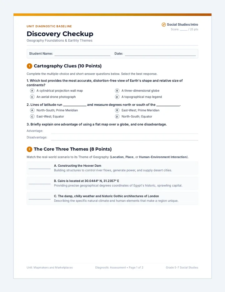
Southern Surveyor Slides
An engaging presentation designed to introduce students to the geography, states, and capitals of the Southeast United States. Includes visual aids for state identification and a placeholder for custom video content.
Southern Surveyor Worksheet
A printable mapping worksheet where students match states to their capitals and identify regional landmarks. Designed with clear spaces for handwriting and a word bank for support.
Southern Surveyor Answer Key
A comprehensive answer key for the Southern Surveyor worksheet, providing all states, capitals, and landmark answers for teacher reference.
Southern Surveyor Slides Revised
An updated instructional presentation for mapping the Southeast US. Focuses on state identification, memory tricks, and geographic boundaries without the video placeholder.
Southeast Reference Map Sheet
A visual reference sheet showing the relative locations and assigned numbers of the 12 Southeast states. Helps students complete the mapping worksheet.
Southeast Base Map Sheet
A large outline base map for students to physically manipulate and place state/capital cards. Includes schematic placement zones for all 12 Southeast states.
Southeast Sorting Cards Sheet
A sheet of cut-out cards featuring the names and capitals of all 12 Southeast states, numbered to correspond with the Master Map. Perfect for tactile sorting and spatial reasoning activities.