Slope Sherpas Teacher Guide SPECIAL EDUCATION ROADMAP
SLOPE SHERPAS
Scaffolded Unit: Linear Equations & Coordinate Geometry
Target Setting
Resource Room Math
Duration 60-90 Mins
Subject Coordinate Math
Focus y = mx + b
Design Scaffolded
Lesson Vision & Scaffolding Focus
This lesson is specifically designed for resource students who benefit from structured visual organizers and concrete steps. Rather than jumping into abstract computations, this lesson uses color-coded coordinates (Blue for X/Run, Red for Y/Rise) , visual grid counting, and direct instruction templates to build coordinate literacy. Students master drawing lines and calculating steepness using a highly visual mountain mapping theme.
Scaffolded Objectives
Calculate slope by counting Rise (UP) and Run (RIGHT) on a coordinate grid map.Graph linear equations of form \(y = mx + b\) using structured step-by-step checklists.Identify the starting value (\(b\)) and steepness (\(m\)) using concrete guides.
Accommodations Built-In
Color-coding: Red-alert highlights for Y/vertical values, Ocean Blue highlights for X/horizontal values.Eliminated algebra drag: Systems of equations replaced with logical conceptual parallel lines exploration.Visual Checklists: Steps to graph pre-written as checkbox tasks on the student sheets.
Common Hurdles & How We Solved Them
✖ Confusing Rise and Run: Resource students often put horizontal change on top. Solution: We use the graphic mnemonic "Rise UP to the clouds, Run RIGHT horizontally" with arrows.
✖ Graphing "Lostness": Not knowing where to place the first point. Solution: The worksheet explicitly spells out the Starting coordinate, telling them: "Put your first dot on the Y-Axis at number..."
Slope Sherpas Teacher Guide Page 1 of 2
RESOURCE ROOM TIMELINE
Structured pacing designed to maximize student focus and success
1
Warm-up: The Altitude Briefing 10 Mins
Introduce the "Mount Linear" climbing mission. Act out the movements: "Rise up" by reaching your arms up high, and "Run right" by marching forward. Show how we count squares on a giant grid drawn on the whiteboard.
2
Direct Instruction: Slide Walkthrough 15 Mins
Display Mountain Mapper Slides . Leverage the color-coded coordinates to model subtraction steps on Slide 3. Connect Y subtraction directly to "Rise" (Red highlight) and X subtraction to "Run" (Blue highlight). Keep definitions highly tactile.
3
Guided Practice: Guided Worksheet Mapping 20 Mins
Pass out the Trail Blazer Worksheet . Complete Part 1 (matching tools) out loud. Then guide them through Part 2's subtraction boxes. Encourage students to write the coordinate numbers directly into the corresponding colored brackets.
4
Independent Climb: Task Cards 15 Mins
Cut out and scatter the Summit Climb Task Cards . Direct resource students to start on the Green Circle cards first. Provide physical colored markers (Red and Blue highlighter) so they can visually mark the Rise and Run values on their cards.
5
Debrief: Field Log Review 5 Mins
Bring students back to "Base Camp." Review Question 2 on page 2 of the worksheet together: "Which trail climbs up faster?" Praise students for using the terms "steepness" and "steeper" based on their grid calculations.
Resource Teacher Pro-Tips
Visual Chunking: Do not let students look at both pages of the worksheet at once. Fold the paper in half so they only see the active section. This reduces sensory overwhelm and keeps focus high.
Highlighter Accommodations: Allow students to highlight the y-intercept number in the equations on page 2 with a yellow marker. Tell them: "Yellow is where your pencil lands first!"
Slope Sherpas Teacher Guide Page 2 of 2
Mountain Mapper Slides SCAFFOLDED ADVENTURE MATH LINEAR RELATIONSHIPS FOR MAP MAKERS
SLOPE SHERPAS
Step-by-step mountain mapping using linear equations. Learn to calculate and draw pathways on a grid.
Helper Guide Included Color-Coded Steps
Slope Sherpas Introductory Deck Slide 1 of 5
SCAFFOLDED ADVENTURE MATH WHAT IS SLOPE?
The Climbing Slope
The slope tells you how steep your mountain trail is. Think of it as a vertical climb divided by a horizontal walk.
RISE (Change in Y) Climbing UP vertically
RUN (Change in X) Walking RIGHT horizontally
Slope Formula
\(m = \frac{\text{RISE (Vertical)}}{\text{RUN (Horizontal)}}\)
\(m = \frac{\text{Y Change}}{\text{X Change}}\)
To find slope, count how many steps UP RIGHT .
Slope Sherpas Lesson Slides Slide 2 of 5
SCAFFOLDED ADVENTURE MATH STEP-BY-STEP CALCULATION
Finding Slope of Ridge Route
Let's find the slope step-by-step between these coordinates:
A
Start (Base Camp) (2 , 3)
B
Destination (High Camp) (6 , 9)
Guided Checklist
1
Calculate Vertical Rise (subtract Y values) \(9 - 3 = 6 \text{ steps UP}\)
2
Calculate Horizontal Run (subtract X values) \(6 - 2 = 4 \text{ steps RIGHT}\)
3
Place RISE on top of RUN to get Slope \(m = \frac{6}{4} = \frac{3}{2}\)
Slope Sherpas Lesson Slides Slide 3 of 5
SCAFFOLDED ADVENTURE MATH THE TRAIL EQUATION
How to Read a Trail Equation: \(y = mx + b\)
m
Trail Slope (The Steepness)
Tells you how to move from point to point:
\(m = \frac{\text{How many steps UP}}{\text{How many steps RIGHT}}\)
b
Base Camp (The Start Point)
Tells you where to put your first dot on the grid:
Plot first dot on Y-Axis at: \((0, b)\)
Slope Sherpas Lesson Slides Slide 4 of 5
SCAFFOLDED ADVENTURE MATH GRAPHING STEPS
Let's Graph: \(y = \frac{1}{2}x + 2\)
Watch this simple checklist to graph the equation correctly onto your map:
1 Find the start height b = 2 and plot a dot on the Y axis.
2 From that dot, go UP 1 square (Rise).
Trail Blazer Worksheet SCAFFOLDED SUPPORT VERSION
TRAIL BLAZER ROADMAP
Mount Linear Expedition
Guided Slope Practice
My Name:
Date:
1 Part 1: Your Trail Guide Tools
Review your three helper definitions before you begin graphing:
START POINT (b)
Where you place your very first point on the vertical line.
RISE (Up)
How many steps you climb straight up on the map.
RUN (Right)
How many steps you walk straight right on the map.
2 Part 2: Let's Calculate the Climb
Let's find the steepness of a trail from Base Camp A (2, 3) to High Camp B (6, 9) . Follow the guided color steps below:
Mapped Coordinates
Point A (2 , 3) (\(x_1\) , \(y_1\))
Point B (6 , 9) (\(x_2\) , \(y_2\))
1
Find the vertical RISE (Change in Y):
Subtract the second Y coordinate minus the first Y coordinate.
\(y_2\) [ ] − \(y_1\) [ ] = RISE = ______
2
Find the horizontal RUN (Change in X):
Subtract the second X coordinate minus the first X coordinate.
\(x_2\) [ ] − \(x_1\) [ ] = RUN = ______
3
Combine them to find Slope (\(m\)):
Place your RISE answer on top, and your RUN answer on the bottom.
\(m = \frac{\text{RISE}}{\text{RUN}}\) → \(m = \frac{[\quad \text{Answer 1} \quad]}{[\quad \text{Answer 2} \quad]}\) → Final Slope = ______
Slope Sherpas Guided Support Worksheet Page 1 of 2
CARTOGRAPHER FIELD LOG
PART 3: PLOT THE TRAILS
Mount Linear Visual Map
Follow the visual Checklist Prompts on the right to easily draw the trail on the map!
109876543210
012345678910
0 Altitude (y)
Horizontal Distance (x)
A Trail Equation: \(y = \frac{1}{2}x + 2\)
1. Start Elevation (Base Camp) Plot your first dot on the Y-axis at: y = 2
2. Climb Up (Rise) From your first dot, count UP : 1 grid square
3. Walk Right (Run) From there, count RIGHT : 2 grid squares
B Trail Equation: \(y = 2x + 1\)
1. Start Elevation (Base Camp) Plot your first dot on the Y-axis at: y = 1
2. Climb Up (Rise) From your first dot, count UP : 2 grid squares
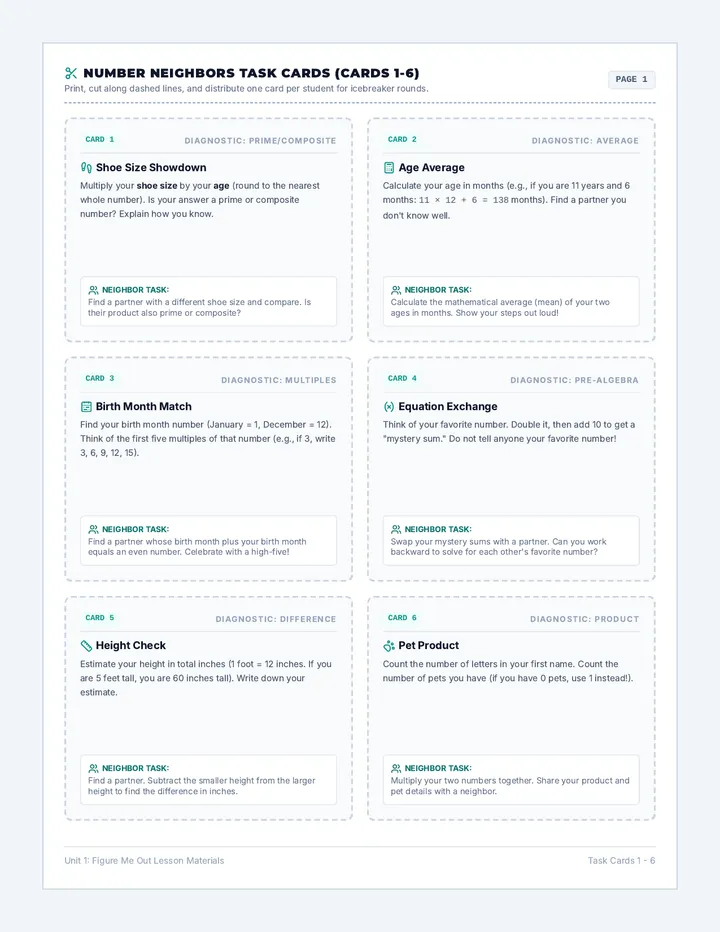
Summit Climb Task Cards SUPPORTIVE EXTRA PRACTICE
SUMMIT CLIMB TASK CARDS
🟢 Trail 1 🟦 Trail 2 ◆ Trail 3
These practice cards are designed to help you climb Mount Linear step-by-step. Read the highlighted **Climber Hints** inside each card to find the answers!
🟢 Card 1
Slope-Intercept ID
The Base Camp Coordinates
A mountain pathway is written as:1. Base Camp Start height (b): ______2. Trail Slope (m): ______
Climber Hint: The start number is the single number at the end. The slope is next to the \(x\).
Level: Beginner Green Circle
🟢 Card 2
Coordinate Slope
Calculated Landmarks
Find the slope of a trail connecting point A (1, 2) to point B (4, 8):Slope (\(m = \frac{\text{Rise}}{\text{Run}}\)): ______
Climber Hint: Put your Rise number on top and your Run number on the bottom, then simplify!
Level: Beginner Green Circle
🟦 Card 3
Descent Slope
Downhill Ski Slope
A skier starts at a high elevation of 10 units on the y-axis. They travel down with a negative slope of -2.
Climber Hint: Place your slope of -2 in front of the \(x\), and your start of 10 as the final number.
Level: Intermediate Blue Square
🟦 Card 4
Table Map
Landmark Elevational Chart
Calculate the slope from this simple linear table:
<table class="w-2/3 mx-auto text-center border-collapse border border-blue-200 text-[9px] my-1 bg-white"><tbody><tr class="bg-blue-50"><th class="border border-blue-200 px-2 py-0.2 font-mono">Distance (x)</th><td class="border border-blue-200 px-2 py-0.2">2</td><td class="border border-blue-200 px-2 py-0.2">4</td></tr><tr><th class="border border-blue-200 px-2 py-0.2 font-mono">Altitude (y)</th><td class="border border-blue-200 px-2 py-0.2">5</td><td class="border border-blue-200 px-2 py-0.2">8</td></tr></tbody></table>
Climber Hint: Subtract Y values to find Rise: \(8 - 5 = 3\). Subtract X values to find Run: \(4 - 2 = 2\).
Level: Intermediate Blue Square
◆ Card 5
Ridge Plateau
The Flat Mountain Meadow
A flat horizontal trail crosses landmarks (3, 7) and (9, 7).