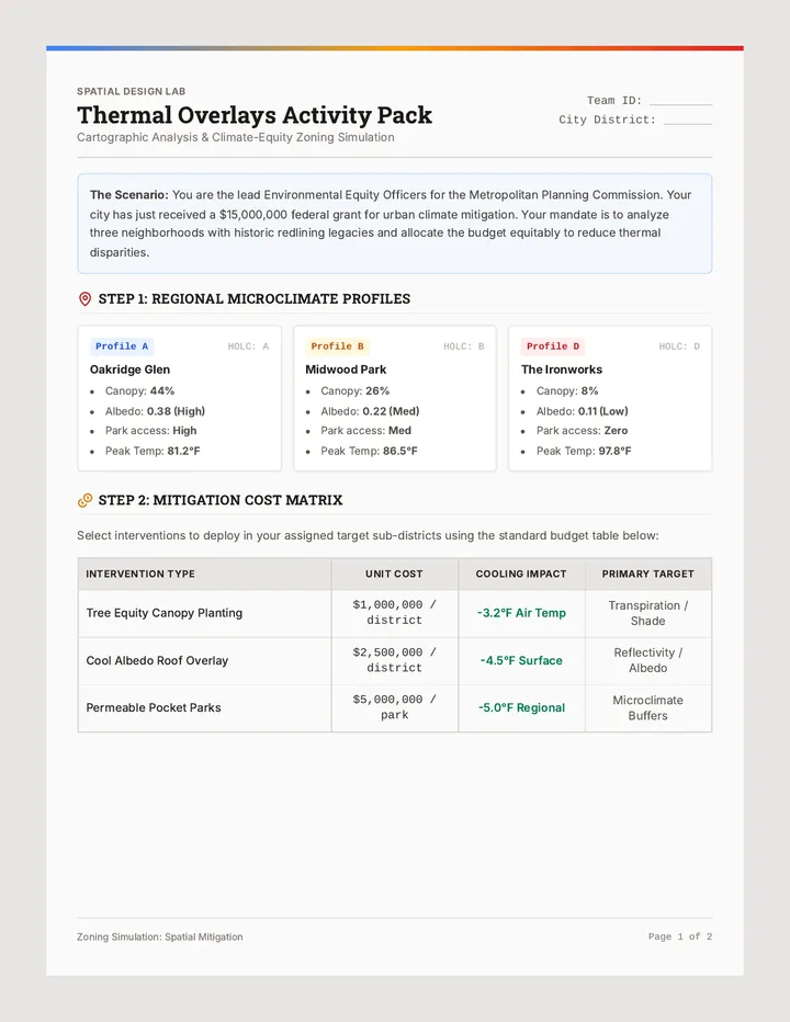
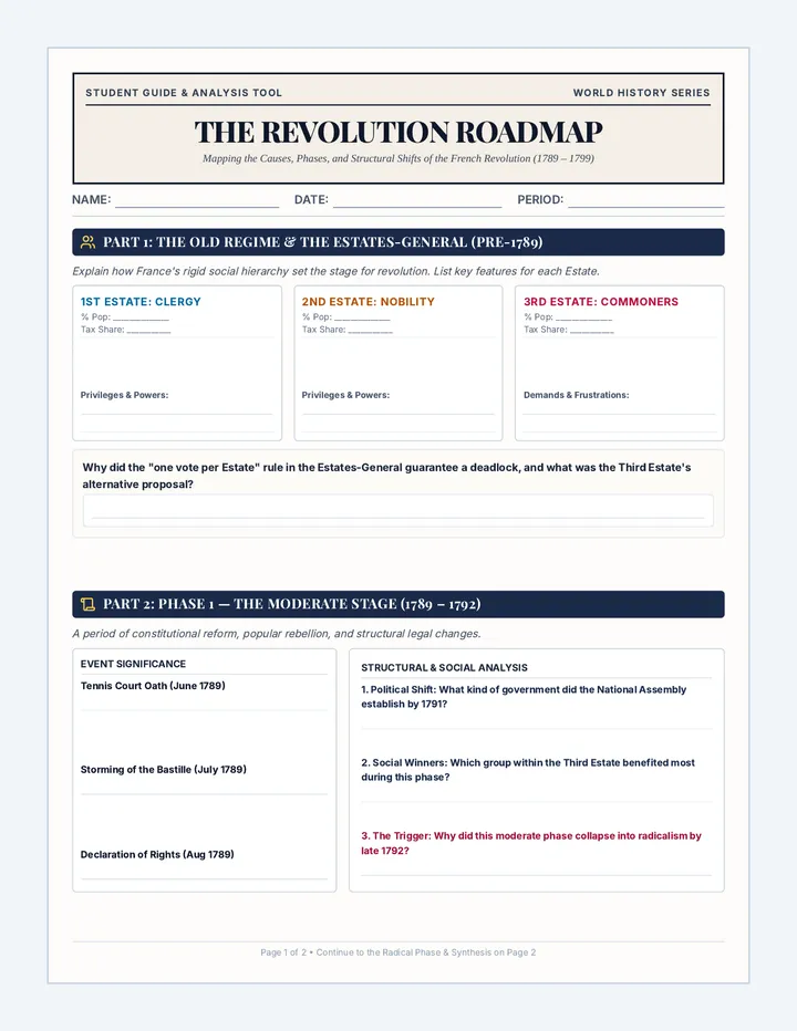
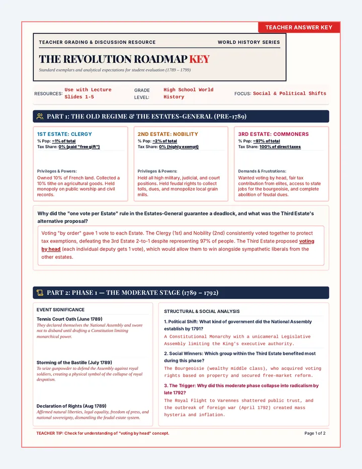
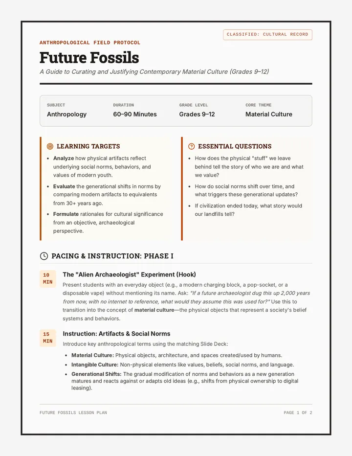
Mapping African Biomes
Students use spatial analysis to categorize African biomes and climate zones, correlating physical features with environmental baselines through satellite imagery and topographic maps.
Students use spatial analysis to categorize African biomes and climate zones, correlating physical features with environmental baselines through satellite imagery and topographic maps.