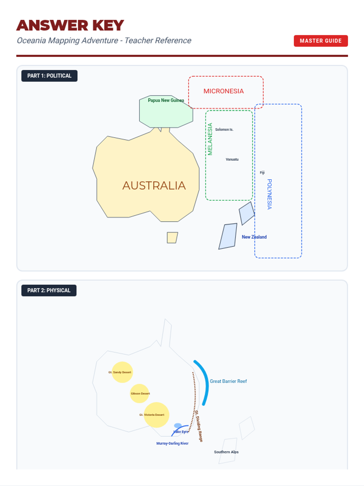
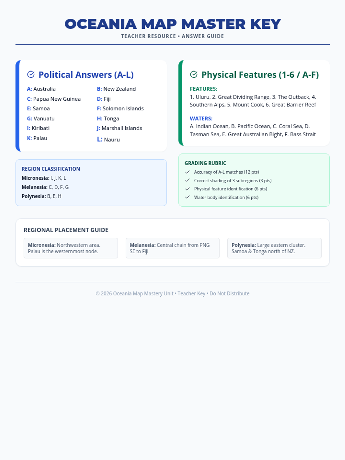
A political map worksheet for Oceania where students label major countries (Australia, NZ, Fiji, etc.) and color-code the three subregions (Melanesia, Micronesia, Polynesia). Includes a structured layout for labeling and a legend for subregion identification.