Analytical frameworks for interpreting history, geography, and civic information. Equips learners with tools for chronological sequencing, map literacy, and critical evaluation of primary and secondary sources.
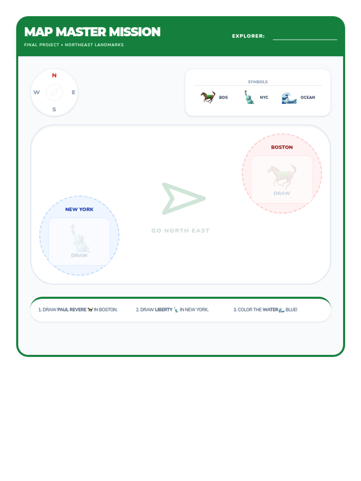
Revised final mapping project for the Northeast Landmark unit. Features geographically accurate positioning (NE diagonal), enlarged drawing areas, high-contrast directional tools, and fixed layout issues to prevent element overlap. Designed to fit on a single page for 5th grade low-literacy students.
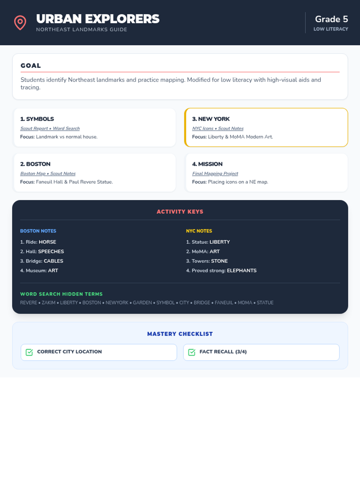
Final mission slides for the Northeast Landmark unit. Includes a full review of landmarks for both cities, corrected map symbol consistency, and clear directional guidance for the final project. Designed for visual-heavy instruction for 5th grade low-literacy students.
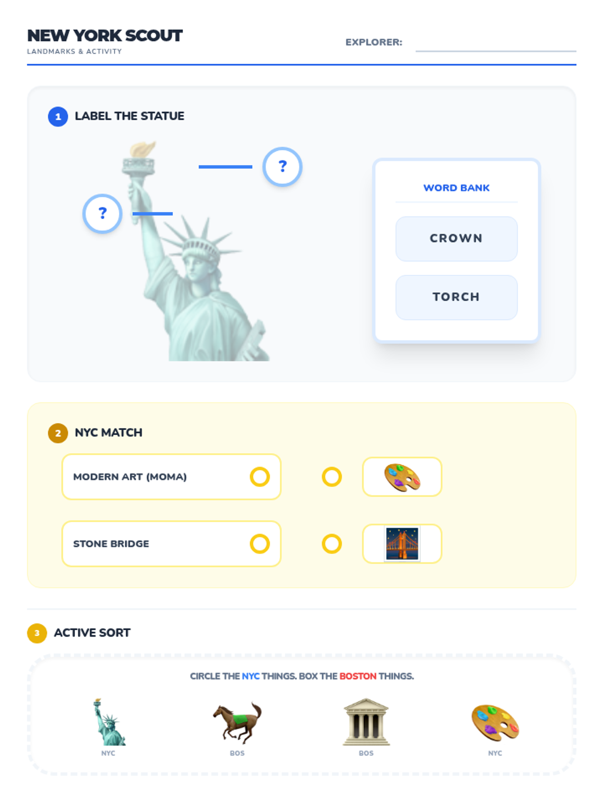
Revised New York landmark worksheet including MoMA and the Statue of Liberty. Features high-contrast icons, matching tasks, and city sorting activities on a single page for 5th grade low-literacy students. Updated to make sorting an active task and fix labeling alignment. Removed pre-printed answers for student work areas.
Revised New York City landmark slides including the Statue of Liberty, MoMA, and the Brooklyn Bridge. Features high-contrast visuals, strictly contained slide sections to prevent bleed, and replacement of Lucide icons with high-quality emojis for reliability. Slide content strictly contained.
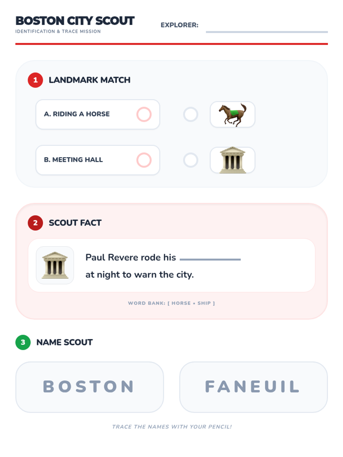
Updated Boston landmark worksheet with Faneuil Hall and Paul Revere. Designed for low-literacy 5th graders with visual supports, tracing practice, and a fill-in-the-blank section. All tasks fit on a single page. Updated for matching alignment and larger explorer field. Trace text darkened for visibility.
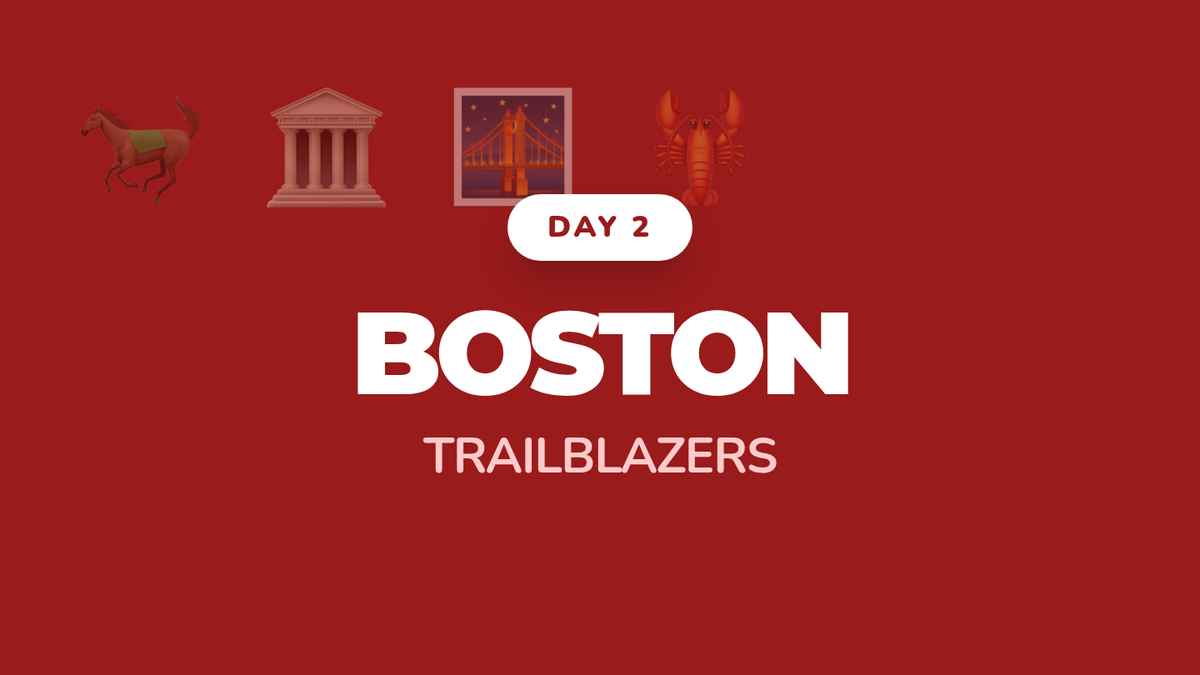
Revised Boston landmark slides including Faneuil Hall, Paul Revere, and the Museum of Fine Arts (Art Museum). Designed for visual-heavy instruction for 5th grade low-literacy students. Slide content is strictly contained to prevent bleed. Use 1440x810 viewport correctly.
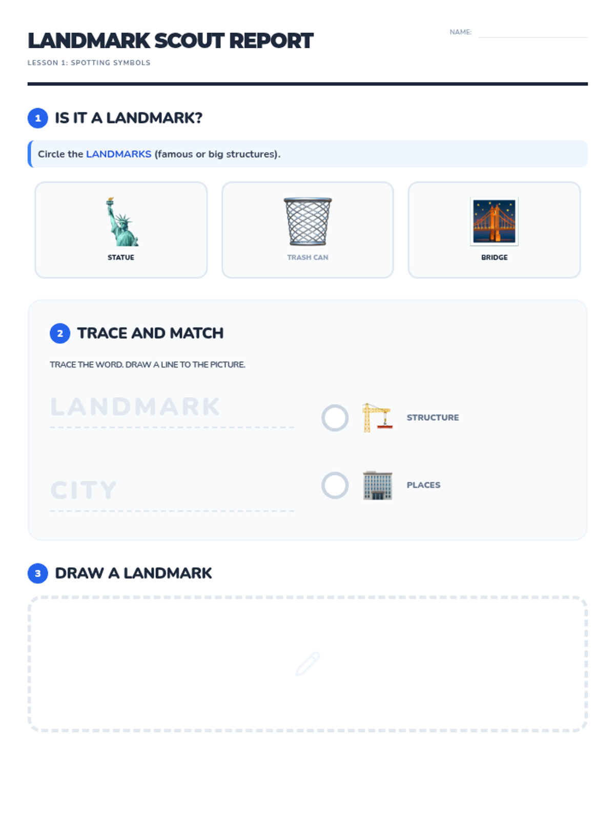
Introductory landmark worksheet with high-contrast tracing, improved page flow, and specific visual examples. Tailored for low-literacy 5th graders with clear task separation and legible instructional text. Updated to fit on a single page.
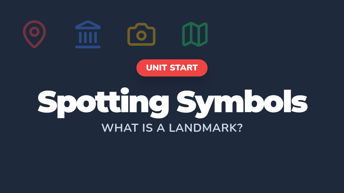
Visual introductory slides defining landmarks using specific requested examples like the Statue of Liberty and Brooklyn Bridge. Updated for higher contrast, specific local examples, and polished iconography for low-literacy 5th graders. All slides strictly contained.
Teacher's guide for the Urban Explorers unit, outlining daily goals, scaffolding strategies for low-literacy students, and assessment criteria for mapping and landmark identification. Updated to include answer keys for word searches and fill-in-the-blank activities. Updated for single-page layout.
A celebratory certificate for kindergarten students to receive upon completion of the Pathfinders School Tour unit, recognizing their skills in mapping and school expertise.
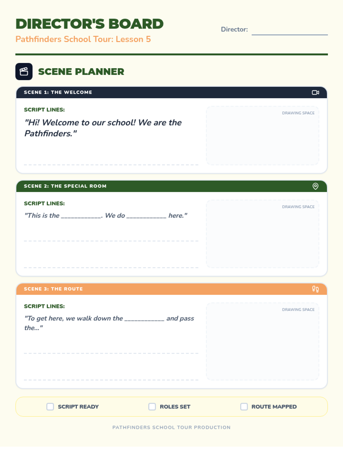
A storyboard and script planner for kindergarteners to organize the scenes of their school tour video, including dialogue prompts and space for camera angle sketches.
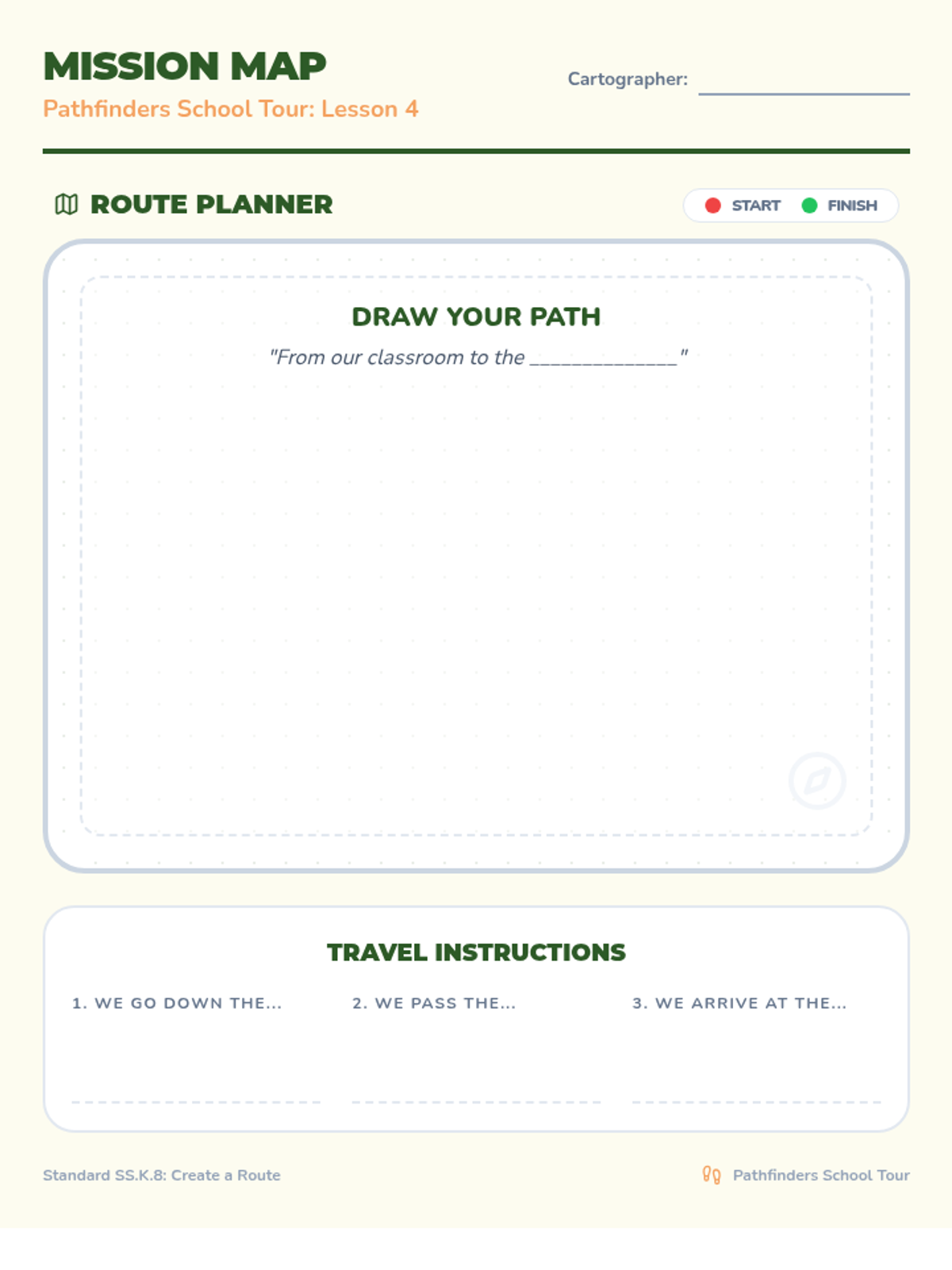
A mapping worksheet for kindergarteners to visualize and describe a specific route within the school, including space for a drawn map and a structured 'travel instructions' section.
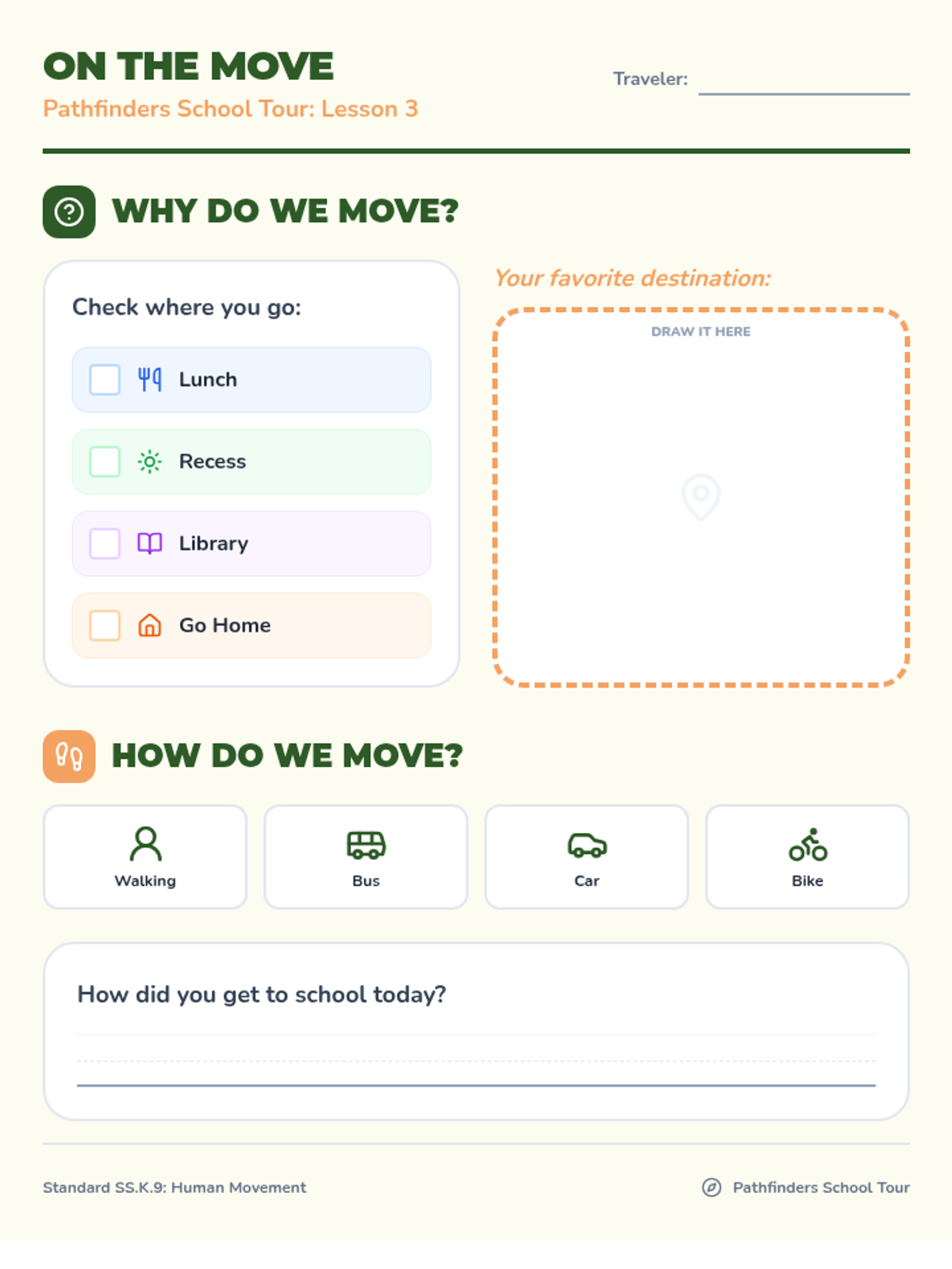
A student activity sheet exploring the 'why' (reasons for moving) and 'how' (modes of transportation) people move within and to school, aligned with kindergarten geography standards.
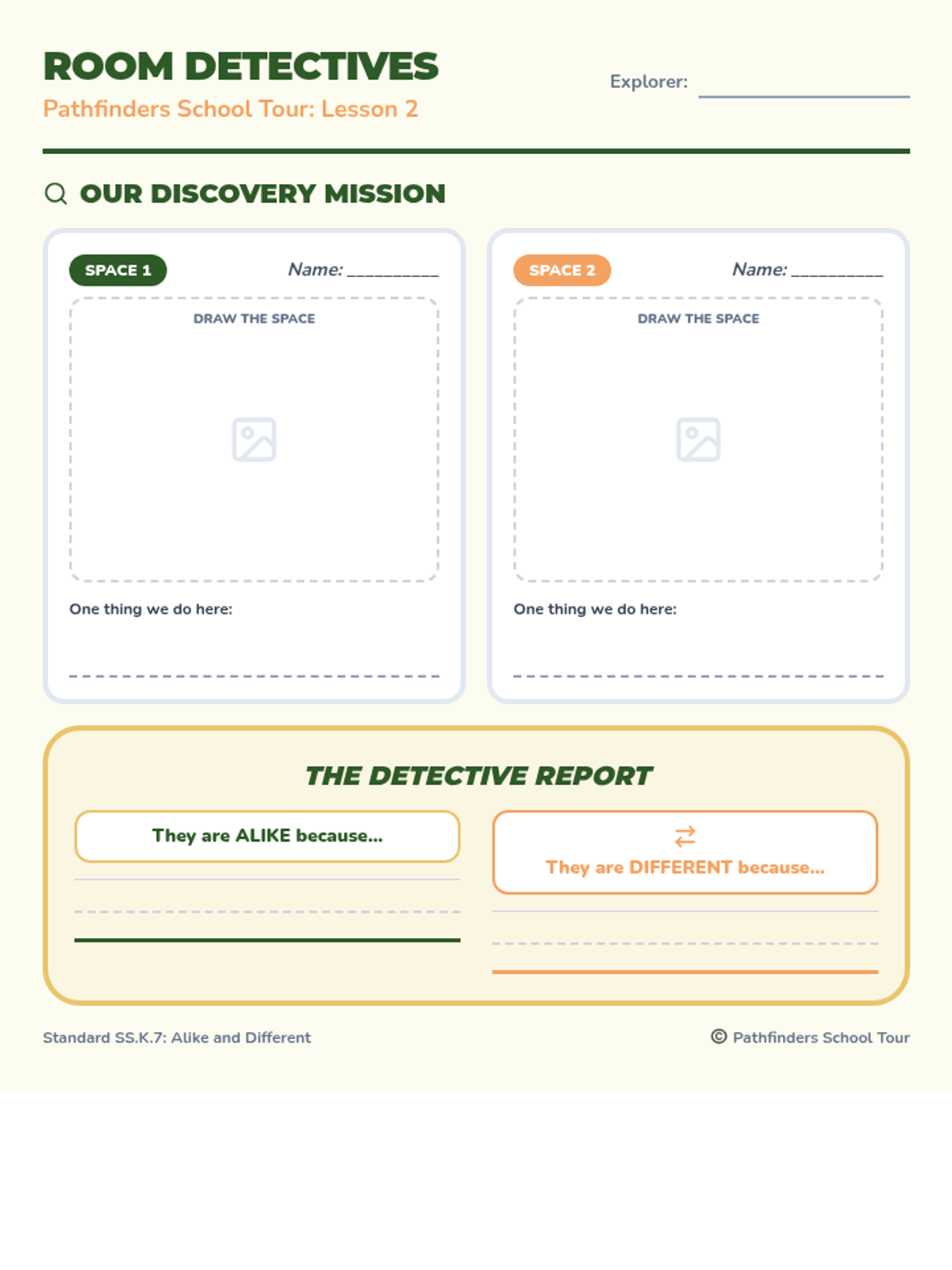
A graphic organizer for kindergarteners to compare two different school rooms, documenting their drawings, purposes, and identifying similarities and differences.
Introductory slide deck for the Pathfinders School Tour unit, covering the project mission, school roles (SS.K.6), and comparing similarities and differences (SS.K.7).
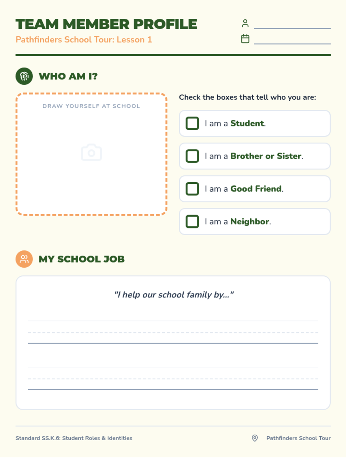
A student worksheet designed for kindergarteners to identify their various roles and identities within the school community, including a self-portrait area and role-selection checkboxes.
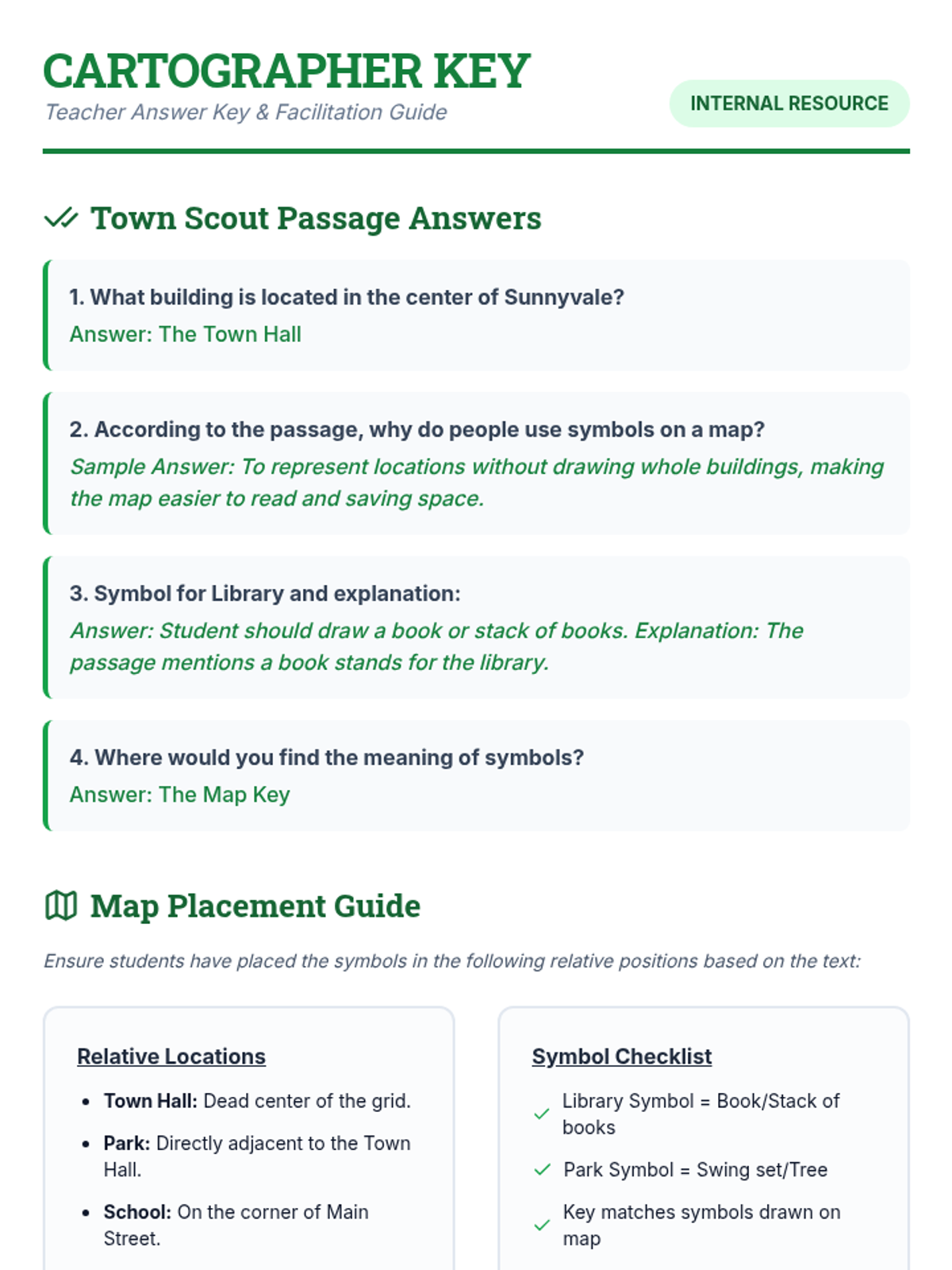
A teacher-facing guide providing the answer key for the passage and a geographic layout guide for the community mapping activity.
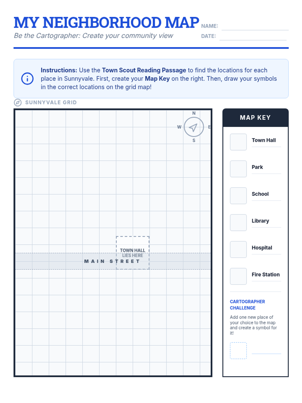
An activity sheet featuring a grid-based map of Sunnyvale where students practice drawing symbols and filling out a map key based on descriptive text.
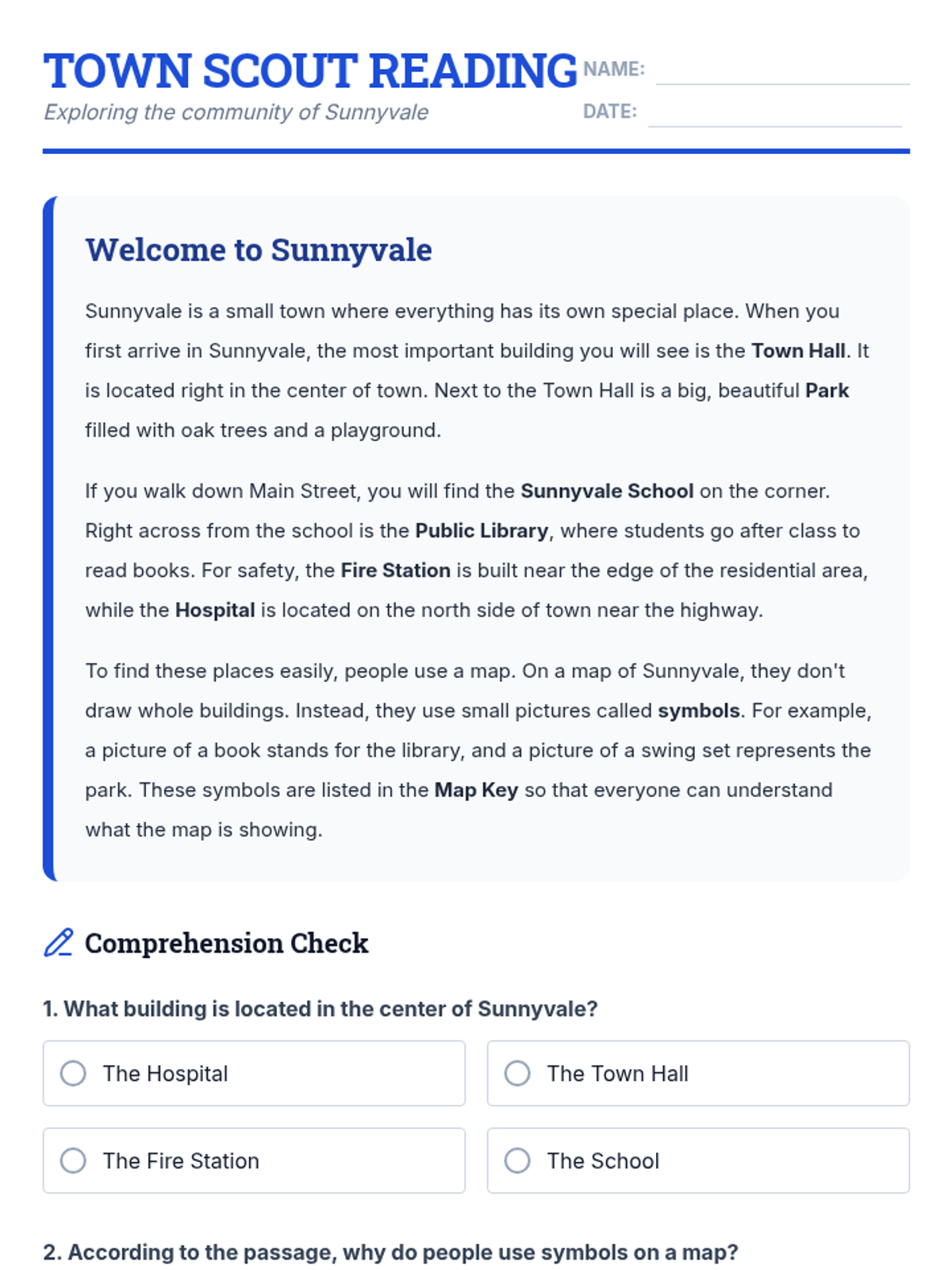
A reading passage about the community of Sunnyvale that introduces students to map symbols and keys, followed by comprehension questions.
A visual presentation teaching students the purpose of maps, how to use a map key, and the importance of symbols in geographic navigation.
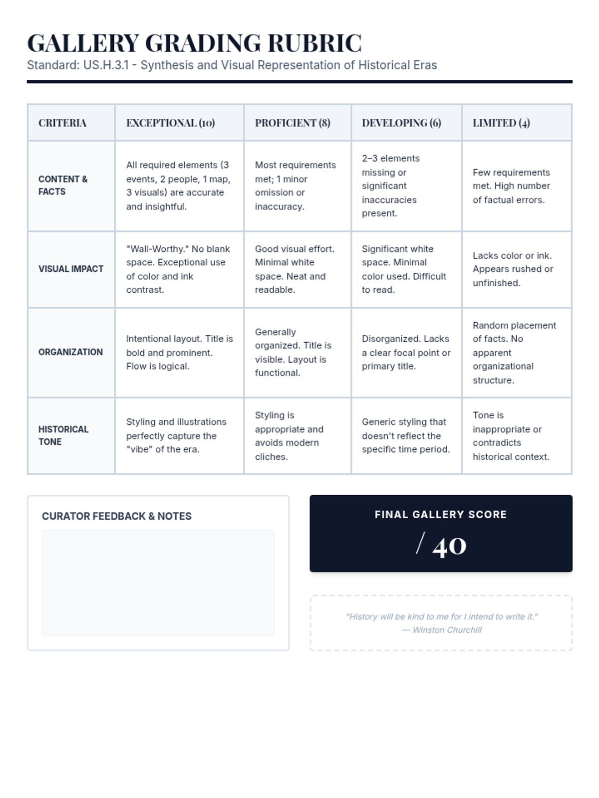
A grayscale, high-contrast rubric for evaluating student historical one-pagers, optimized for budget-friendly printing.
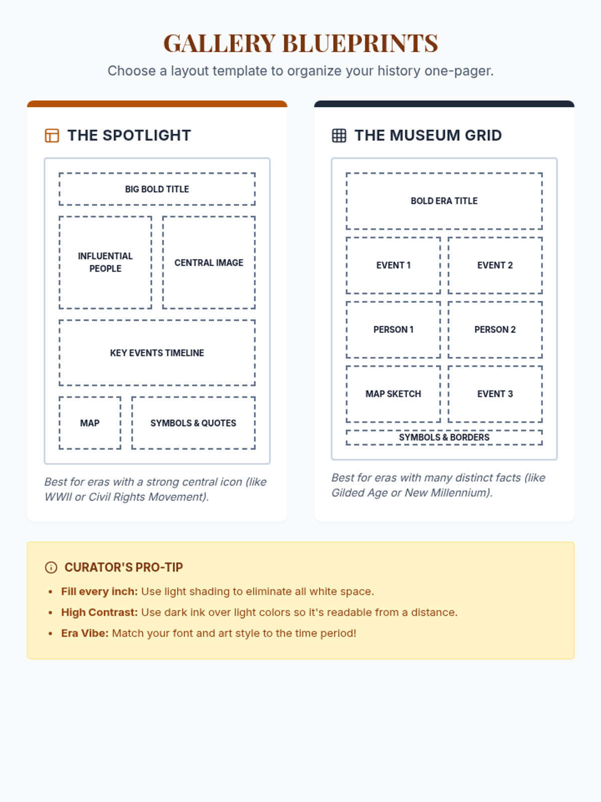
A grayscale visual layout guide providing two template options to help students organize their historical one-pager posters.
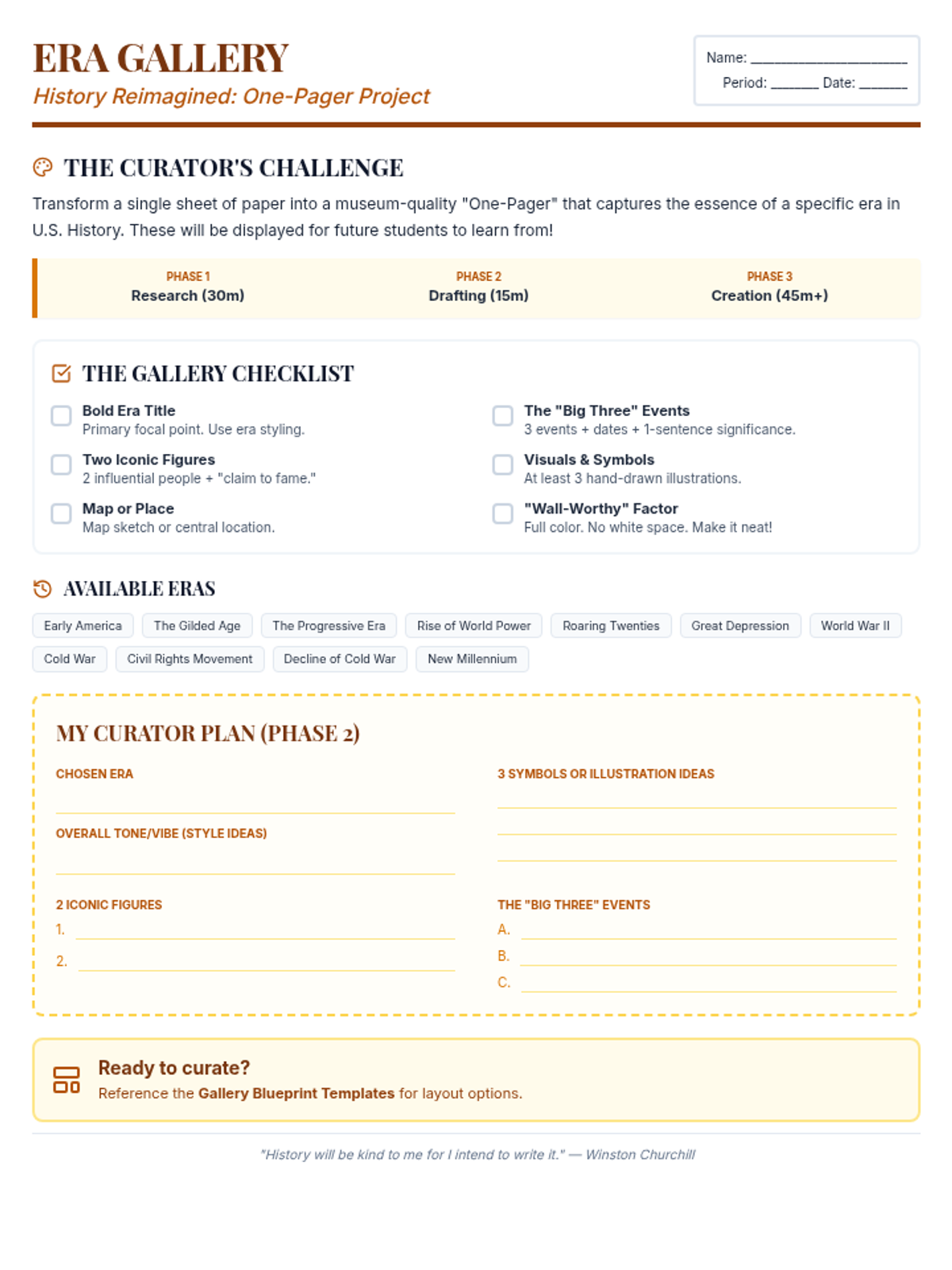
A grayscale, high-contrast project guide for US History students that outlines the requirements for creating a high-quality historical one-pager.
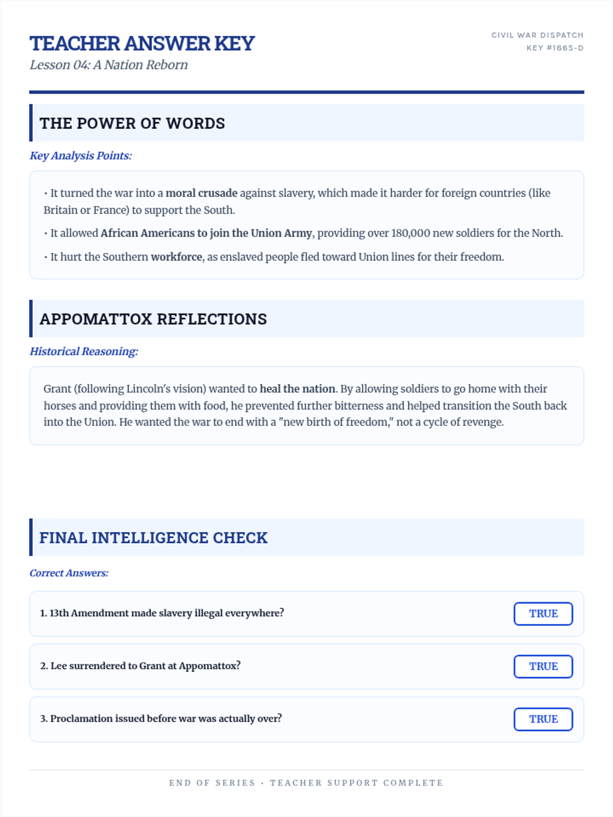
A teacher answer key for the A Nation Reborn worksheet, detailing the war's end and the significance of the 13th Amendment.
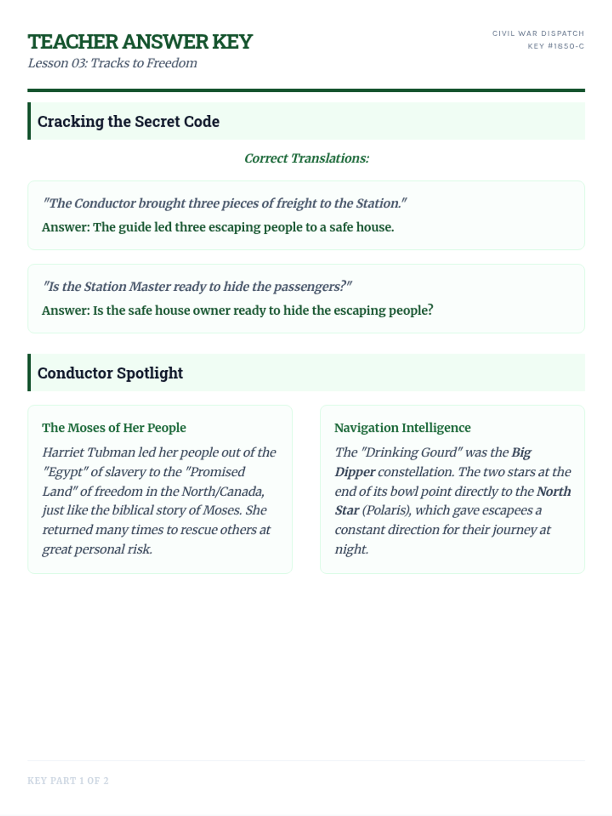
A teacher answer key for the Tracks to Freedom worksheet, providing code translations and analytical support for the Underground Railroad lesson.
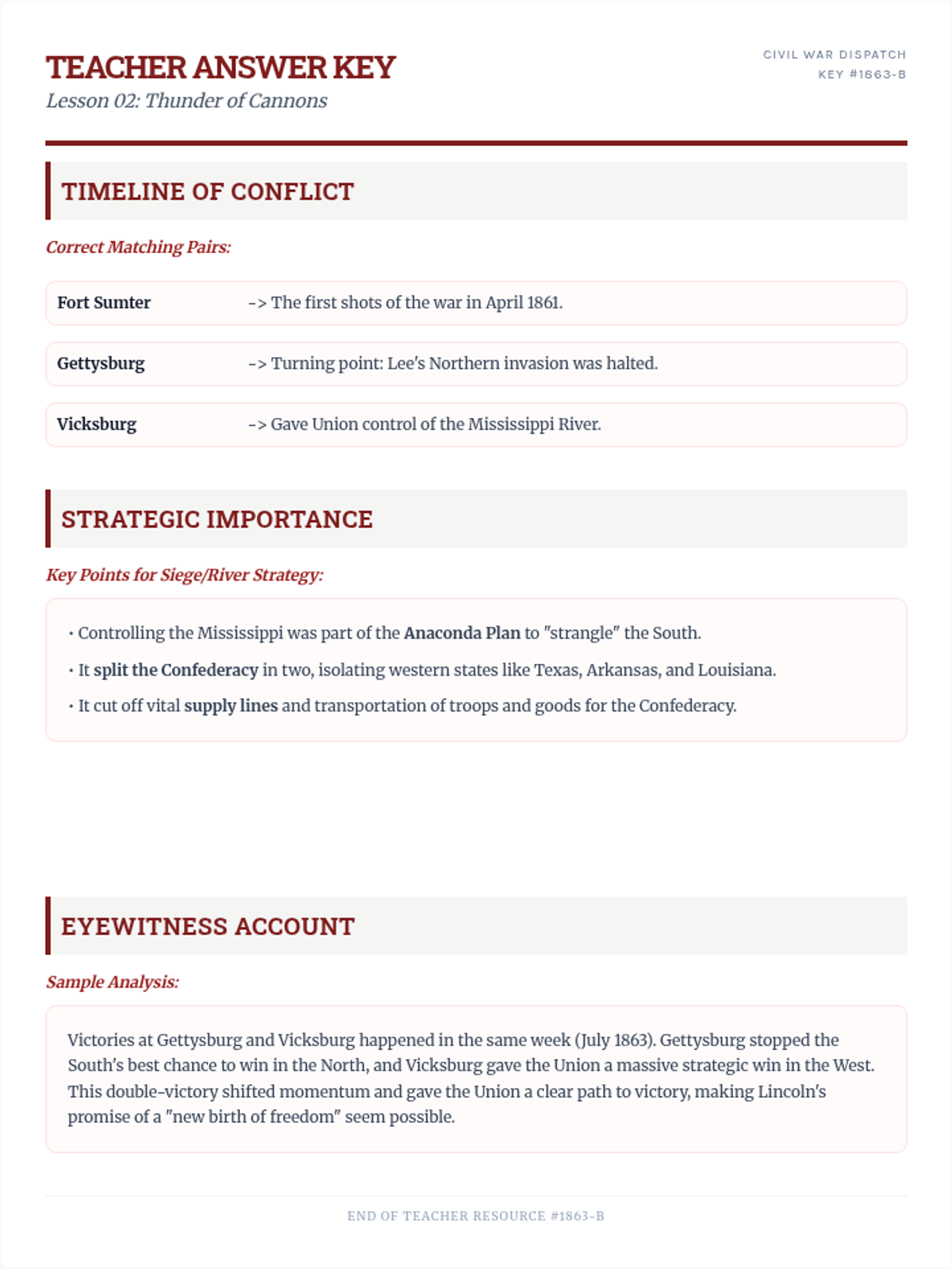
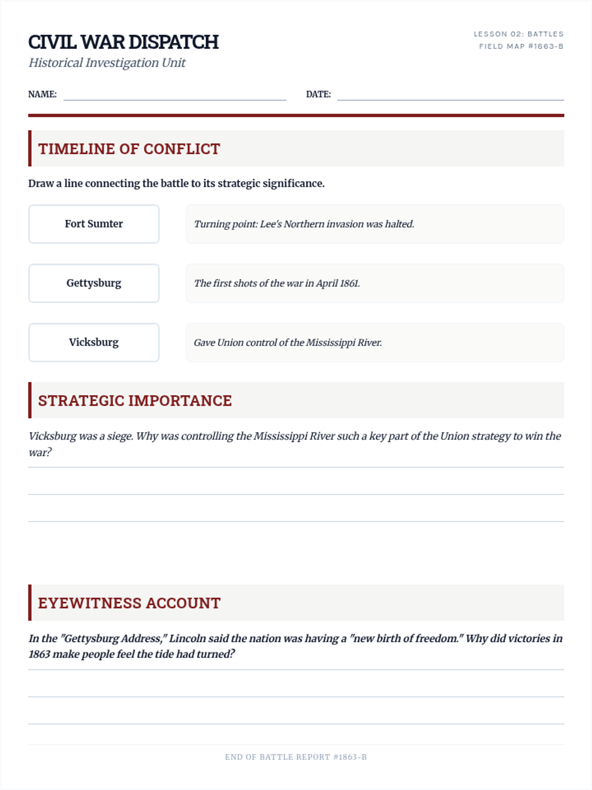
A teacher answer key for the Thunder of Cannons worksheet, covering battle significance and strategic analysis.
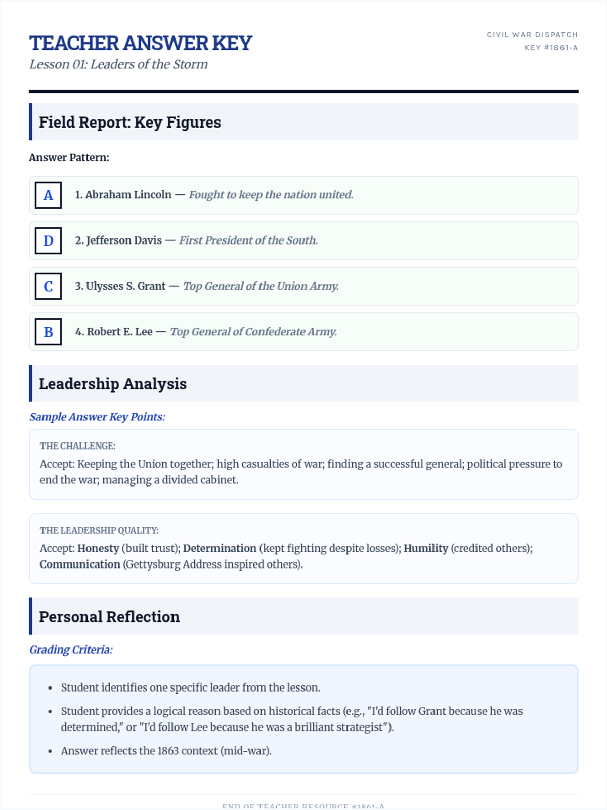
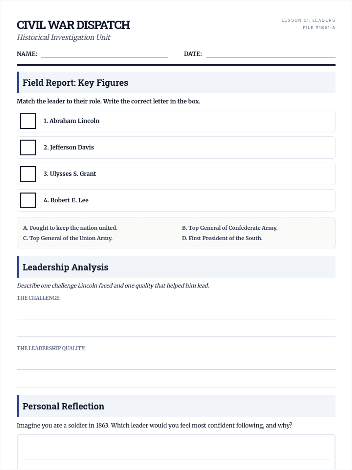
A teacher answer key for the Leaders of the Storm worksheet, providing correct matches and sample responses for leadership analysis.
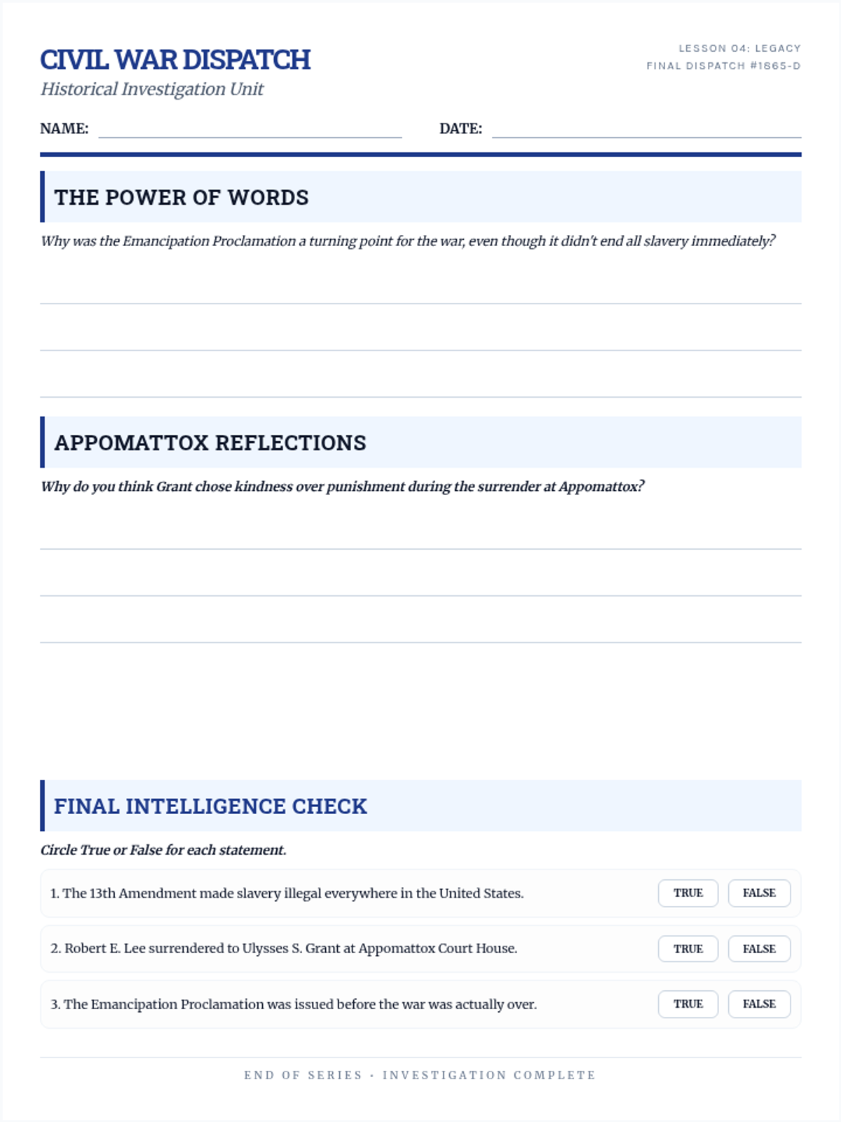
A student worksheet for the final Civil War lesson, covering the Emancipation Proclamation and the war's conclusion, optimized for single-page 8.5x11 printing.
A slide deck covering the end of the Civil War, the Emancipation Proclamation, and the 13th Amendment.
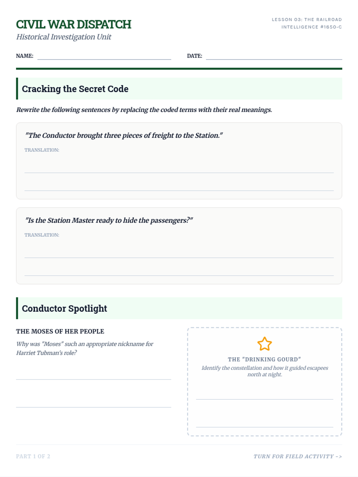
A 2-page student worksheet for the Underground Railroad lesson, formatted for 8.5x11 printing with terminology translation, biographical analysis, and a field sketch activity.
A slide deck explaining the Underground Railroad, its terminology, Harriet Tubman's role, and the secret signals used.
A student worksheet focusing on the strategic significance of major Civil War battles and timeline matching, formatted for single-page 8.5x11 printing.
A presentation covering major battles of the Civil War, including Fort Sumter, Gettysburg, and Vicksburg.
A student worksheet for the first lesson on Civil War leaders, optimized for single-page 8.5x11 printing with clear matching exercises and short-answer analysis.
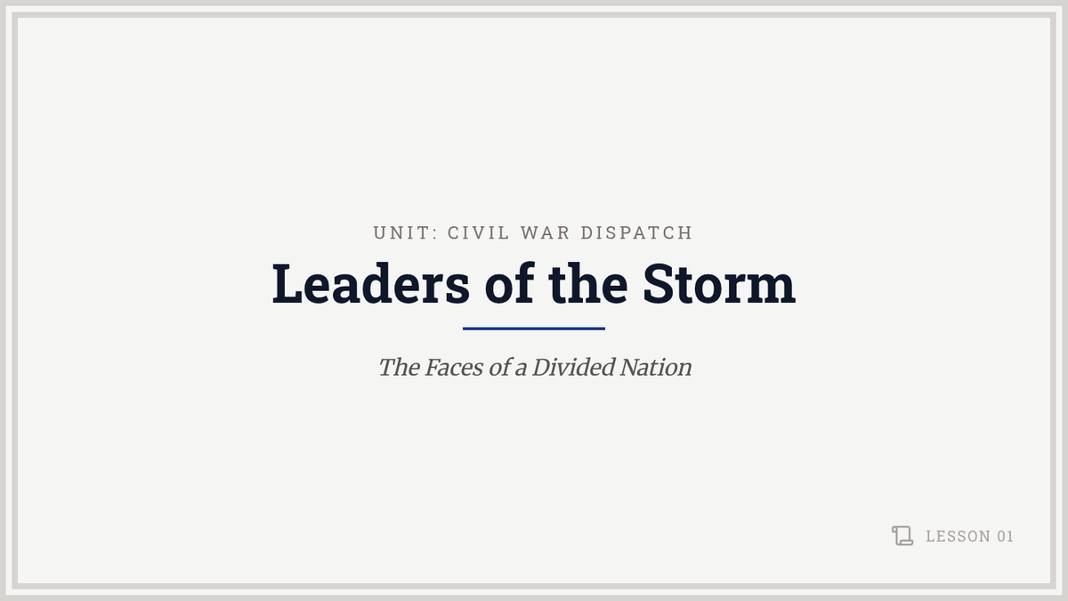
A slide deck introducing the key political and military leaders of the Union and Confederacy during the Civil War.
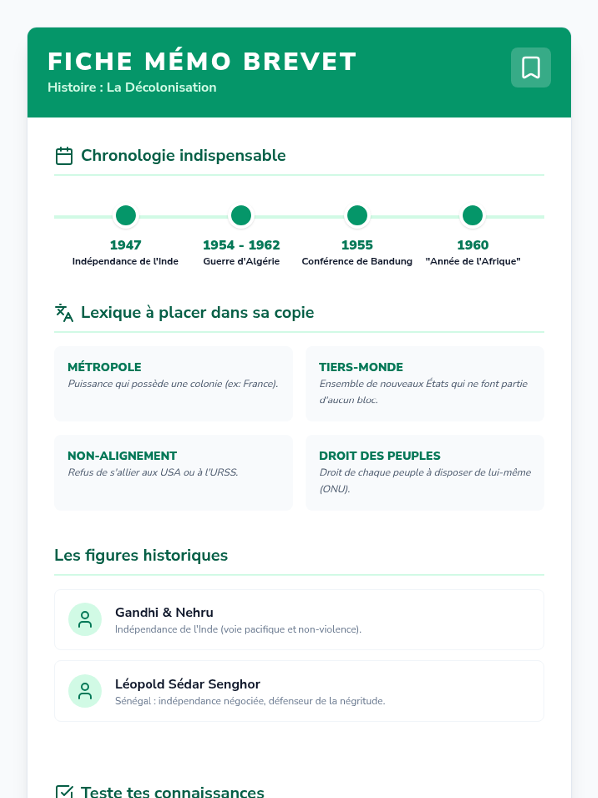
Fiche mémo synthétique pour le Brevet sur la décolonisation, regroupant dates clés, vocabulaire essentiel, acteurs majeurs, un mini-quiz et des conseils méthodologiques.
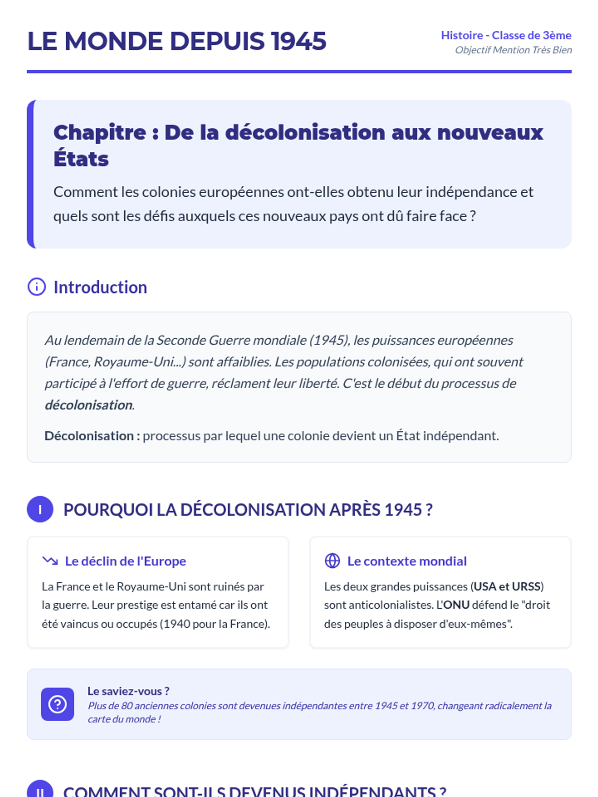
Cours structuré et complet sur la décolonisation pour les élèves de 3ème, incluant les causes détaillées, les modalités (Inde, Algérie, Indochine) et l'affirmation du Tiers-Monde. Version optimisée avec mise en page corrigée.
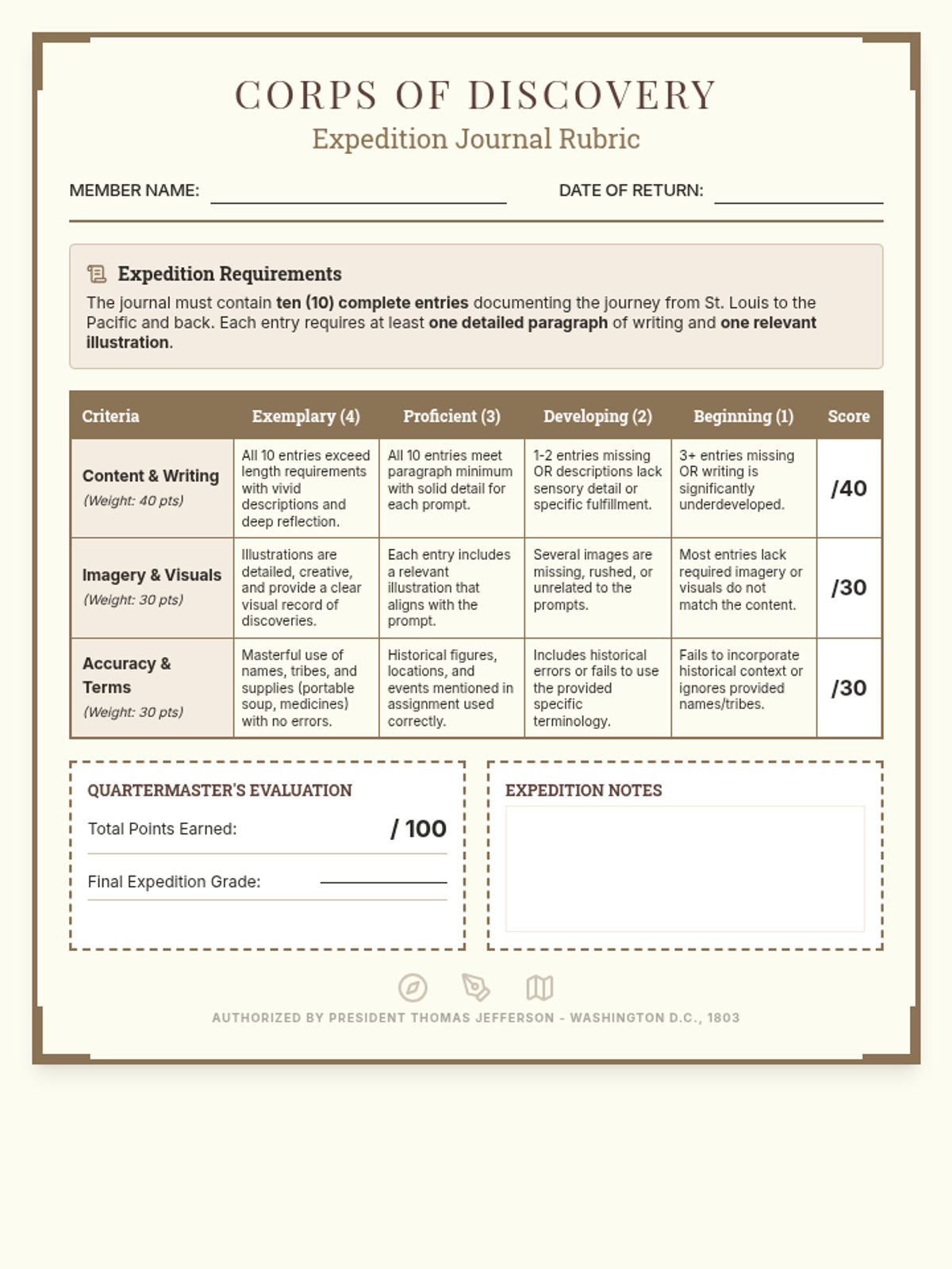
An analytic rubric for the Corps of Discovery journal assignment, featuring categories for content detail, imagery, and historical accuracy with a 100-point total. Revised to fit on a single page with improved teacher work areas and white background for legibility.
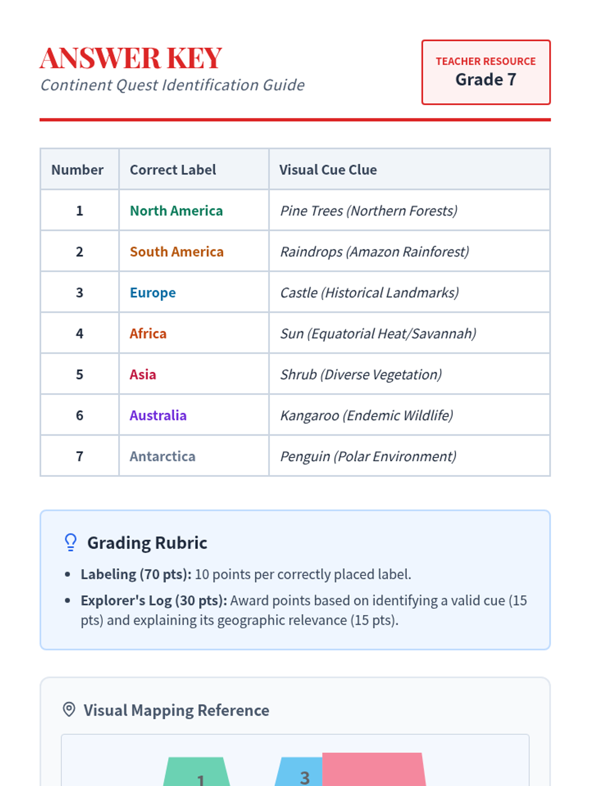
A teacher answer key for the Continent Quest Quiz, including grading notes and visual cue explanations.
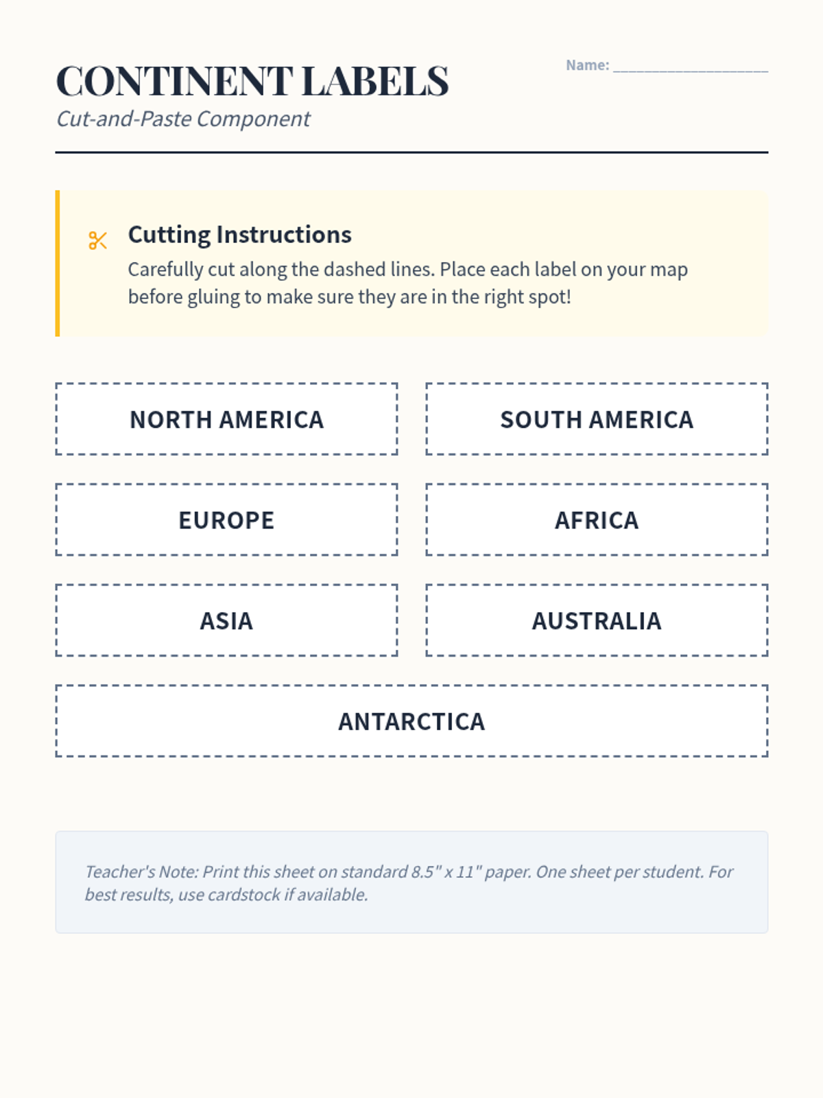
Word bank labels for the Continent Quest Quiz, designed to be cut out and pasted onto the map.
A color world map quiz for labeling the seven continents with visual cues and numbered boxes for cut-and-paste labels.
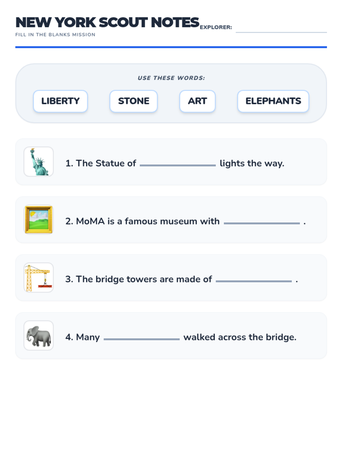
A picture-supported fill-in-the-blank worksheet for Lesson 3 (New York). Students use a word bank to complete facts about the Statue of Liberty, MoMA, and the Brooklyn Bridge. Designed for low-literacy 5th graders. Updated for single-page layout and improved sentence flow. Updated header for legibility. Punctuation fixed.
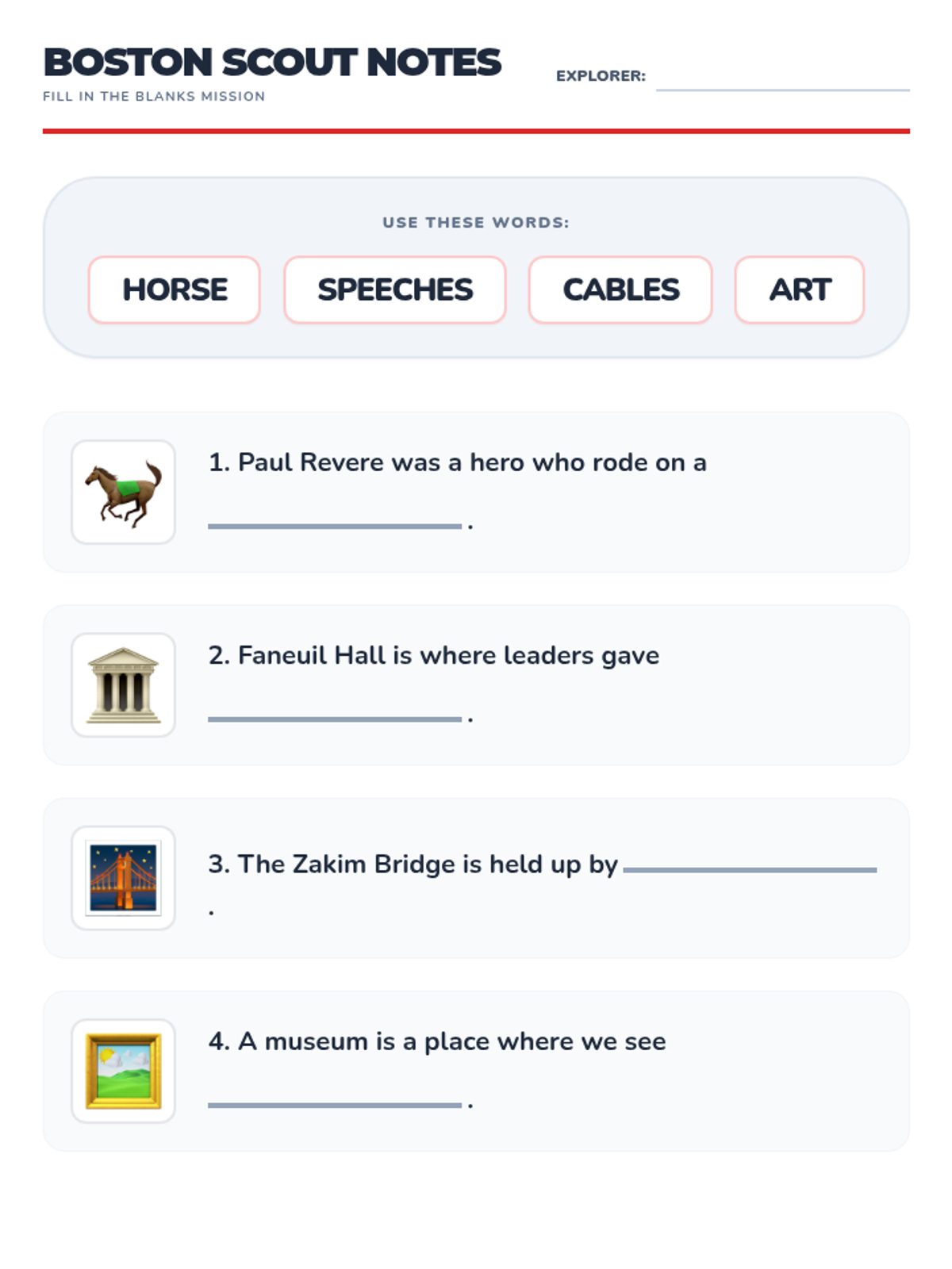
A picture-supported fill-in-the-blank worksheet for Lesson 2 (Boston). Students use a word bank to complete simple historical and descriptive sentences about Boston landmarks including Faneuil Hall and the Art Museum. Updated for single-page layout and improved sentence flow. Zakim icon replaced with bridge emoji for clarity.
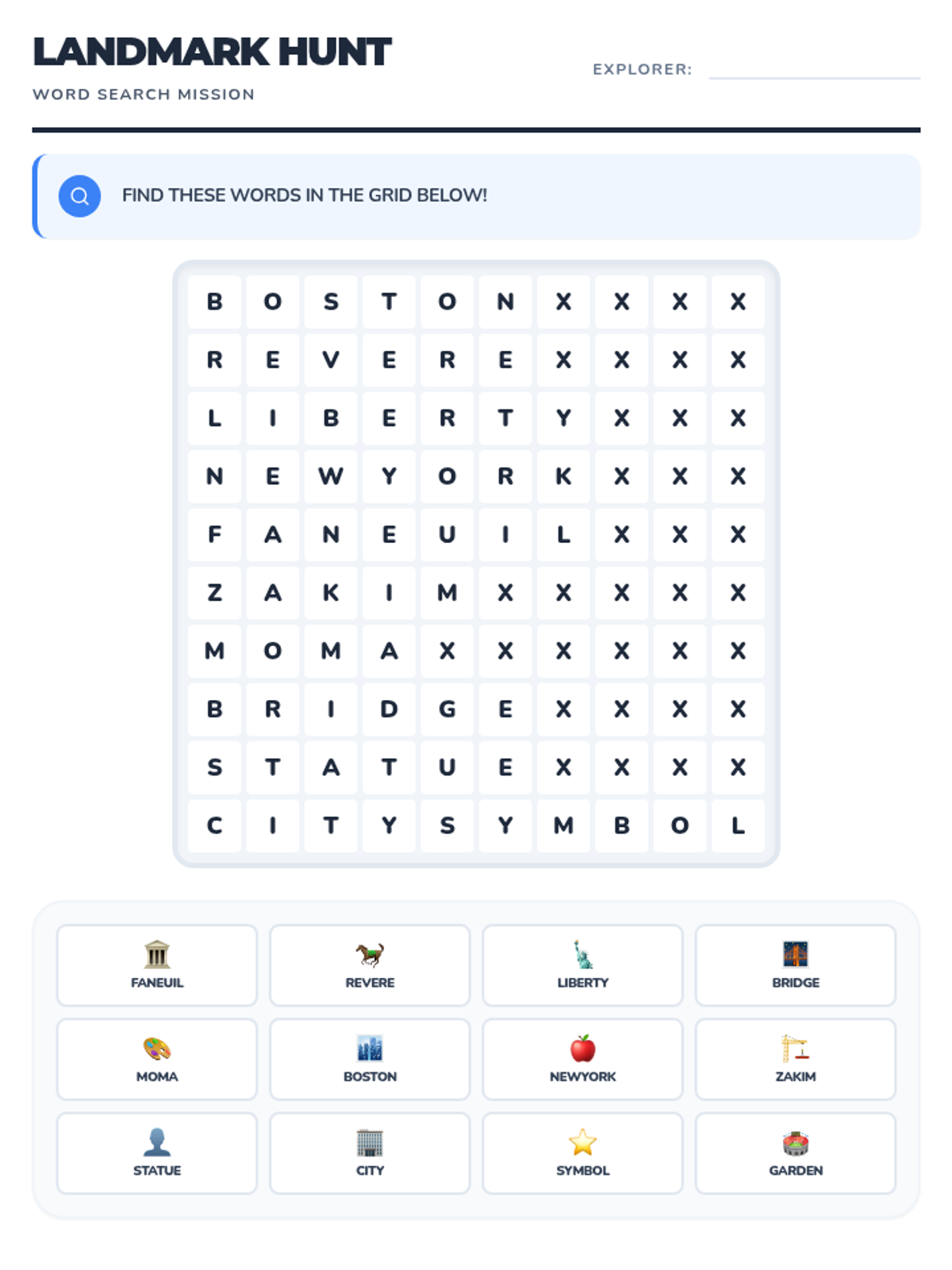
A simple, large-print word search for reinforcing key unit vocabulary like "landmark", "city", and "bridge". Includes picture support in the word bank for low-literacy students. Updated with Faneuil and MoMA. Updated for single-page layout and grid sync. All 12 words confirmed in grid.
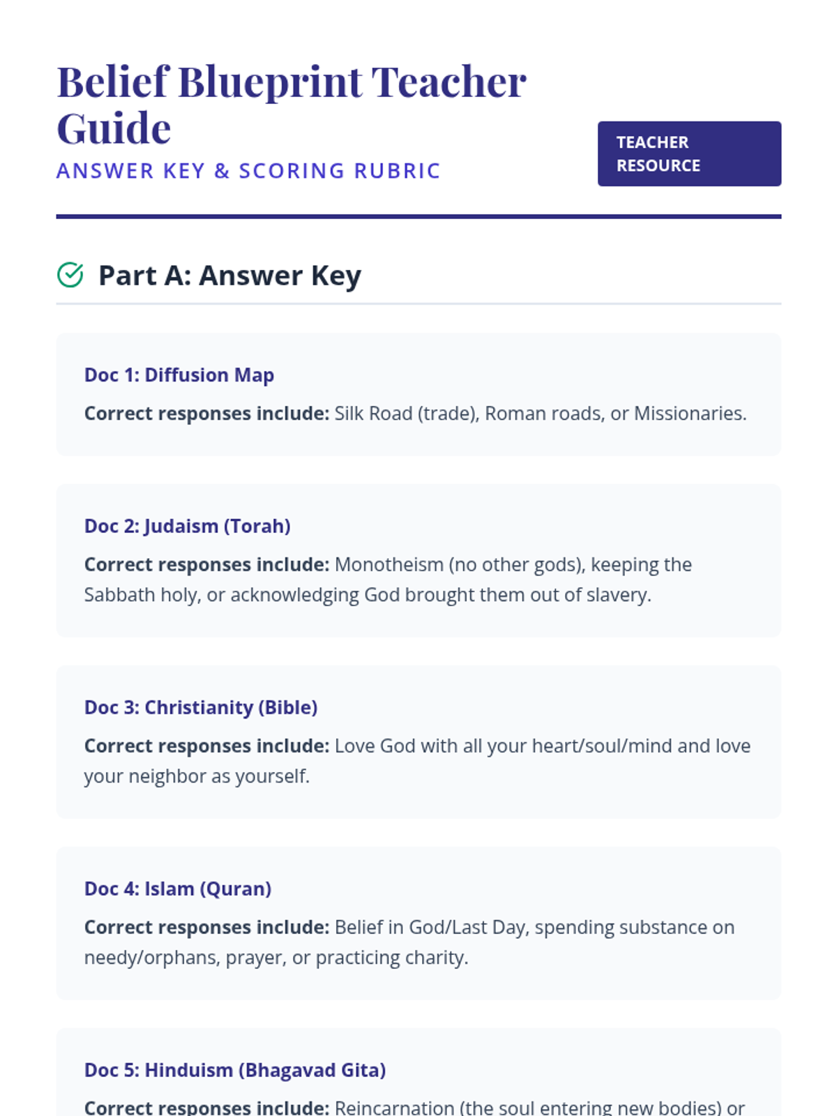
A comprehensive teacher's guide for the World Religions DBQ, including a detailed answer key for document analysis, an NYS-aligned 1-5 scoring rubric, and instructional strategies for guiding student writing.
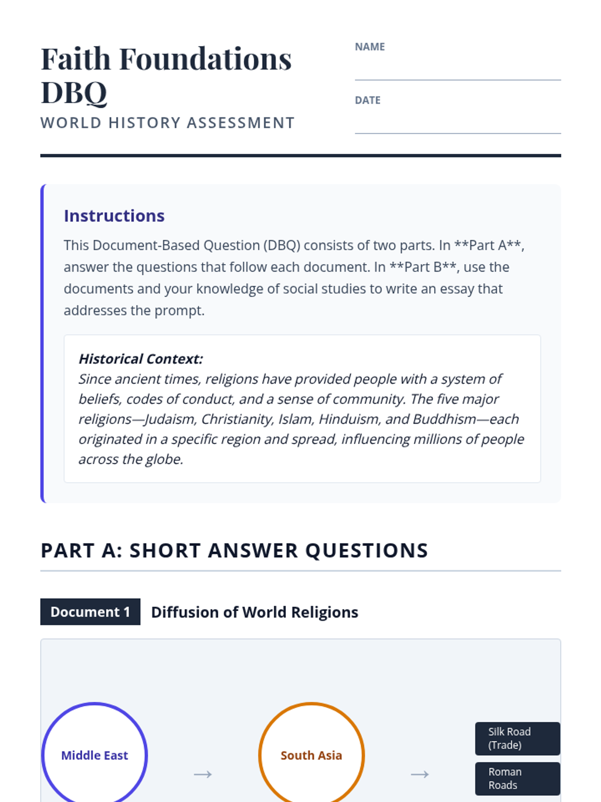
A formal 6th-grade NYS-style DBQ assessment on World Religions, featuring maps and sacred text excerpts for Hinduism, Buddhism, Judaism, Christianity, and Islam, followed by a document-based essay prompt.
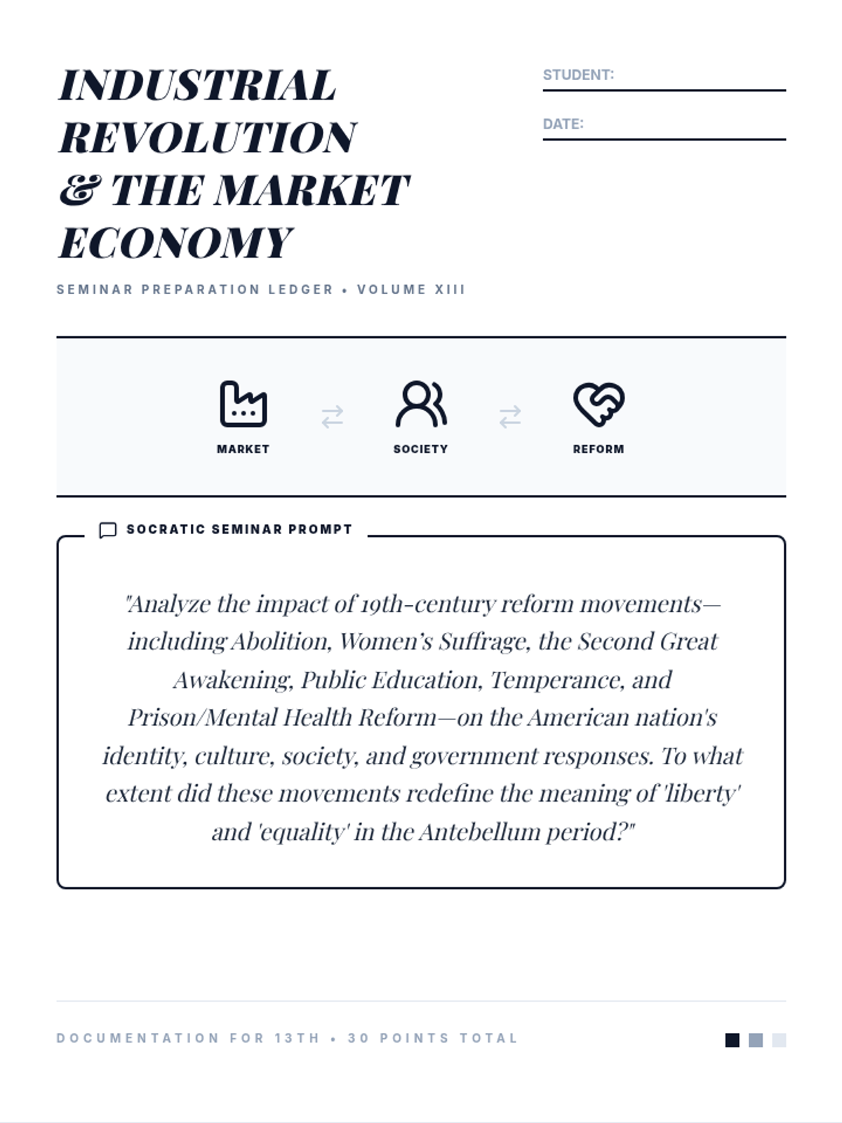
A detailed 5-page seminar preparation ledger for the Industrial Revolution and Market Economy lesson. Features a dedicated cover page with relevant historical icons and a prominent Socratic prompt, three separate article analysis pages, and a final synthesis evaluation. Writing lines are darkened for optimal print quality.
A visually engaging presentation that introduces the 6th-grade World Religions DBQ assessment, outlining the mission, providing visual context for maps and sacred texts, and setting clear writing expectations for students.
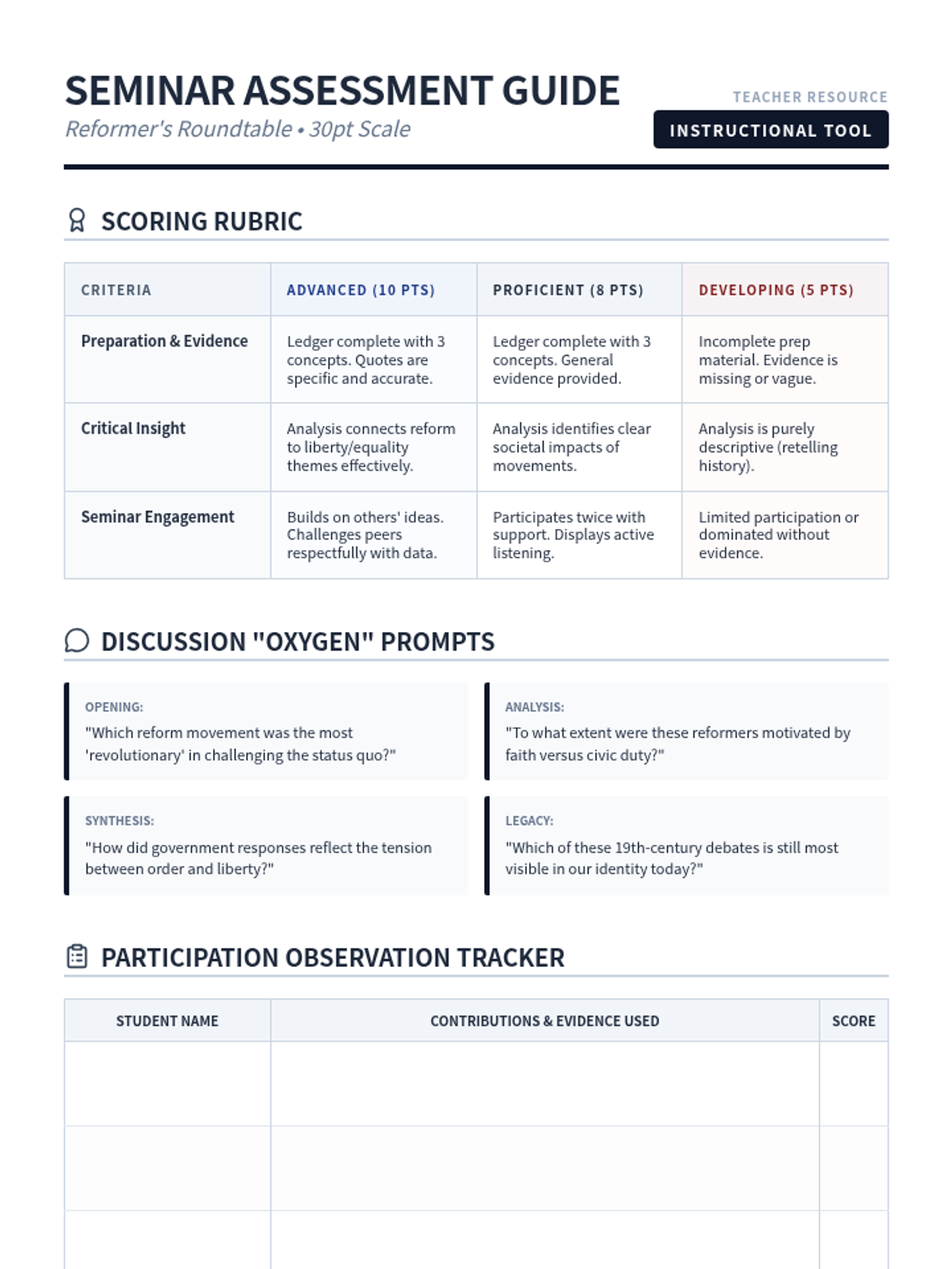
A teacher-facing guide for evaluating the Socratic Seminar, featuring a 30-point rubric, discussion prompts to guide student conversation, and an observation tracker.
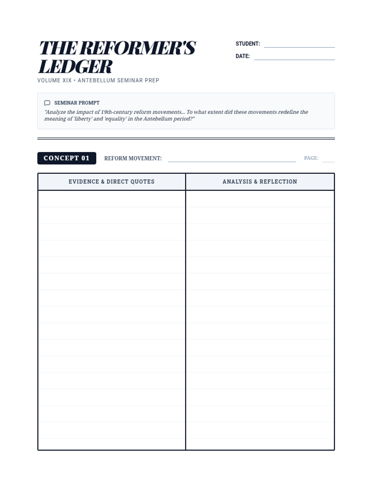
A visual presentation to introduce the Socratic Seminar prompt, the concept of 19th-century reform movements, and the double-entry journal preparation method. Includes discussion norms and expectations.
A multi-page double-entry journal for Socratic Seminar preparation. Each of the three reform movements has its own dedicated full-page ledger with guided columns for evidence and reflection, followed by a final synthesis page.
A comprehensive large-print resource containing the "Impact of Digital Technologies" report and a student analysis page. Features 26px (~20pt) text, bolded key terms, and high-contrast writing lines for accessibility. Layout is optimized for readability and ample response space.
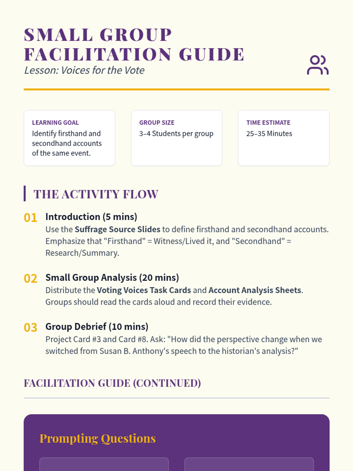
A facilitation guide for teachers to lead the "Voices for the Vote" small group activity. It includes pacing suggestions, discussion prompts, and differentiation strategies, with optimized layout for printing.
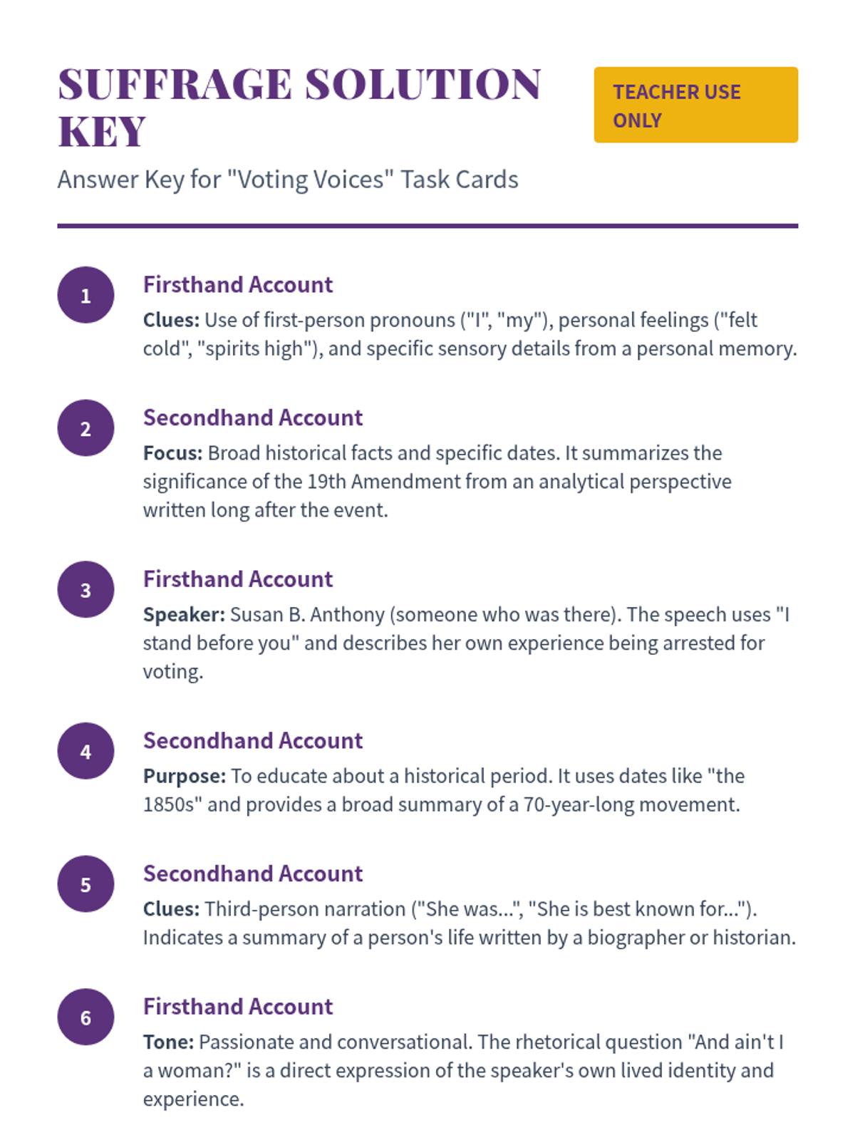
A complete answer key for the Voting Voices task cards, including explanations of clues and evidence for each account type to assist teachers in grading or facilitating discussion. Labels and formatting have been cleaned for clarity.
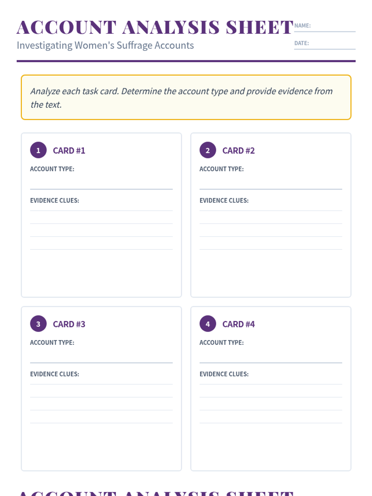
A student recording sheet for the Voting Voices task cards, providing structured space for students to identify the account type and provide detailed evidence for all 8 cards across two pages. Header and spacing optimized for printing.
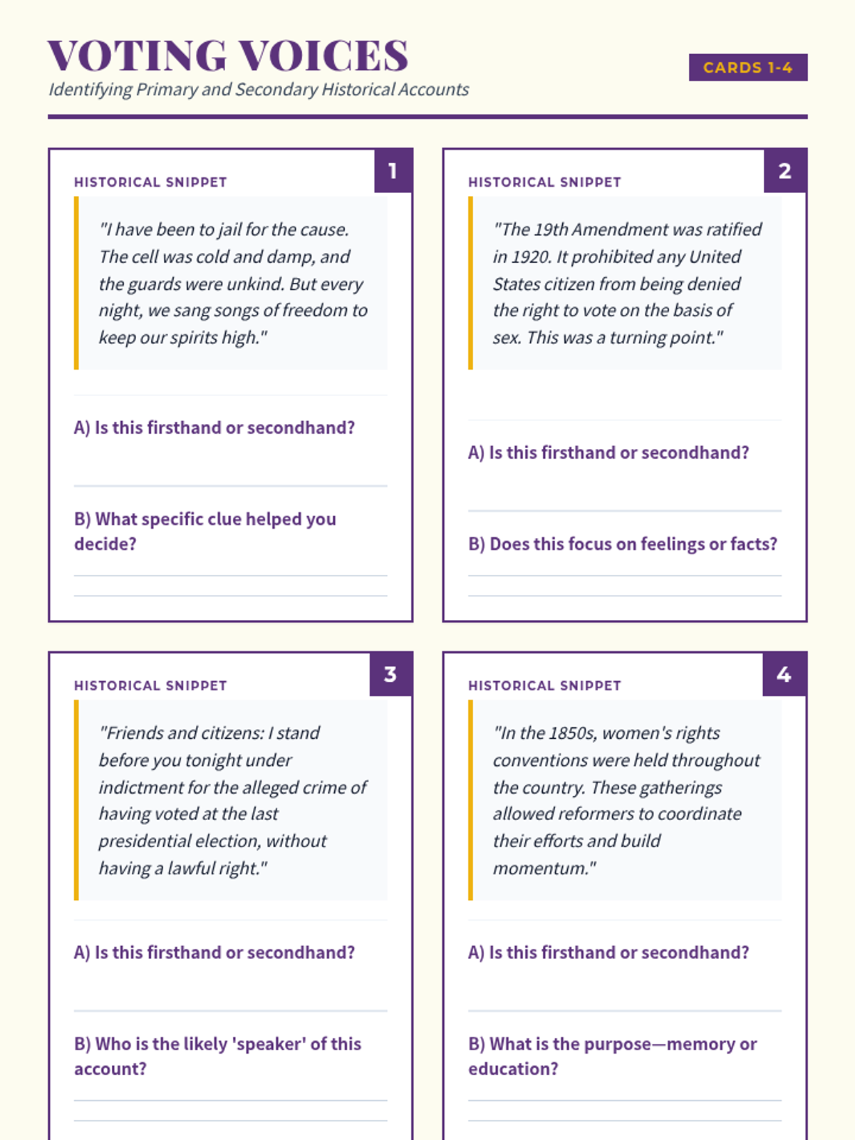
A set of 8 historical task cards featuring primary and secondary source snippets about the Women's Suffrage Movement, each with analysis questions and handwriting lines to help students identify the type of account. Card layout and text density have been optimized for printing.
A 5-slide presentation introducing firsthand and secondhand accounts using the context of the Women's Suffrage Movement, featuring a case study comparison and clear definitions. Layout and text spacing have been optimized for clarity.
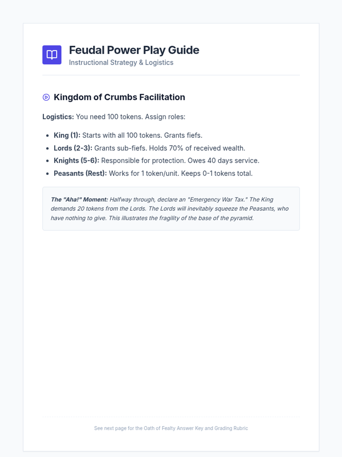
A comprehensive teacher guide for the Feudal Power Play lesson, including simulation facilitation instructions, answer keys for primary source analysis, and a grading rubric for the student contracts.
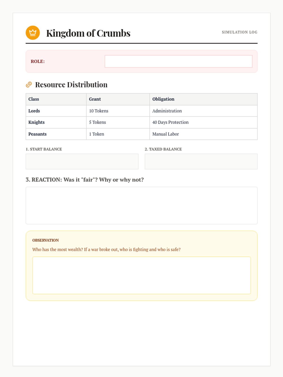
A student log and reflection guide for a classroom simulation where students assume roles in the feudal hierarchy and experience the flow of resources and obligations.
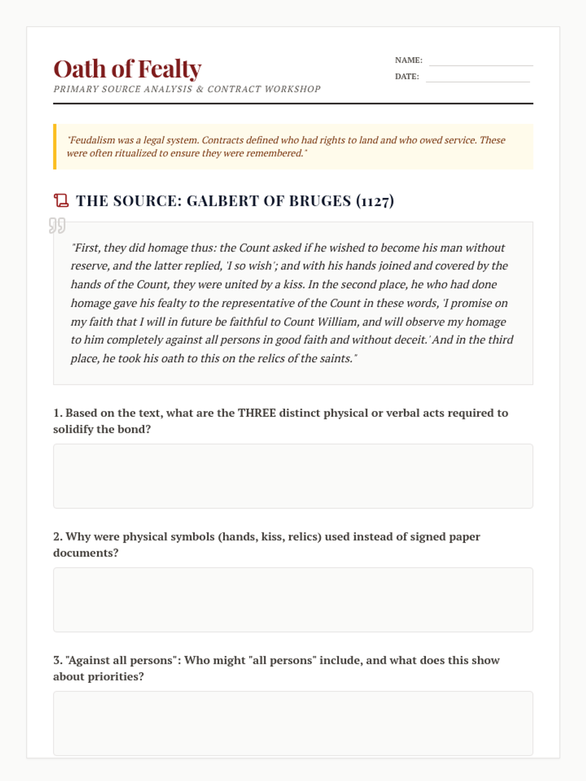
A two-page worksheet featuring a primary source analysis of an 1127 feudal oath and a creative 'Charter of Obligation' activity where students draft their own feudal contracts.
A visually rich slide deck for 10th-grade students exploring the social, economic, and political structures of Feudalism and the Manorial System. Focuses on reciprocal obligations and the 'Three Orders' of medieval society.
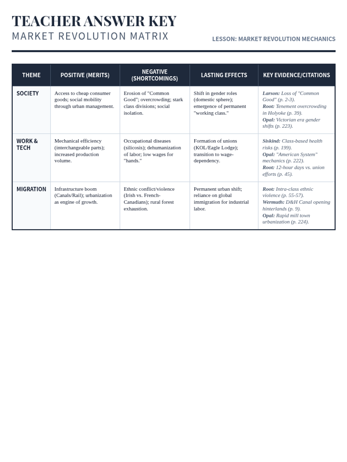
A comprehensive teacher's answer key for the Market Revolution Matrix, featuring evidence-backed synthesis points and exemplar seminar questions to guide high-level discussion.
An instructional slide deck to guide students through the analysis of the market revolution and prepare them for a evidence-based Socratic seminar.
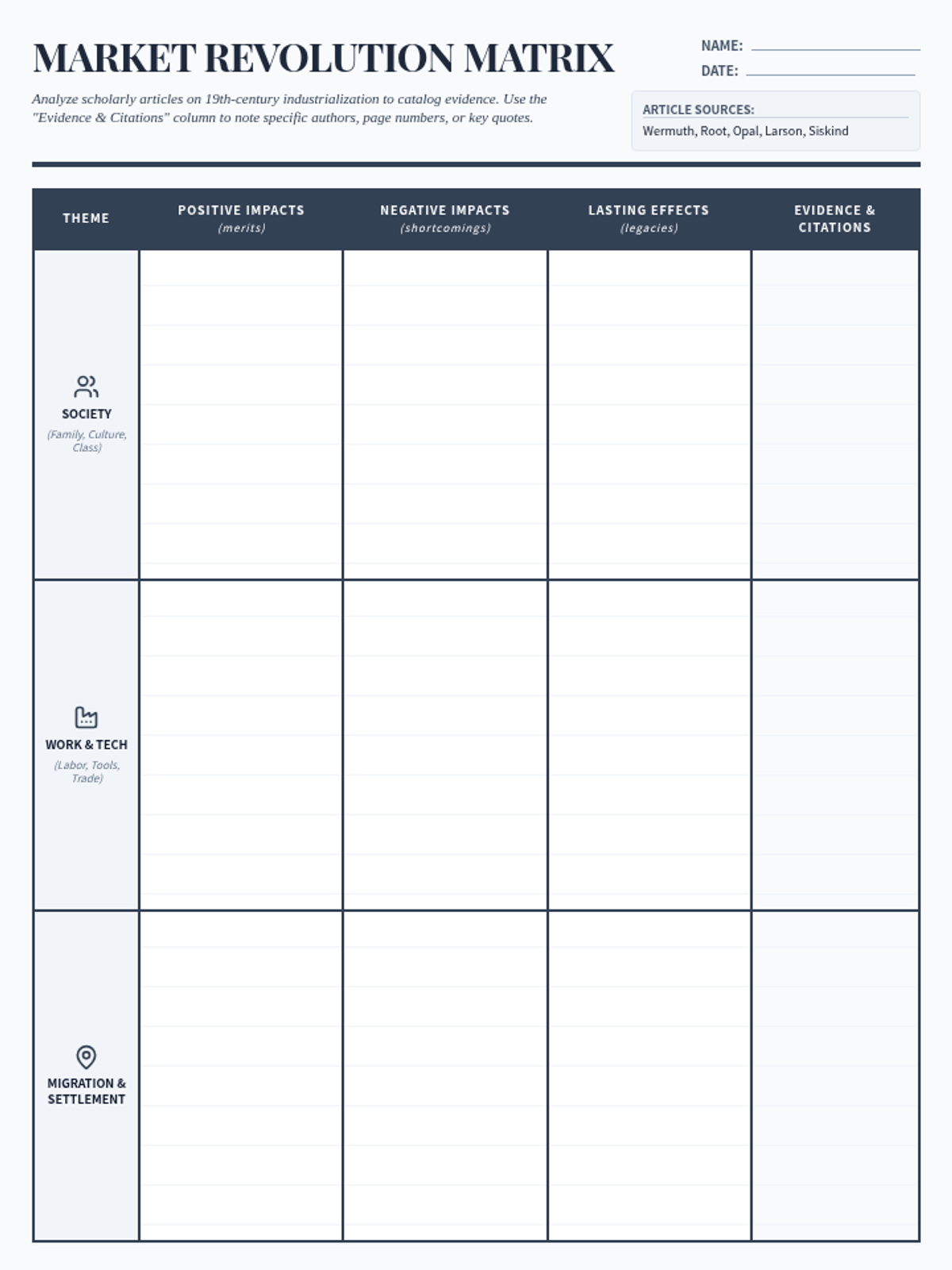
An expanded 2-page graphic organizer and preparation guide for a Socratic Seminar. It features a thematic matrix with a new evidence/citation column, a synthesis reflection on the definition of the mid-19th century American citizen, and placeholders for student-led discussion questions.
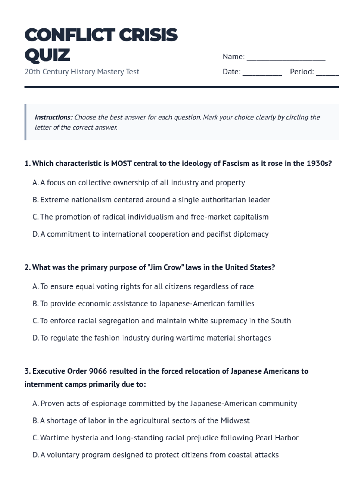
A 15-question multiple choice test covering key topics from WWII to the Civil Rights era. Focuses on vocabulary, cause-and-effect, and synthesis questions. Professional layout with fixed page breaks to keep questions together.
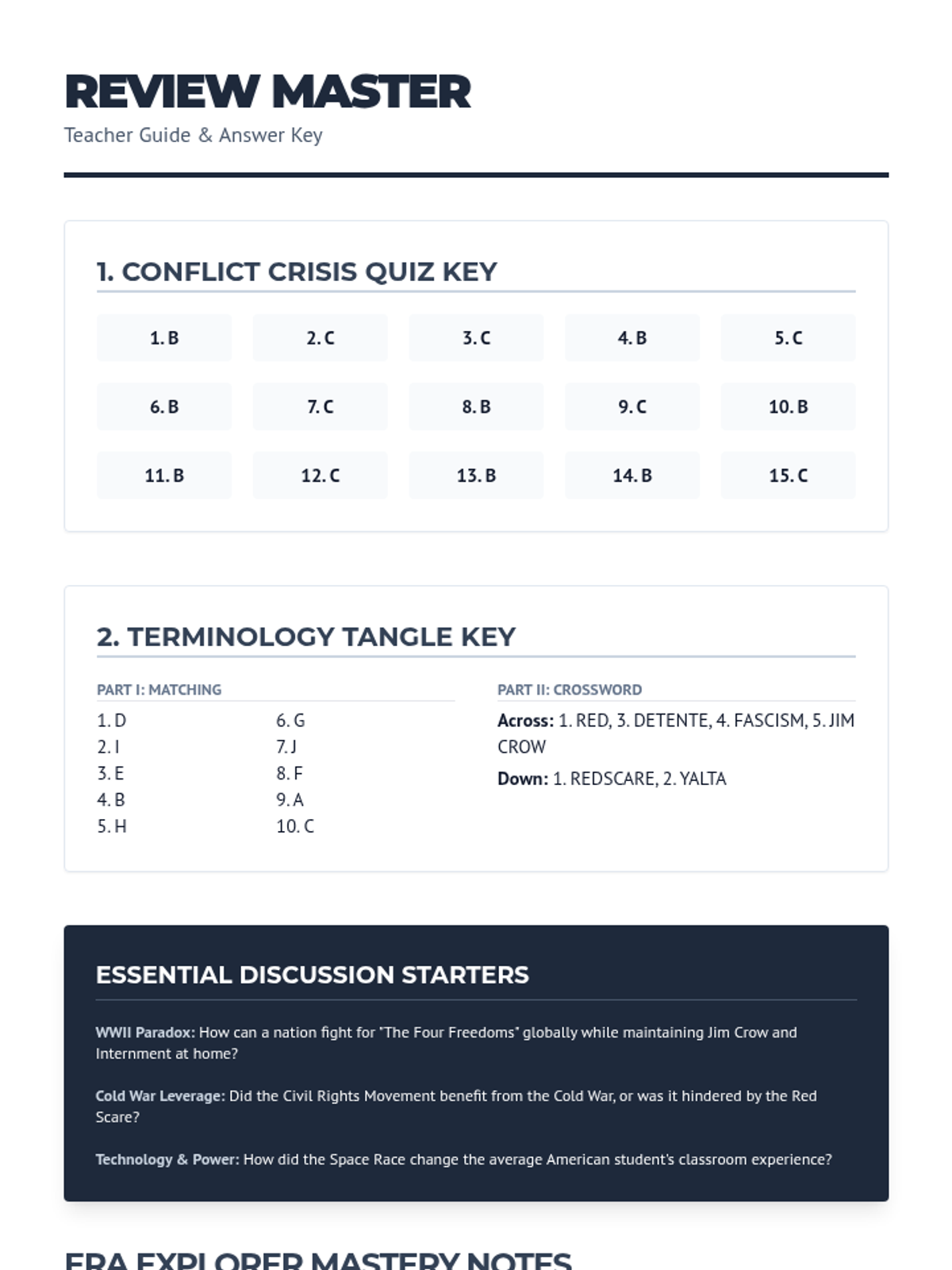
A comprehensive teacher guide and answer key covering the multiple-choice quiz, matching worksheet, and guided study guide. Includes instructional strategies, discussion prompts, and notes on common student misconceptions.
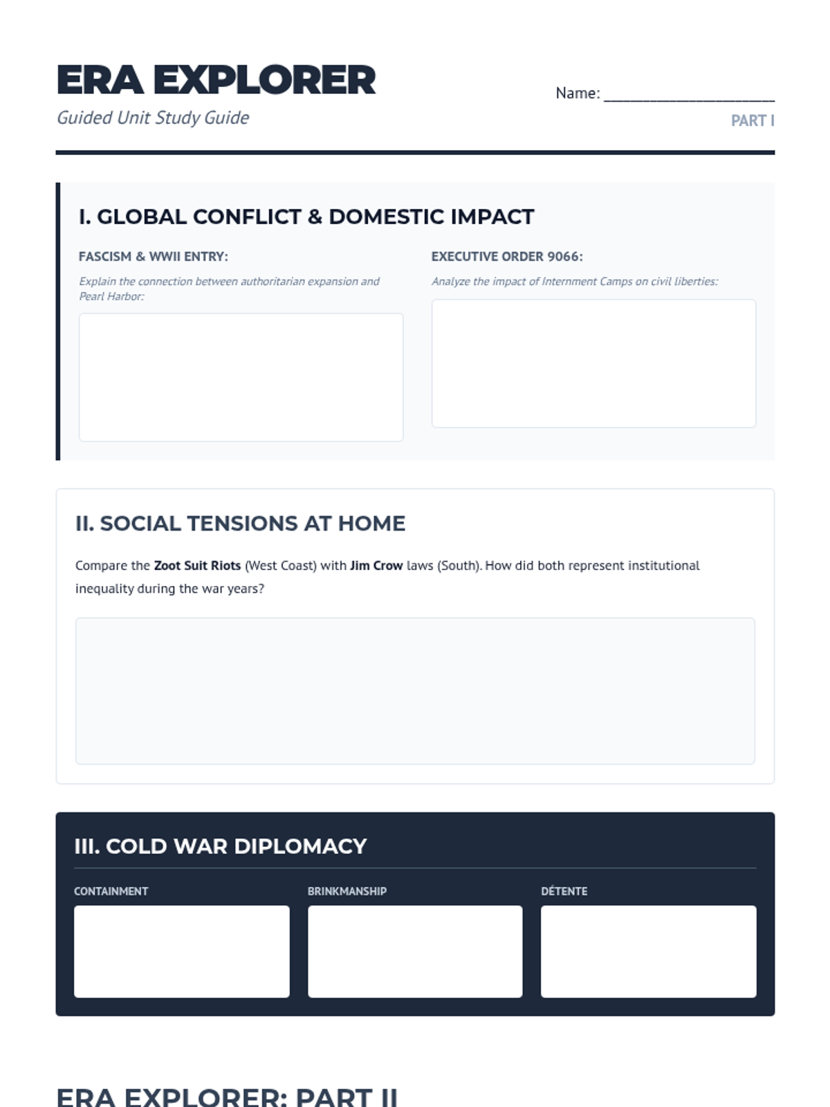
A two-page guided study guide exploring cause-and-effect relationships and key historical themes. Includes sections for WWII, the Cold War, social movements, and cultural diplomacy. Fixed page breaks and optimized work areas.
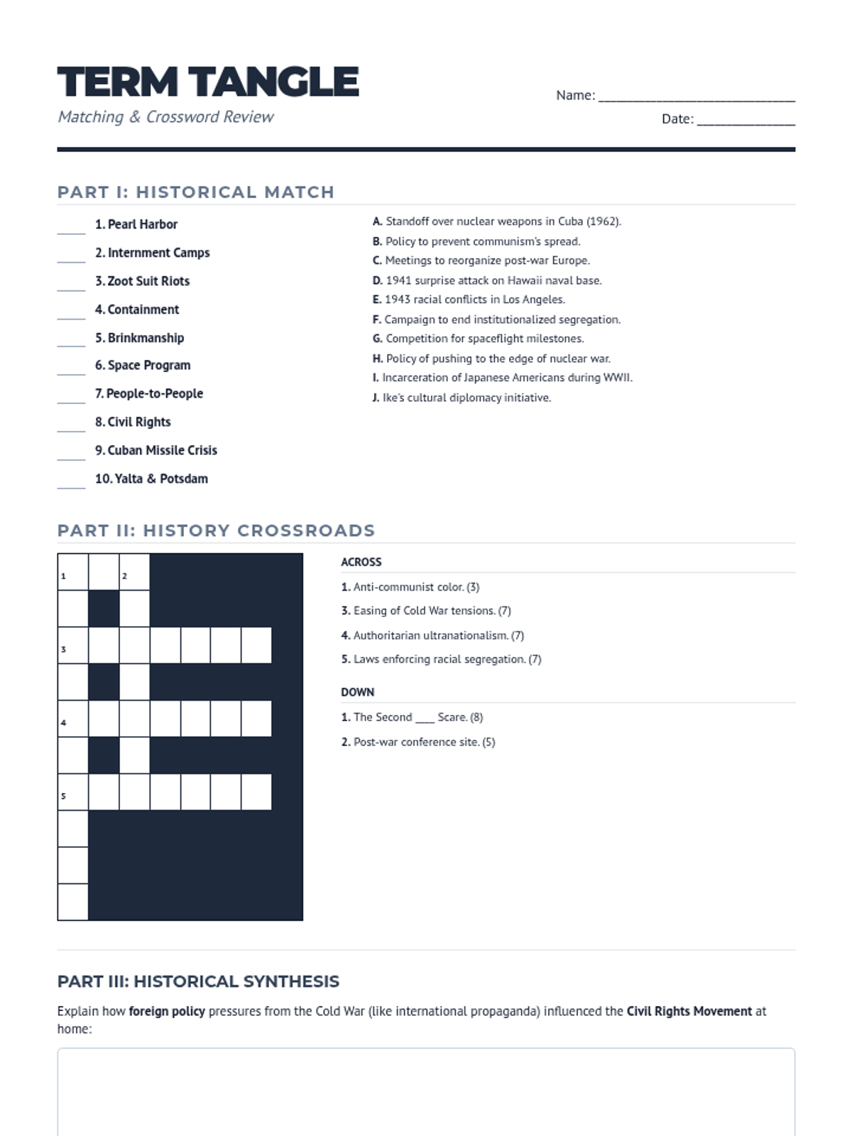
A matching and crossword worksheet focusing on vocabulary and key facts from WWII through the Cold War and Civil Rights era. Now condensed to a single page.
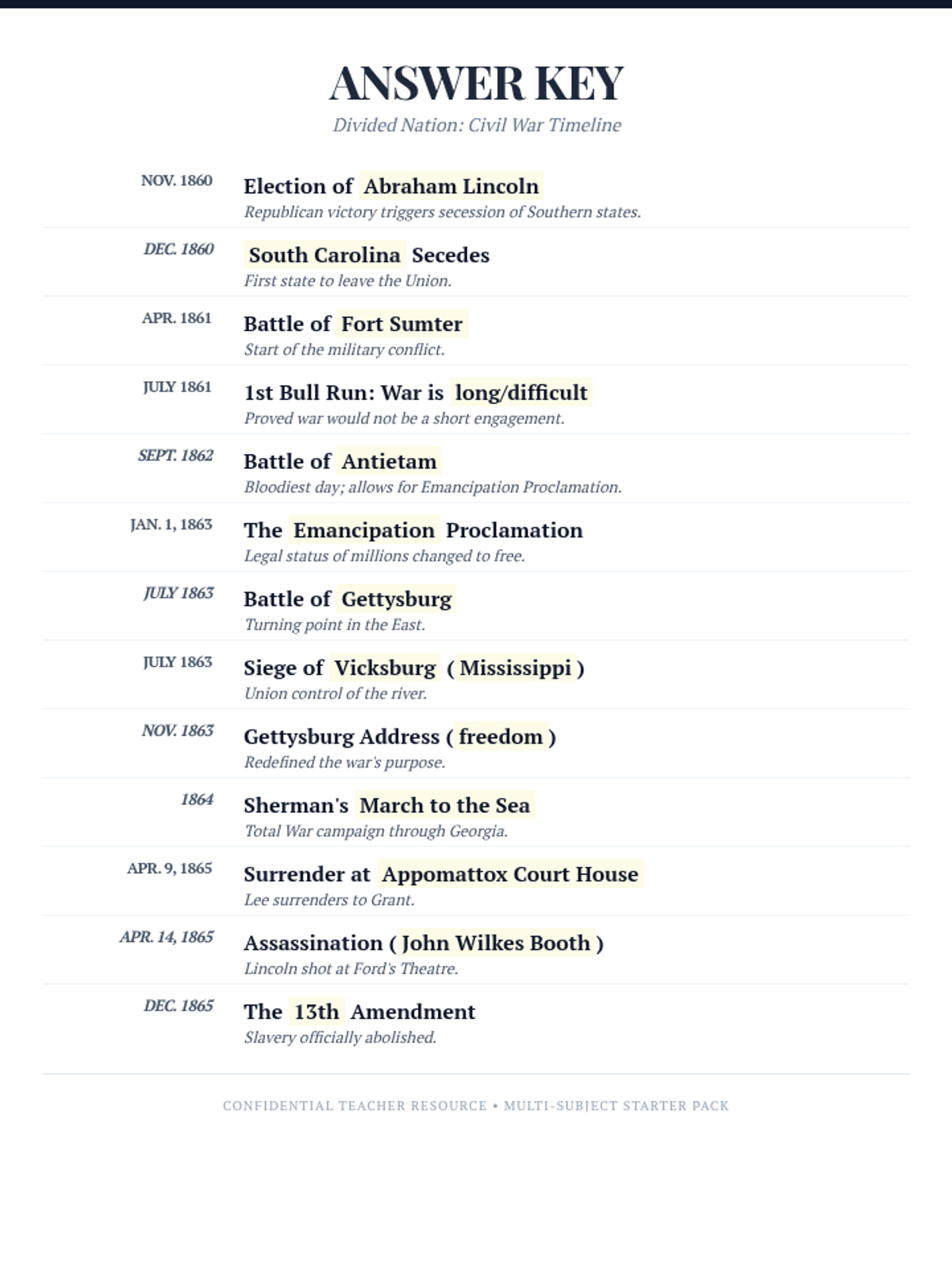
A concise 1-page teacher's answer key for the Divided Nation Civil War timeline worksheet.
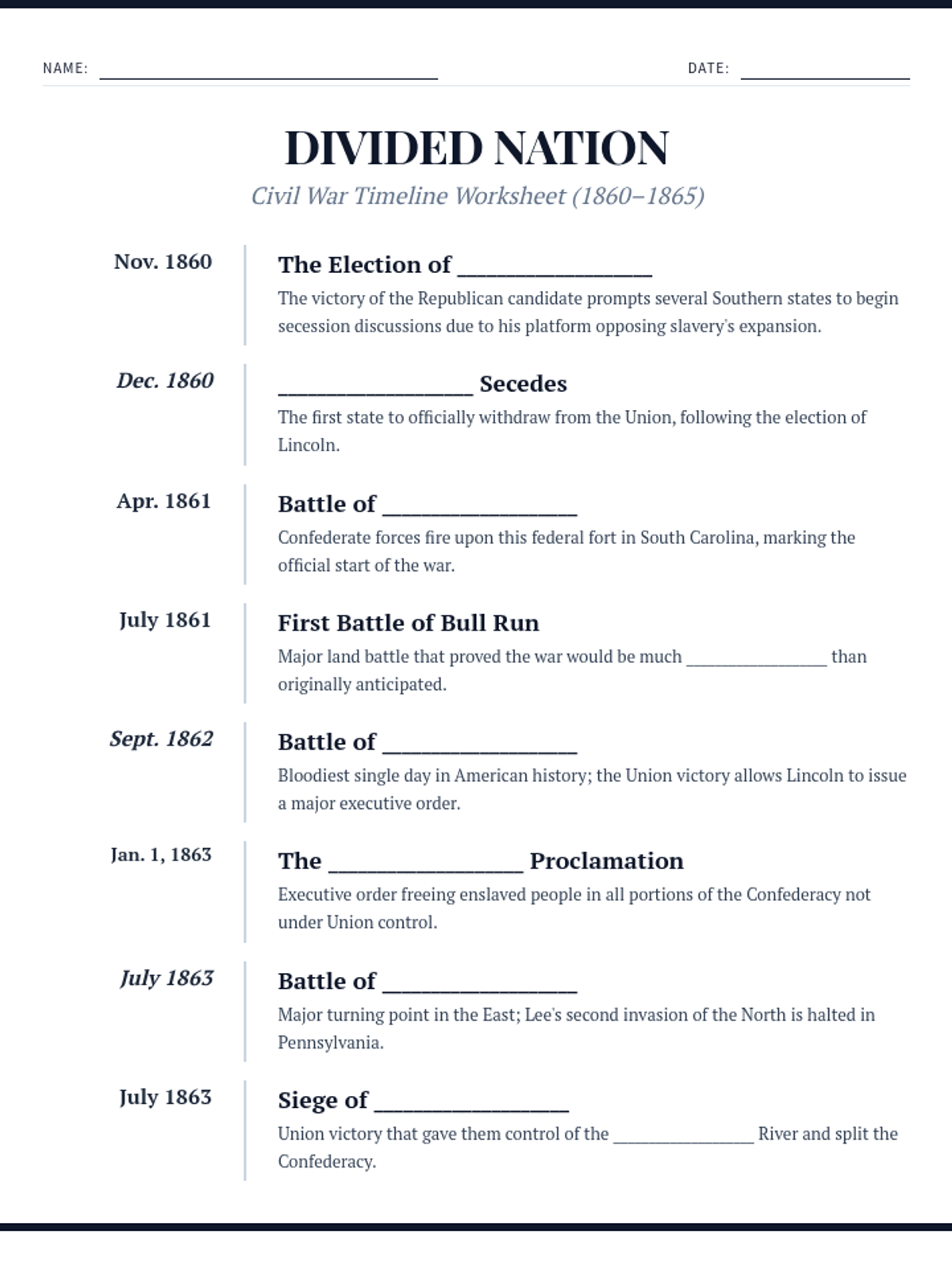
A condensed 2-page high school timeline worksheet for the American Civil War, featuring 13 key events with optimized spacing and page breaks.
A polished 10-slide presentation for 7th-grade science students explaining photosynthesis, featuring MathJax for chemical formulas and improved organelle diagrams.
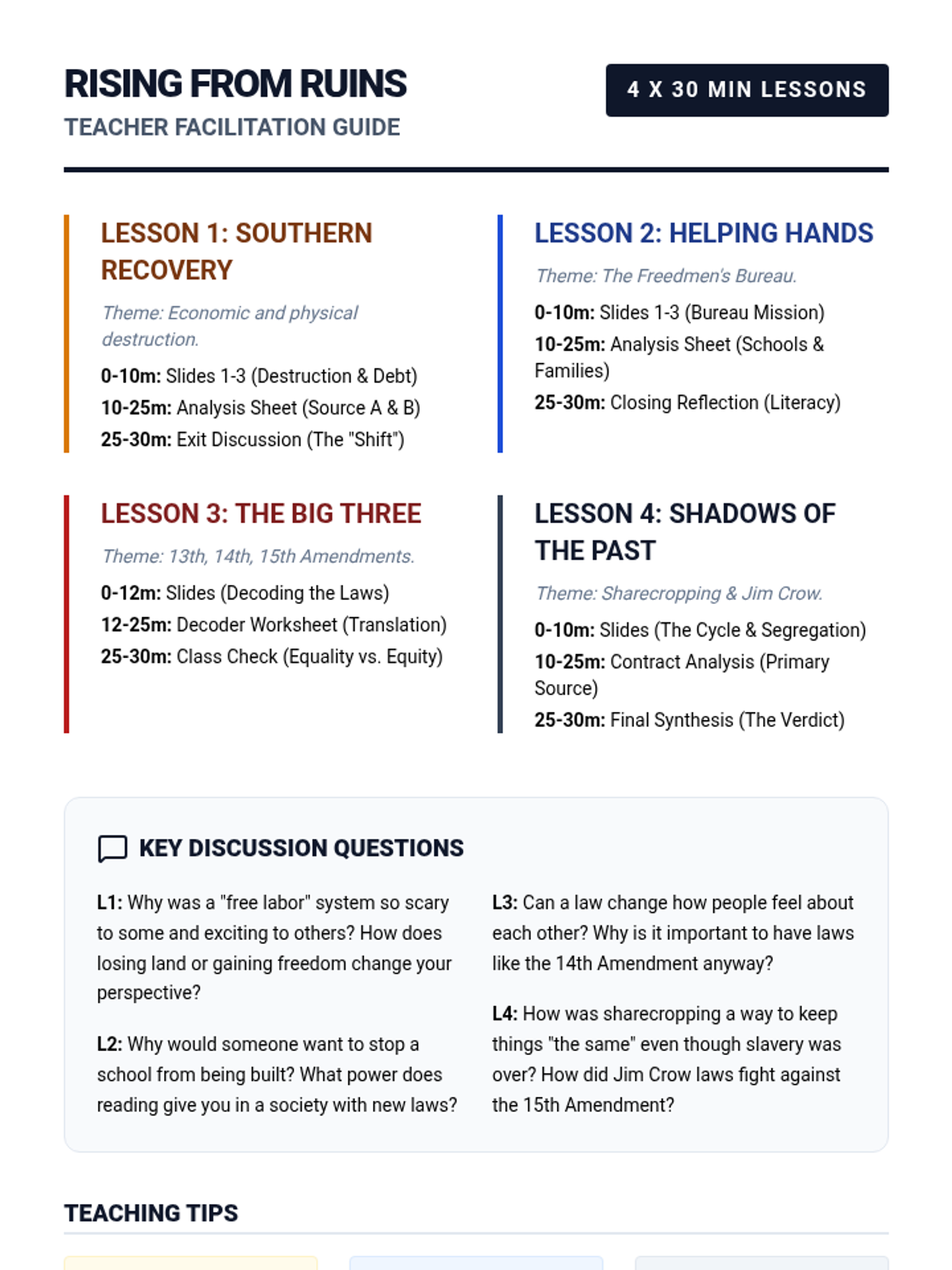
A comprehensive guide for teachers to manage the four 30-minute lessons, including pacing, discussion prompts, and differentiation strategies.
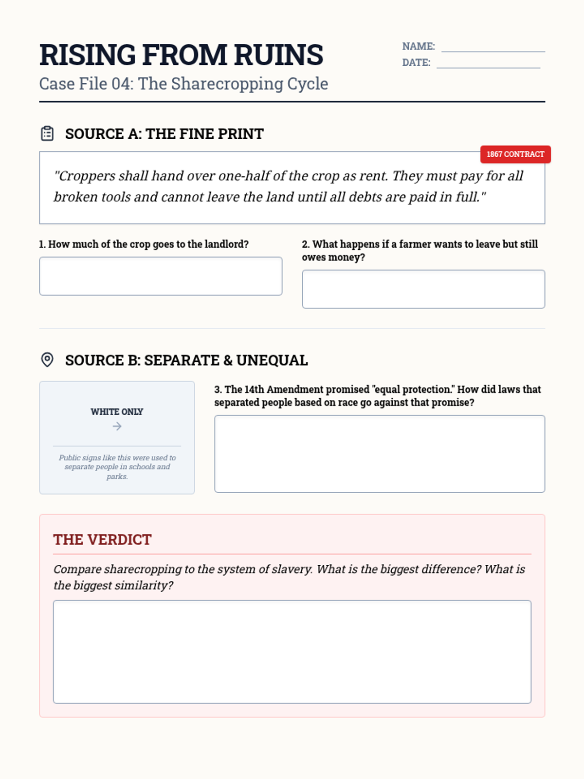
A student worksheet analyzing a sharecropping contract and the impact of Jim Crow laws on Southern life.
A slide presentation for Lesson 4 covering the economic trap of sharecropping and the legal and social restrictions of the Jim Crow era.
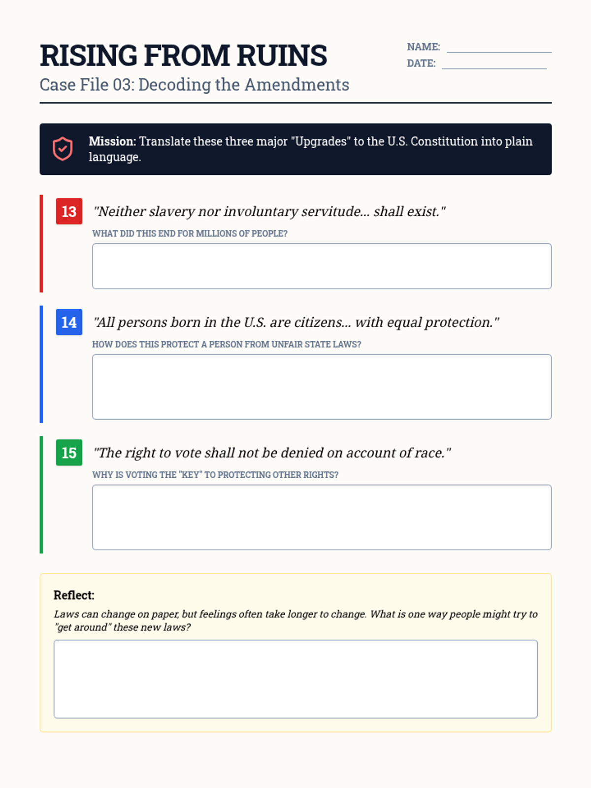
A student worksheet requiring students to interpret the 13th, 14th, and 15th Amendments in plain language and reflect on their impact.
A slide presentation for Lesson 3 explaining the 13th, 14th, and 15th Amendments and their significance in establishing civil rights.
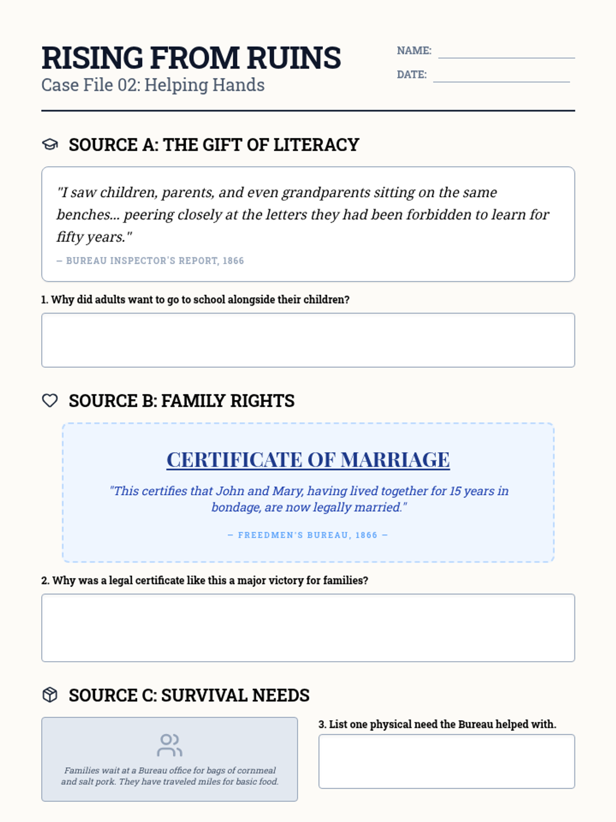
A student analysis sheet featuring primary source excerpts related to the Freedmen's Bureau's work in education and family reunification.
A slide presentation for Lesson 2 detailing the purpose, successes, and challenges of the Freedmen's Bureau during Reconstruction.
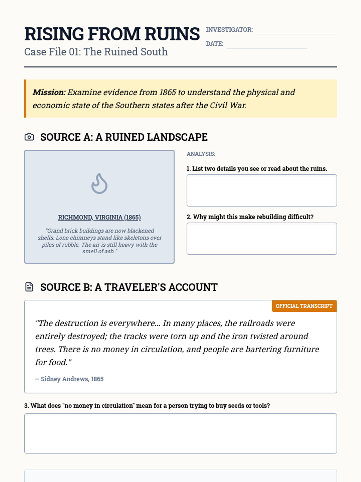
A student worksheet featuring primary source excerpts and prompts to analyze the physical and economic destruction of the South following the Civil War.
A slide deck for Lesson 1 introducing students to the physical and economic state of the South after the Civil War and the transition to a free labor system.
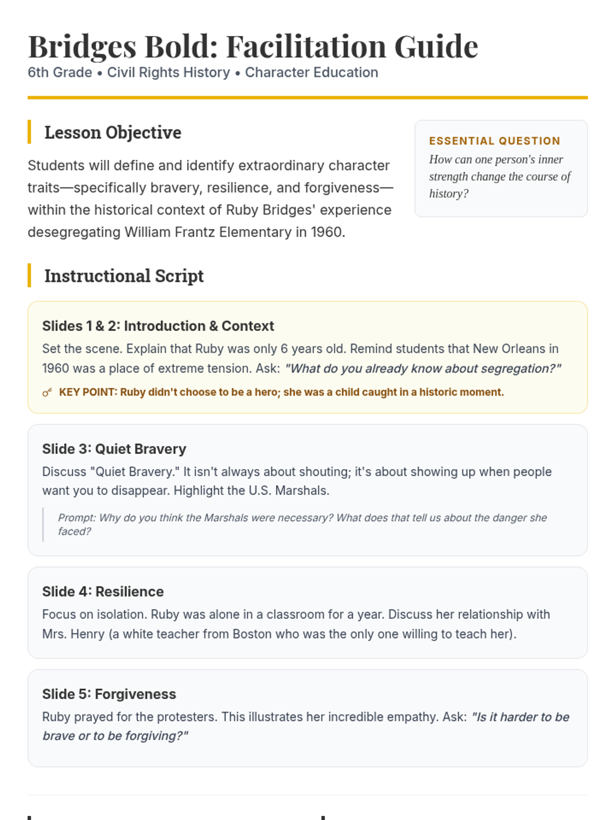
A teacher-facing facilitation guide for the Ruby Bridges lesson. Final polish to ensure all content blocks remain unified across page breaks, utilizing break-inside-avoid and tightened vertical spacing for a professional two-page layout.
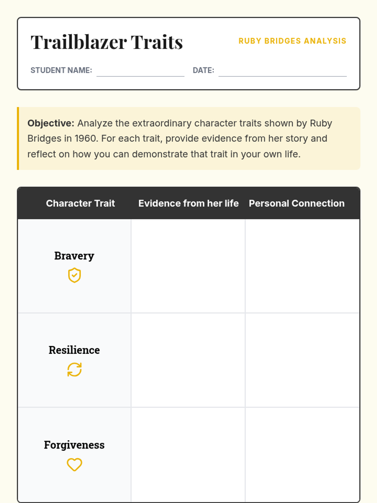
A student worksheet for analyzing the character traits of Ruby Bridges. Revised to prevent awkward page breaks and increase student writing space in the analysis table.
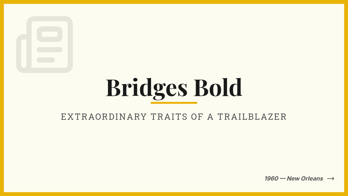
A presentation deck for 6th-grade students focused on the extraordinary character traits of Ruby Bridges, specifically her bravery, resilience, and capacity for forgiveness during the desegregation of New Orleans schools. Updated Slide 3 for better visual balance and impact.