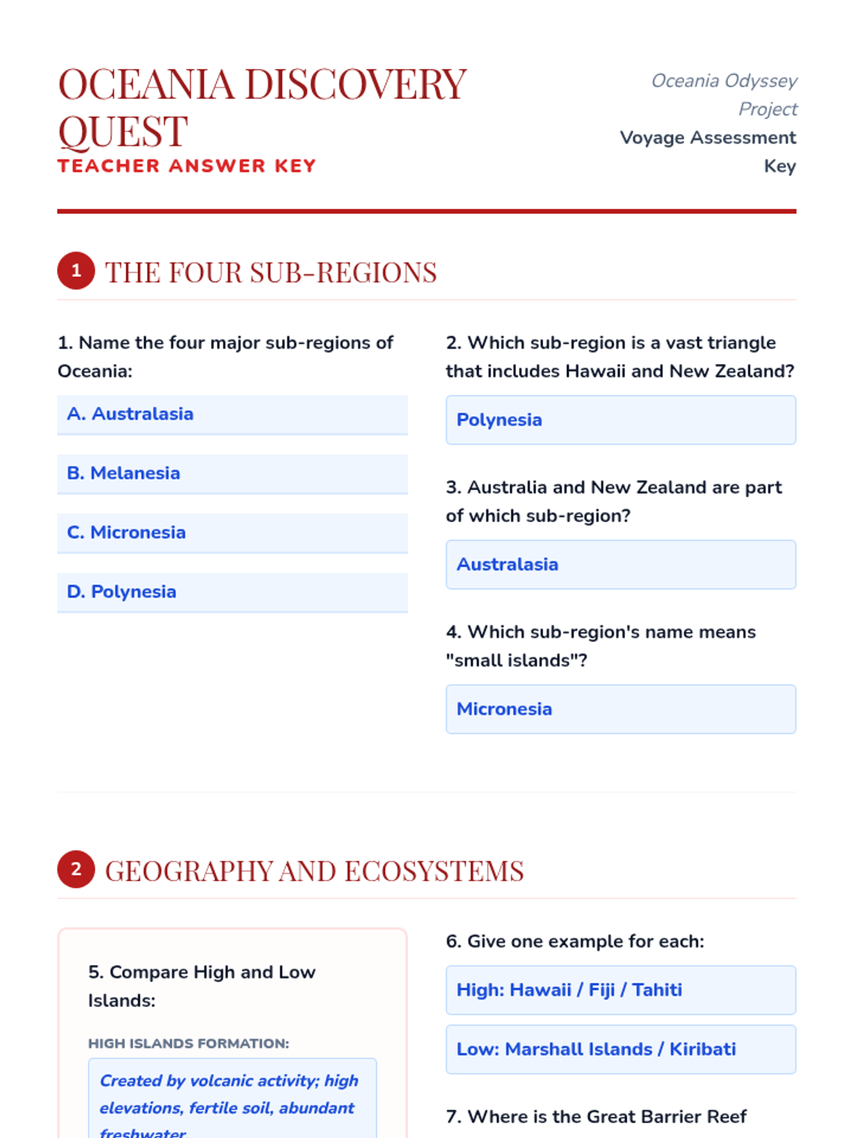
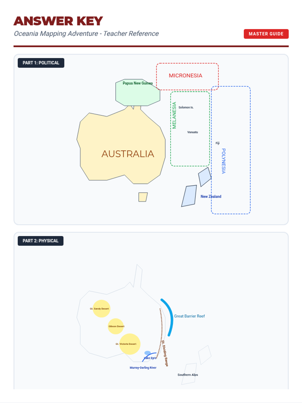
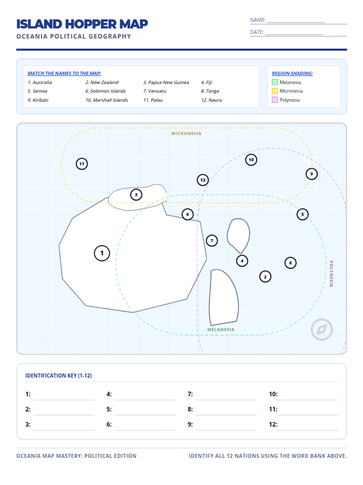
A comprehensive answer key for both the political and physical map worksheets. Includes detailed lists of countries by subregion, physical feature coordinates (locations), and a grading checklist for teachers.
An answer key for the Oceania Discovery Quest, featuring detailed responses for all 22 questions. Designed for teacher use with clear, contrasting answer text.
A 22-question discovery quest for students to complete while exploring the Oceania Odyssey slides. Includes sections on geography, indigenous cultures, colonialism, and climate change, with clear work areas for written responses.
A visually engaging 12-slide presentation covering Oceania's geography, indigenous cultures, colonial history, and climate challenges. Features high-contrast layouts, clear headings, and key vocabulary for student reference.
A teacher answer key for the Oceania Mapping Handout, providing visual placement of nations, subregions, deserts, and physical landmarks. Consolidated into a high-legibility format.
A 2-page student worksheet for labeling and coloring the political boundaries and physical landmarks of Oceania, including Australia, New Zealand, and major island groups. Updated with improved maps and page layout.
A physical geography worksheet for Oceania. Students identify and label major landmarks like the Great Barrier Reef, Uluru, the Southern Alps, and the Outback. Includes a checklist of features and specific map symbols for mountains and reefs.
A political map worksheet for Oceania where students label major countries (Australia, NZ, Fiji, etc.) and color-code the three subregions (Melanesia, Micronesia, Polynesia). Includes a structured layout for labeling and a legend for subregion identification.