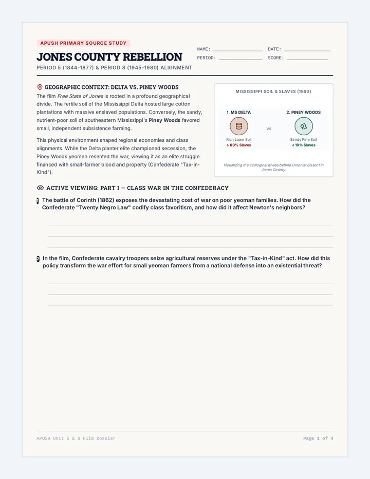
Vernacular Regions vs. Political Borders
This lesson explores the concept of 'vernacular' or perceptual regions that exist independently of state lines, such as 'The Bible Belt,' 'Cascadia,' or 'New England.' Students engage in a mapping exercise to overlay these cultural zones onto political maps, discussing how shared identities often transcend state governance.