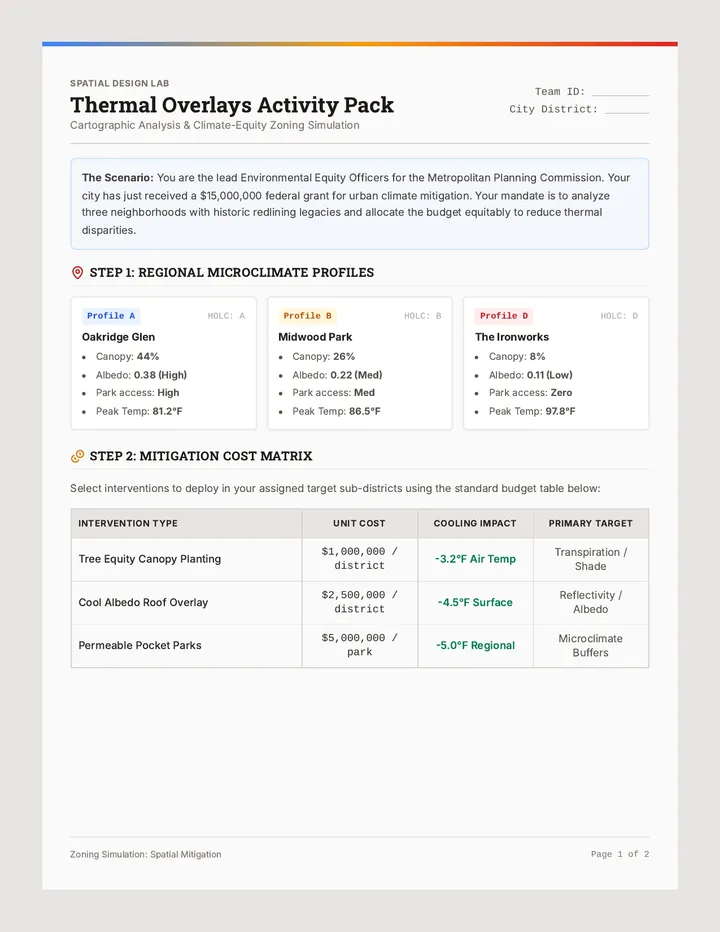
Capital Centrality and Population Distribution
Students investigate the location of state capitals relative to population density and geographic centers. Using GIS data or detailed demographic maps, they evaluate the accessibility of government centers for diverse populations. The lesson highlights the tension between historical capital locations and modern demographic shifts.