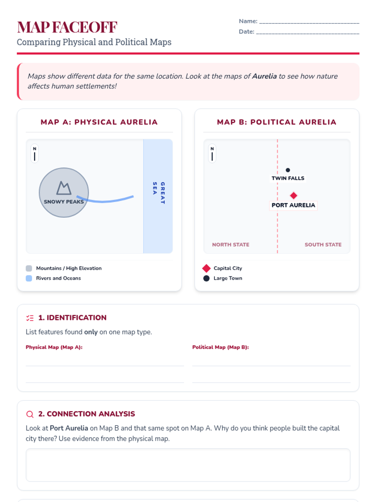
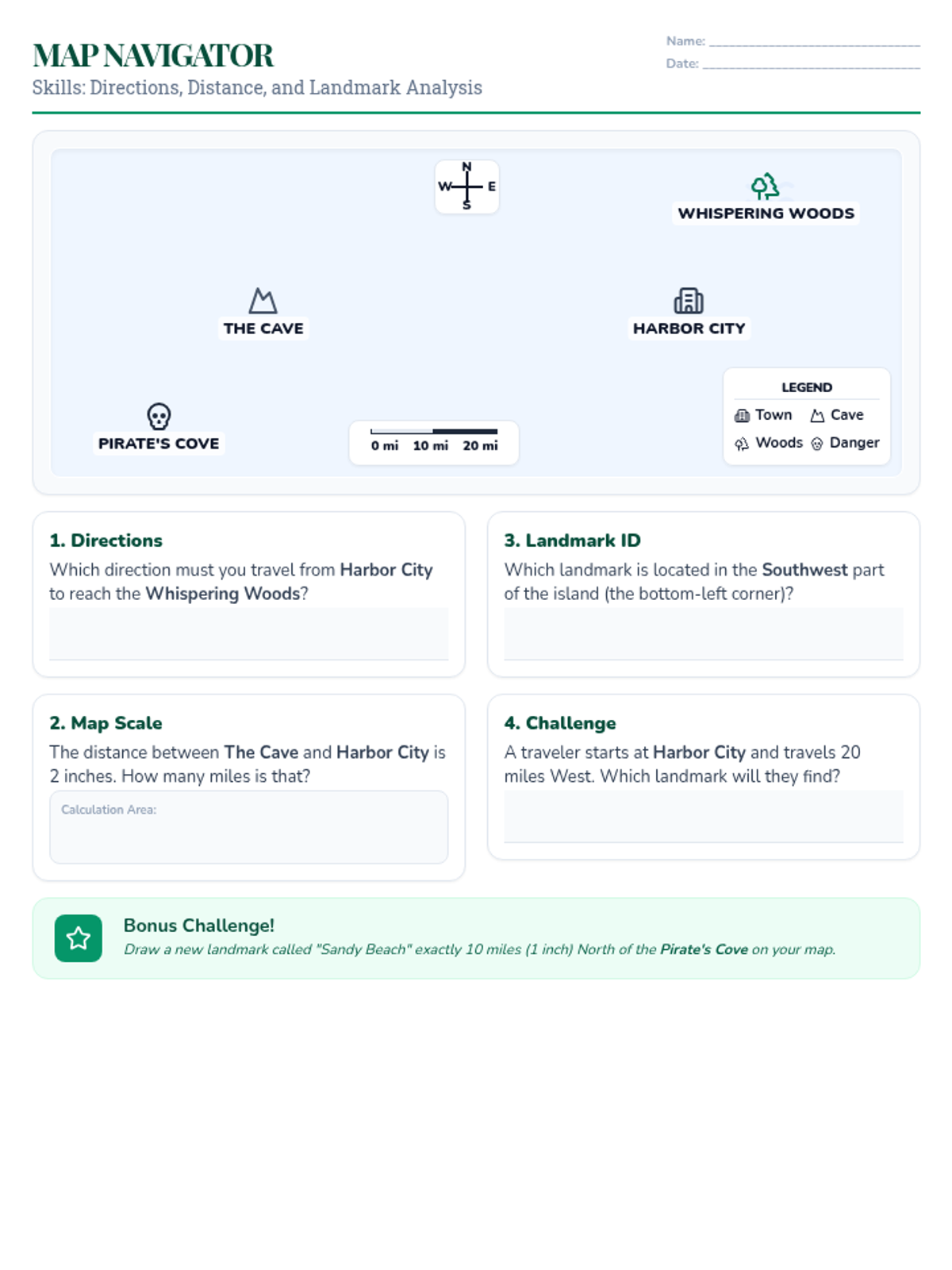
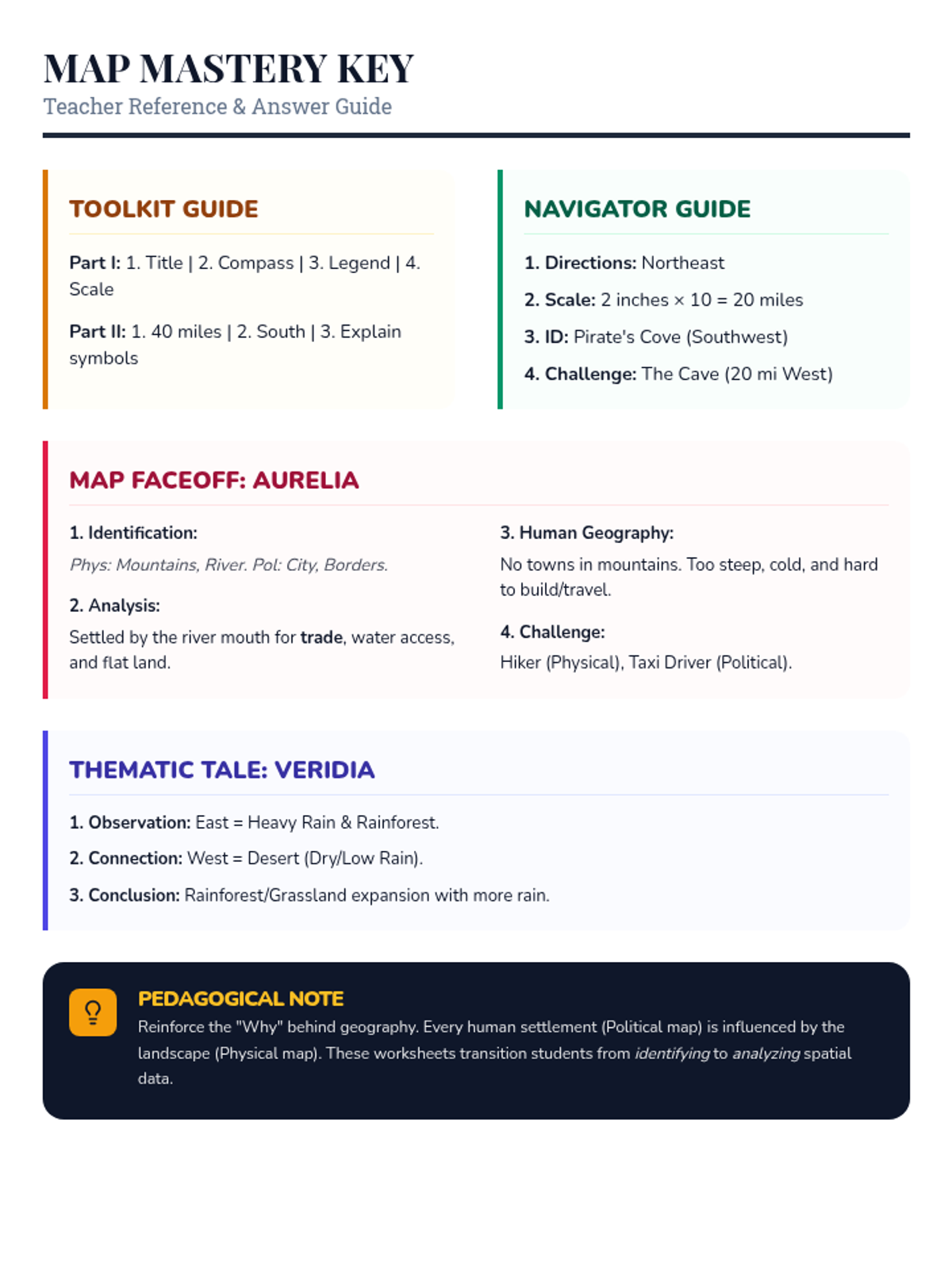
An analysis worksheet that tasks students with comparing two thematic maps (Rainfall vs. Vegetation) to understand geographical relationships and draw evidence-based conclusions.
Updated outline slide with a navy blue background and sky blue text/accents for a professional look.
An introductory slide defining family as a core social unit, updated with a professional navy blue theme.
A comparison worksheet where students analyze a physical map and a political map of the same region to understand how geographical features influence human settlements and borders.
A hands-on map navigation worksheet where students use a compass rose and map scale to find landmarks, calculate real-world distances, and describe relative locations on a fictional map.
A teacher's answer key for the Cartographer's Toolkit, Map Navigator, Map Faceoff, and Thematic Tale worksheets, including sample responses and instructional notes.
A foundational worksheet for 5th-grade students to identify map parts (title, scale, legend, compass rose) and perform basic map math and directional tasks.
An instructional slide deck introducing 5th-grade students to essential map features like the compass rose, scale, and legend, as well as an introduction to analyzing thematic maps.
A teacher answer key for the Puebla Post reading comprehension worksheet, including suggested answers and instructional tips.
A reading comprehension worksheet styled as a 19th-century newspaper, telling the story of the debt crisis and the Battle of Puebla with seven analysis questions.
A complete answer key for the "Ancient Echoes Notes Worksheet" with improved visual clarity and layout consistency for teachers.
A guided notes worksheet for 5th-grade students to complete while viewing the "Ancient Echoes" presentation. Improved layout for printing and handwriting legibility.
An engaging 10-slide presentation exploring the connections between the Maya, Aztec, and Inca civilizations and modern-day Latin American countries. Refined for etymological accuracy and visual polish.