Visual presentation exploring the concept of laws by comparing classroom rules to statewide rules.
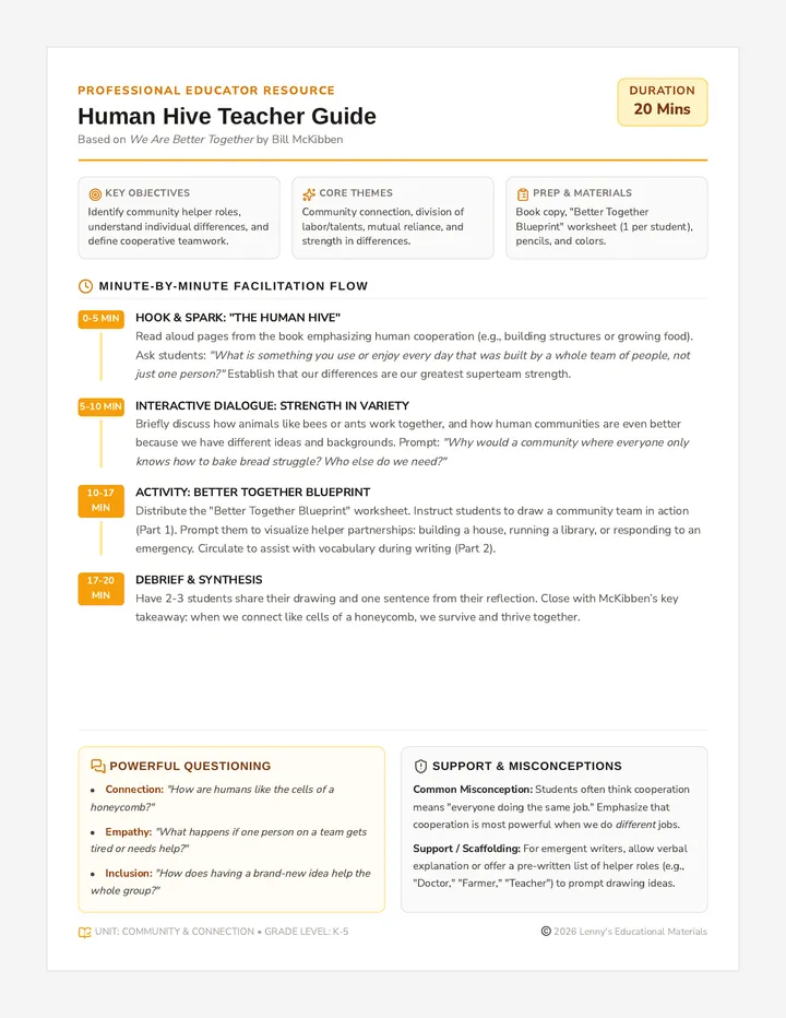
A teacher-facing lesson plan and facilitation guide for a 20-minute lesson. Includes a minute-by-minute pacing breakdown, book discussion prompts, common student misconceptions, and differentiation strategies.
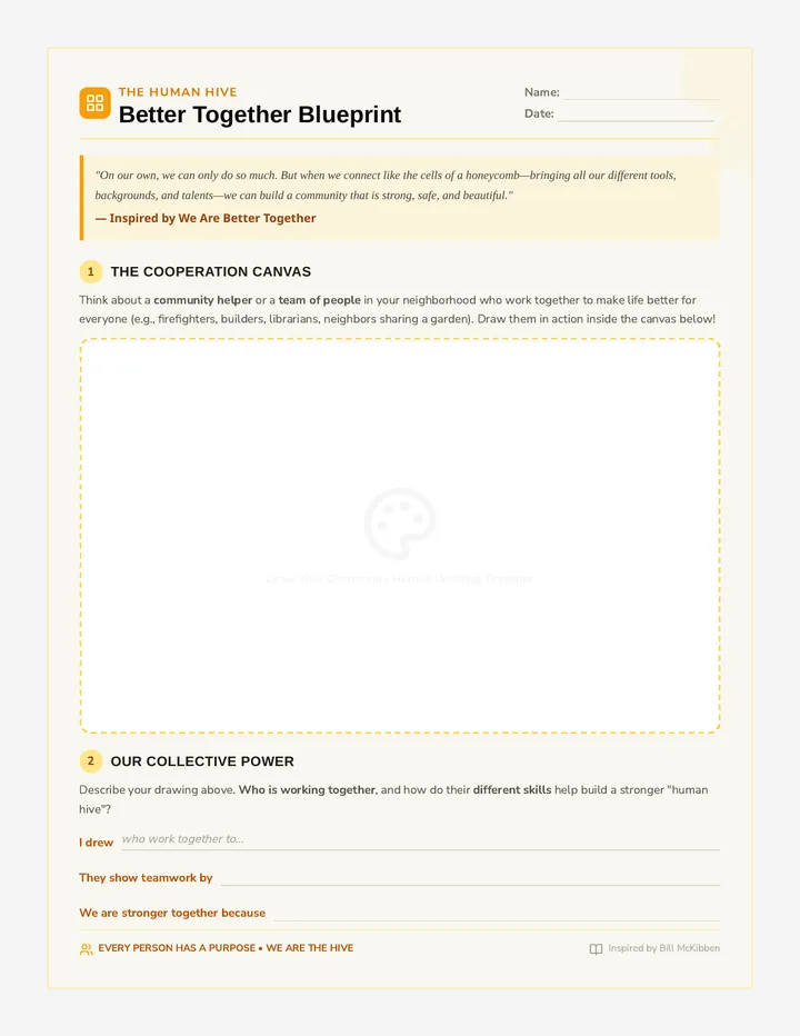
A student-facing activity sheet featuring a 'Cooperation Canvas' drawing area and scaffolded writing prompts. Designed to help students connect the themes of Bill McKibben's book to their own communities through art and reflection.
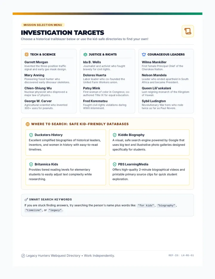
A highly visual 1-page student menu and resource directory featuring categorized historical figures and safe, kid-friendly search databases for independent research.
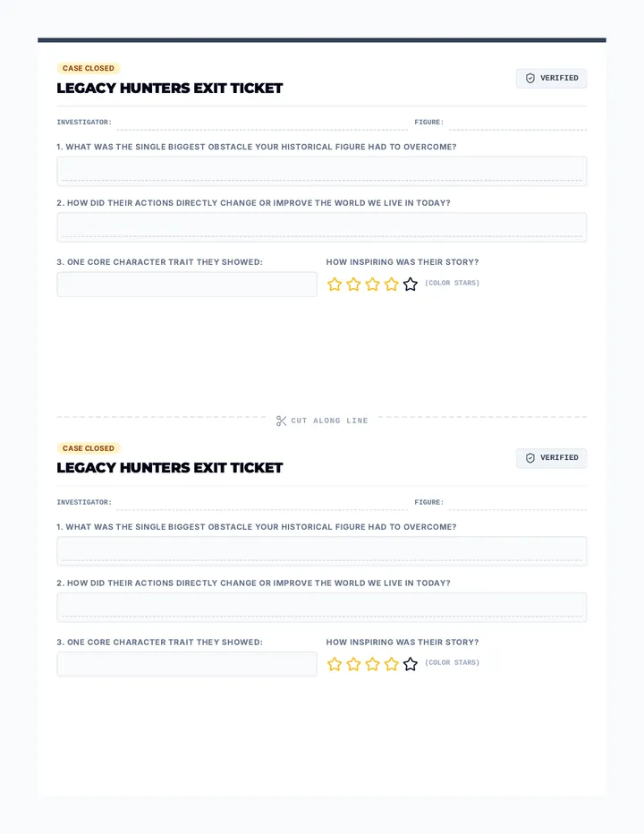
A structured single-page exit ticket designed for easy writing, prompting students to synthesize their figure's main struggle, achievement, and character traits.
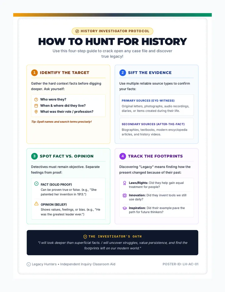
A visual anchor chart detailing the key steps of historical research, how to evaluate primary vs secondary sources, and critical questions to ask.
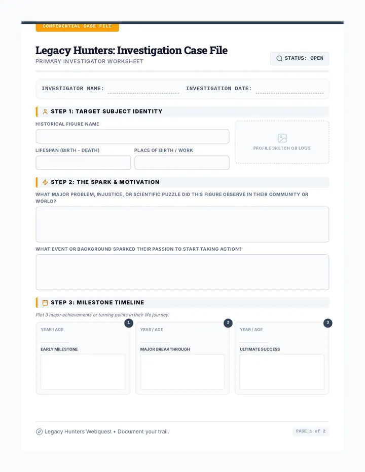
A highly engaging 2-page research packet ("Case File") for students to explore their chosen historical figure, documenting origins, motivations, struggles, achievements, and legacy.
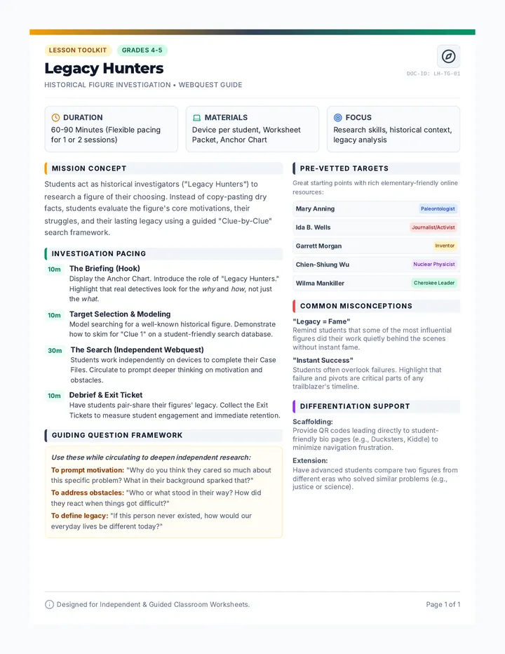
A structured 1-page guide for teachers detailing lesson setup, common misconceptions, pacing, and differentiation strategies for the Legacy Hunters history webquest.
كتيب أذكار النوم الصحيحة من السنة النبوية الشريفة منسق باللونين الرمادي والتركواز الفاتح، ومصمم كملف PDF جاهز للطباعة والقراءة المريحة.
A vibrant, colorful, and highly cheerful 2-page Arabic weekly worship tracker for kids. It features bright playful pastel colors, friendly mascots, beautiful cloud borders, and interactive badges designed to excite and motivate children.
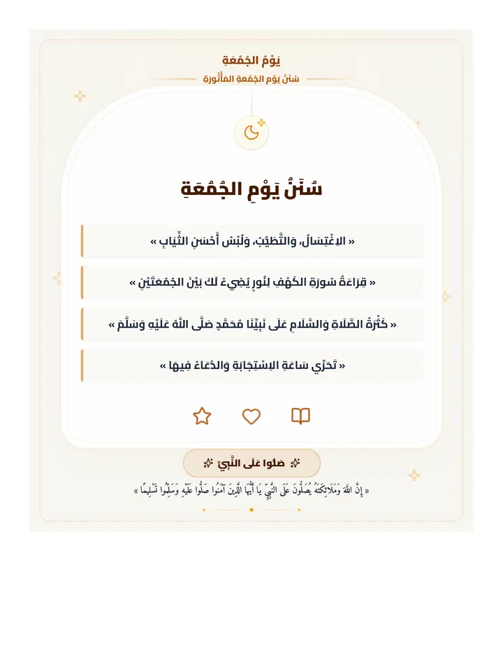
A beautifully elevated Friday sunnah reminder poster in a luxury emerald-themed Mihrab layout, designed with large connected Arabic typography for mobile and Telegram sharing.
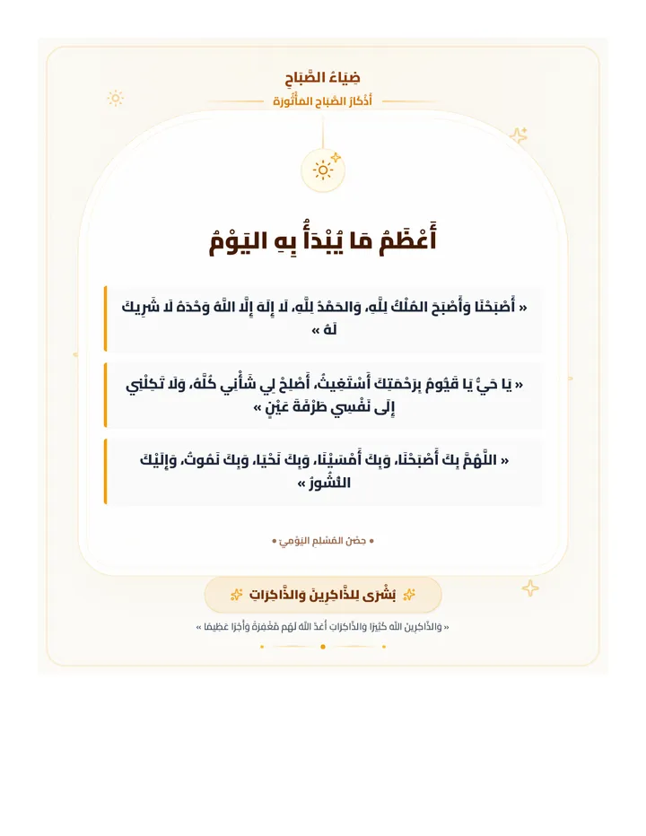
A beautifully elevated morning remembrance card featuring selected core morning adhkar in a luxury sunrise-themed Mihrab layout, designed with large connected Arabic typography for mobile and Telegram sharing.
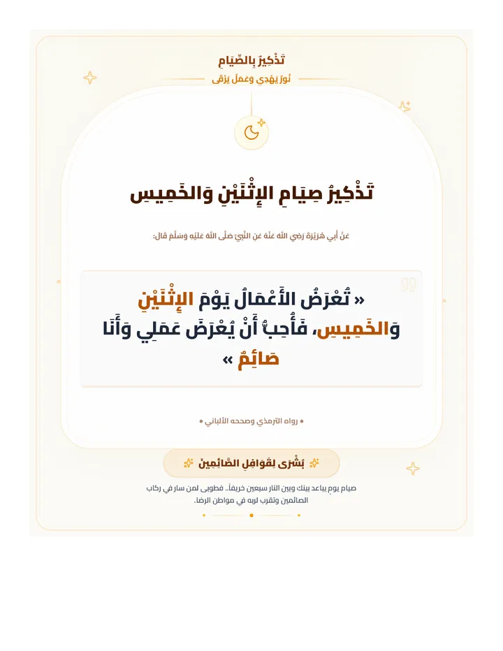
A beautifully elevated spiritual reminder poster for Mondays and Thursdays fasting, featuring a luxury Mihrab arch layout, elegant warm colors (Fajr/Dawn theme), delicate golden stars, and precise Arabic typography with Cairo font.
Printable career headband crowns for young learners, complete with colorable school theme badges and outline extension straps.
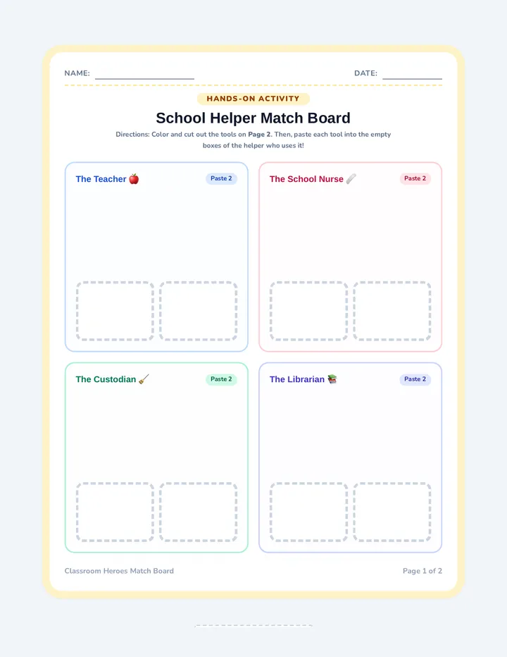
A cut-and-paste sorting activity. Students color and cut out eight iconic school helper tools, then glue them into the correct helper's corresponding empty box.
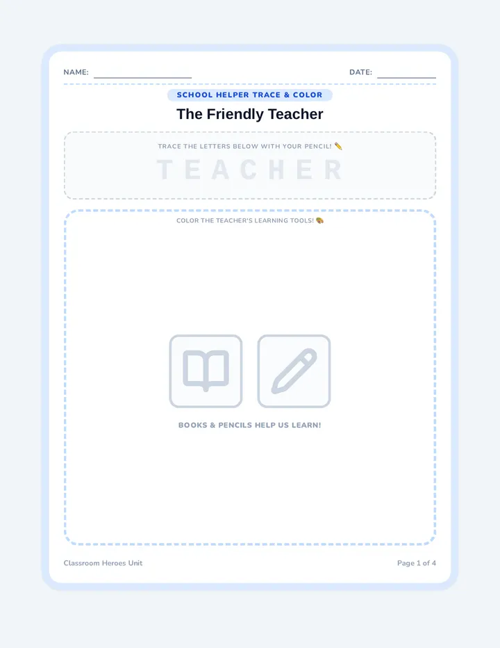
A multi-page trace and color workbook for young learners, with light gray lettering templates for spelling PRACTICE, and simple, high-contrast coloring sheets.
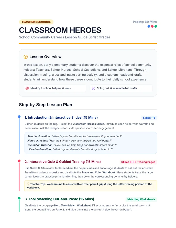
An instructional resource guide for kindergarten and 1st-grade teachers containing a detailed lesson timeline, guided classroom discussion questions, differentiation strategies, and an essential materials checklist.
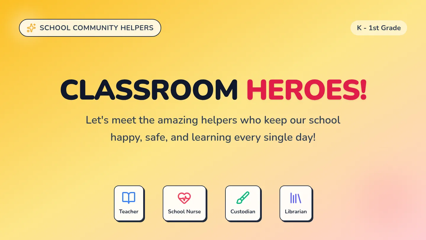
An engaging slide presentation designed specifically for Kindergarten and 1st-grade school helper exploration. Featuring huge text, bold playful visual cards, interactive tool quiz slides, and simplified instructions for hands-on activities.
خلاصة أذكار الصباح والمساء بتصميم وردي وذهبي روحاني مميز يحمل شعار ضياء (بدون كلمة قناة) ومعرف المستخدم @Azizyh47، منسق في 3 صفحات سهلة القراءة والطباعة مع دعم الخطوط العربية الأصيلة.
An answer key for the Bedford Tales Worksheet, providing the correct multiple-choice options and teaching tips for the instructor.
A simplified story about the town of Bedford, Massachusetts, using visual icons and 20 multiple-choice questions for reading comprehension.
A visual slide deck featuring high-quality portraits of George Washington, John Adams, Teddy Roosevelt, and Barack Obama. Includes key facts and a matching game to support recognition and historical understanding.
An answer key for the Presidential Heroes worksheet. Provides clear, symbolic answers and teaching tips for facilitators. Designed to prevent page breaks within important sections.
A visual identification worksheet for Kindergarteners. Features five identification questions with uniform styling for answer choices to ensure a fair assessment. Each question is contained to prevent awkward page breaks.