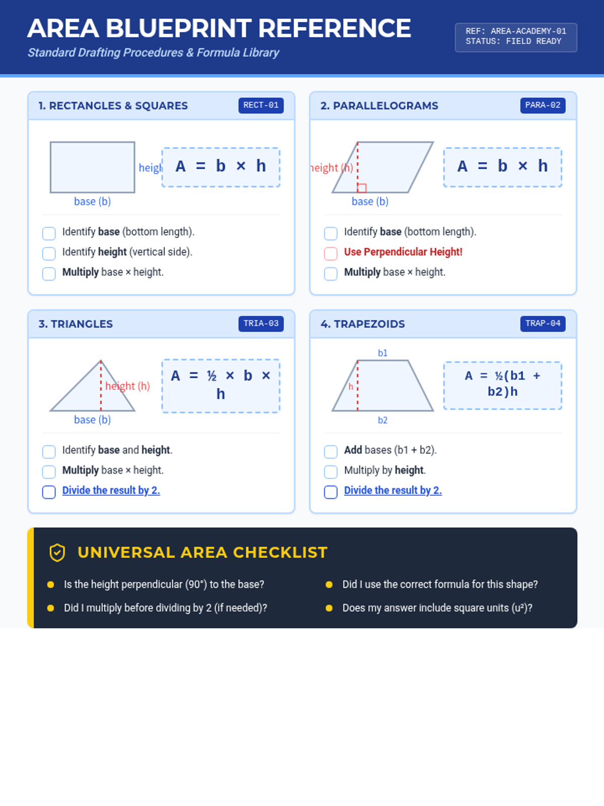
The opening mission for the Trapezoid Territory unit. Students plot the primary boundary coordinates on a 2D plane to visualize the land reserve.
The opening mission for the Trapezoid Territory unit. Students plot the primary boundary coordinates on a 2D plane to visualize the land reserve.