Terrain and Territory
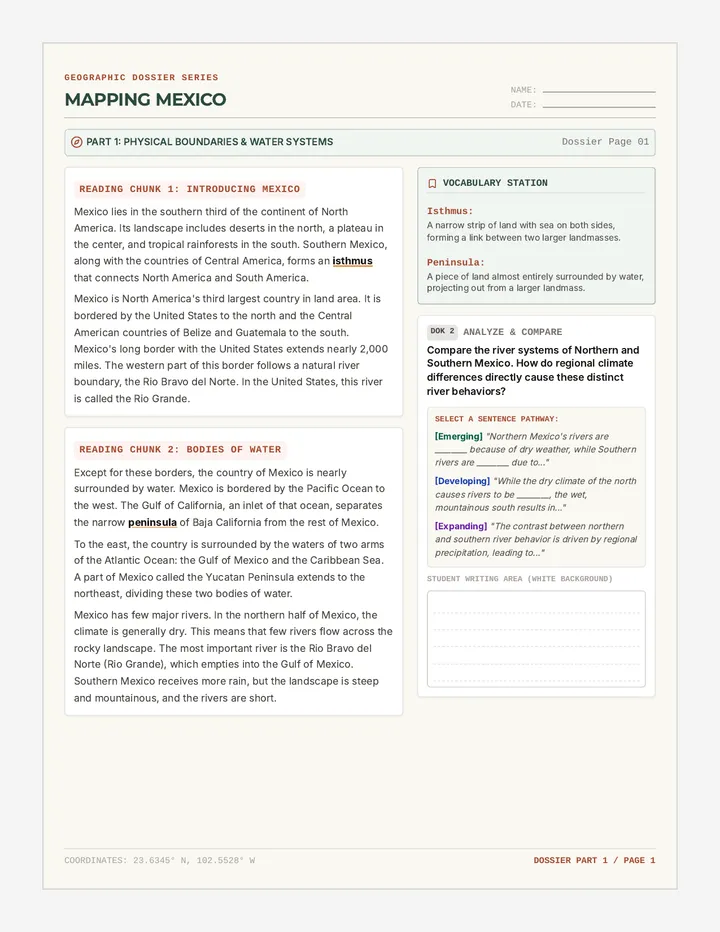
Students analyze thematic maps to identify diverse physical regions of the Americas and create map overlays to visualize the relationship between elevation, climate, and human activity.
Students analyze thematic maps to identify diverse physical regions of the Americas and create map overlays to visualize the relationship between elevation, climate, and human activity.