Using LiDAR and geomorphic signatures to identify ancient landslides and create hazard susceptibility maps.
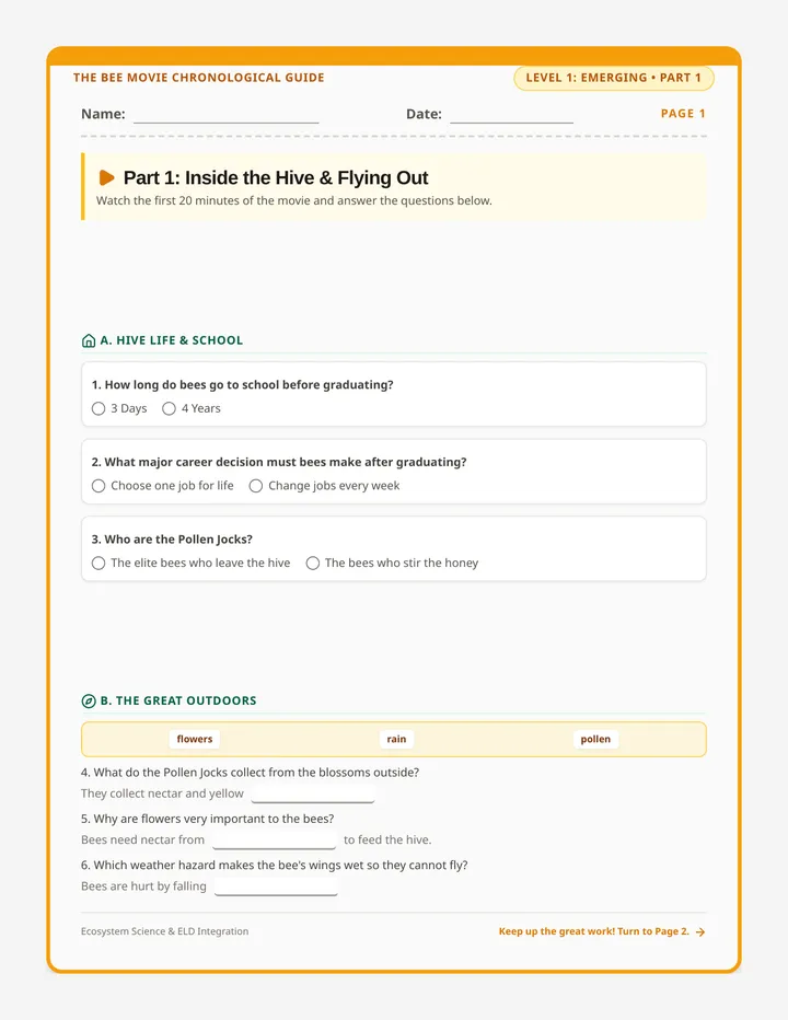
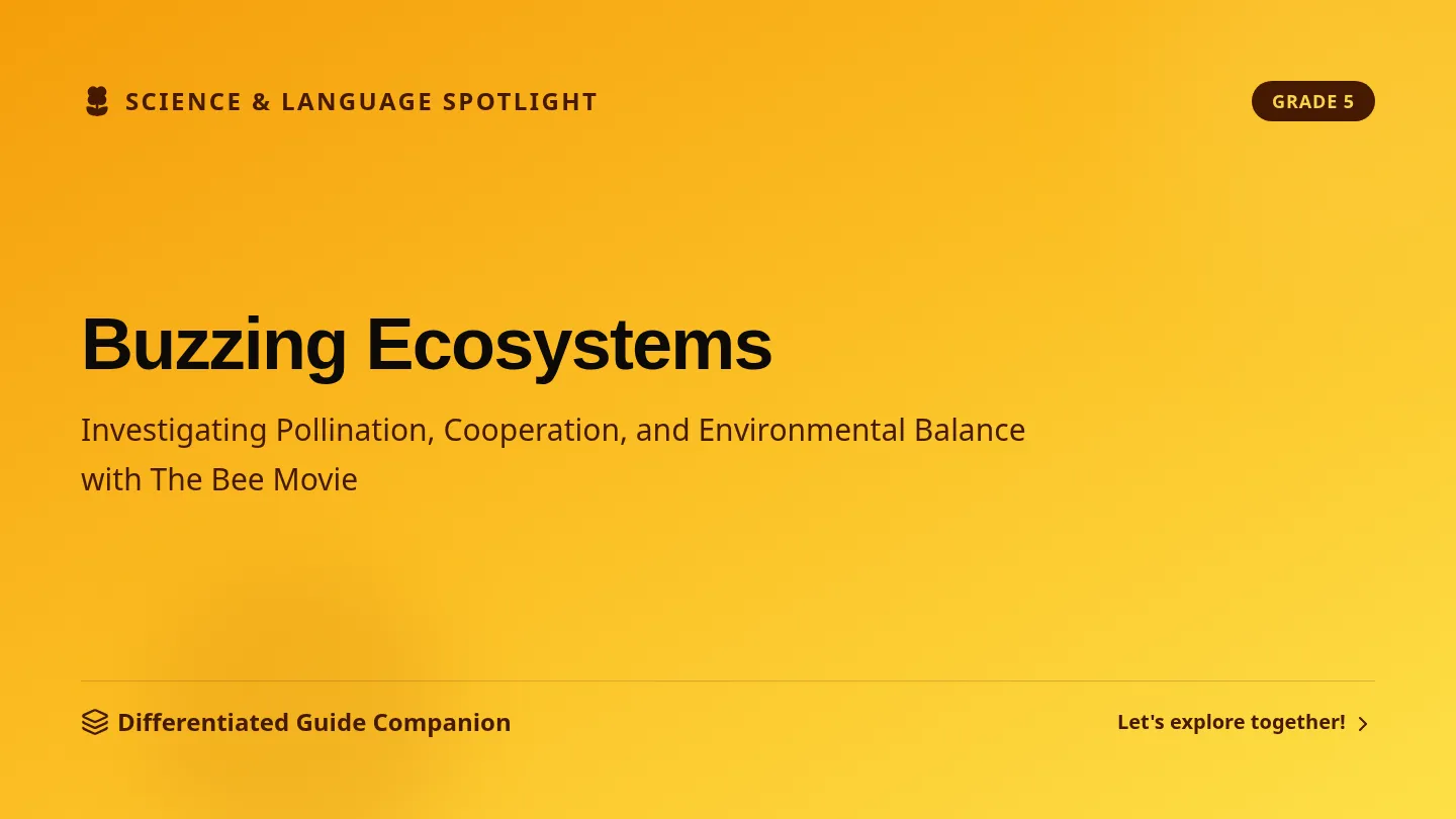
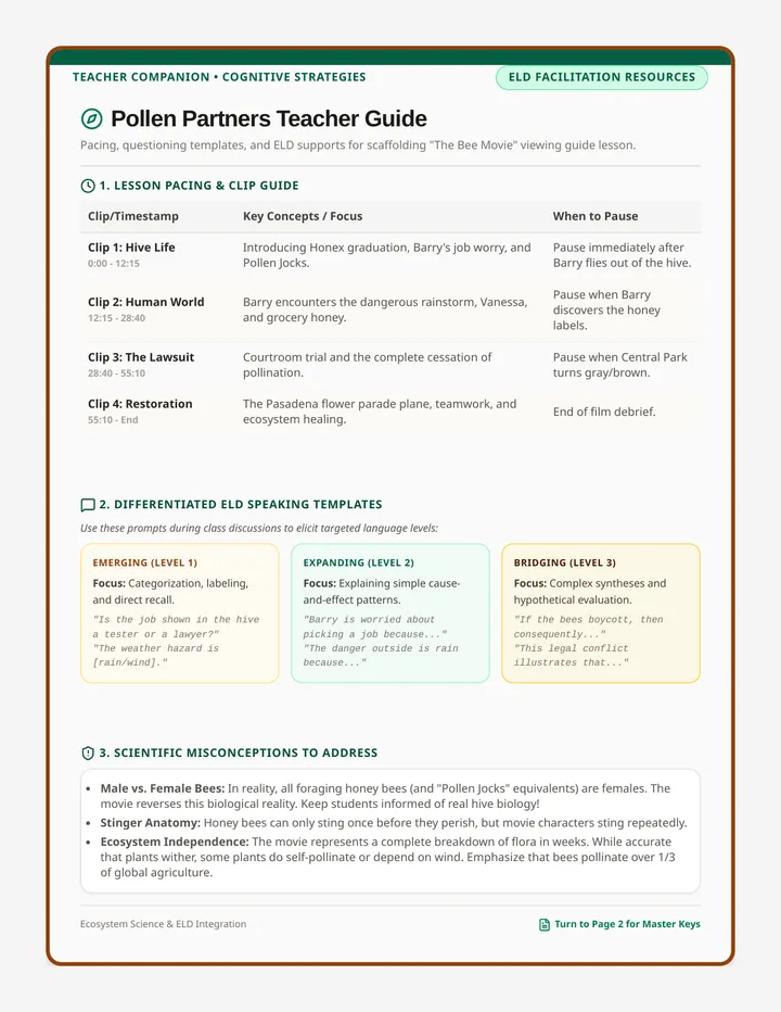
A 5th-grade viewing guide lesson centered around the ecological themes of The Bee Movie. This lesson provides tiered scaffolds (Emerging, Expanding, and Bridging) to support English Language Learners in analyzing pollination, human-bee interaction, and environmental responsibility.
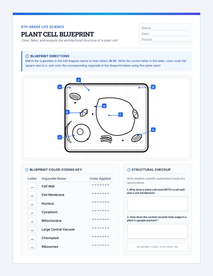
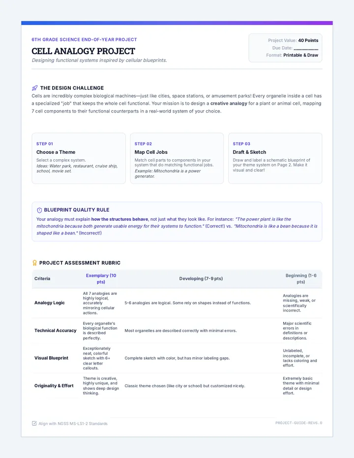
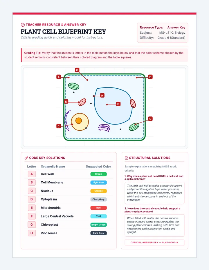
An end-of-year science project lesson where 6th-grade students explore plant and animal cells through creative coloring worksheets and a student-designed cell analogy project. Includes high-quality coloring diagrams and a comprehensive graphic organizer guide.
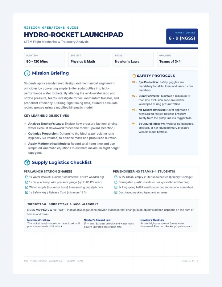
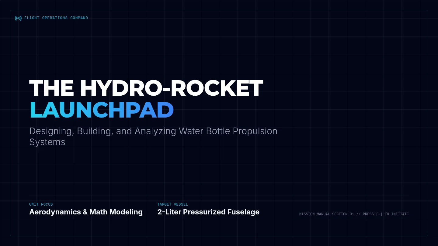
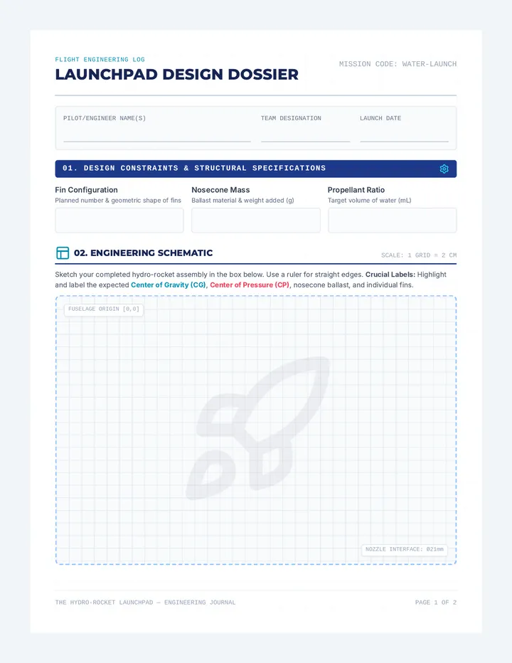
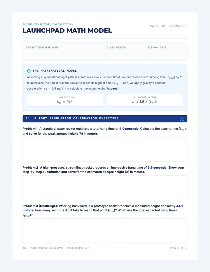
A comprehensive STEM lesson where students design, build, and launch water bottle rockets to explore pressure, volume, and Newton's laws. Students apply physics principles and mathematical formulas to model trajectories and calculate apogee height from hang time.
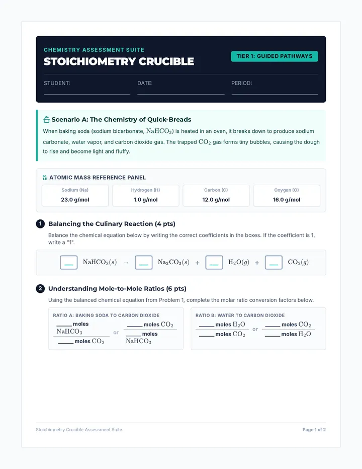
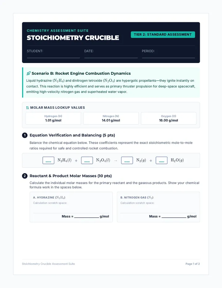
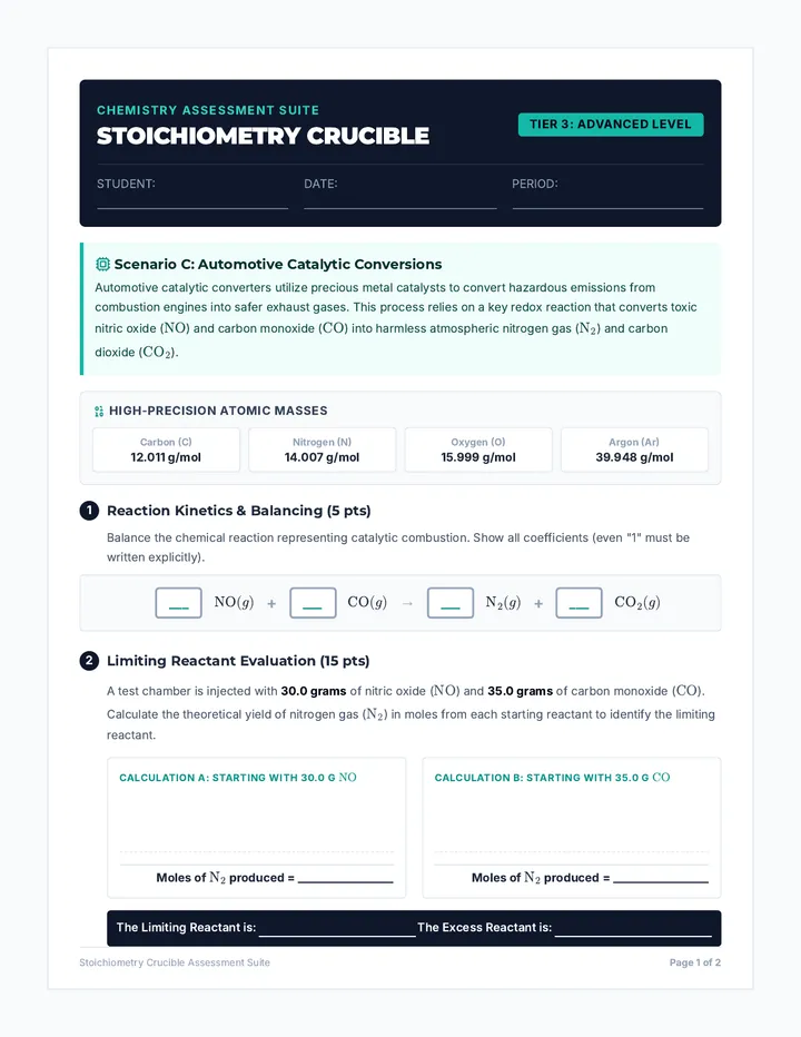
A differentiated stoichiometry assessment suite tiered by mathematical complexity, visual scaffolding, and conceptual depth. Features three distinct, parallel versions of a 2-page quiz centered around unique real-world chemistry applications.
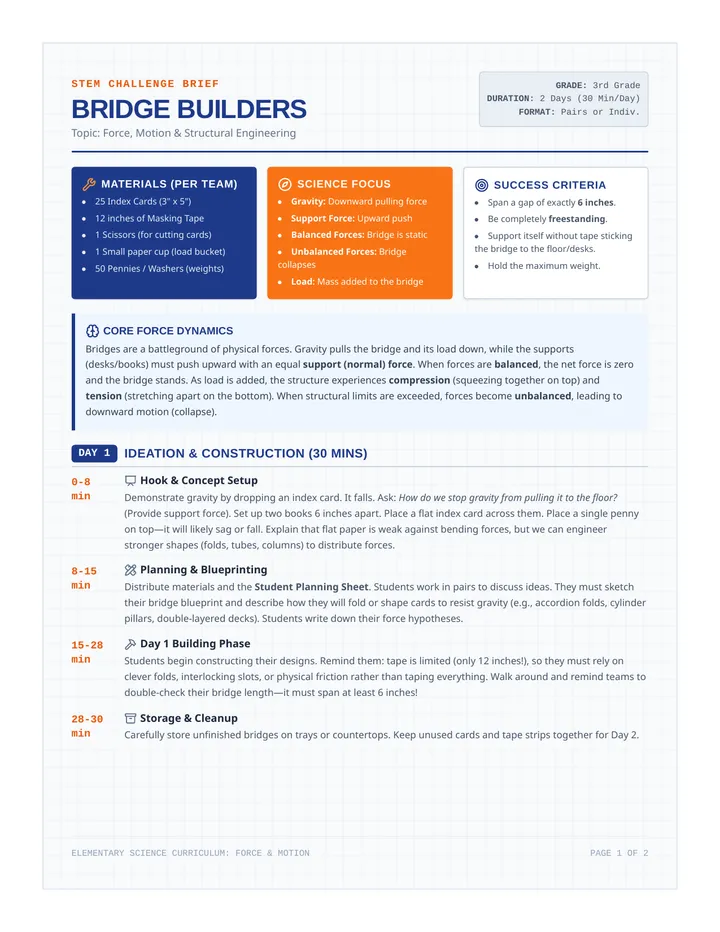
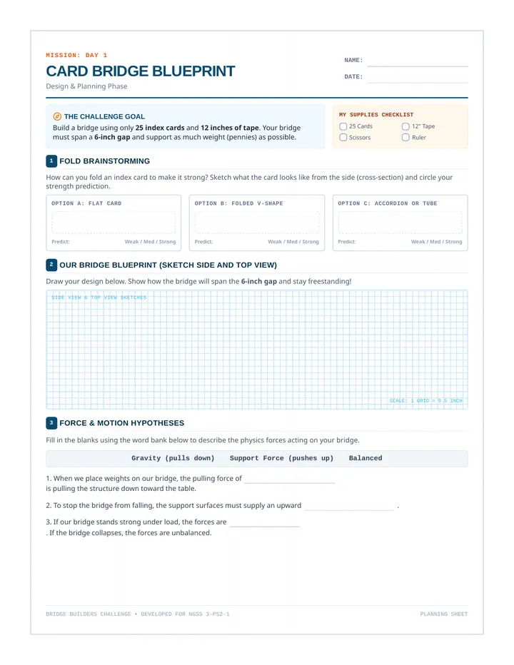
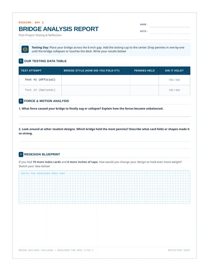
A 2-day hands-on STEM engineering challenge where 3rd-grade students design, build, and test index card bridges to explore balanced and unbalanced forces, gravity, and load-bearing structures.
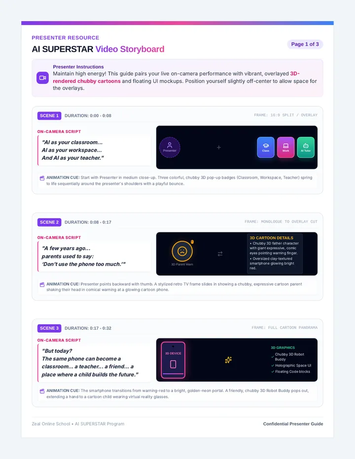
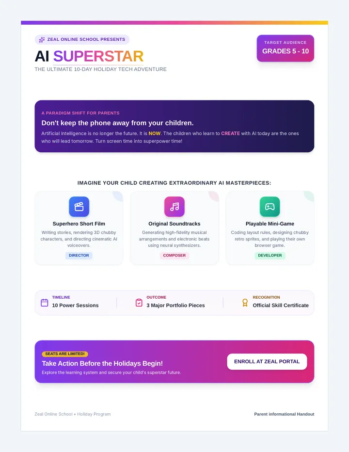
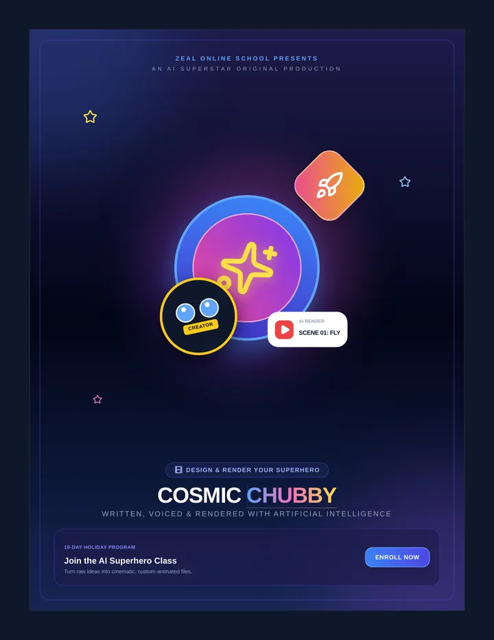
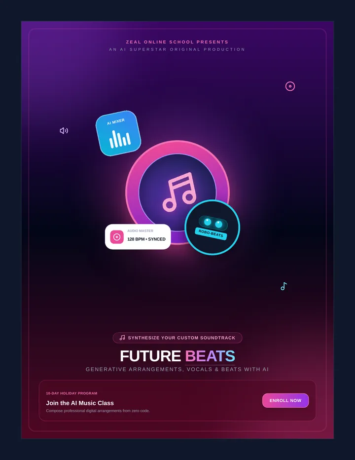
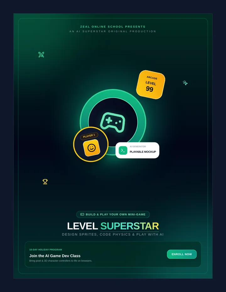
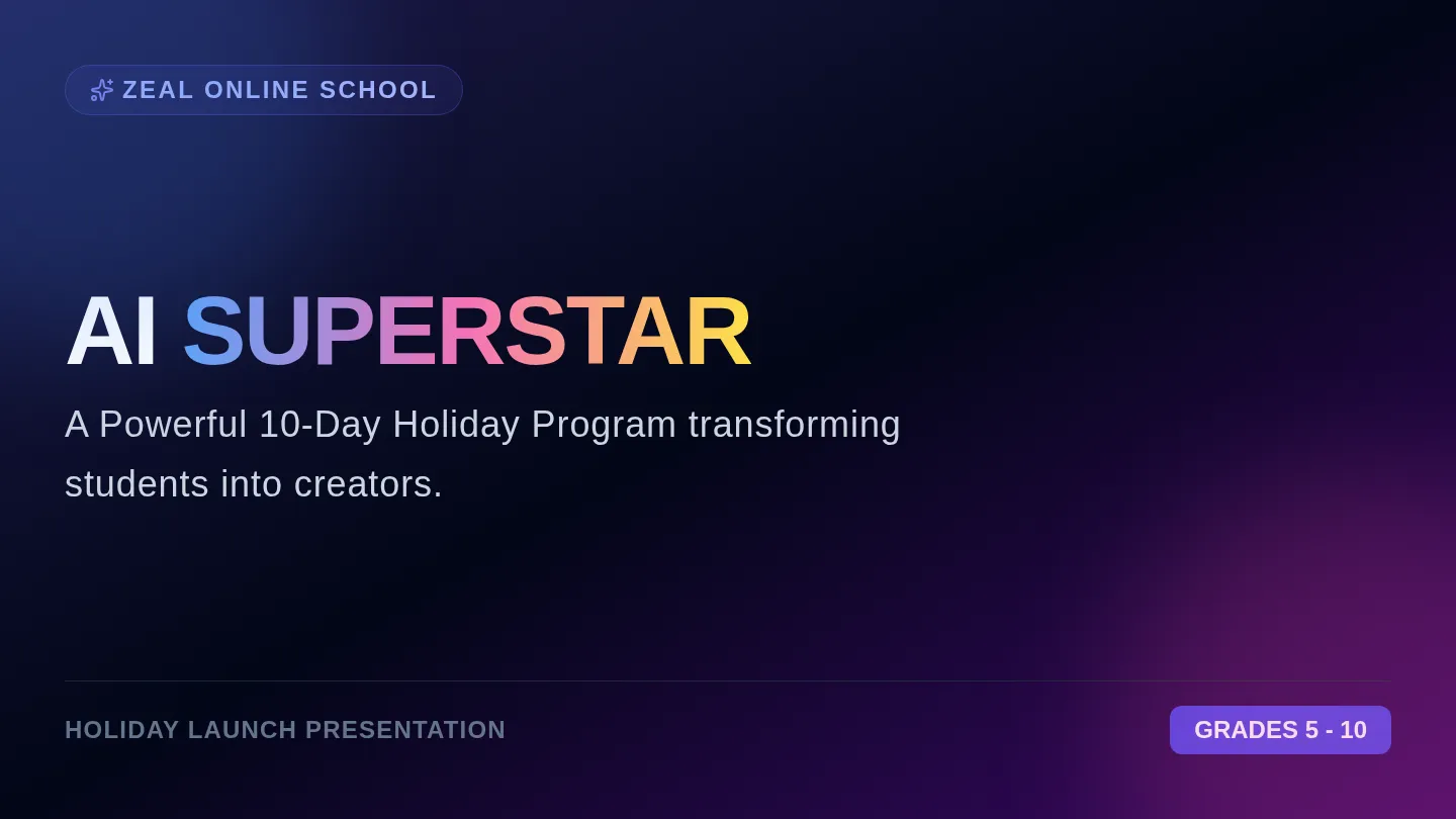
A promotional and planning resource bundle for Zeal Online School's 'AI Superstar' program. Includes a highly descriptive scene-by-scene video storyboard guide for the presenter and a vibrant promotional flyer and informational packet for parents.
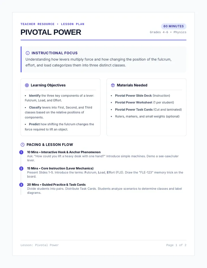
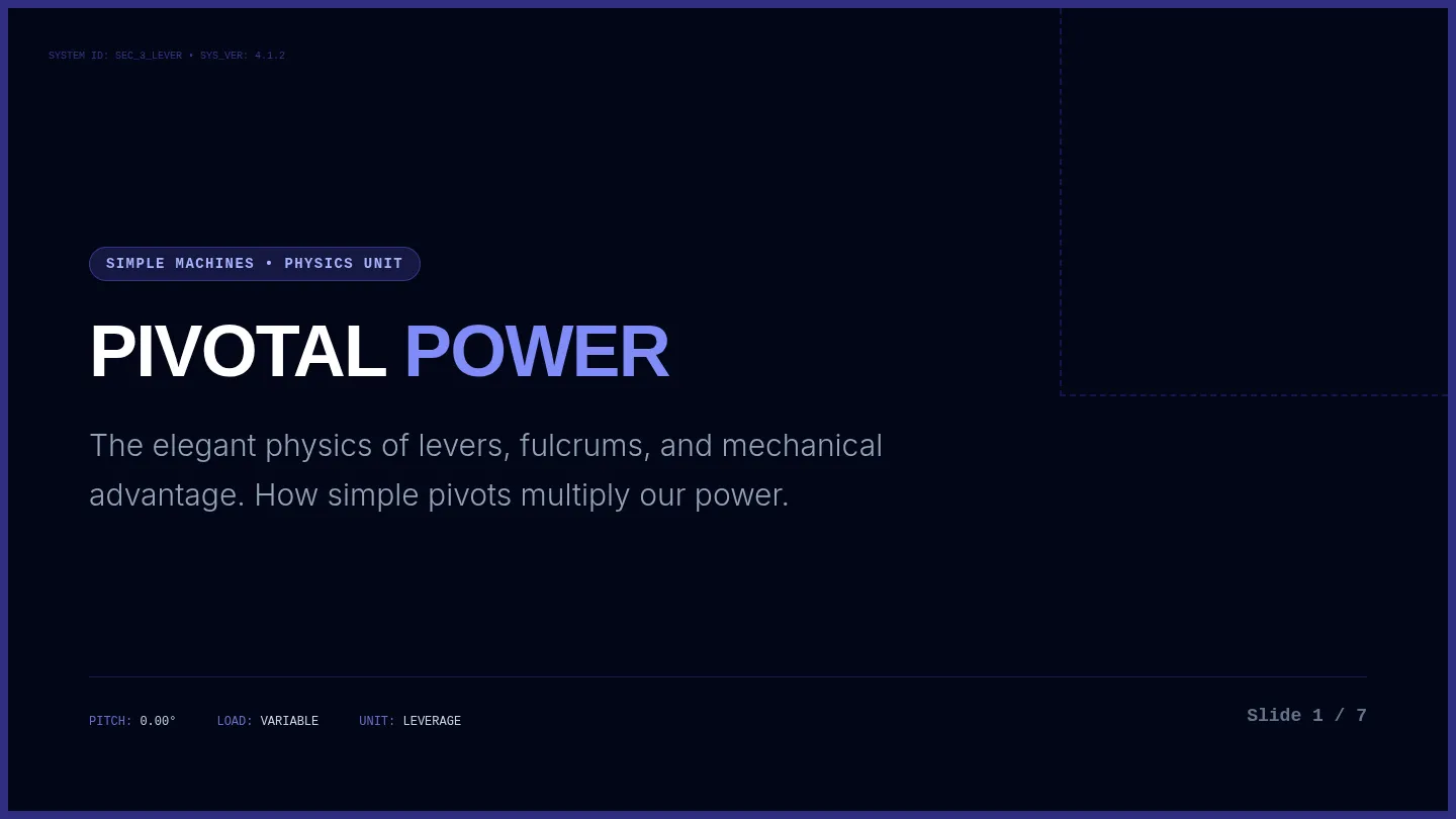
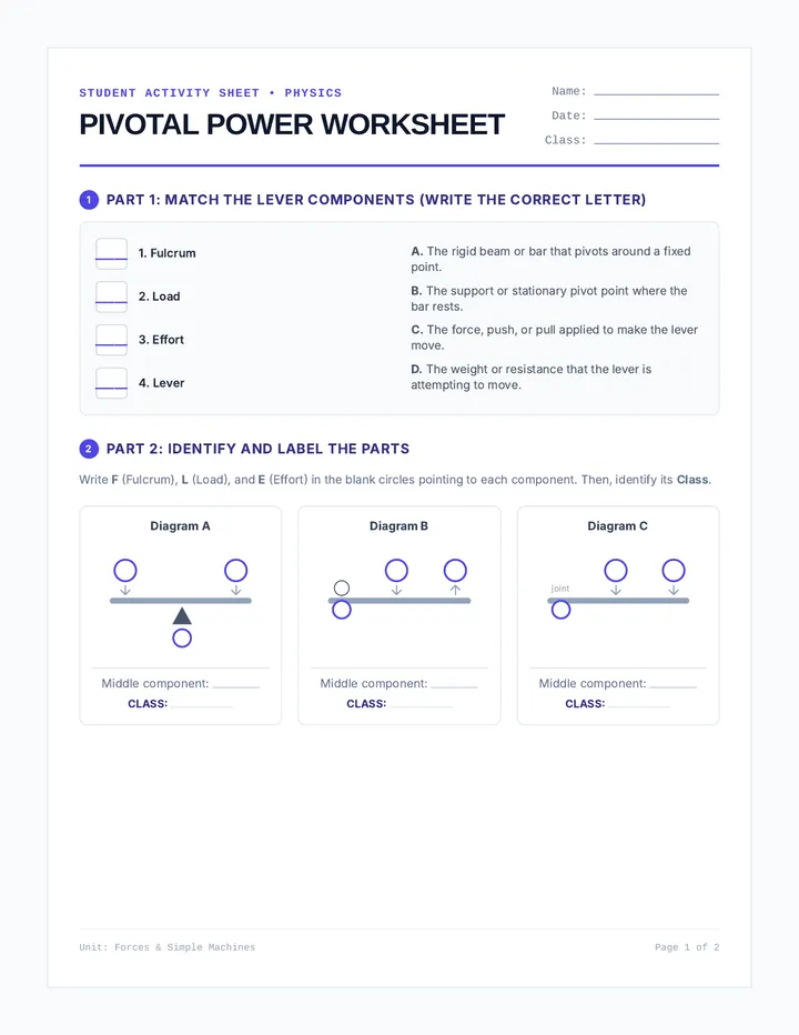
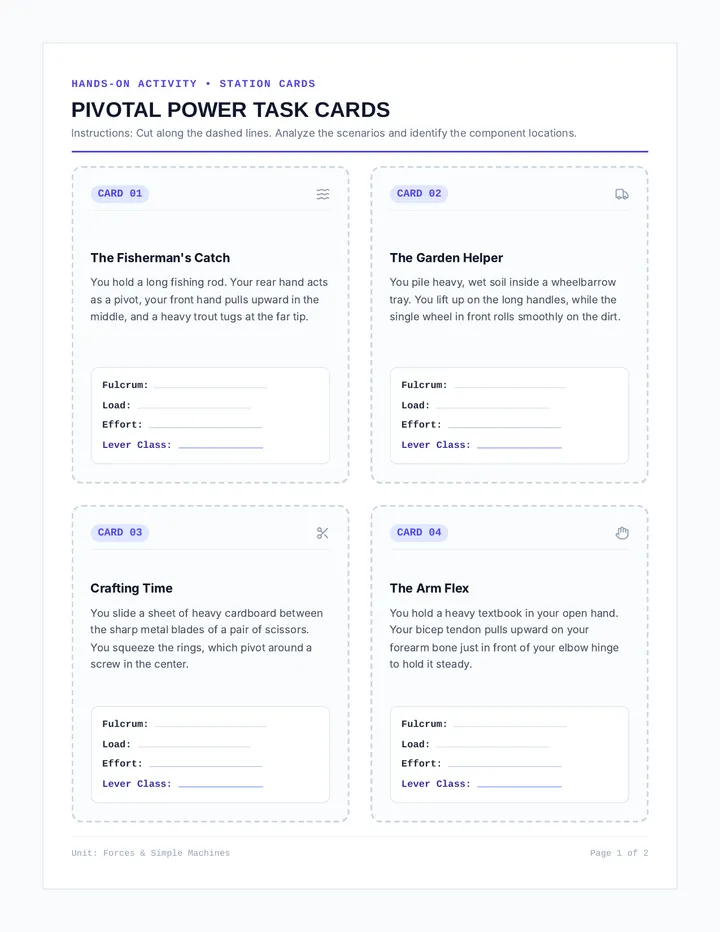
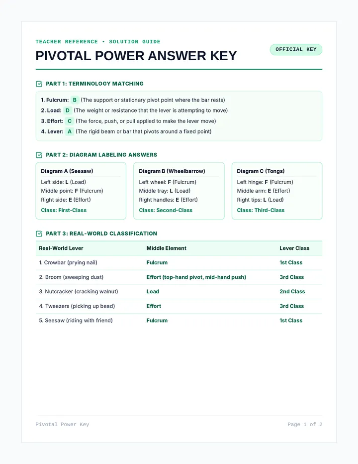
A dynamic science lesson on simple machines focusing on levers and fulcrums. Students explore the three classes of levers through hands-on scenarios, visual models, and interactive challenges.
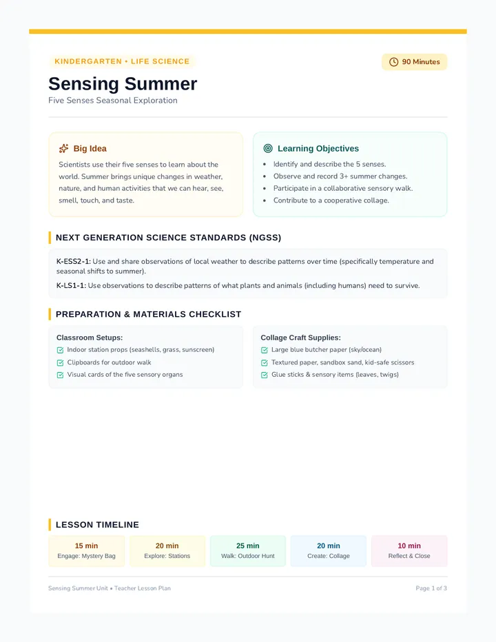
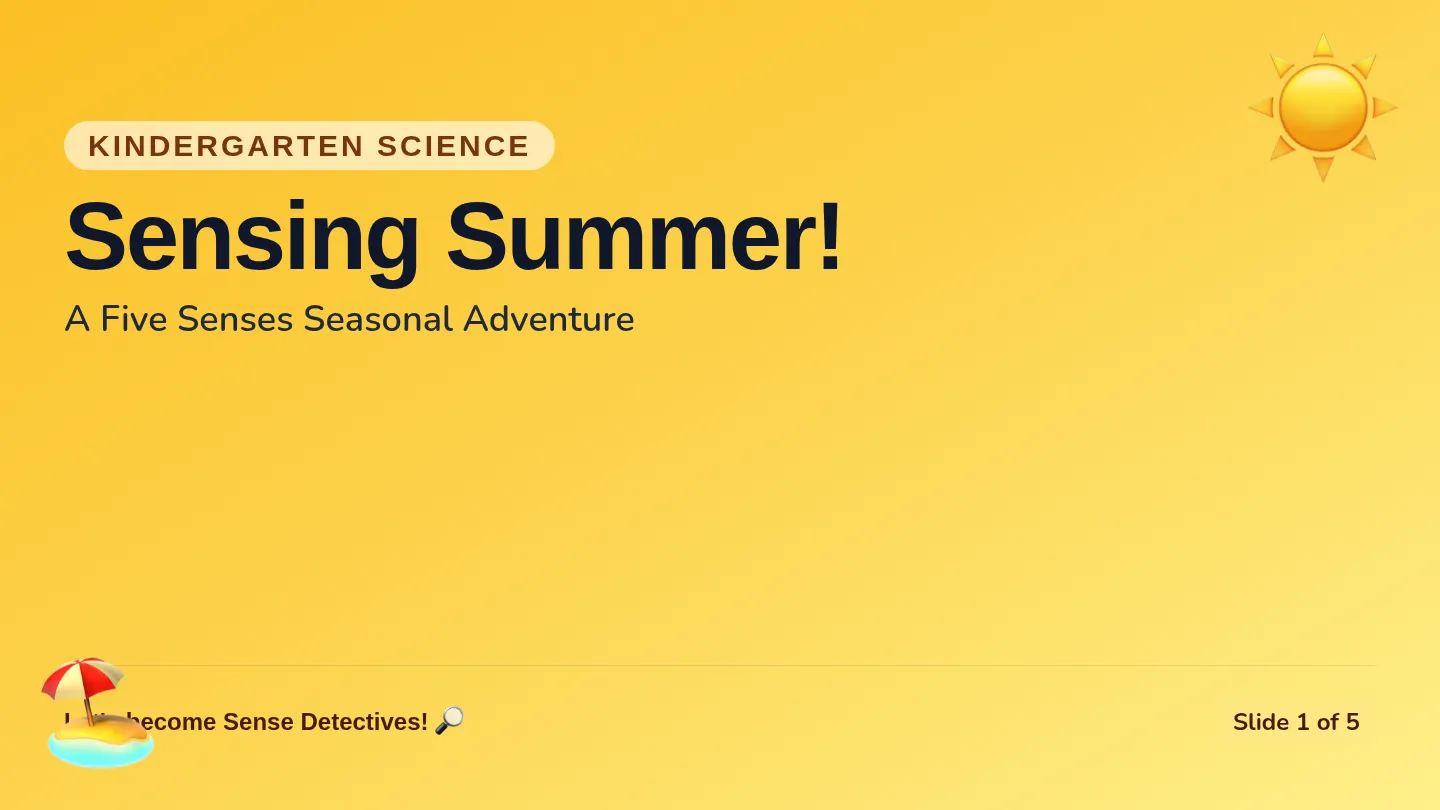
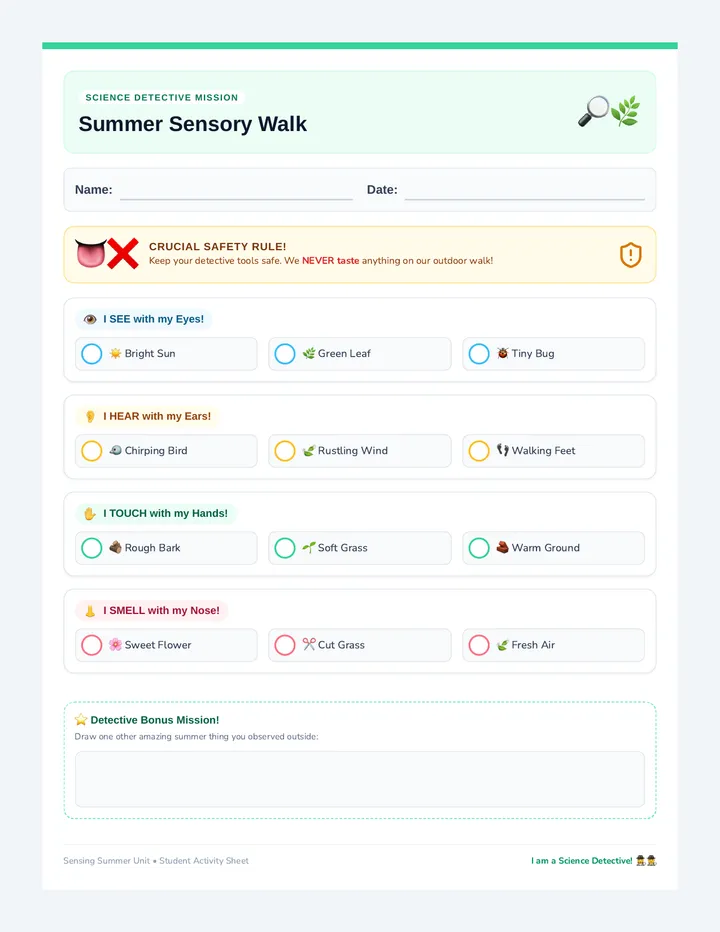
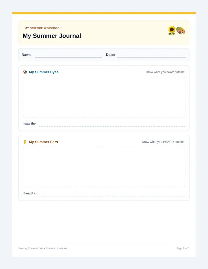
An interactive sensory science lesson where kindergarteners explore the seasonal changes of summer using their five senses through classroom discovery, an outdoor sensory walk, and journal reflections.
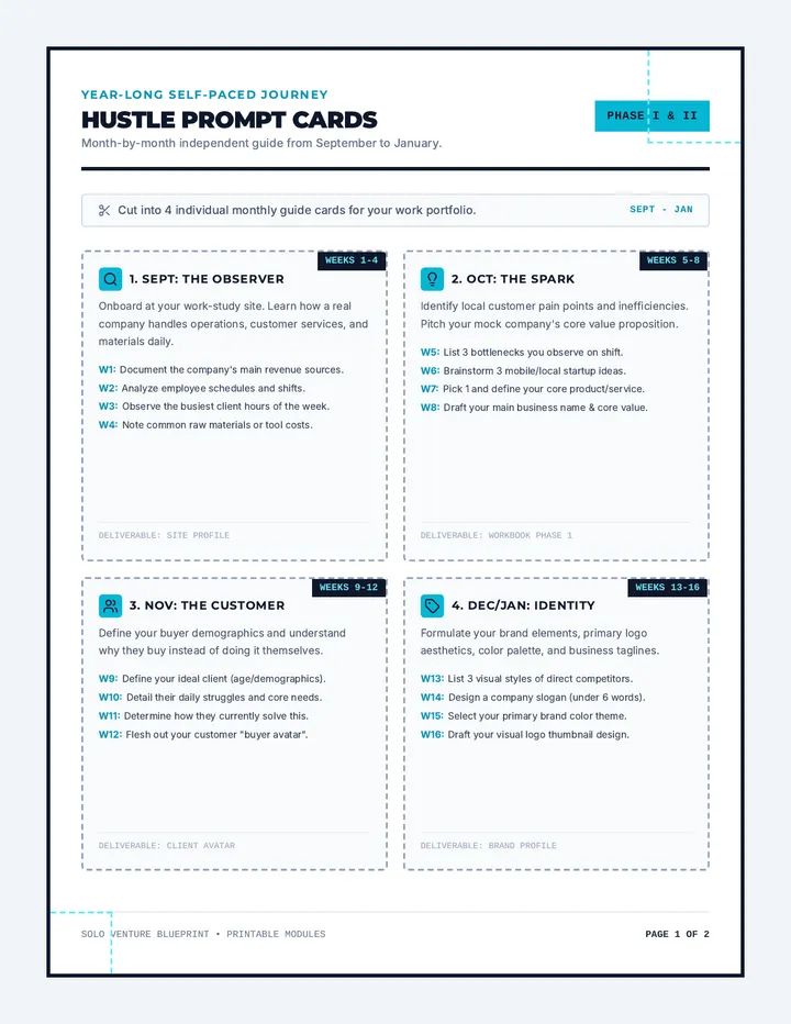
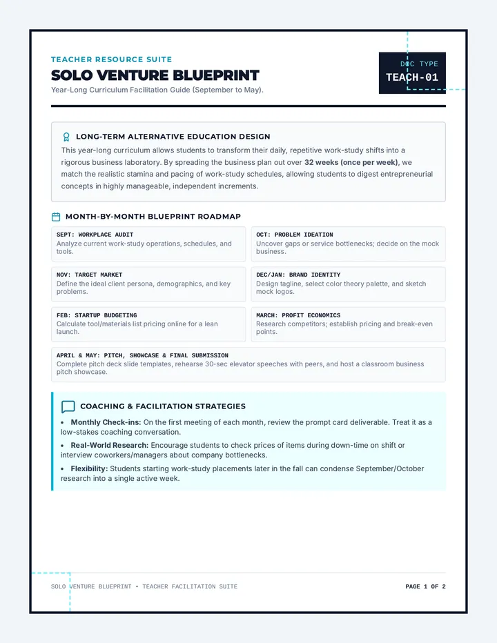
A modular, self-paced entrepreneurship project designed for alternative education students in work-study programs. It bridges real-world work experience with business planning, allowing students to design and pitch their own mock business.
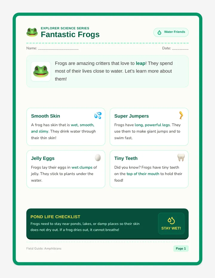
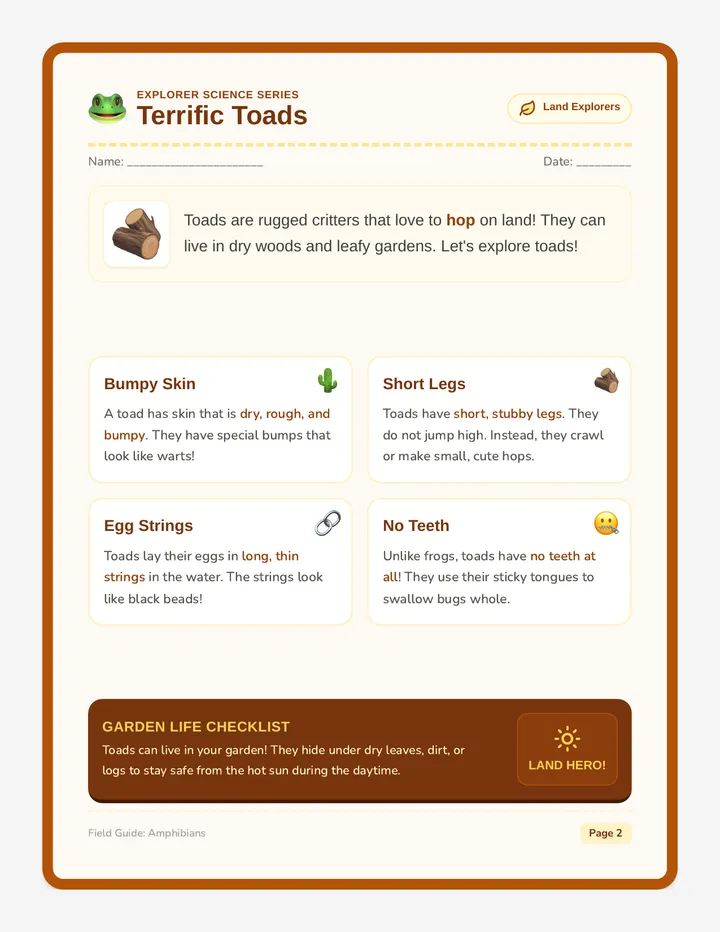
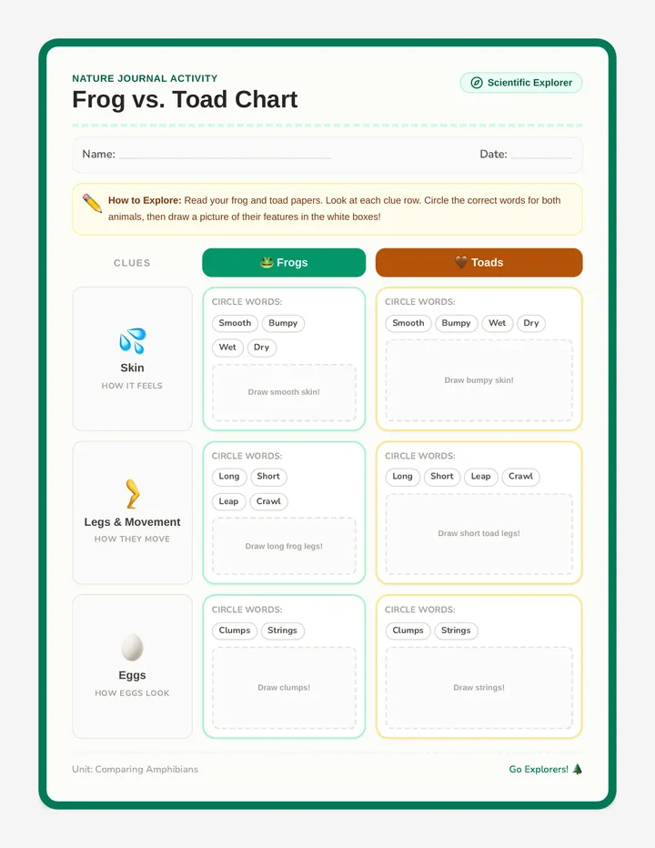
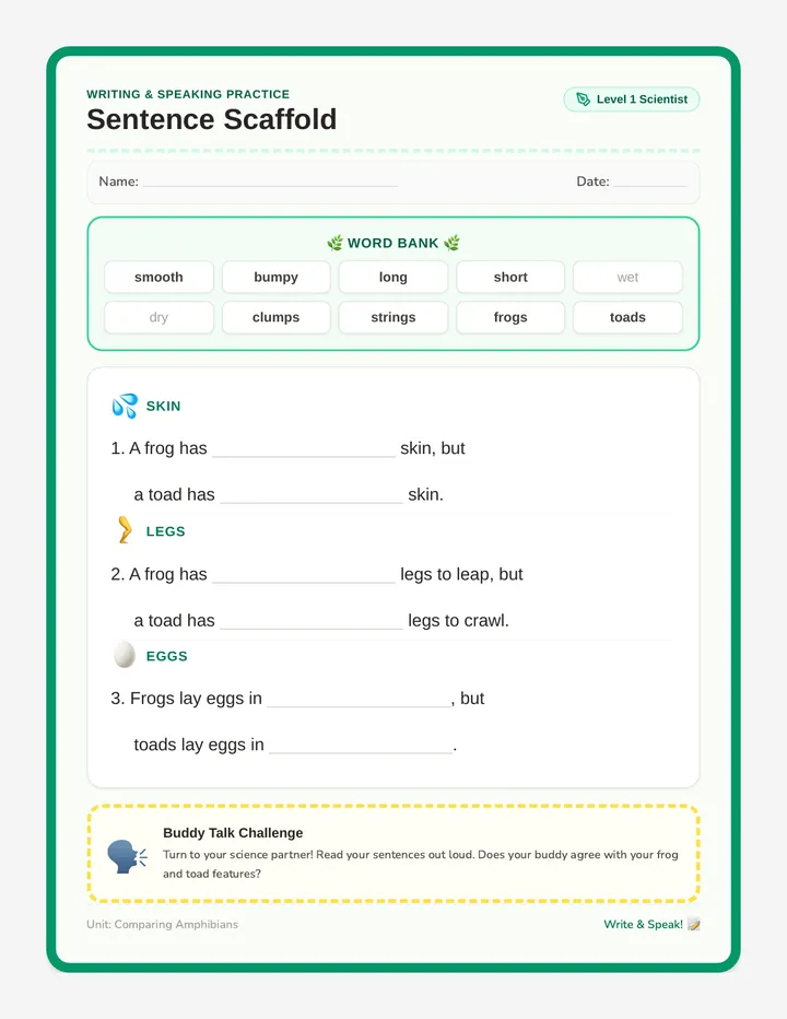
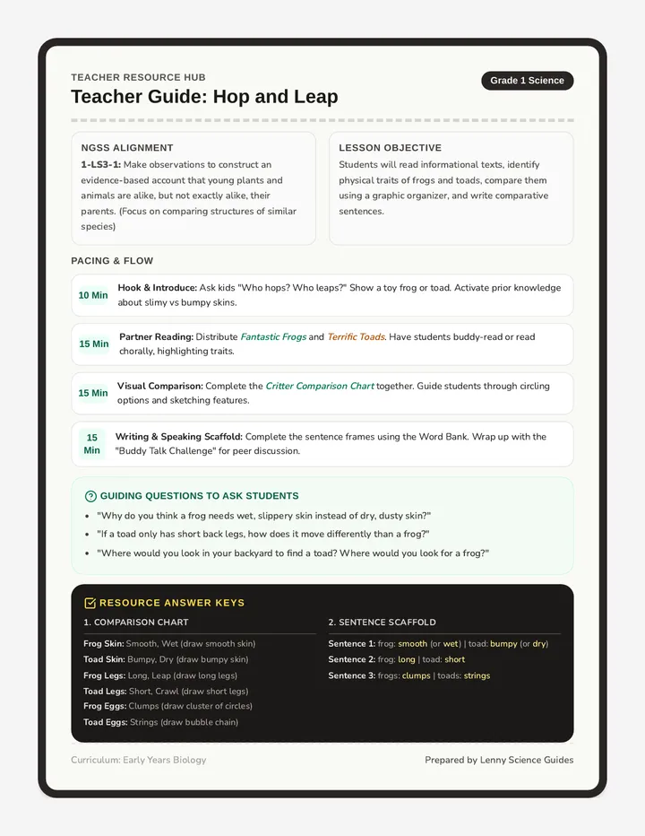
A first-grade science lesson comparing the observable physical and behavioral features of frogs and toads. Includes dual illustrated reading passages, a picture-supported graphic organizer, a sentence-frame writing scaffold, and a teacher facilitation guide.
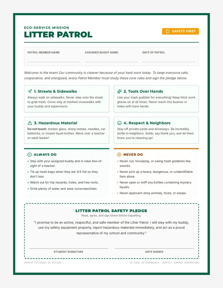
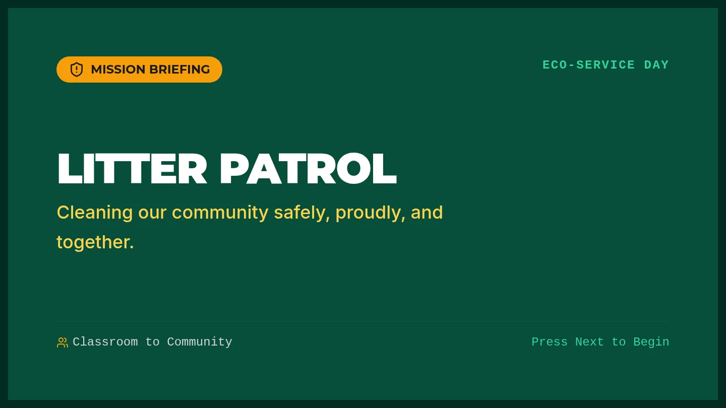
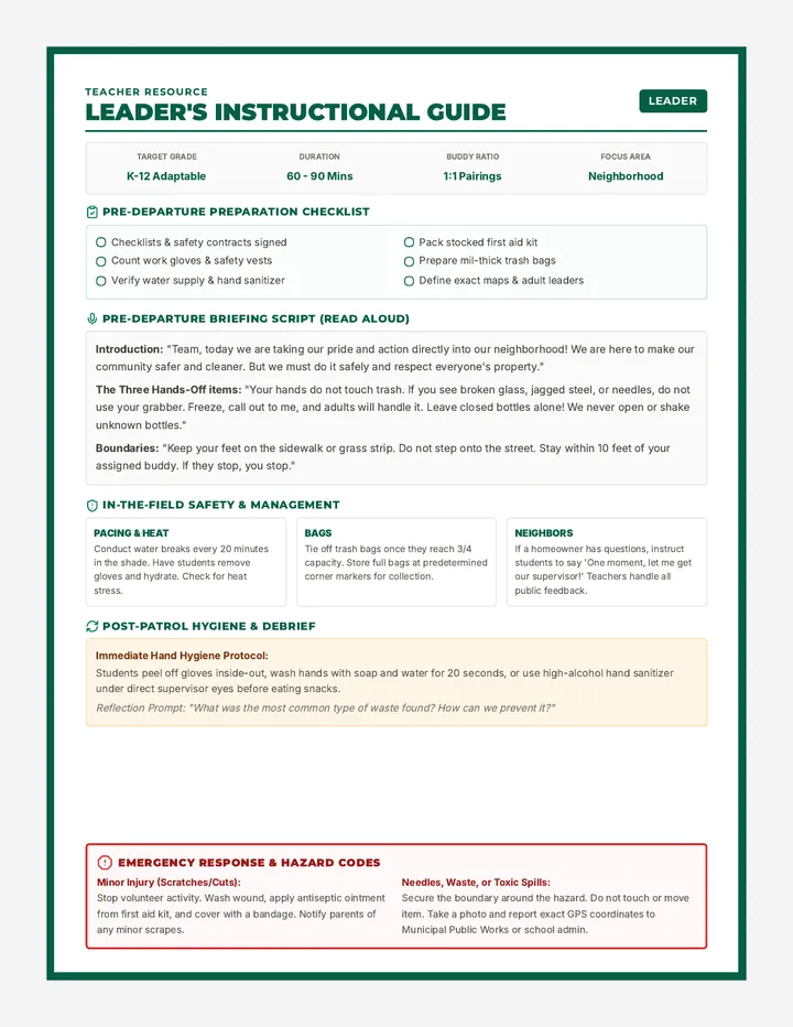
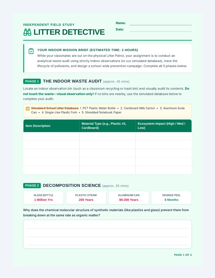
A comprehensive safety and preparation kit for students and teachers participating in a neighborhood trash pick-up community service project. It includes safety slides, a student contract and checklist, and a detailed teacher instruction guide.
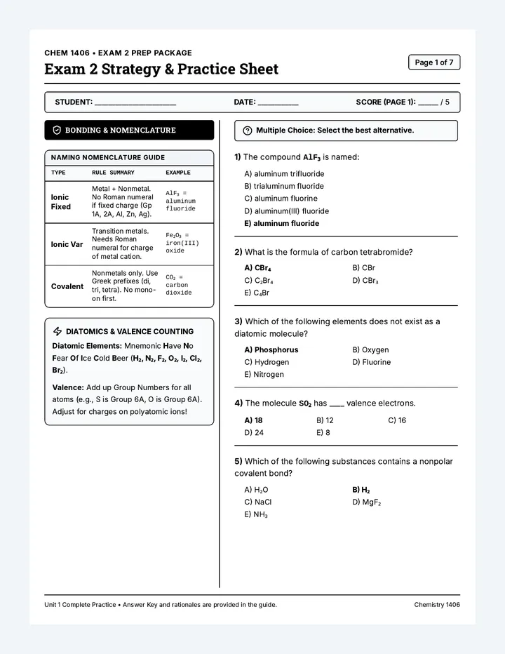
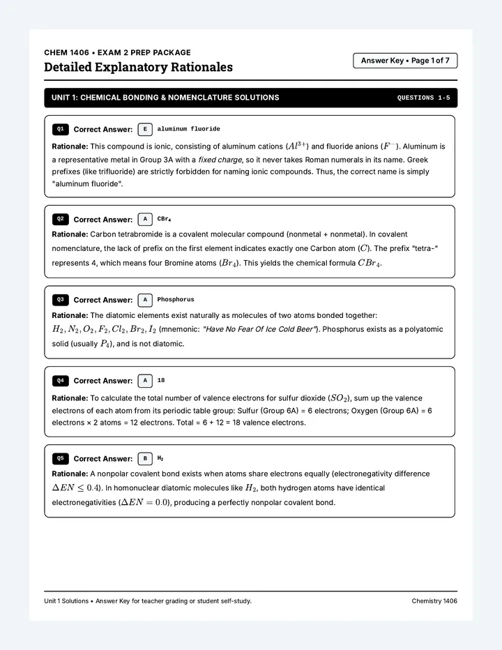
A comprehensive study and practice package for Chemistry 1406 Exam 2. It contains a highly structured, side-by-side strategy guide paired with a 30-question practice exam, and a matching detailed answer key with step-by-step rationales.
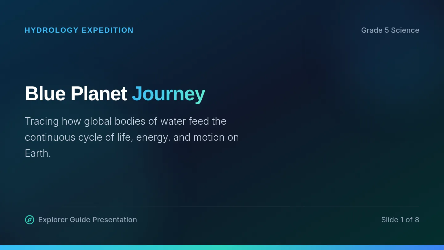
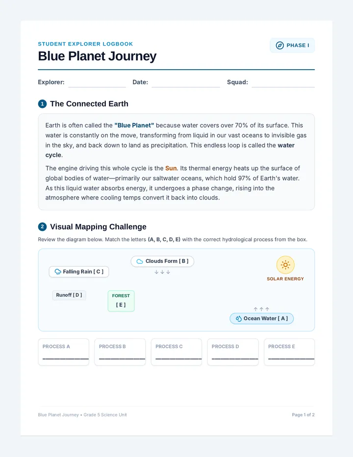
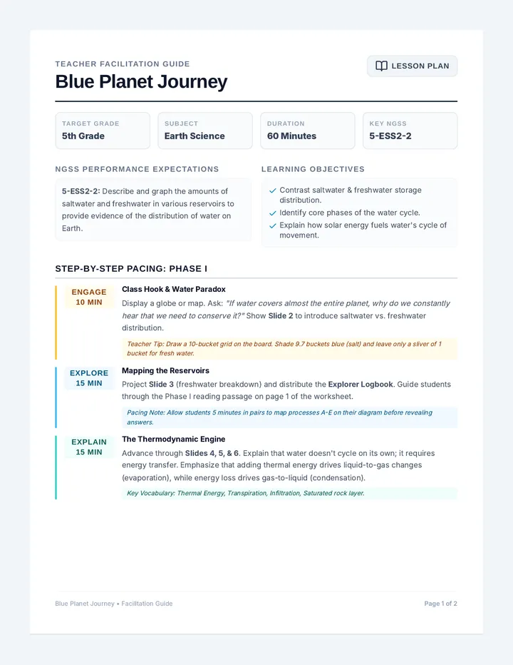
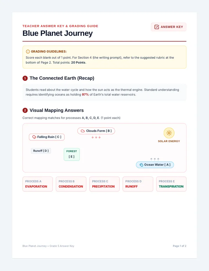
An immersive 5th-grade exploration of Earth's water systems, connecting global bodies of water directly to the continuous cycle of evaporation, condensation, precipitation, and runoff. Students trace how thermal energy drives these transitions across saltwater and freshwater reservoirs.
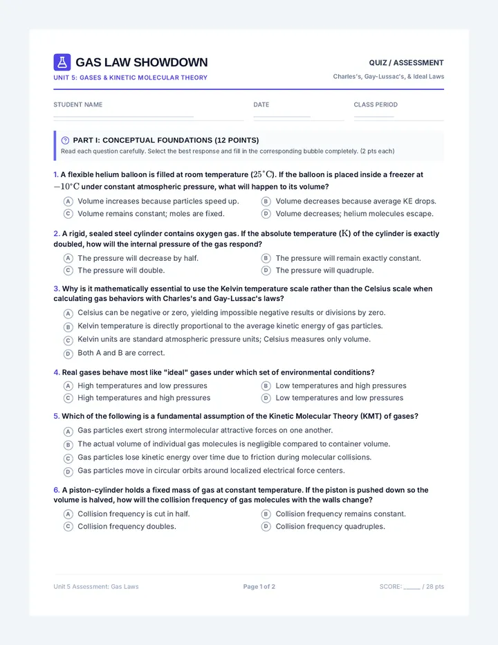
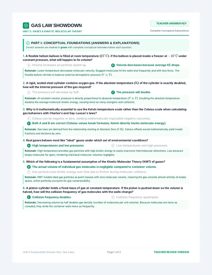
A rigorous assessment lesson covering Charles's Law, Gay-Lussac's Law, and the Ideal Gas Law. Students demonstrate understanding through conceptual multiple-choice questions and solve multi-step algebraic calculations with gas behavior formulas.
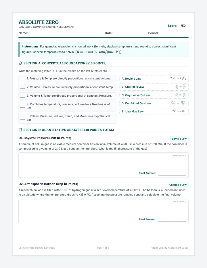
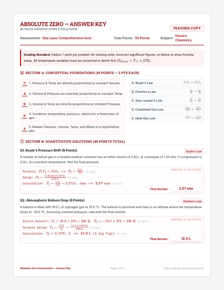
A comprehensive assessment lesson on the behavior of gases. Students demonstrate their understanding of Boyle's, Charles's, Gay-Lussac's, Combined, and Ideal gas laws through theoretical and quantitative problem-solving.
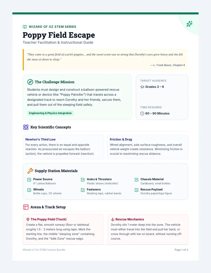
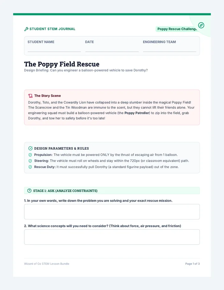
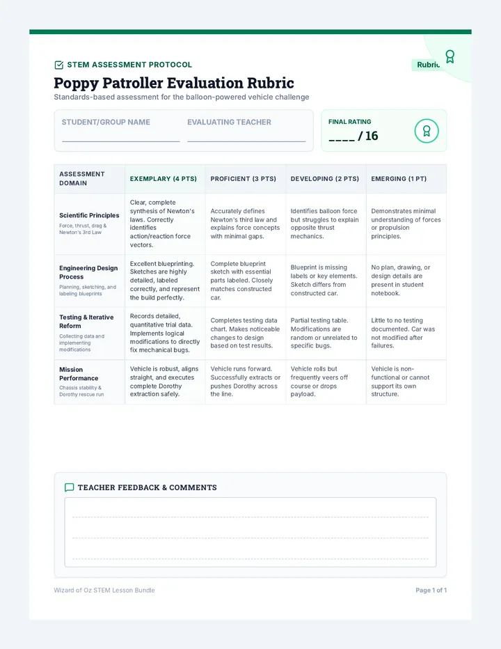
A hands-on STEM challenge based on The Wizard of Oz where students design and build a balloon-powered rescue vehicle to save Dorothy and her friends from the sleeping effects of the Poppy Field. This lesson guides students through the complete engineering design process, combining physical science concepts with literary connections.
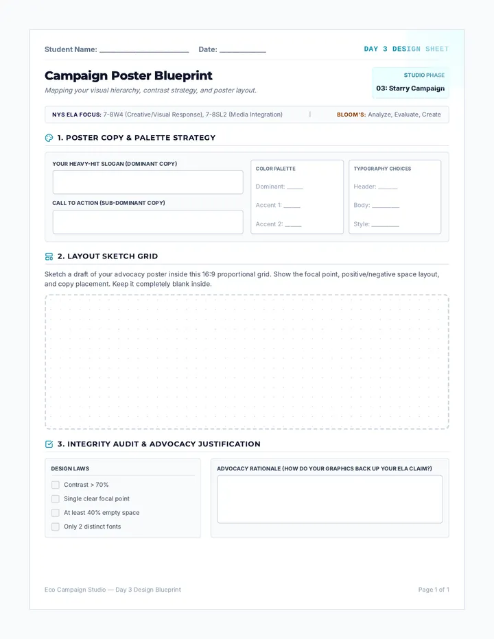
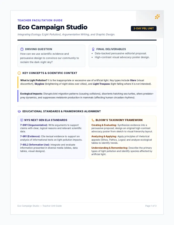
Students explore principles of visual design, contrast, and visual hierarchy to design and sketch an advocacy poster that supports their persuasive argument.
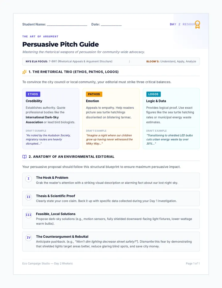
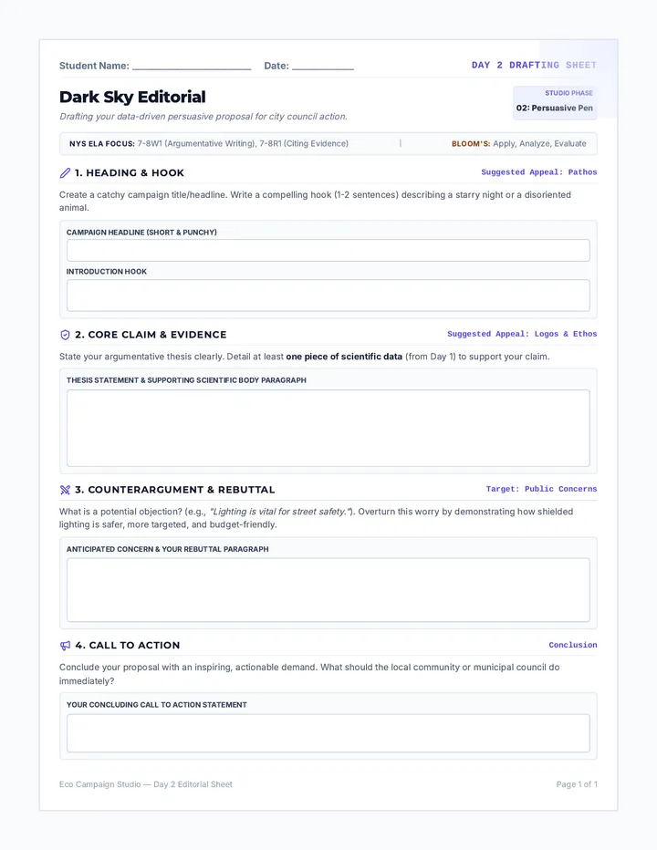
Students translate their scientific evidence into a structured, persuasive editorial or proposal, mastering rhetorical appeals and learning to counter opposing viewpoints.
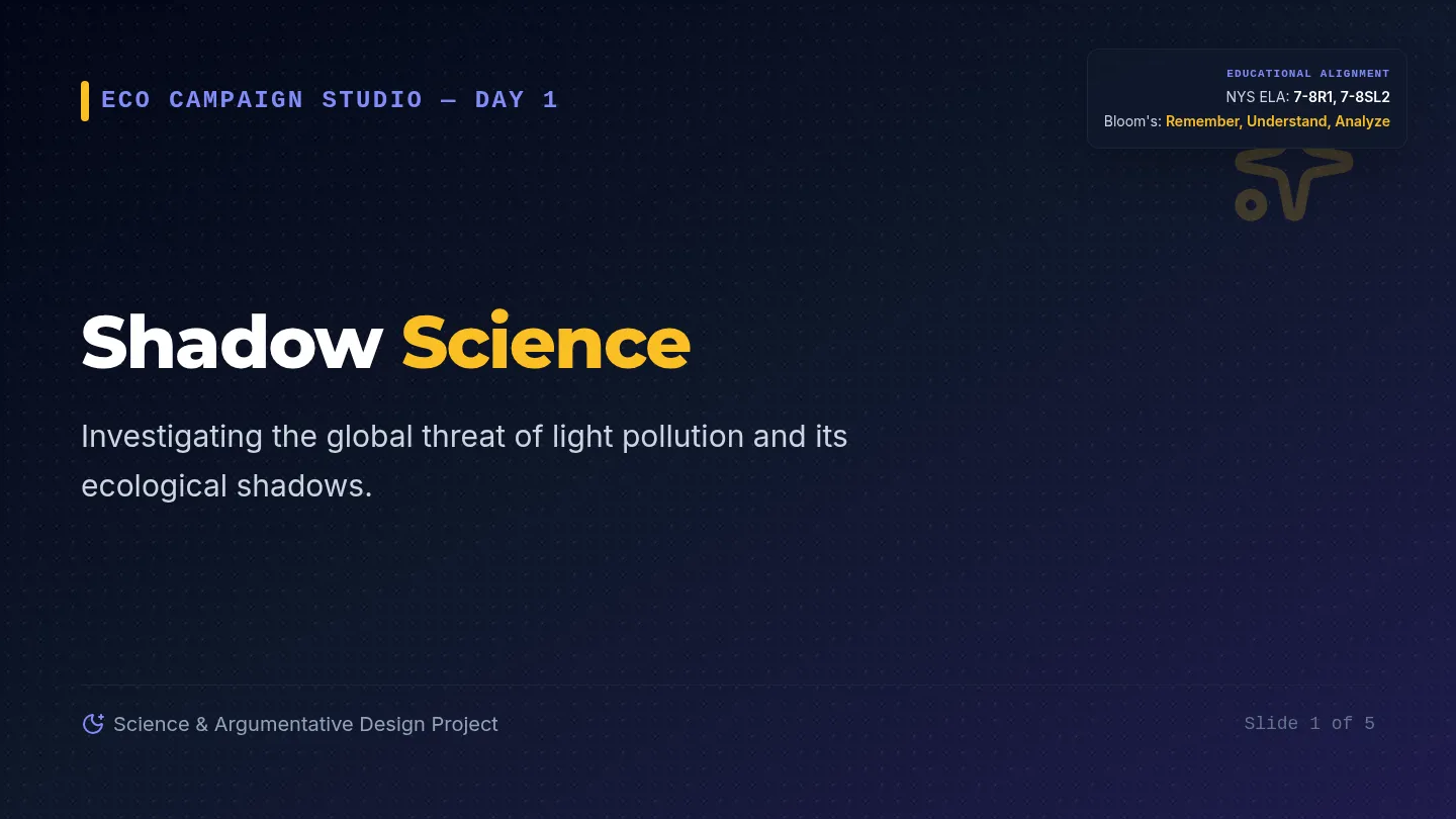
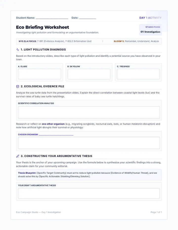
Students investigate the science of light pollution, explore its ecological effects on wildlife and human health, and analyze real-world data to formulate their core argumentative thesis.
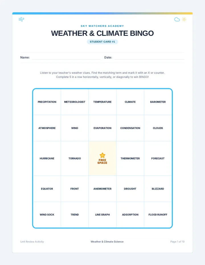
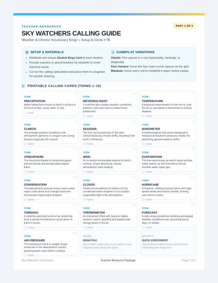
A weather and climate science unit featuring a complete class set of ready-to-print Bingo cards and a comprehensive teacher calling and tracking guide.
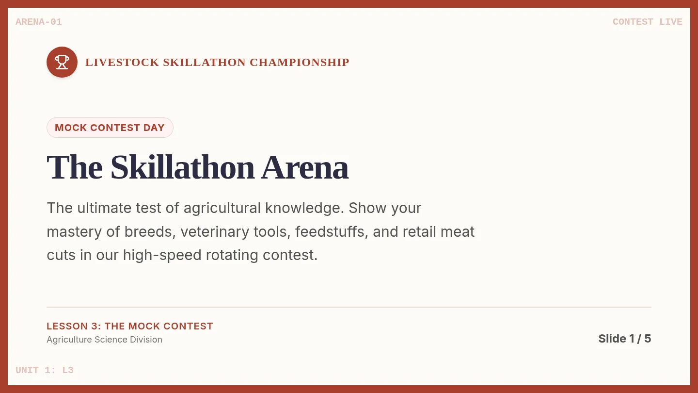
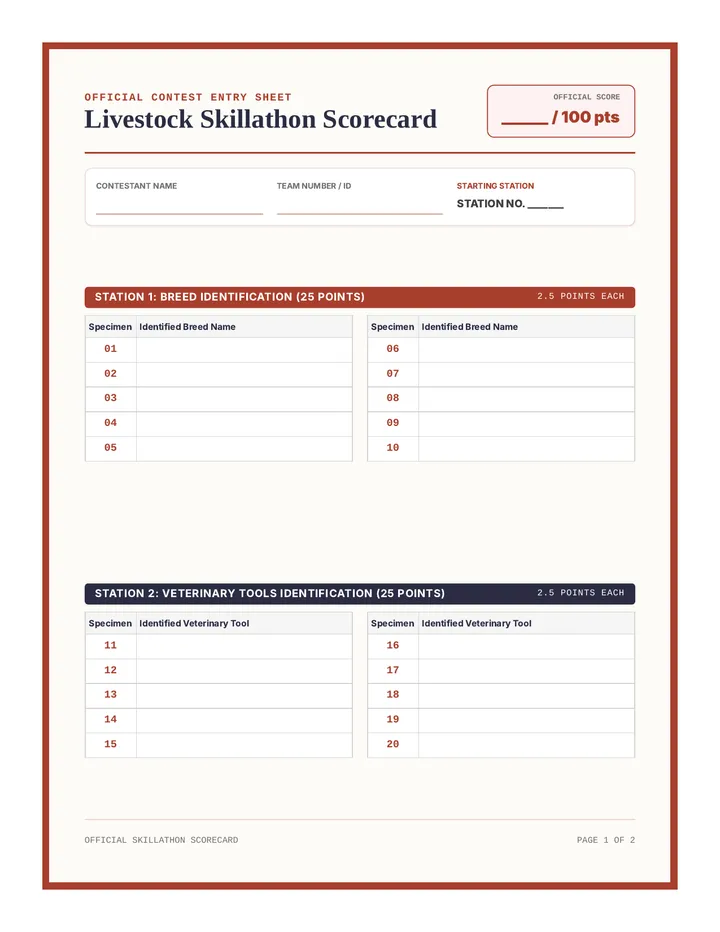
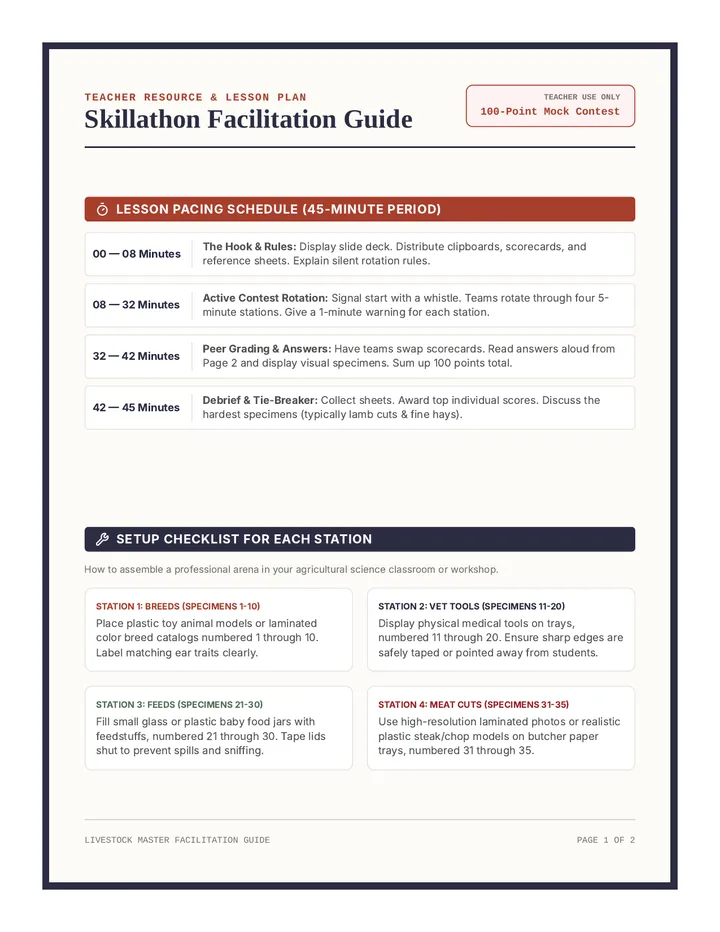
Students participate in a high-stakes, realistic mock Livestock Skillathon, rotating through four hands-on stations to test their knowledge and earn points.