Students overlay current population density maps with the location of state capitals to analyze accessibility and representation. They will calculate the distance from major population centers to the seat of government.
An AP U.S. History film study lesson on 'Free State of Jones' exploring Civil War dissent, Reconstruction failures (Period 5), and their long-term legacy in 20th-century Jim Crow courts (Period 8).
A comprehensive AP U.S. History study of the internal conflicts of the Confederacy, the legal boundaries of Reconstruction, and the long struggle for civil rights in Mississippi, structured around the historical events depicted in the film Free State of Jones.
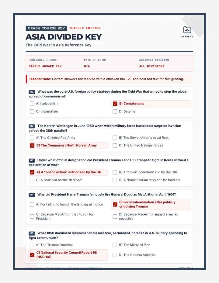
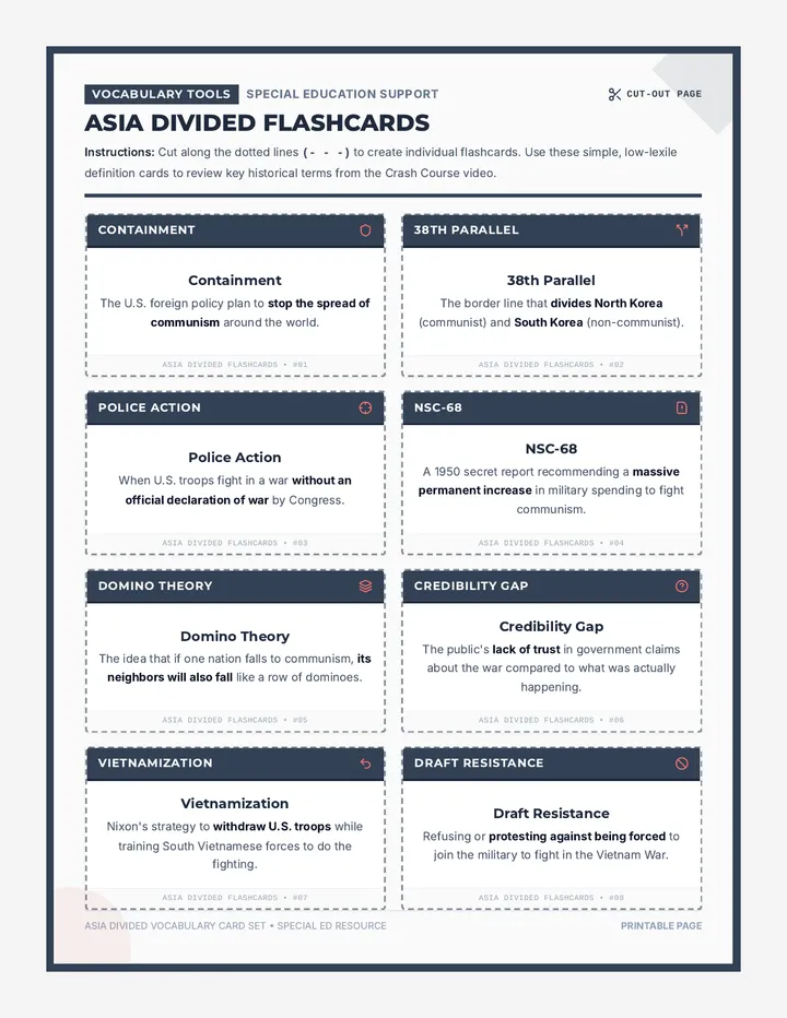
A deep-dive lesson exploring the Cold War in Asia (focusing on the Korean and Vietnam Wars) using Crash Course US History #38. This lesson includes a 15-question comprehension worksheet, a complete teacher answer key, and specialized low-lexile definition flashcards for special education.
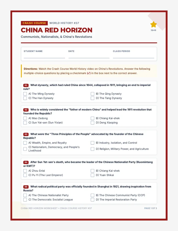
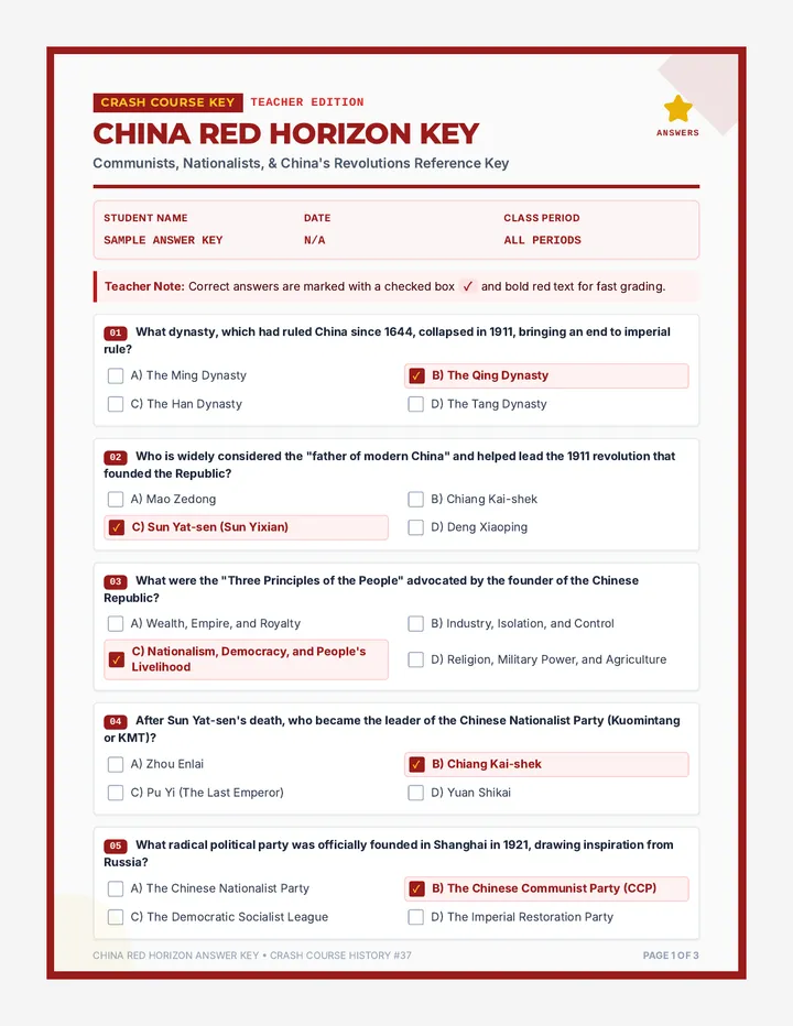
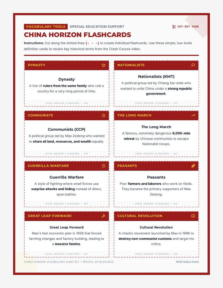
A deep-dive lesson exploring the Chinese revolutions of the 20th century using Crash Course World History #37. Includes a 15-question comprehension worksheet, a complete teacher answer key, and specialized low-lexile definition flashcards for special education.
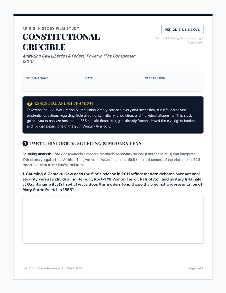
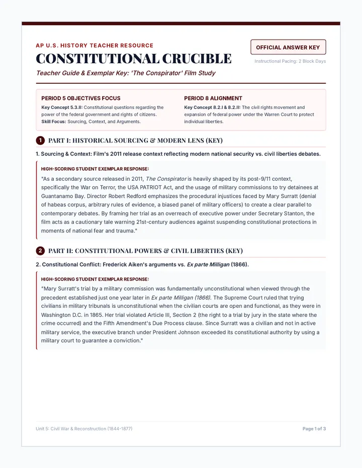
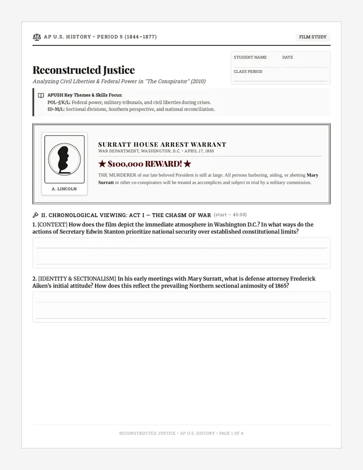
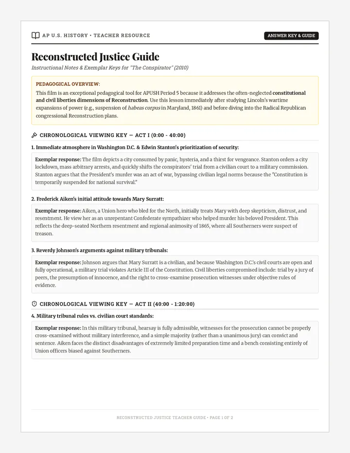
An AP U.S. History film study and constitutional analysis of 'The Conspirator'. Students explore Period 5 legal precedents, executive authority, and civil liberties, while tracing long-term continuities in civil rights into the 20th century.
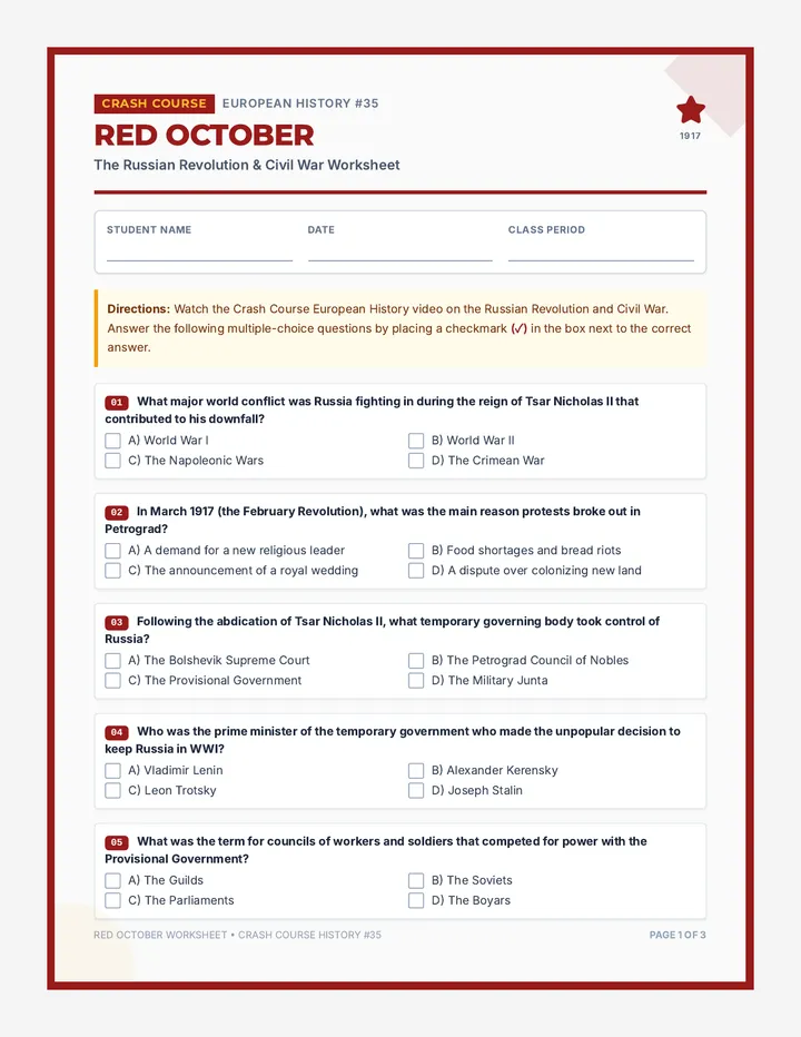
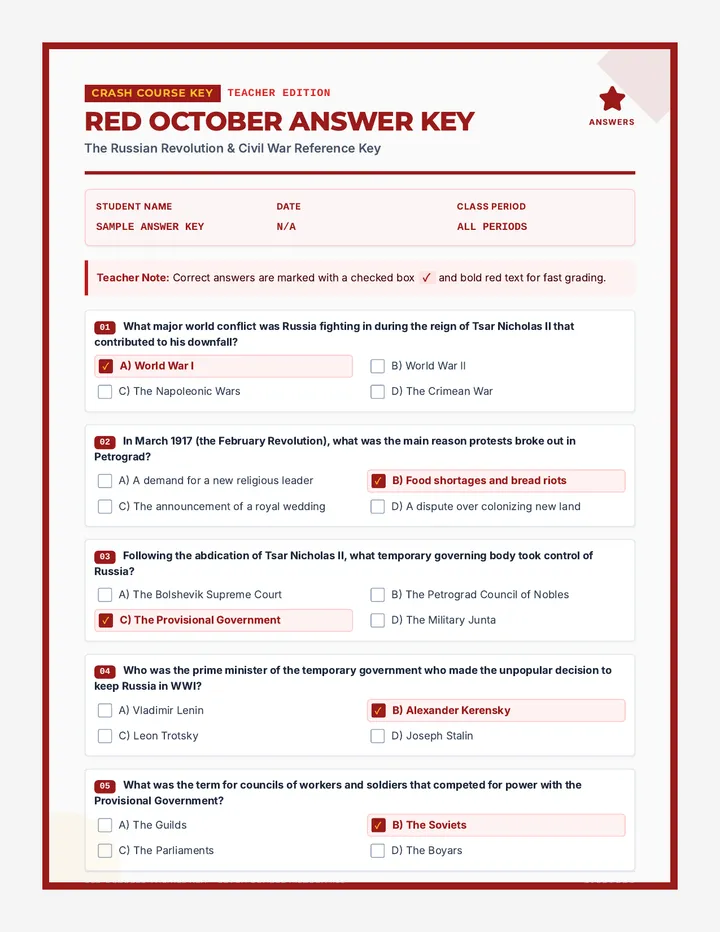
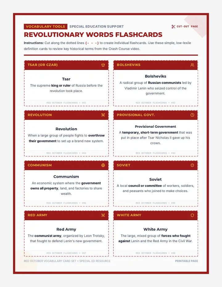
A comprehensive lesson focused on the Russian Revolution and Civil War, utilizing Crash Course European History #35. This lesson includes a 15-question comprehension worksheet, a complete teacher answer key, and specialized low-lexile definition flashcards for special education support.
A highly targeted lesson analyzing the film 'The Conspirator' (2010) through the lens of AP U.S. History Period 5 objectives. It explores the constitutional crises, civil liberties, and regional animosities surrounding the trial of the Lincoln assassination co-conspirators in 1865.
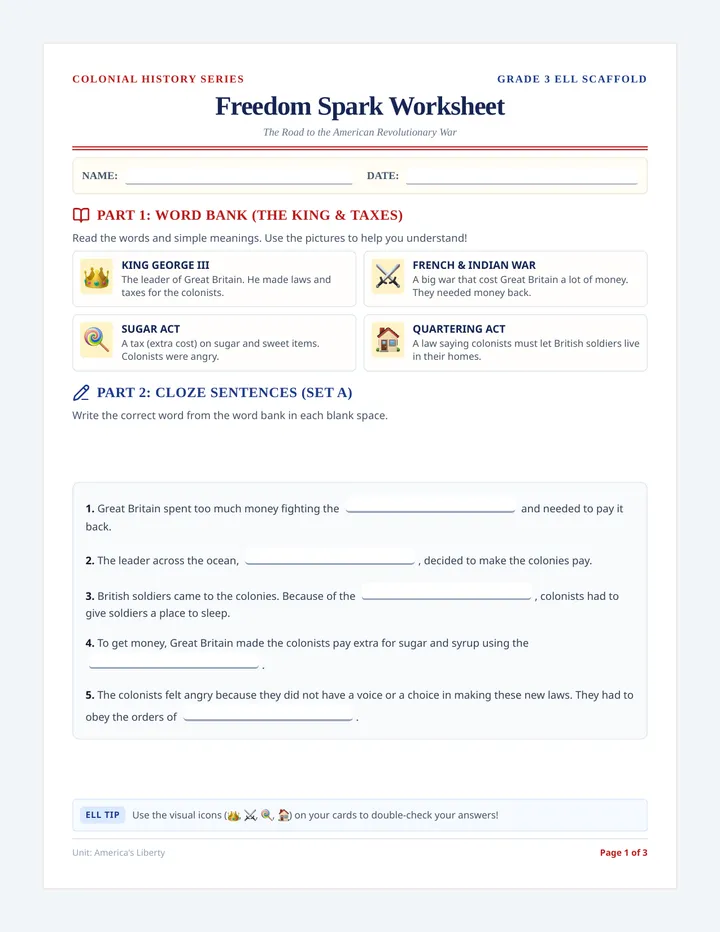
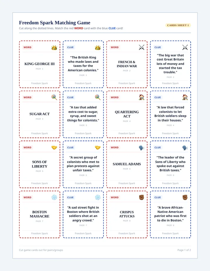
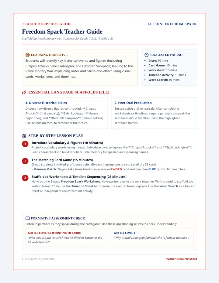
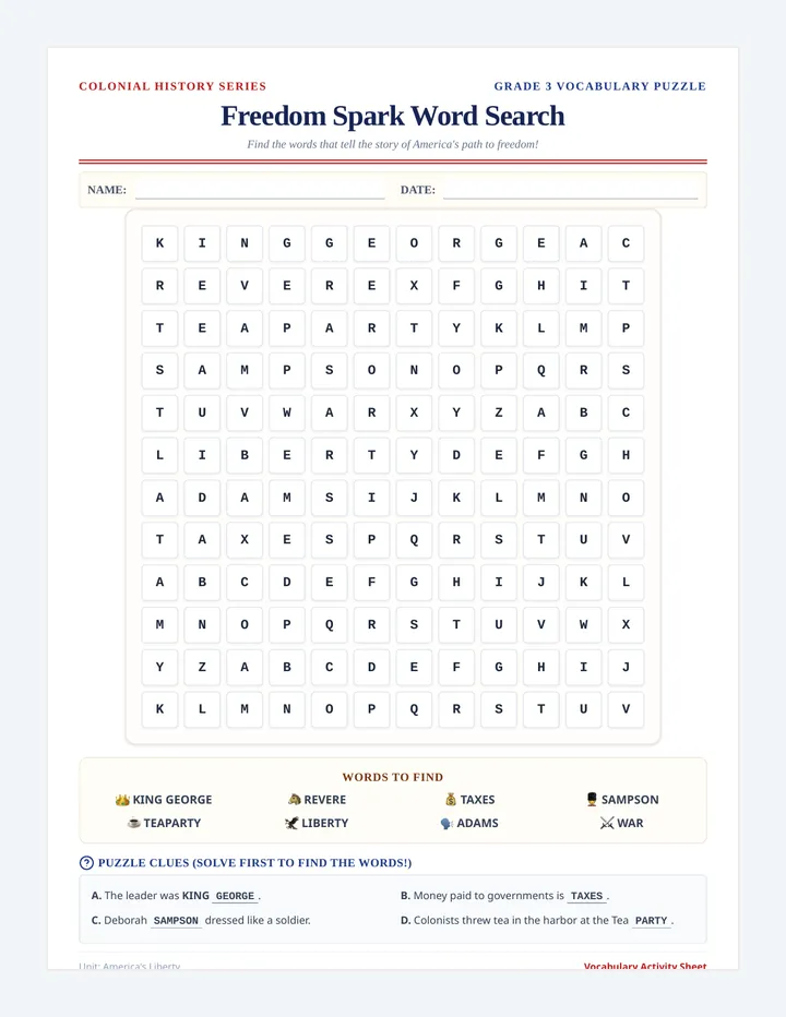
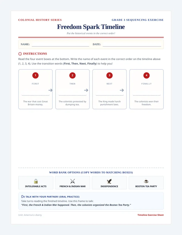
An introductory history lesson on the key events leading to the American Revolutionary War, designed specifically for third-grade English Language Learners (ELL). It includes a visual vocabulary cloze worksheet, interactive matching cards for learning events, and a comprehensive facilitation guide for teachers.
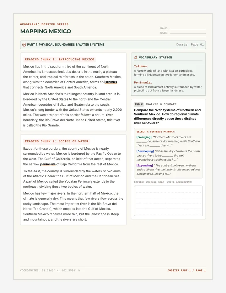
A comprehensive lesson exploring Mexico's physical geography, diverse climates, and distinct economic regions. Students engage in structured side-by-side reading, vocabulary analysis, and DOK2/DOK3 text-dependent analysis.
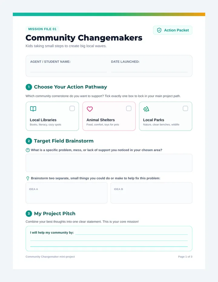
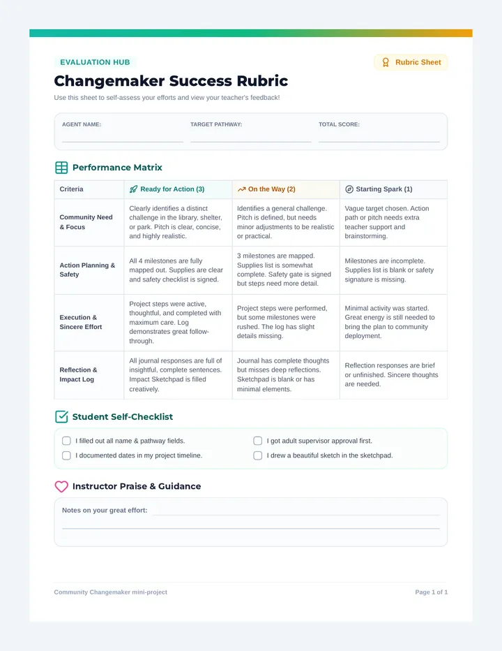
A mini-project curriculum designed to empower young students to become local community changemakers. It guides them through brainstorming, planning, and executing simple, impactful action projects for local libraries, animal shelters, or parks.
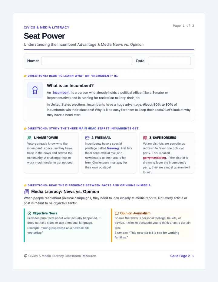
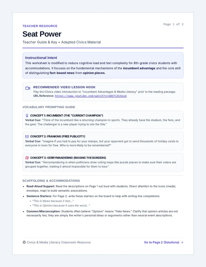
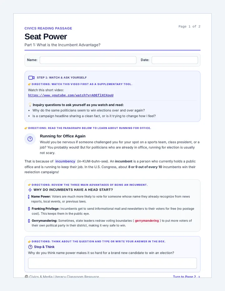
A foundational civics lesson on incumbency, electoral advantages, and media literacy. Students explore why current politicians usually win reelection and learn to distinguish between objective news reports and opinion articles.
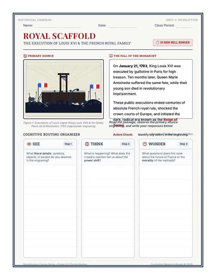
A quick, high-impact bell ringer lesson exploring the execution of King Louis XVI and the French royal family through a primary source engraving and a See-Think-Wonder cognitive routing activity.