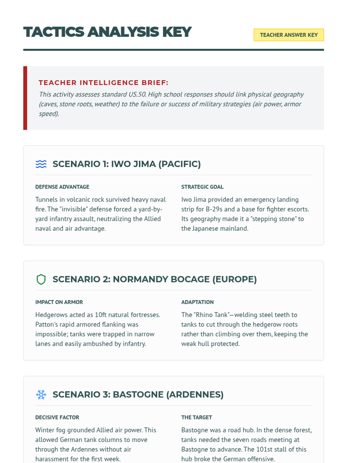
A map analysis activity connecting physical terrain to WWII military outcomes. Revised with schematic tactical map visuals and specific named/dated source labels for each scenario.
A curated two-page index of high-impact historical visuals (photos and landscapes) to accompany the Global Fronts lesson, including archival links, dates, and pedagogical context. Revised to fix page break splitting.
Detailed teacher answer key for the Theater Tactics Map Analysis, providing analytical responses on geography and military factors in WWII. Revised for layout.
Detailed teacher answer key for the Strategic Command Organizer, providing specific historical context and sample synthesis responses aligned with TN US.50. Revised for better page layout.