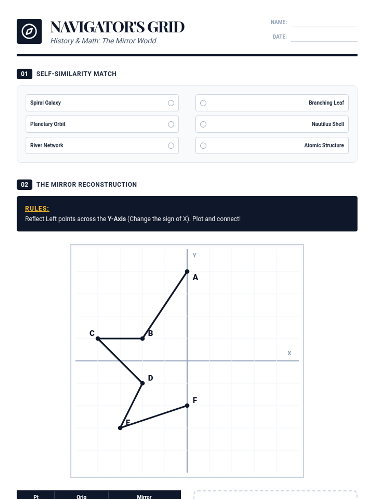
A cross-curricular student worksheet where students identify the domain and range of stylized geographic regions on a coordinate grid, translate real-world latitude and longitude into mathematical notation, and design a landmass within specified boundaries.