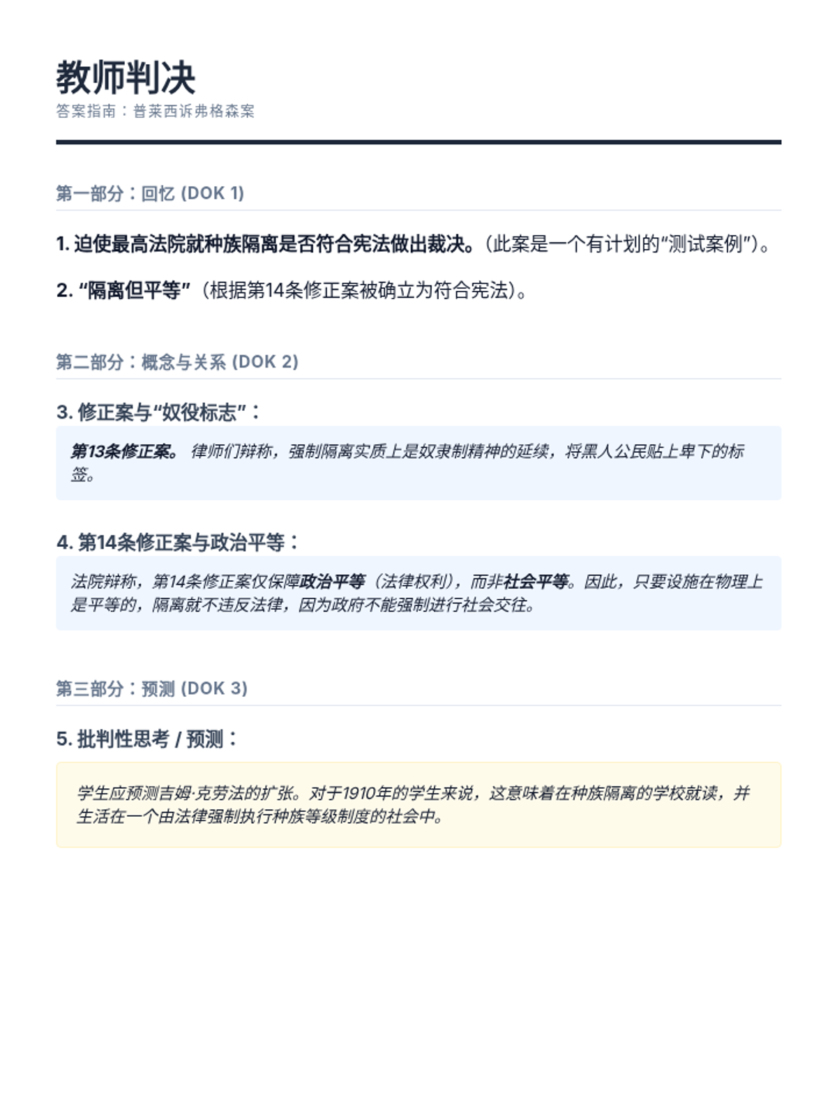
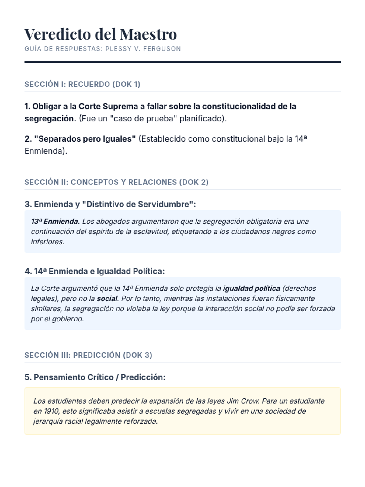
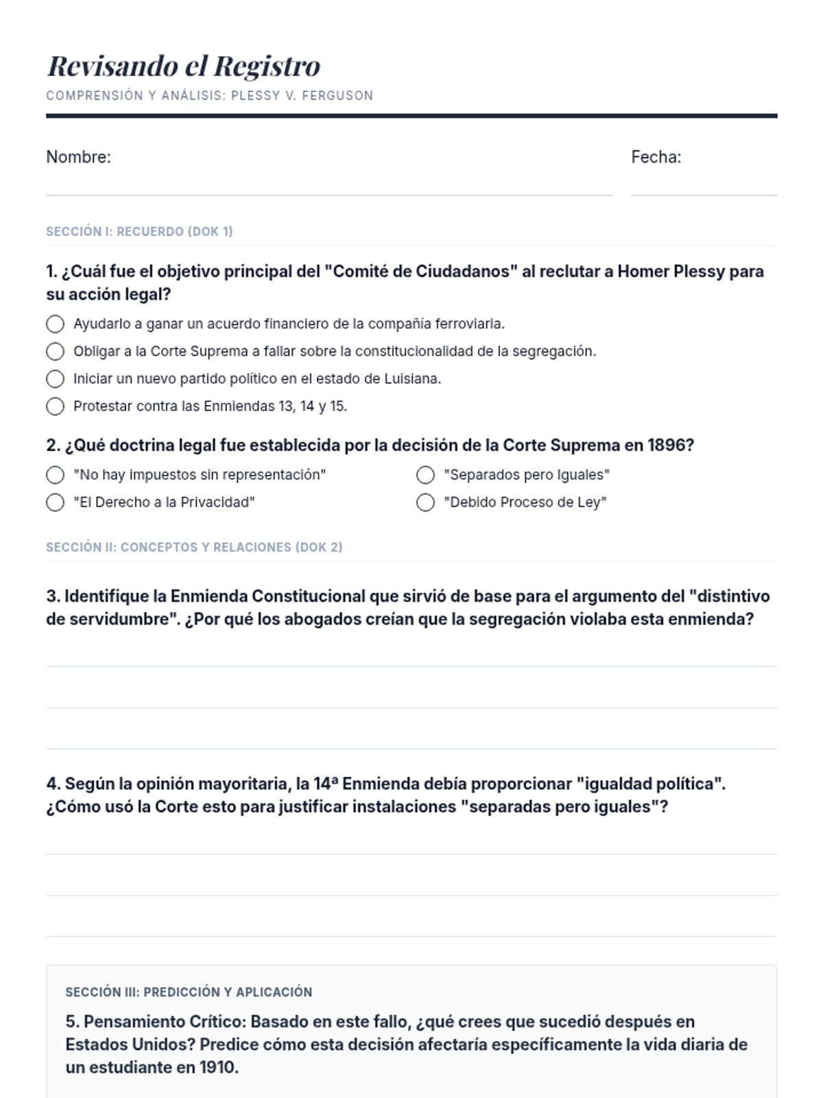
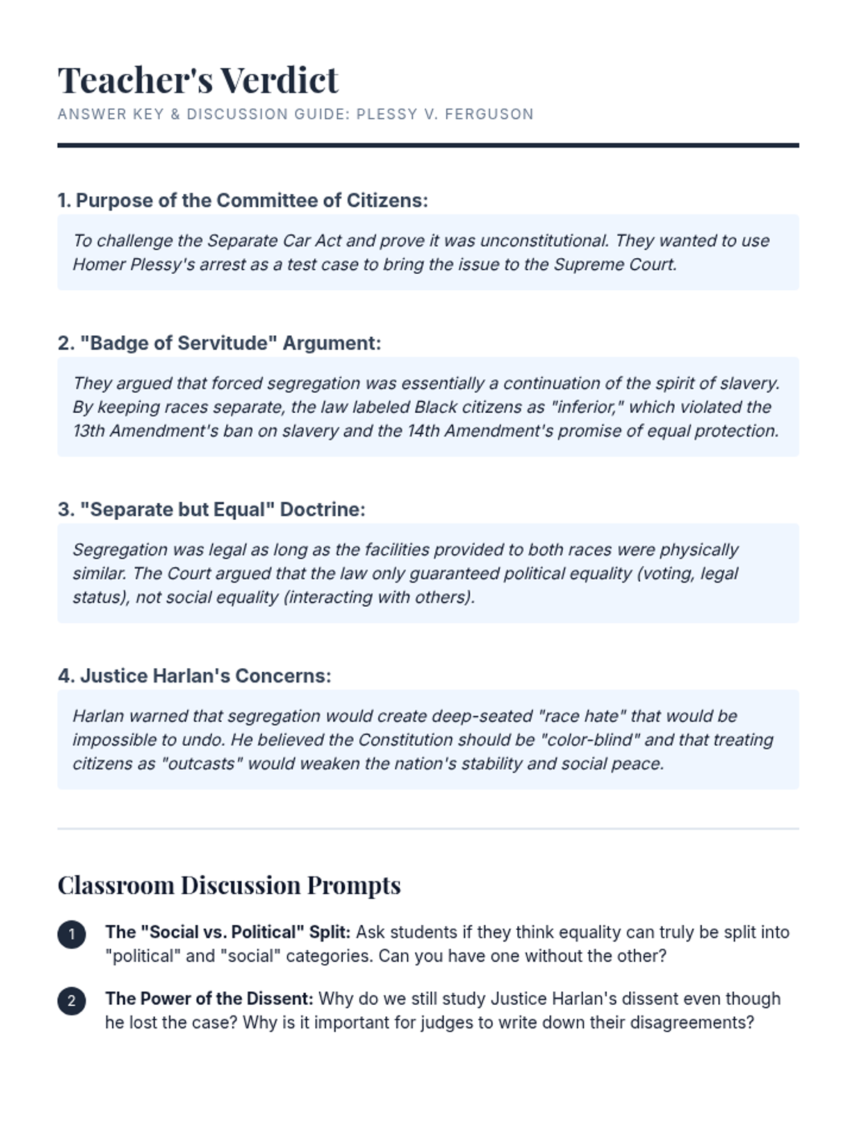
A student mapping activity that challenges students to visualize the territorial changes in England, France, Spain, and Russia using evidence from the station dossiers. Features simplified sketching tasks and synthesis questions, specifically formatted to fit on 8.5x10.5 inch paper.