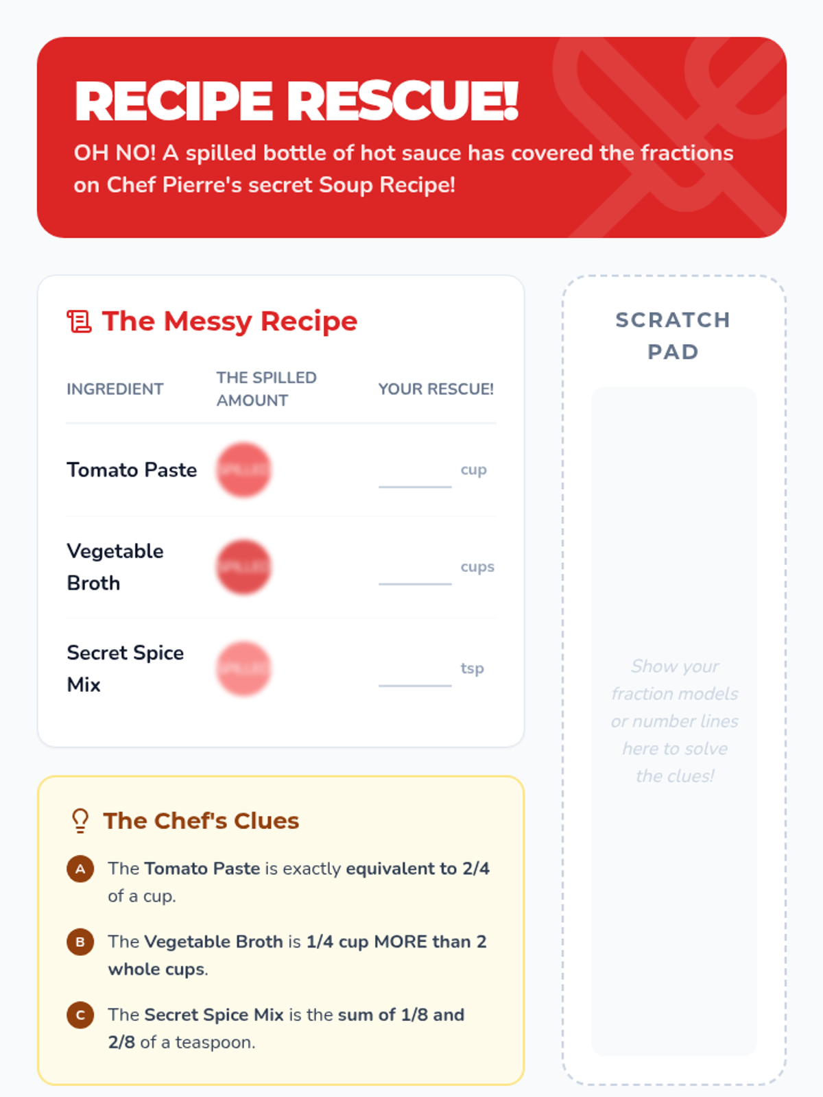
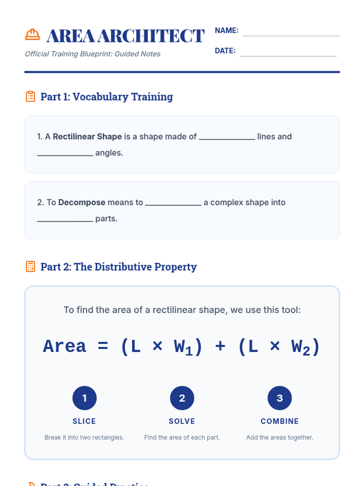
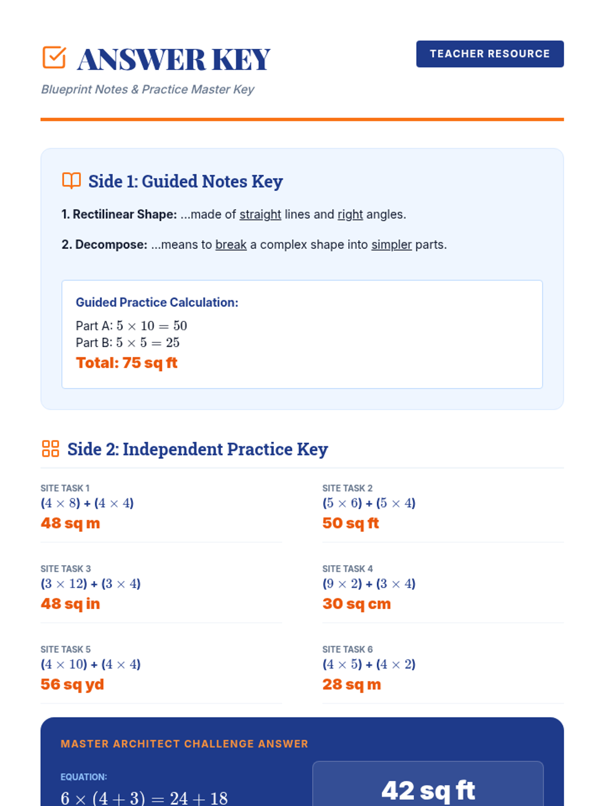
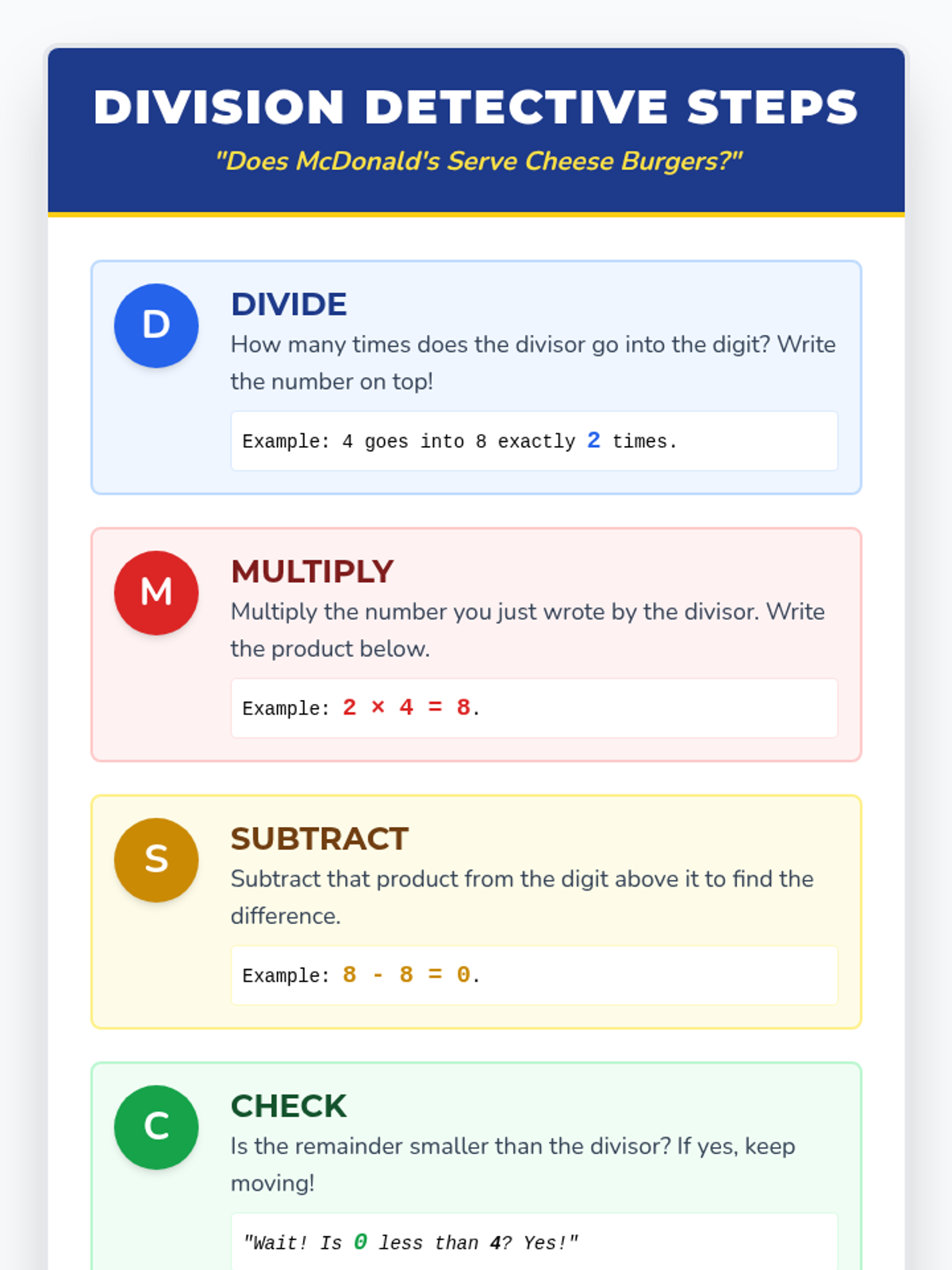
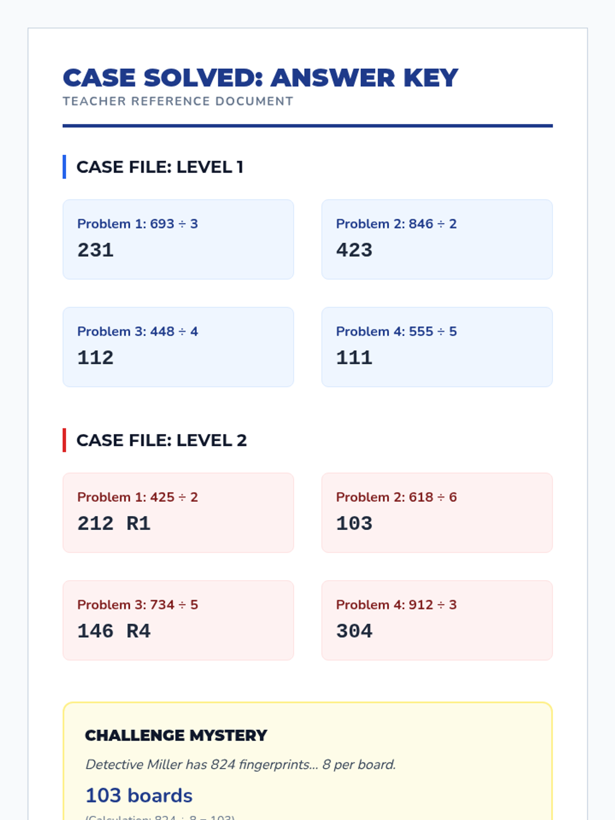
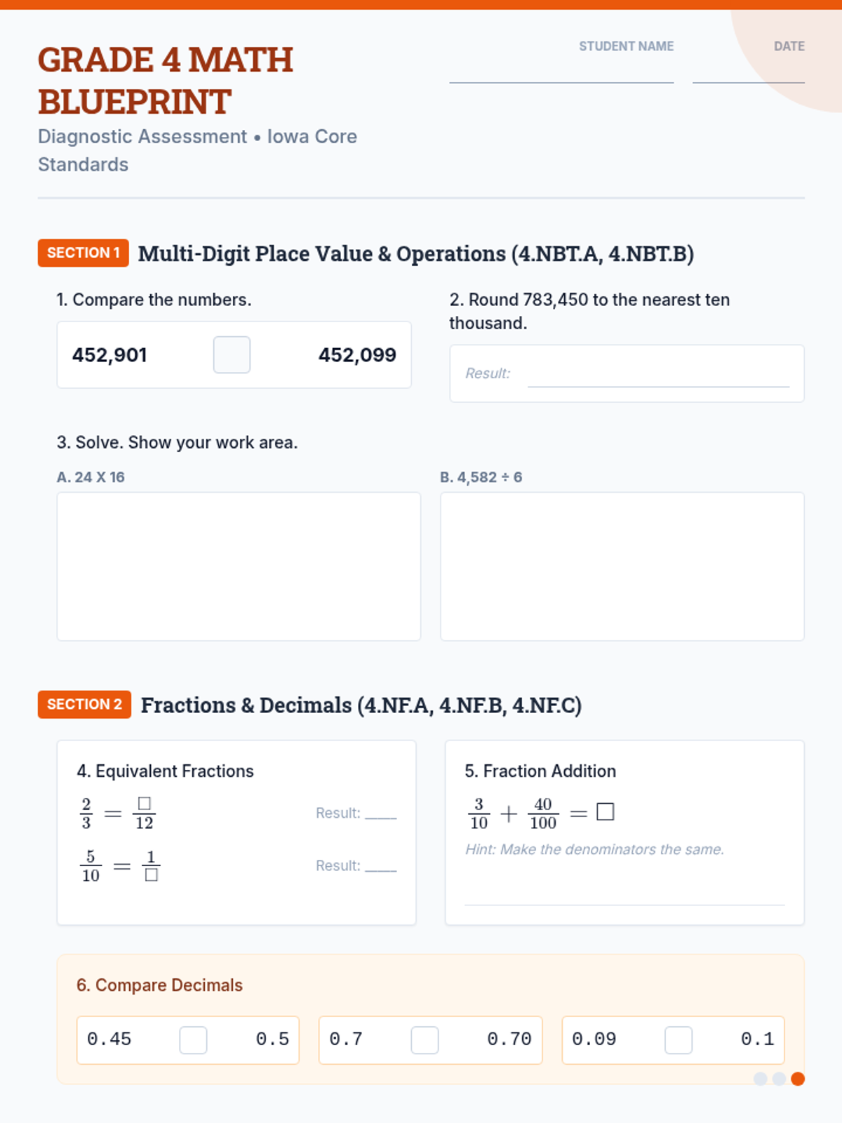
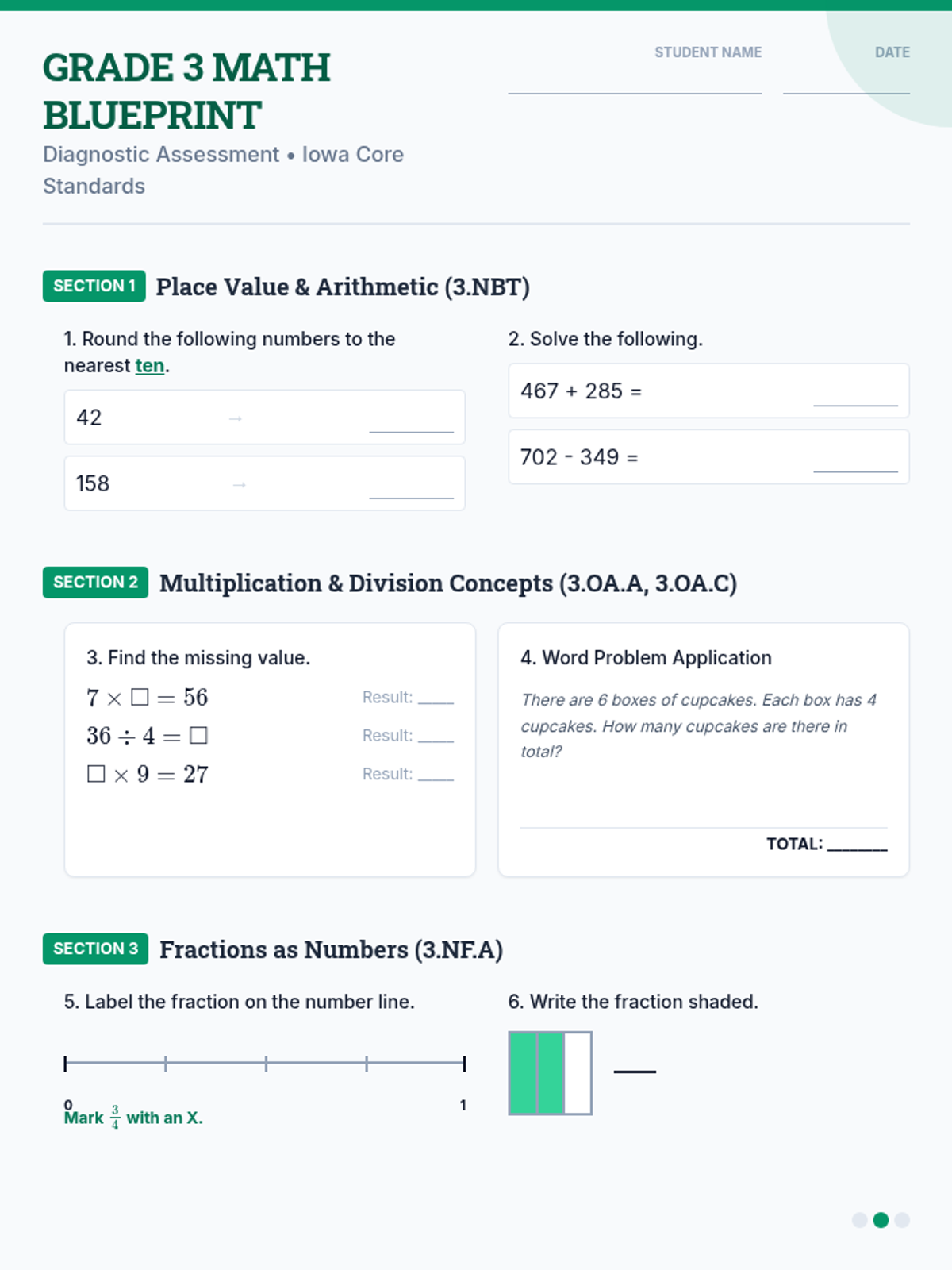
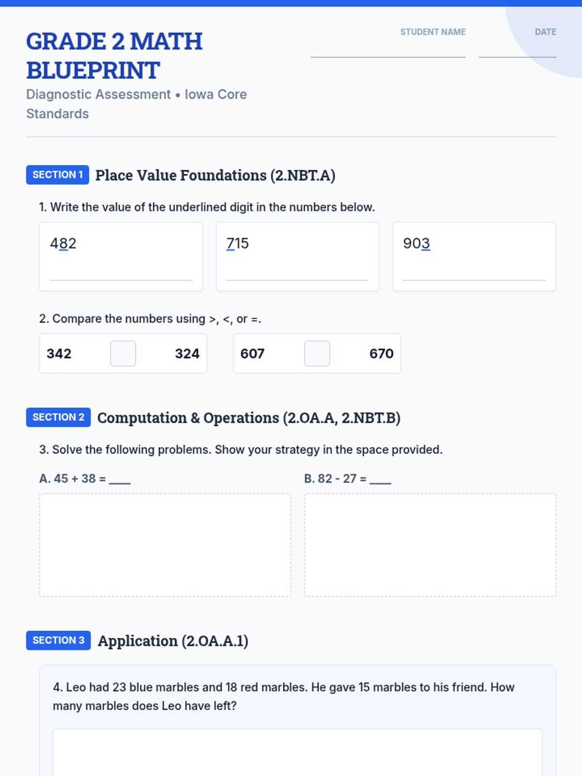
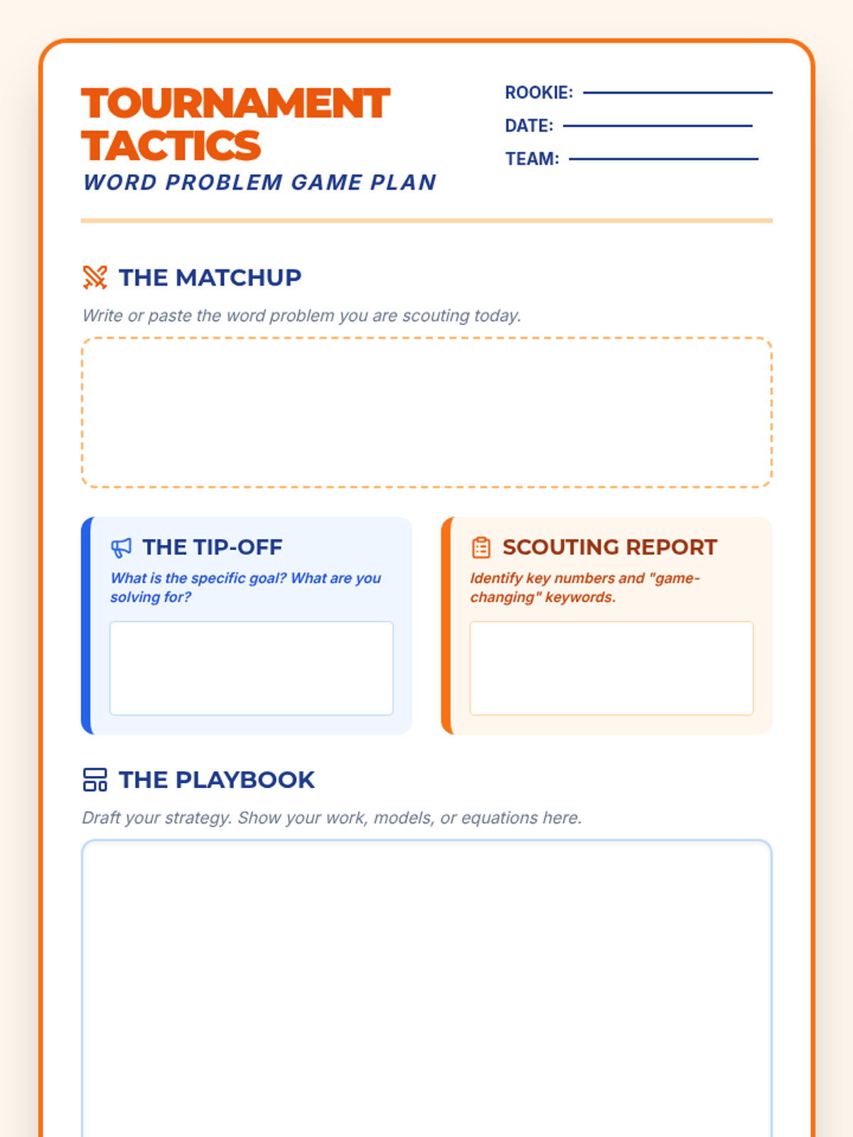
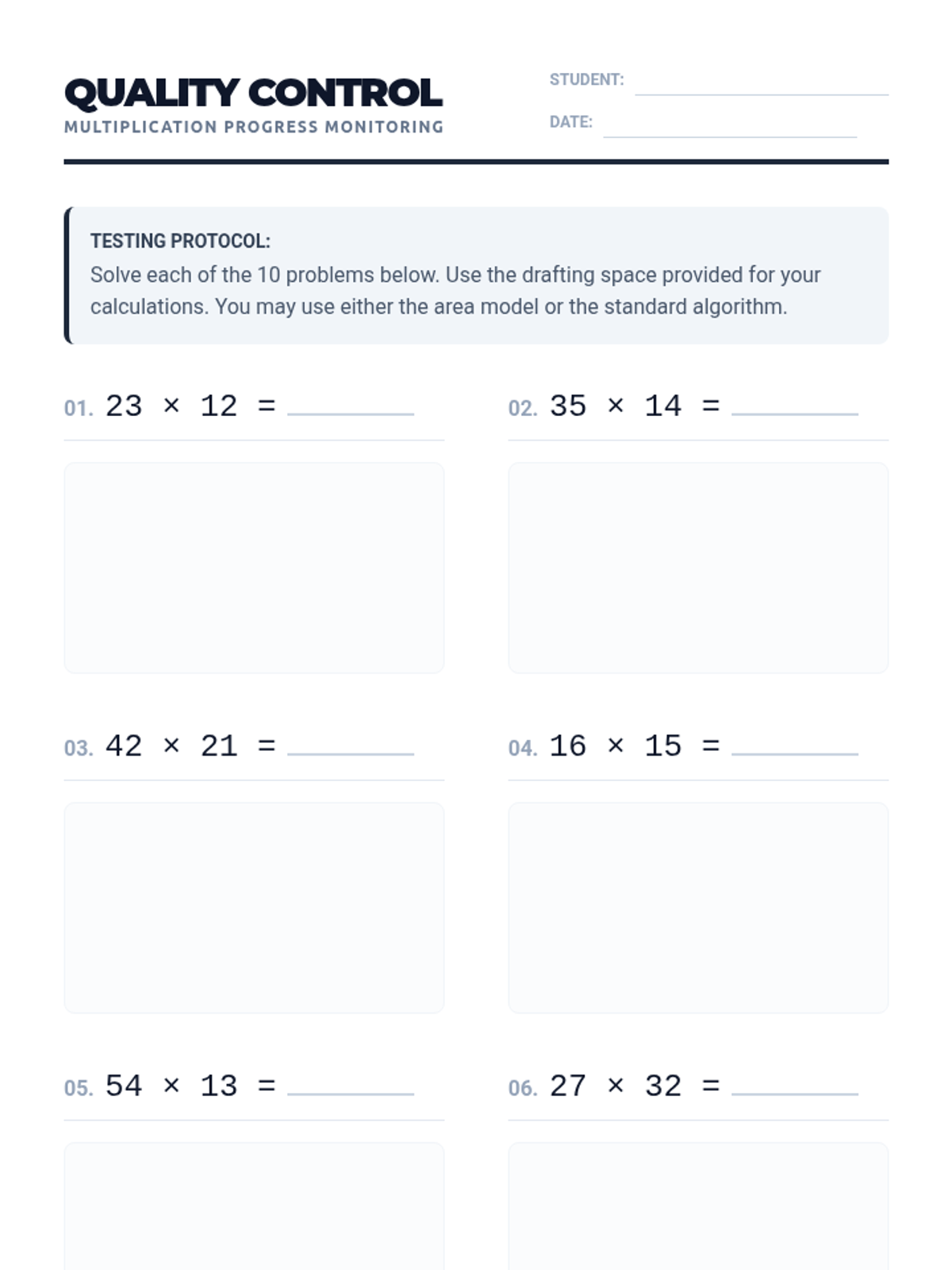
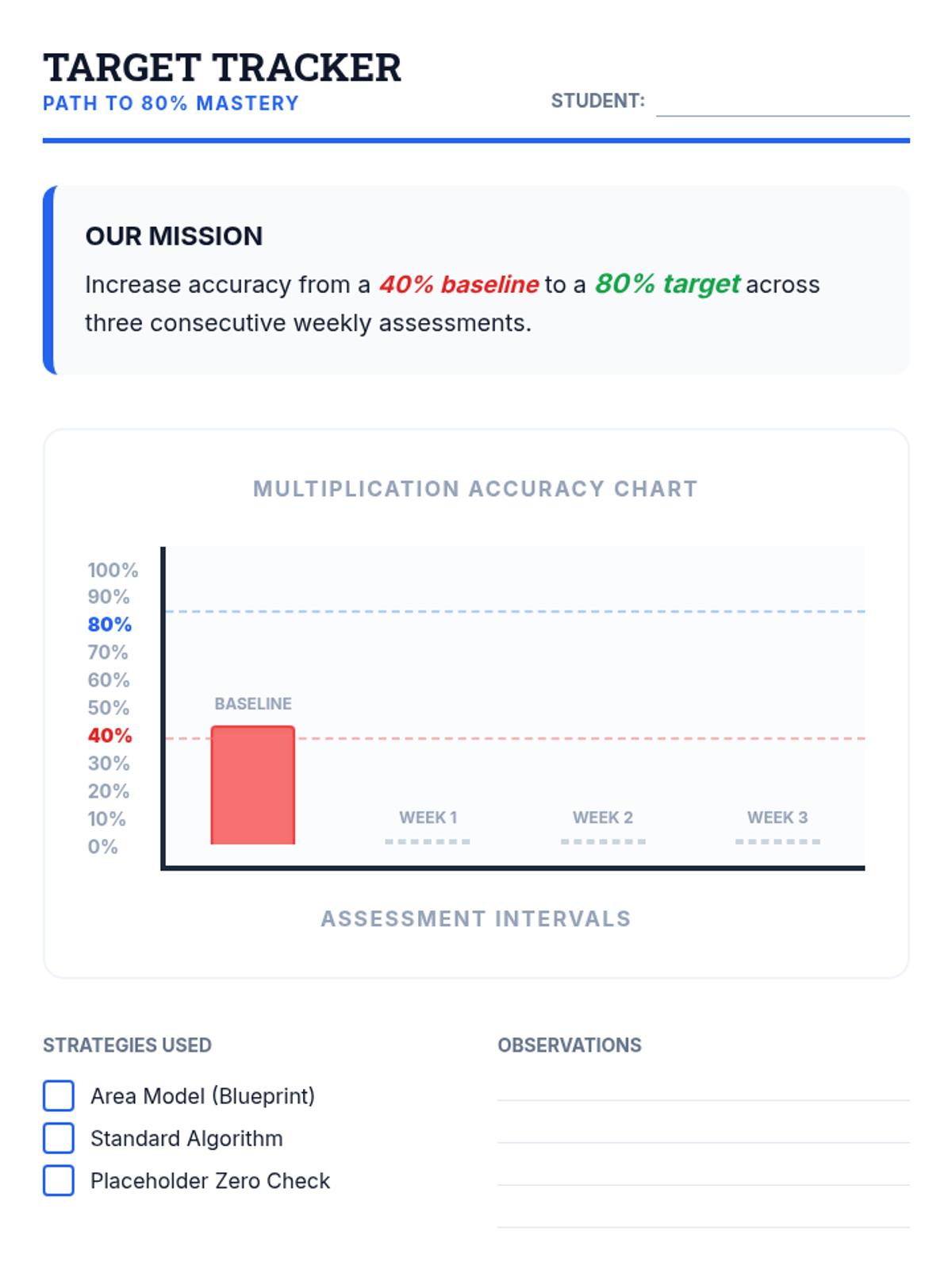
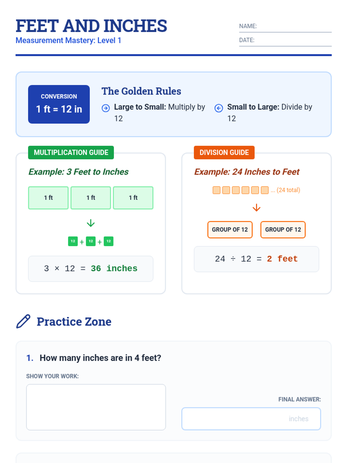
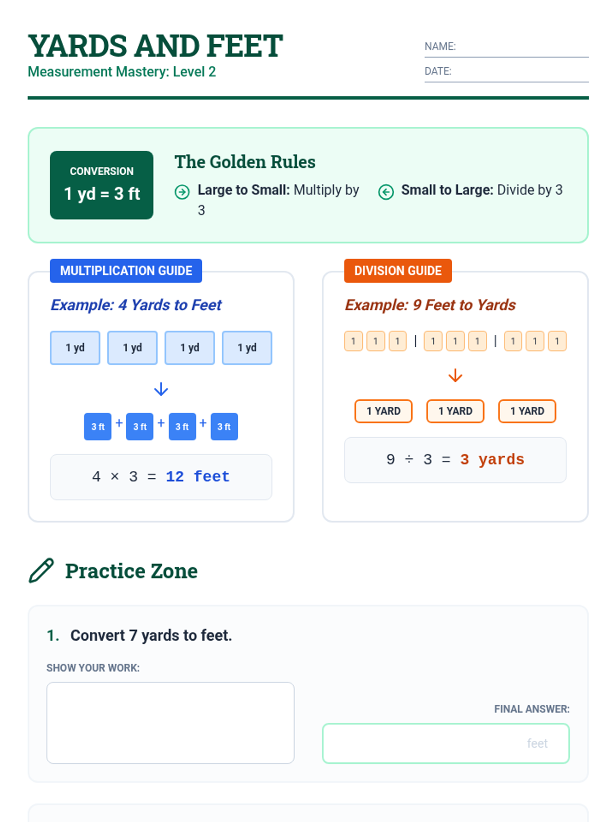
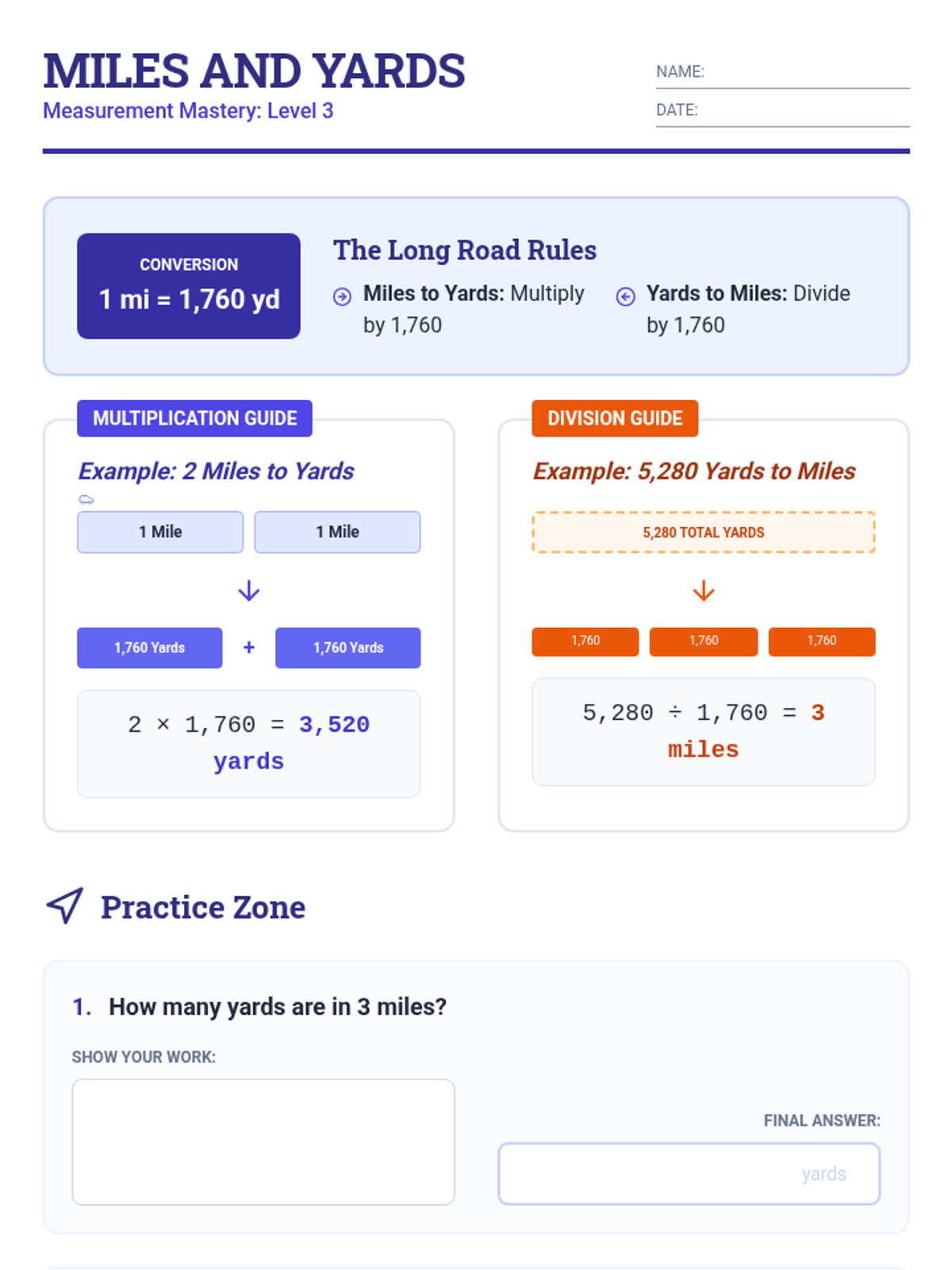
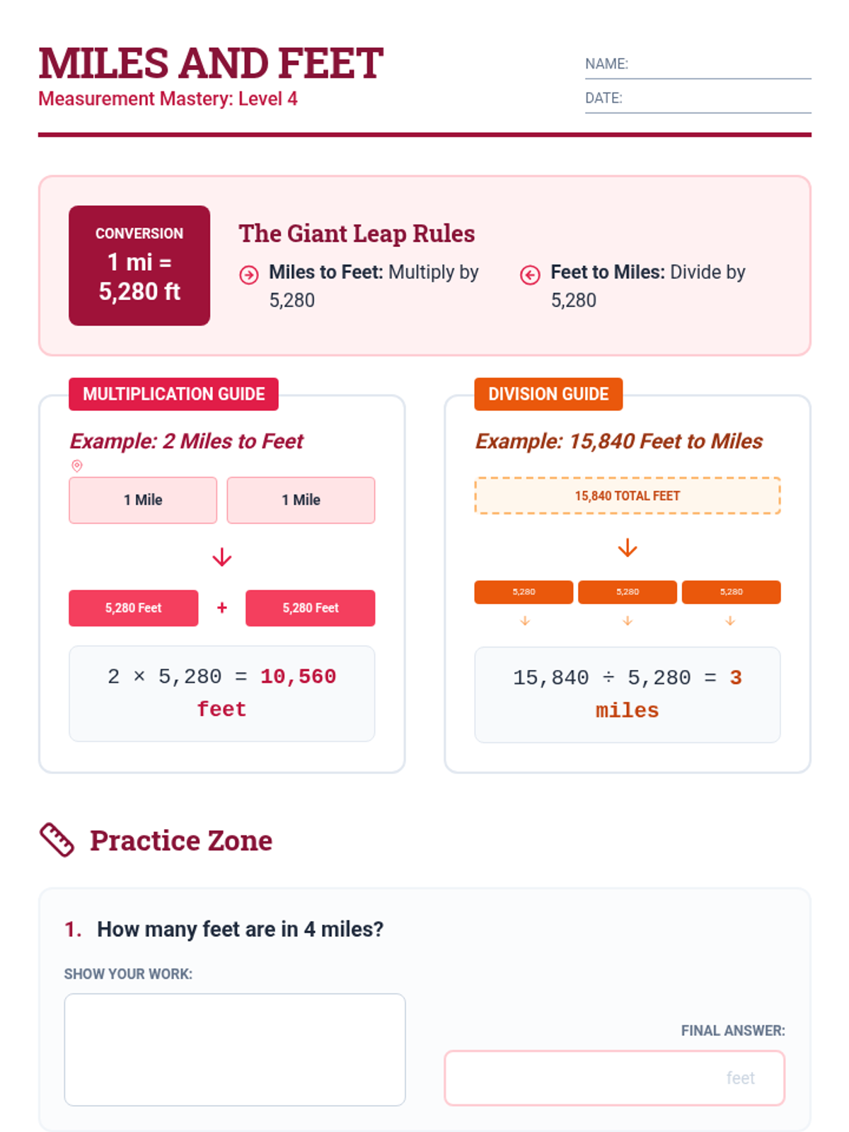
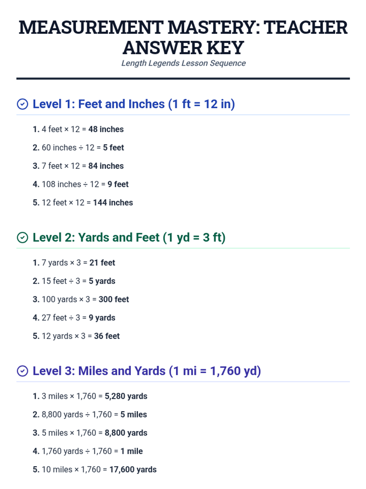
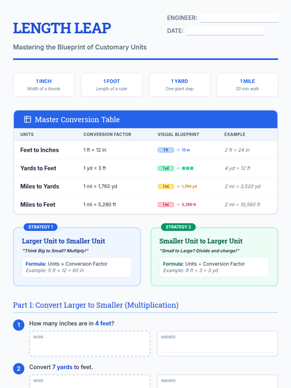
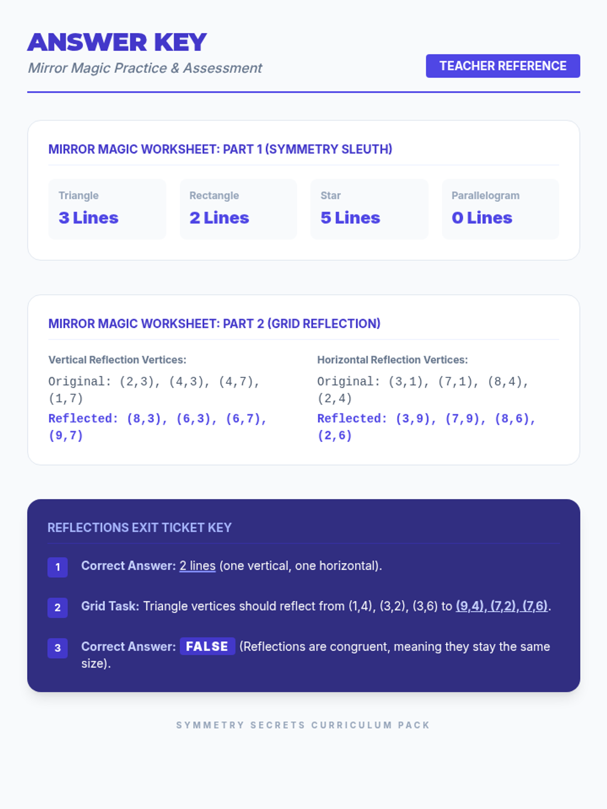
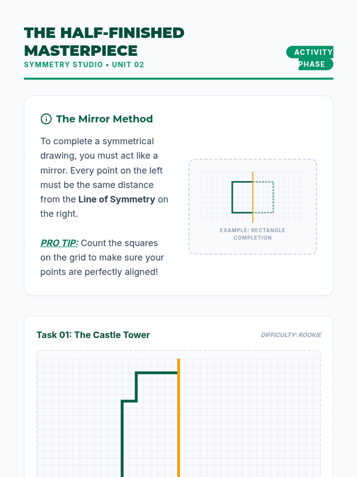
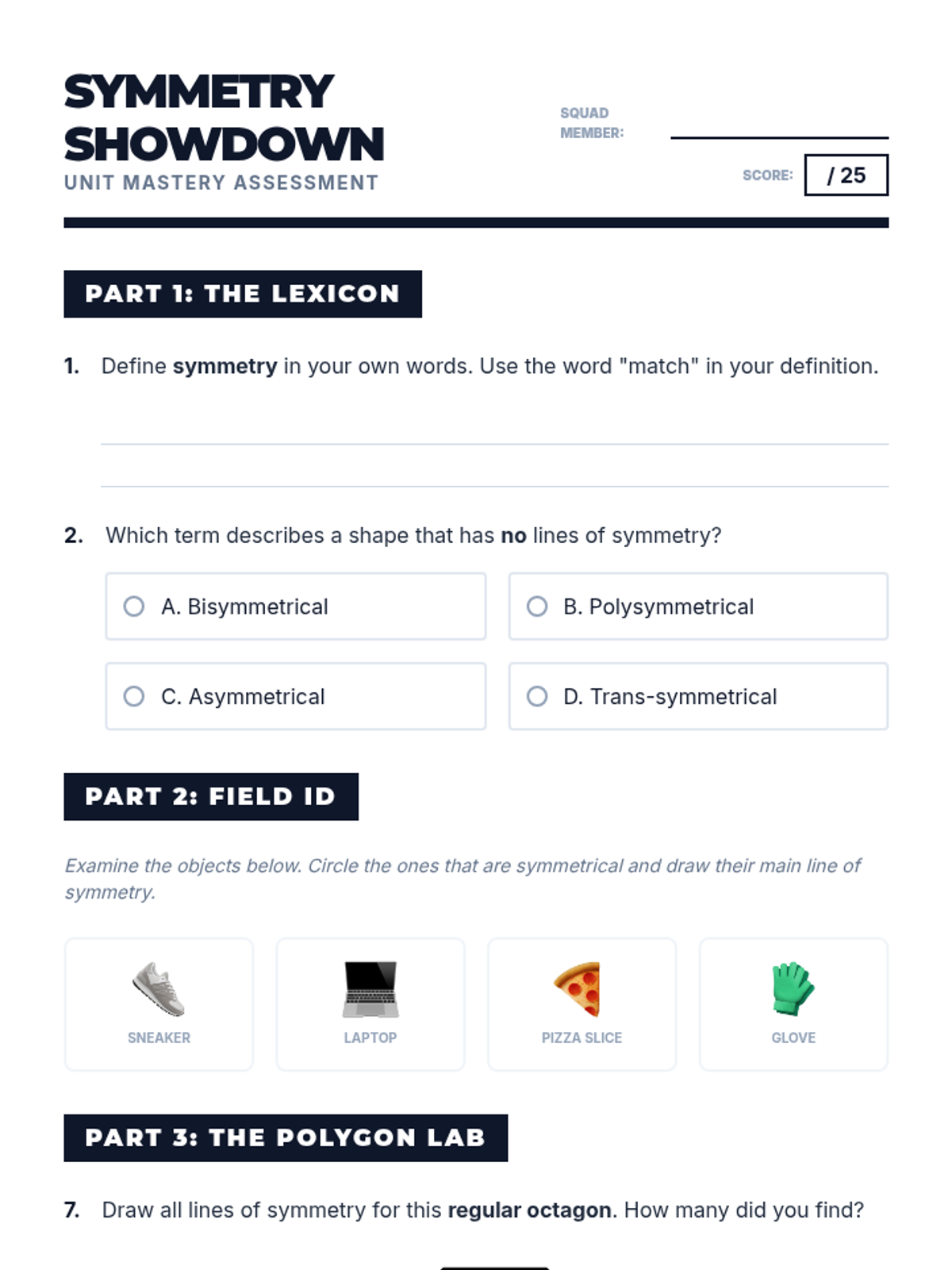
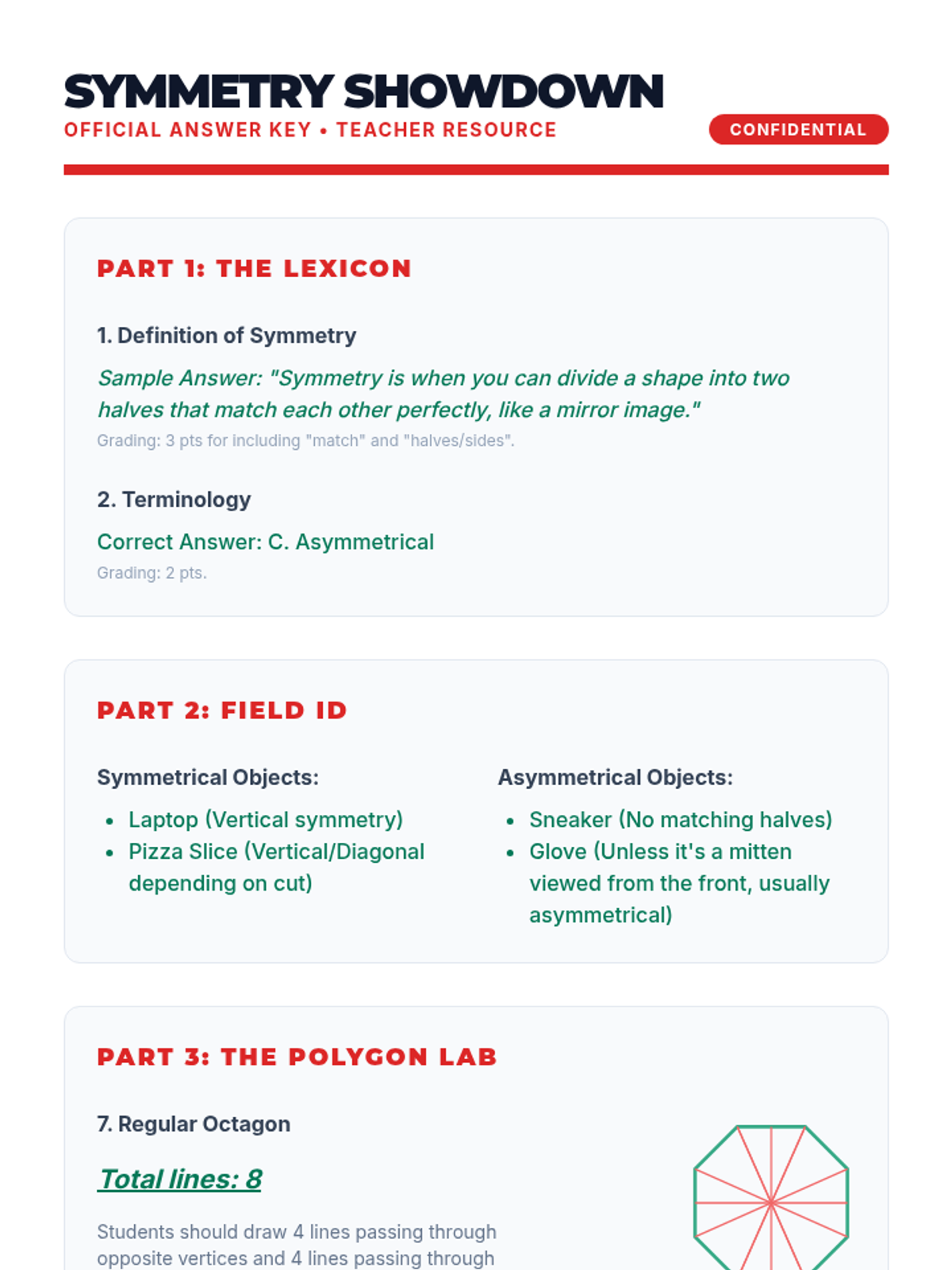
A Tier 2 small group intervention focused on graphing ordered pairs in the first quadrant and interpreting their real-world meaning through a "City Planning" theme. Students use coordinate grids to map out locations and explain what each coordinate represents in context.