A visual slide deck covering the key historical events, figures, and concepts of the Native American struggles on the Great Plains from 1850-1890, including interactive game reveal slides.
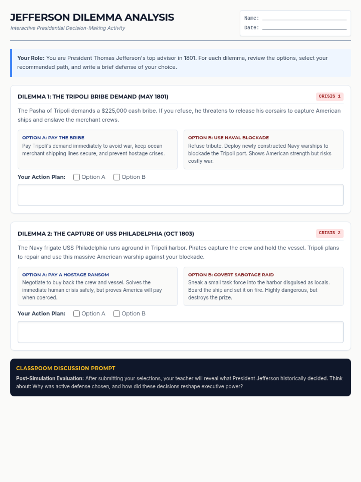
An engaging decision-making simulation worksheet where students analyze three complex foreign policy dilemmas faced by President Thomas Jefferson, selecting choices and defending them using evidence.
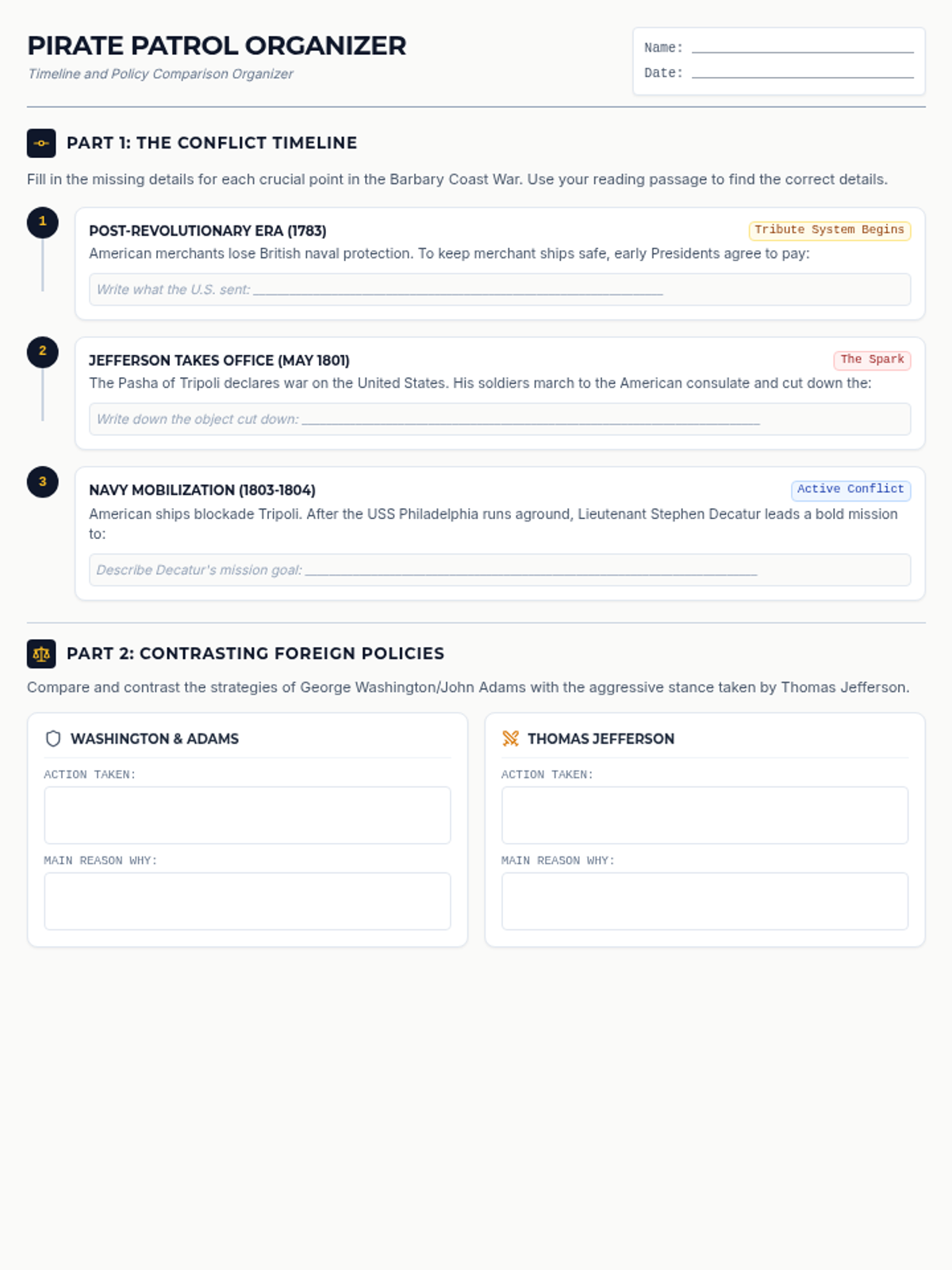
A beautifully organized student graphic organizer featuring a multi-step chronological timeline of the Barbary conflict and a policy comparison matrix for analyzing early American presidents.
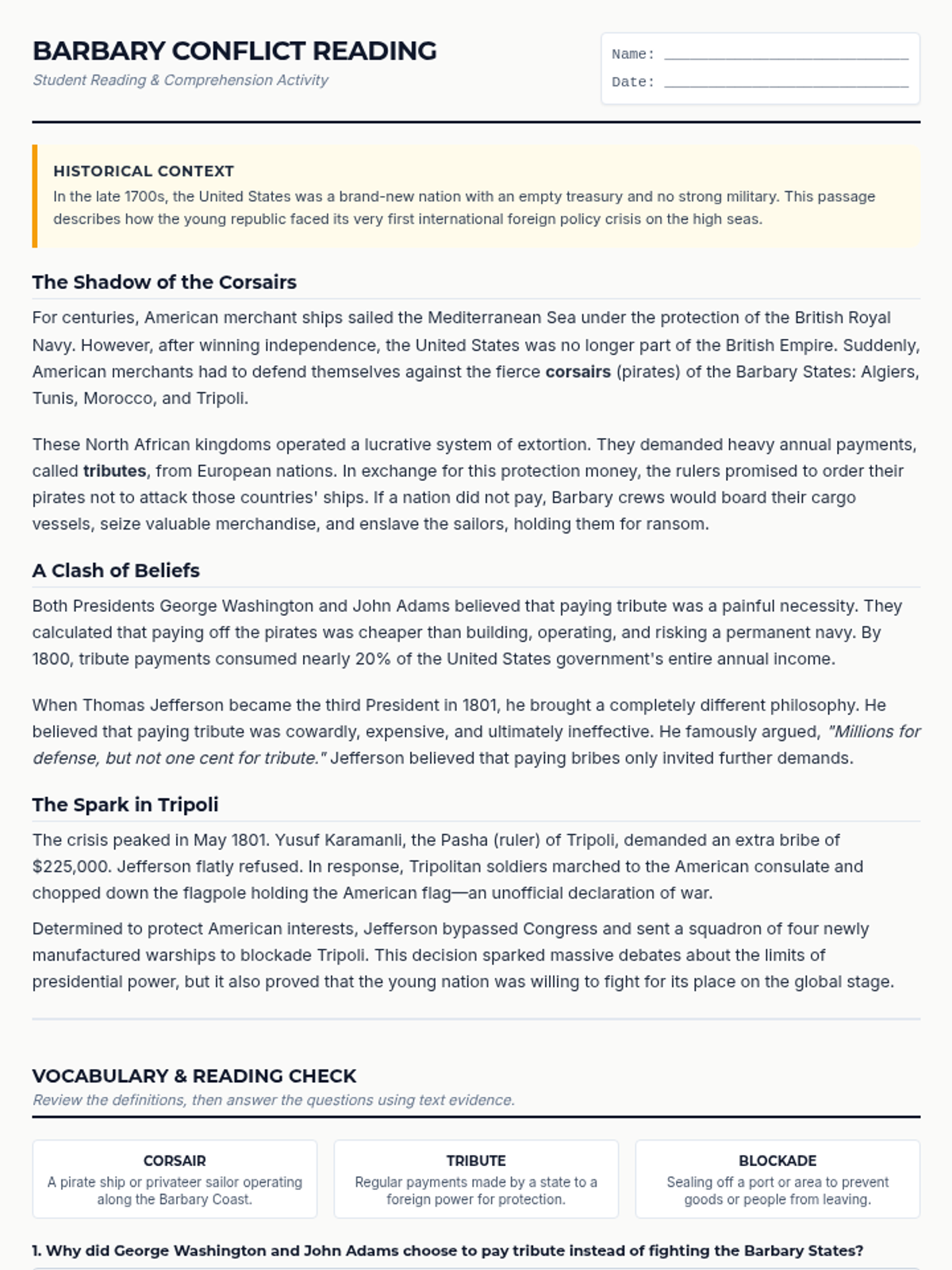
A high-quality 2-page student worksheet containing a reading passage on the Barbary pirates, key vocabulary terms, and structured comprehension questions with handwriting space.
A visually striking 6-slide digital presentation for direct classroom instruction detailing the financial crisis of Barbary coast tributes, the flagpole incident, Stephen Decatur's daring night raid, and the overall legacy of the conflict.
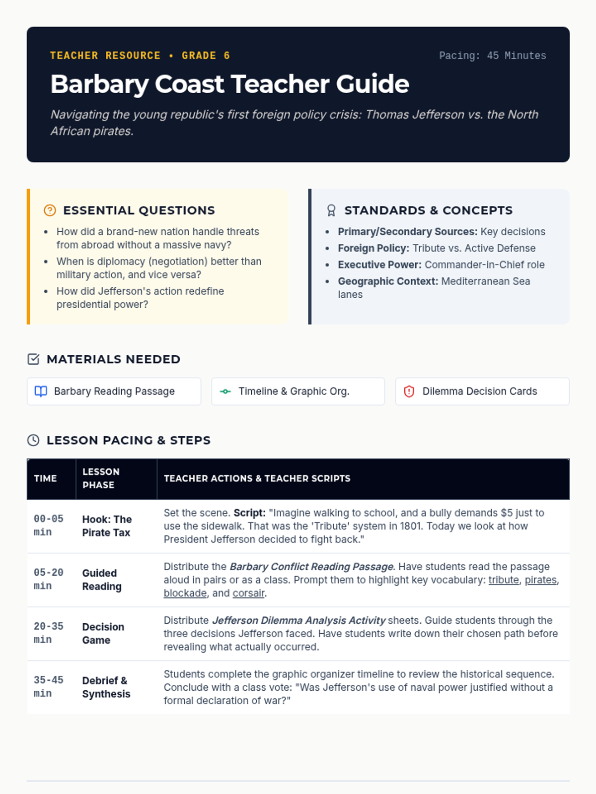
A comprehensive, 2-page print-ready lesson plan for teachers detailing a 45-minute lesson structure, lesson pacing, guided questions, student misconceptions, and differentiation strategies for a sixth-grade history lesson.
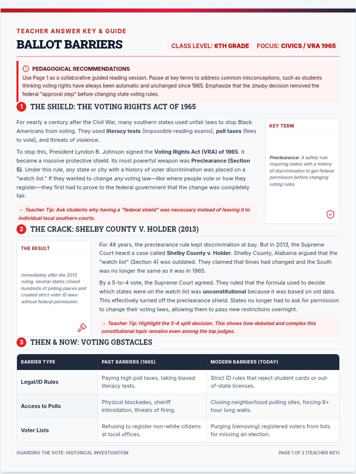
A complete teacher answer key and instructional guide for the Ballot Barriers Worksheet, featuring exemplary student responses, background context, and guiding questions.
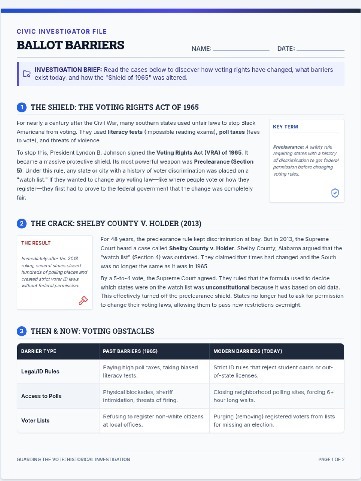
A student-facing guided reading worksheet covering the history of the Voting Rights Act of 1965, the Shelby County decision, and modern voting barriers. Includes a historical comparison graphic and critical thinking questions.
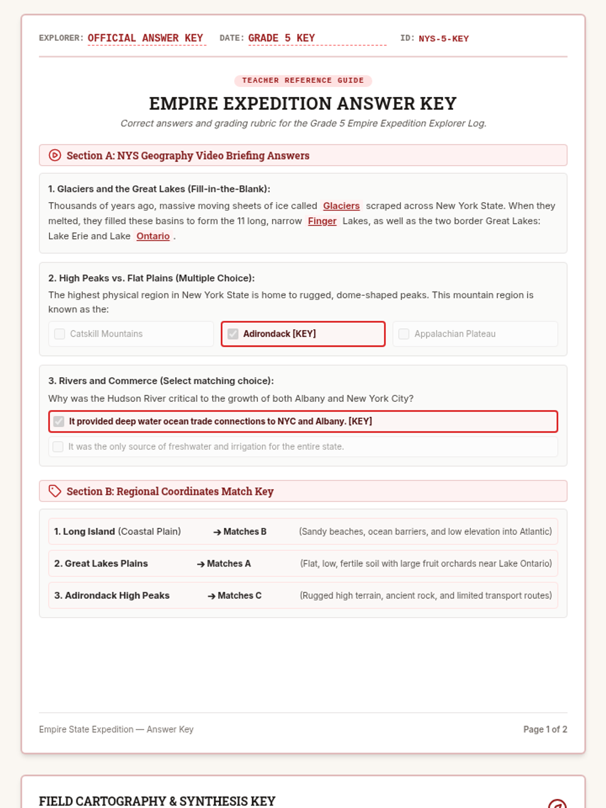
A complete answer key for the Empire Expedition Explorer Log, providing expected student responses for all regional and geographic questions.
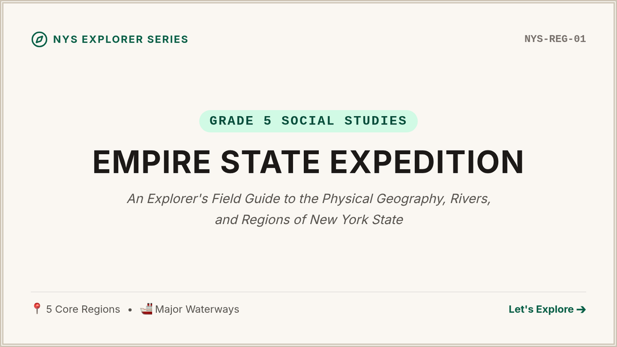
Visually rich slide deck designed to guide students through the key geographic regions, major water bodies, and landforms of New York State.
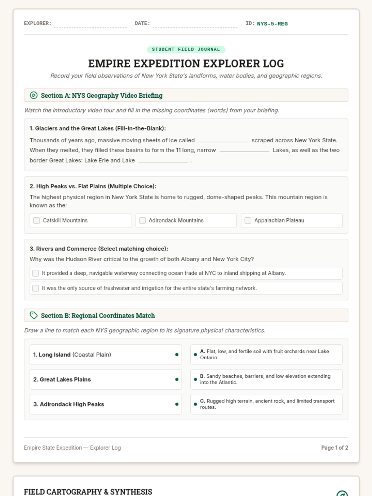
A 2-page print-ready student-facing explorer log worksheet designed to serve as a video guide, matching activity, map-labeling organizer, and writing workspace for NYS geography.
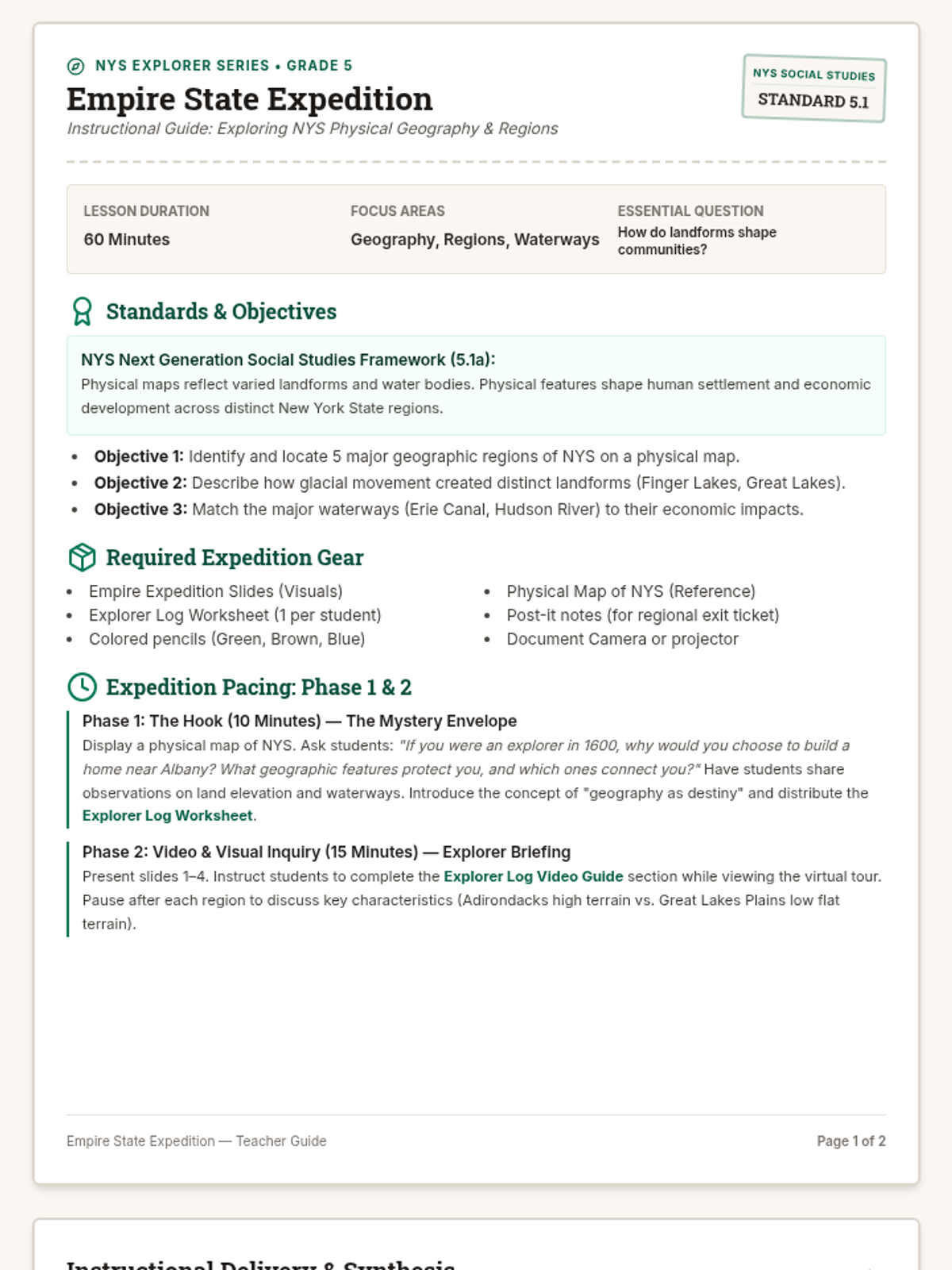
A comprehensive Grade 5 Social Studies teacher's instructional guide mapping out a 60-minute lesson on New York State geography and regions, aligned to NYS Next Generation standards.
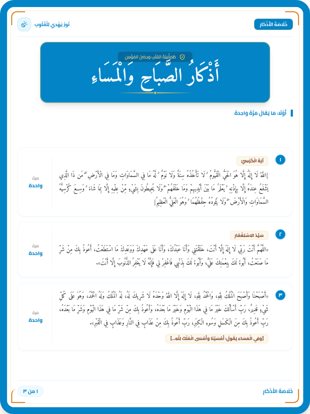
بطاقات أذكار الصباح والمساء بتصميم ملكي فاخر باللون السماوي الغامق والبيج الفاتح الفاتح (Deep Sky Blue & Pale Beige)، يحتوي على العنوان بحجم خط عريض وكبير في وسط الصفحة الأولى داخل شكل بيجي دافئ، مع استبدال النجم بـ شمس وقمر، وحذف عبارة يكن لك حصنا حصينا من النصيحة الروحية.
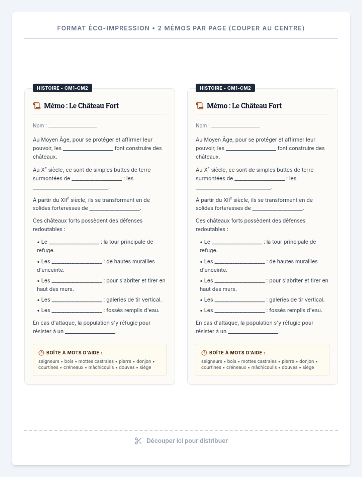
Fiche mémo individuelle à distribuer aux élèves de CM1-CM2. Elle comporte la trace écrite de la séance sous forme de texte à trous pour fixer les repères historiques et le vocabulaire d'architecture. Conçue en format éco-impression avec deux mémos par feuille A4.
Diaporama moderne et contrasté de 5 diapositives pour animer la séance en classe de CM1-CM2. Comprend des diapositives explicatives sur les mottes castrales, le château fort de pierre, les stratégies d'attaque et de défense ainsi qu'un quiz oral collectif.
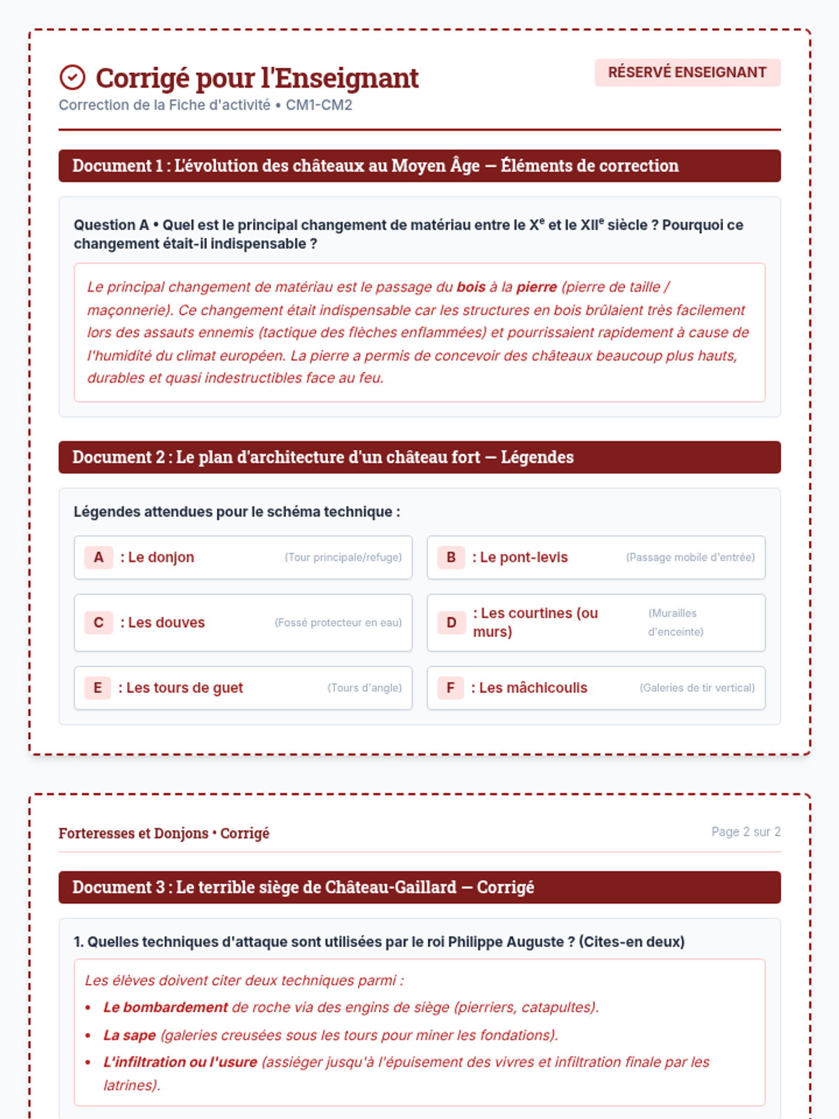
Fiche de correction complète destinée à l'enseignant. Elle contient les réponses précises de la fiche d'activité élève ainsi que des conseils d'évaluation et de notation pour valoriser le travail historique.
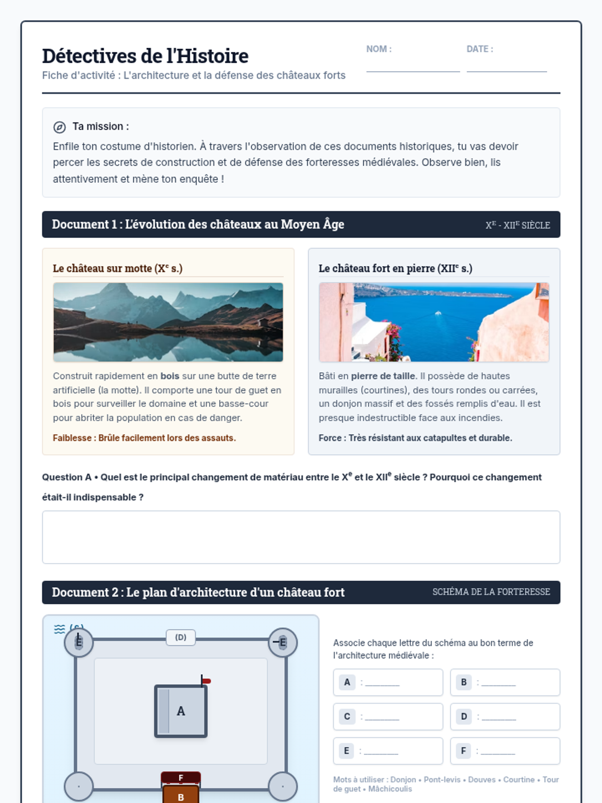
Fiche d'activité complète en 2 pages destinée aux élèves de CM1-CM2. Elle comporte l'analyse guidée de quatre documents : évolution du château fort, plan légendé de la forteresse de pierre, récit historique du siège de Château-Gaillard et éléments de tactique militaire.
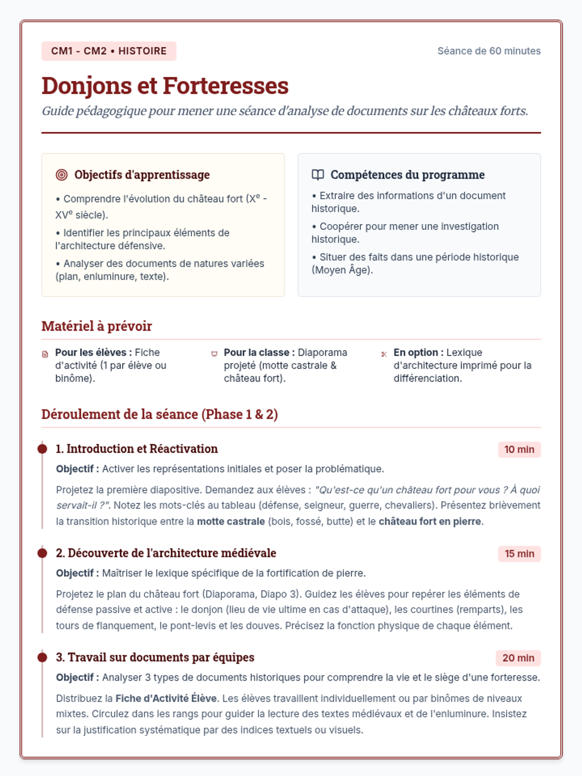
Guide de séance complet pour mener une séance d'histoire clé en main en classe de CM1-CM2 sur l'architecture, l'évolution et la fonction défensive des châteaux forts médiévaux. Comprend la répartition horaire, les objectifs et la trace écrite.
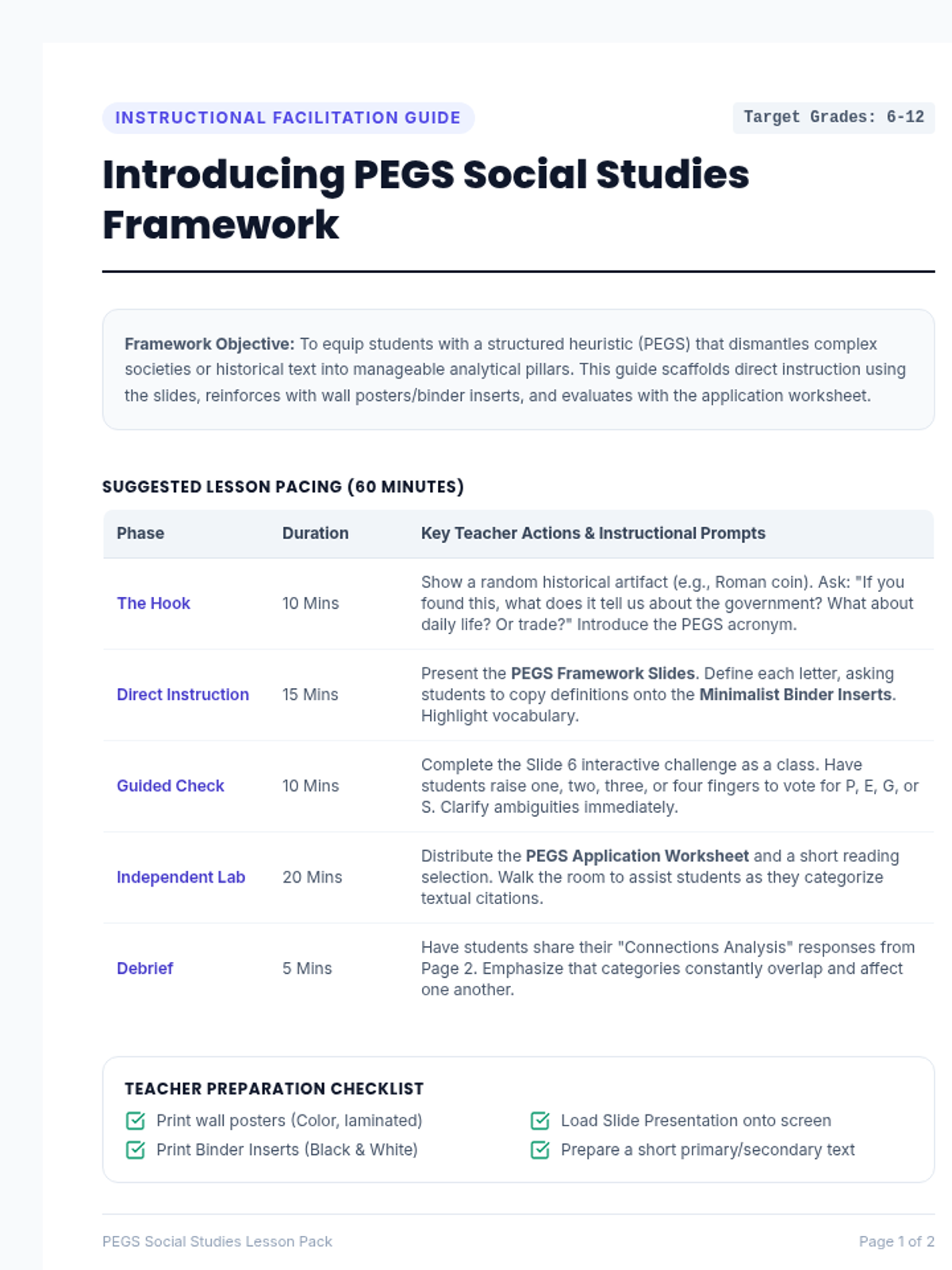
An essential 2-page instructional guide for teachers. Page 1 delivers a clear 60-minute lesson pacing outline, teacher action flows, and a prep checklist. Page 2 offers Socratic questioning strategies, analysis on common student misconceptions, and a highly structured grading rubric.
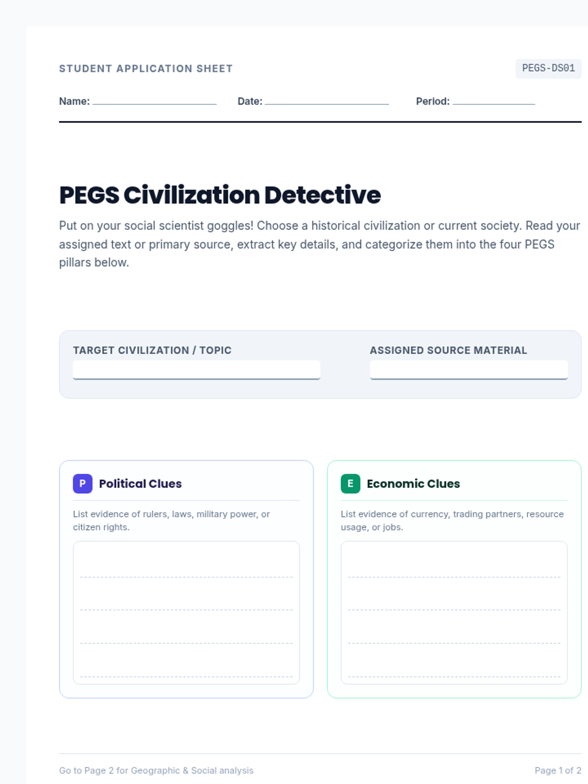
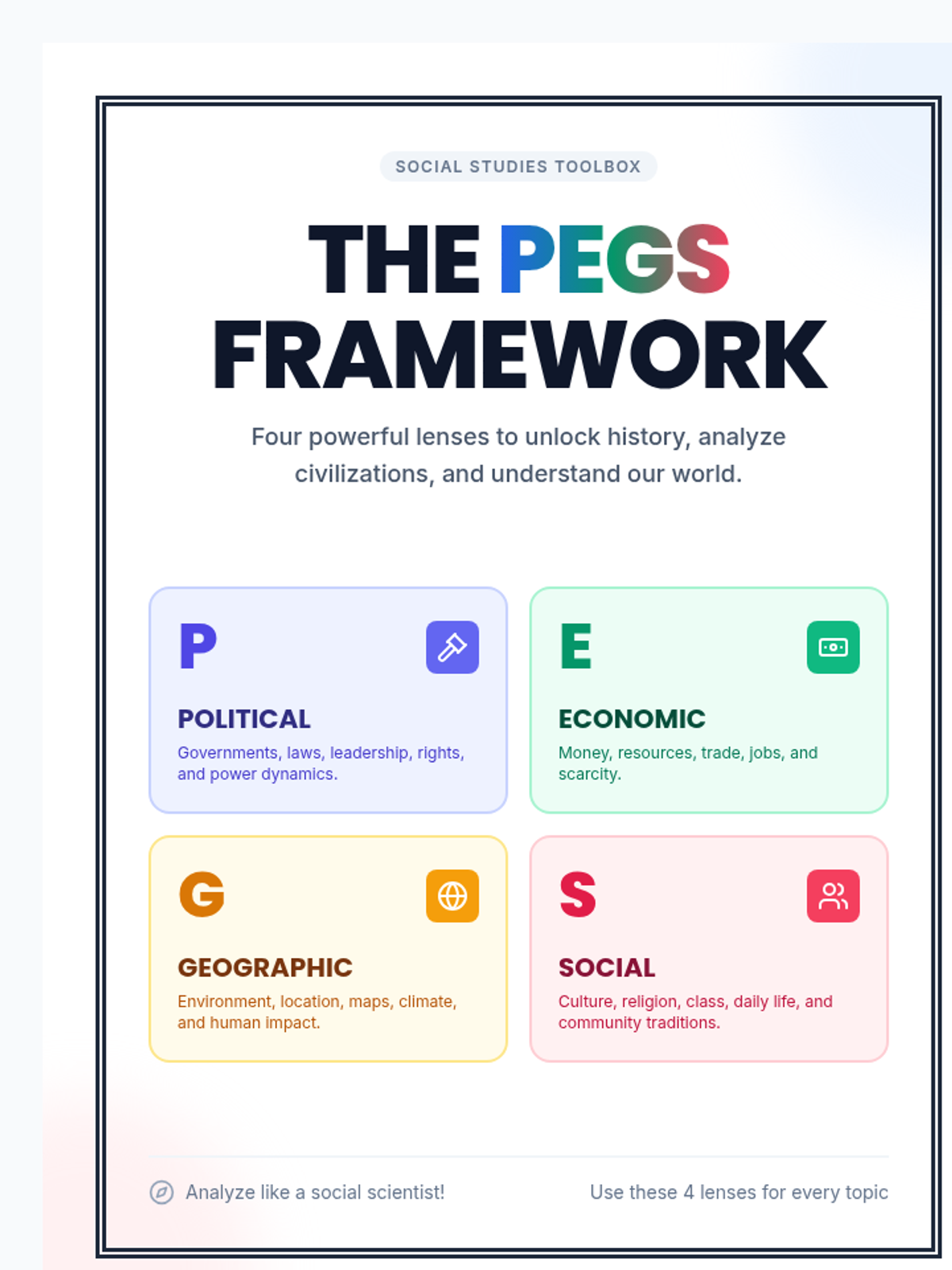
A highly versatile 2-page student analysis worksheet. Features custom, ink-friendly, white-background entry fields for compiling evidence across all 4 PEGS dimensions (Political, Economic, Geographic, Social) and a final critical-thinking synthesis section where students analyze cross-pillar connections.
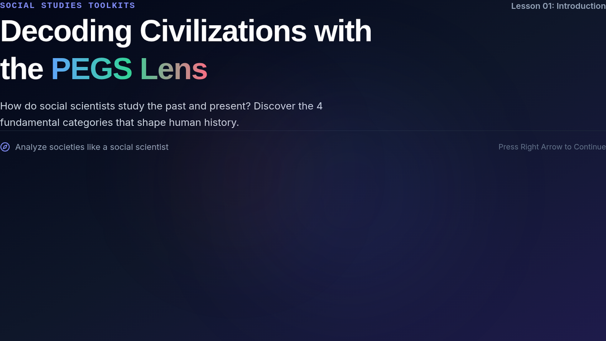
An engaging 6-slide widescreen presentation designed for introducing the PEGS framework to students. Features robust slide breakdowns for Political, Economic, Geographic, and Social criteria, utilizing massive high-visibility text, matching category colors, and a fun interactive naming challenge at the end.
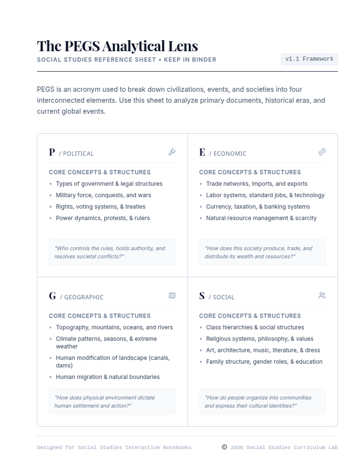
An elegant, minimalist 2-page student binder insert set. Page 1 provides a high-density reference sheet detailing key components of the PEGS analytical lens, while Page 2 features an actionable primary source inquiry checklist for classroom analysis and active reading.
A stunning, vibrant, icon-heavy set of 5 vertical classroom posters. Features a main title page followed by deeply detailed visual breakdown pages for Political (P), Economic (E), Geographic (G), and Social (S) categories. Complete with core questions, buzzwords, and inquiry checklists.
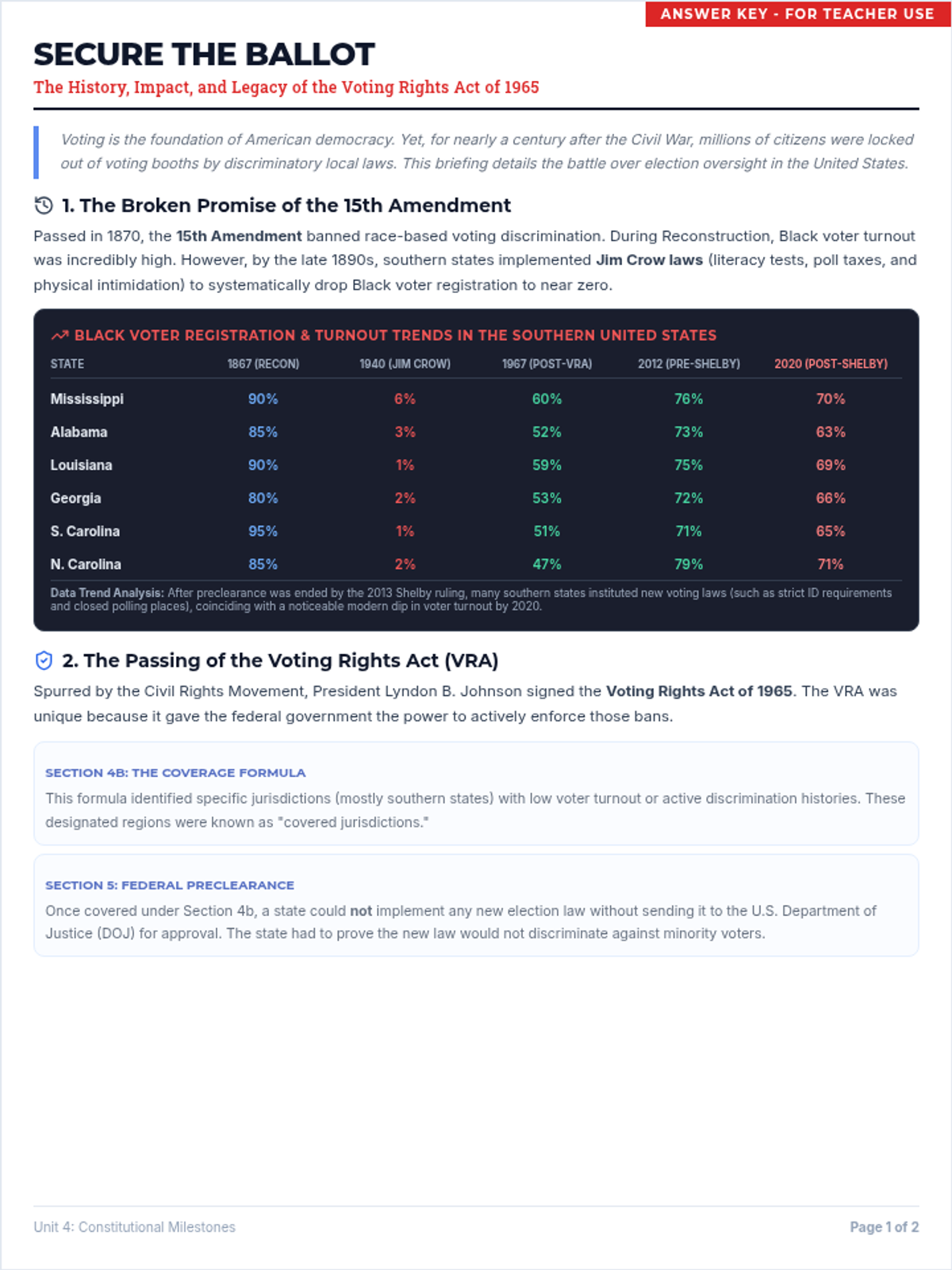
The matching teacher answer key for the Voting Rights Act background sheet, populated with high-quality exemplar responses for text-dependent reading comprehension questions.
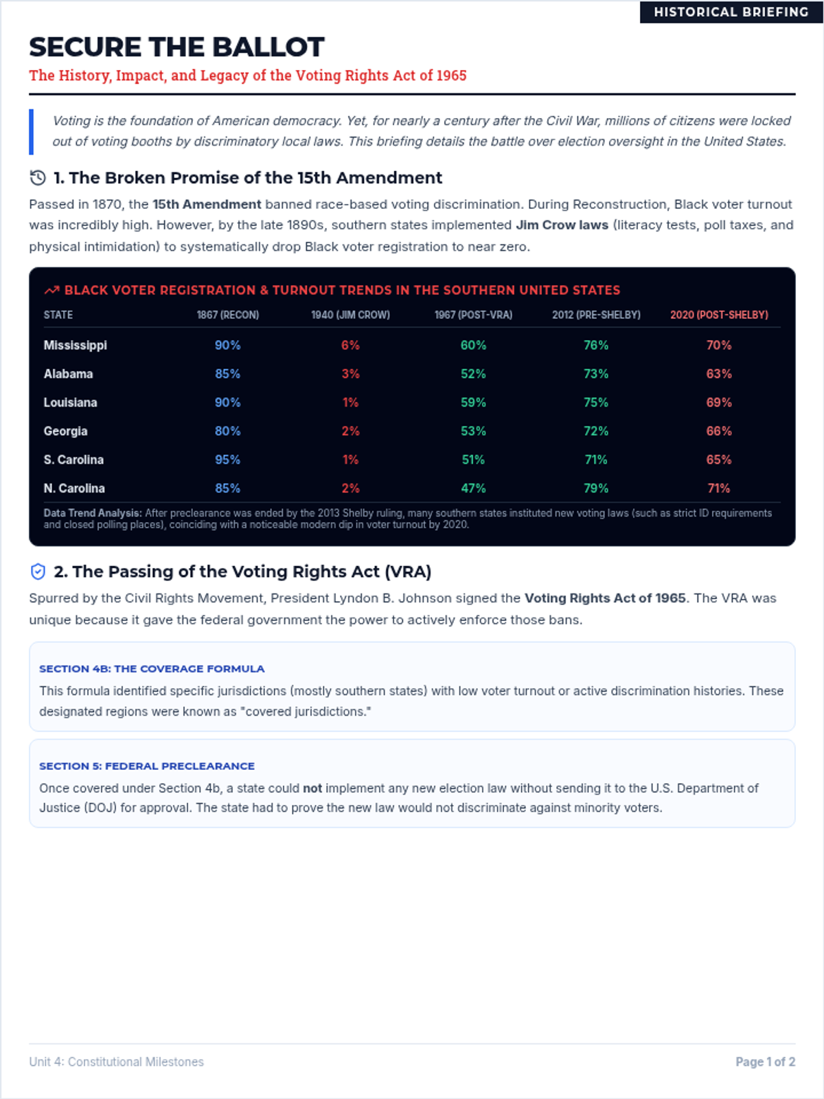
A comprehensive, highly readable historical background sheet for students explaining the 15th Amendment, Jim Crow voting barriers, VRA Sections 4b/5, and the Shelby County v. Holder decision. Includes three text-dependent reading comprehension questions.
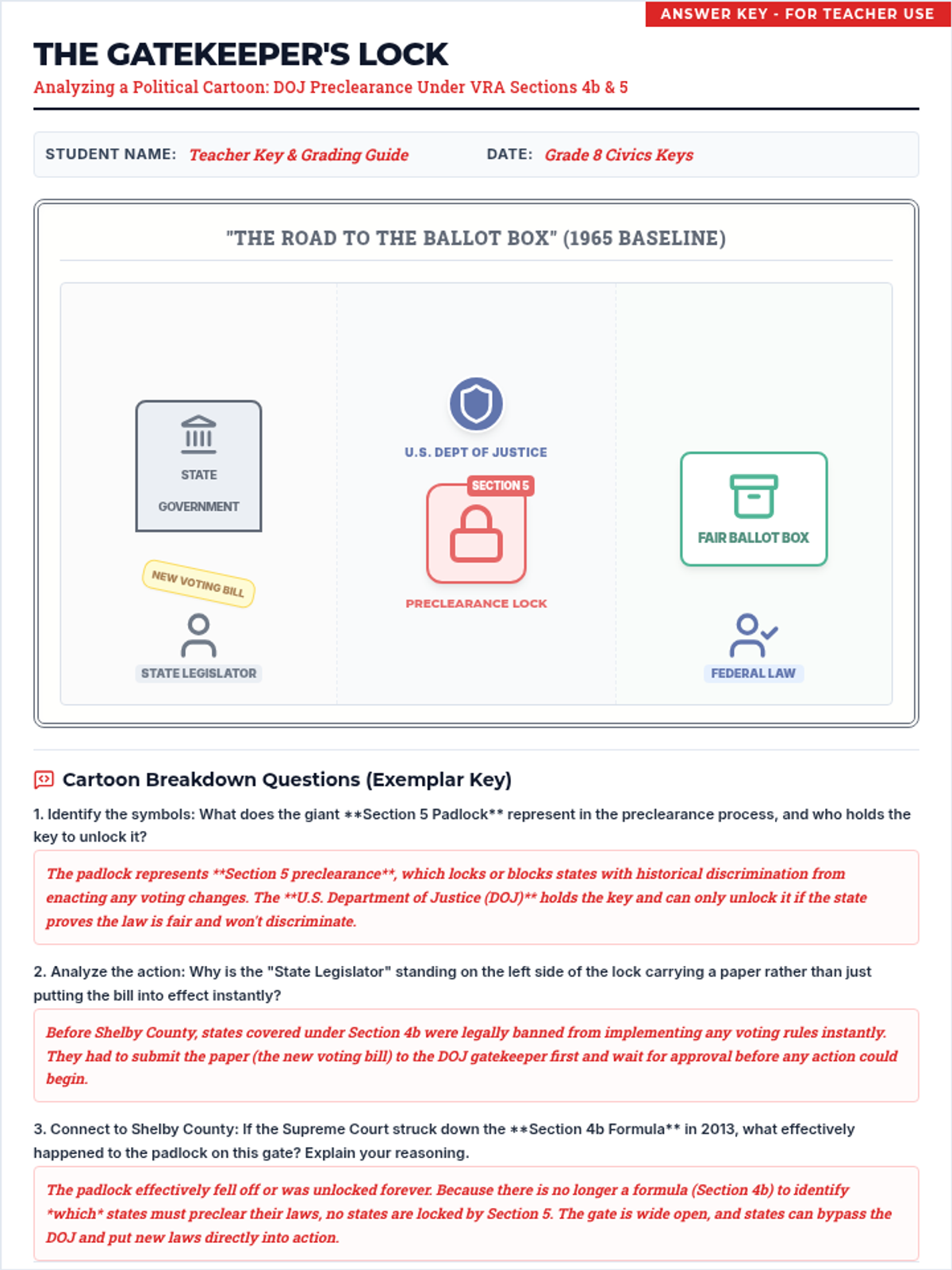
The matching teacher answer key for the gatekeeper political cartoon analysis activity, detailing symbols, preclearance rules, and Shelby County impacts.
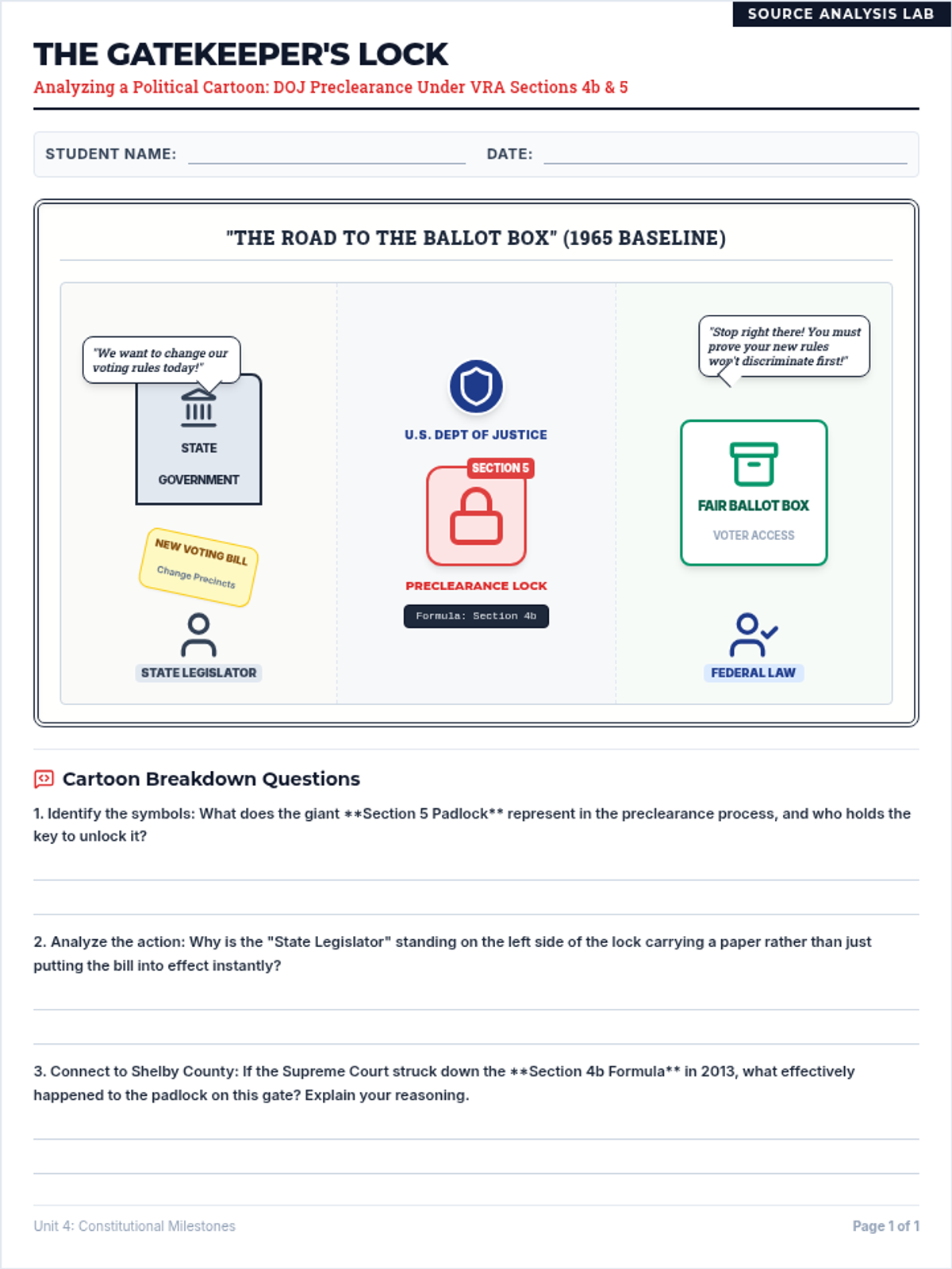
A visual source analysis worksheet focused on a custom political cartoon representing the DOJ's federal preclearance gatekeeper role under VRA Sections 4b and 5. Includes scaffolding and observation questions for 8th-grade civics.
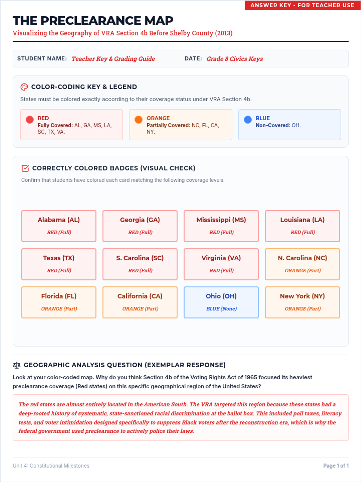
The matching teacher answer key for the preclearance map activity, featuring visual indicators and geographic analysis guidance.
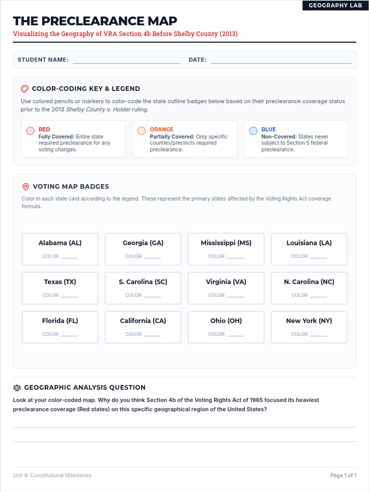
A hands-on student map color-coding activity. Students color-code specific U.S. states as fully covered, partially covered, or non-covered under the Voting Rights Act preclearance formula to understand the regional impact of the law.
An identical companion sheet to the student mapping activity, fully populated with high-quality exemplar answers, constitutional citations, and conceptual explanations suitable for 8th-grade Civics teachers.
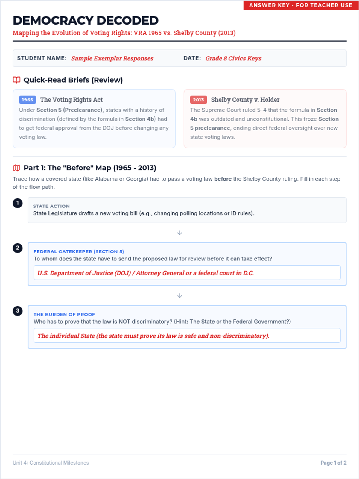
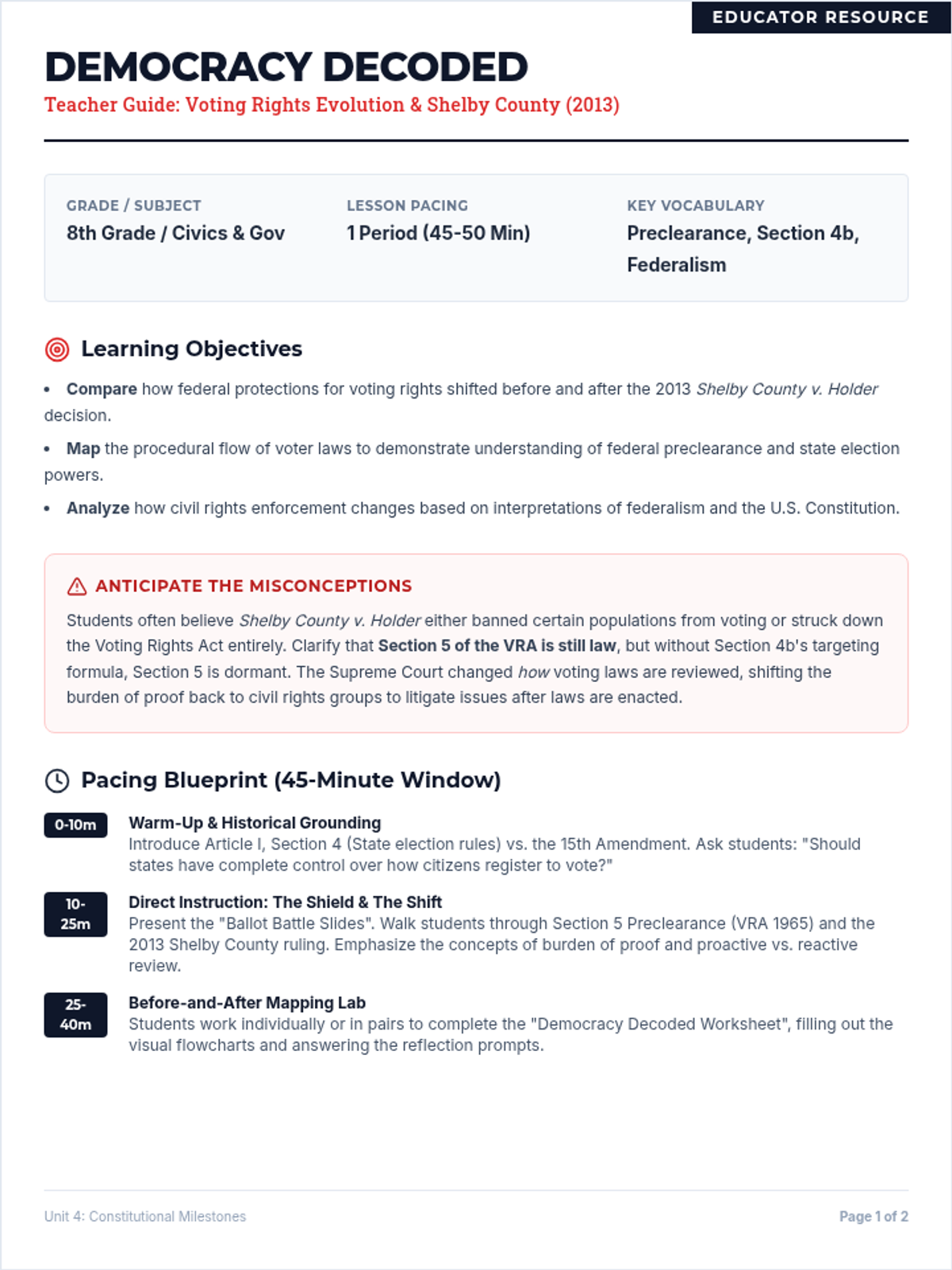
A comprehensive teacher facilitation guide to support delivering the Democracy Decoded lesson. Includes timeline breakdowns, answers to potential misconceptions, socratic prompts, and scaffolding support for 8th-grade civics.