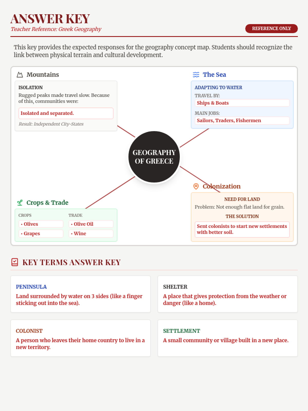
A scaffolded concept map for 6th-grade students to explore the geographic features of Ancient Greece, including its mountains, surrounding seas, and farming adaptations. Includes vocabulary definitions and hints to guide student work.
A comprehensive guide for teachers, including lesson objectives, daily pacing, key vocabulary, and differentiation strategies for the Golden Caravan lesson.
A trade simulation game where students act as merchants to understand the trans-Saharan trade and the economic effects of Mansa Musa's gold distribution.
A student travelogue template for narrative writing, structured as a series of journal entries reflecting Mansa Musa's journey.
Instructional slides covering the history of the Mali Empire, the logistics of Mansa Musa's pilgrimage, and his global economic impact.
A historical reading passage about Mansa Musa's pilgrimage, highlighting the scale of his caravan, the impact on regional economies, and the cultural exchange that followed.
A completed teacher reference for the Greek Geography Map, featuring full answers for the concept map and vocabulary definitions.
A pair of identical exit tickets for a quick check for understanding at the end of the lesson. It covers river identification, the significance of Hammurabi's Code, and a student self-assessment of confidence. Blank spacing and padding have been adjusted to ensure perfect fit on a single page.
A comprehensive answer key for the Royal Decree Assessment, providing correct answers for the true/false and fill-in-the-blank sections, along with sample responses and grading criteria for the short-answer questions.
A visually engaging slide deck for presenting the key concepts of Ancient Mesopotamia, including geography, irrigation, the rise of city-states, cuneiform writing, Hammurabi's Code, and early empires. It features high-contrast visuals, clear hierarchy, and discussion prompts.
A concise answer key for the River Realm Map Activity, providing the correct numeric matches for geographic features and grading criteria for the shading and analysis portions.
A map-based activity for students to identify key geographic features of Ancient Mesopotamia, including the Tigris and Euphrates rivers, the Fertile Crescent, and surrounding regions. It includes a stylized map for labeling and a short-answer section for geographic analysis.