Essential safety protocols, map reading, and compass navigation for wilderness environments. Strengthens group dynamics and problem-solving through structured outdoor team-building challenges.
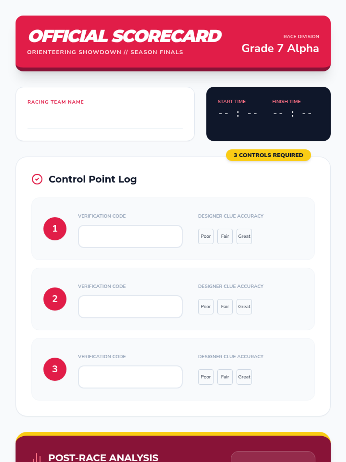
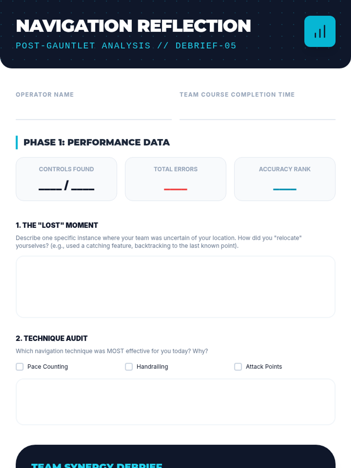
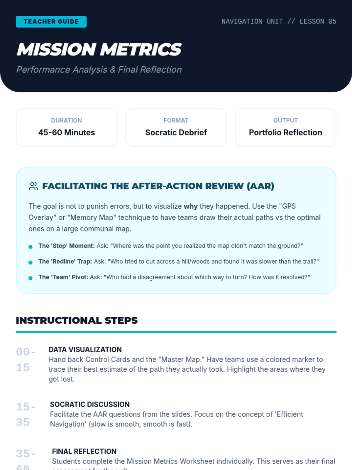
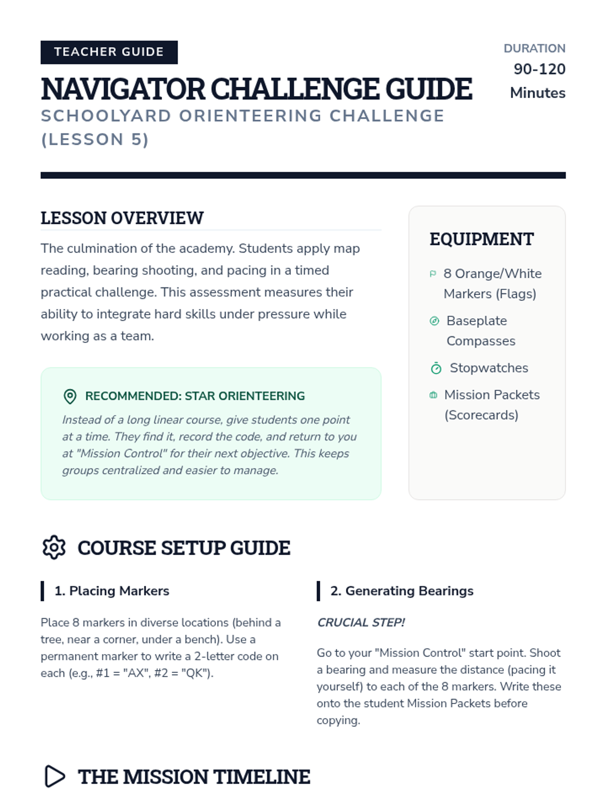
The sequence concludes with a timed race where teams navigate the peer-designed courses. Students must balance physical speed with the need to stop and check their navigation to avoid costly wrong turns. Reflection follows the activity, focusing on how stress affects decision-making and the efficiency of their route choices.
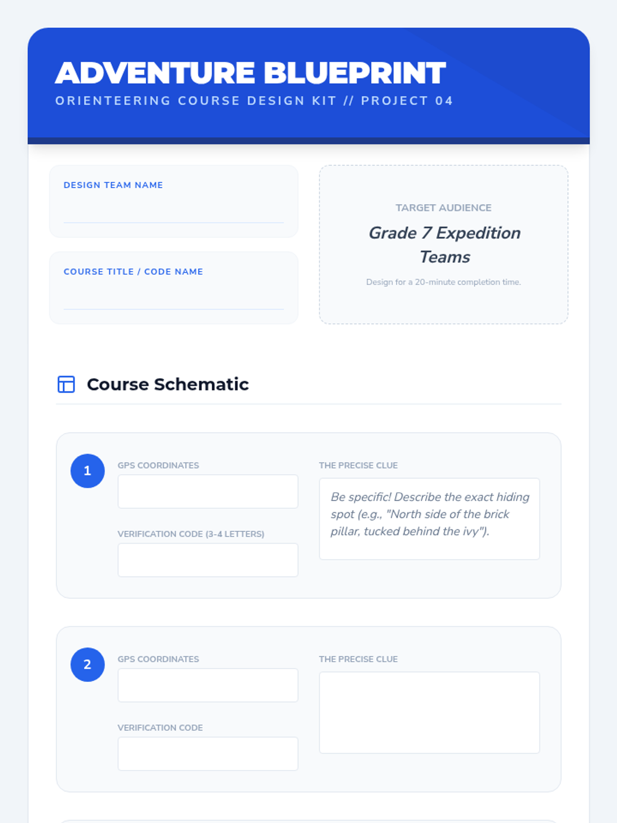
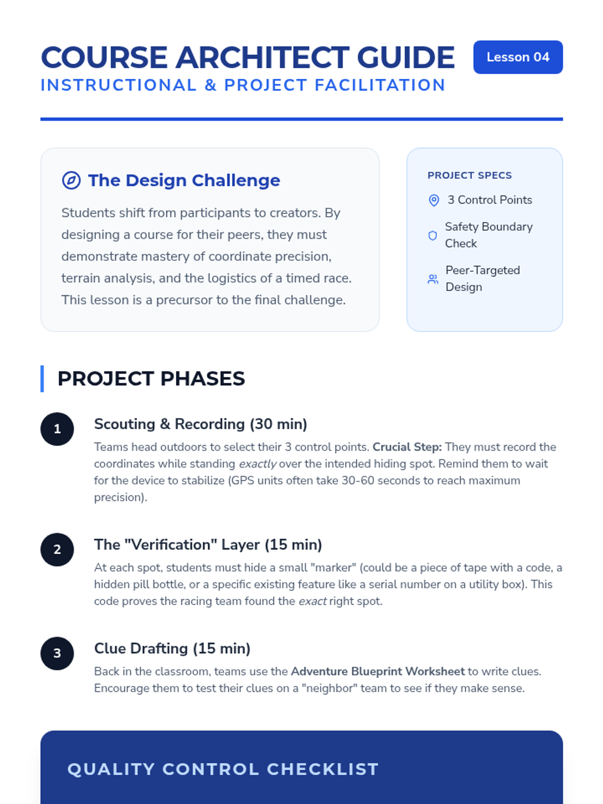
Flipping the role from participant to designer, student groups create their own mini-orienteering course for another team. They must select safe control points, mark them on a map or record coordinates, and write clues. This project-based lesson reinforces understanding by forcing students to consider the user experience and terrain clarity.
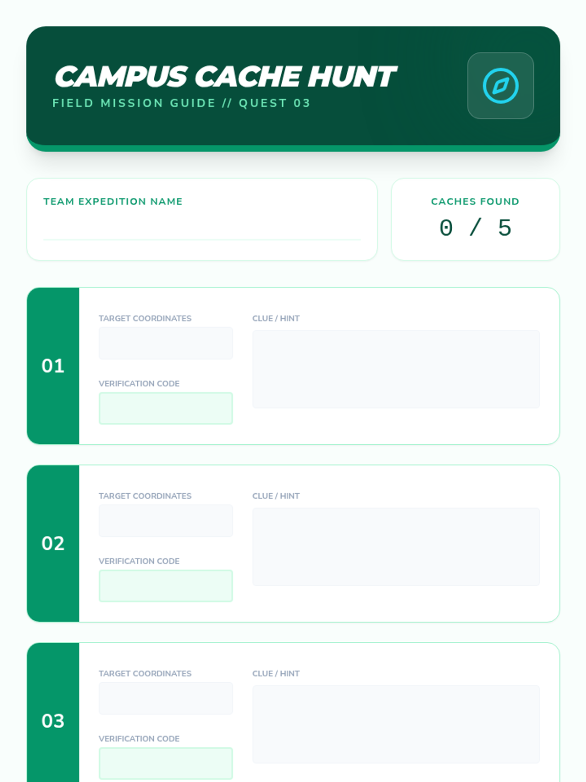
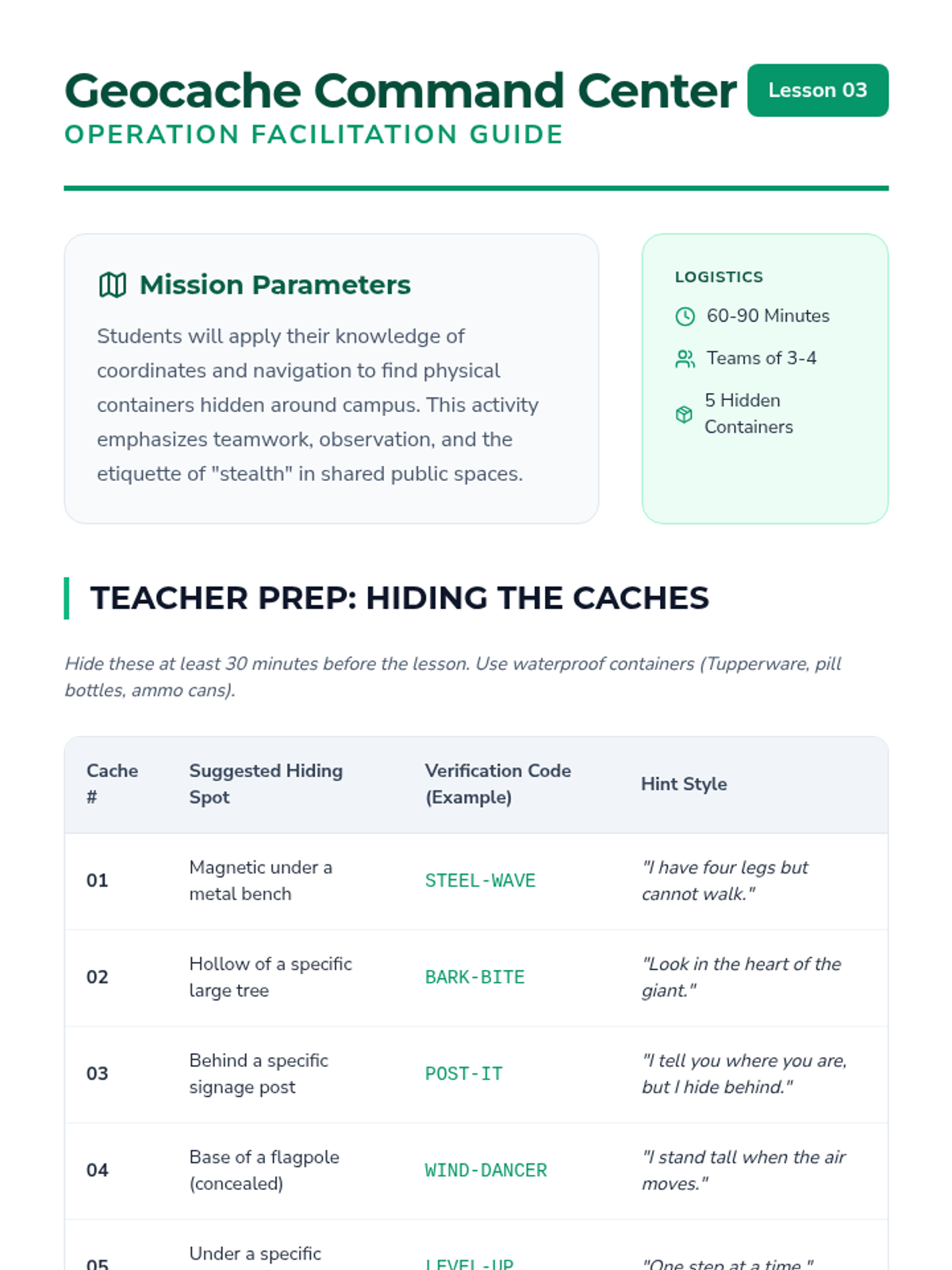
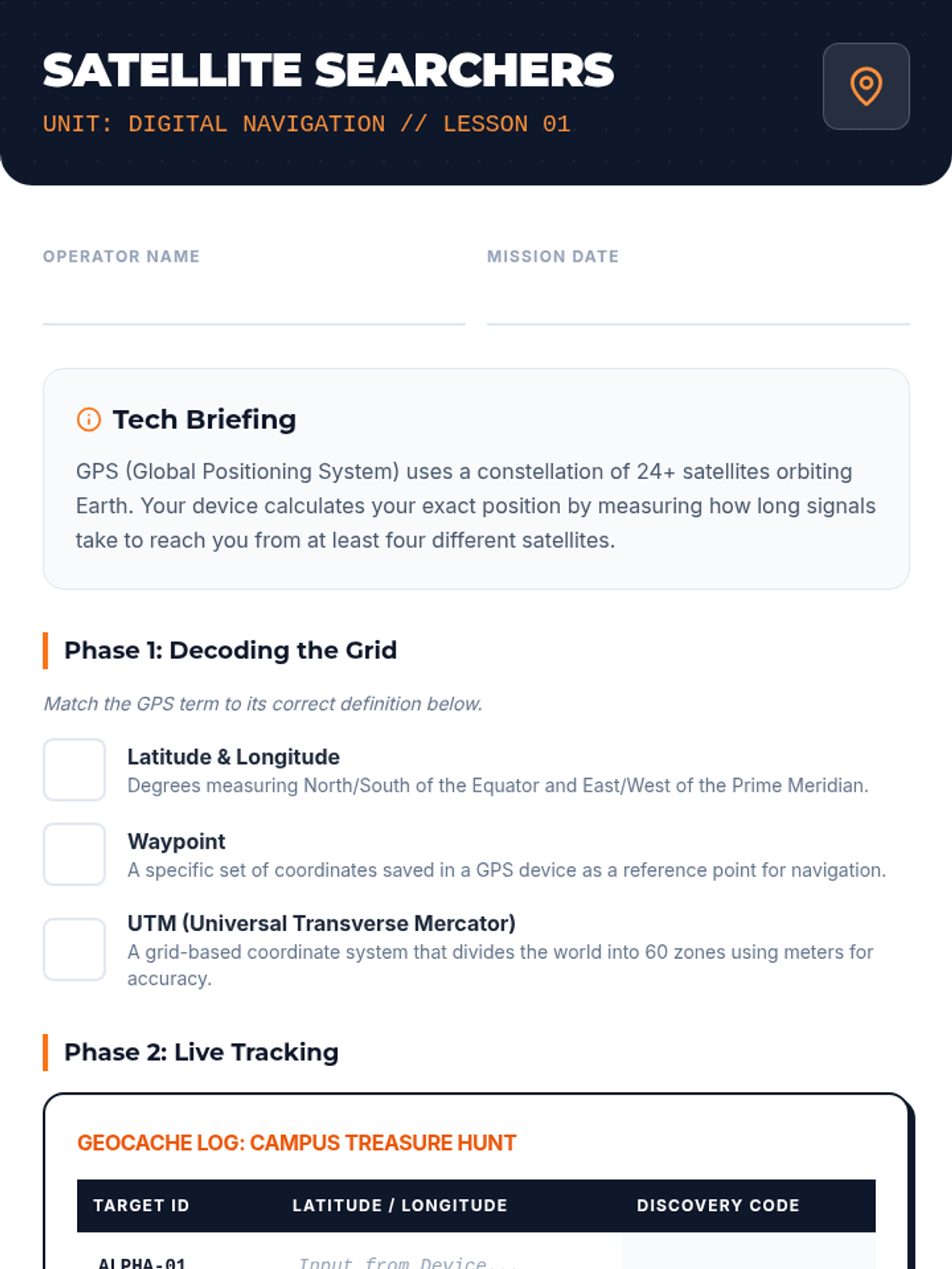
Students work in small teams to locate a series of hidden 'caches' around the campus using GPS coordinates. This game-based lesson requires them to decipher clues and navigate terrain obstacles to find physical containers. It encourages teamwork and problem-solving while applying navigation concepts in a fun, low-stakes environment.
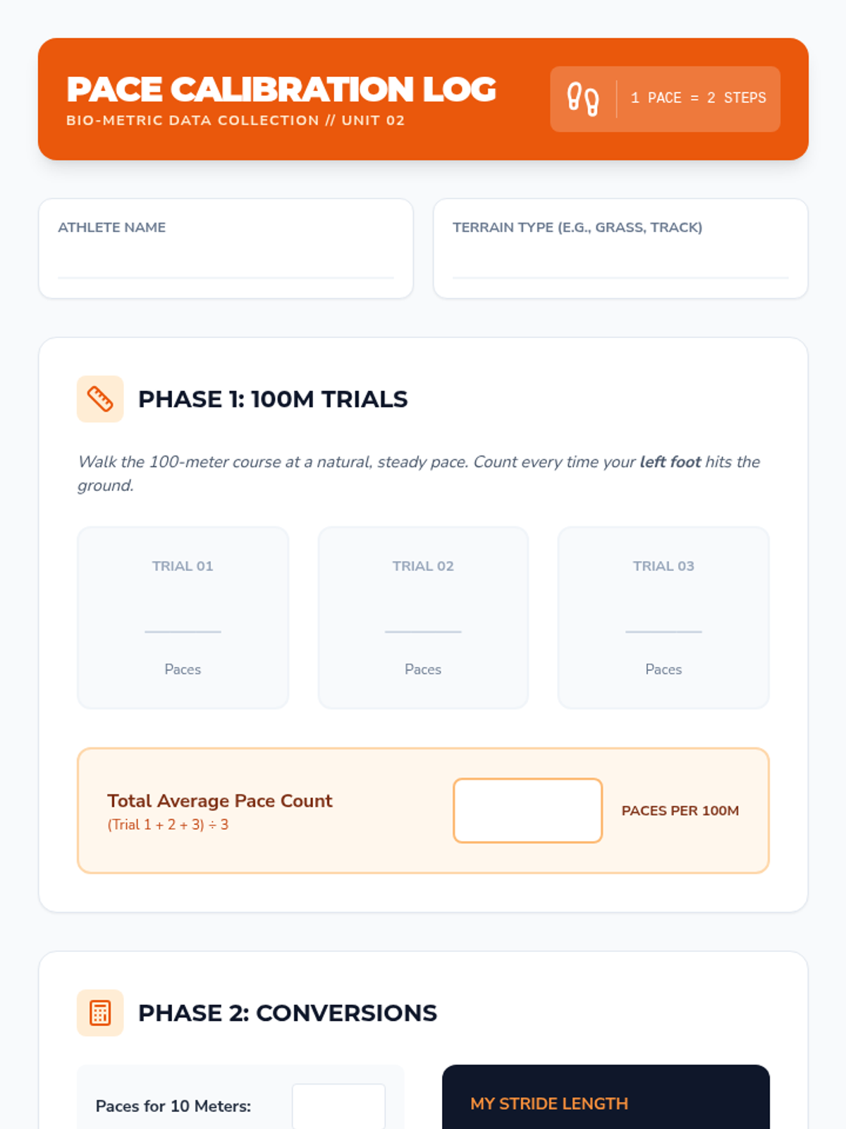
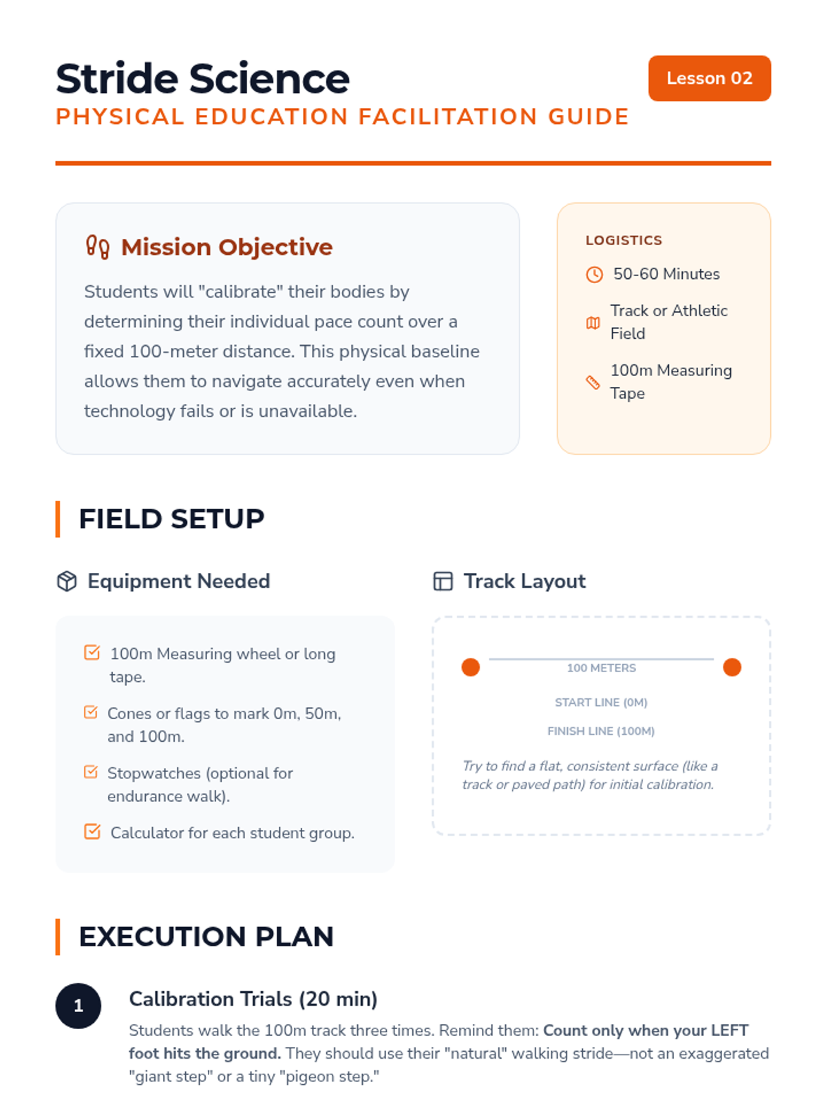
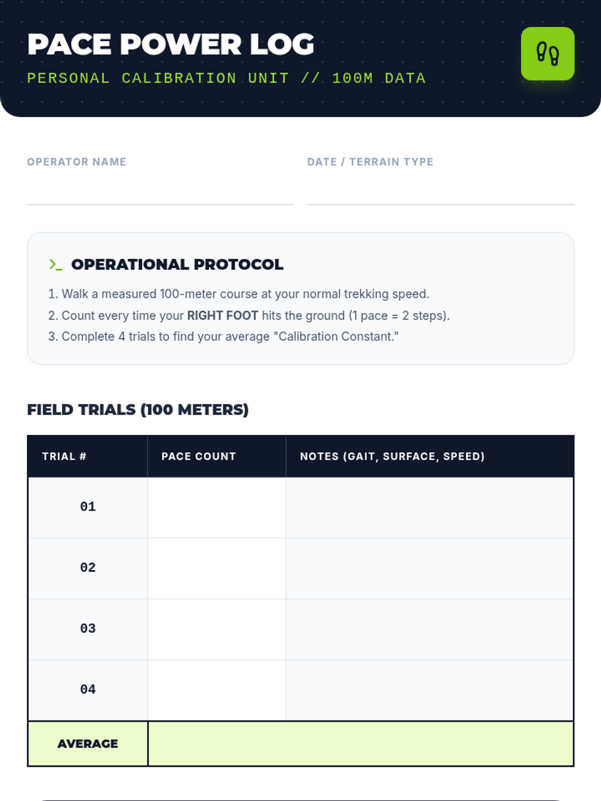
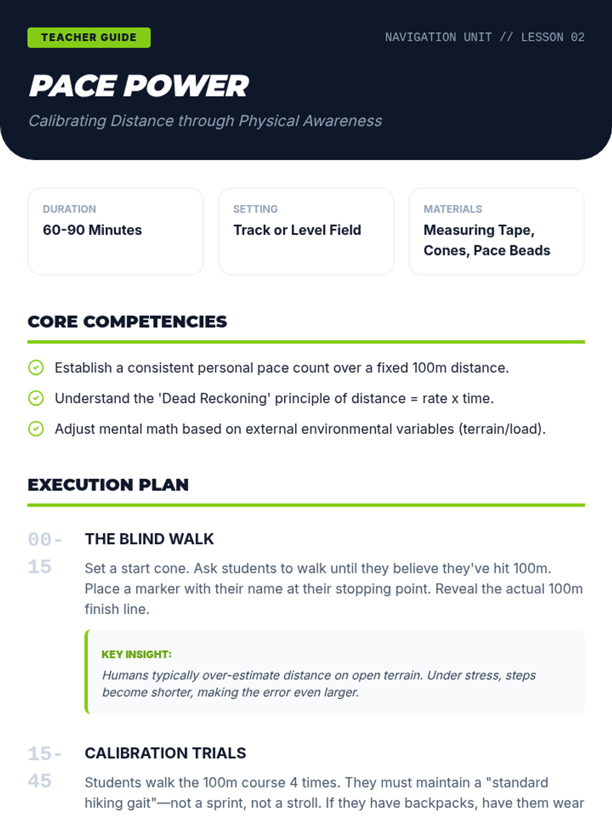
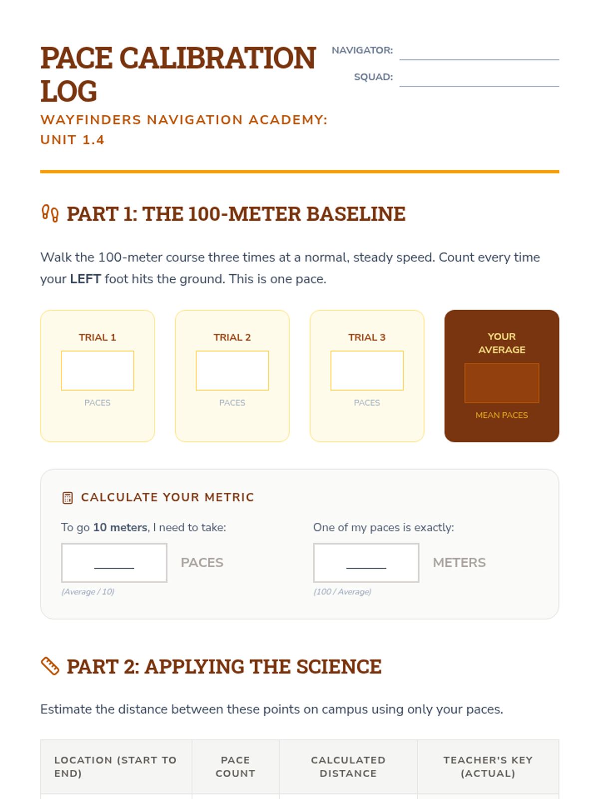
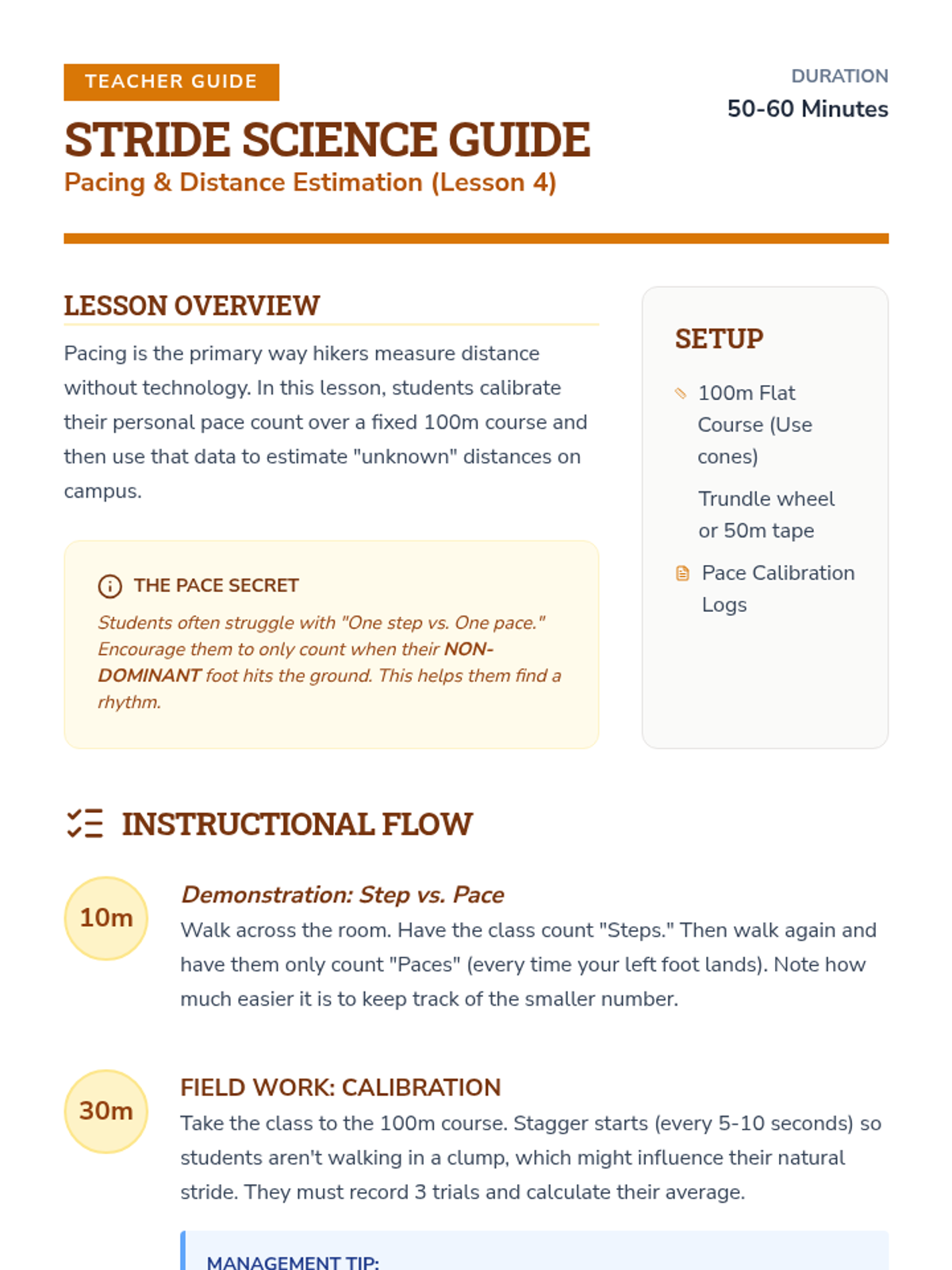
Before relying on technology, students calibrate their physical movement by measuring their pace count over 100 meters. They participate in an endurance walk/jog where they must estimate distance traveled without tools. This physical education-focused lesson highlights the link between fitness and successful navigation.
A reflective analysis of performance data and route choices to improve future navigational decision-making and teamwork.
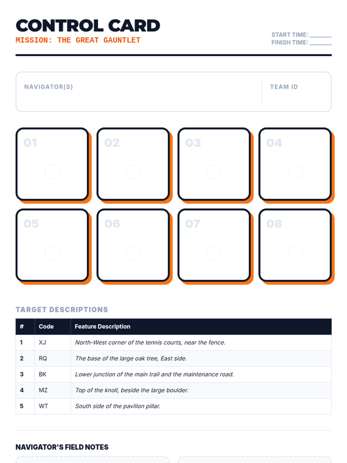
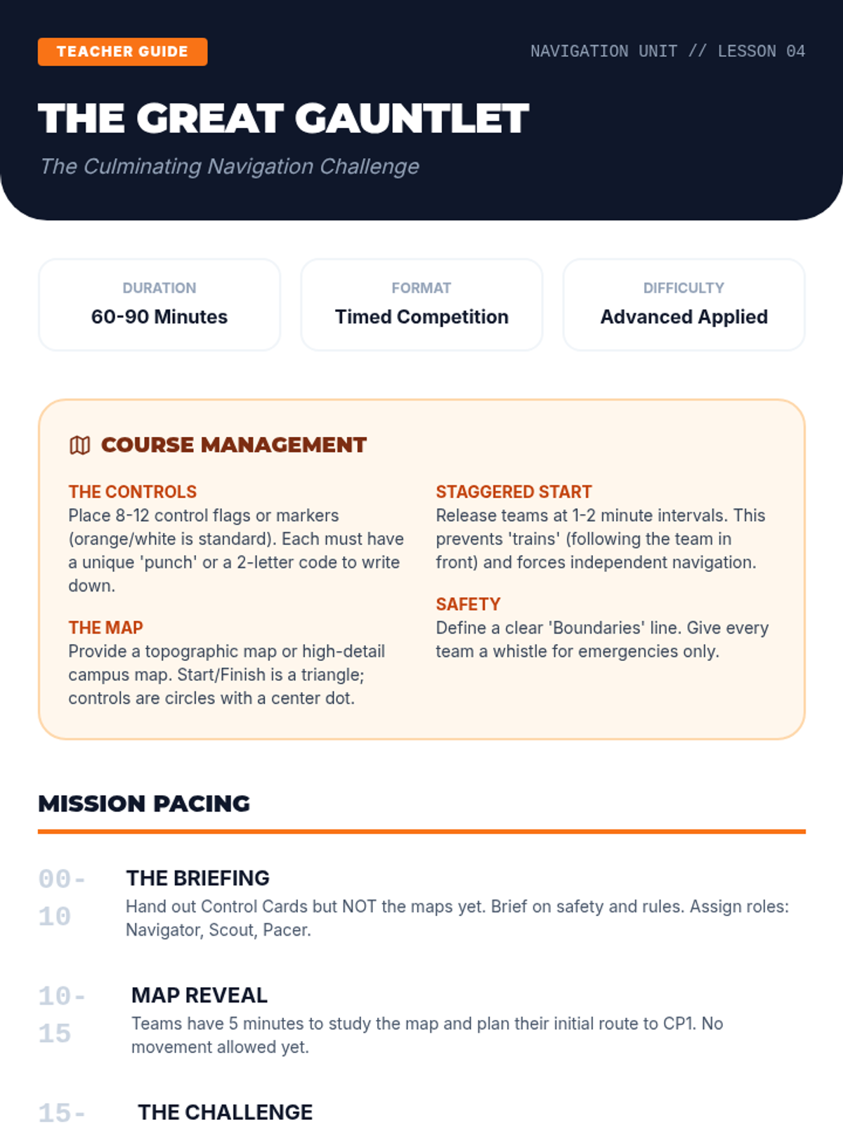
A culminating physical and mental challenge where students navigate a timed course, applying all previously learned skills under pressure.
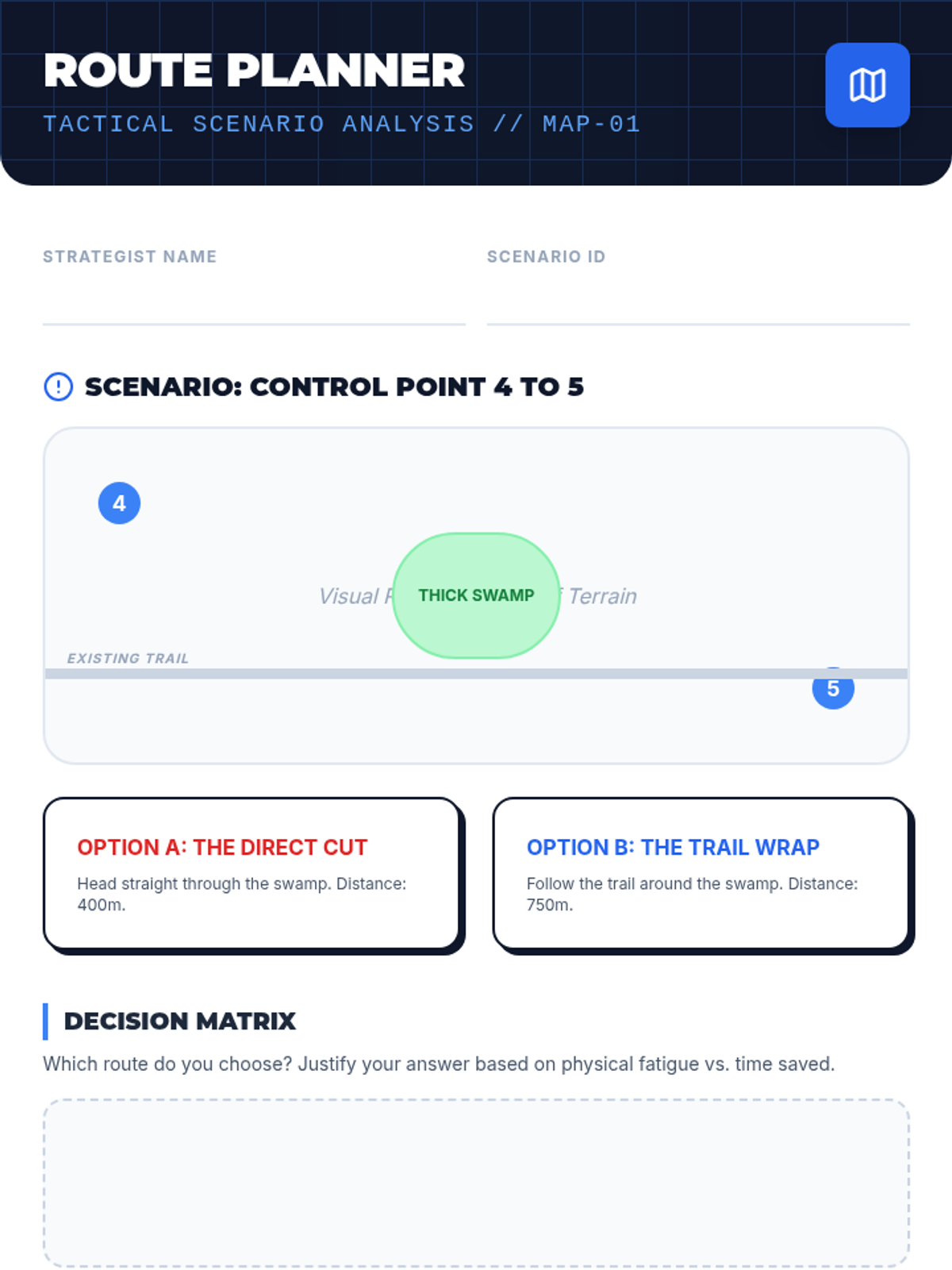
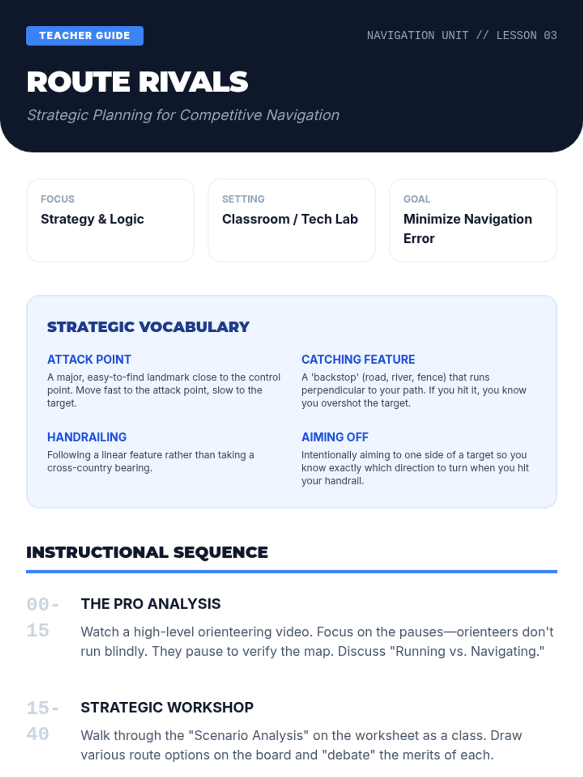
An introduction to competitive orienteering strategies, focusing on route choice, attack points, and catching features to optimize speed and accuracy.
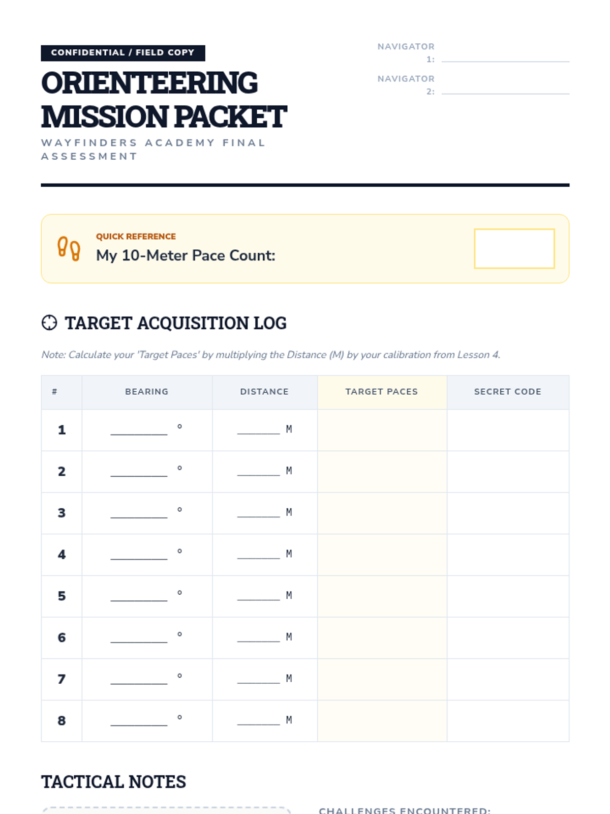
Students calibrate their personal pace count to estimate distance over varied terrain, a vital skill for dead reckoning and precise navigation.
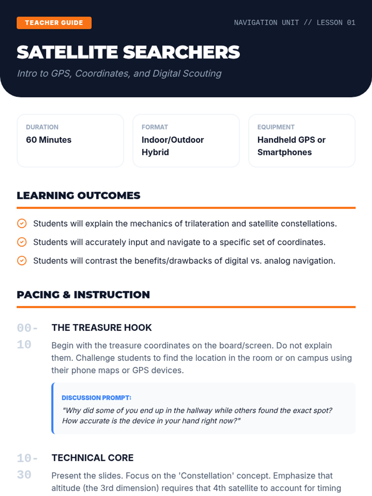
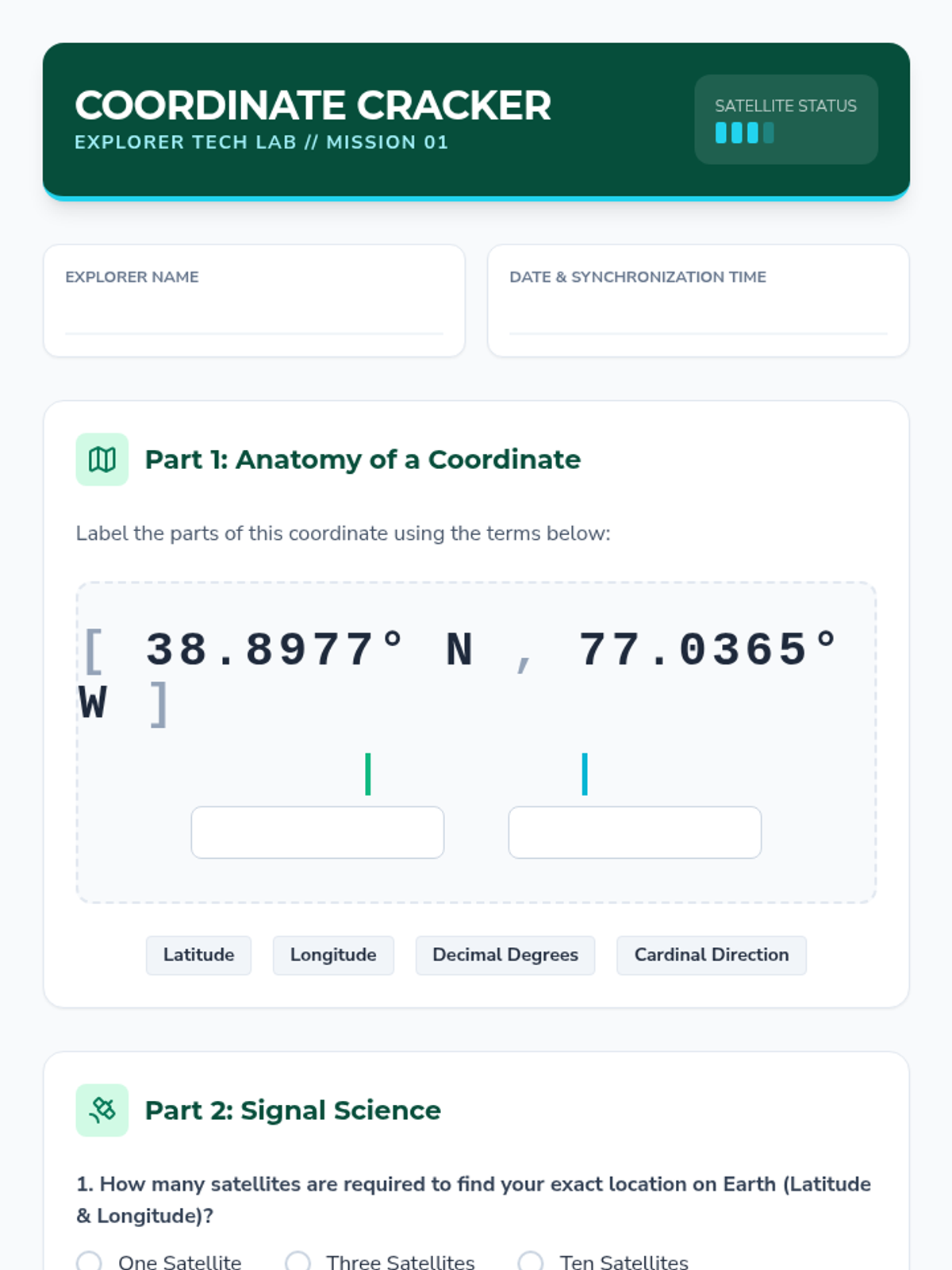
Students explore GPS technology, learning to interpret coordinates and manage waypoints while understanding the relationship between satellite tech and traditional map skills.
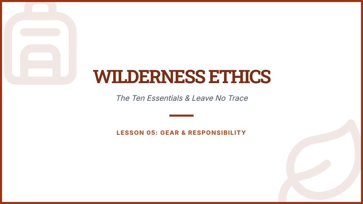
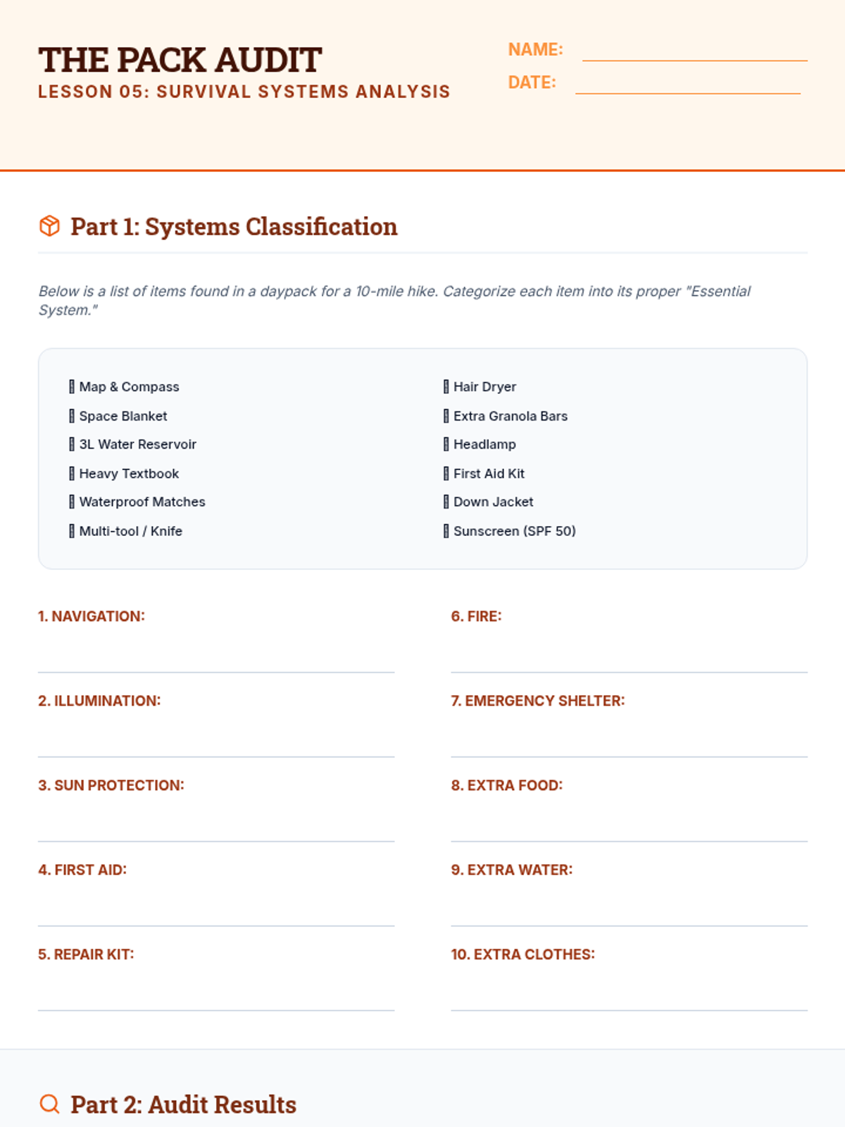
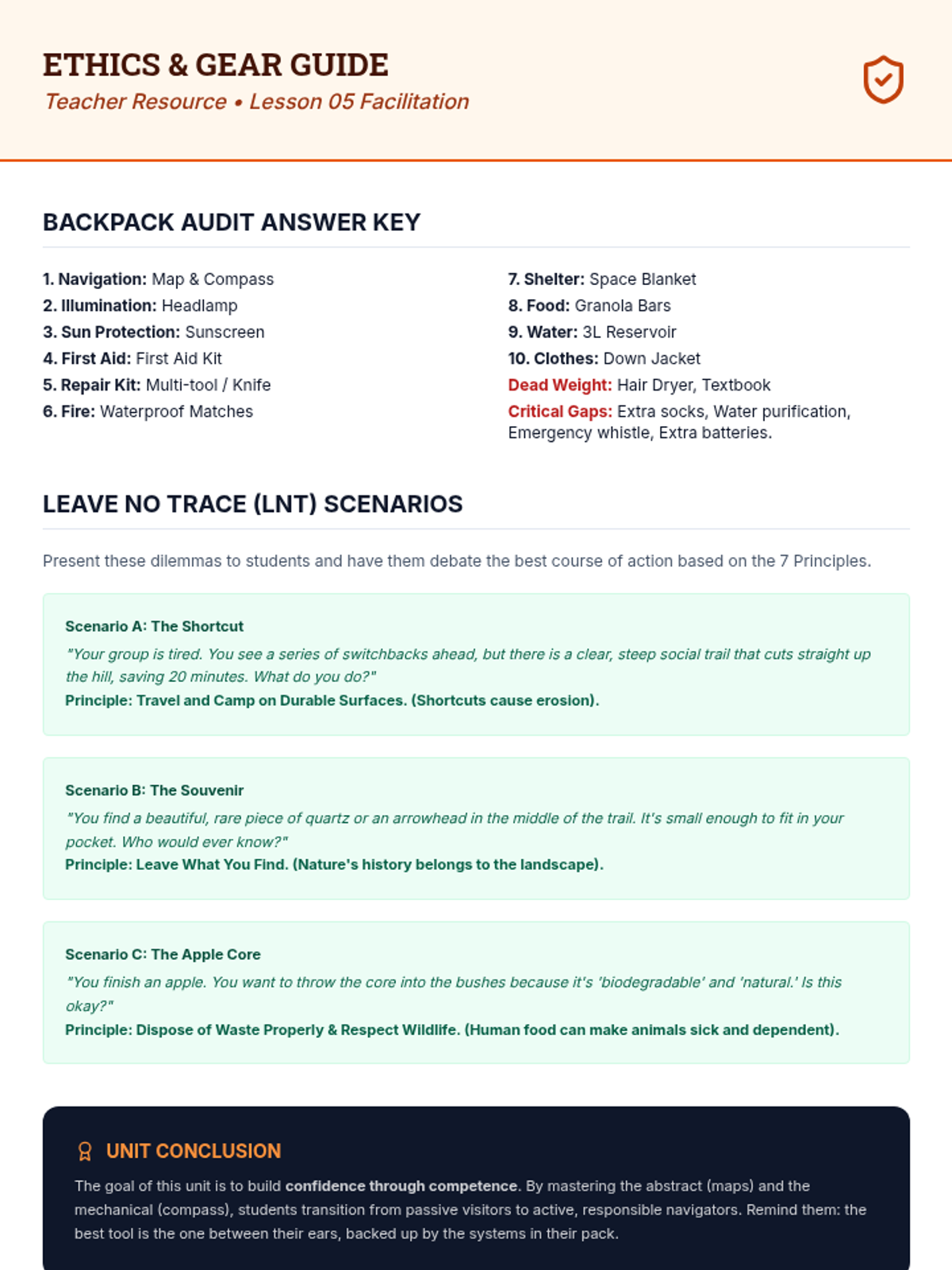
Essential gear for wilderness safety and the ethics of Leave No Trace principles.
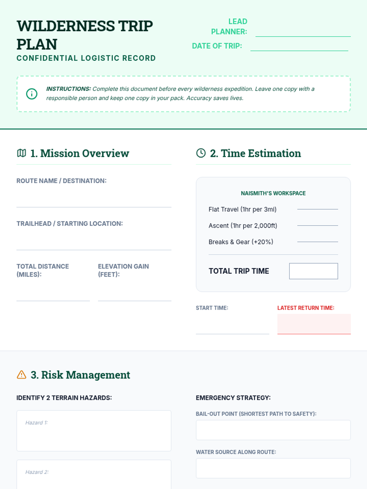
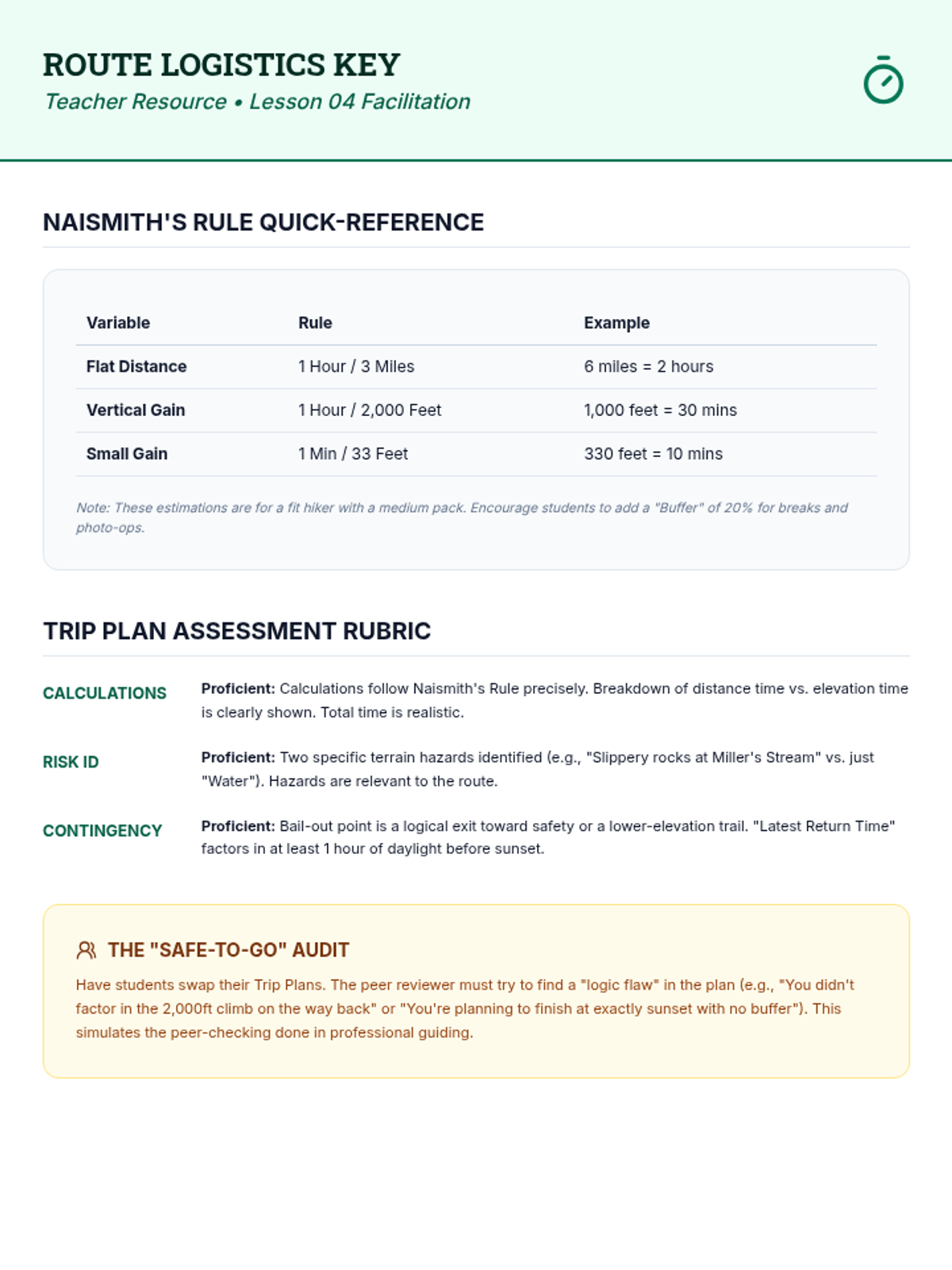
Logistical planning using Naismith's Rule to calculate travel time and assessing route risks.
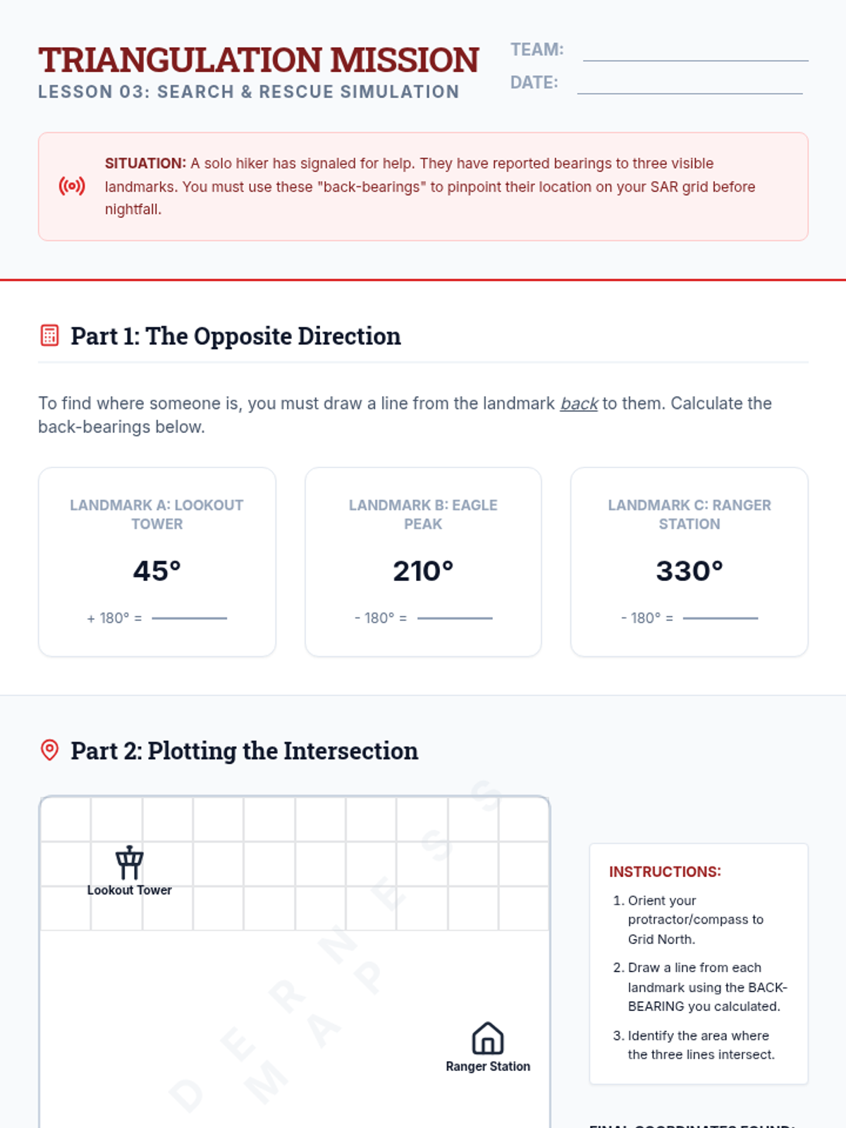
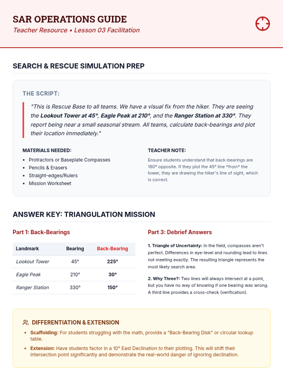
Integrating map and compass skills to pinpoint an unknown location using back-bearings and triangulation.
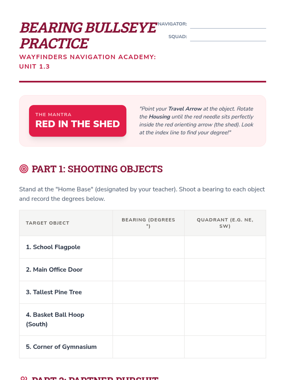
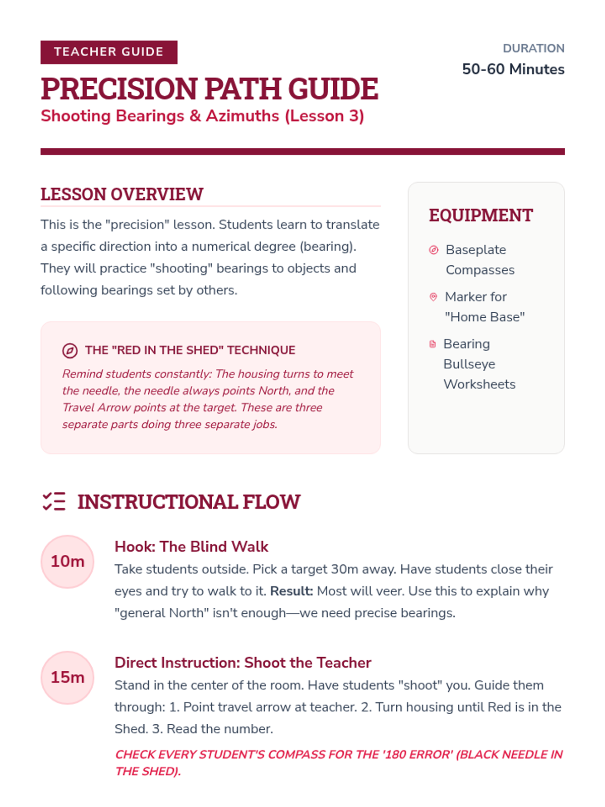
Introduction to the baseplate compass, magnetic declination, and the process of shooting and following bearings.
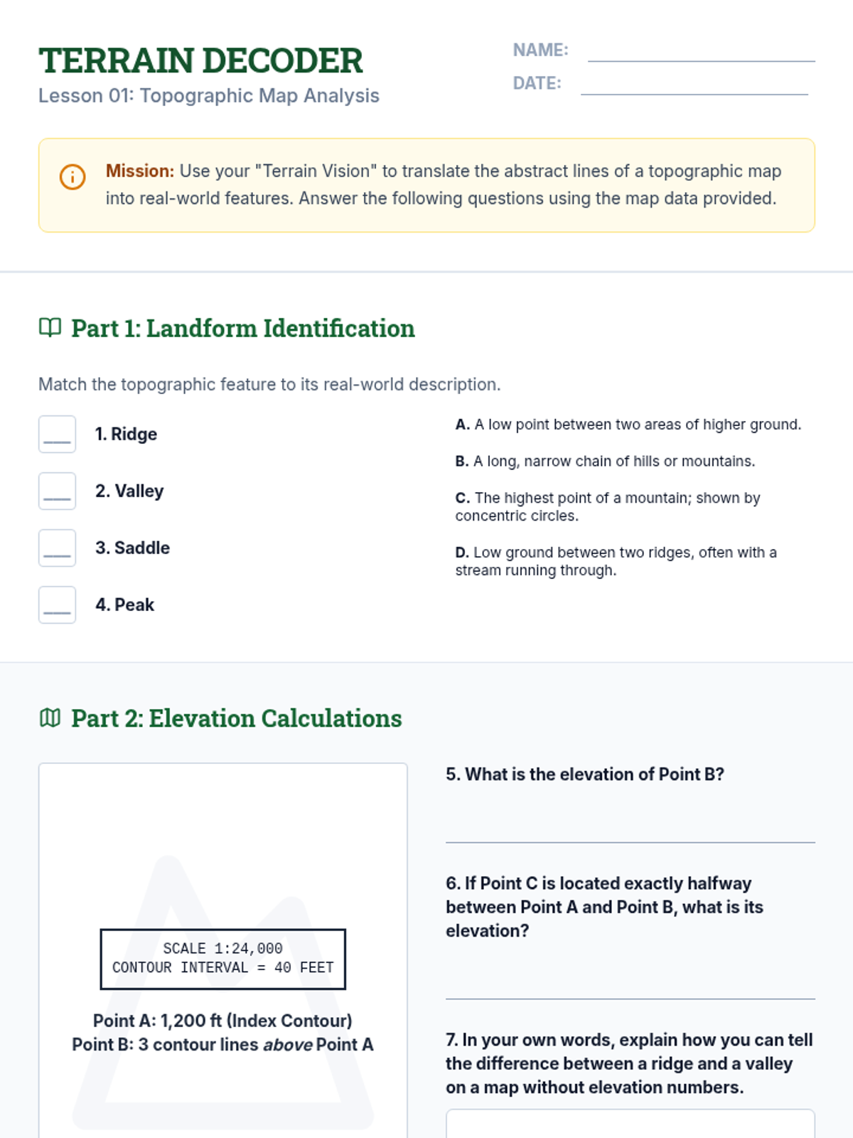
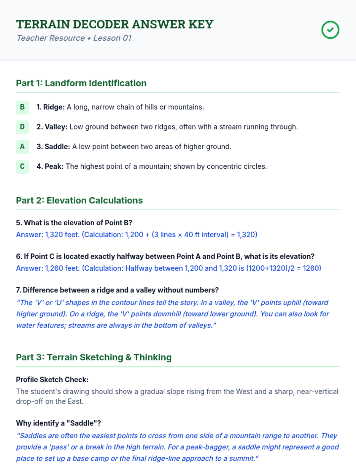
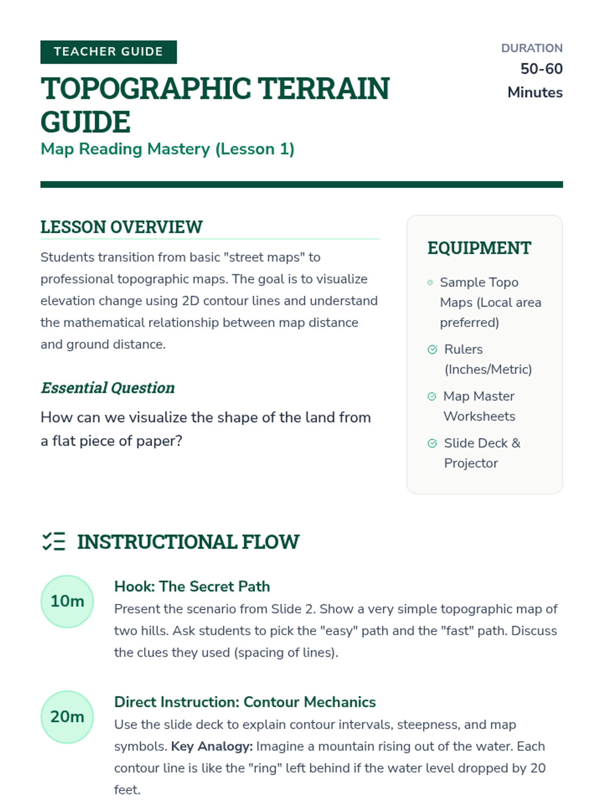
Students learn to translate 2D contour lines into 3D visualizations, identifying ridges, valleys, and peaks.
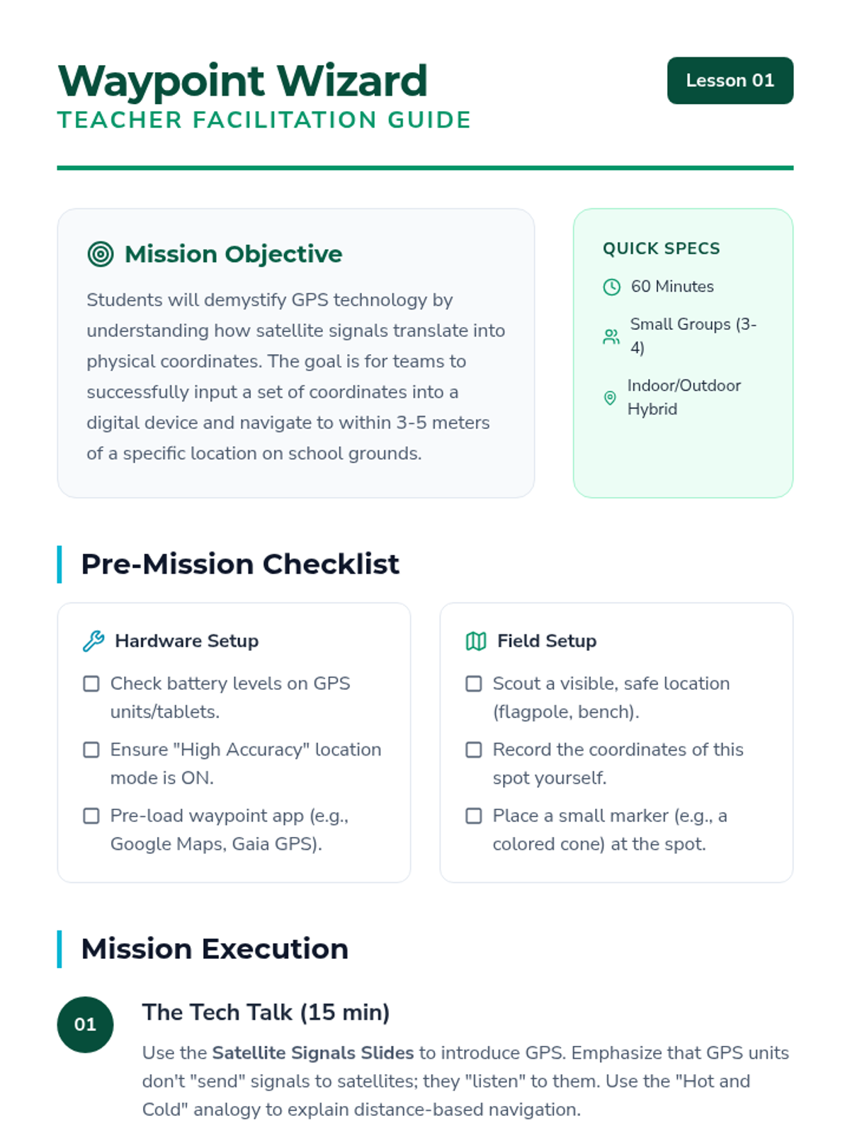
Students explore how Global Positioning Systems work, learning about latitude, longitude, and satellite triangulation. They practice entering coordinates into a device and navigating to a static waypoint on the school grounds.
A final challenge where students apply all learned skills to complete a timed schoolyard orienteering course.
Learners calibrate their personal pace count to measure distances accurately on foot.
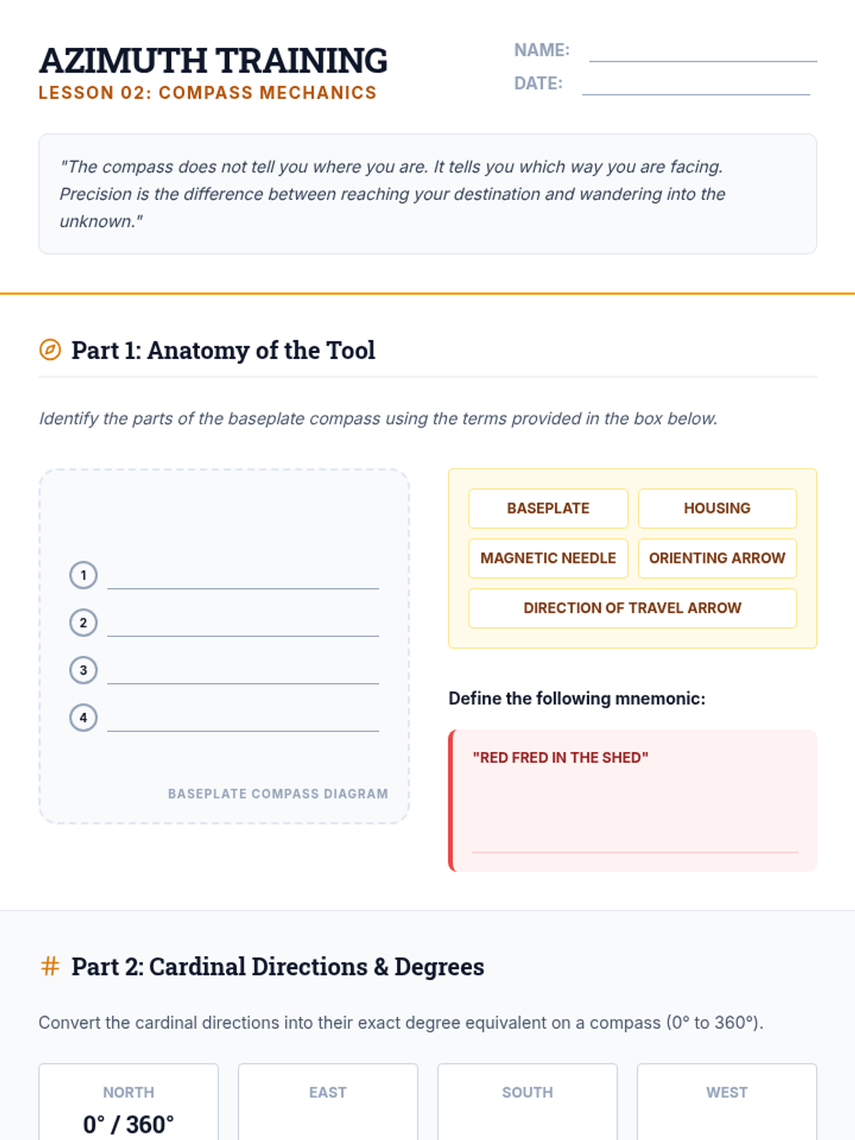
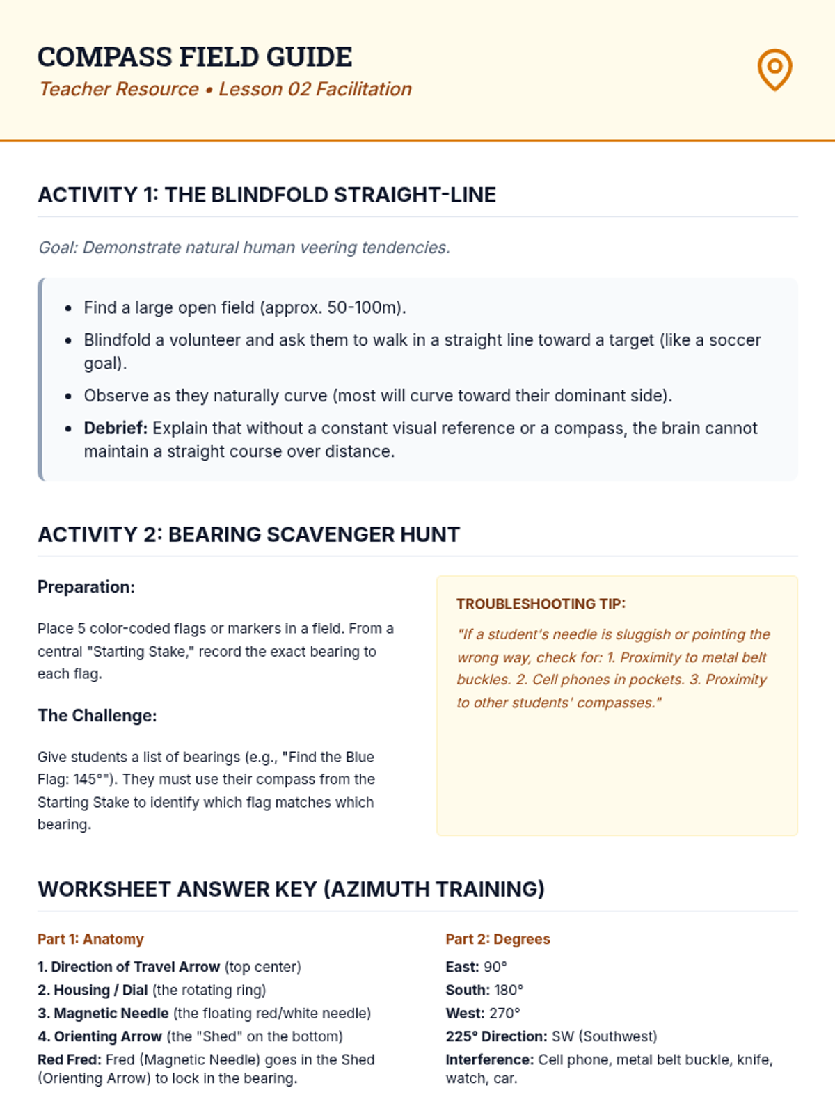
Students learn the 'Red in the Shed' technique to shoot bearings and follow a precise line of travel.
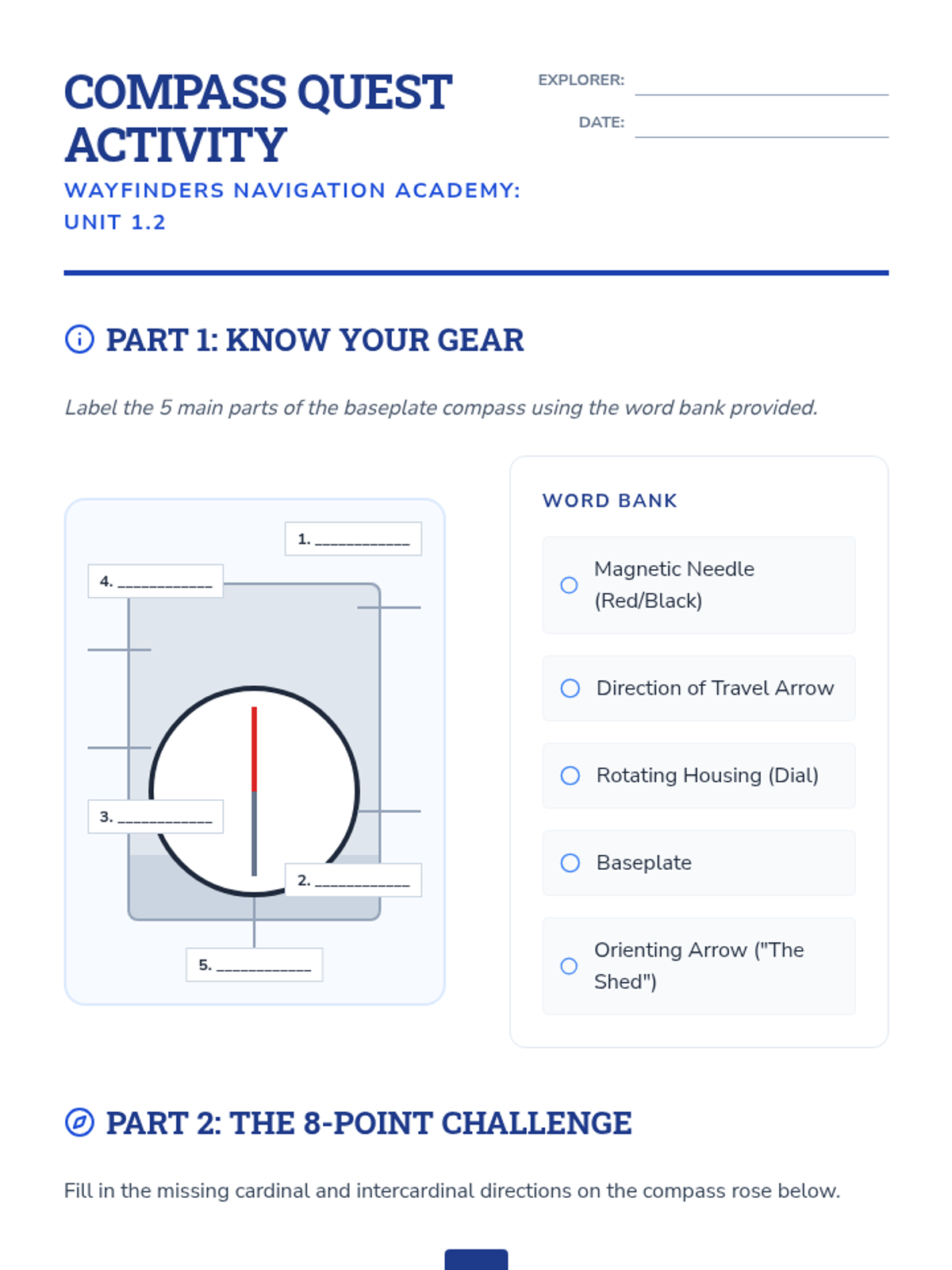
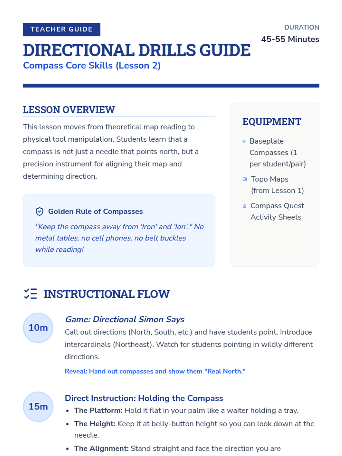
This lesson covers the parts of a baseplate compass, cardinal directions, and how to orient a map to North.
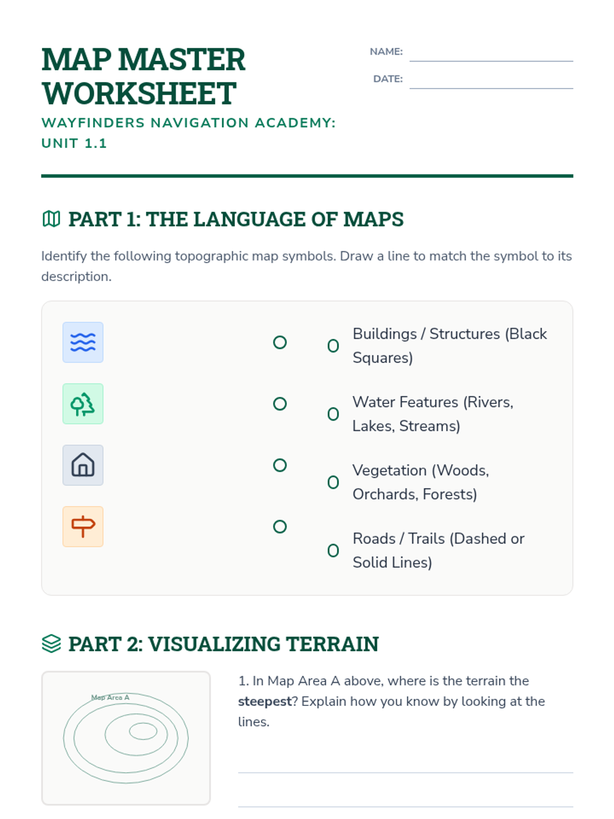
Students explore topographic maps, identifying legends, scales, and contour lines to visualize terrain and calculate distances.
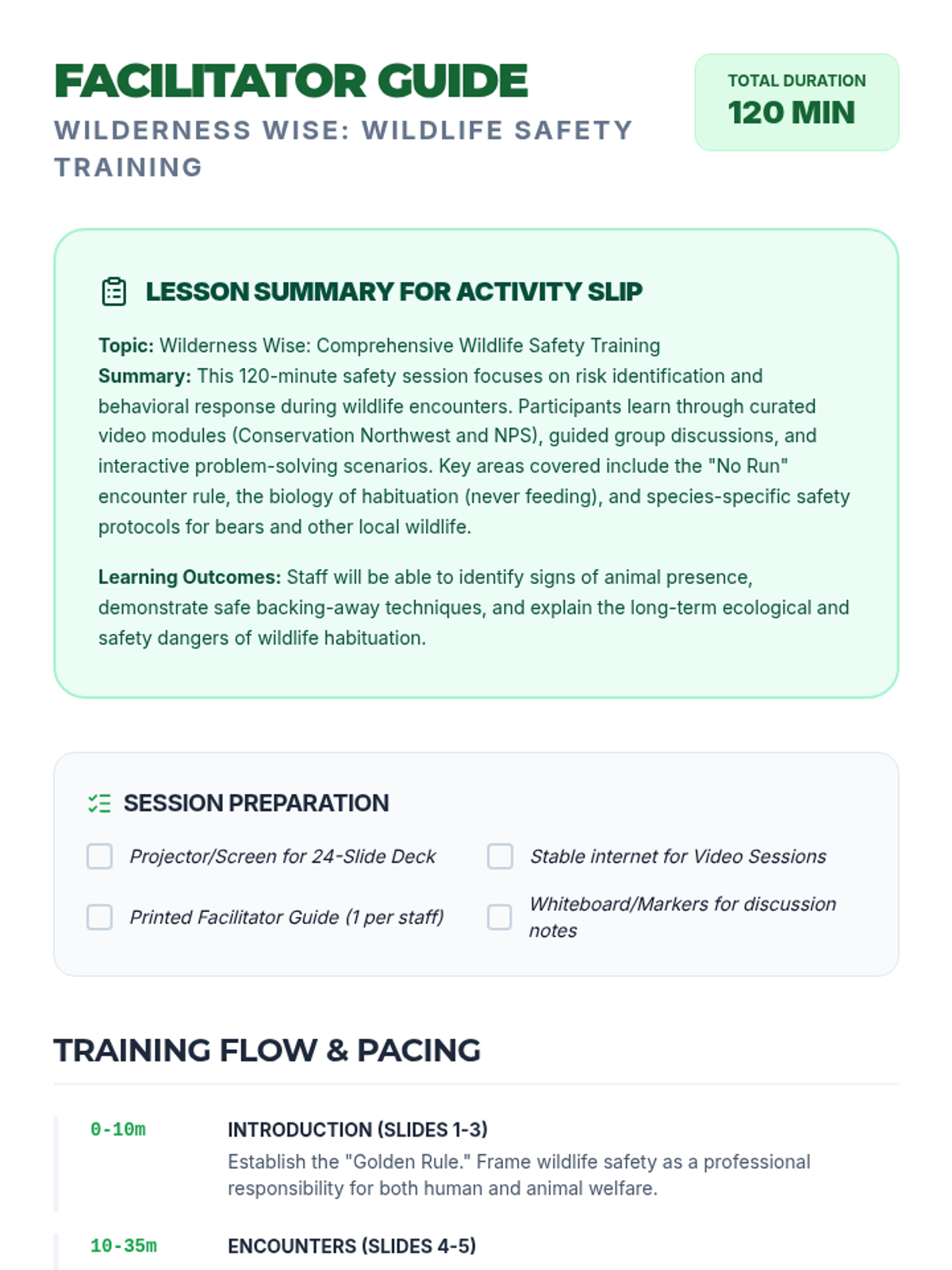
A comprehensive 120-minute safety training session focused on identifying wildlife risks, recognizing safe behaviors, and responding correctly to animal encounters. This lesson equips participants with practical skills to protect both themselves and local wildlife.
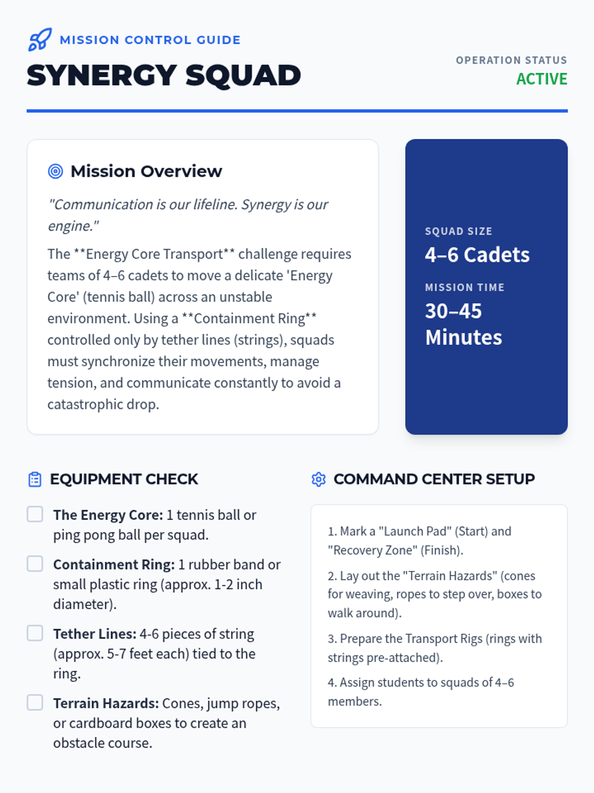
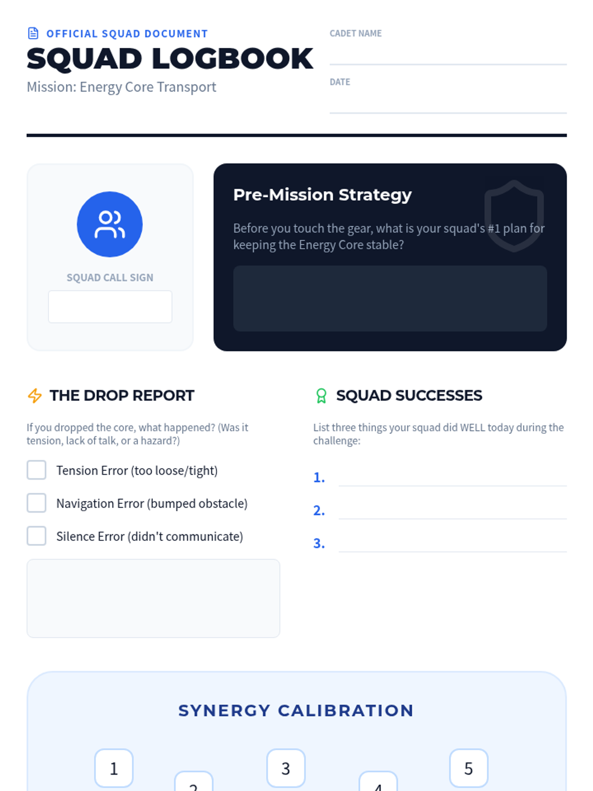
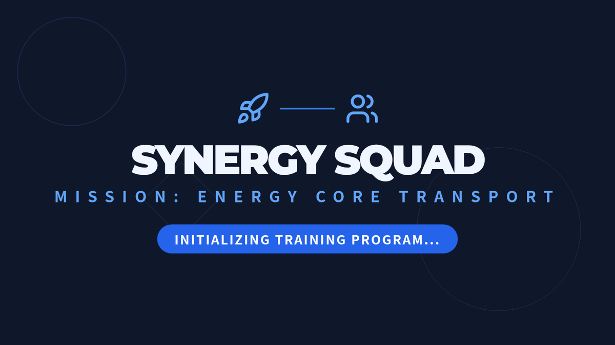
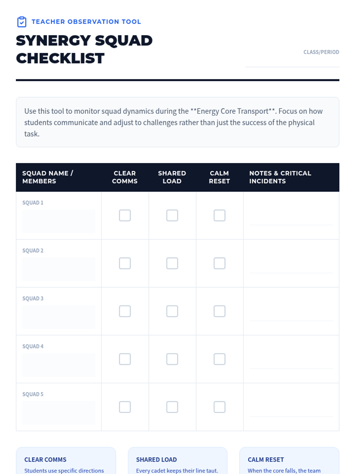
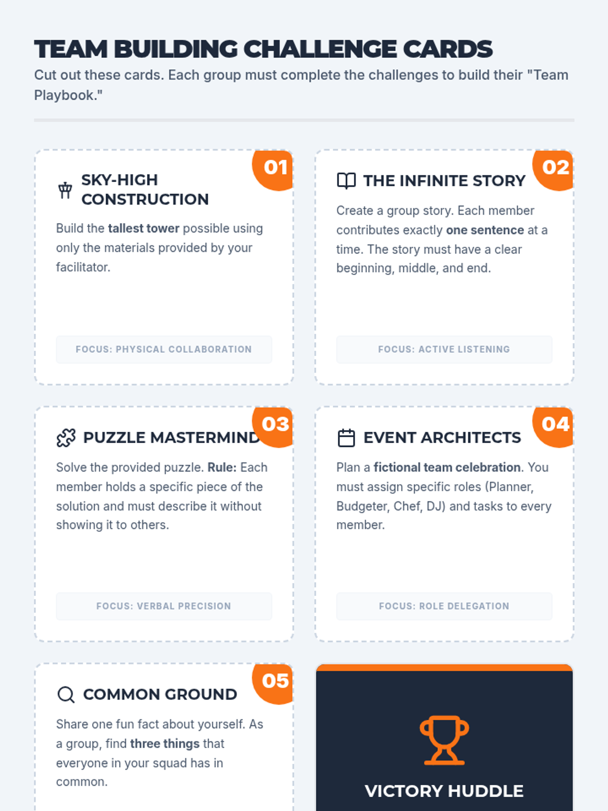
Students develop essential teamwork skills through a high-stakes physical challenge. By transporting a delicate 'energy core' using only a multi-stringed ring, teams must synchronize their movements and communicate clearly to succeed.
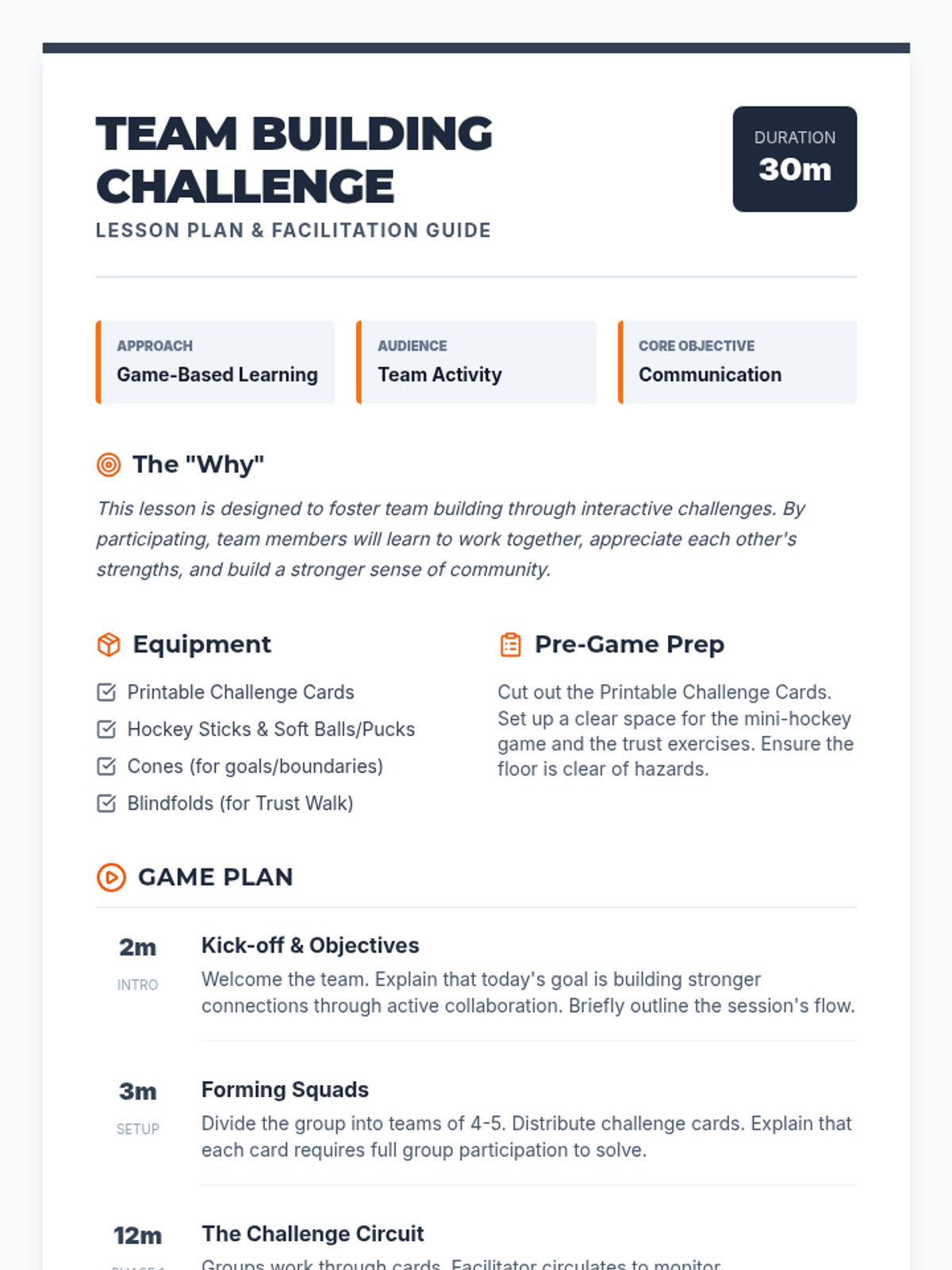
A high-energy team-building lesson focused on communication, trust, and collaboration through interactive challenges and a hockey-themed strategy game.
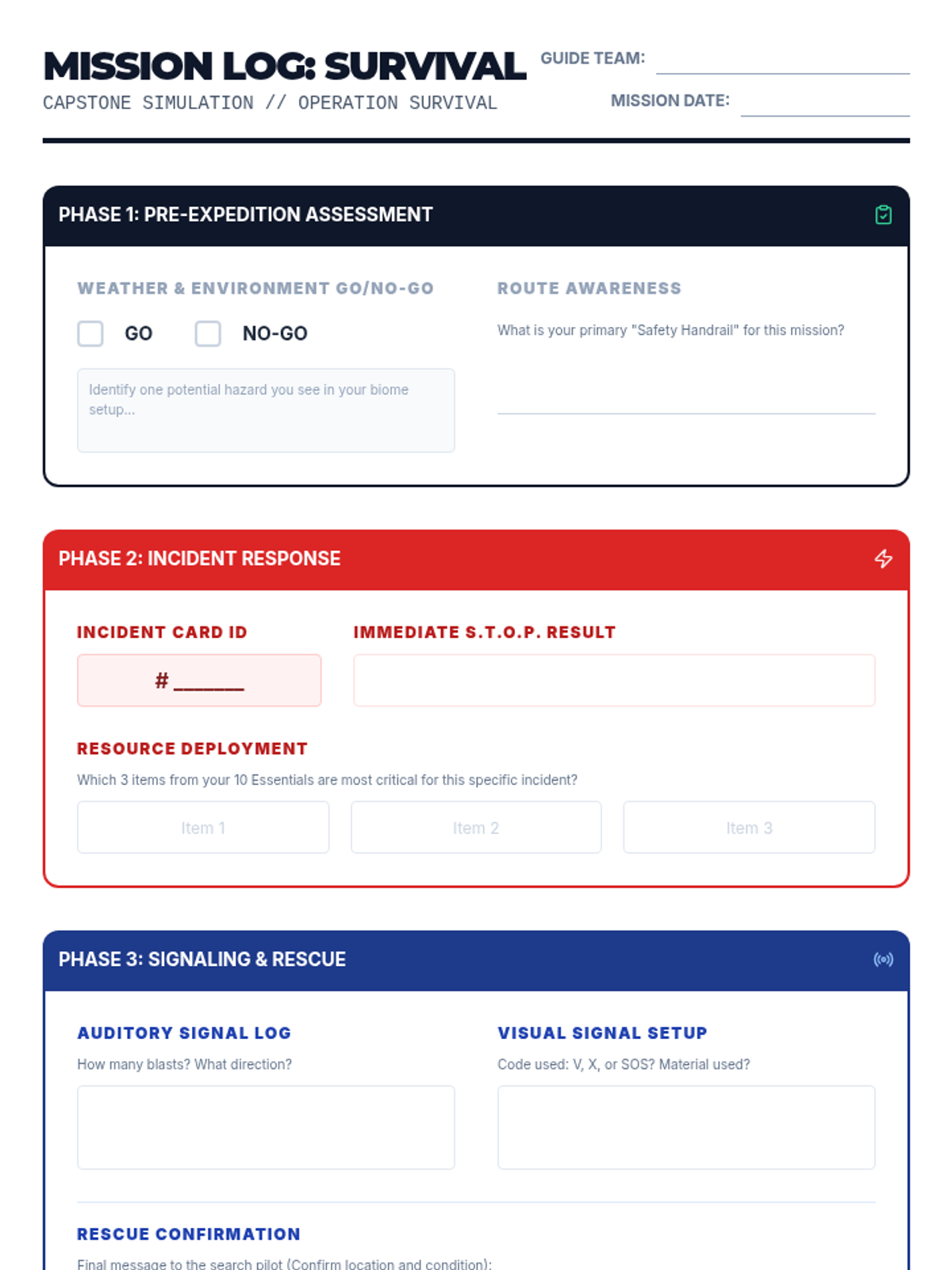
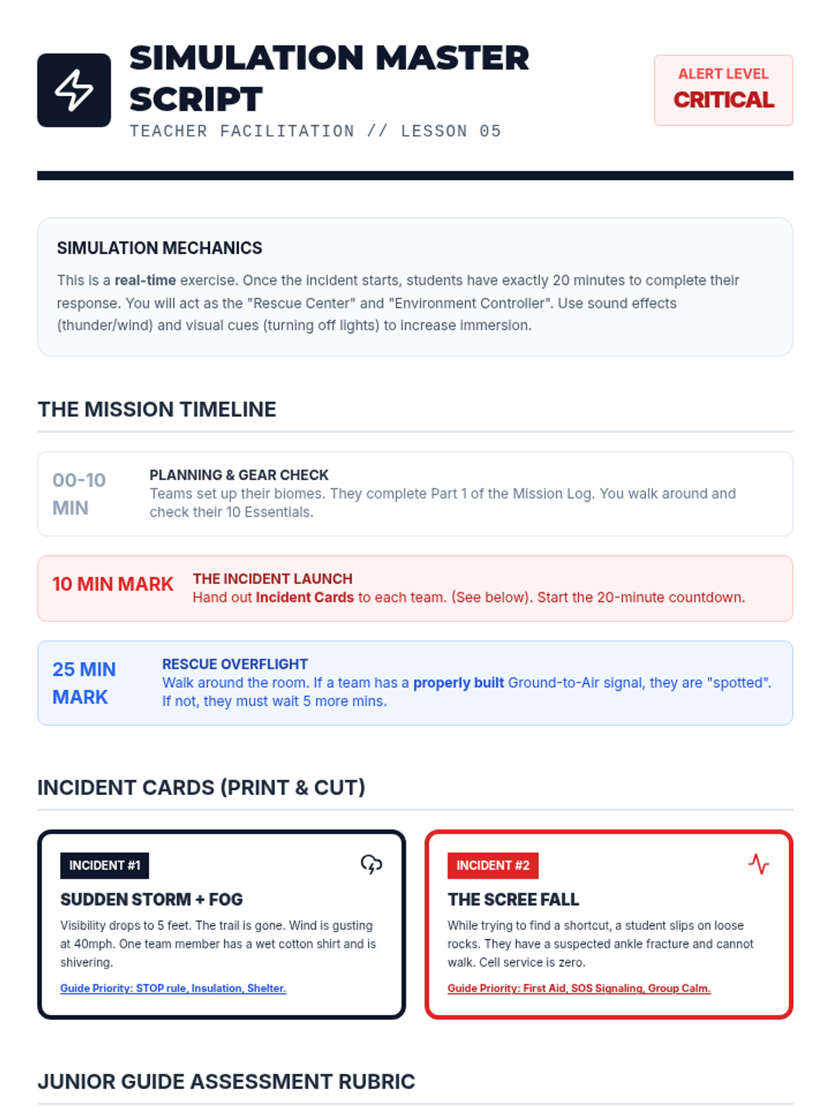
A capstone simulation where teams must manage a sudden weather shift and injury using all previously learned protocols.
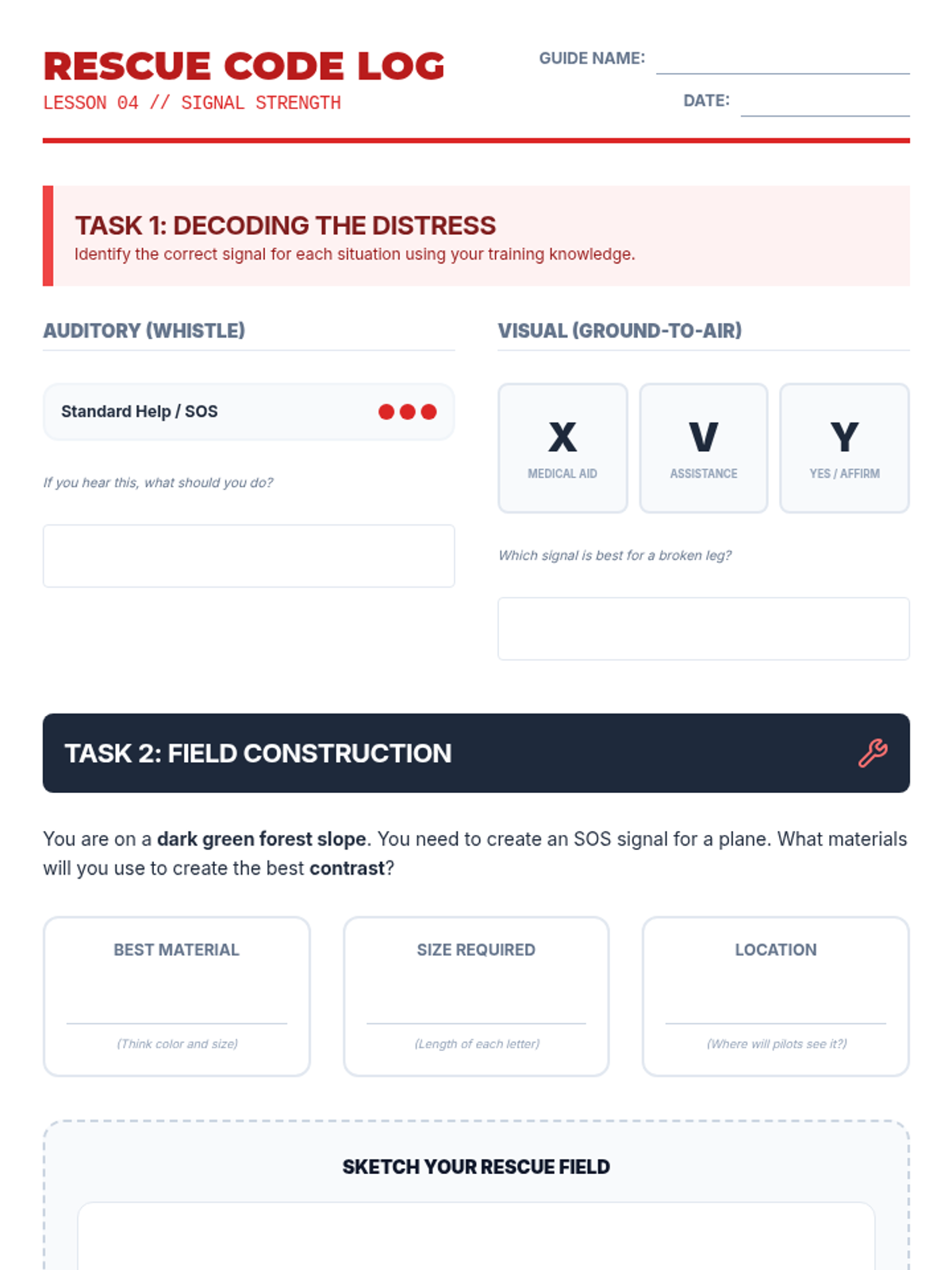
Teaches auditory and visual signaling methods, including ground-to-air signals and signal mirror use.
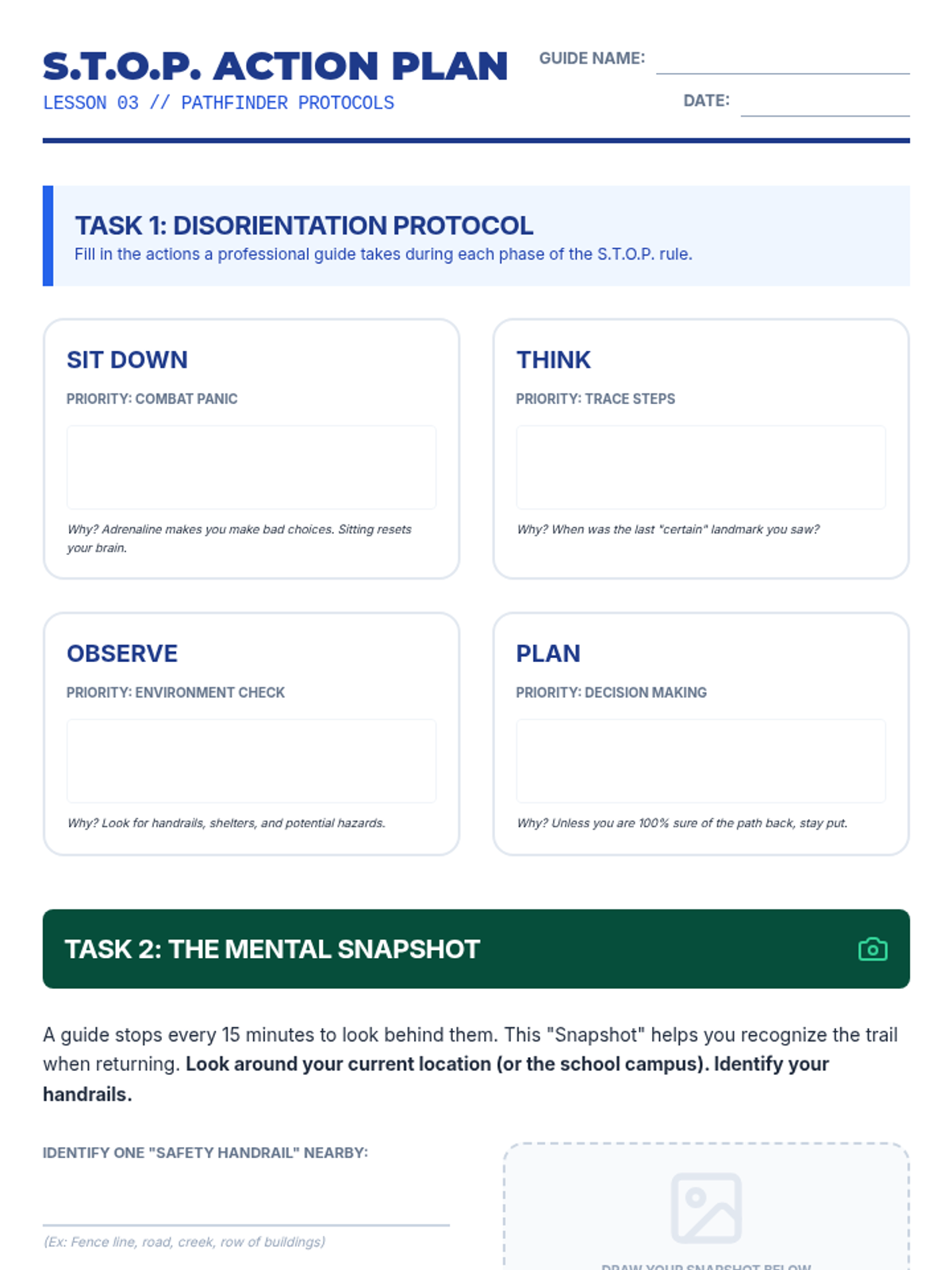
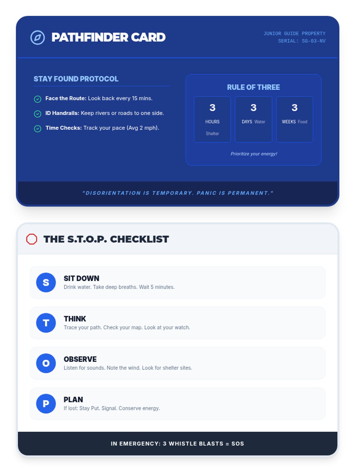
Introduces the S.T.O.P. rule and basic situational awareness to prevent and manage getting lost.
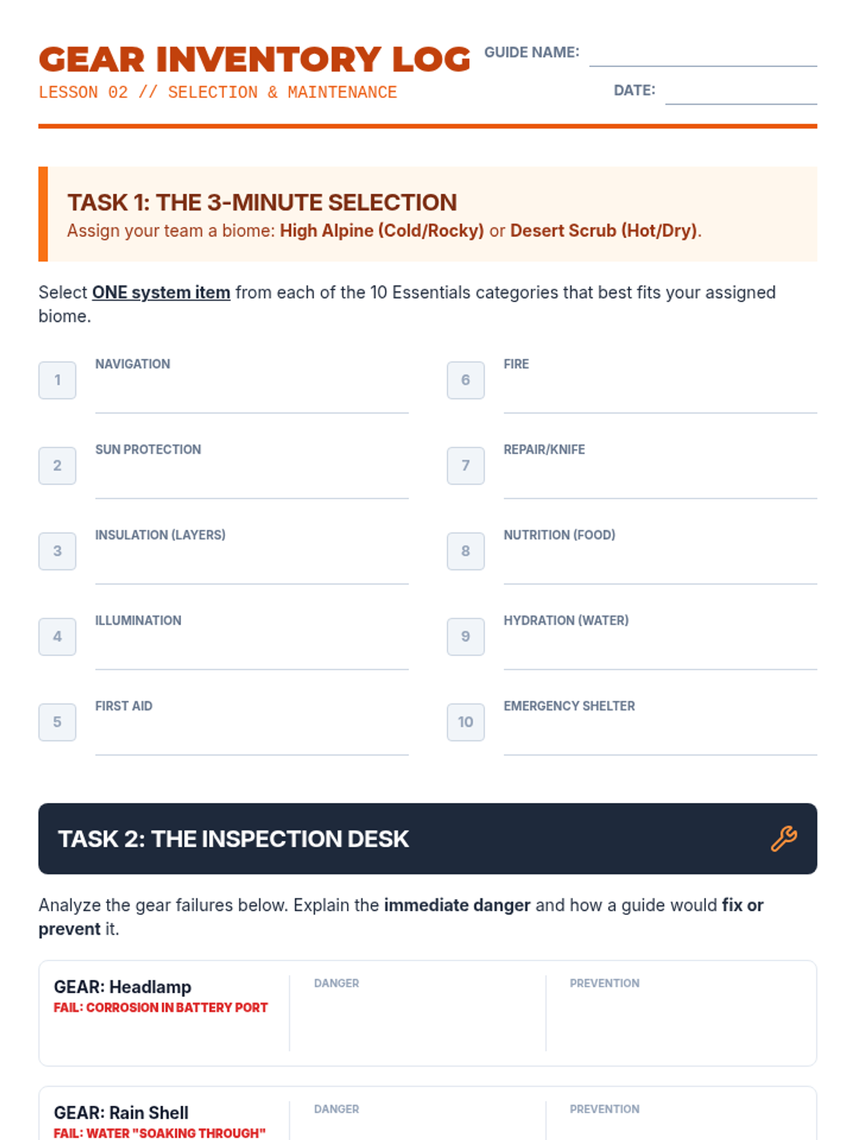
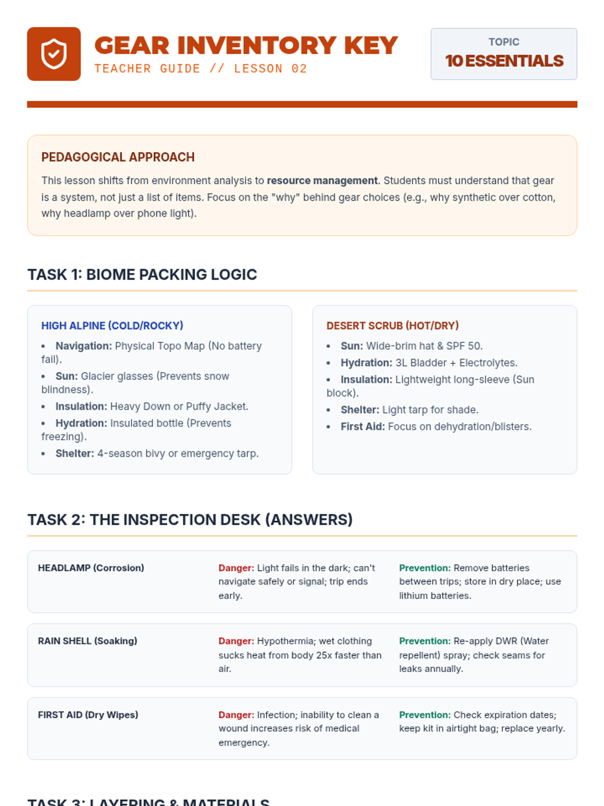
Focuses on the Ten Essentials, equipment maintenance, and proper layering for different biomes.
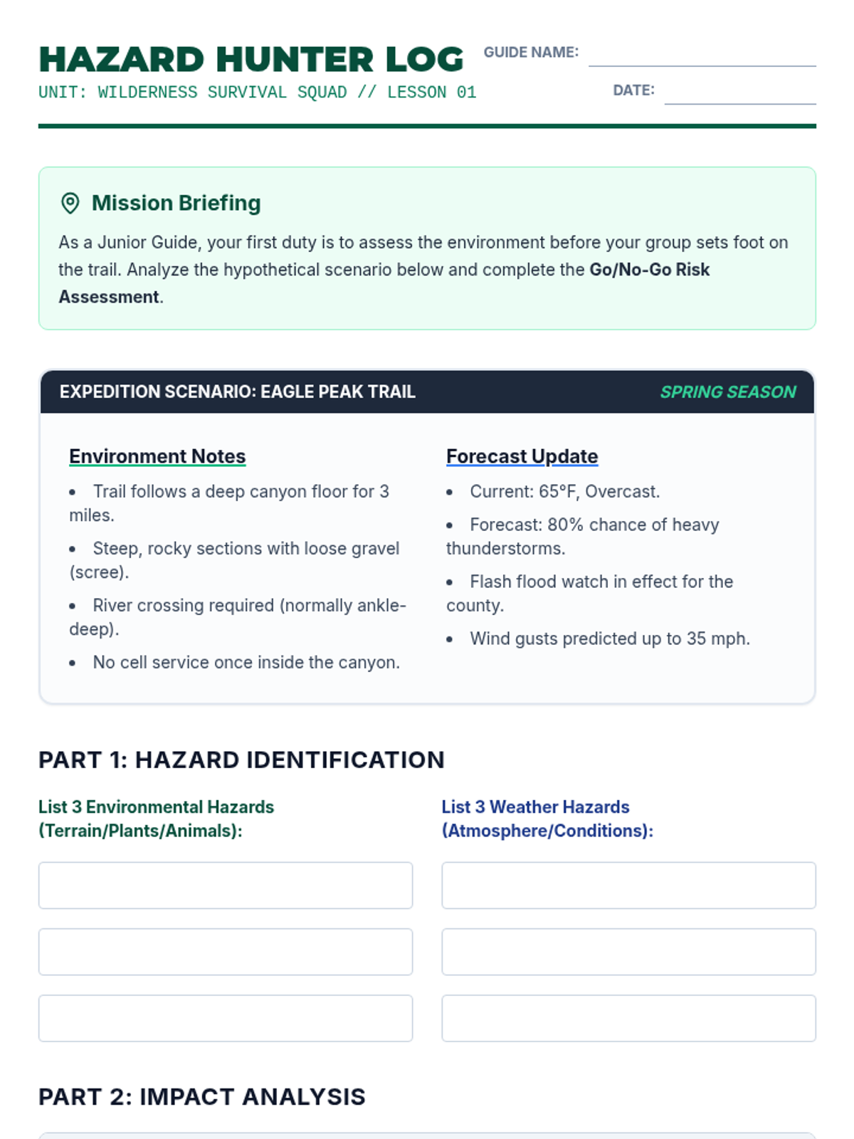
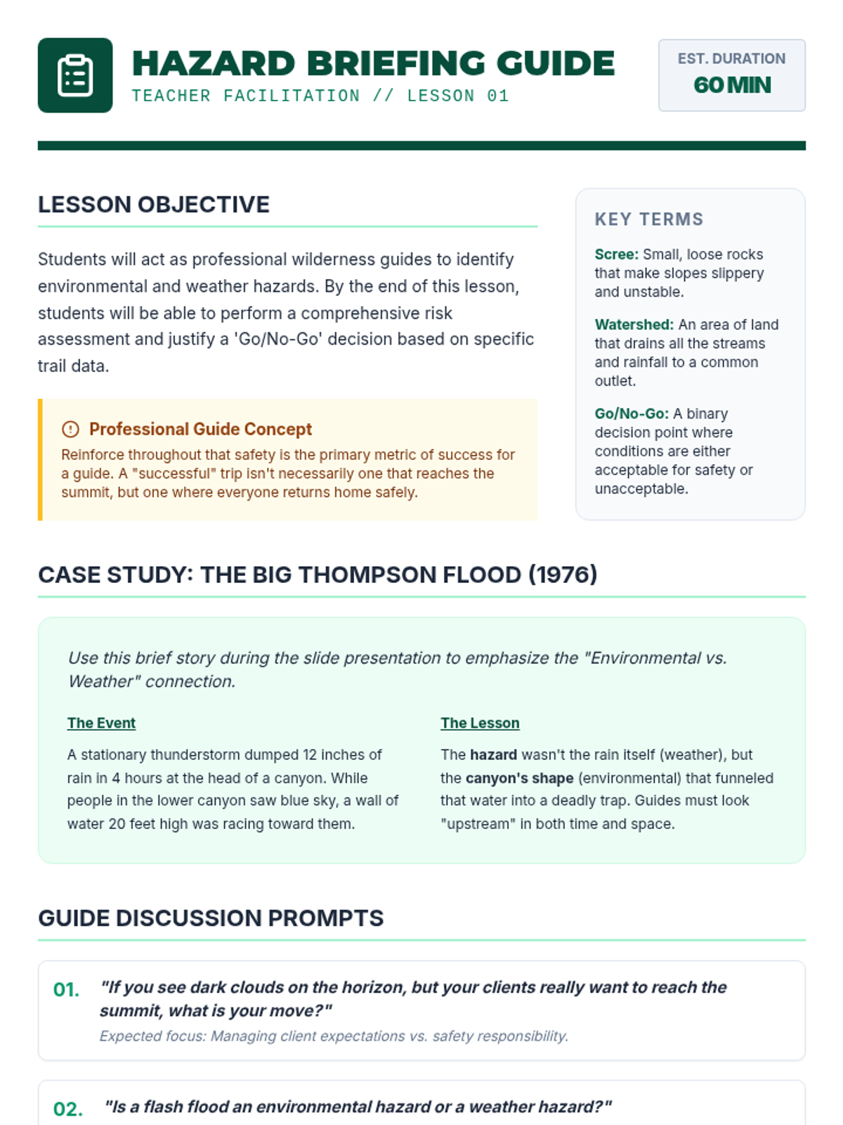
Students analyze environmental hazards and weather patterns to create a 'Go/No-Go' decision framework for outdoor expeditions.
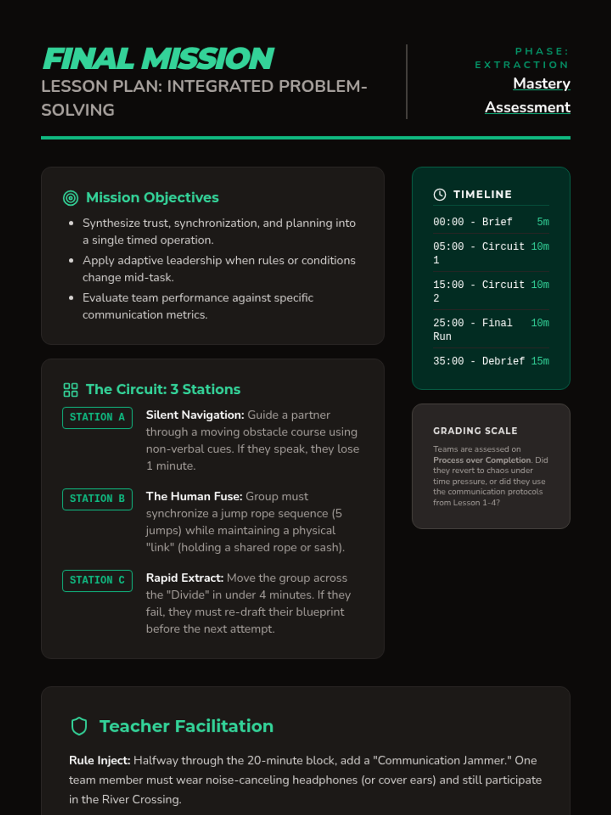
A culminating circuit challenge where teams apply all previously learned communication and planning strategies under time pressure.
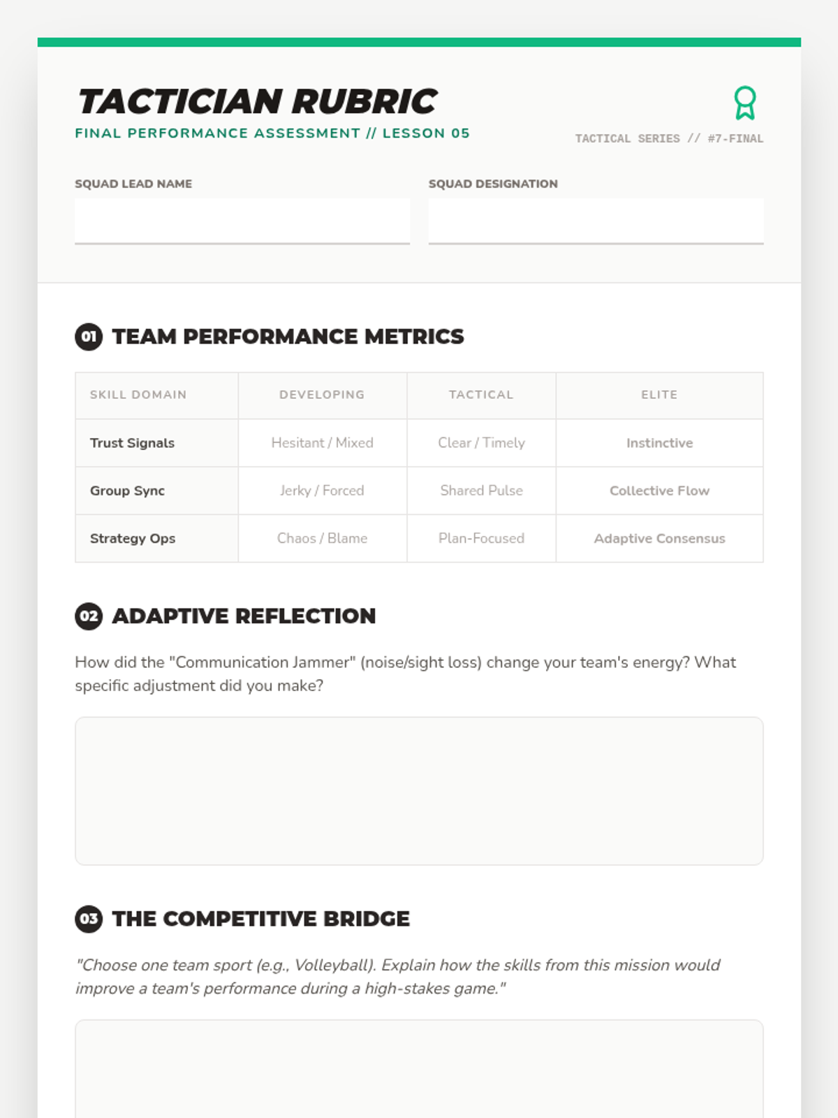
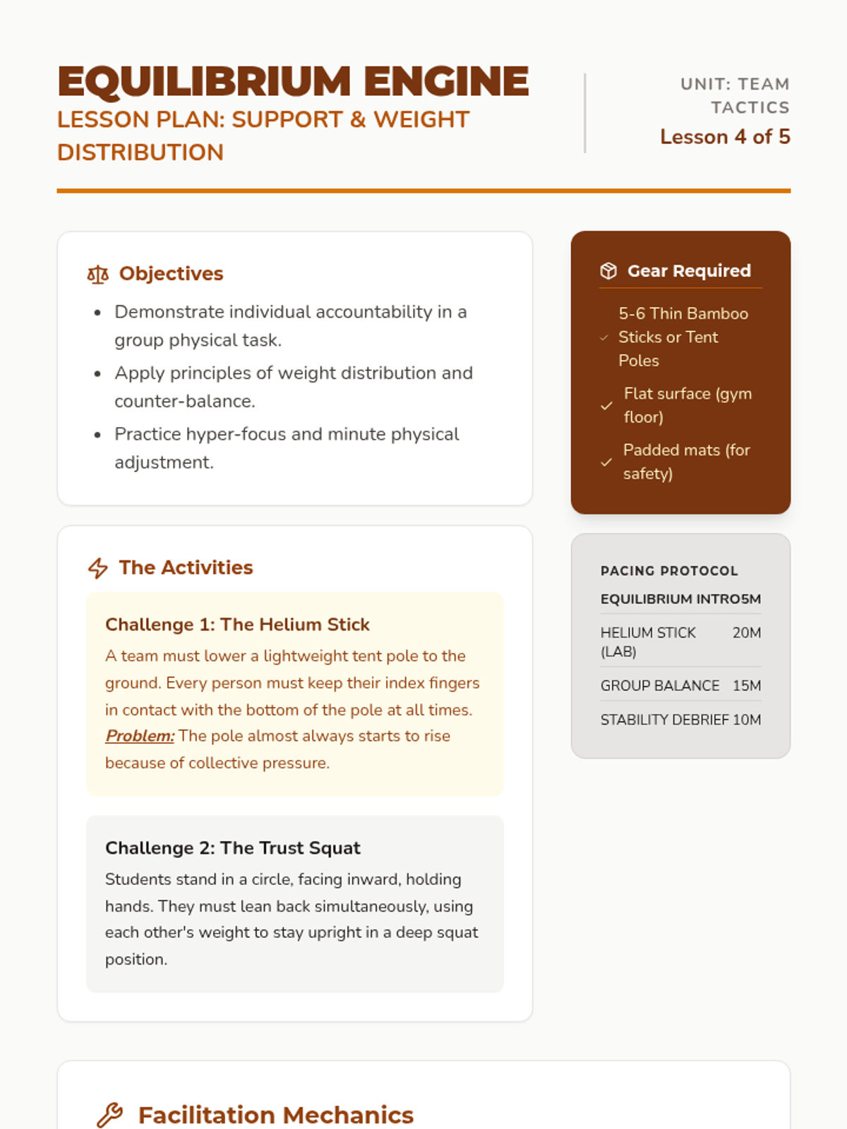
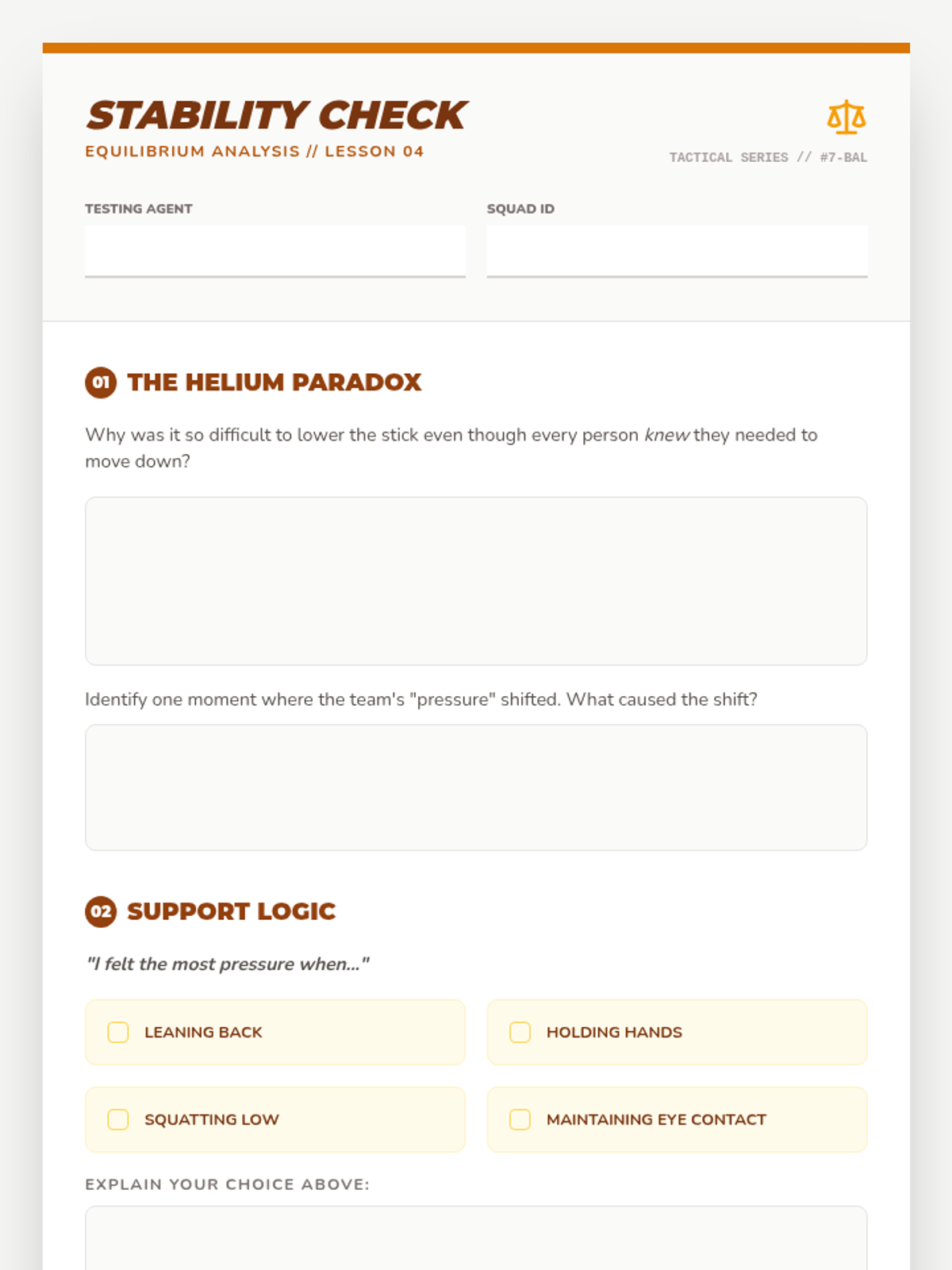
Explores physical support, weight distribution, and individual accountability through collaborative balance tasks.
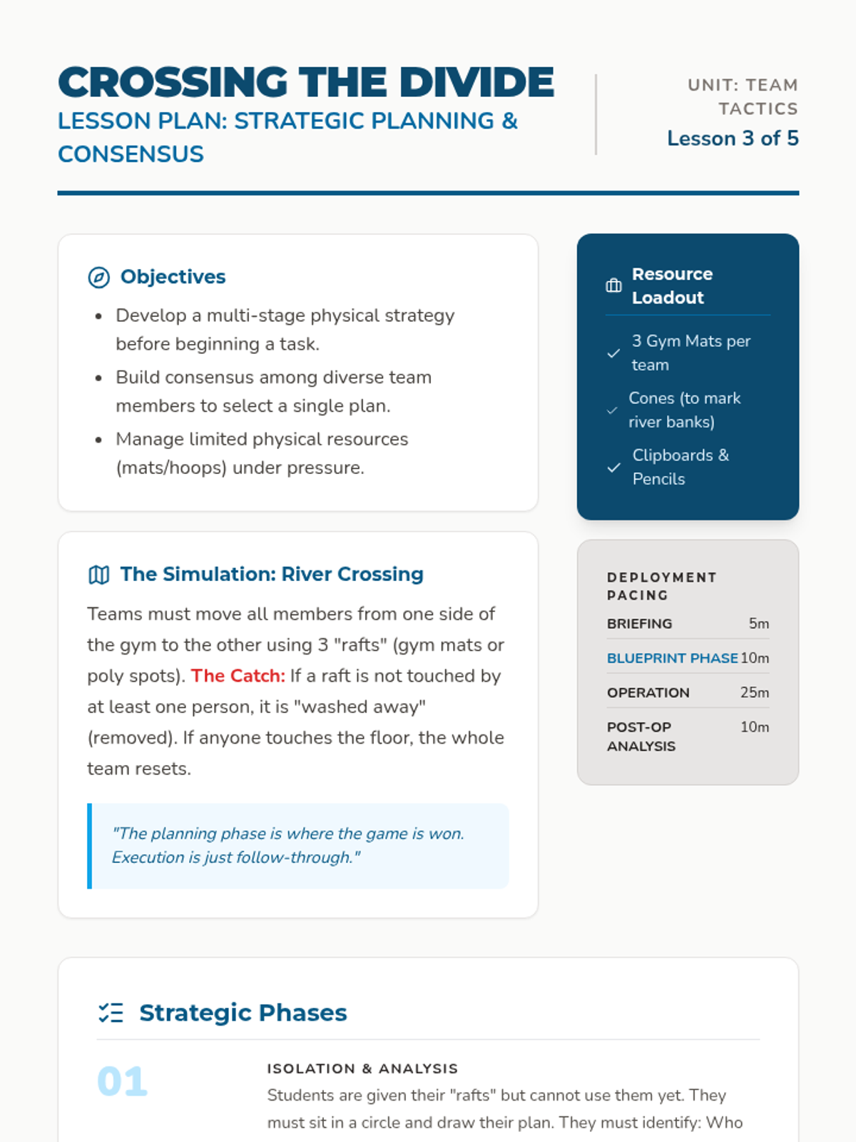
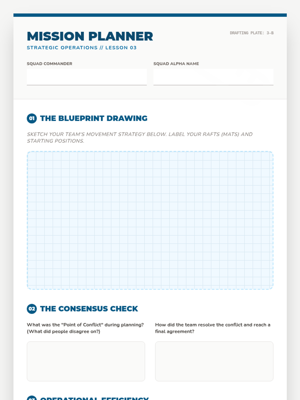
Emphasizes the planning phase and consensus building through the 'River Crossing' simulation.