Analytical frameworks for interpreting history, geography, and civic information. Equips learners with tools for chronological sequencing, map literacy, and critical evaluation of primary and secondary sources.
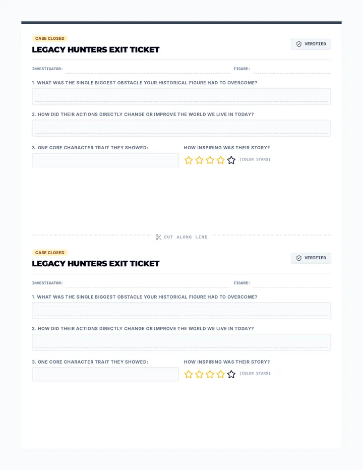
A structured single-page exit ticket designed for easy writing, prompting students to synthesize their figure's main struggle, achievement, and character traits.
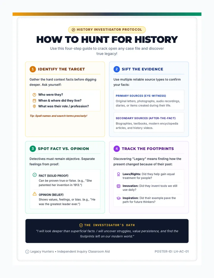
A visual anchor chart detailing the key steps of historical research, how to evaluate primary vs secondary sources, and critical questions to ask.
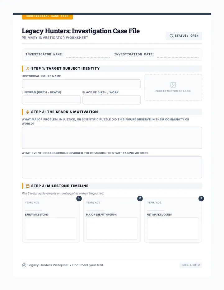
A highly engaging 2-page research packet ("Case File") for students to explore their chosen historical figure, documenting origins, motivations, struggles, achievements, and legacy.
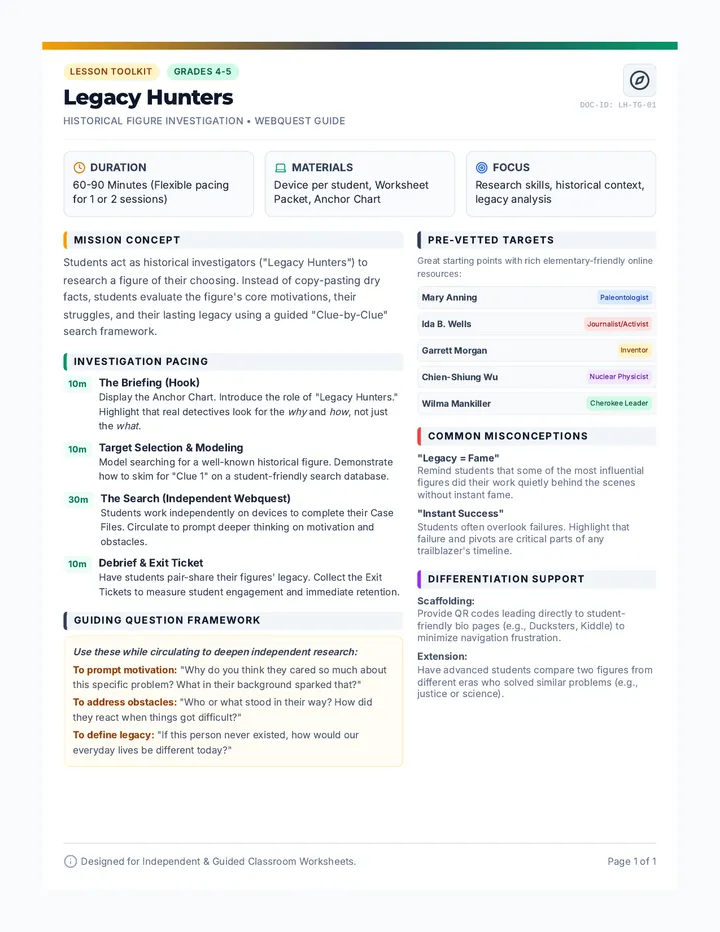
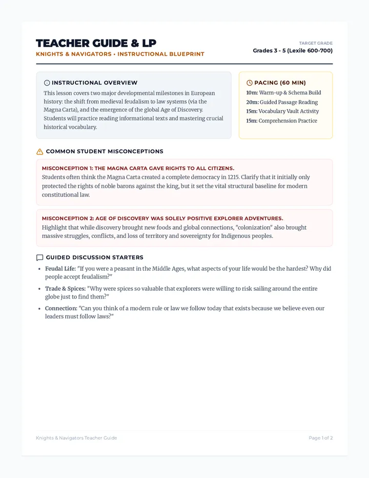
A structured 1-page guide for teachers detailing lesson setup, common misconceptions, pacing, and differentiation strategies for the Legacy Hunters history webquest.
Teacher answer key for the Liberty Ledger reading passage and the Revolution Timeline graphic organizer.
A visual timeline graphic organizer for students to record key dates, event names, and descriptions from the Sugar Act through the Intolerable Acts. Designed to fit on a single page with 3rd grade guiding lines.
A newspaper-themed reading passage for 3rd grade covering the Sugar Act, Stamp Act, Boston Massacre, Boston Tea Party, and Intolerable Acts, followed by comprehension questions.
Un guide pédagogique pour l'enseignant expliquant comment mettre en œuvre la programmation de Cycle 2, avec des conseils sur la différenciation et les temps d'enseignement incluant l'EVAR.
Un document complet de 5 pages présentant la programmation par année (CP, CE1, CE2) pour toutes les matières, avec des focus détaillés sur le Français, les Maths, le Monde, les Arts, l'EPS, l'EMC et l'EVAR selon le BO 2025.
A teacher answer key for the kid-friendly 3rd grade Colony Tracker worksheet, featuring clear solutions and teaching tips.
A kid-friendly student worksheet for 3rd graders to track colonial settlements, featuring large writing areas, fun icons, and matching activities.
A colorful, high-energy slide deck for 3rd graders explaining the founding of the 13 colonies with very large text and a final summary slide showing all settlements at once.
A kid-friendly, grid-based timeline showing the founding of all 13 colonies plus Roanoke, designed for 3rd graders with bright colors and simple descriptions.
An interactive mapping activity where students trace the path of the plastic bottle across the US water system, labeling key features and identifying environmental hazards.
A worksheet designed for third-graders to practice vocabulary, sequence the geographic path of the plastic bottle, and reflect on environmental impact.
A comprehensive lesson plan for teachers, outlining objectives, standards, and a step-by-step procedure for teaching the geographic path of plastic from Indiana to the ocean.
An engaging slide deck that visually traces the journey of a plastic bottle from Indiana to the Atlantic Ocean, introducing key geographic concepts like tributaries and currents.
A teacher guide for the Columbus Voyage craft, including instructional objectives, material lists, step-by-step facilitation instructions, and a reference key for map placement and historical facts.
An interactive map craft for students to track Christopher Columbus's voyage across the Atlantic. Includes a base map and a separate page of cut-outs including ships, location labels, and logbook timeline entries.
A single-page visual overview of the 13 Colonial America events, designed as an anchor chart or reference sheet for 3rd-grade students. Provides a clear chronological flow with dates and key summaries. Fixed page break and line alignment.
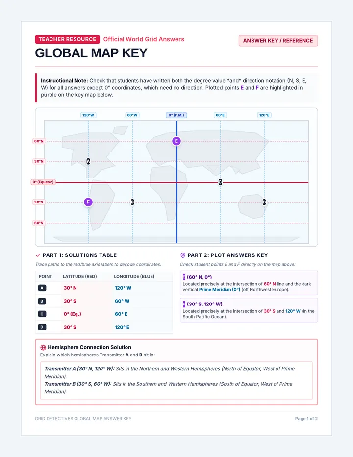
The teacher answer key for the Global Map Practice Sheet, featuring complete coordinate answers, sample explanations, and plotted locations highlighted in the key color code.
A 2-page practice worksheet featuring a stylized global world map with continent outlines, coordinate intersections, and color-coded red/blue tracking lines for continent-based coordinate work.
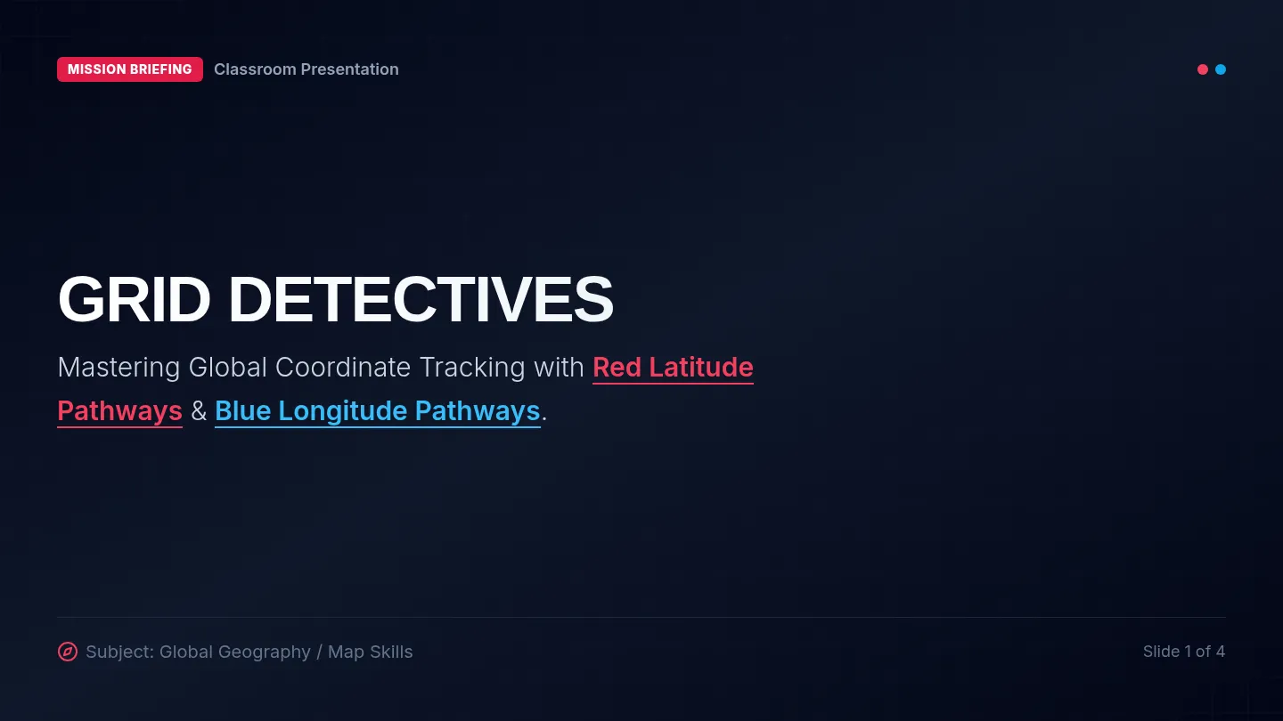
A 4-slide instructional presentation that introduces students to latitude and longitude coordinates using high-contrast, color-coded visual pathways (red for latitude, blue for longitude).
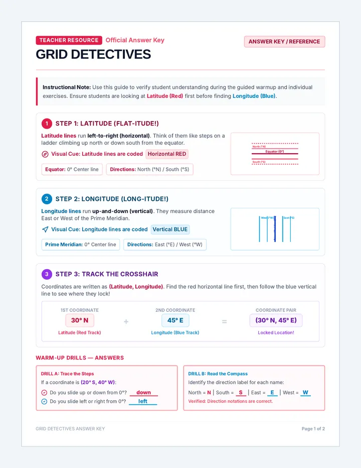
The teacher answer key for the Grid Detectives Worksheet, featuring complete coordinate answers, sample explanations, and plotted locations highlighted in the key color code.
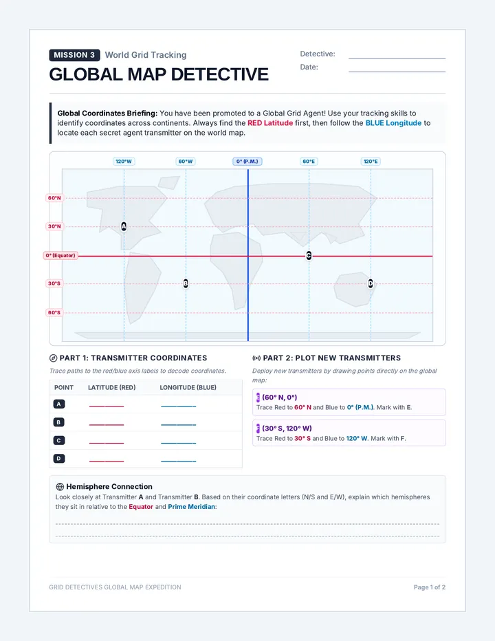
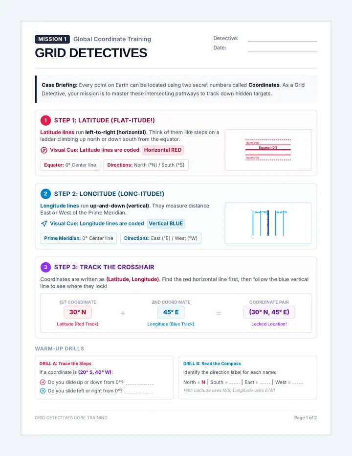
A 2-page guided worksheet featuring step-by-step scaffolds, custom grid maps, and red/blue color paths that help students master latitude and longitude tracking.
A teacher-facing lesson plan, pacing guide, and complete answer key for the Knights and Navigators Worksheet and the Knights and Navigators Vocabulary Worksheet. Provides instructional tips, common misconceptions, and model answers for student grading.
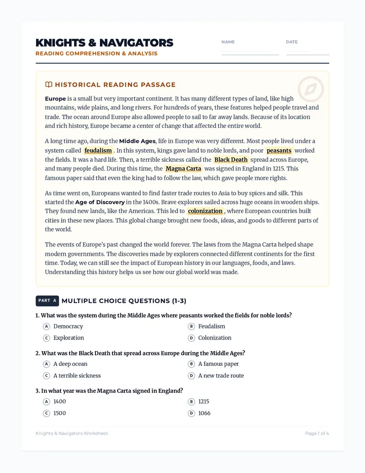
A student-facing reading comprehension worksheet about European history, covering the Middle Ages and the Age of Discovery. Includes a 4-paragraph text written at a 600-700 Lexile level, 10 multiple-choice questions, 10 true/false questions, 5 fill-in-the-blank questions with a word bank, and 2 open-response questions with sentence starters. Vocabulary words are highlighted in the text for context clue deduction.
An answer key for the UK Map Discovery worksheet, providing teachers with correct labels and reflections.
A student worksheet designed to test identification skills of the United Kingdom's geography, including the four countries and the Thames River.
A colorful and clearly labeled educational diagram of the United Kingdom, featuring the four countries and the River Thames with key facts.
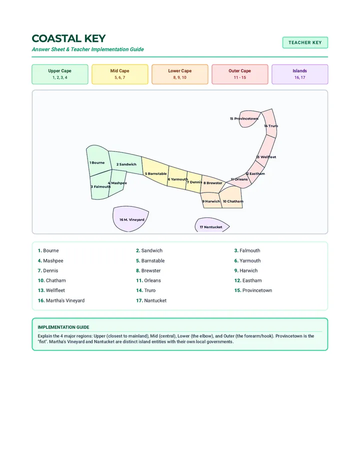
A teacher's answer key for the Cape Cod Cartography worksheet. Includes a color-coded organic SVG map showing regional divisions with clear, non-overlapping labels and a teacher's implementation guide. Layout is optimized for single-page printing.
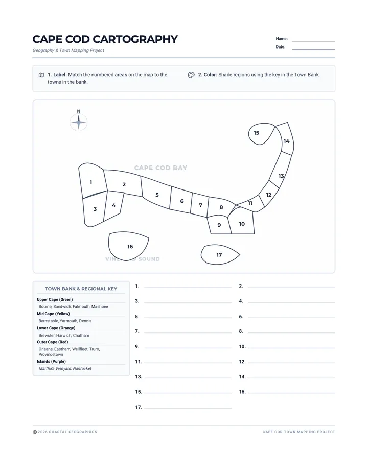
A blank map labeling worksheet for Cape Cod and the Islands. Includes a stylized SVG map with numbered towns, a town bank with regional coloring guides, and optimized single-page layout.
A teacher answer key for the Continent Quest Quiz, including grading notes and visual cue explanations.
Word bank labels for the Continent Quest Quiz, designed to be cut out and pasted onto the map.
A color world map quiz for labeling the seven continents with visual cues and numbered boxes for cut-and-paste labels.
A printable map of the thirteen colonies for third-grade students to color-code by region, including a legend and a checklist of all thirteen colonies.
A comprehensive teacher guide and answer key for the Colonial Crossroads lesson, including correct responses and instructional tips.
An engaging reading passage for third-grade students that details the differences between the New England, Middle, and Southern colonies, followed by comprehension questions.
A vocabulary matching game featuring visual icons for key colonial terms, paired with a regional matching challenge for third graders.
Teacher guide containing lesson pacing, answer keys for the Field Notes worksheet, and differentiation strategies for the map-making project.
A vibrant, colorful landscape presentation slide designed to look like a full physical trifold project board. Features a "Wild West Show" color palette with red, blue, and gold panels, and large, readable text.
A vibrant, colorful trifold poster simulation about Buffalo Bill Cody with a showman's aesthetic. Features a central 471x600 portrait area, red and blue side wings, and a yellow timeline.
A comprehensive answer key and teaching guide for the Memorial Day ML unit, featuring sample student responses and specific instructional strategies for Emerging Multilingual Learners.
A comprehension worksheet companion to 'Memorial Day Reading ML'. Features visual word bank icons, illustrated writing prompts, and a designated labeling area for drawings. Revised to maximize visual scaffolding for Emerging ML students and fit on a single page.
A visual-heavy simplified reading passage for Emerging ML students, featuring a high-contrast visual glossary, stopping points with icons, and larger, more accessible font sizes. Revised for uniformity and layout.
An introductory slide deck explaining Memorial Day origins and vocabulary, adapted for Emerging Multilingual Learners with simplified text, visual supports, and interactive prompts. Revised for visual uniformity in assessment.
A comprehensive answer key and teaching guide for the Memorial Day unit. Revised to fix page break issues and maintain consistent labeling with the student worksheet.
A visual-rich supplemental reading analysis worksheet for Memorial Day, featuring vocabulary icons, background motifs, and clear section markers. Revised for significantly enhanced visual engagement and instructional clarity.
A visual-rich informational reading passage about Memorial Day with a symbol sidebar and icon-supported questions. Revised to fix text clipping and layout issues from previous versions while adding significantly more visual elements.
An introductory slide deck explaining the origins of Memorial Day, its history as Decoration Day, and the vocabulary essential for understanding its significance. Revised for visual centering and better background contrast.
An answer key for the Explorer Tales Worksheet, providing correct responses and evidence-based explanations for teacher use.
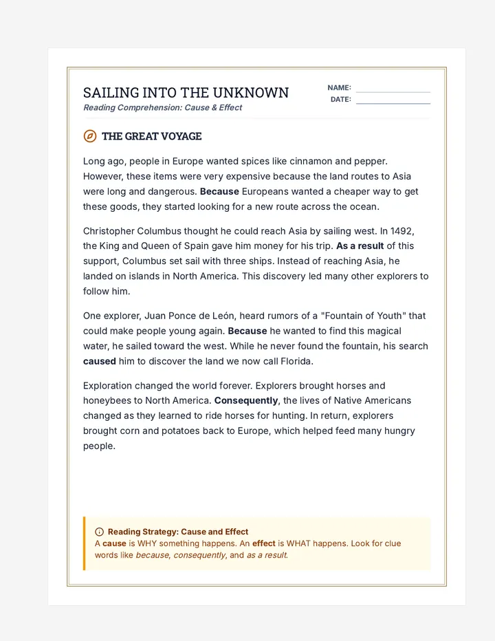
A reading comprehension worksheet for 3rd grade students featuring a passage about European explorers and questions that target cause and effect skills.
A teacher answer key and instructional guide for the 1st-grade version of the medieval stronghold lesson. Includes simplified answers and a teacher note on assessing early writing. Optimized for 8.5x11 printing.
A modified version of the Fortress Secrets worksheet adapted for a 1st-grade reading level. Features shorter sentences, larger font sizes, simplified vocabulary, and a guided writing frame to introduce the RACER strategy to young learners. Optimized for double-sided printing on 8.5x11 inch paper.