Essential safety protocols, map reading, and compass navigation for wilderness environments. Strengthens group dynamics and problem-solving through structured outdoor team-building challenges.
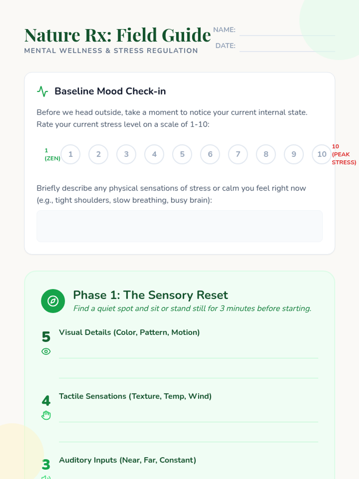
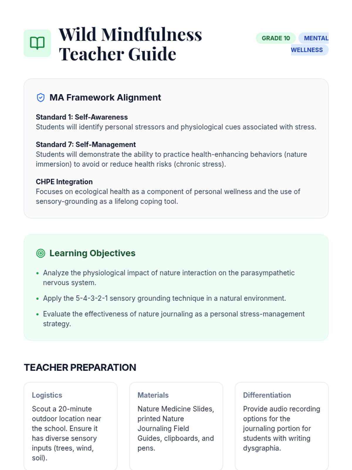
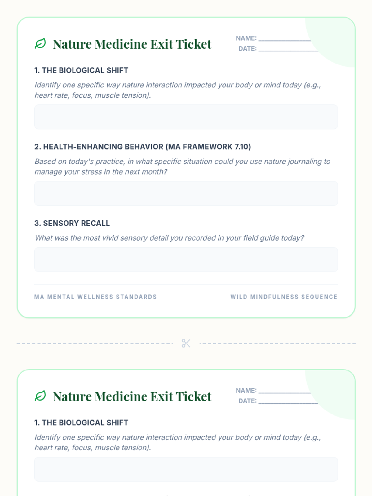
A lesson exploring the mental health benefits of nature journaling, focusing on stress reduction and self-awareness as part of the Massachusetts Grade 10 Mental Wellness standards. Students will practice sensory-based journaling and analyze its physiological and psychological effects.
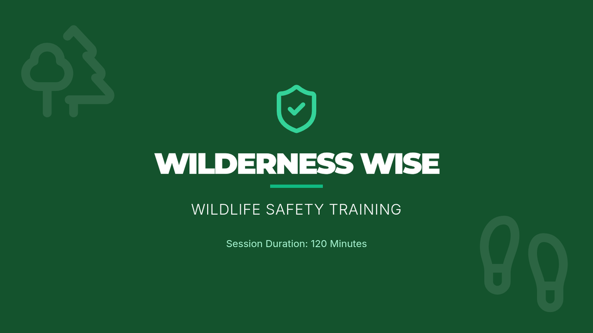
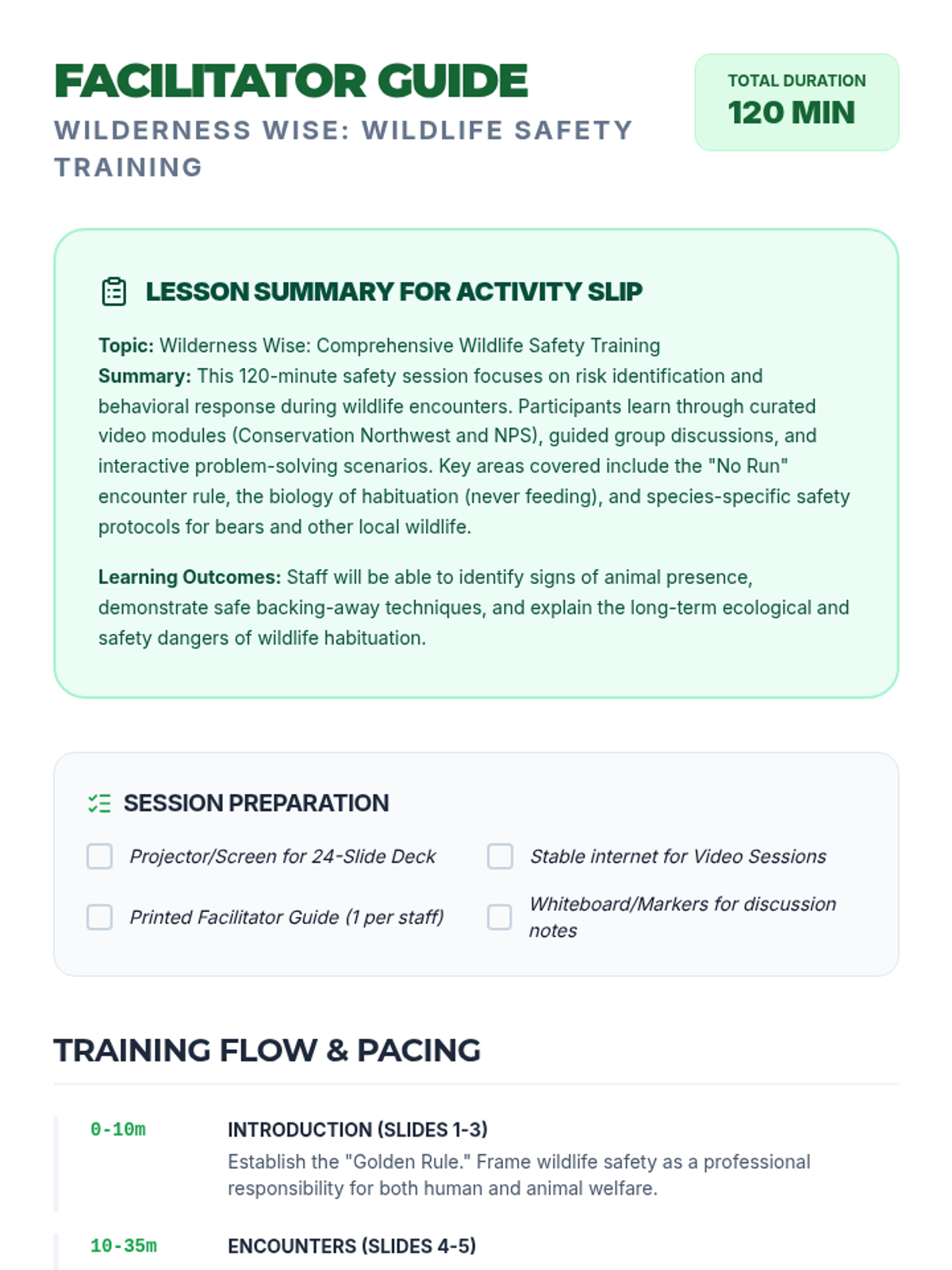
A comprehensive 120-minute safety training session focused on identifying wildlife risks, recognizing safe behaviors, and responding correctly to animal encounters. This lesson equips participants with practical skills to protect both themselves and local wildlife.
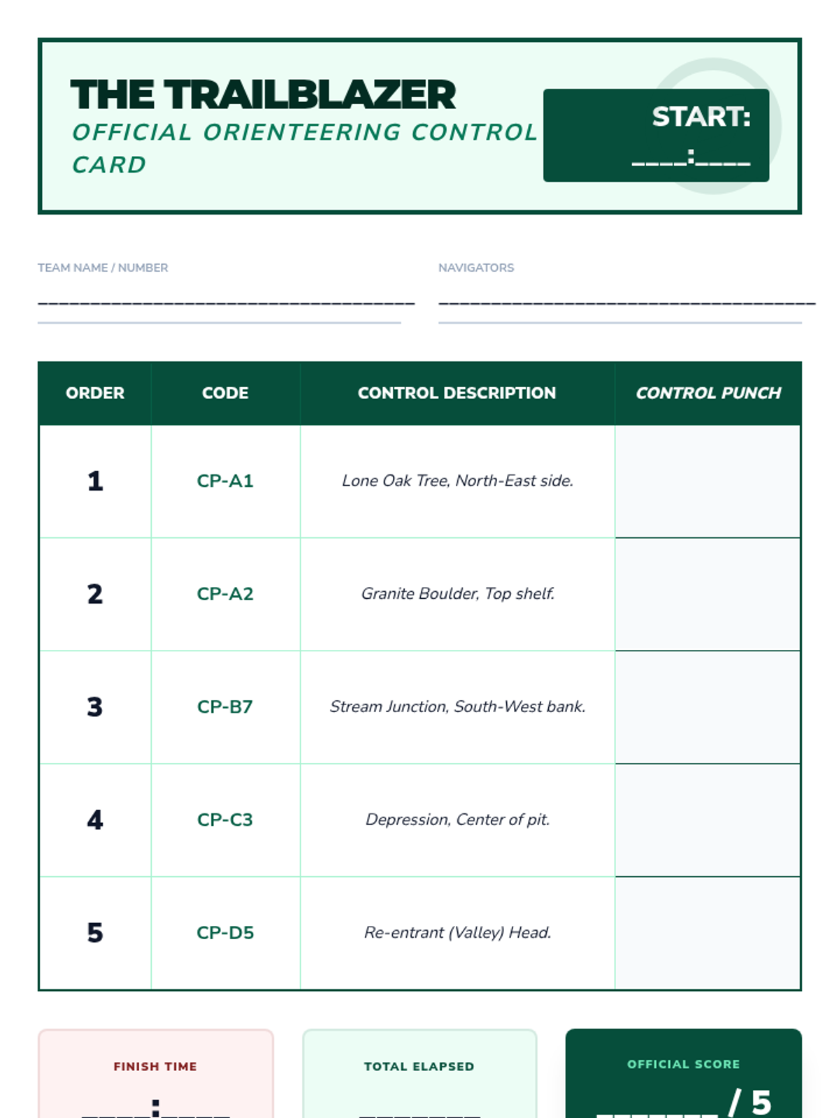
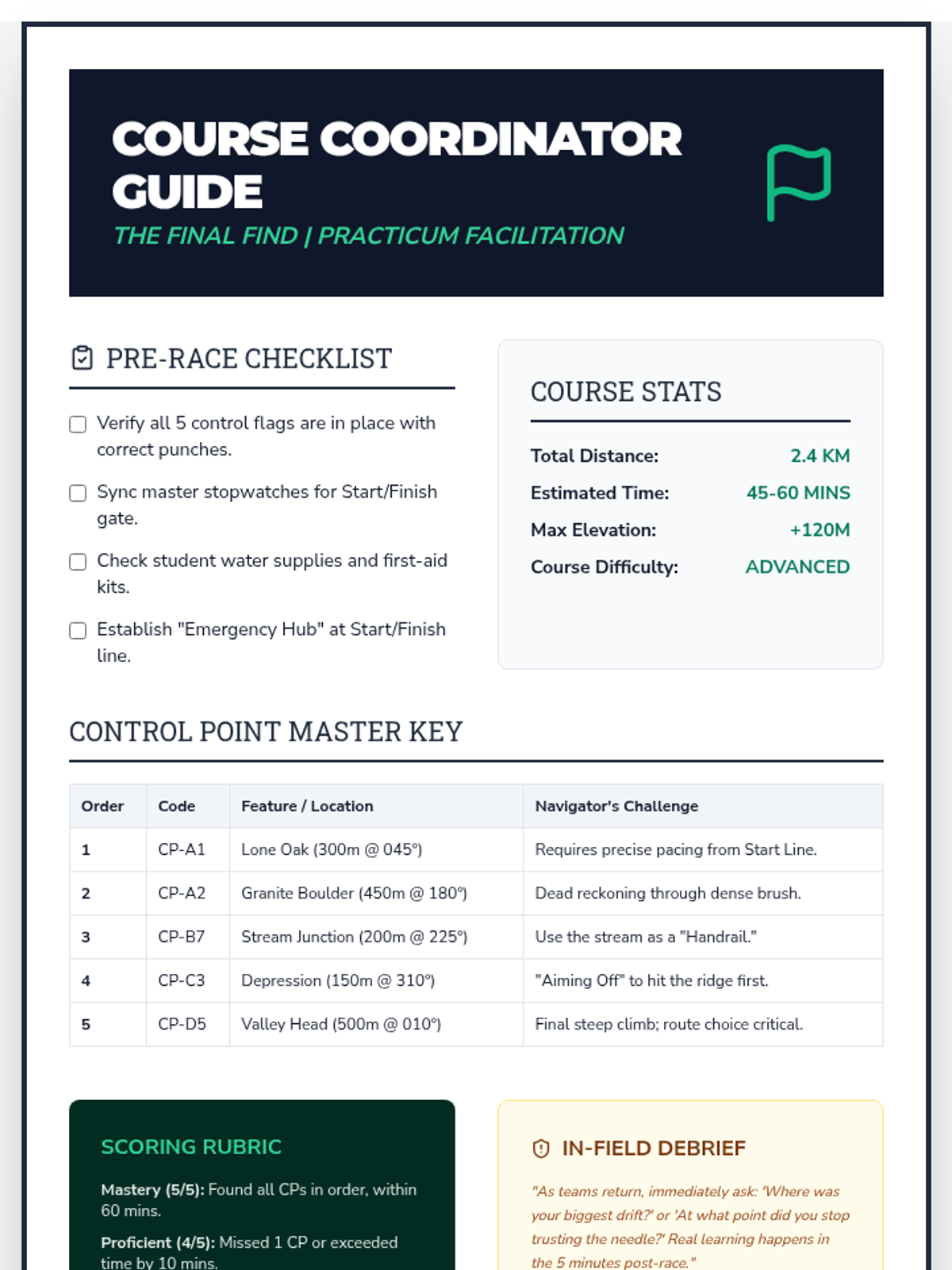
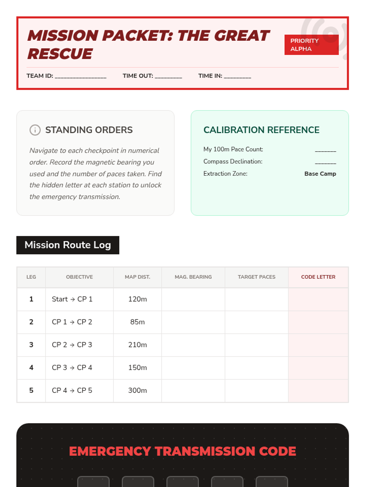
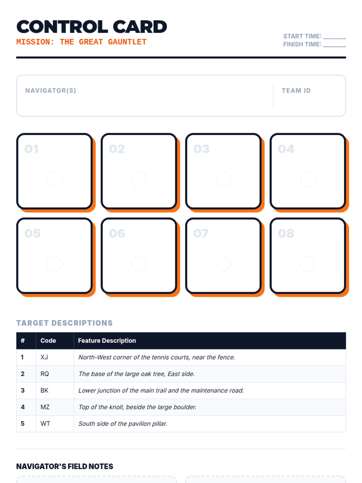
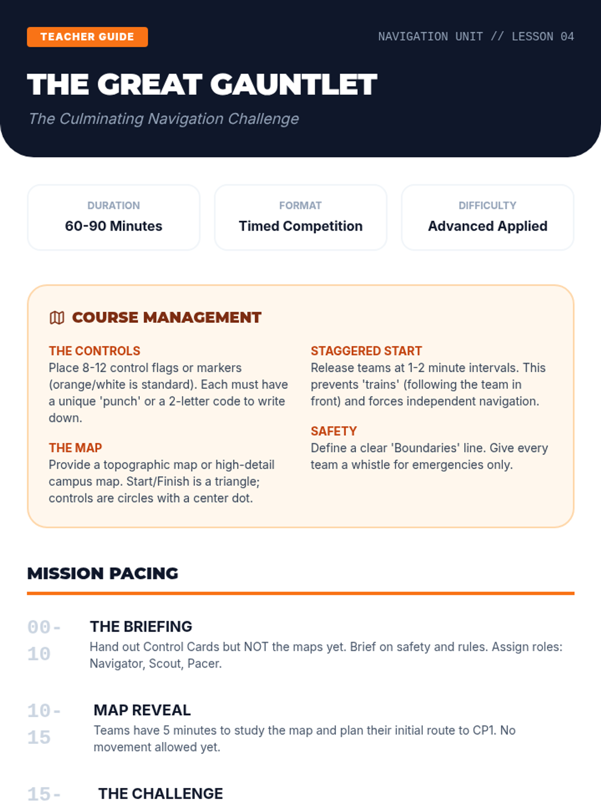
A culminating timed orienteering event where students navigate a complex course to find sequential control points.
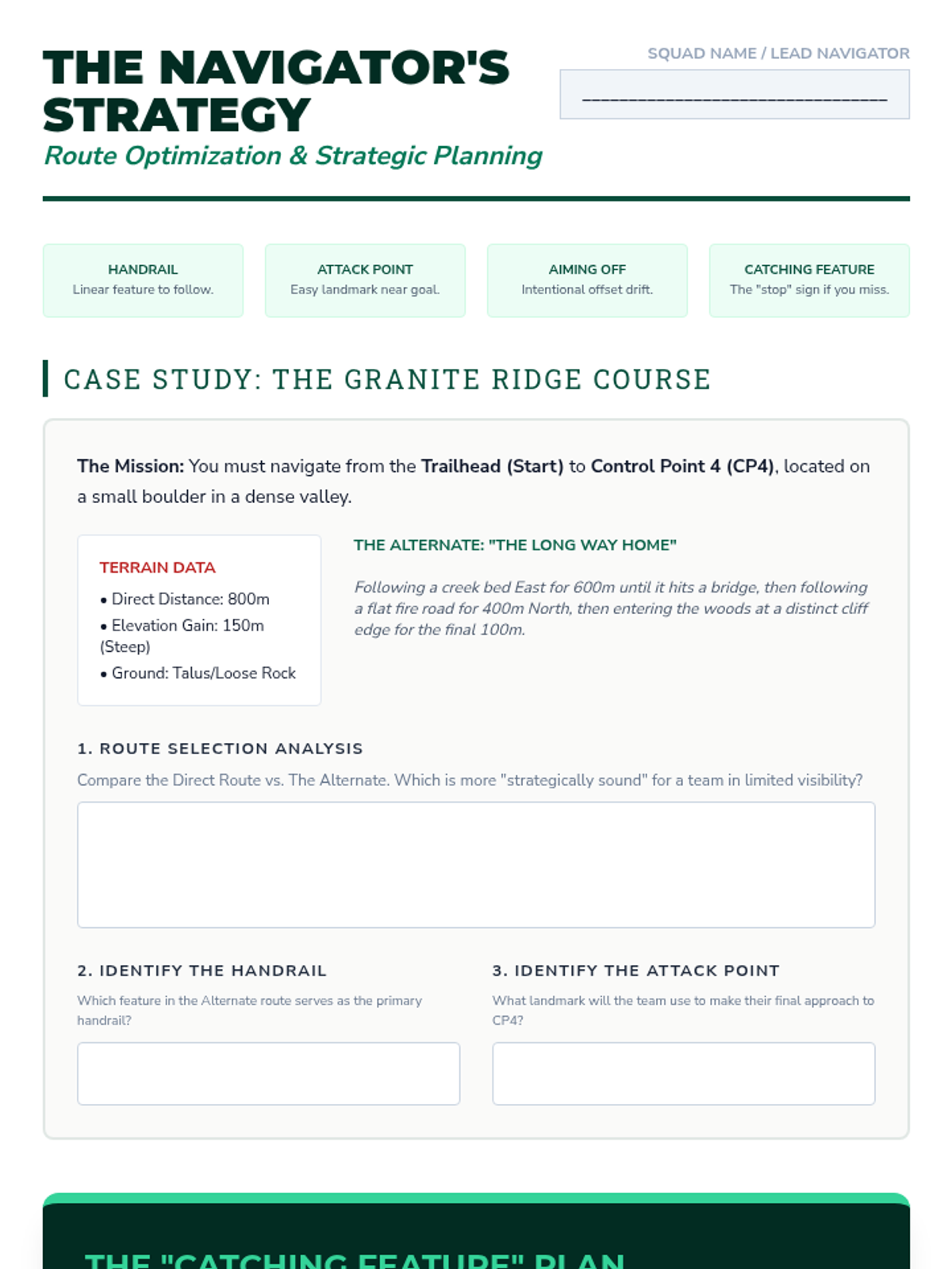
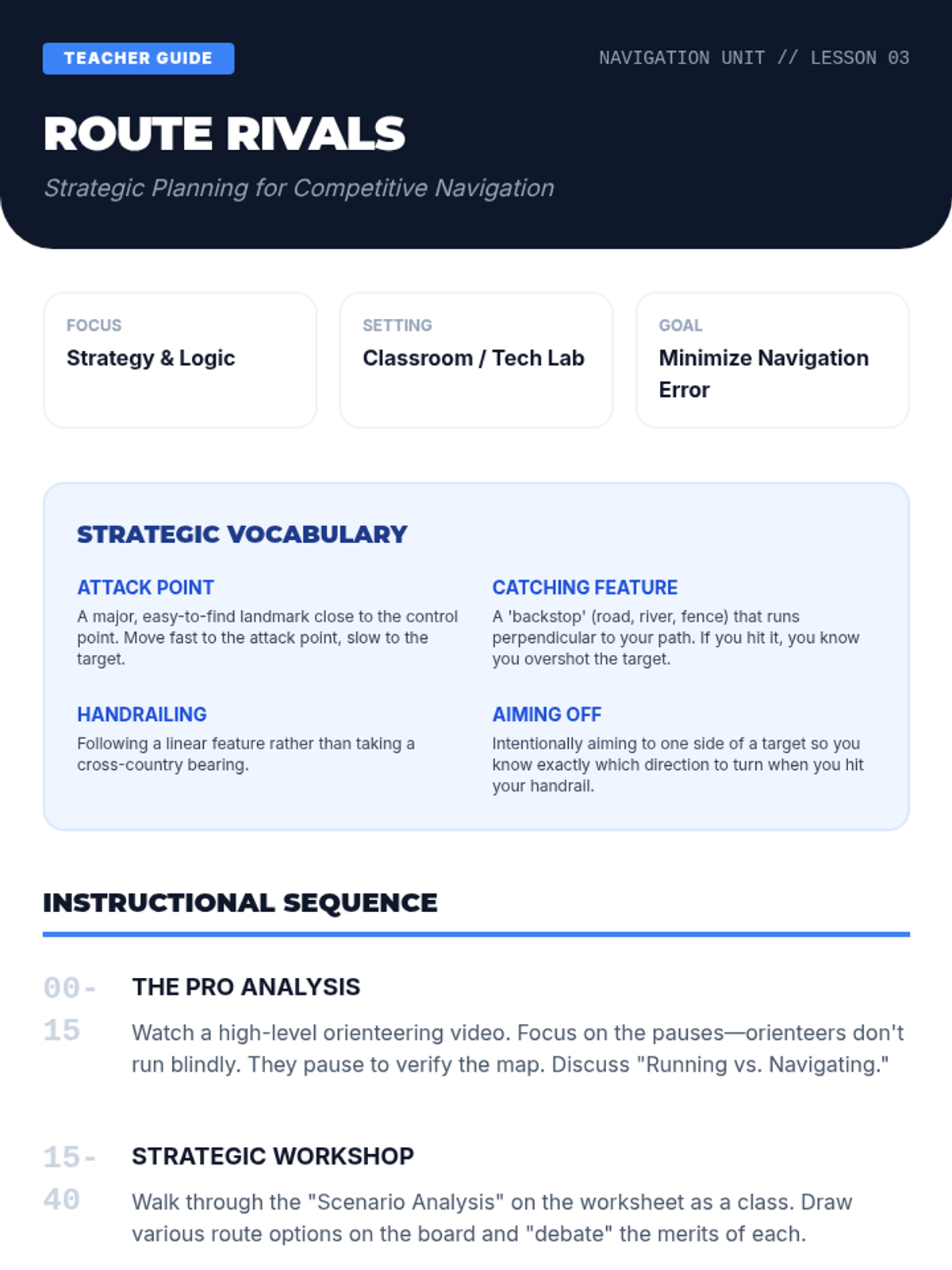
Students analyze terrain for strategic advantages using concepts like handrails, aiming off, and attack points.
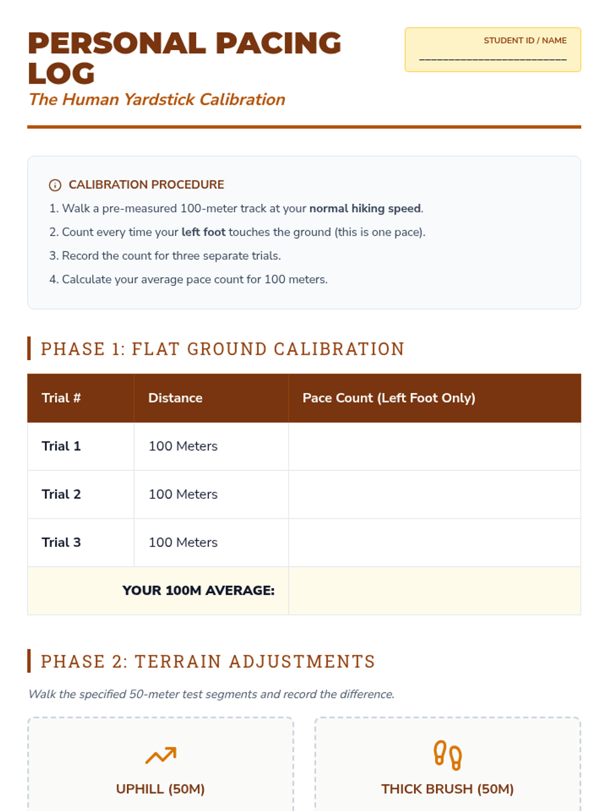
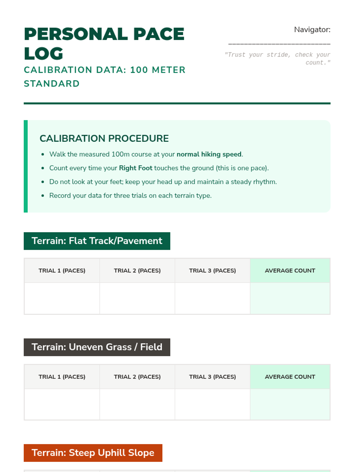
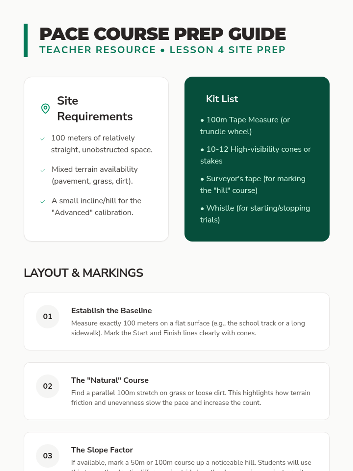
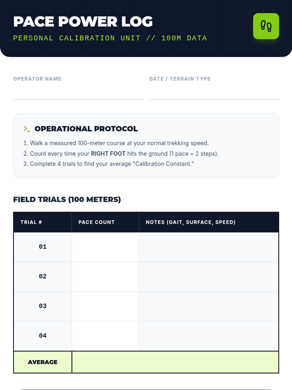
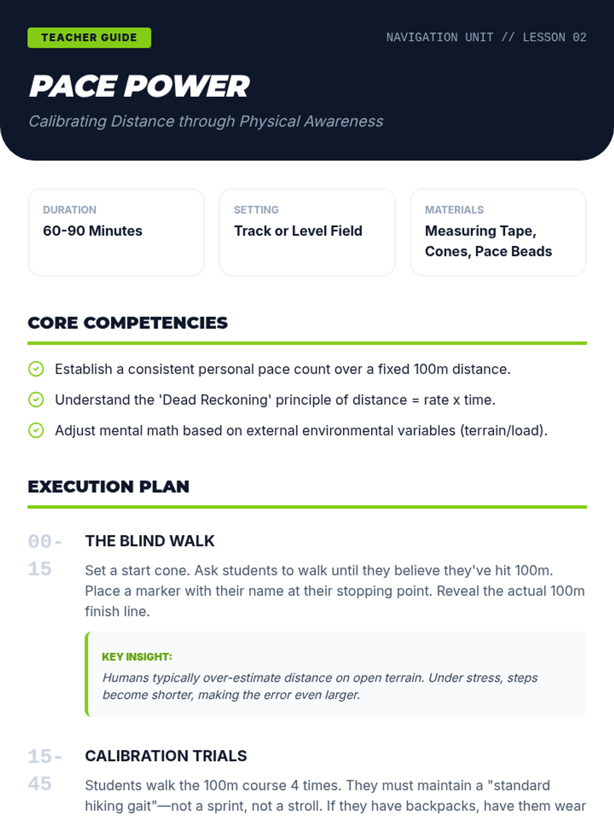
Students calculate their personal pace counts and apply dead reckoning to navigate without visual landmarks.
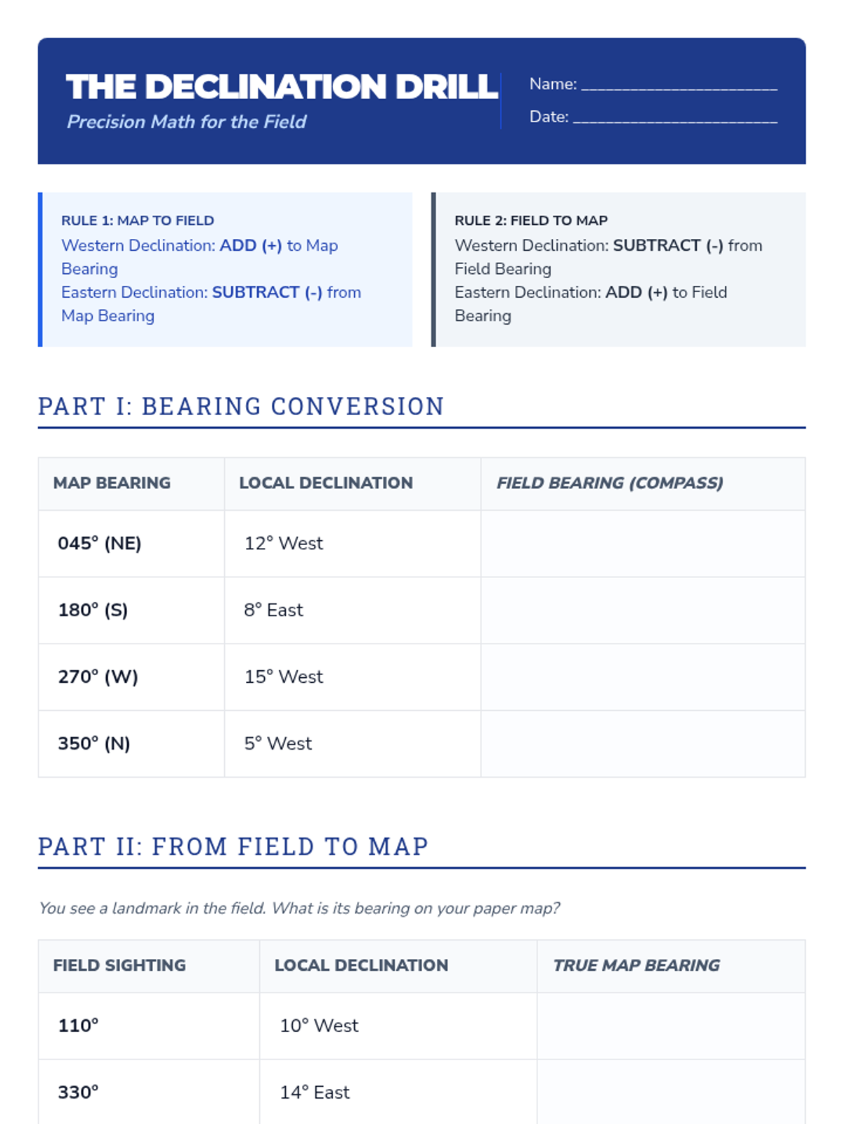
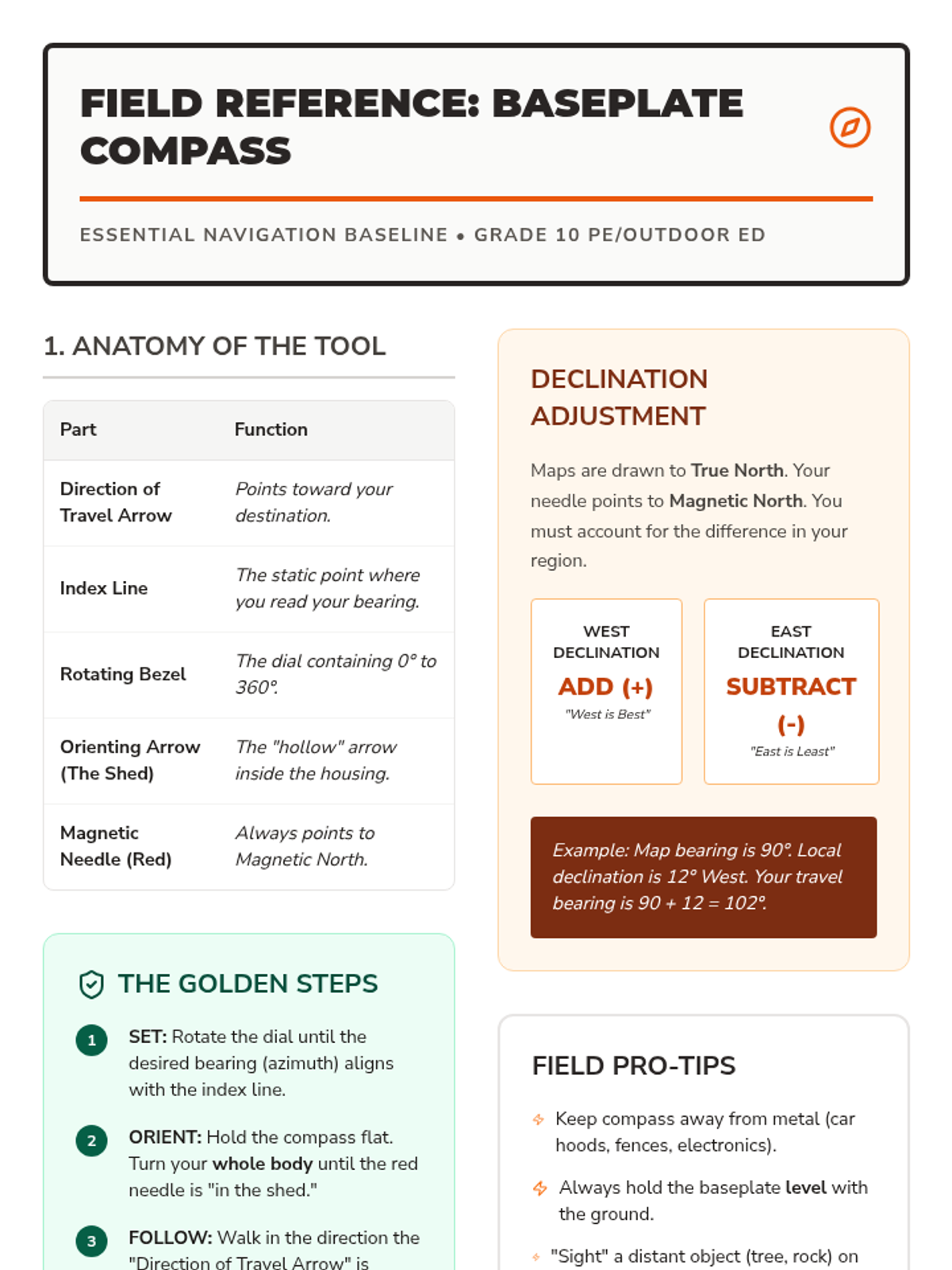
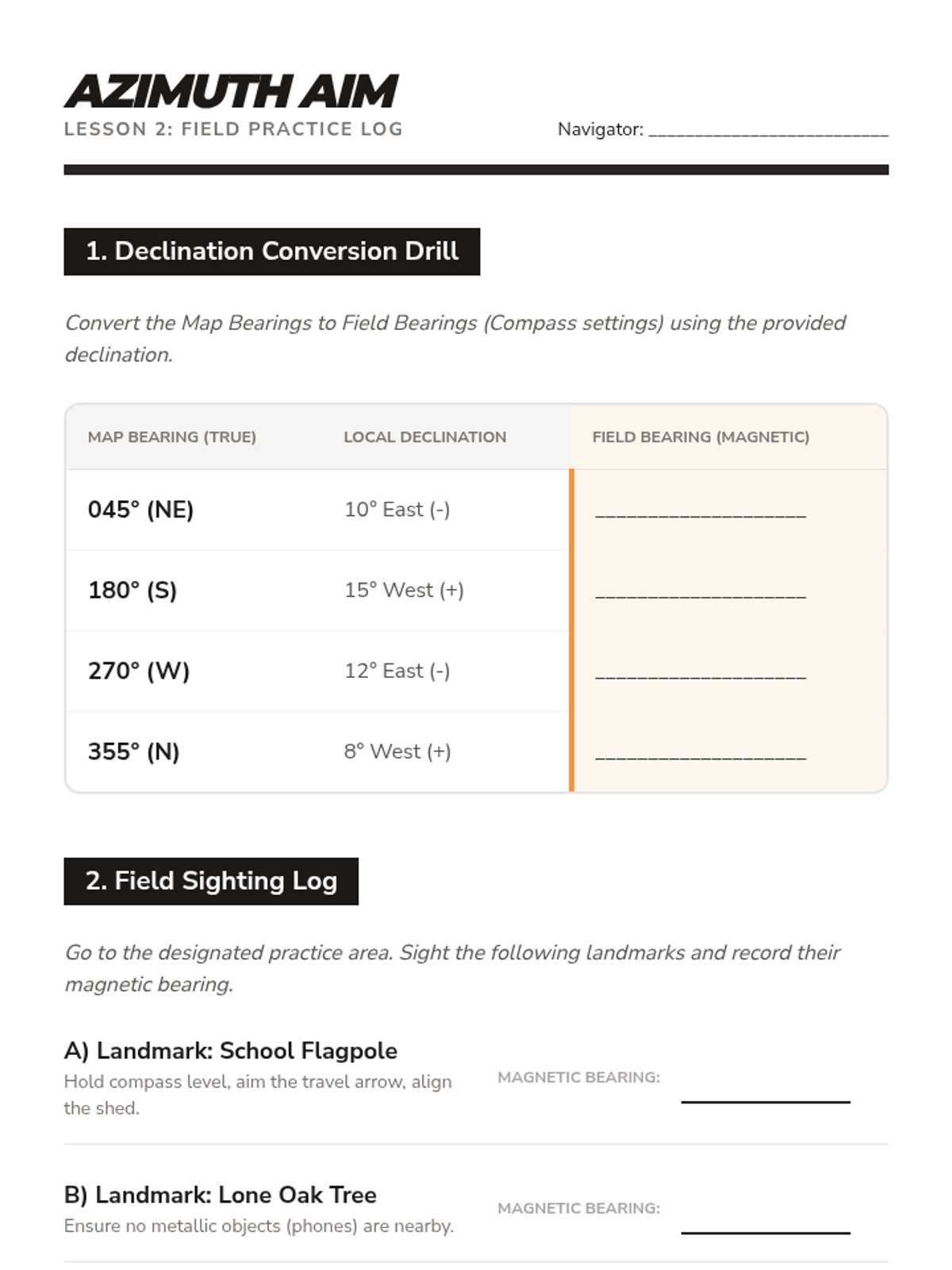
A technical workshop on using baseplate compasses, calculating bearings, and adjusting for magnetic declination.
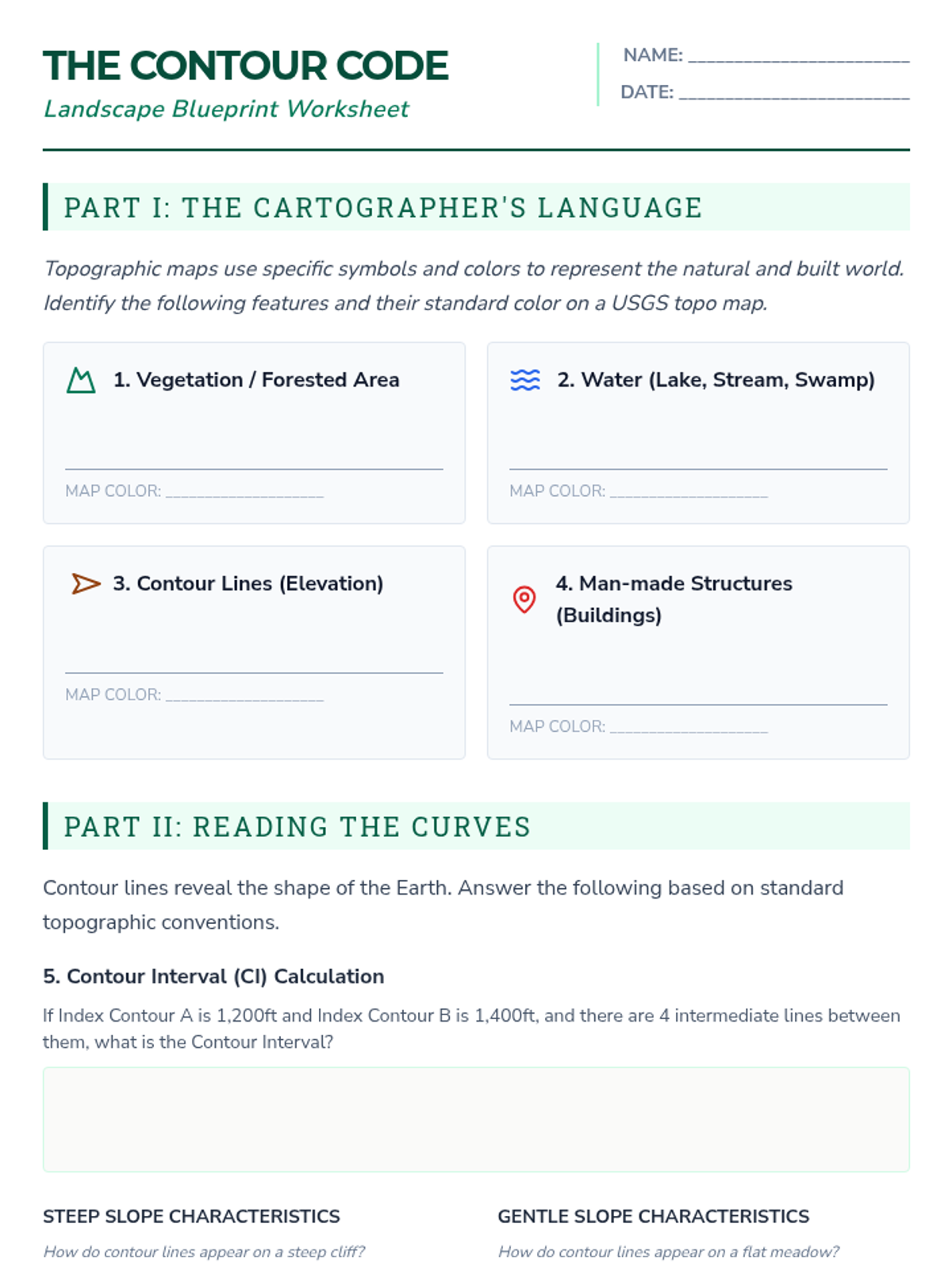
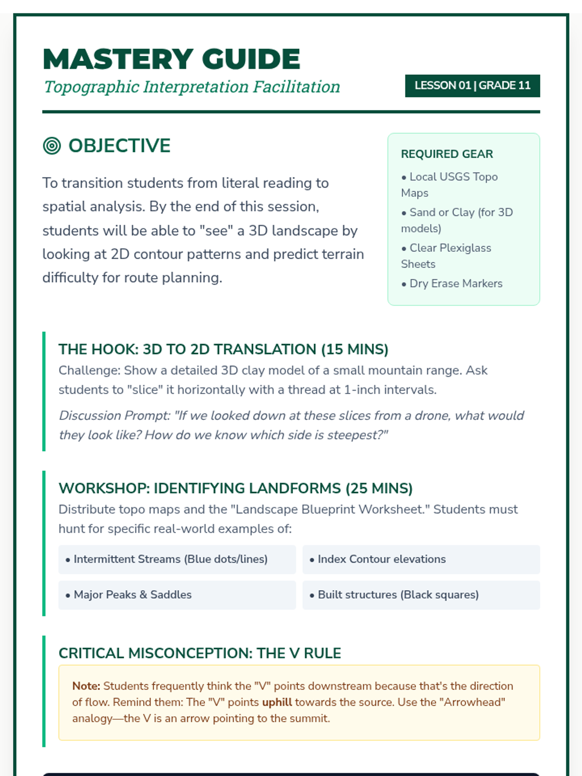
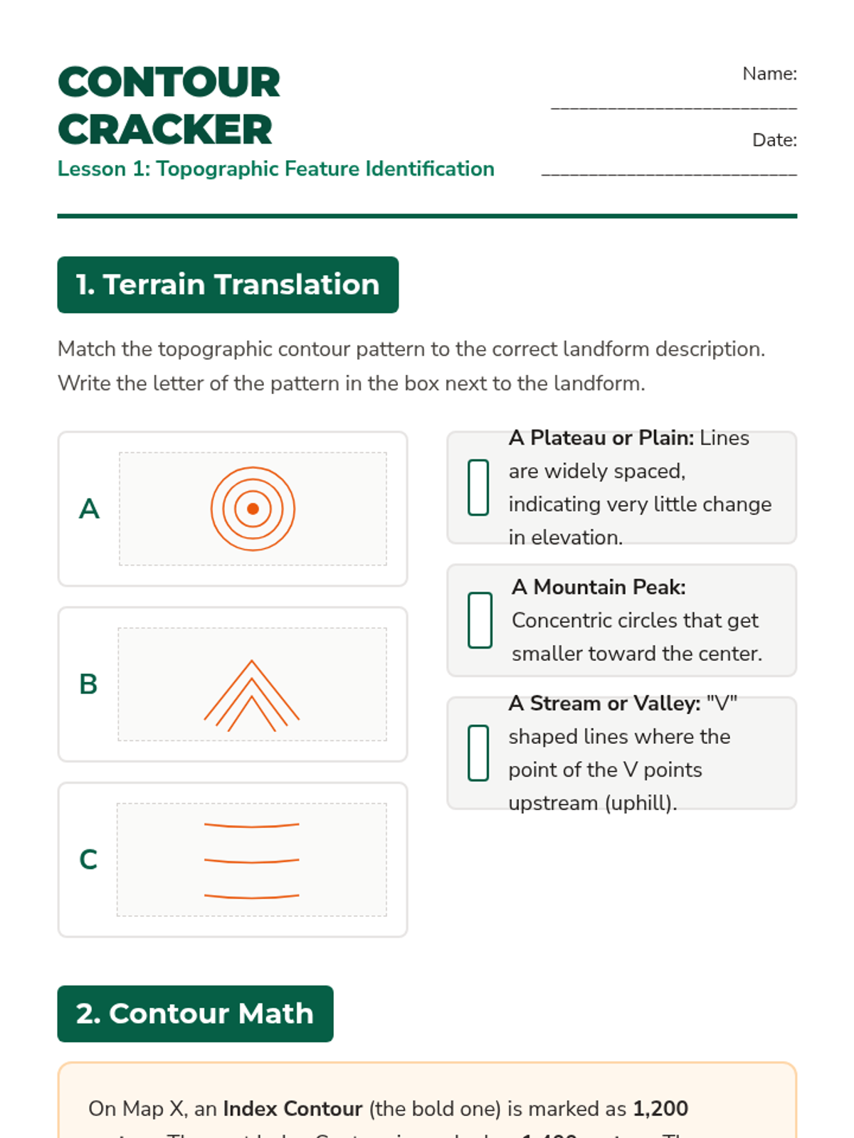
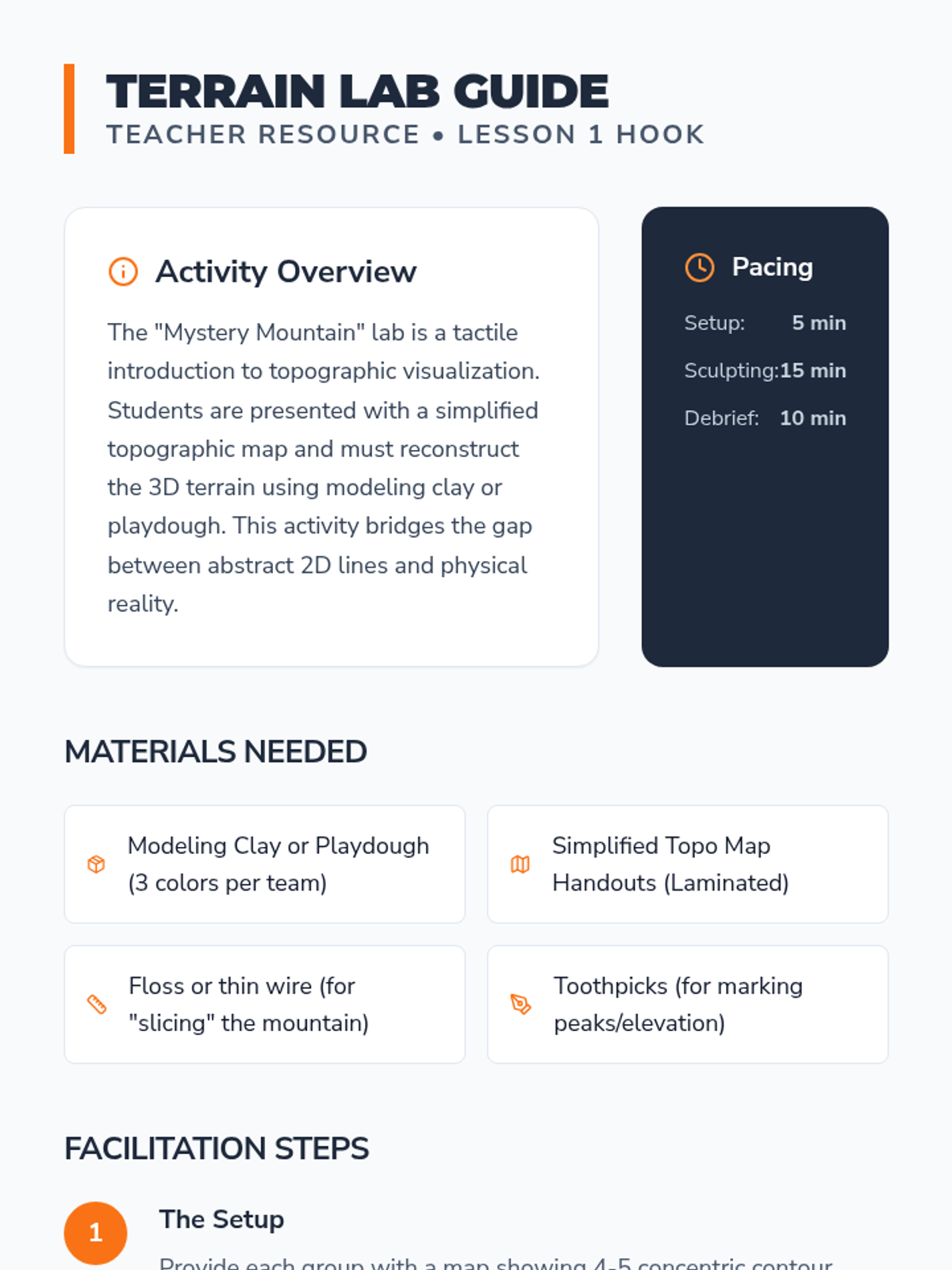
Students deconstruct topographic maps, visualizing 3D terrain from 2D contour lines and identifying key landscape features.
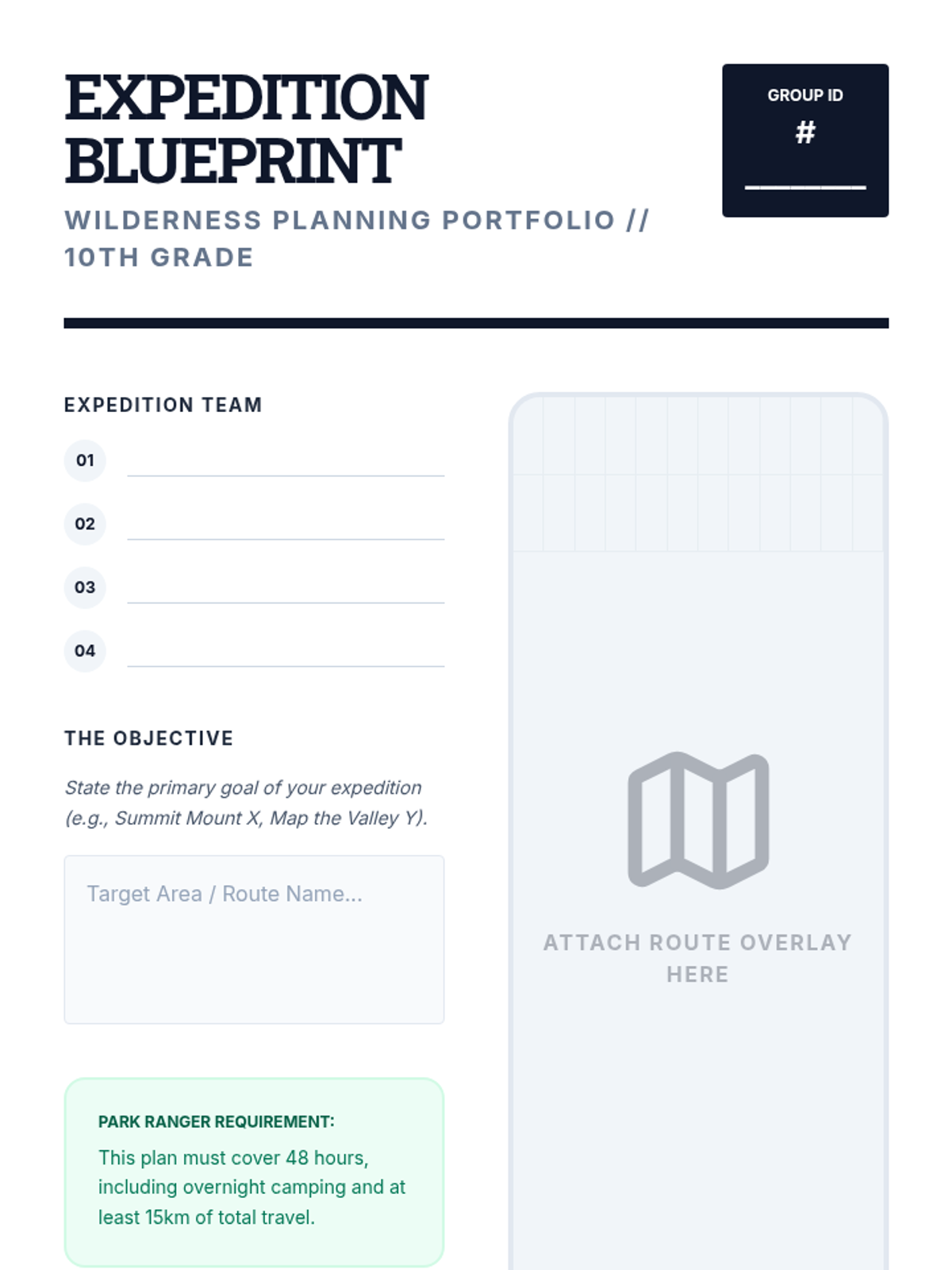
The capstone project where students synthesize all previous skills to create a professional-grade expedition plan for a 2-day wilderness journey.
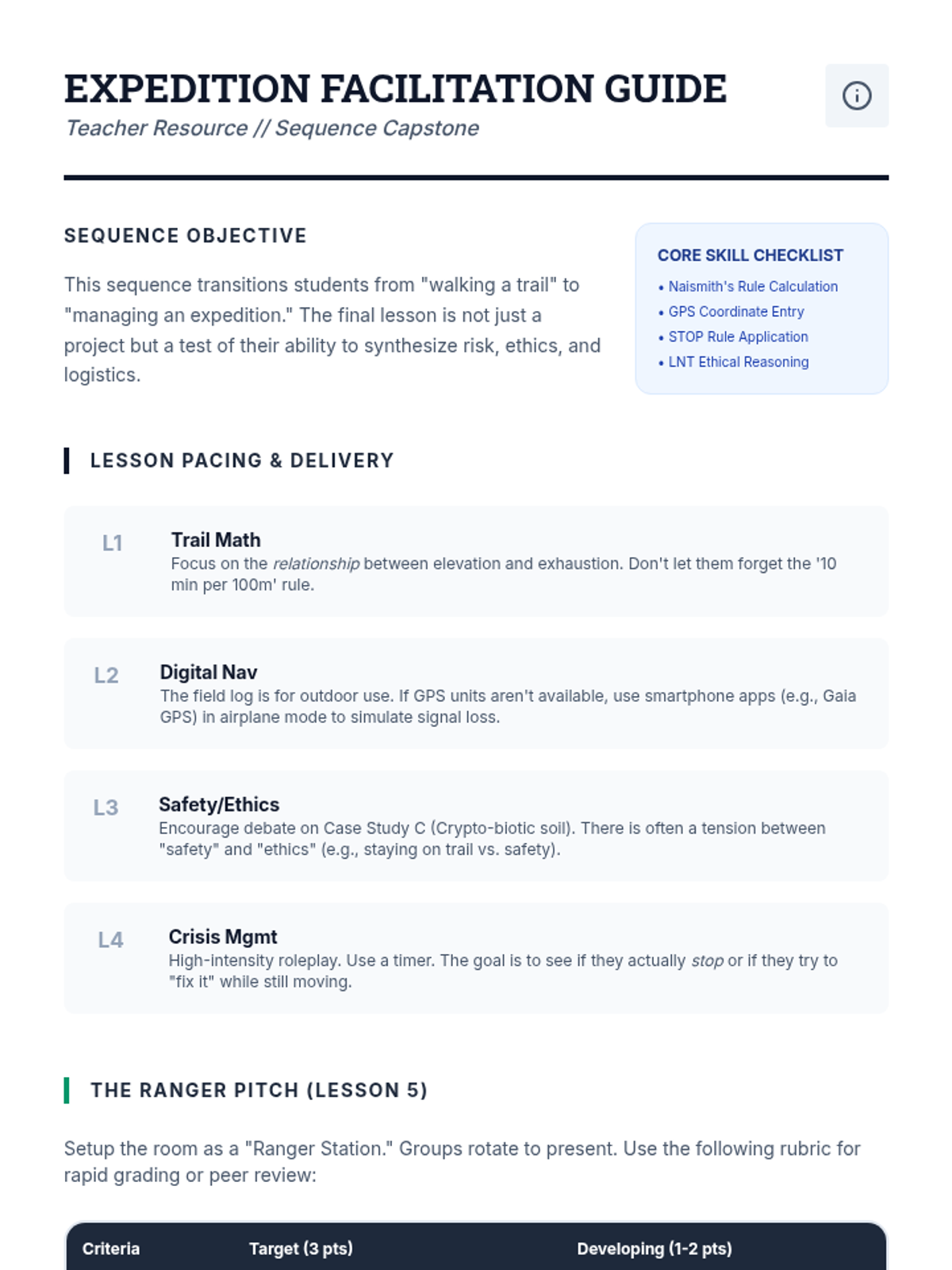
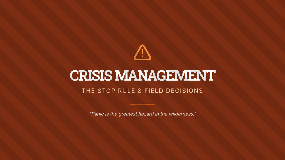
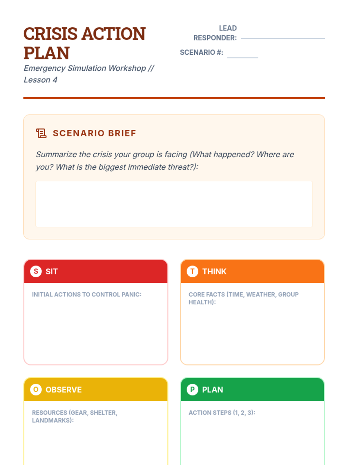
A high-stakes simulation lesson focusing on the STOP rule and emergency decision-making. Students practice responding to wilderness crises like sudden weather changes or medical emergencies.
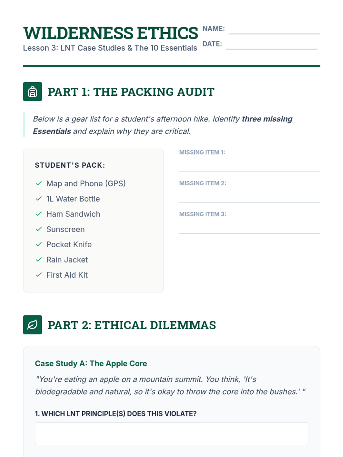
An exploration of wilderness safety through the 10 Essentials and the ethical framework of Leave No Trace. Students debate the balance between outdoor access and environmental preservation.
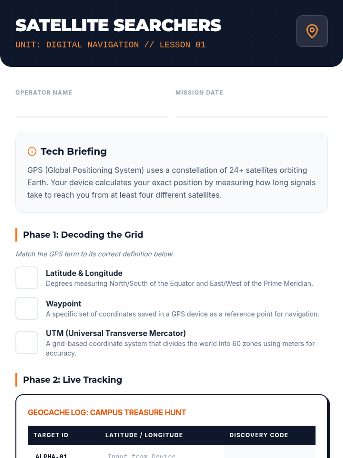
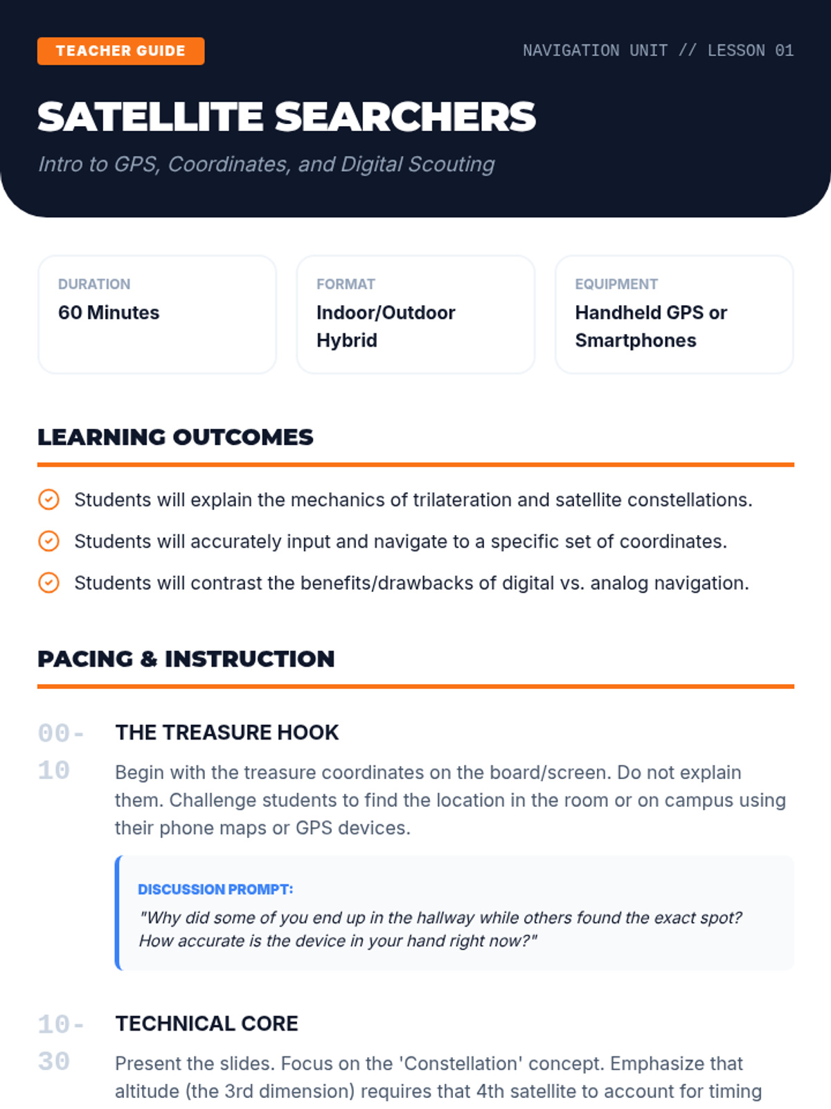
Introduction to GPS technology and digital navigation. Students learn to mark waypoints, track routes, and understand the practical limitations of digital tools in the backcountry.
Students master the math of the mountains by learning Naismith's Rule and interpreting topographic elevation profiles. They calculate travel times and analyze trail difficulty to plan safe, realistic hiking legs.
A culminating activity where students complete a timed orienteering circuit in a search and rescue scenario.
Students establish personal pace counts and learn distance estimation strategies across varying terrain.
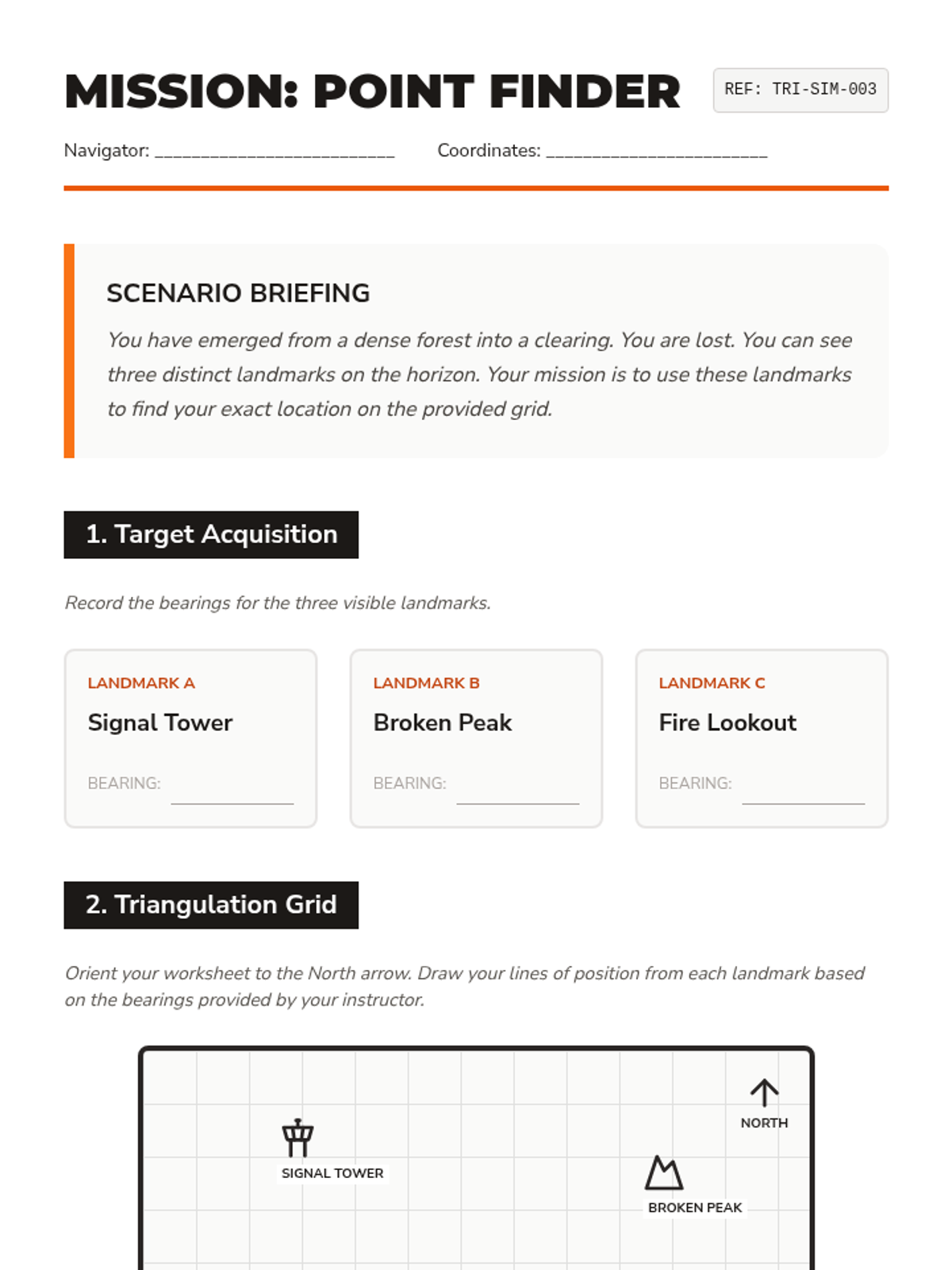
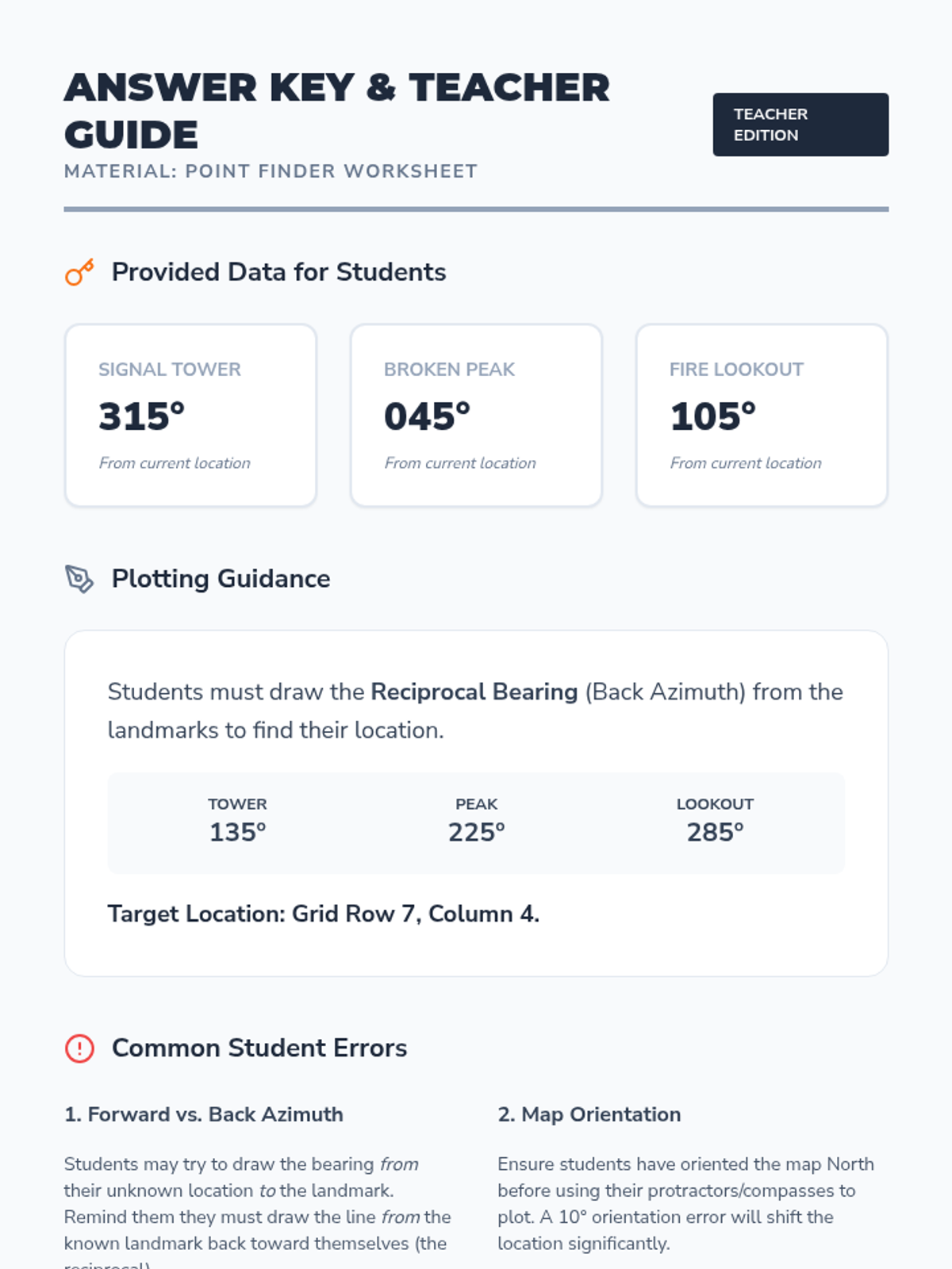
Students learn to align their map with the physical landscape and practice triangulation to determine their exact location.
This lesson focuses on the anatomy of a baseplate compass and the mathematics of navigation, including bearings and declination.
Students analyze topographic maps to interpret contour lines, scale, and legend symbols, translating 2D lines into 3D terrain visualization.
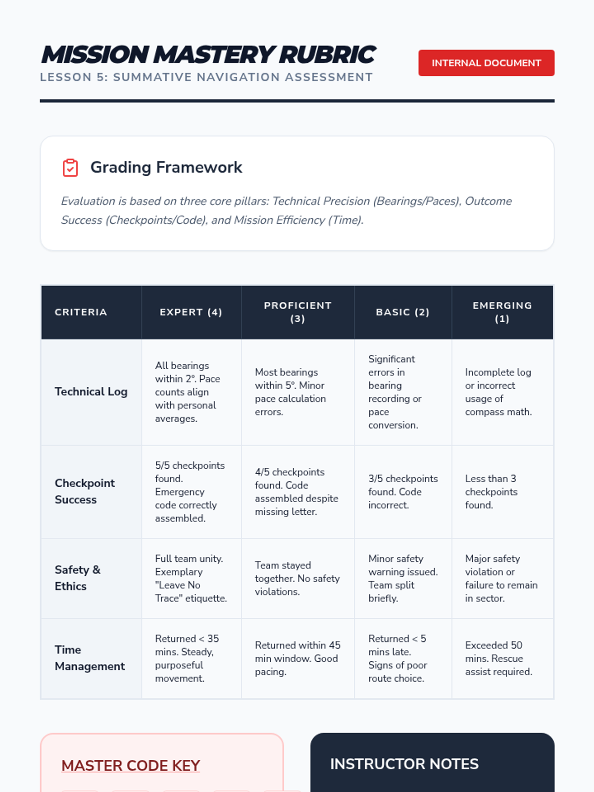
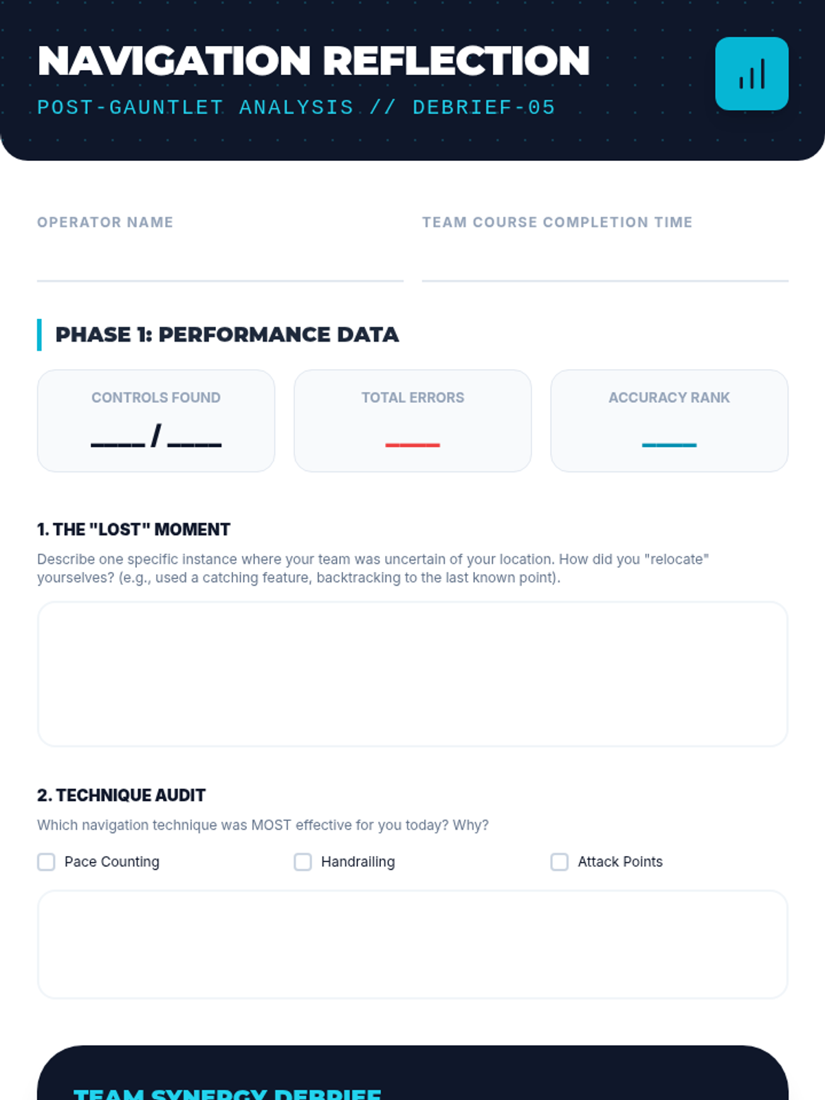
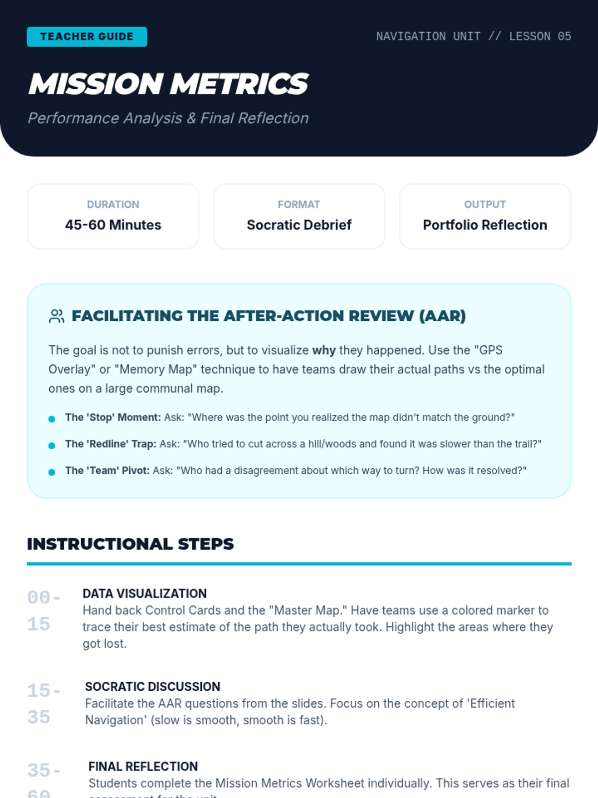
A reflective analysis of performance data and route choices to improve future navigational decision-making and teamwork.
A culminating physical and mental challenge where students navigate a timed course, applying all previously learned skills under pressure.
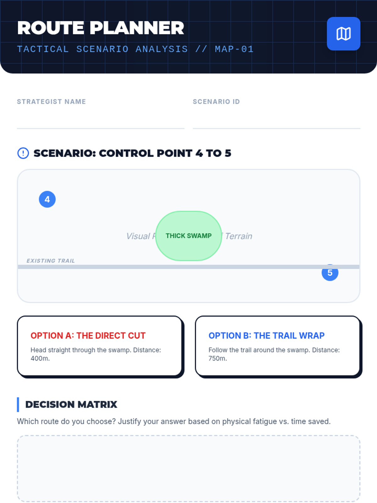
An introduction to competitive orienteering strategies, focusing on route choice, attack points, and catching features to optimize speed and accuracy.
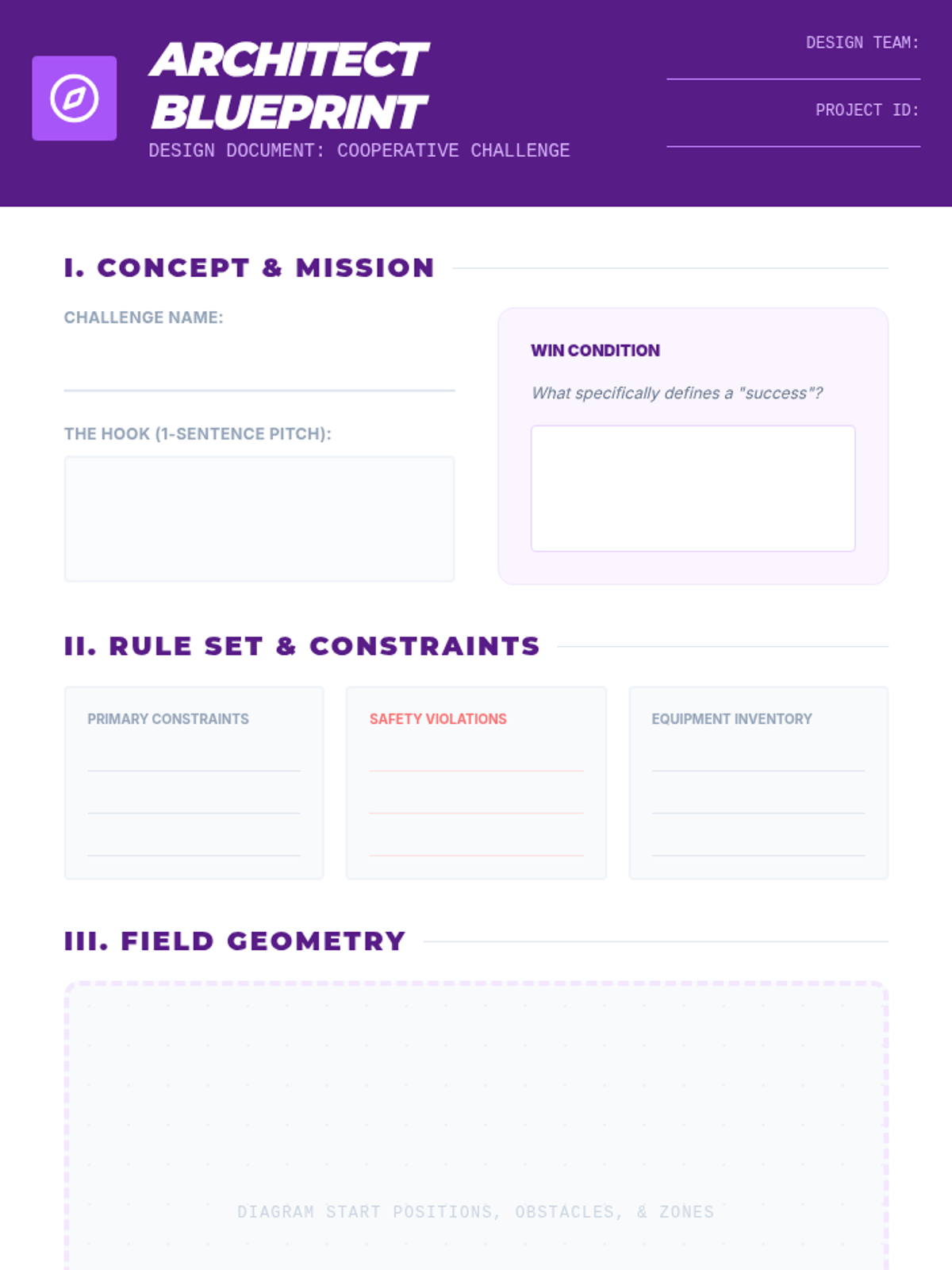
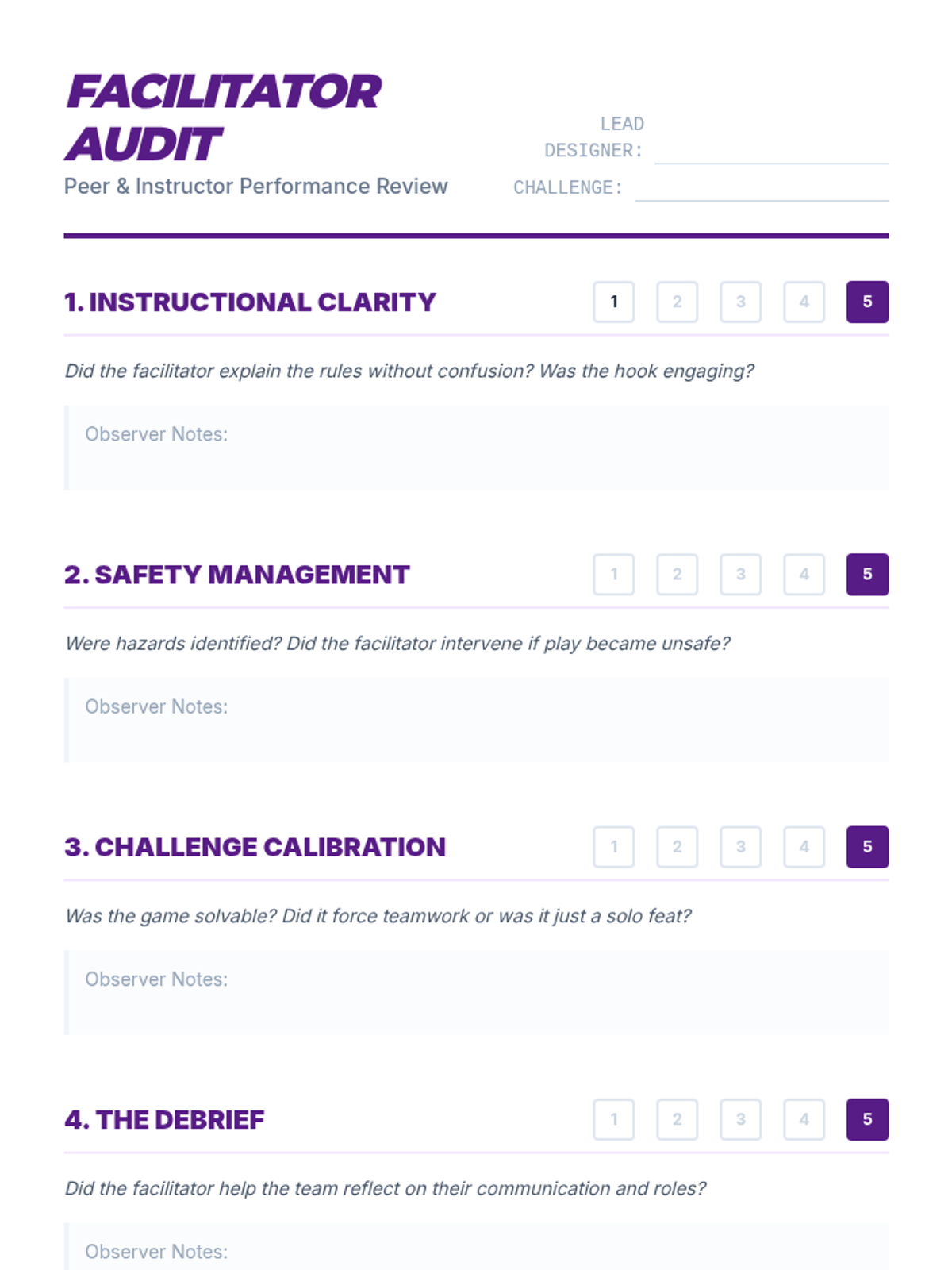
Students apply their learning by designing and facilitating their own cooperative physical challenges.
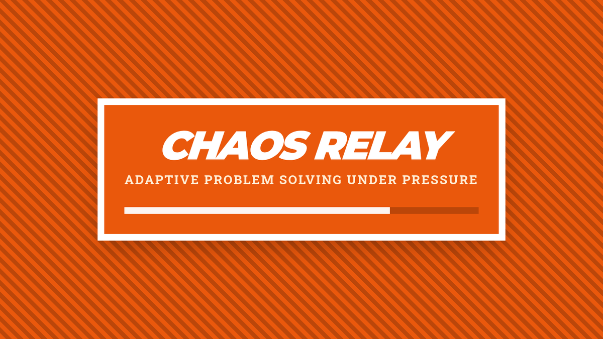
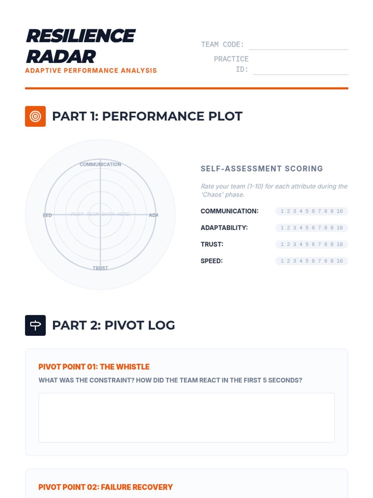
A high-intensity relay with rapidly changing constraints to test team resilience and adaptability.
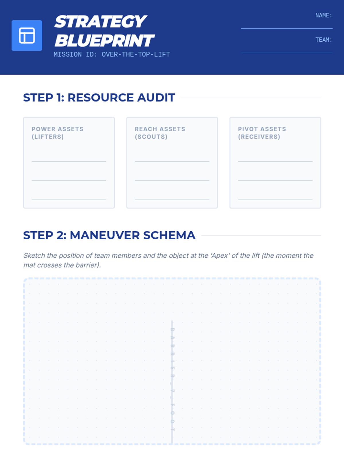
Teams must move large objects over barriers, emphasizing the planning and resource allocation phase of problem-solving.
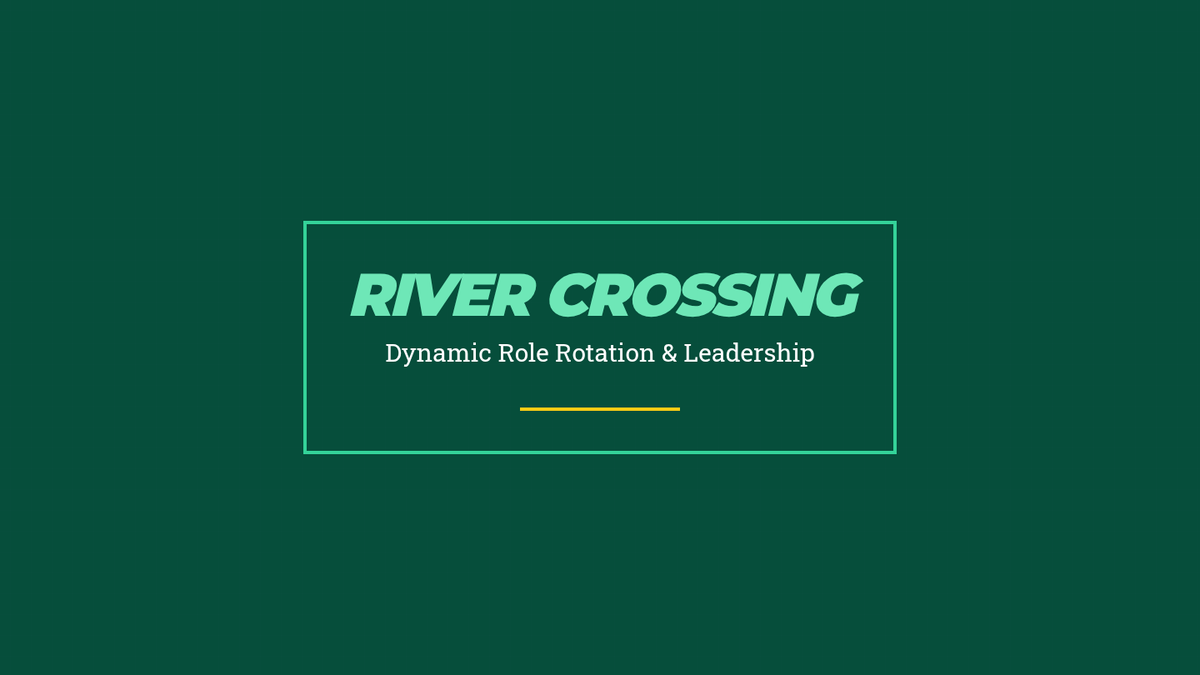
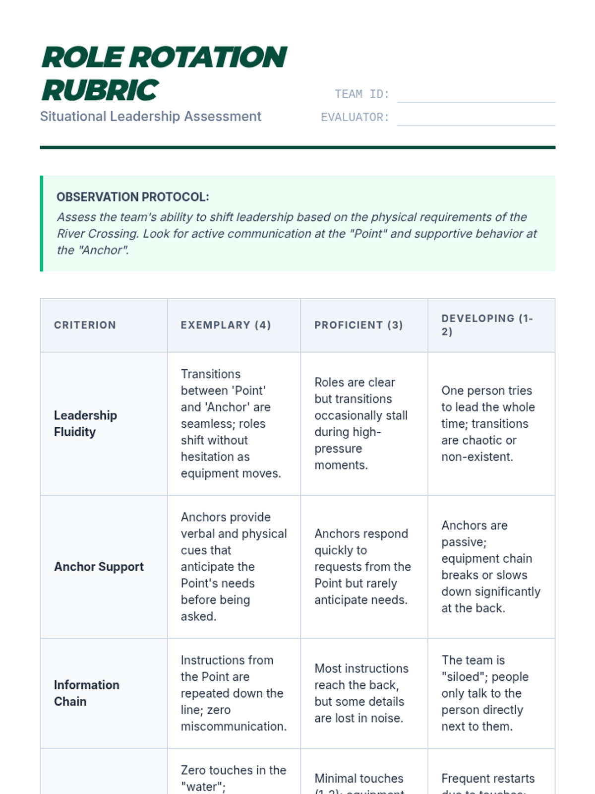
Focuses on the 'River Crossing' challenge to analyze how leadership roles shift based on situational needs.
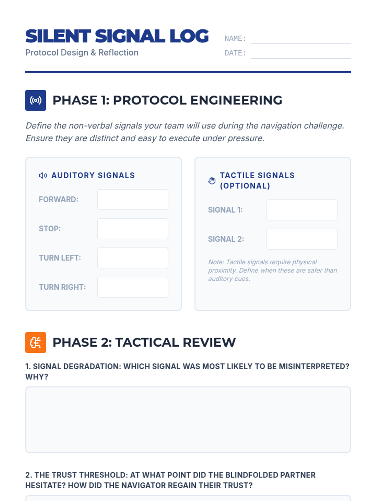
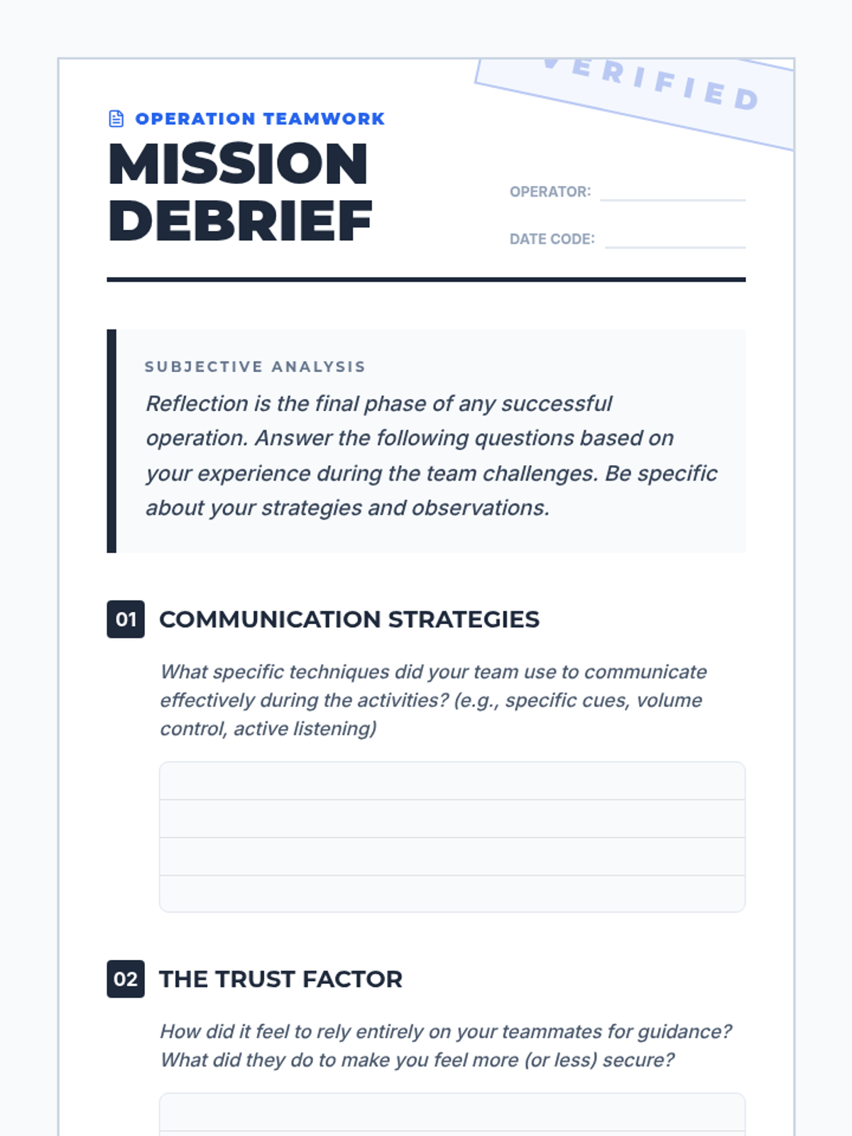
Students explore trust and communication through blindfolded navigation challenges using non-verbal cues.
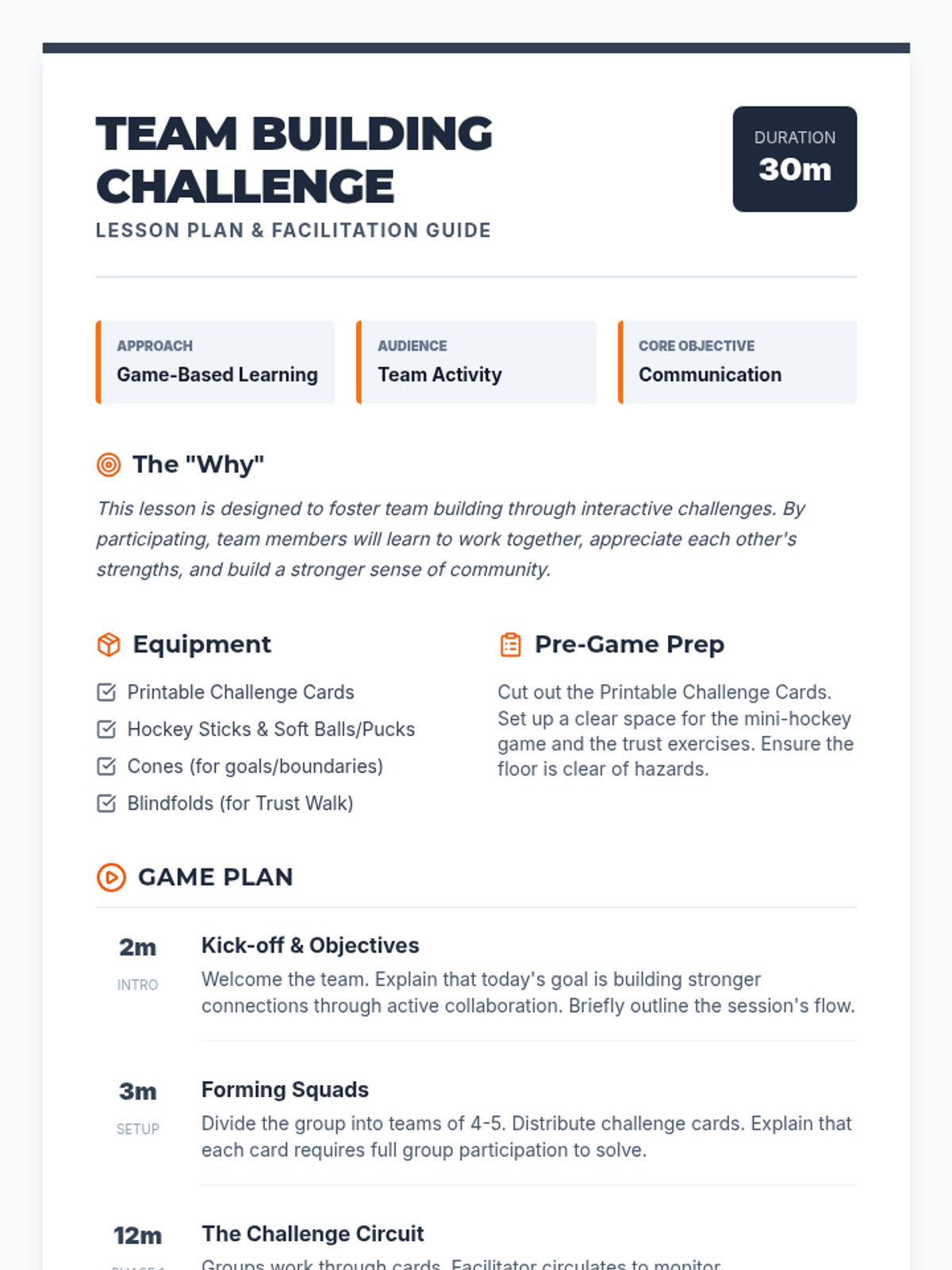
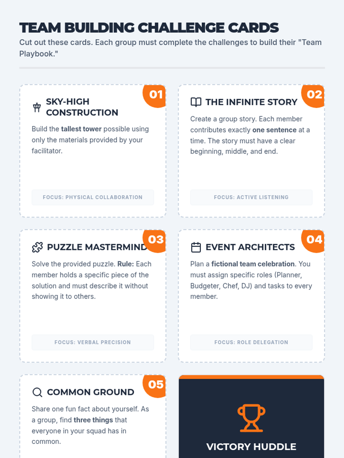
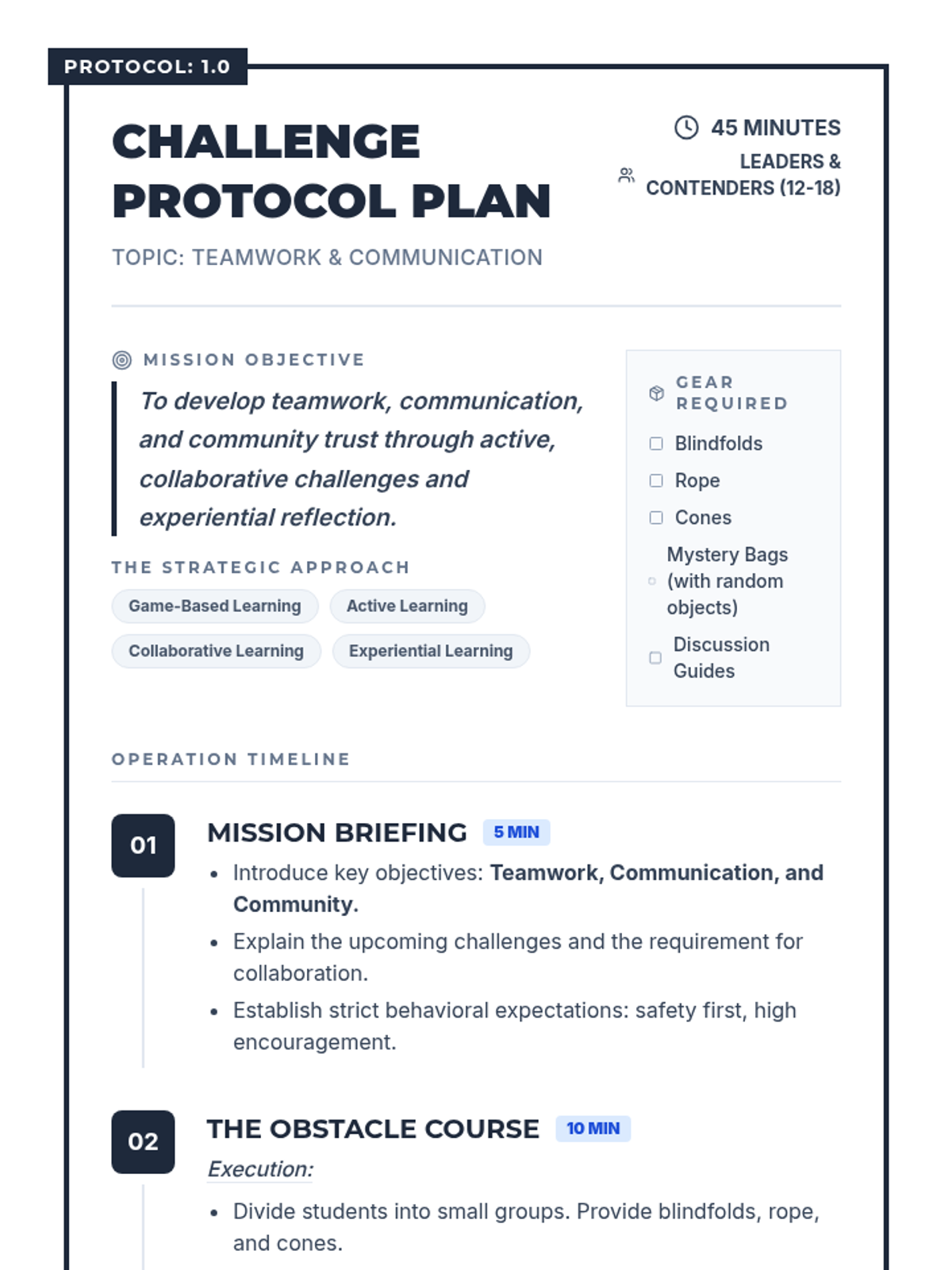
A high-energy team-building lesson focused on communication, trust, and collaboration through interactive challenges and a hockey-themed strategy game.
Students calibrate their personal pace count to estimate distance over varied terrain, a vital skill for dead reckoning and precise navigation.
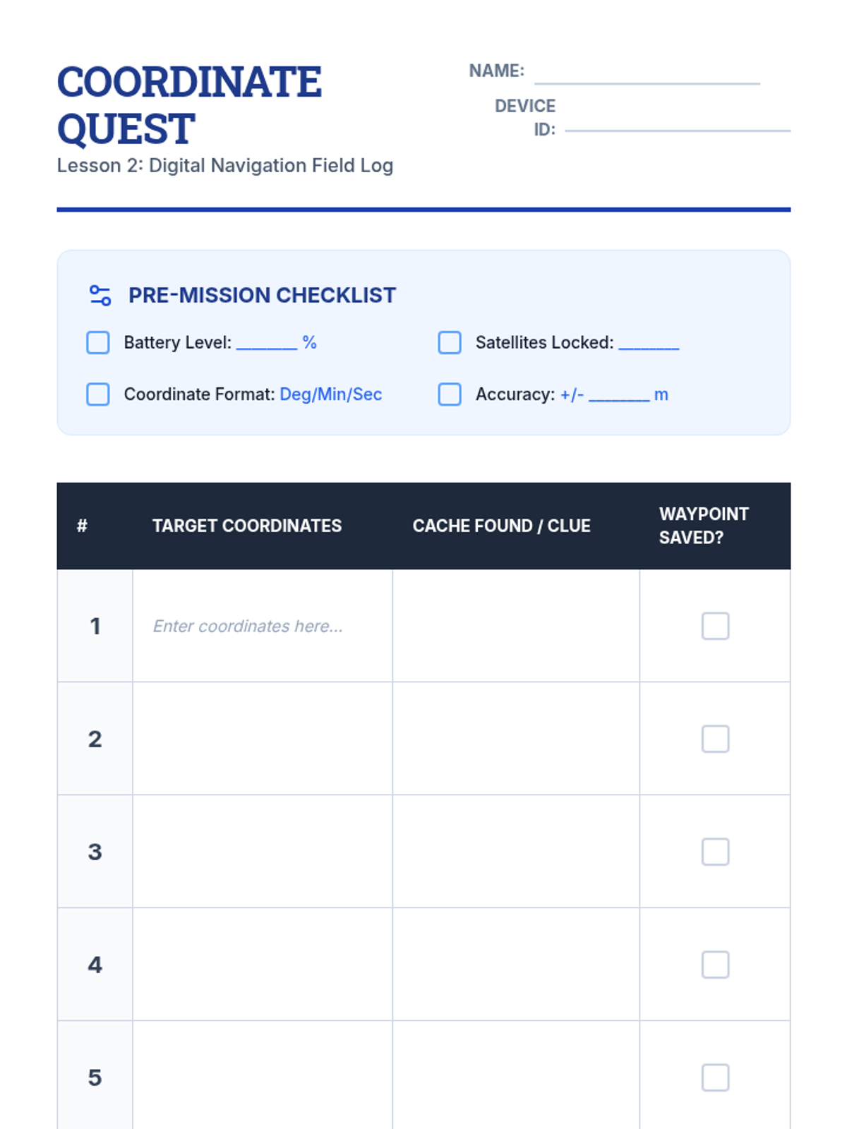
Students explore GPS technology, learning to interpret coordinates and manage waypoints while understanding the relationship between satellite tech and traditional map skills.
An active, game-based lesson focused on building communication, trust, and collaboration through physical challenges and creative problem-solving tasks.
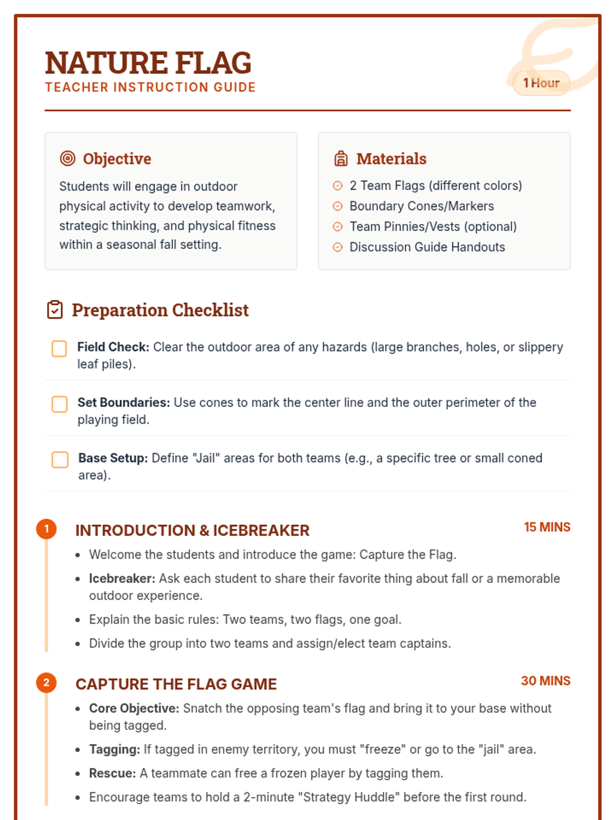
An active, outdoor lesson where students play Capture the Flag to develop teamwork, strategy, and physical fitness in a fall nature setting.