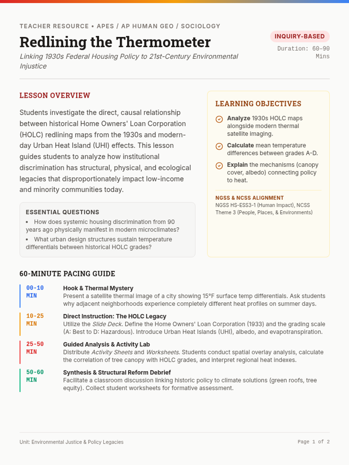
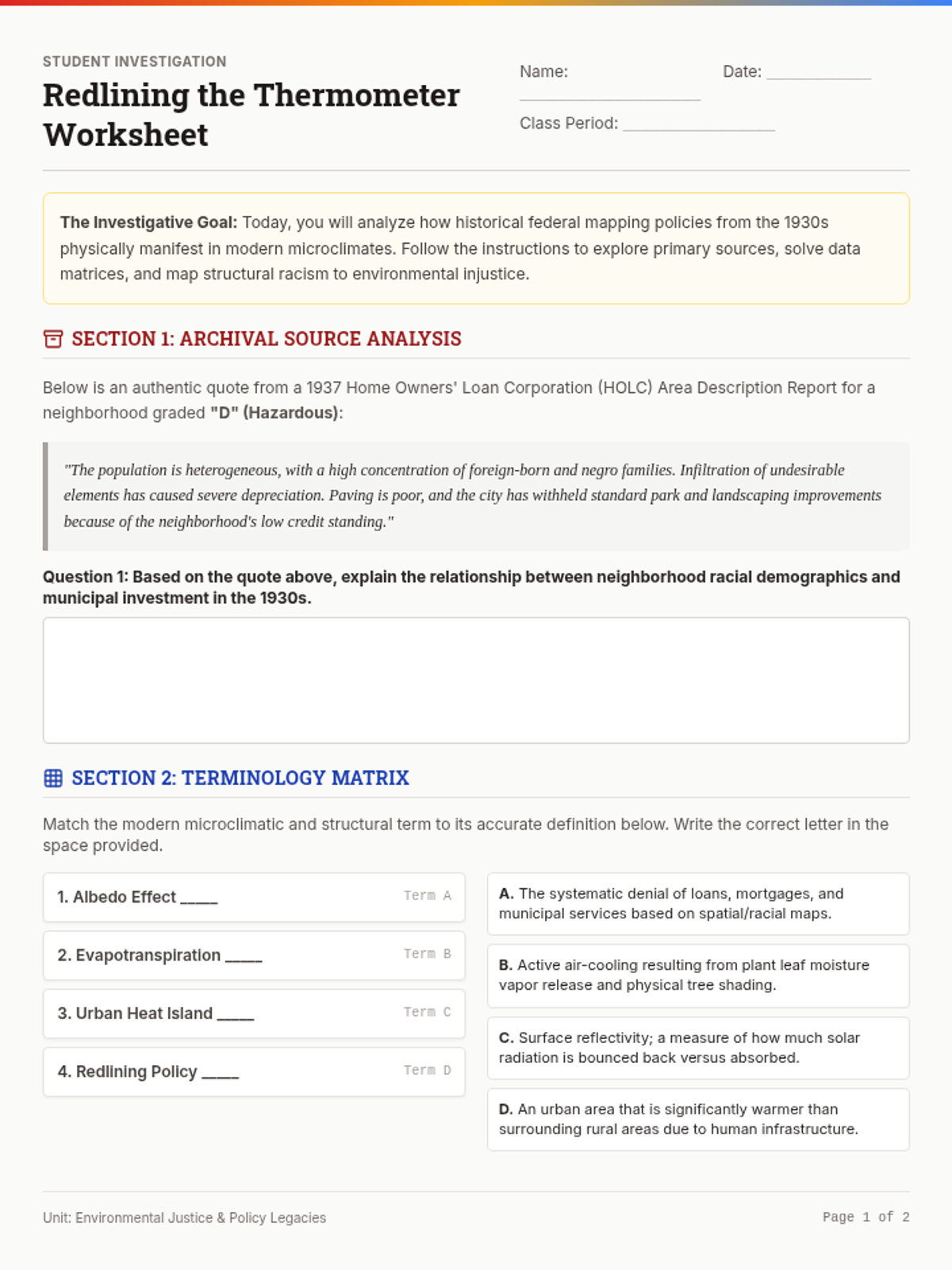
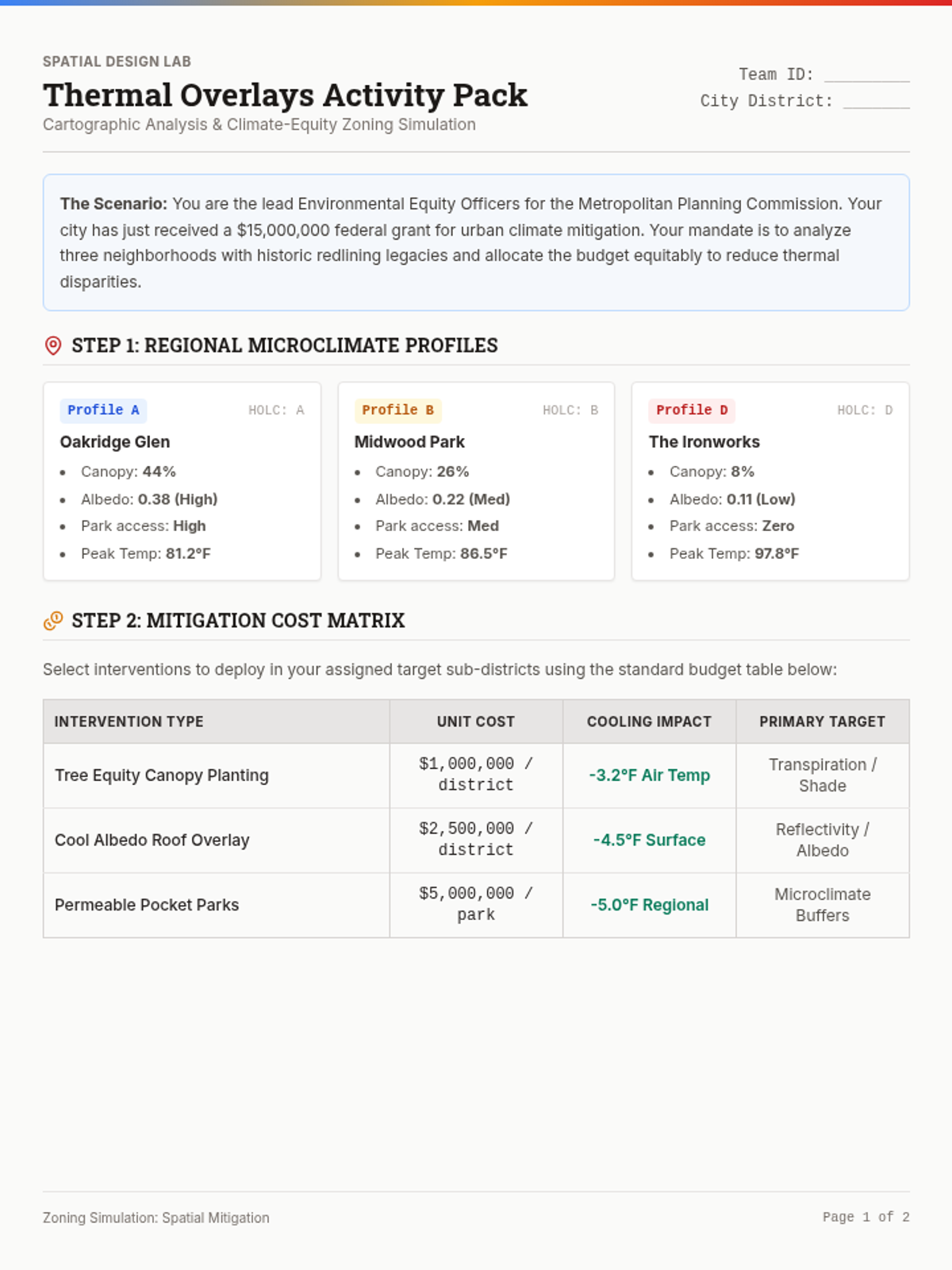
The Expanding Footprint
Students use geospatial visualization to analyze urban sprawl, land use, and the urban heat island effect. They investigate the loss of green space and the environmental consequences of horizontal city growth.
Students use geospatial visualization to analyze urban sprawl, land use, and the urban heat island effect. They investigate the loss of green space and the environmental consequences of horizontal city growth.